Signs Tagged With Shield Inside Sign
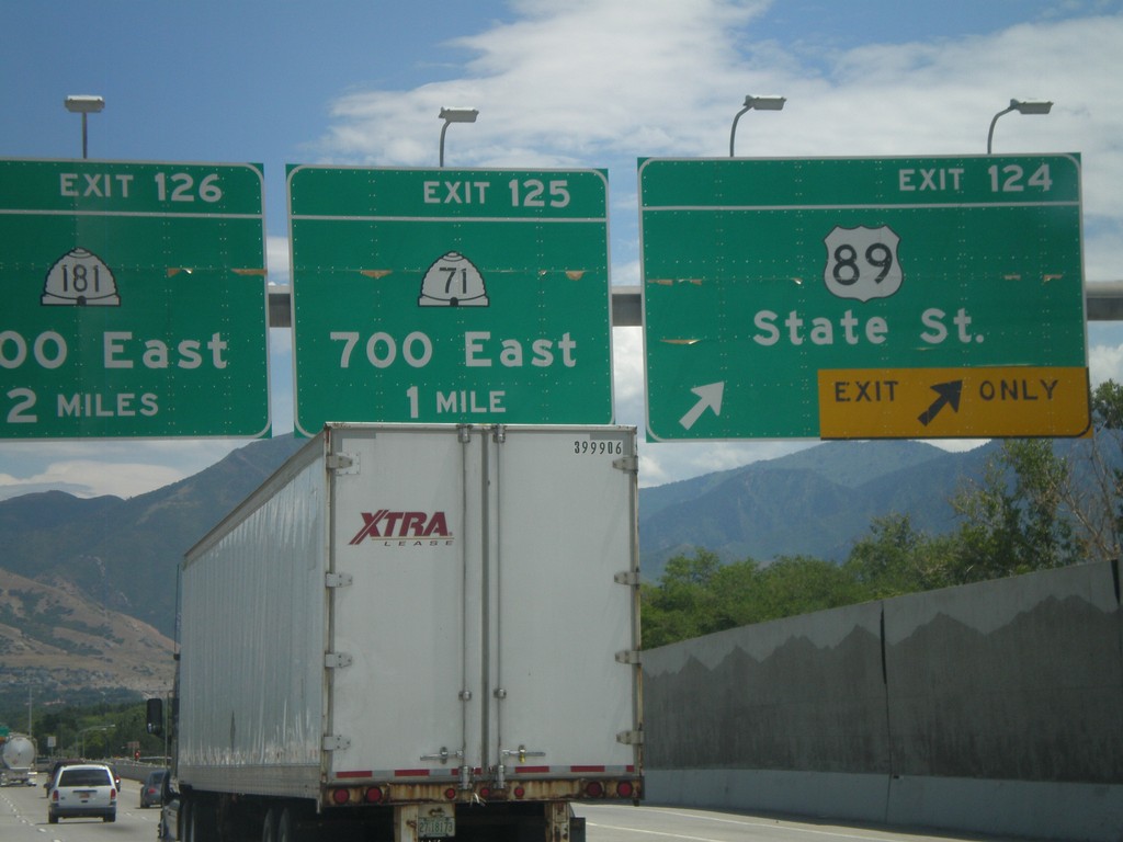
I-80 East - Exits 124, 125, and 126
I-80 east at Exit 124 - US-89/State St. Approaching Exit 125 - UT-71/700 East. Also approaching Exit 126 - UT-181/1300 East.
Taken 07-31-2010


 South Salt Lake
Salt Lake County
Utah
United States
South Salt Lake
Salt Lake County
Utah
United States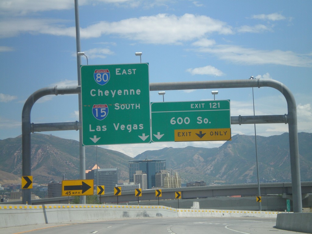
I-80 East - Exit 121
I-80 east at Exit 121 - 600 South. This exit is located on the merge between I-15 South and I-80 East. Use I-80 East for Cheyenne, and I-15 South for Las Vegas.
Taken 07-31-2010
 Salt Lake City
Salt Lake County
Utah
United States
Salt Lake City
Salt Lake County
Utah
United States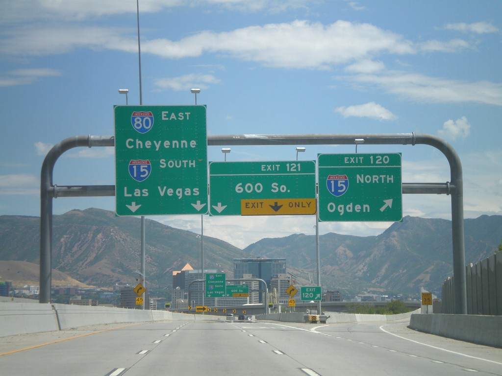
I-80 East - Exits 120 and 121
I-80 east at Exit 120 - I-15 North/Ogden. Approaching Exit 121 - 600 South. I-15 and I-80 join briefly through Salt Lake City. Continue on I-80 East for Cheyenne, and I-15 South for Las Vegas.
Taken 07-31-2010
Salt Lake City
Salt Lake County
Utah
United States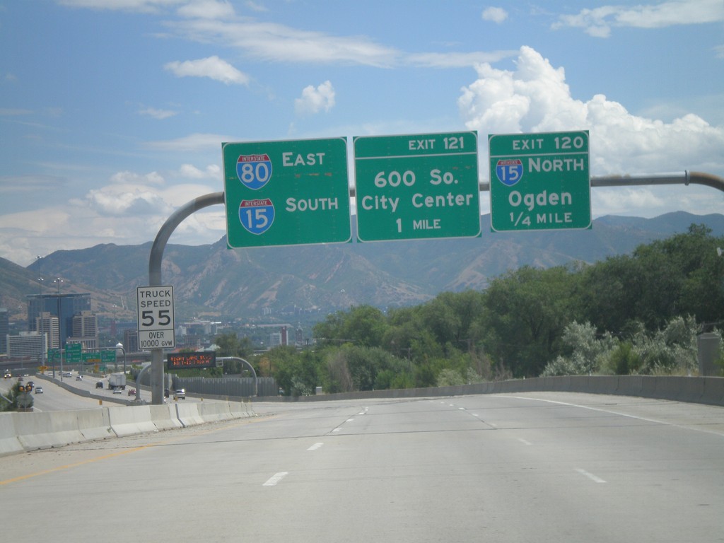
I-80 East - Exits 120 and 121
I-80 east approaching Exit 120 - I-15 North/Ogden. Also approaching Exit 121 - 600 South. Use left lanes for I-80 East and I-15 South.
Taken 07-31-2010
Salt Lake City
Salt Lake County
Utah
United States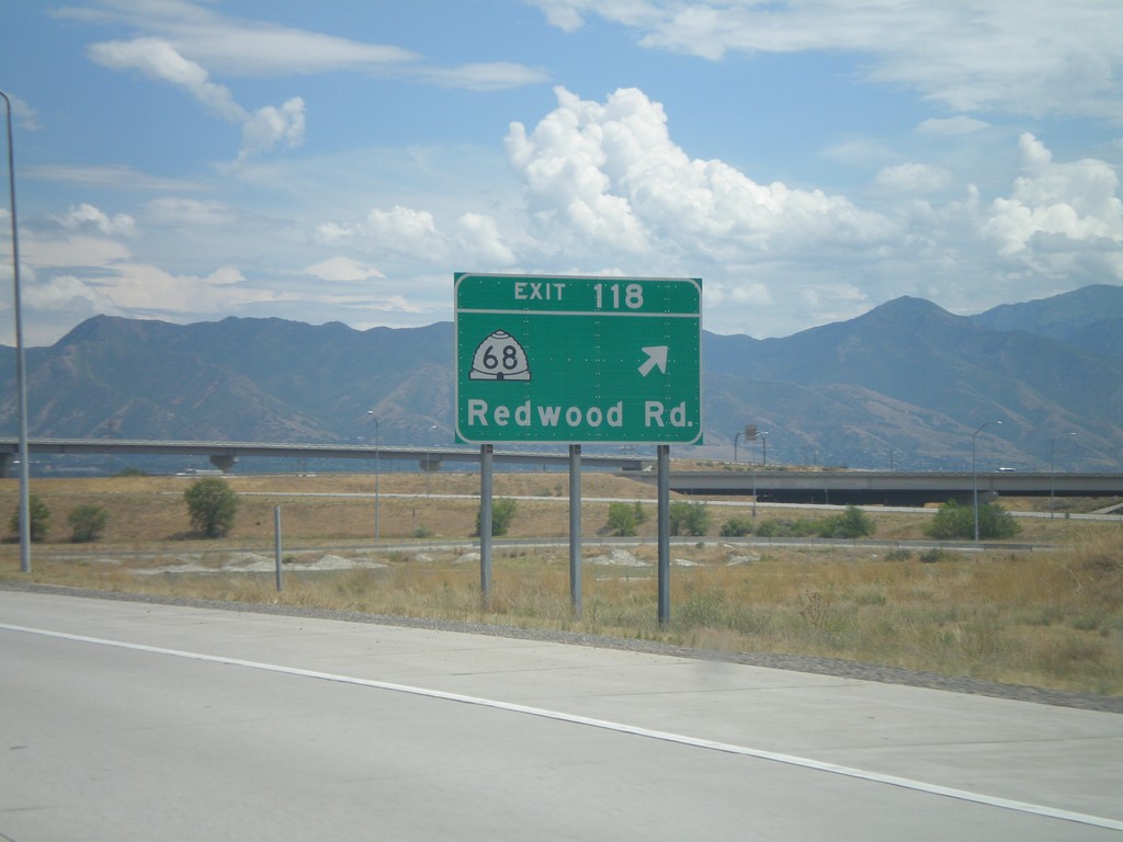
I-80 East - Exit 118
I-80 east at Exit 118 - UT-68/Redwood Road.
Taken 07-31-2010
 Salt Lake City
Salt Lake County
Utah
United States
Salt Lake City
Salt Lake County
Utah
United States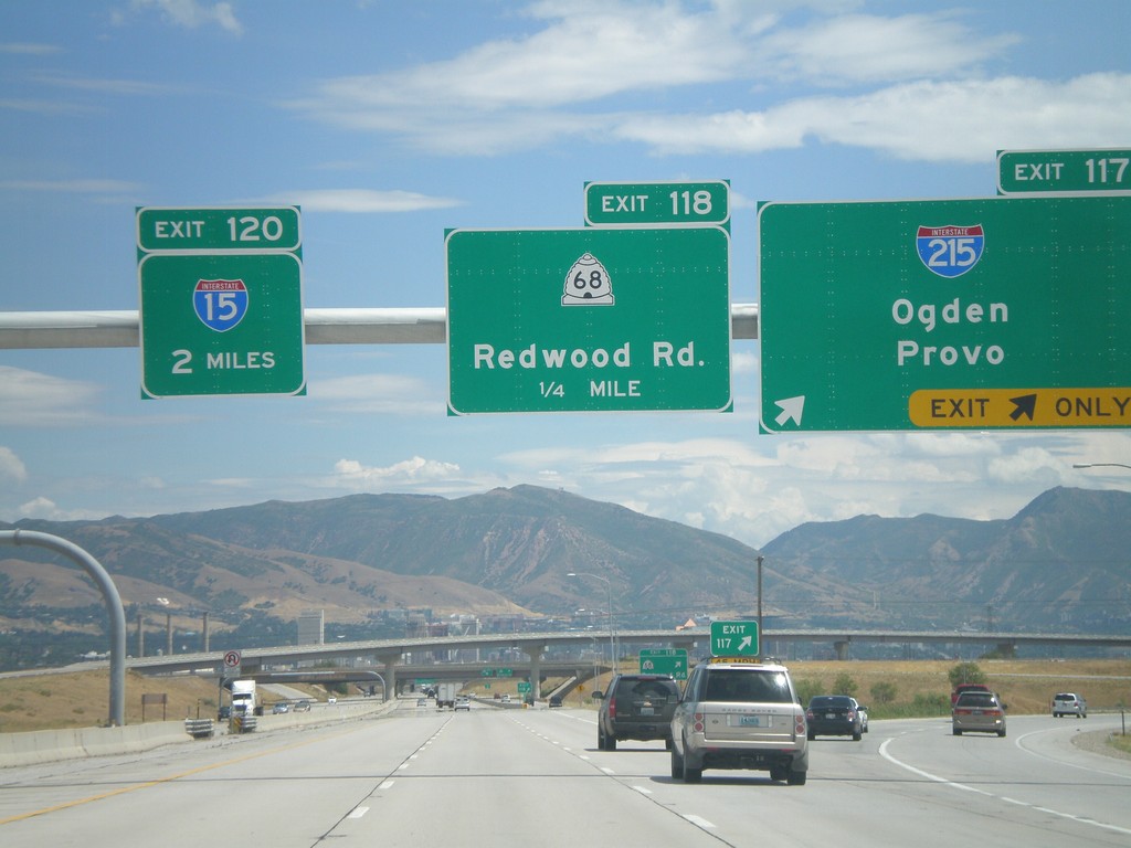
I-80 East - Exit 117. Approaching Exits 118 and 120
I-80 east at Exit 117 - I-215/Odgen/Provo. I-215 is the Salt Lake City Belt Route. Approaching Exit 118 - UT-68/Redwood Road, and Exit 120 - I-15.
Taken 07-31-2010
 Salt Lake City
Salt Lake County
Utah
United States
Salt Lake City
Salt Lake County
Utah
United States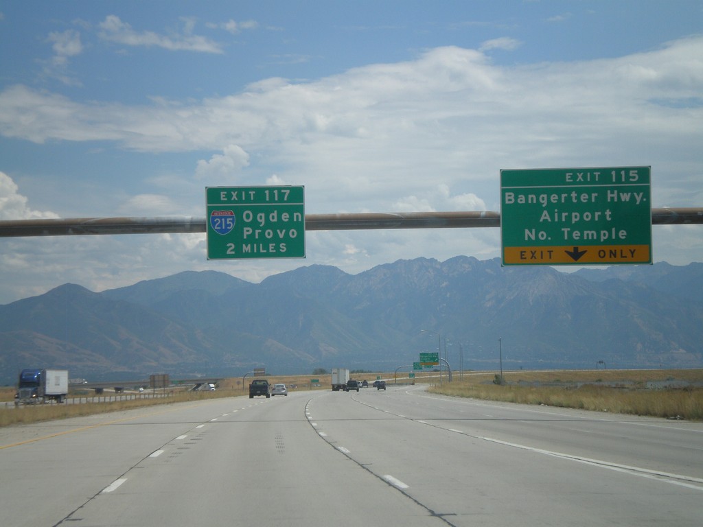
I-80 East - Exits 115 and Exit 117.
I-80 east at Exit 115 - Bangerter Highway/Airport/North Temple. Approaching Exit 117 - I-215/Ogden/Provo.
Taken 07-31-2010
Salt Lake City
Salt Lake County
Utah
United States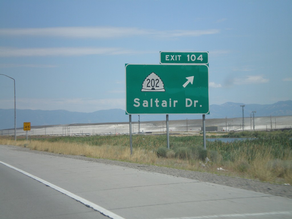
I-80 East - Exit 104
I-80 east at Exit 104 - UT-202/Saltair Drive.
Taken 07-31-2010
 Magna
Salt Lake County
Utah
United States
Magna
Salt Lake County
Utah
United States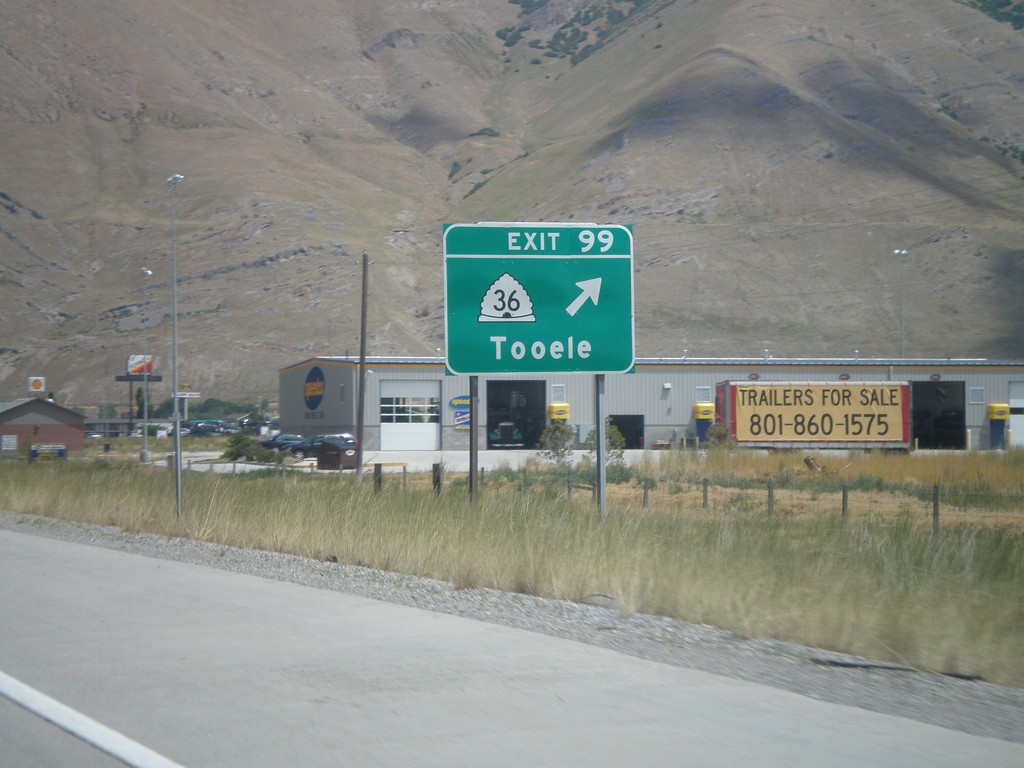
I-80 East - Exit 99
I-80 east at Exit 99 - UT-36/Tooele.
Taken 07-31-2010
 Tooele
 County
Utah
United States
Tooele
Tooele County
Utah
United States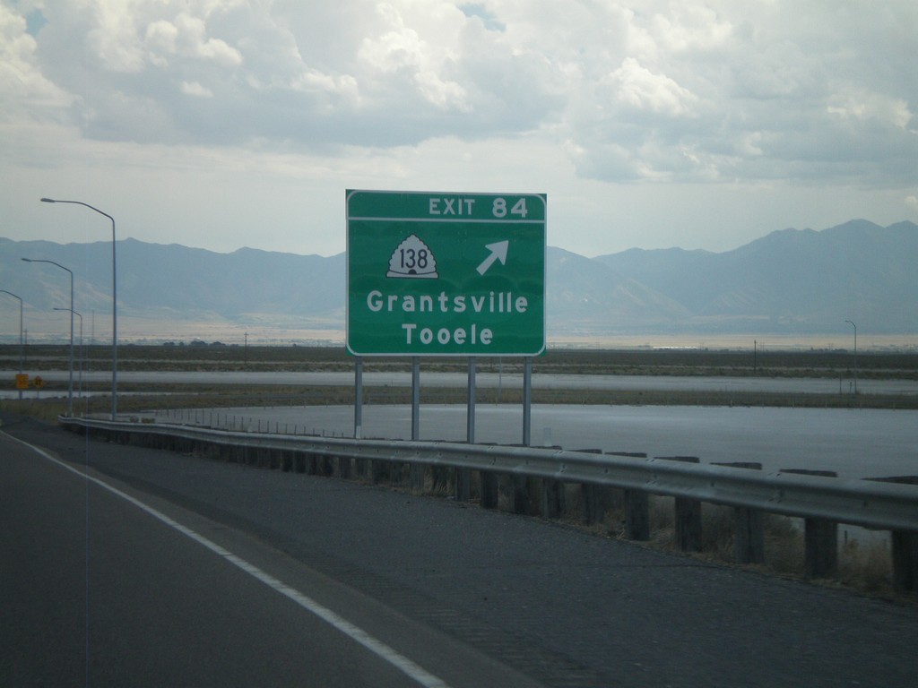
I-80 East - Exit 84
I-80 east at Exit 84 - UT-138/Grantsville/Tooele.
Taken 07-31-2010
 Grantsville
Tooele County
Utah
United States
Grantsville
Tooele County
Utah
United States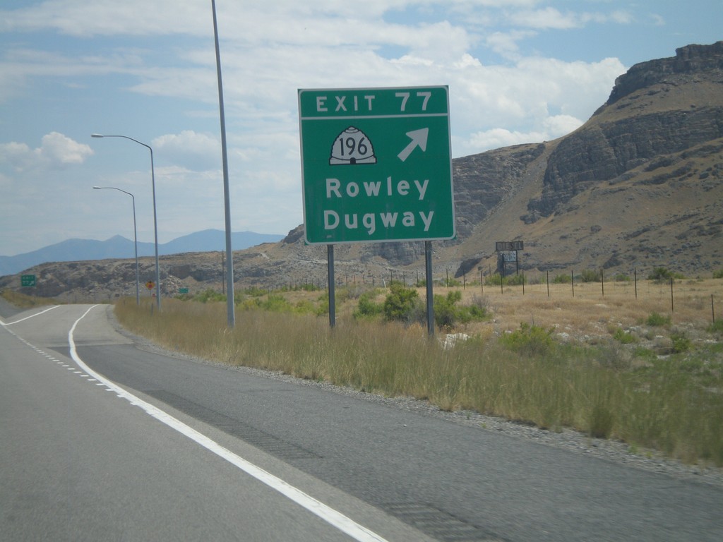
I-80 East - Exit 77
I-80 east at Exit 77 - UT-196/Rowley/Dugway.
Taken 07-31-2010
 Grantsville
Tooele County
Utah
United States
Grantsville
Tooele County
Utah
United States
I-80 at Delle Interchange
Approaching I-80 onramps in Delle. Both I-80 shields are part of a white box, which is unusual in Utah.
Taken 07-31-2010
Grantsville
Tooele County
Utah
United States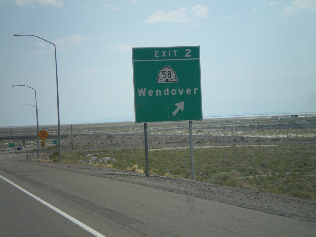
I-80 East - Exit 2
I-80 east at Exit 2 - UT-58/Wendover. This is the eastern end of the Wendover/West Wendover business loop.
Taken 07-31-2010

 Wendover
Tooele County
Utah
United States
Wendover
Tooele County
Utah
United States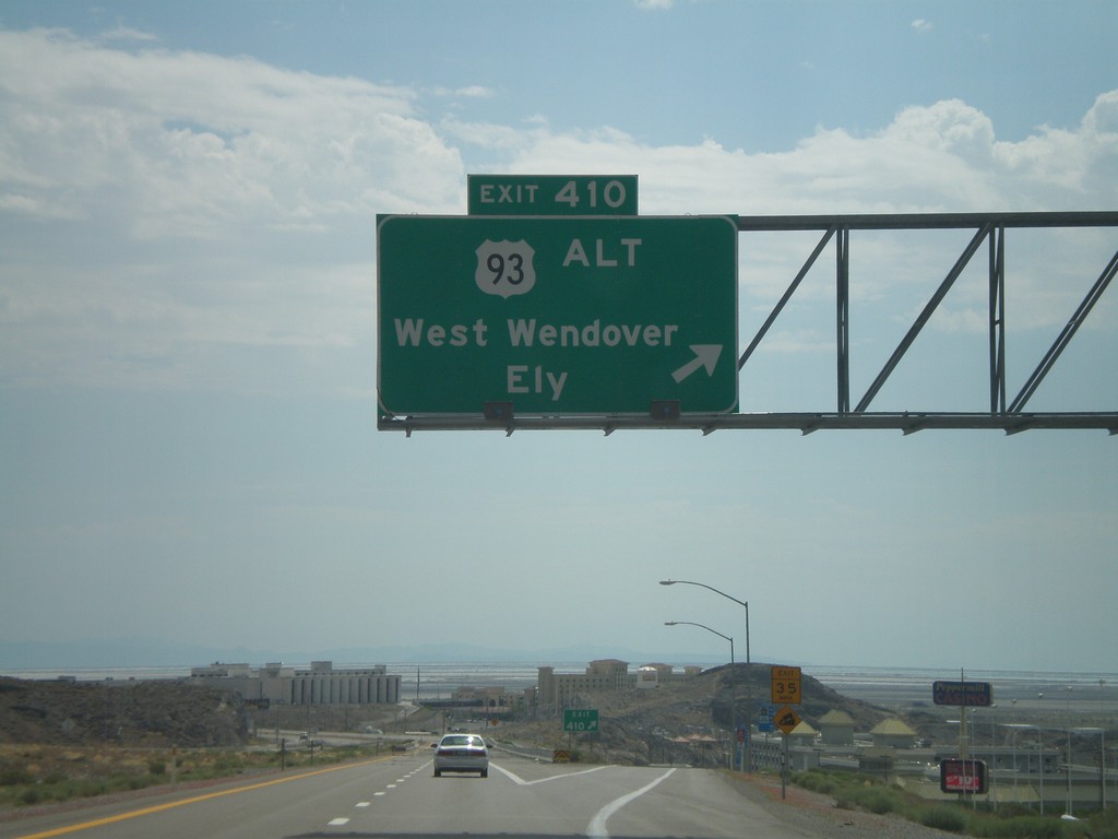
I-80 East - Exit 410
I-80 east at Exit 410 - US-93 Alt./West Wendover/Ely. This is the last exit in Nevada on I-80 east. This exit is the western end of the West Wendover/Wendover business loop. The casinos in West Wendover and the salt flats beyond are visible.
Taken 07-31-2010
 West Wendover
Elko County
Nevada
United States
West Wendover
Elko County
Nevada
United States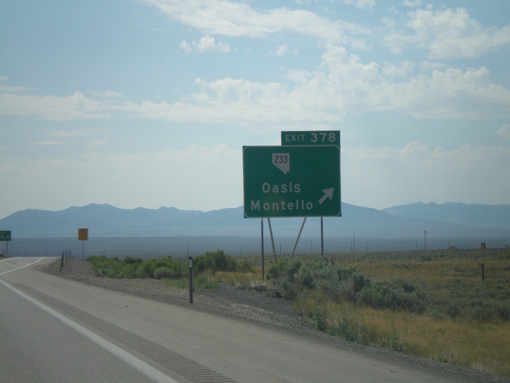
I-80 East - Exit 378
I-80 east at Exit 378 - NV-233/Oasis/Montello
Taken 07-31-2010
 Wells
Elko County
Nevada
United States
Wells
Elko County
Nevada
United States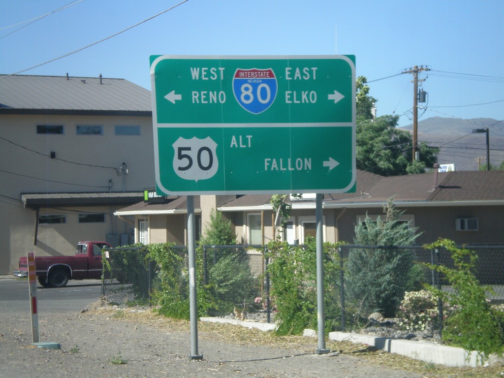
Alt. US-95 North at Alt. US-50/BL-80/NV-427
Alt. US-95 north at Alt. US-50/BL-80 east to Fallon and Elko and BL-80/NV-427 west to Reno.
Taken 07-12-2010


 Fernley
Lyon County
Nevada
United States
Fernley
Lyon County
Nevada
United States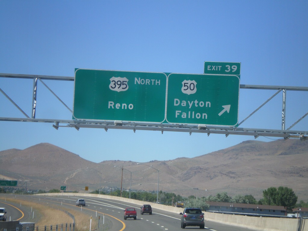
US-395 North - Exit 39
US-395 north at Exit 39 - US-50/Dayton/Fallon. Continue north on US-395 for Reno. The US-50/US-395 split ends here.
Taken 07-12-2010

 Carson City
Nevada
United States
Carson City
Nevada
United States
US-50 East At CA-89 South
US-50 east at CA-89 south/Markleeville/Jackson to CA-88. CA-89 north joins US-50 east to South Lake Tahoe.
Taken 07-12-2010

 South Lake Tahoe
El Dorado County
California
United States
South Lake Tahoe
El Dorado County
California
United States
US-50 East at CA-89
US-50 east at CA-89 south.
Taken 07-12-2010
South Lake Tahoe
El Dorado County
California
United States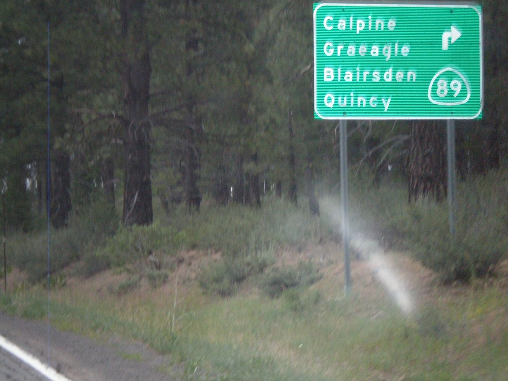
CA-49 South/CA-89 North at Split
CA-49 south at CA-89 north split. CA-89 turns left here towards Calpine, Graeagle, Blairsden, and Quincy.
Taken 07-09-2010
 Calpine
Sierra County
California
United States
Calpine
Sierra County
California
United States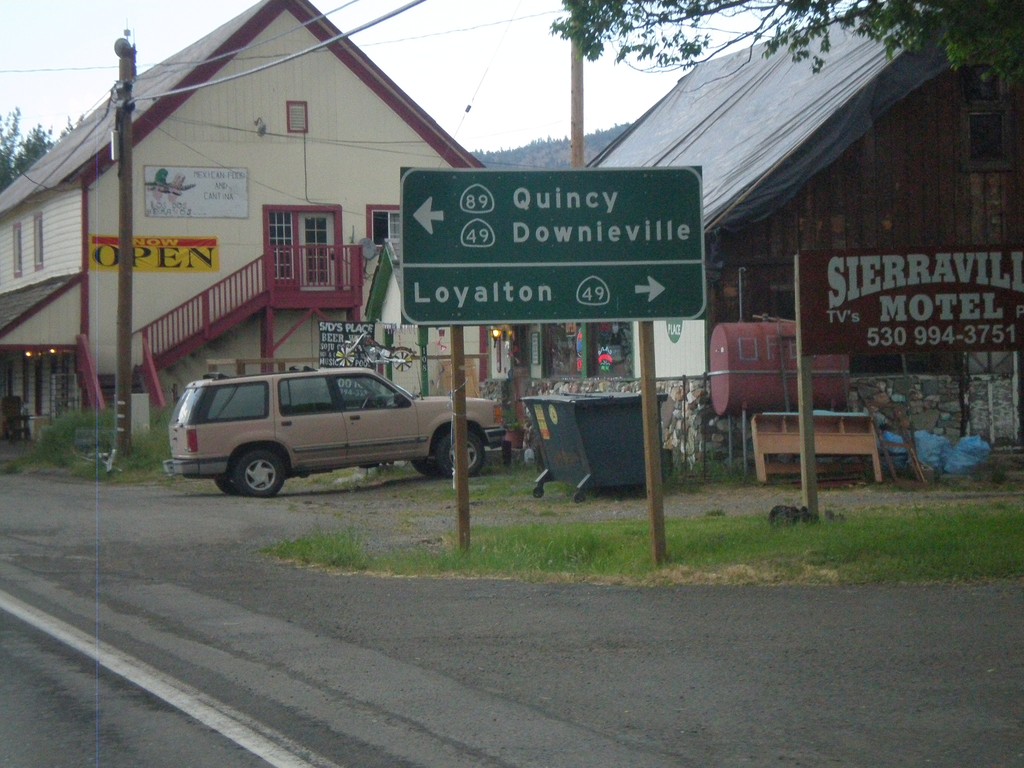
CA-89 North Approaching CA-49
CA-89 north at CA-49. Use CA-49 north for Loyalton. Use CA-49 South/CA-89 North for Quincy and Downieville.
Taken 07-09-2010
Sierraville
Sierra County
California
United States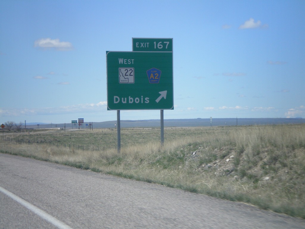
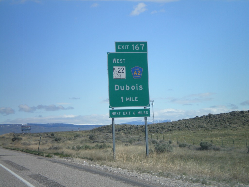
I-15 South - Exit 167
I-15 south at Exit 167 - ID-22 West/CR-A2/Dubois.
Taken 05-02-2010

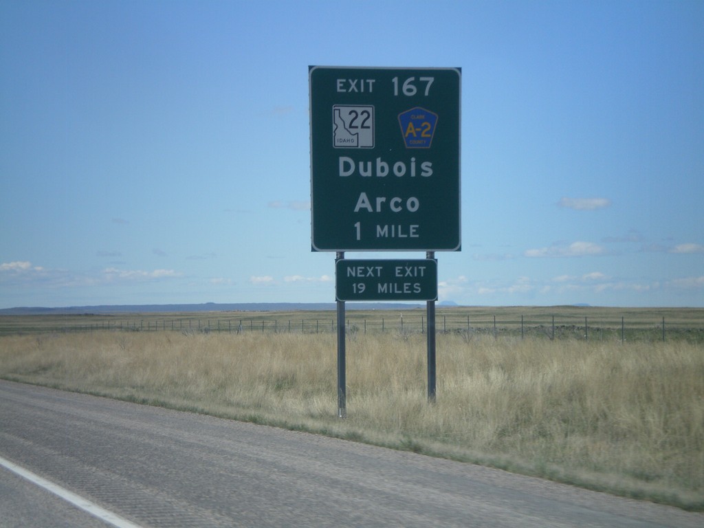
I-15 South - Exit 167
I-15 South approaching Exit 167 - ID-22/Clark County A2/Dubois/Arco. The actual sign at the exit omits Arco from the destination.
Taken 05-02-2010
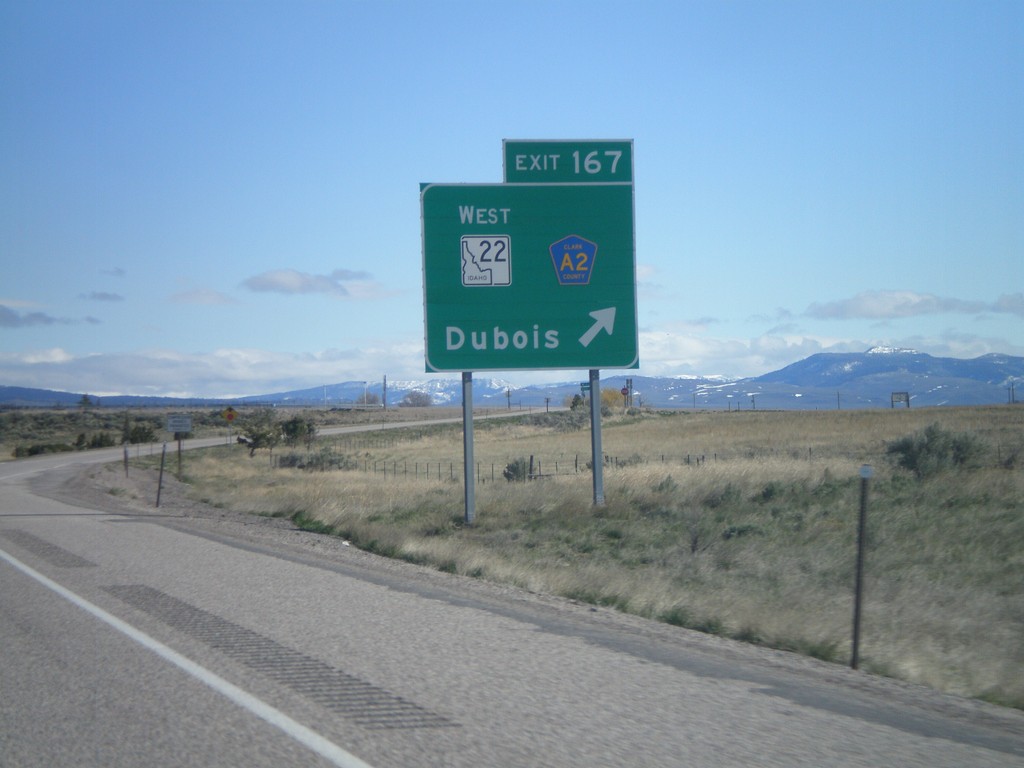
I-15 North - Exit 167
I-15 north Exit 167 - ID-22 West/Clark County A2/Dubois.
Taken 05-02-2010
I-15 North - Exit 167
I-15 north approaching Exit 167 - ID-22 West/Clark County A2/Dubois.
Taken 05-02-2010