Signs Tagged With Shield Inside Sign
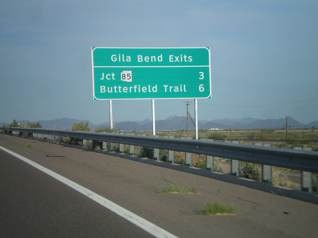
I-8 East - Gila Bend Exits
Gila Bend exits on I-8 east - Jct. AZ-85 and Butterfield Trail.
Taken 03-20-2010
 Gila Bend
Maricopa County
Arizona
United States
Gila Bend
Maricopa County
Arizona
United States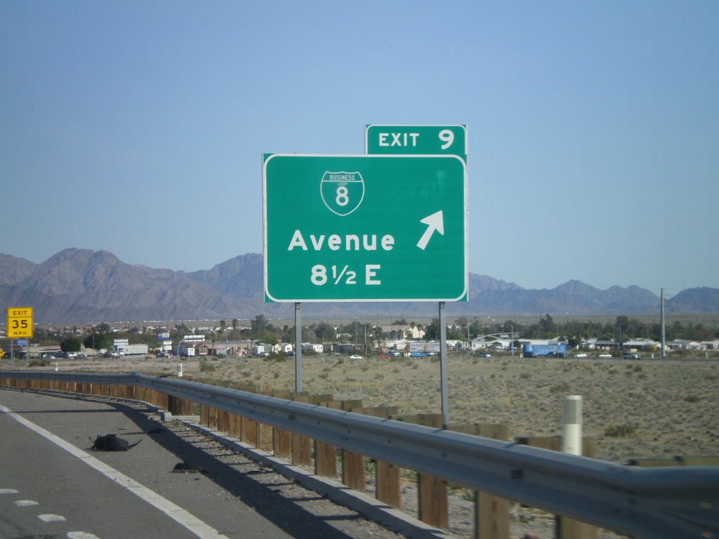
I-8 East - Exit 9
I-8 east at Exit 9 - BL-8/Avenue 8 1/2 East.
Taken 03-20-2010
 Yuma
Yuma County
Arizona
United States
Yuma
Yuma County
Arizona
United States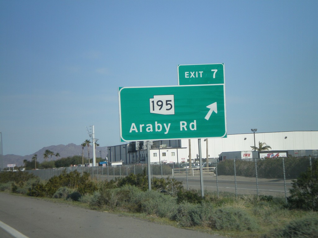
I-8 East - Exit 7
I-8 east at Exit 7 - AZ-195/Araby Road. AZ-195 is being constructed as an alternate route between Yuma and the San Luis Port of Entry at the Mexico border. Currently only a few miles of this route is complete.
Taken 03-20-2010
 Yuma
Yuma County
Arizona
United States
Yuma
Yuma County
Arizona
United States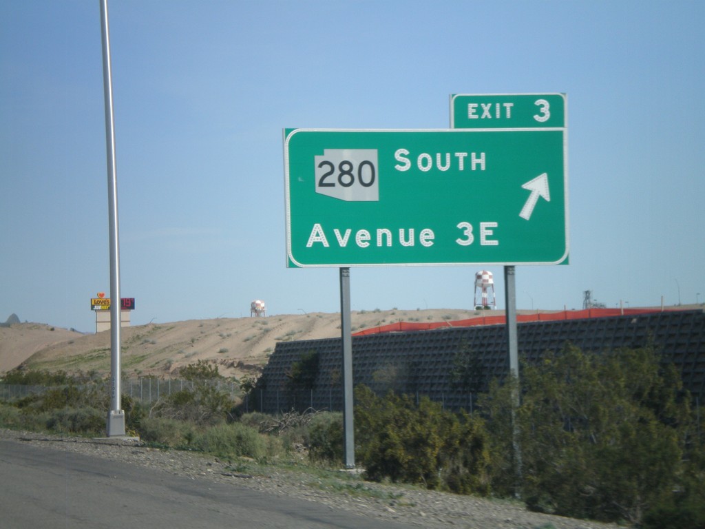
I-8 East - Exit 3
I-8 east at Exit 3 -AZ-280 South/Ave 3E
Taken 03-20-2010
 Yuma
Yuma County
Arizona
United States
Yuma
Yuma County
Arizona
United States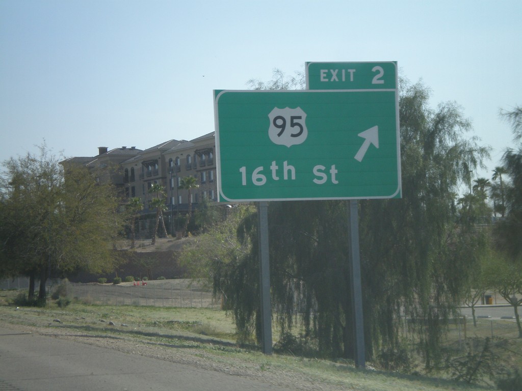
I-8 East - Exit 2
I-8 east at Exit 2 - US-95/16th St.
Taken 03-20-2010
 Yuma
Yuma County
Arizona
United States
Yuma
Yuma County
Arizona
United States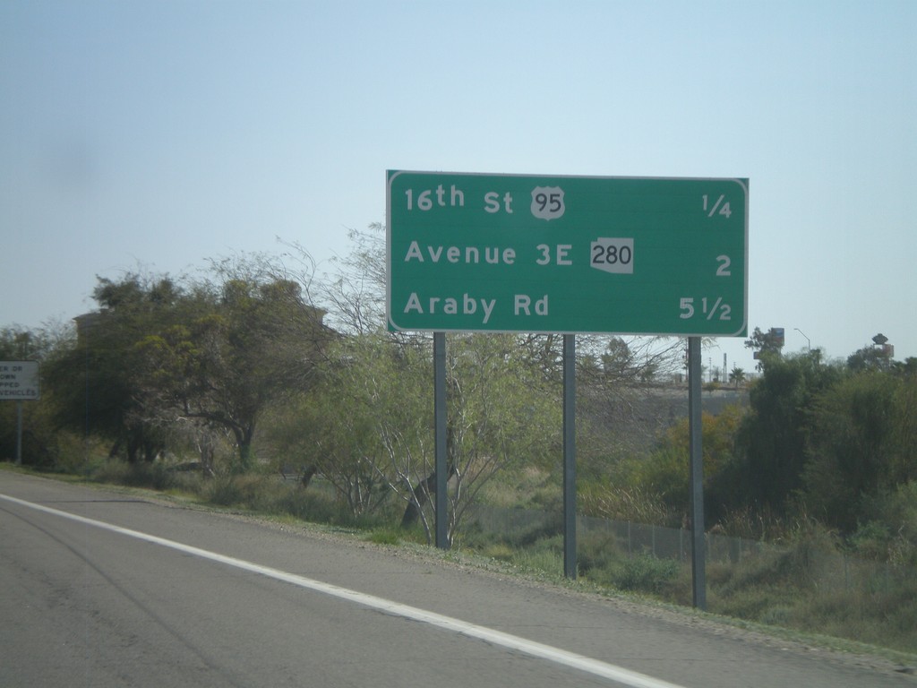
I-8 East - Distance Marker
Upcoming exits on I-8 east - 16th St./US-95, Ave 3E/AZ-280, Araby Road.
Taken 03-20-2010
Yuma
Yuma County
Arizona
United States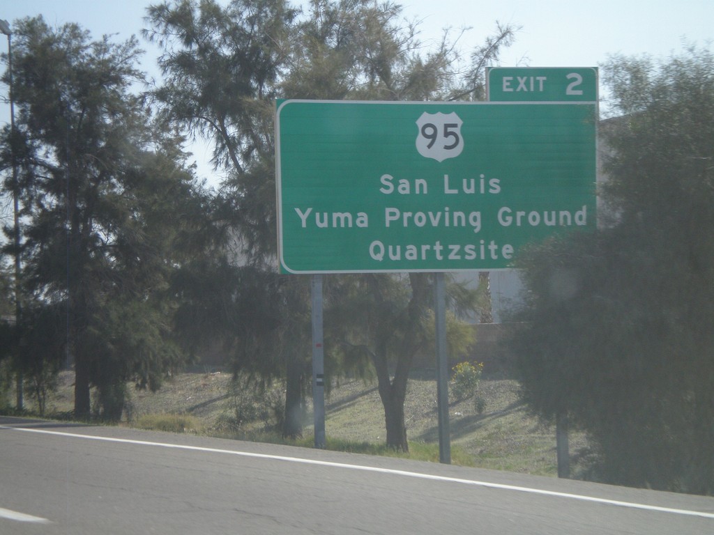
I-8 East Approaching Exit 2
I-8 east approaching Exit 2 - US-95 jct. Use US-95 for San Luis, Yuma Proving Ground, and Quartzite.
Taken 03-20-2010
Yuma
Yuma County
Arizona
United States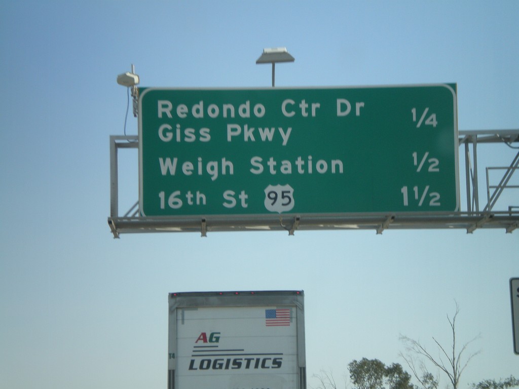
I-8 East - Yuma Exits
Upcoming exits on I-8 east in Yuma - Redondo Center Drive/Giss Parkway, Weigh Station, 16th St./US-95.
Taken 03-20-2010
Yuma
Yuma County
Arizona
United States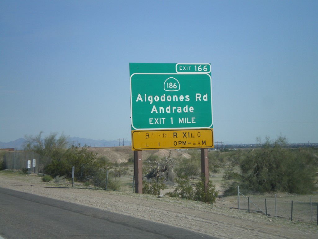
I-8 East Approaching Exit 166
I-8 east approaching Exit 166 - CA-186/Algodones Road/Andrade. Use CA-186 south for access to the Algodones Port of Entry with Mexico. The Port of Entry is closed from 10 PM to 6 AM.
Taken 03-20-2010
 Winterhaven
Imperial County
California
United States
Winterhaven
Imperial County
California
United States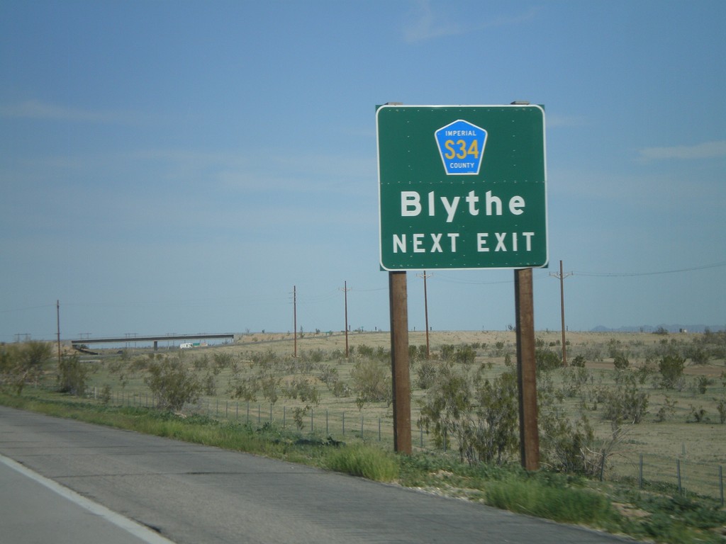
I-8 East Approaching Exit 159
I-8 east approaching Exit 159 - Imperial County S-34 to Blythe.
Taken 03-20-2010
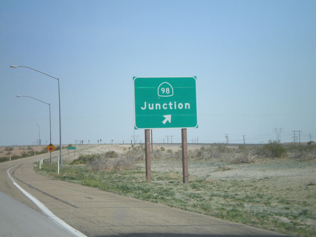
I-8 East - Exit 143
I-8 east at Exit 143 - CA-98 Junction
Taken 03-20-2010
 Holtville
Imperial County
California
United States
Holtville
Imperial County
California
United States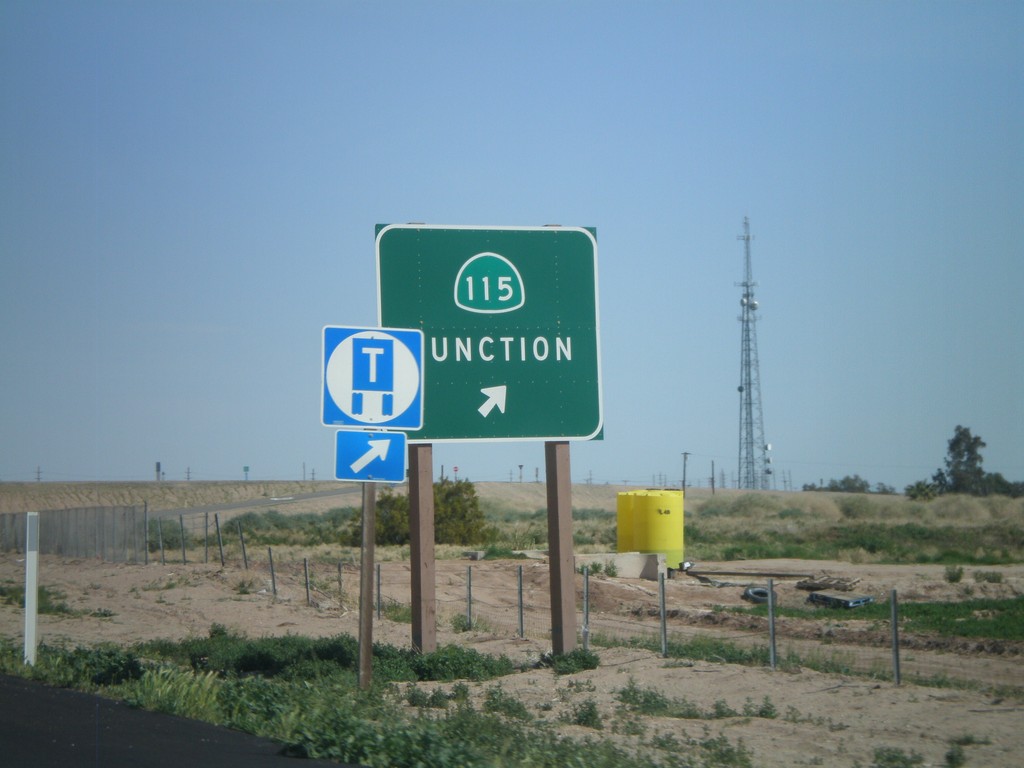
I-8 East - Exit 131
I-8 east at Exit 131 - CA-115 Junction
Taken 03-20-2010
 Date City
Imperial County
California
United States
Date City
Imperial County
California
United States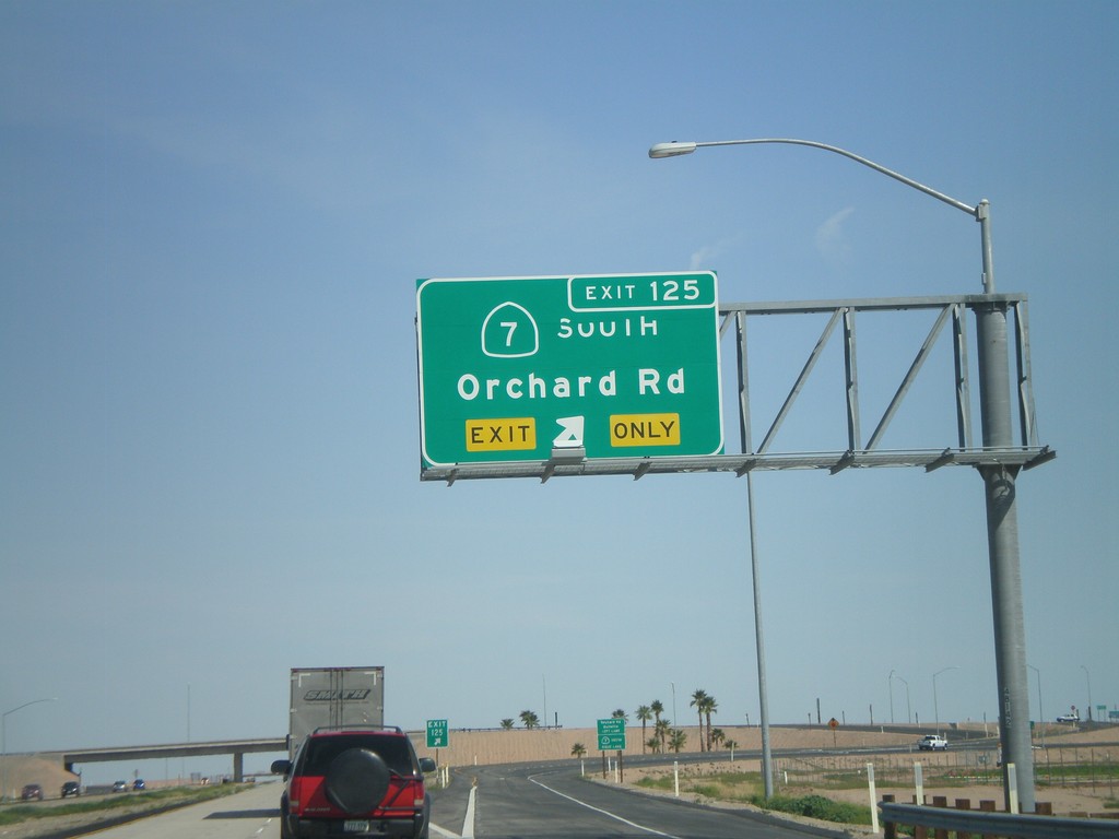
I-8 East - Exit 125
I-8 east at Exit 125 - CA-7 South/Orchard Road
Taken 03-20-2010
 Holtville
Imperial County
California
United States
Holtville
Imperial County
California
United States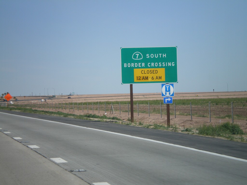
I-8 East Approaching CA-7 - Port of Entry Hours
I-8 east approaching CA-7 - Border Crossing Hours. Port of Entry Closed from 12AM to 6AM.
Taken 03-20-2010
Holtville
Imperial County
California
United States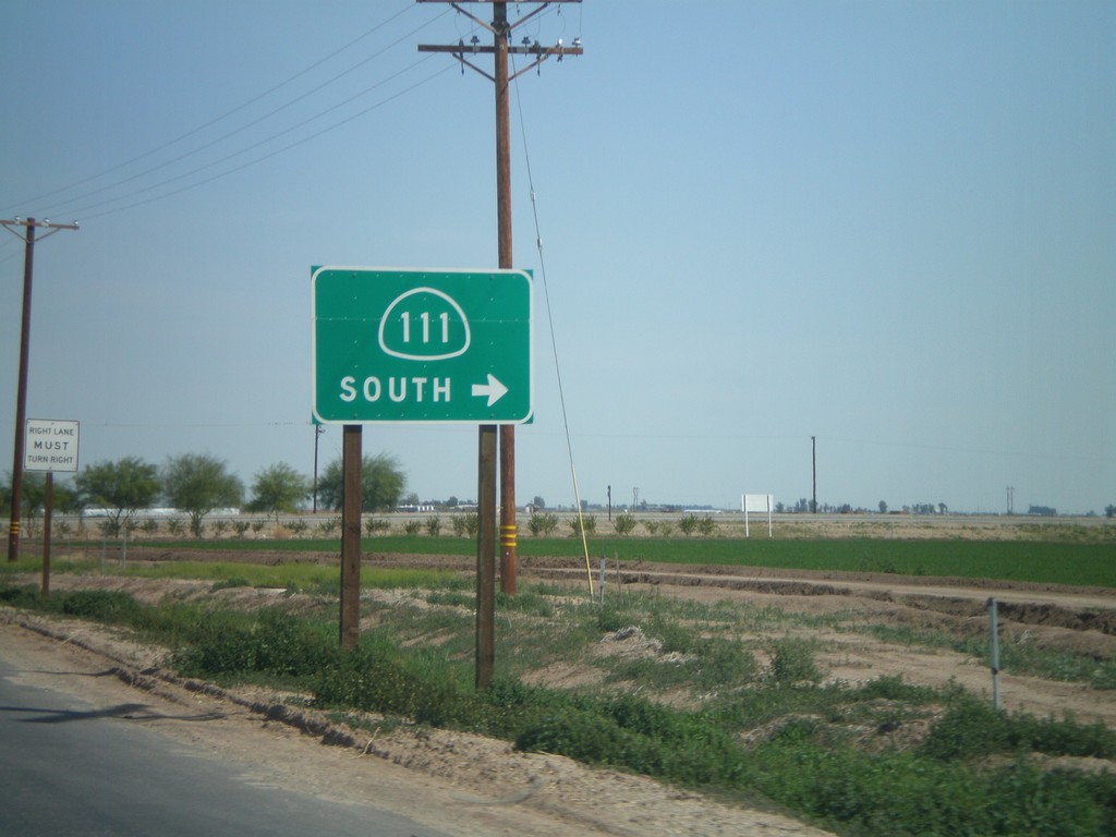
CA-78 East/CA-111 South Approaching Split
CA-78 East/CA-111 South approaching split. Turn right for CA-111 south.
Taken 03-20-2010

 Brawley
Imperial County
California
United States
Brawley
Imperial County
California
United States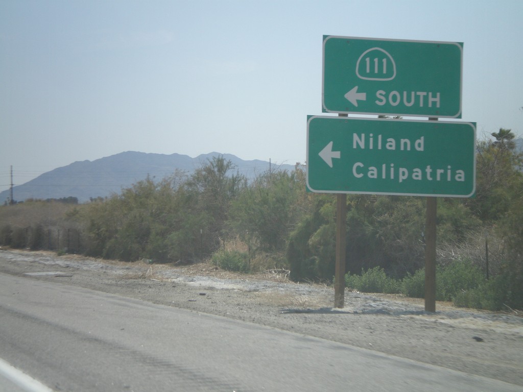
CA-86S Approaching CA-111
CA-86S approaching CA-111 South to Niland and Calipatria.
Taken 03-20-2010
 Mecca
Riverside County
California
United States
Mecca
Riverside County
California
United States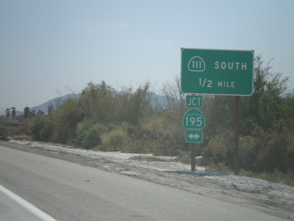
CA-86S South Approaching CA-195 To CA-111
CA-86S South approaching CA-195 to CA-111 South.
Taken 03-20-2010
 Mecca
Riverside County
California
United States
Mecca
Riverside County
California
United States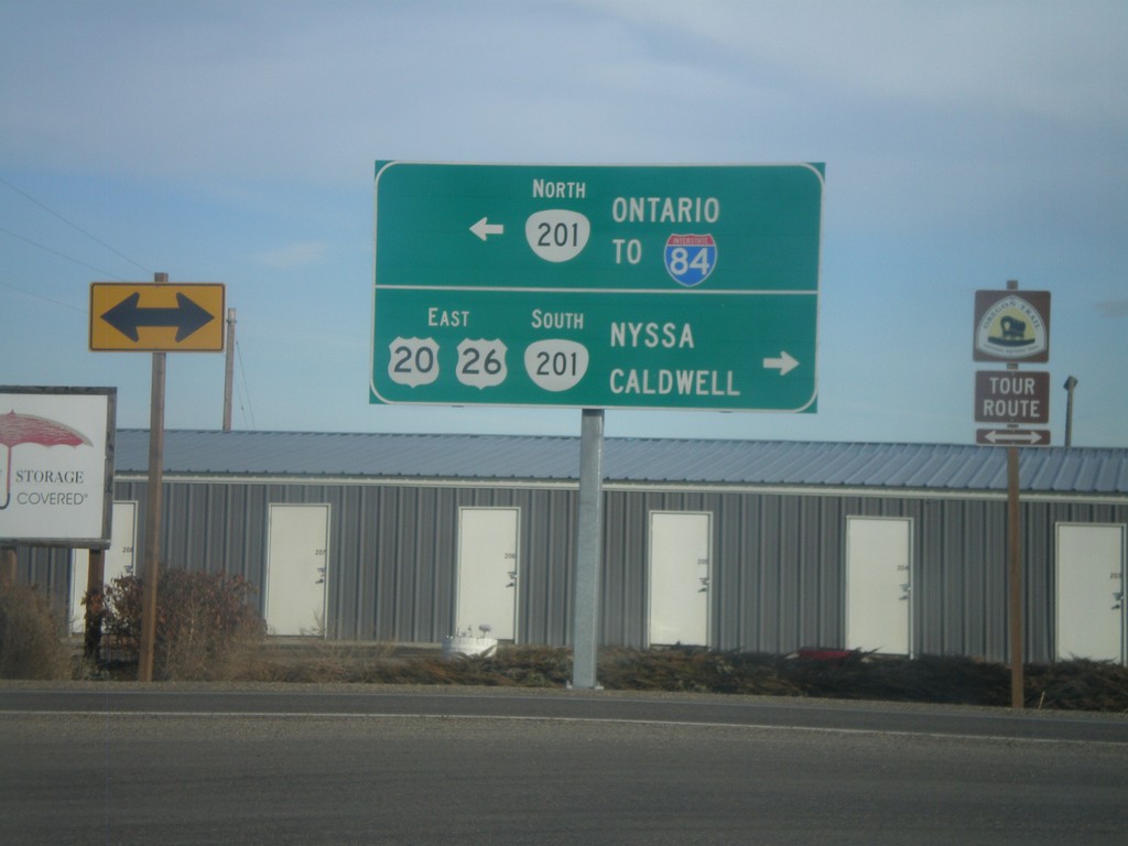
US-20/US-26 East at OR-201
US-20/US-26 east at OR-201. Use OR-201 South/US-20 East/US-26 East to Nyssa and Caldwell (ID). Use OR-201 North for Ontario and I-84.
Taken 01-18-2010

 Ontario
Malheur County
Oregon
United States
Ontario
Malheur County
Oregon
United States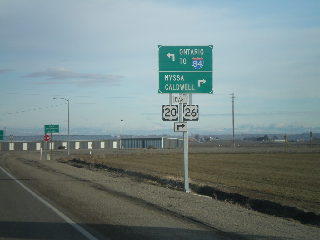
US-20/US-26 East at OR-201
US-20/US-26 east at OR-201. Use OR-201 South/US-20 East/US-26 East to Nyssa and Caldwell (ID). Use OR-201 North for Ontario and I-84.
Taken 01-18-2010
 Ontario
Malheur County
Oregon
United States
Ontario
Malheur County
Oregon
United States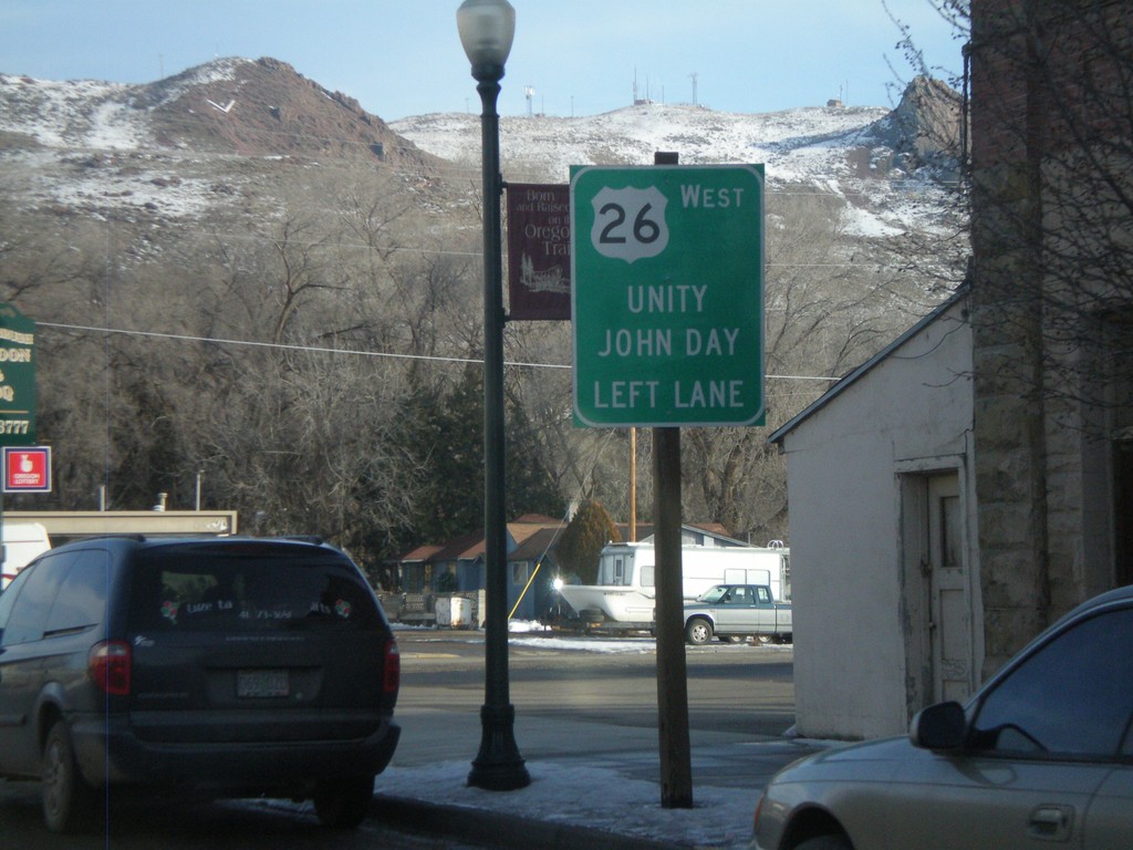
US-20 East Approacing US-26 West
US-20 east approaching US-26 in downtown Vale. Use US-26 west for Unity and John Day. US-20 and US-26 join eastwards into Idaho.
Taken 01-18-2010
Vale
Malheur County
Oregon
United States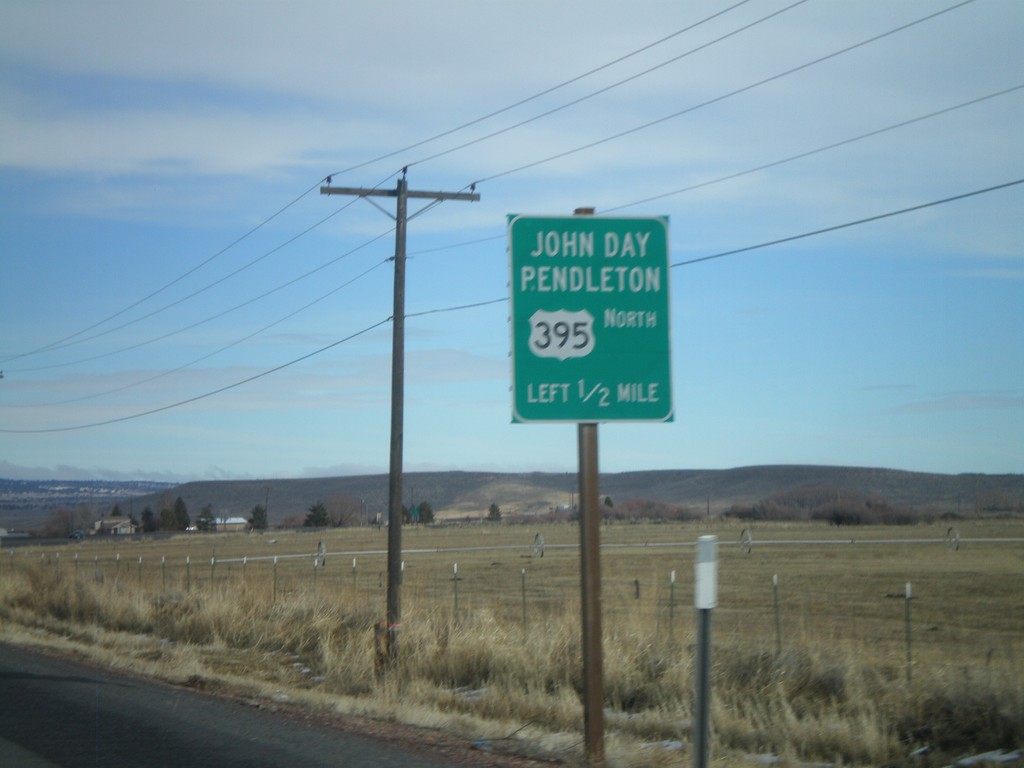
US-20 East/US-395 North Approaching US-395
US-20 East/US-395 North approaching US-395 north to John Day and Pendleton.
Taken 01-18-2010
 Burns
Harney County
Oregon
United States
Burns
Harney County
Oregon
United States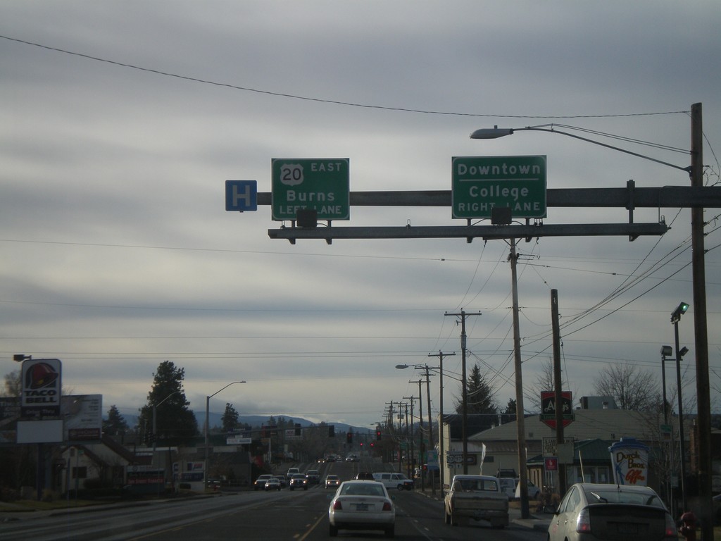
US-20 East/Business US-97 South At US-20
US-20 West/Business US-97 South approaching US-20 East towards Burns (Greenwood Ave.) Use Greenwood Ave. west for Downtown Bend and College.
Taken 01-18-2010
Bend
Deschutes County
Oregon
United States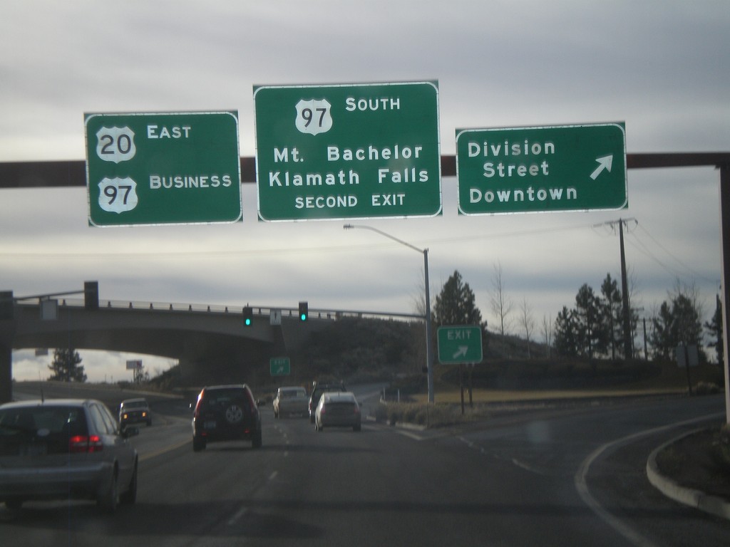
US-20 East/US-97 Business at US-97 South
US-20 West/Business US-97 South at Division St./Downtown exit. Approaching US-97 South/Mt. Bachelor/Klamath Falls exit.
Taken 01-18-2010
 Bend
Deschutes County
Oregon
United States
Bend
Deschutes County
Oregon
United States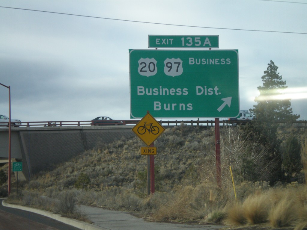
US-97 South - Exit 135A
US-97 south at Exit 135A - US-20/US-97 Business/Business District/Burns.
Taken 01-18-2010
Bend
Deschutes County
Oregon
United States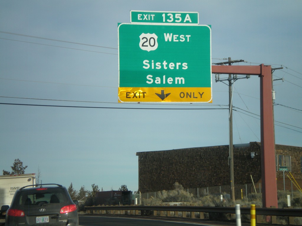
US-97 North - Exit 135A
US-97 north at Exit 135A - US-20 West/Sisters/Salem.
Taken 01-18-2010
Bend
Deschutes County
Oregon
United States