Signs Tagged With Shield Inside Sign
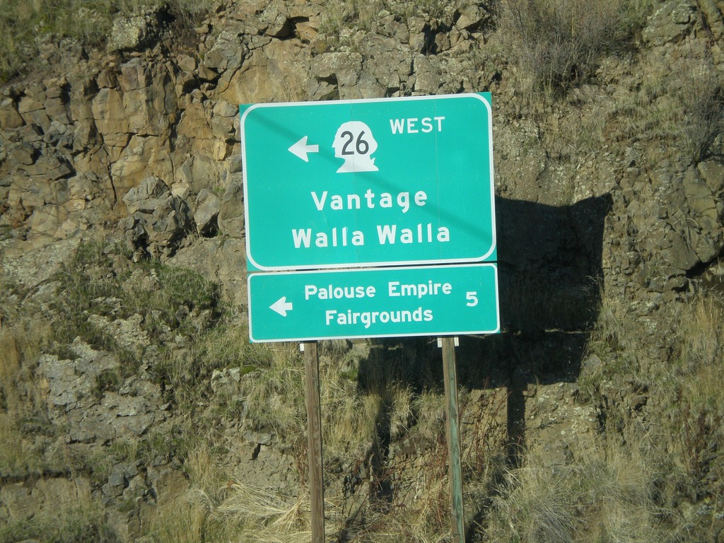
US-195 North at WA-26 West
US-195 north at WA-26 west to Vantage and Walla Walla. WA-26 is the main highway across central Washington from the Palouse region to Seattle. Use WA-26 west for the Palouse Empire Fairgrounds.
Taken 12-26-2009

 Colfax
Whitman County
Washington
United States
Colfax
Whitman County
Washington
United States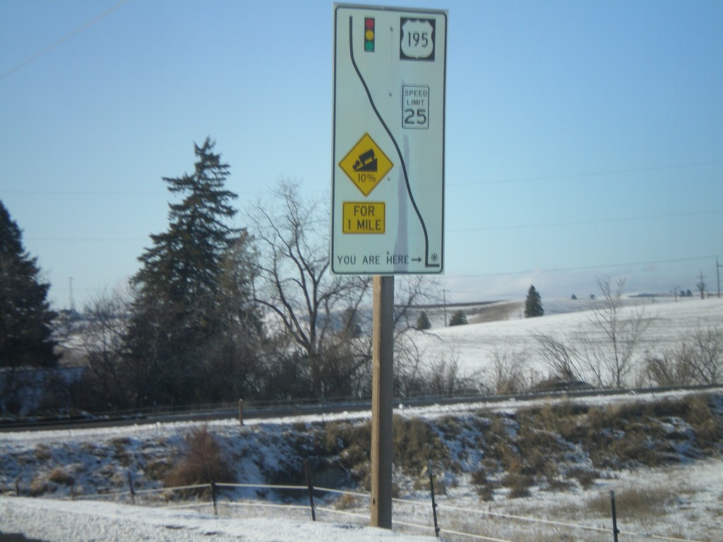
WA-272 East - Grade Information
WA-272 west at the top of a 10% grade above Colfax. Route diagram showing the speed and grade information, and the stoplight at the bottom of the hill at US-195.
Taken 12-26-2009
 Colfax
Whitman County
Washington
United States
Colfax
Whitman County
Washington
United States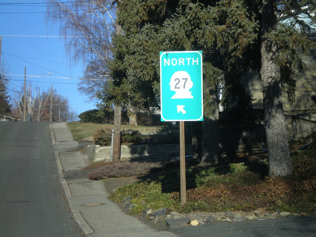
WA-27 North - Palouse
WA-27 North/WA-272 West (unsigned) on Division St. in Palouse.
Taken 12-26-2009
 Palouse
Whitman County
Washington
United States
Palouse
Whitman County
Washington
United States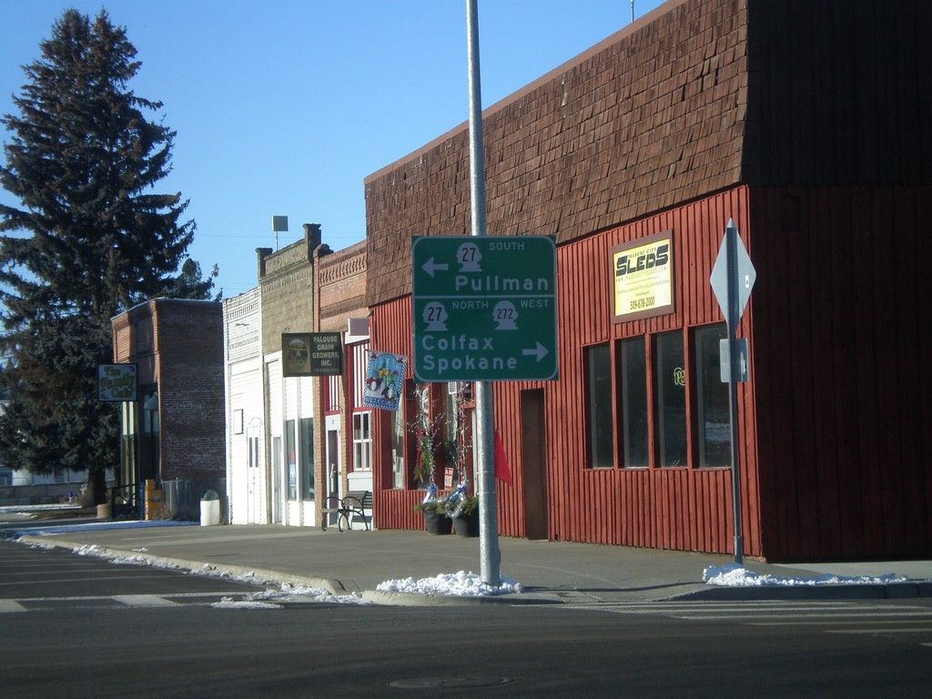
WA-272 West at WA-27
WA-272 west at WA-27 in Palouse. WA-272 joins WA-27 through Palouse. Use WA-27 South for Pullman. Use WA-27 North/WA-272 West for Colfax and Spokane.
Taken 12-26-2009
Palouse
Whitman County
Washington
United States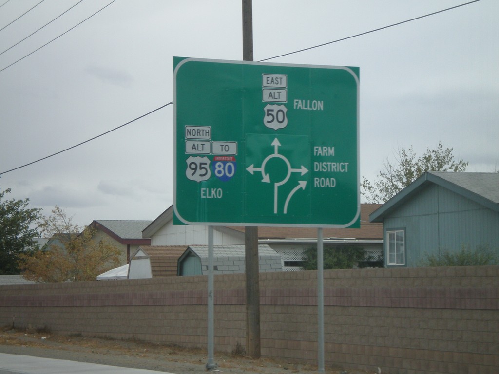
Alt. US-95 North/Alt. US-50 East Approaching Split
BL-80/Alt. US-50 East/Alt. US-95 North approaching roundabout. Alt. US-50 East traffic leaves here towards Fallon. Alt. US-95 North traffic follows BL-80 towards I-80 and Elko. Farm District Road (NV-828) leaves to the south. This roundabout is a recent development in Fallon.
Taken 10-04-2009


 Fernley
Lyon County
Nevada
United States
Fernley
Lyon County
Nevada
United States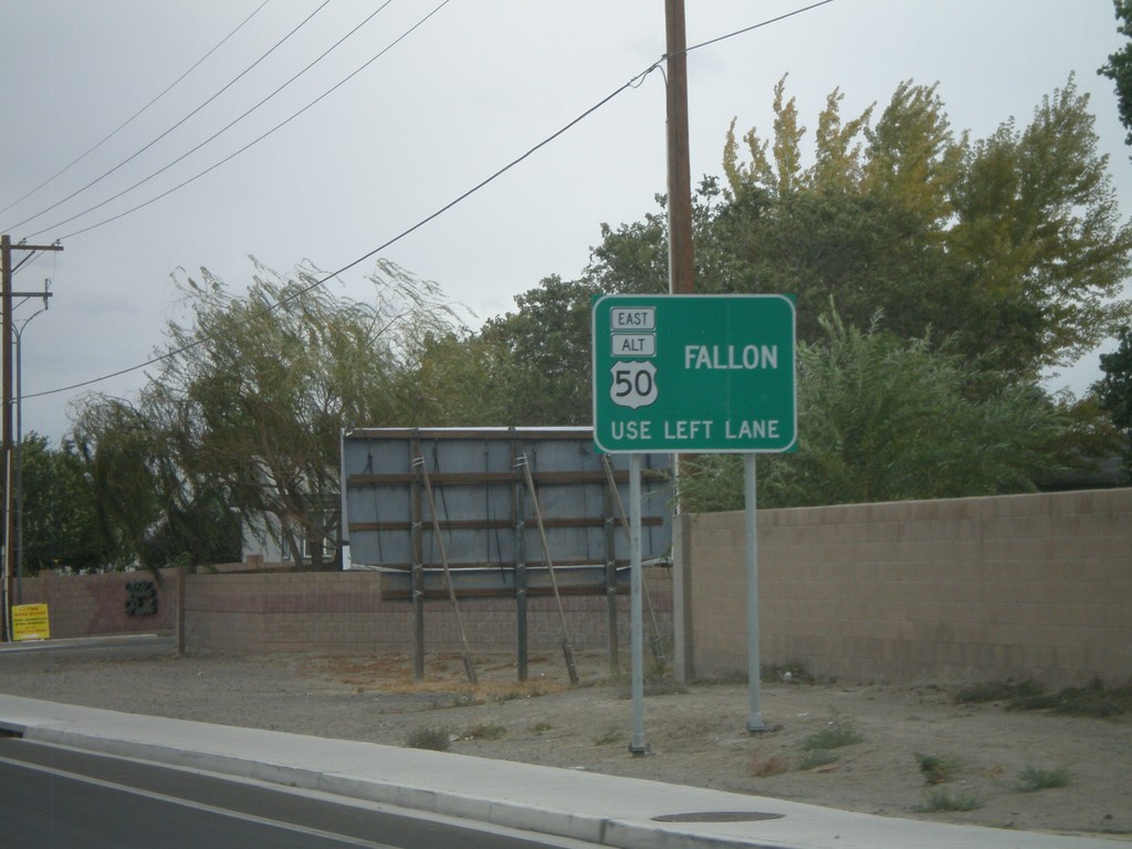
BL-80/Alt. US-95/Alt. US-50 Approaching Split
BL-80/Alt. US-50/Alt. US-95 approaching Alt. US-50 split. Stay in left lane for Alt. US-50 towards Fallon.
Taken 10-04-2009
Fernley
Lyon County
Nevada
United States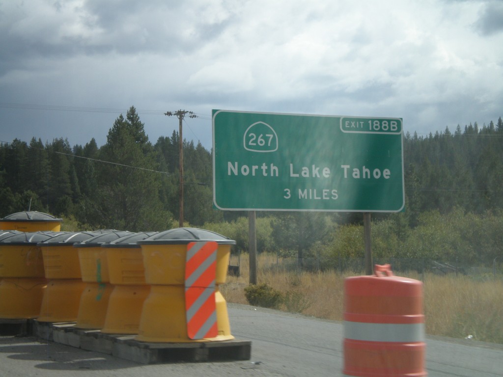
I-80 East Advanced for Exit 188B
Advanced signage for Exit 188B - CA-267/North Lake Tahoe. Approaching Exit 185 - CA-89 south, Lake Tahoe. Both CA-89 and CA-267 connect Truckee with the north shore of Lake Tahoe.
Taken 10-04-2009


 Truckee
Nevada County
California
United States
Truckee
Nevada County
California
United States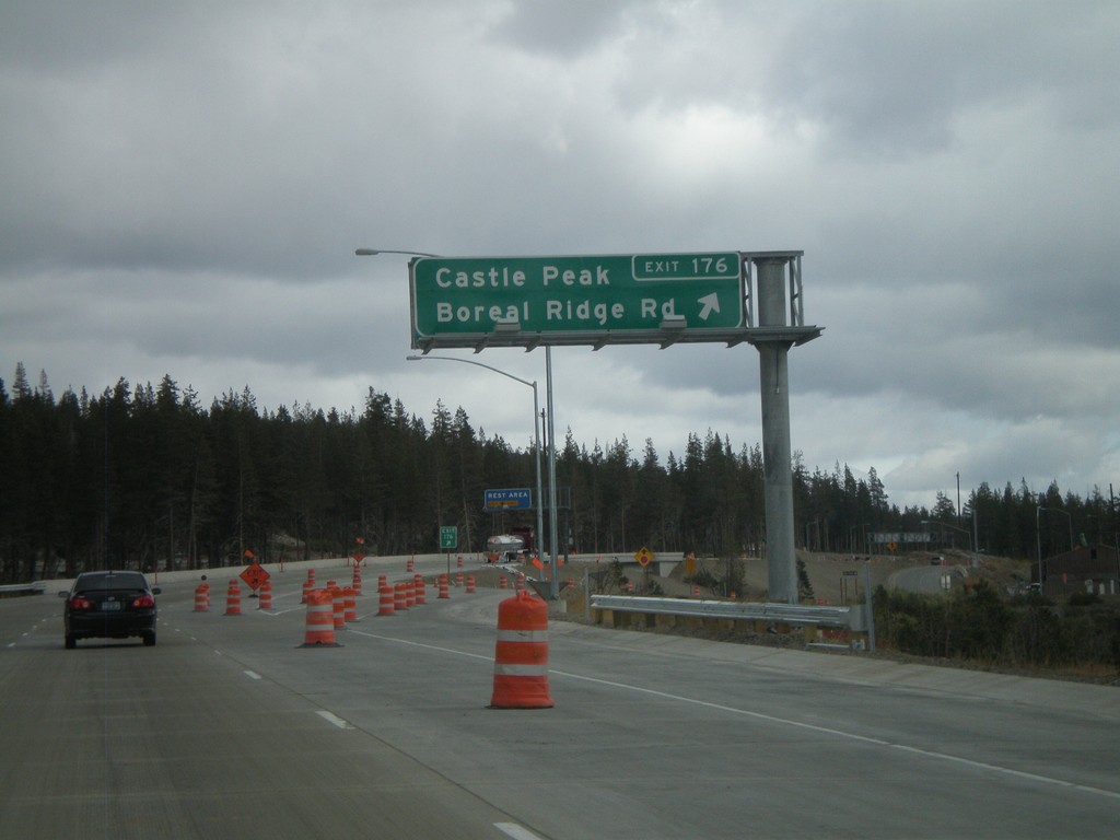
I-80 East - Exit 176
I-80 east at Exit 176 - Castle Peak/Boreal Ridge Road. Exit 176 provides access to Boreal Ski Area. This exit is at the top of Donner Summit, the highest point on I-80 in California.
Taken 10-04-2009
Soda Springs
Nevada County
California
United States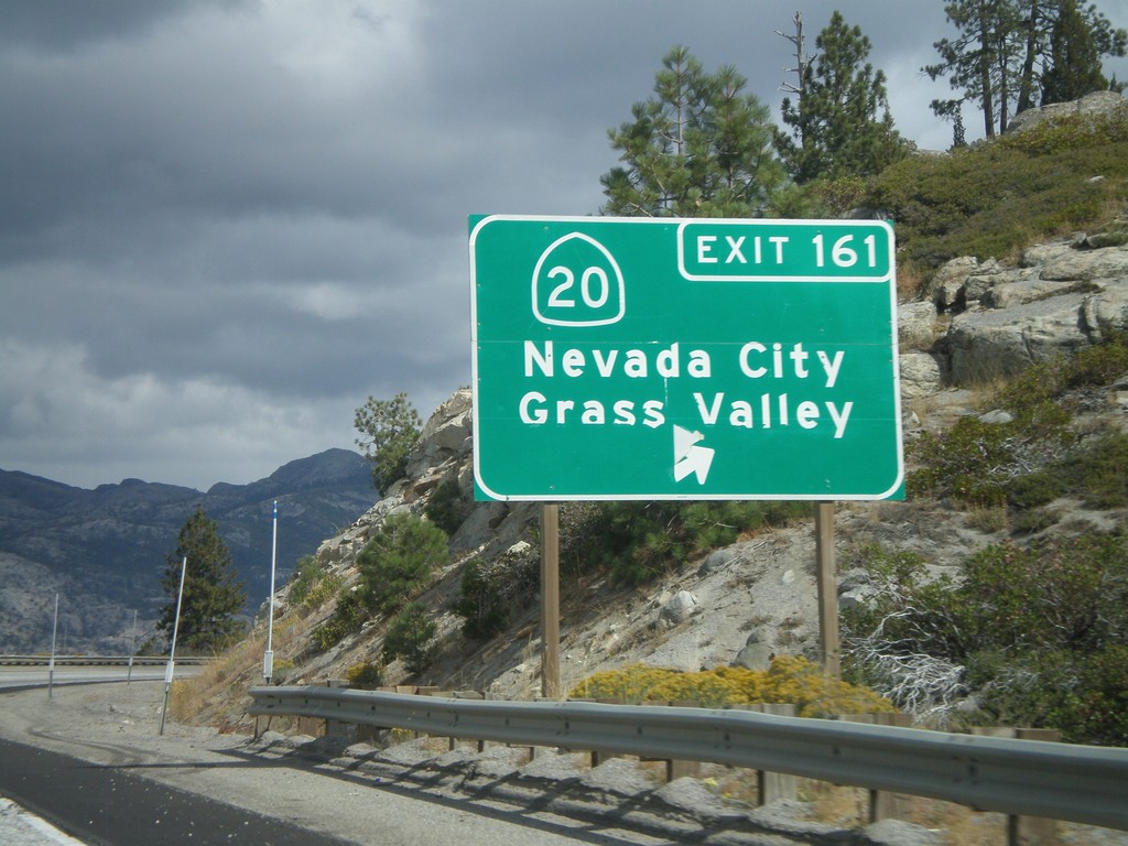
I-80 East - Exit 161
I-80 east at Exit 161 - CA-20/Nevada City/Grass Valley
Taken 10-04-2009
 Yuba Pass
Nevada County
California
United States
Yuba Pass
Nevada County
California
United States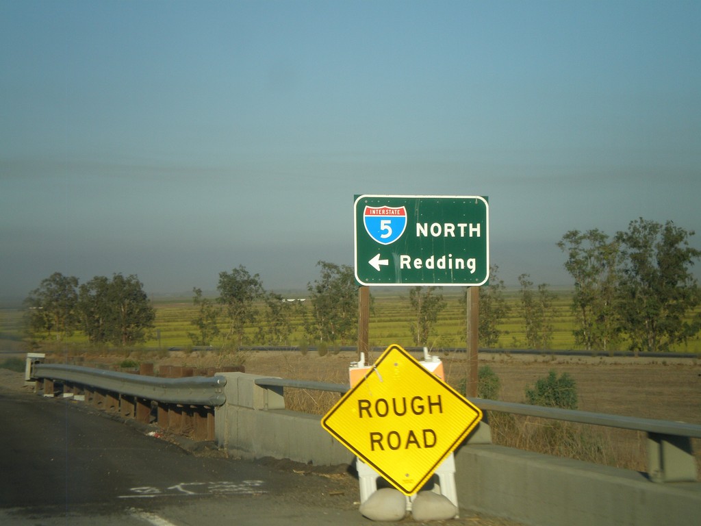
CA-20 East at I-5 North
CA-20 east at I-5 north to Redding.
Taken 09-25-2009
 Williams
Colusa County
California
United States
Williams
Colusa County
California
United States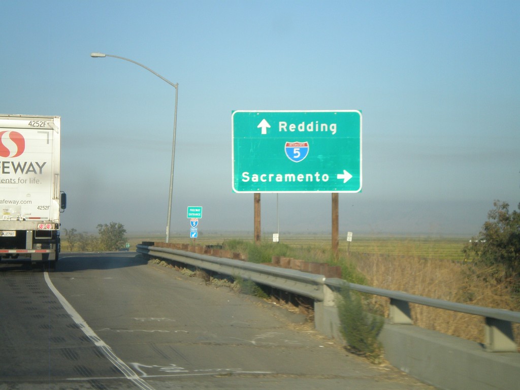
CA-20 East at I-5
CA-20 east at I-5 to Redding and Sacramento.
Taken 09-25-2009
Williams
Colusa County
California
United States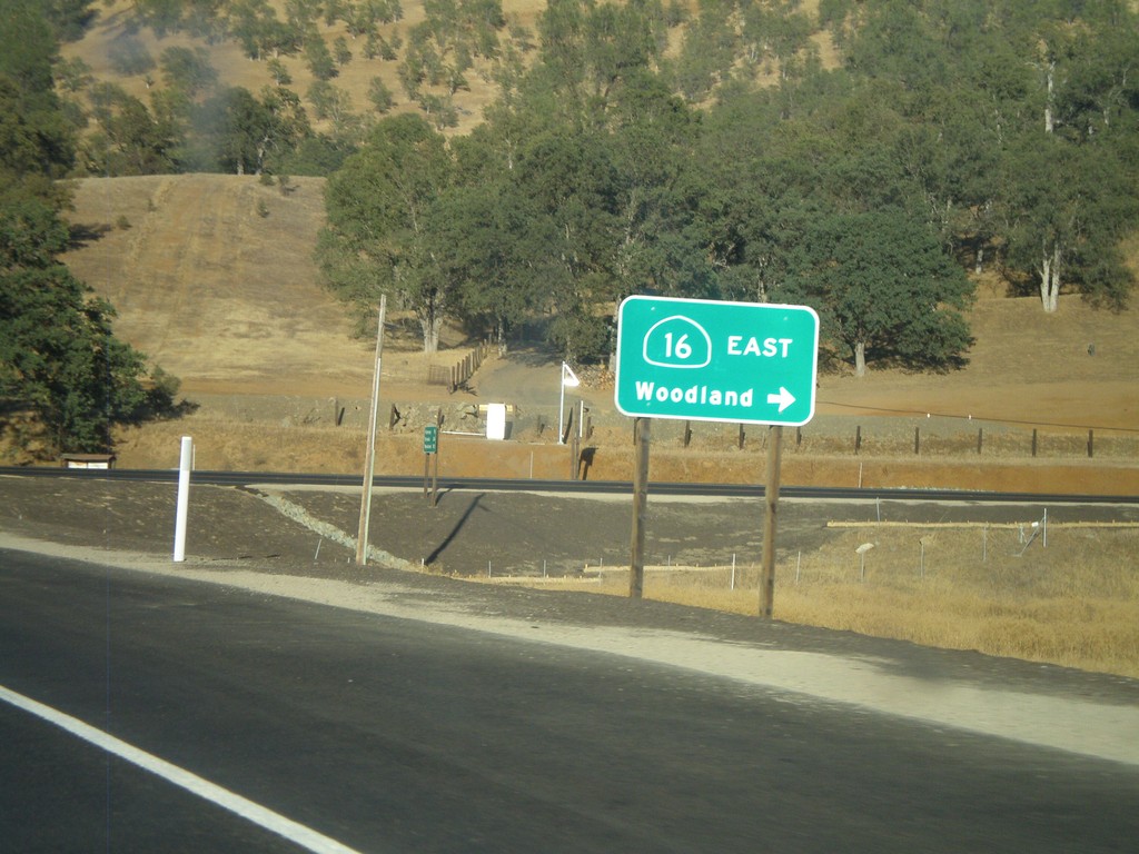
CA-20 East At CA-16 East
CA-20 east at CA-16 east to Woodland.
Taken 09-25-2009
 Williams
Colusa County
California
United States
Williams
Colusa County
California
United States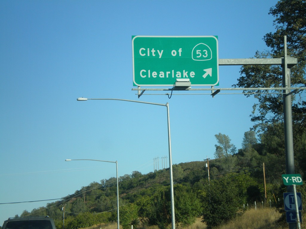
CA-20 East at CA-53
CA-20 East at CA-53 south to City of Clearlake
Taken 09-25-2009
 Clearlake Oaks
Lake County
California
United States
Clearlake Oaks
Lake County
California
United States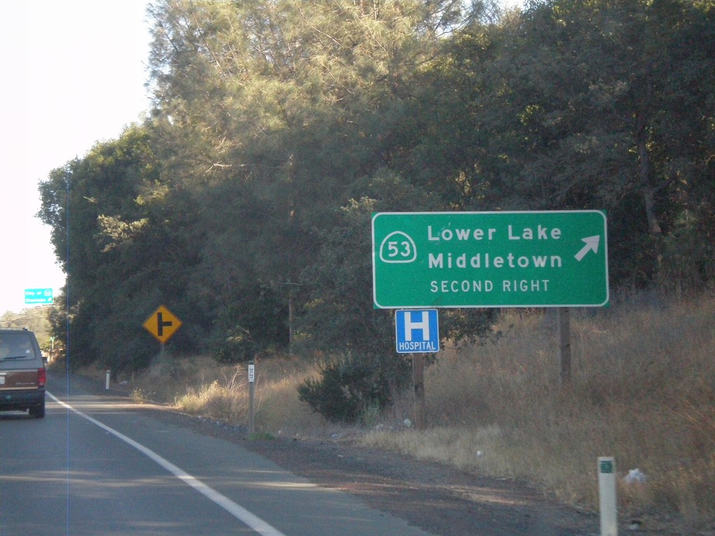
CA-20 East Approaching CA-53
CA-20 East approaching CA-53 south. Turn right on CA-53 for Lower Lake and Middletown.
Taken 09-25-2009
Clearlake Oaks
Lake County
California
United States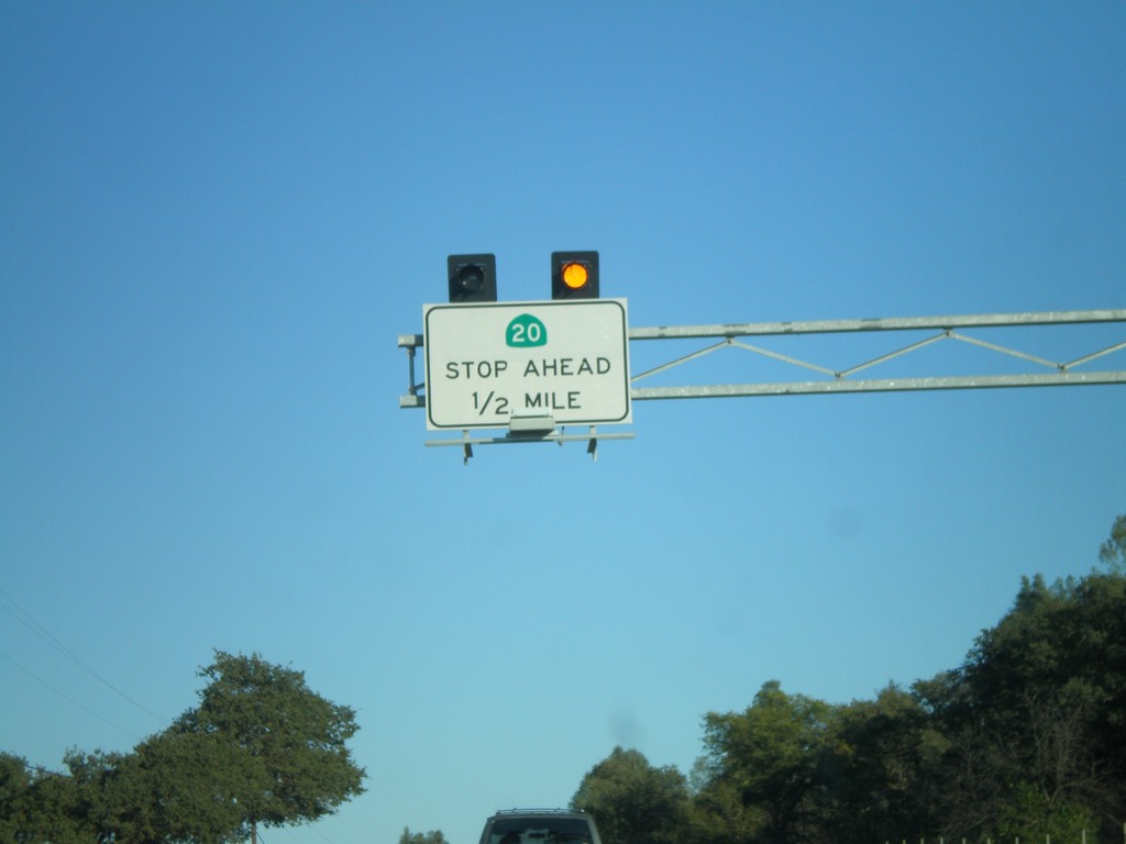
CA-20 East Traffic Must Stop Ahead
CA-20 East approaching CA-53 south. This intersection is controlled by a stop sign on CA-20.
Taken 09-25-2009
Clearlake Oaks
Lake County
California
United States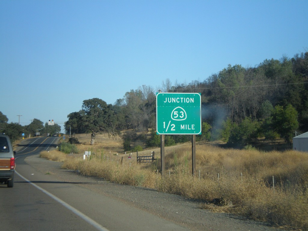
CA-20 East Approaching CA-53
CA-20 East approaching CA-53 south. CA-53 runs south along the east side of Clear Lake.
Taken 09-25-2009
Clearlake Oaks
Lake County
California
United States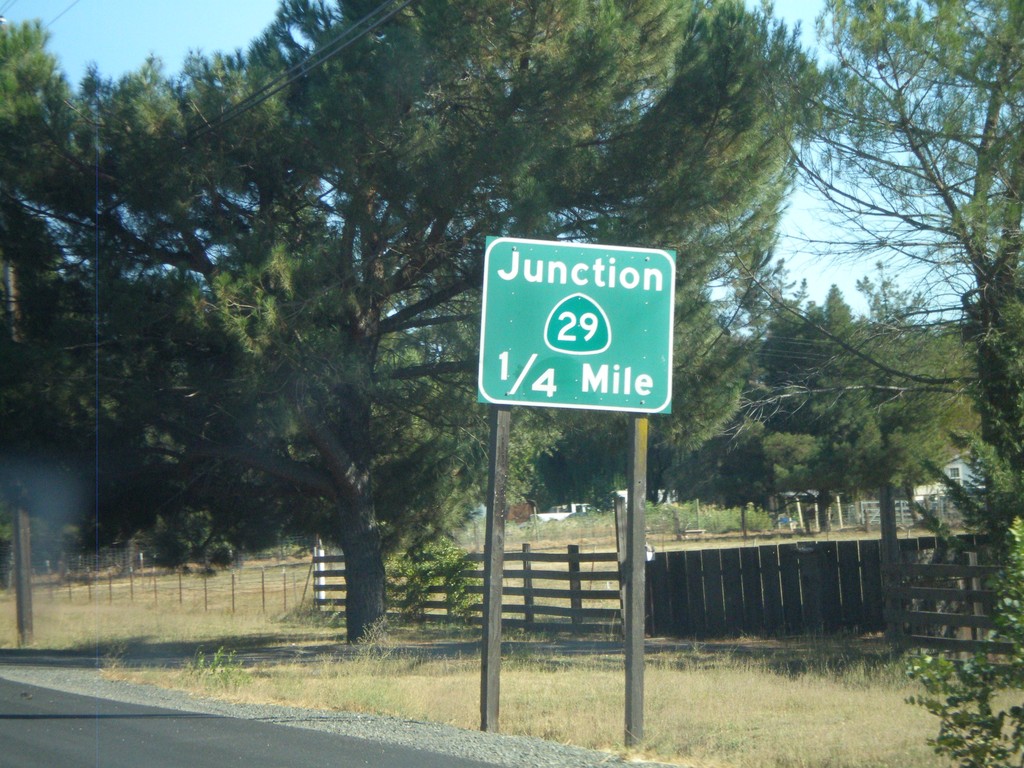
CA-20 East Approaching CA-29
CA-20 east approaching CA-29
Taken 09-25-2009
 Upper Lake
Lake County
California
United States
Upper Lake
Lake County
California
United States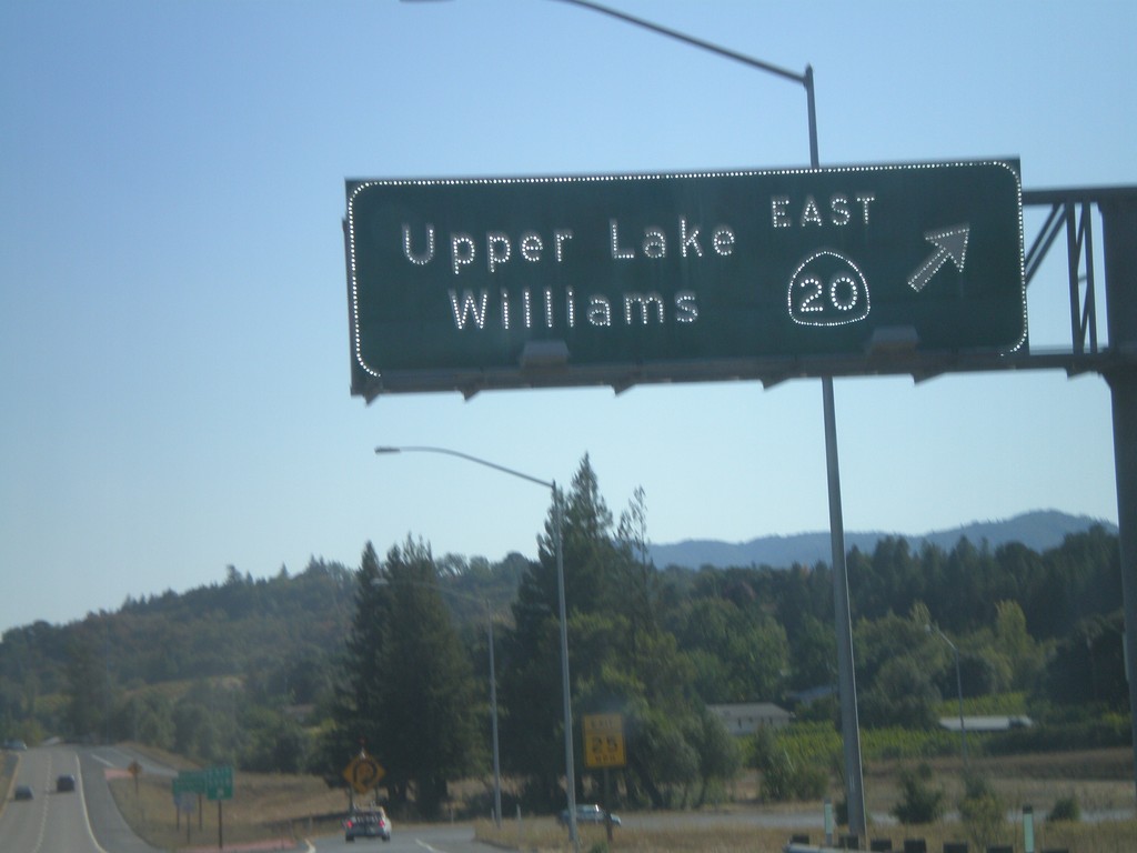
US-101 South - Exit 555B
US 101 south at Exit 555B - CA-20 East/Upper Lake/Williams
Taken 09-25-2009
 Calpella
Mendocino County
California
United States
Calpella
Mendocino County
California
United States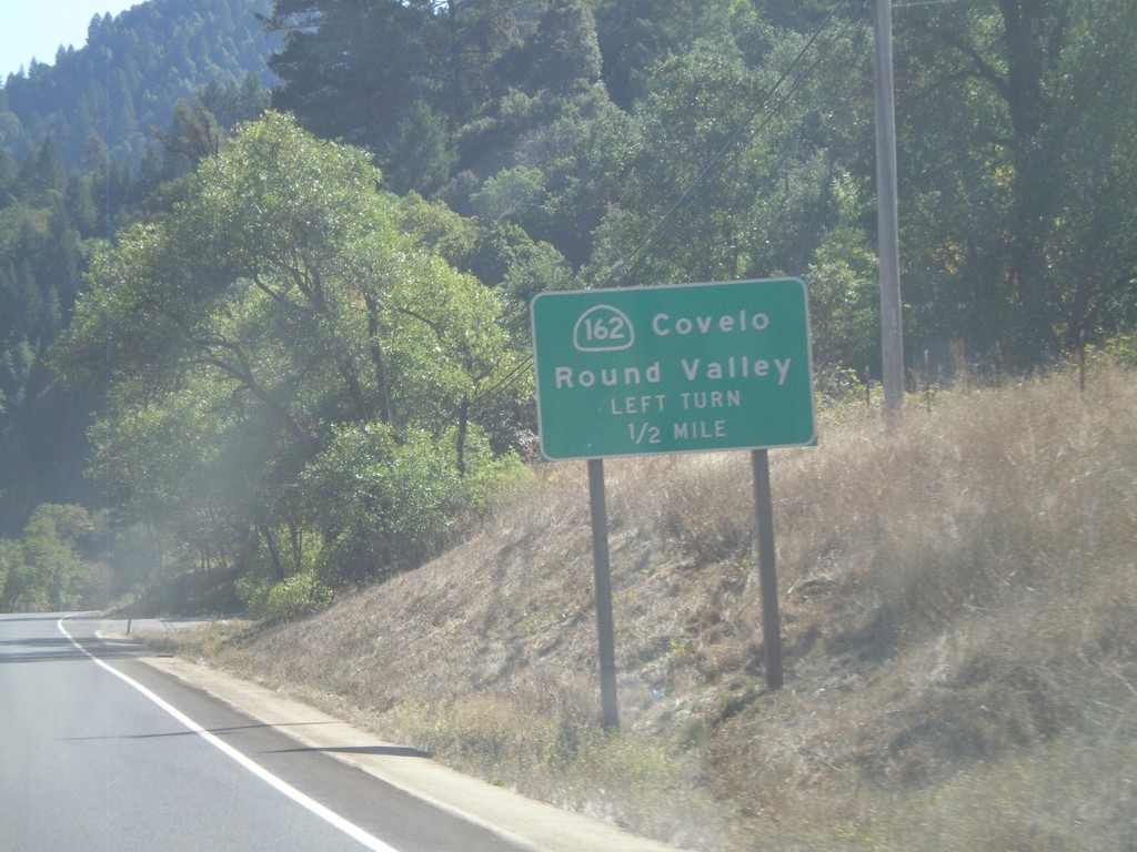
US-101 South Approaching CA-162
US-101 south approaching CA-162 east to Covelo and Round Valley.
Taken 09-25-2009
 Willits
Mendocino County
California
United States
Willits
Mendocino County
California
United States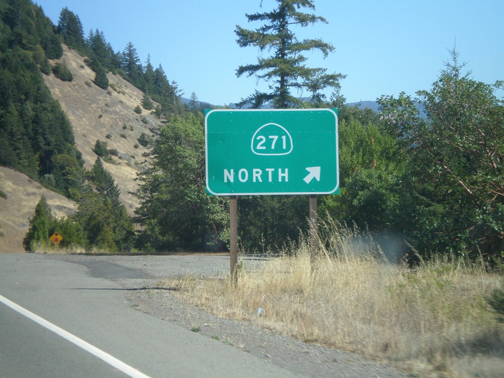
US-101 South - Exit 609
US-101 south at Exit 609 - CA-271 North.. This is the southern terminus of CA-271.
Taken 09-25-2009
 Leggett
Mendocino County
California
United States
Leggett
Mendocino County
California
United States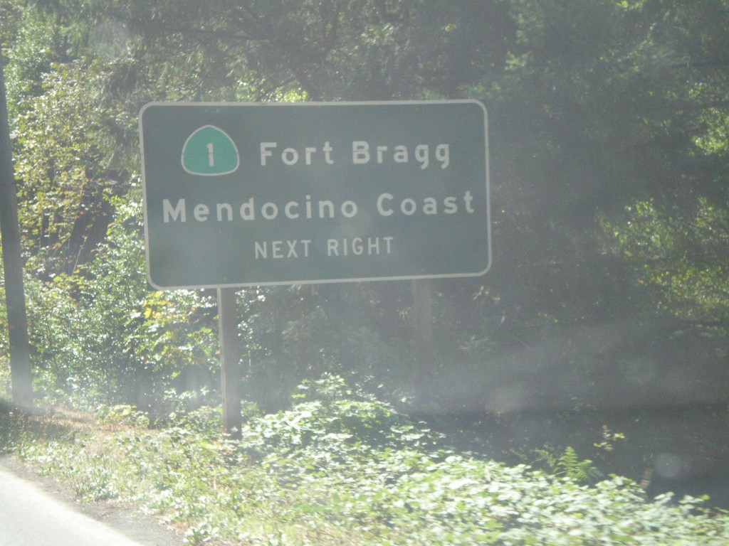
US-101 South Approaching CA-1
US-101 south approaching CA-1/Fort Bragg/Mendocino Coast.
Taken 09-25-2009
 Leggett
Mendocino County
California
United States
Leggett
Mendocino County
California
United States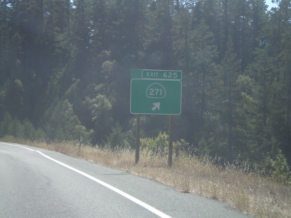
US-101 South - Exit 625
US-101 south at Exit 625 - CA-271
Taken 09-25-2009
Piercy
Mendocino County
California
United States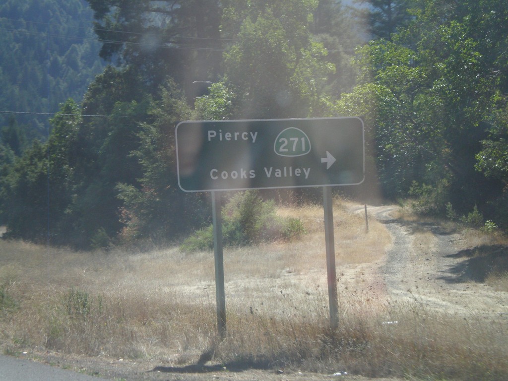
US-101 South at CA-271
US-101 south at CA-271/Piercy/Cooks Valley
Taken 09-25-2009
Garberville
Humboldt County
California
United States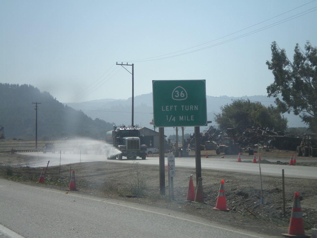
US-101 South Approaching CA-36
US-101 south approaching CA-36 east.
Taken 09-25-2009
 Fortuna
Humboldt County
California
United States
Fortuna
Humboldt County
California
United States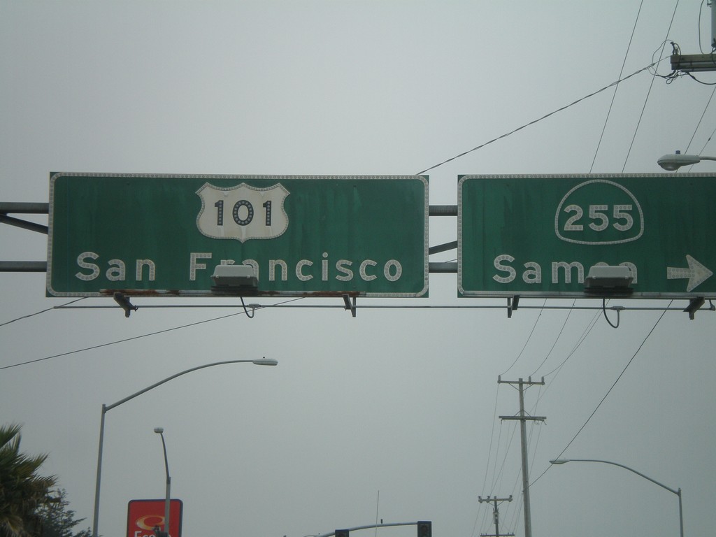
US-101 South At CA-255
US-101 south (4th St.) at CA-255/Samoa in downtown Eureka. Continue on US-101 for San Francisco.
Taken 09-25-2009
 Eureka
Humboldt County
California
United States
Eureka
Humboldt County
California
United States