Signs Tagged With Shield Inside Sign
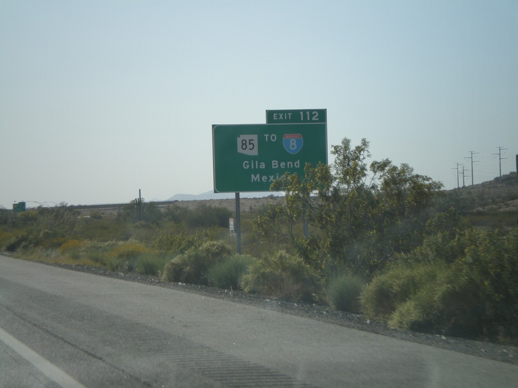
I-10 West Approaching Exit 112
I-10 west approaching Exit 112 - Use Exit 112 for AZ-85/To I-8/Gila Bend/Mexico. The border crossing served by this exit is Lukeville,AZ/Sonoyta,Sonora.
Taken 03-23-2009


 Buckeye
Maricopa County
Arizona
United States
Buckeye
Maricopa County
Arizona
United States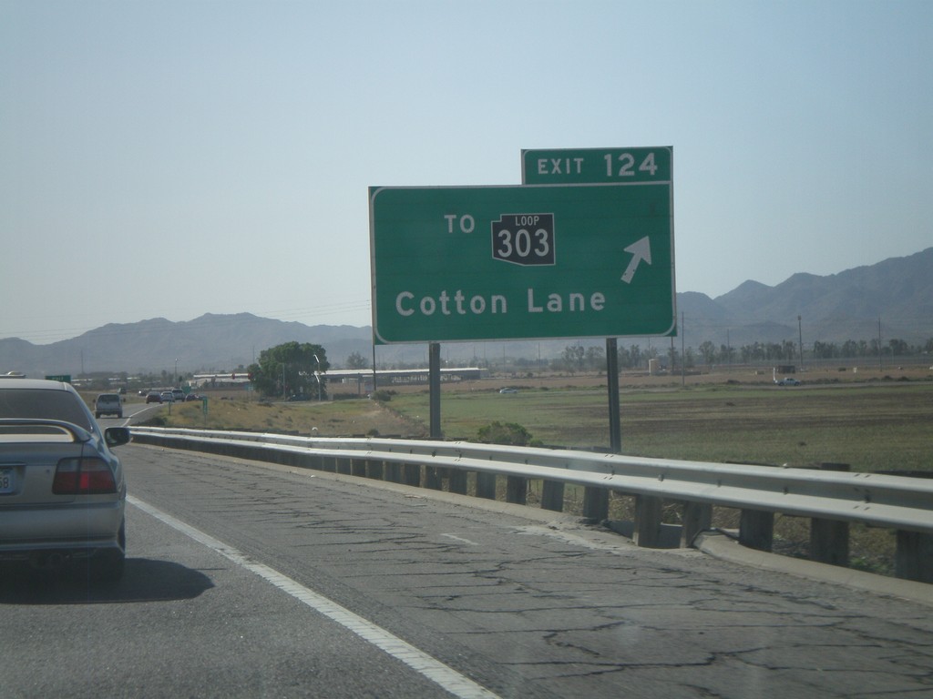
I-10 West - Exit 124
I-10 west at Exit 124 - To AZ-303 Loop/Cotton Lane. AZ-303 is the outermost of the three Phoenix beltways. Each of the three loops has a different color for the shield, although the newer signs just use white. The AZ-303 Loop shield is black.
Taken 03-23-2009
 Goodyear
Maricopa County
Arizona
United States
Goodyear
Maricopa County
Arizona
United States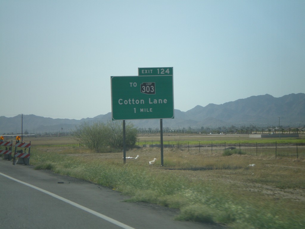
I-10 West Approaching Exit 124
I-10 west approaching Exit 124 - To AZ-303 Loop/Cotton Lane.
Taken 03-23-2009
Goodyear
Maricopa County
Arizona
United States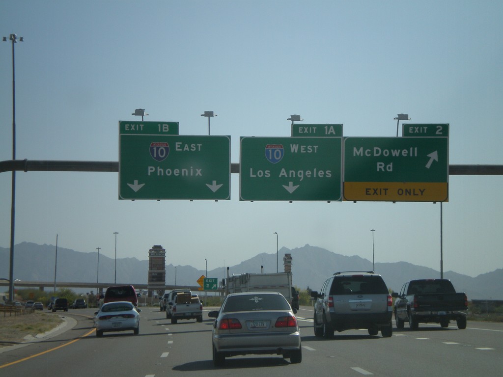
AZ-101 South - Exit 2 and Exit 1AB
AZ-101 Loop South at Exit 2 - McDowell Road. Approaching Exit 1B - I-10 East/Phoenix.
Taken 03-23-2009
 Phoenix
Maricopa County
Arizona
United States
Phoenix
Maricopa County
Arizona
United States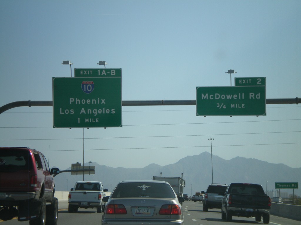
AZ-101 Loop South - Exit 2 and Exit 1AB
AZ-101 Loop South approaching Exit 2 - McDowell Road and Exit 1AB-I-10/Phoenix/Los Angeles.
Taken 03-23-2009
Phoenix
Maricopa County
Arizona
United States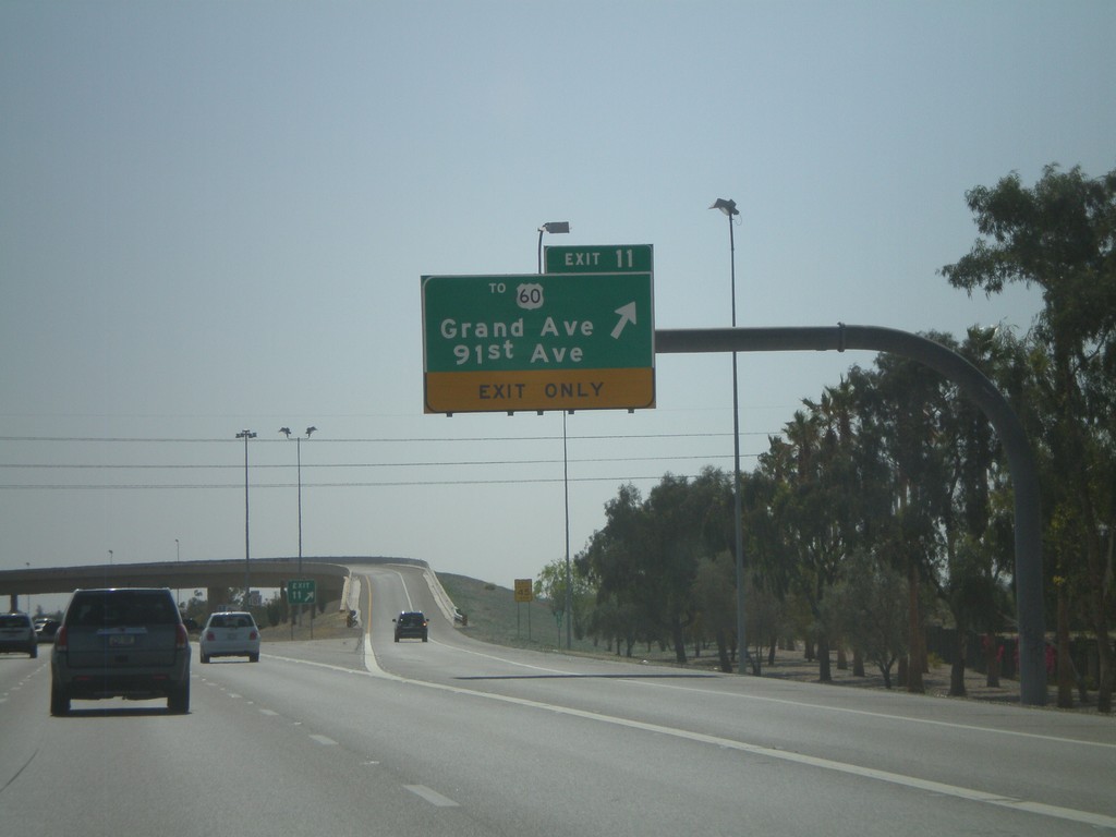
AZ-101 Loop South - Exit 11
AZ-101 Loop South at Exit 11 - To US-60/Grand Ave./91st Ave.
Taken 03-23-2009
 Peoria
Maricopa County
Arizona
United States
Peoria
Maricopa County
Arizona
United States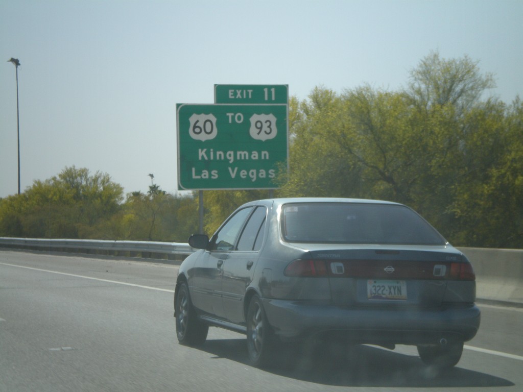
AZ-101 Loop South Approaching Exit 11
AZ-101 Loop South approaching Exit 11. Use Exit 11 for US-60/To US-93/Kingman/Las Vegas.
Taken 03-23-2009
 Peoria
Maricopa County
Arizona
United States
Peoria
Maricopa County
Arizona
United States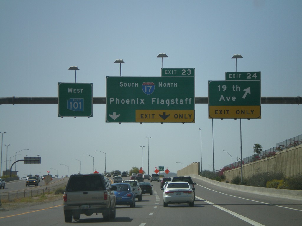
AZ-101 West - Exit 23 and Exit 24
AZ-101 Loop West at Exit 24 - 19th Ave. Approaching Exit 23 - I-17/Phoenix/Flagstaff. All of the loop highways around Phoenix have different color shields on the older signs. AZ-101 Loop has a blue shield.
Taken 03-23-2009
 Phoenix
Maricopa County
Arizona
United States
Phoenix
Maricopa County
Arizona
United States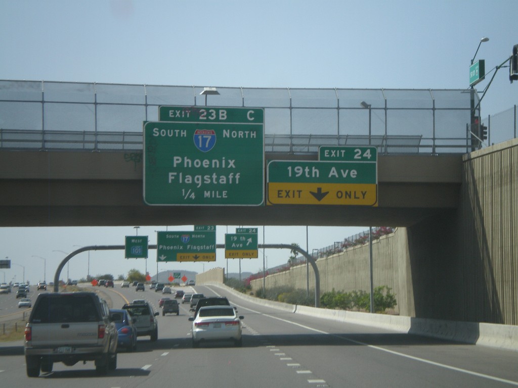
AZ-101 Loop West Approaching Exit 24 and Exit 23BC
AZ-101 Loop West approaching Exit 24 - 19th Ave. Approaching Exit 23 - I-17/Phoenix/Flagstaff.
Taken 03-23-2009
Phoenix
Maricopa County
Arizona
United States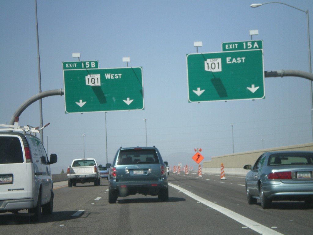
End AZ-51 North at AZ-101 Loop
End AZ-51 North at Exit 15A - AZ-101 Loop East and Exit 15B - AZ-101 Loop West.
Taken 03-23-2009
 Phoenix
Maricopa County
Arizona
United States
Phoenix
Maricopa County
Arizona
United States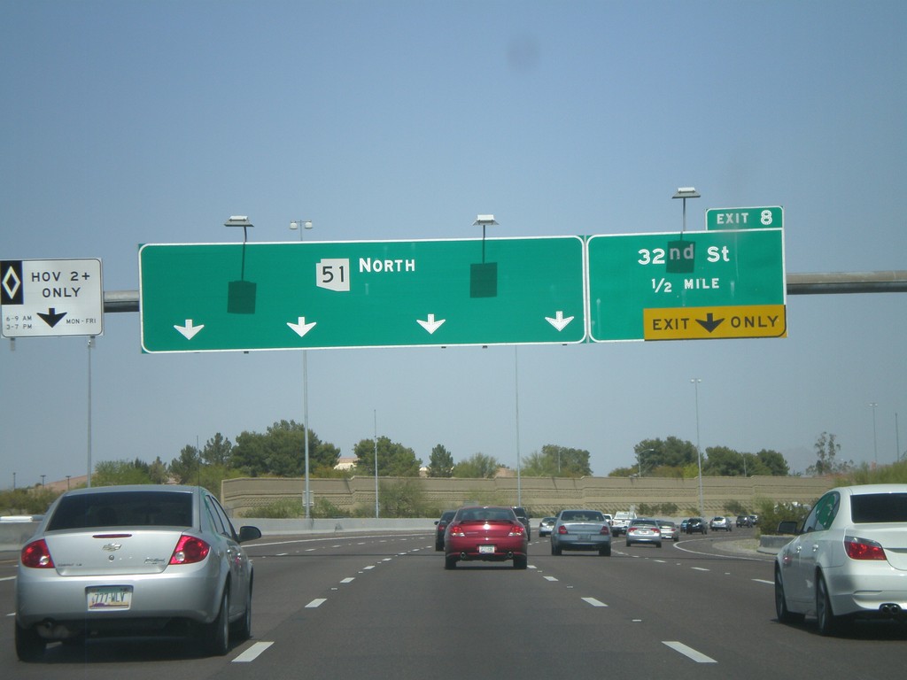
AZ-51 North - Exit 8
AZ-51 north at Exit 8 - 32nd St. No control city is given for AZ-51 North.
Taken 03-23-2009
Phoenix
Maricopa County
Arizona
United States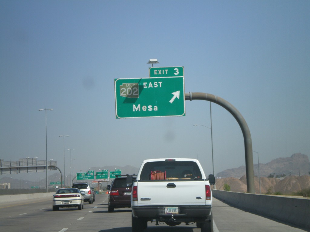
AZ-143 North - Exit 3
AZ-143 north at Exit 3 - AZ-202 Loop/Mesa. All of the loop roads in the Phoenix area have different color shields. AZ-202 Loop has a brown shield.
Taken 03-23-2009

 Tempe
Maricopa County
Arizona
United States
Tempe
Maricopa County
Arizona
United States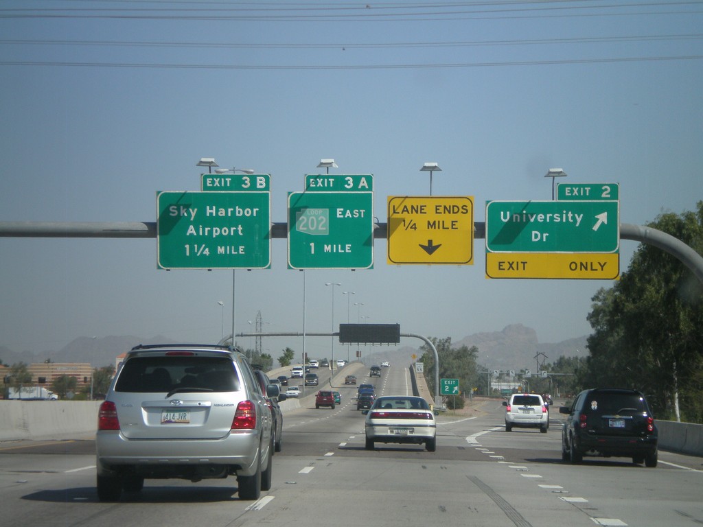
AZ-143 North - Exit 2 and Exit 3AB
AZ-143 north at Exit 2 - University Drive. Approaching Exit 3A - AZ-202 Loop East and Exit 3B - Sky Harbor Airport. The AZ-202 Loop shield appears to be faded. Normally AZ-202 Loop is a brown color.
Taken 03-23-2009
Tempe
Maricopa County
Arizona
United States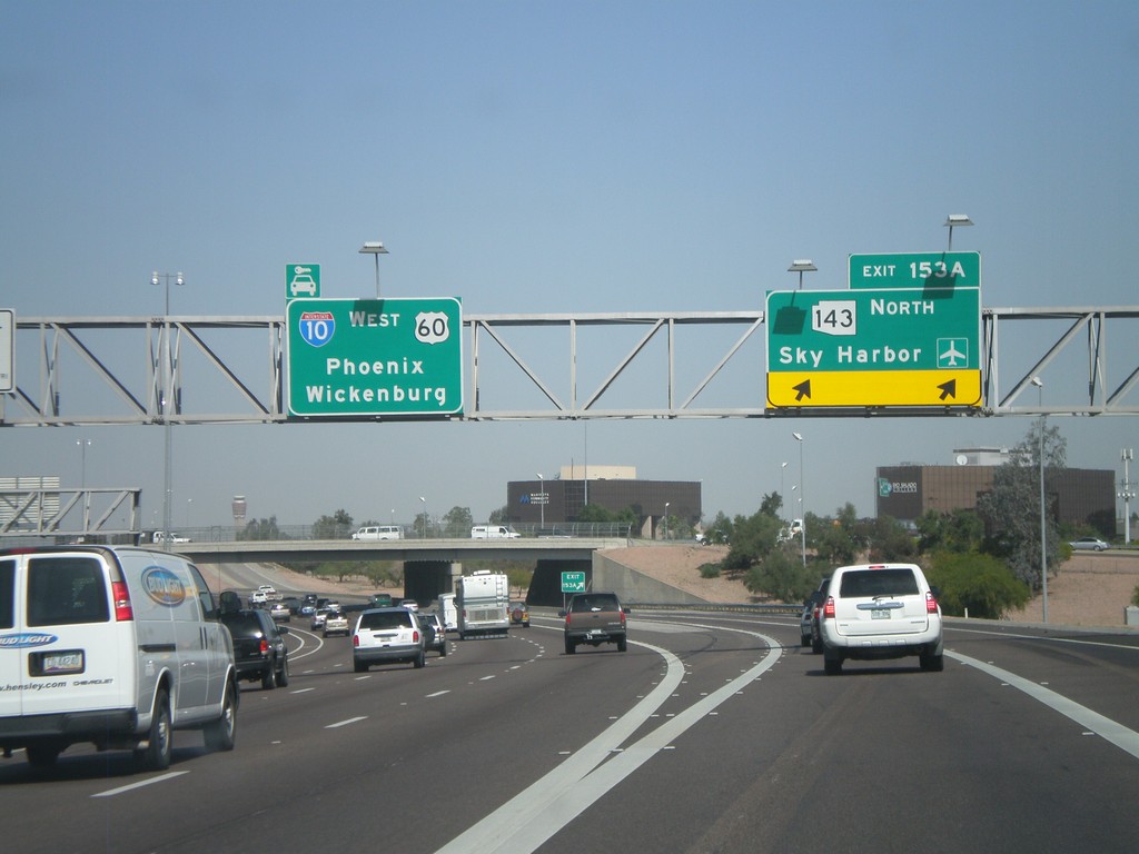
I-10 West - Exit 153A
I-10 west at Exit 153A - AZ-143 North/Sky Harbor Airport. Continue west for I-10/US-60 West/Phoenix/Wickenburg (via US-60).
Taken 03-23-2009
Tempe
Maricopa County
Arizona
United States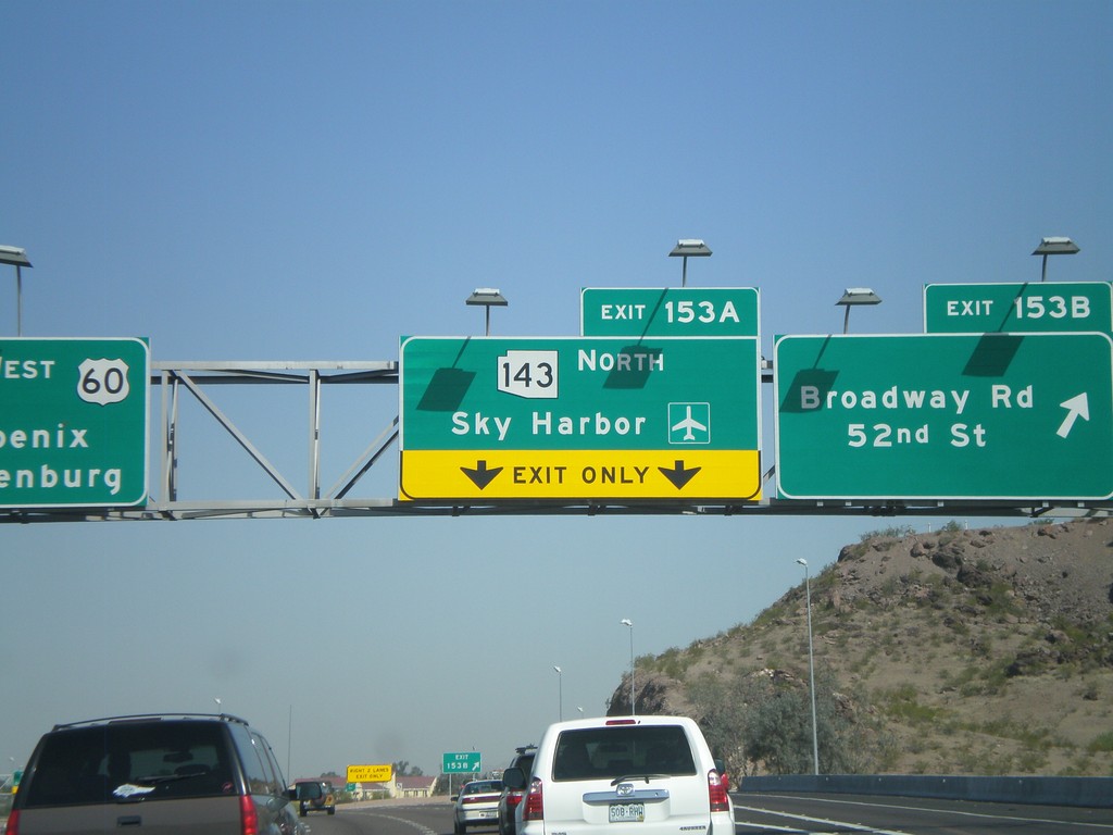
I-10 West - Exit 153B and Exit 153A
I-10 west at Exit 153B - Broadway Road/52nd St. Approaching Exit 153A - AZ-143 North/Sky Harbor Airport.
Taken 03-23-2009
Tempe
Maricopa County
Arizona
United States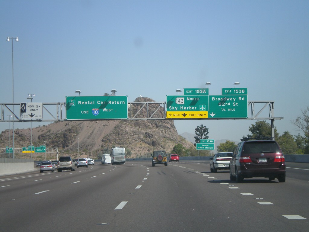
I-10 West - Exit 153A and Exit 153B
I-10 west approaching Exit 153B - Broadway Rd./52nd St. and Exit 153A - AZ-143 North/Sky Harbor Airport. Use I-10 west for Rental Car Returns.
Taken 03-23-2009
Tempe
Maricopa County
Arizona
United States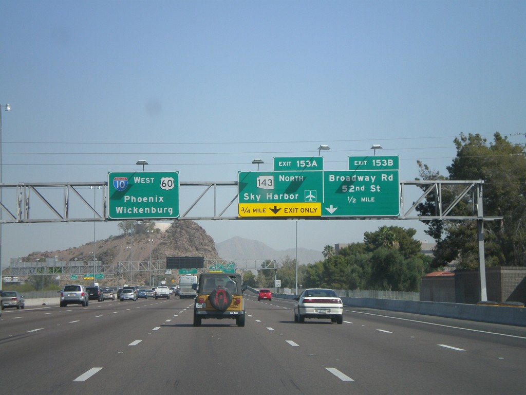
I-10 West Approaching Exit 153A and Exit 153B
I-10 west approaching Exit 153B - Broadway Road/52nd St. Approaching Exit 153A - AZ-143 North/Sky Harbor Airport. Overhead for I-10/US-60 West/Phoenix/Wickenburg (via US-60).
Taken 03-23-2009
Tempe
Maricopa County
Arizona
United States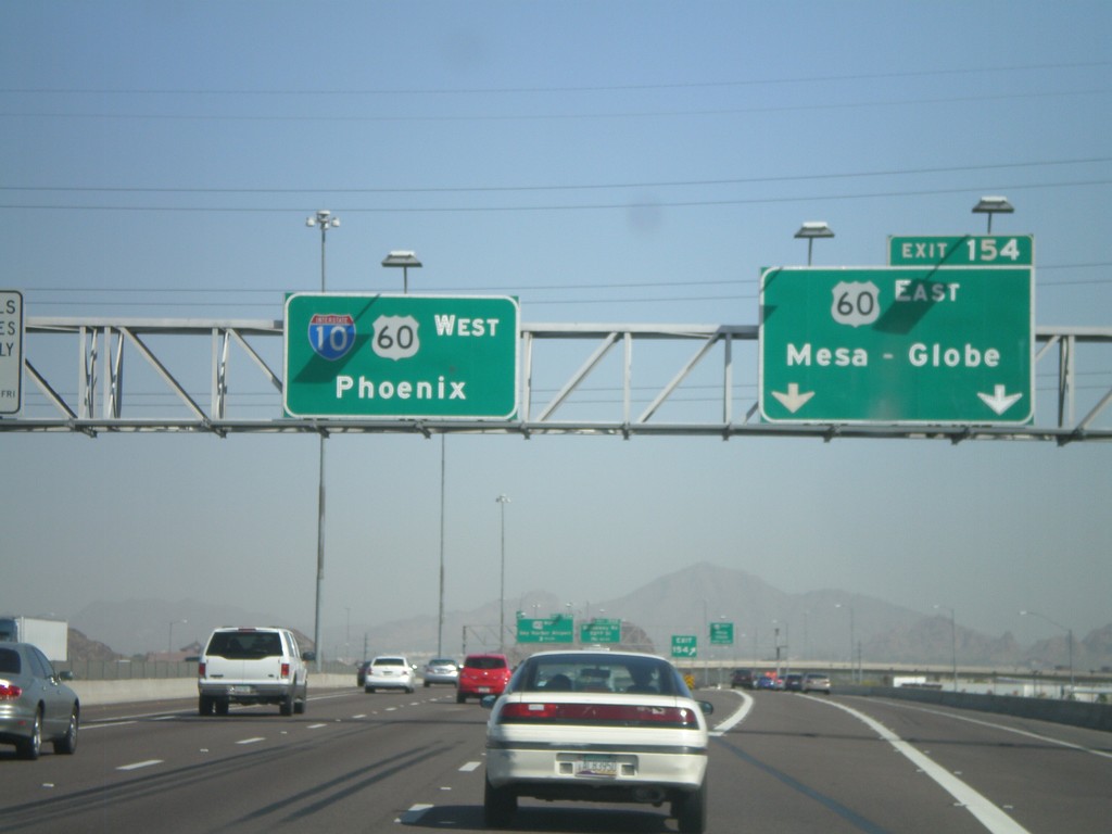
I-10 West - Exit 154
I-10 west at Exit 154 - US-60 East/Mesa-Globe. Sign for I-10/US-60 West/Phoenix. US-60 joins I-10 west through downtown Phoenix.
Taken 03-23-2009
Guadalupe
Maricopa County
Arizona
United States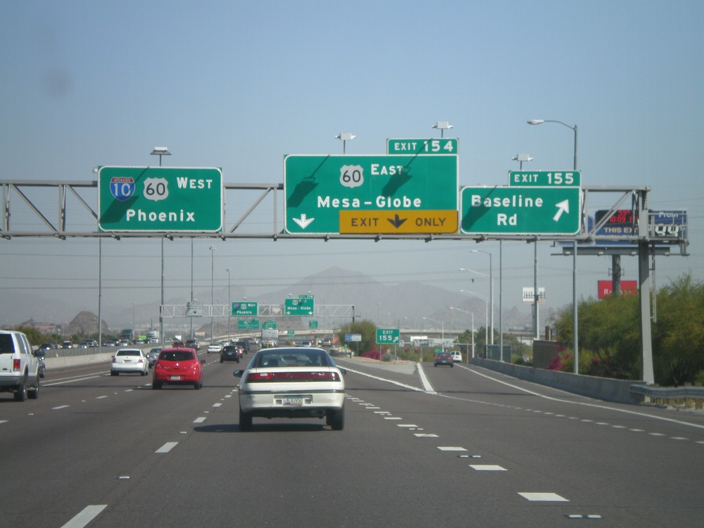
I-10 West - Exit 155 and Exit 154
I-10 west at Exit 155 - Baseline Road. Approaching Exit 154 - US-60 East/Mesa-Globe. Sign for I-10/US-60 West/Phoenix.
Taken 03-23-2009
Guadalupe
Maricopa County
Arizona
United States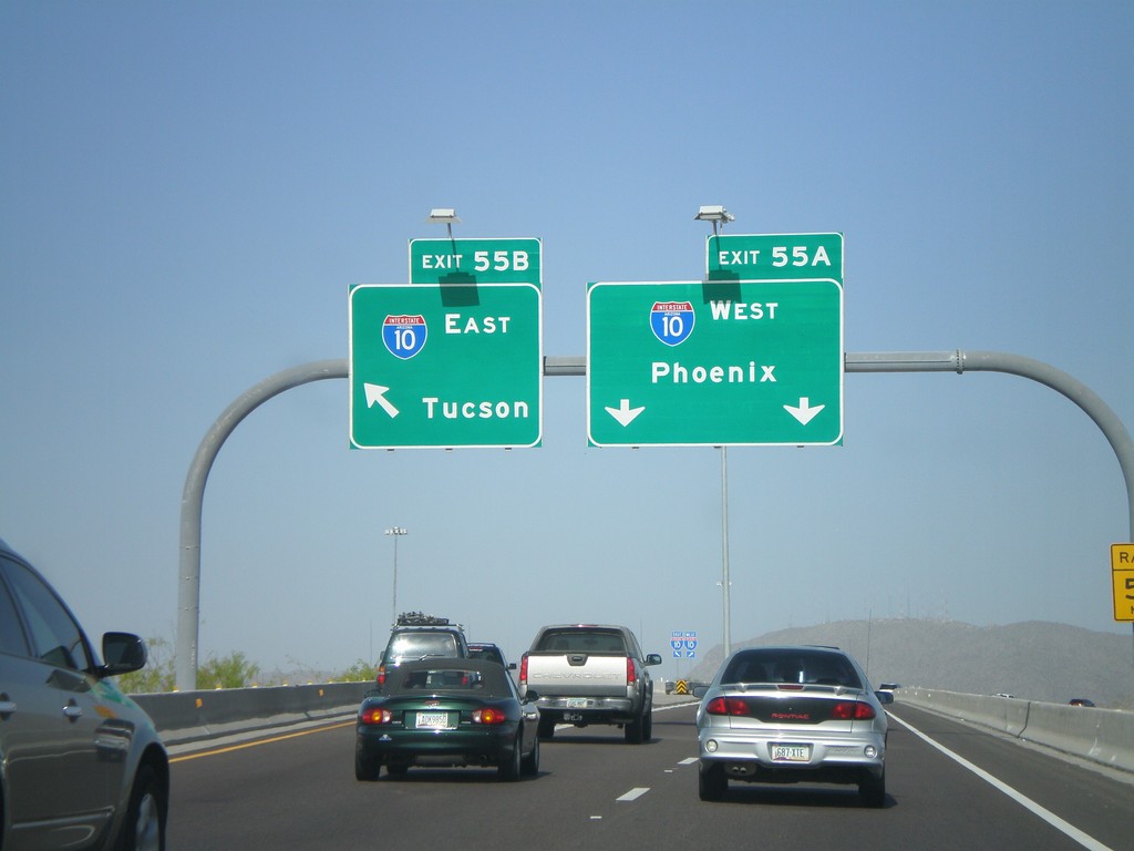
AZ-202 West - Exit 55AB
AZ-202 West Exit 55 Offramp at Exit 55B - I-10 East/Tucson and Exit 55A - I-10 West/Phoenix.
Taken 03-23-2009
Chandler
Maricopa County
Arizona
United States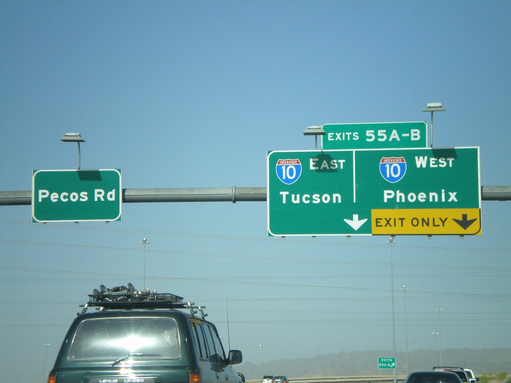
End AZ-202 West at I-10
End AZ-202 Loop west at I-10 - Exit 55AB - Tucson/Phoenix. Continue straight for Pecos Road.
Taken 03-23-2009
Chandler
Maricopa County
Arizona
United States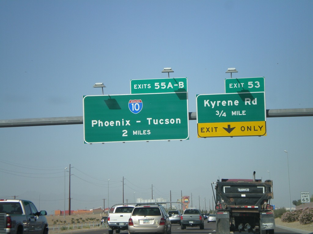
AZ-202 Loop West Approaching Exit 53 and Exit 55AB
AZ-202 Loop west approaching Exit 53 - Kyrene Road. Approaching 55AB - I-10/Phoenix-Tucson.
Taken 03-23-2009
Chandler
Maricopa County
Arizona
United States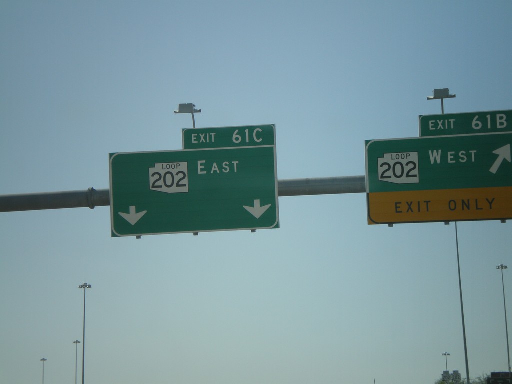
AZ-101 Loop South - Exit 61BC
AZ-101 Loop south at Exit 61B - AZ-202 Loop West and Exit 61C - AZ-202 Loop East. This is the southern end of AZ-101 Loop.
Taken 03-23-2009
Chandler
Maricopa County
Arizona
United States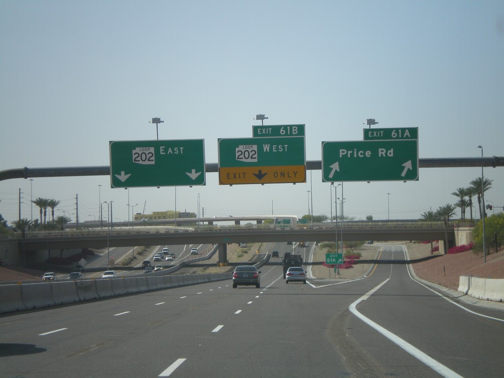
AZ-101 Loop South - Exit 61 AB
AZ-101 Loop south at Exit 61A - Price Road. Approaching Exit 61B - AZ-202 Loop West and Exit 61C - AZ-202 Loop East.
Taken 03-23-2009
Chandler
Maricopa County
Arizona
United States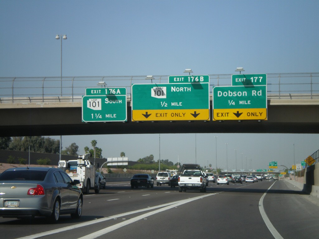
US-60 West Approaching Exit 177 and Exit 176AB
US-60 west approaching Exit 177 - Dobson Road. Approaching Exit 176B - AZ-101 Loop North and Exit 176A - AZ-101 Loop South.
Taken 03-23-2009
Mesa
Maricopa County
Arizona
United States