Signs Tagged With Shield Inside Sign
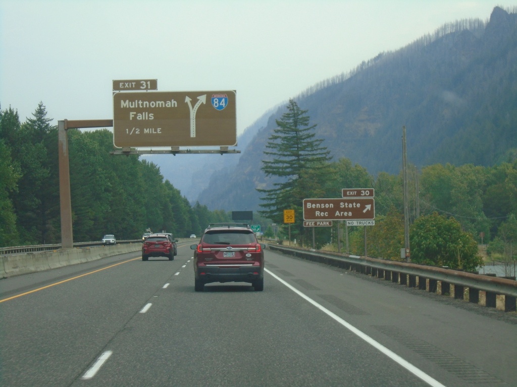
I-84 East - Exits 30 and 31
I-84 east at Exit 30 - Benson State Recreation Area. Approaching Exit 31 - Multnomah Falls. Exit 31 is a left exit.
Taken 08-09-2024

 Bridal Veil
Multnomah County
Oregon
United States
Bridal Veil
Multnomah County
Oregon
United States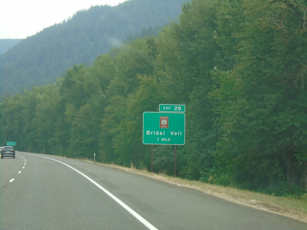
I-84 East - Exit 28
I-84 east approaching Exit 28 - Historic Route 30/Bridal Veil.
Taken 08-09-2024
Corbett
Multnomah County
Oregon
United States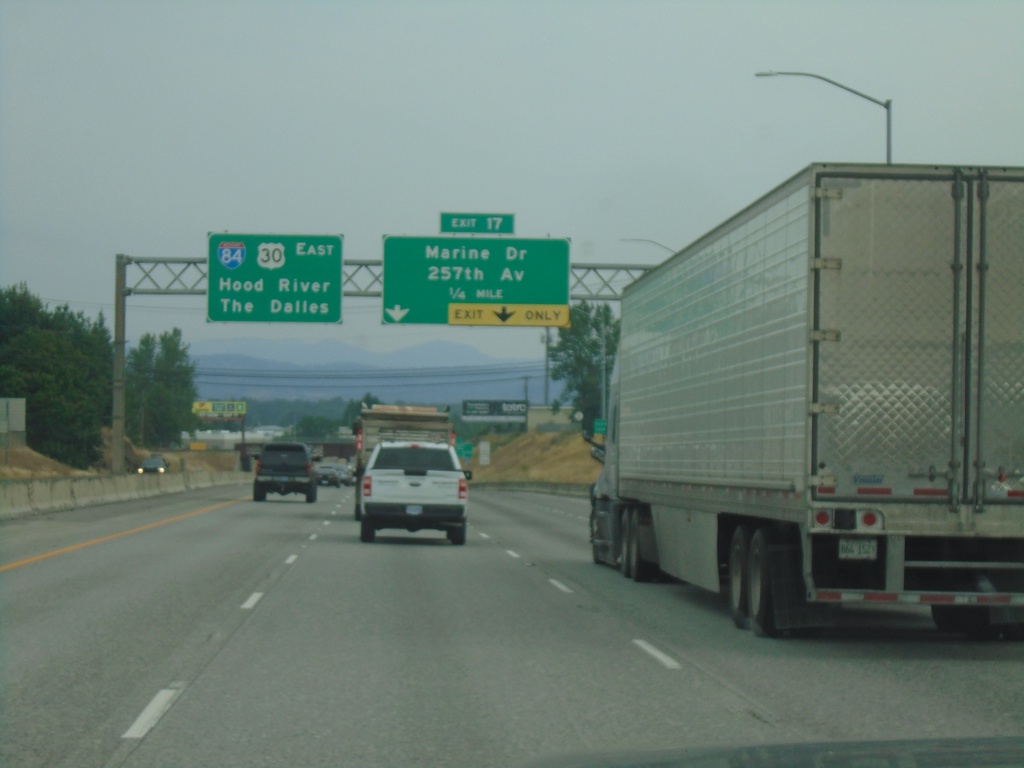
I-84 East Approaching Exit 17
I-84 east approaching Exit 17 - Marine Drive/257th Ave. Continue east on I-84/US-30 for The Dalles and Hood River.
Taken 08-09-2024
Troutdale
Multnomah County
Oregon
United States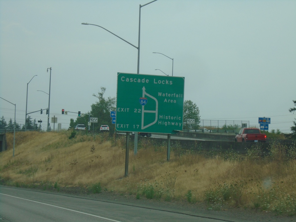
I-84/US-30 East - Historic Columbia River Highway Diagram
Route diagram for the Historic Columbia River Highway on I-84/US-30 East. Use Exit 17 (last Portland Metro. Area exit) on I-84/US-30 East for the Historic Highway. The Historic Columbia River Highway and I-84/US-30 rejoin before Cascade Locks.
Taken 08-09-2024
Fairview
Multnomah County
Oregon
United States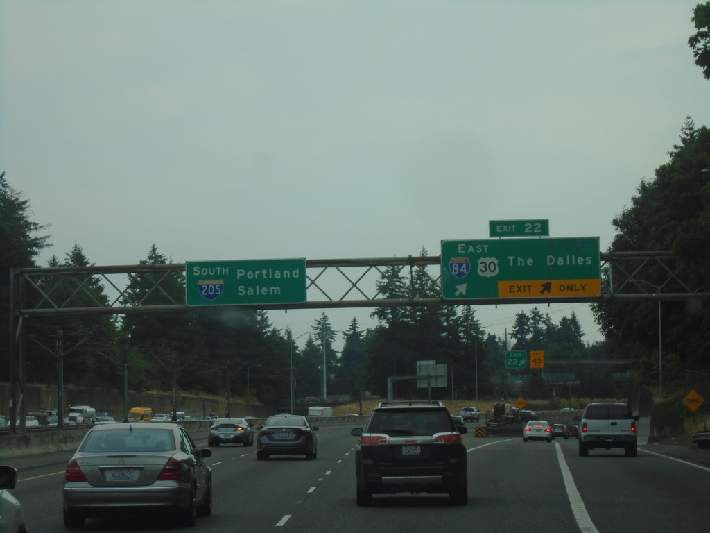
I-205 South - Exit 22
I-205 south at Exit 22 - I-84/US-30 East/The Dalles. Continue south on I-205 for Portland and Salem.
Taken 08-09-2024
 Portland
Multnomah County
Oregon
United States
Portland
Multnomah County
Oregon
United States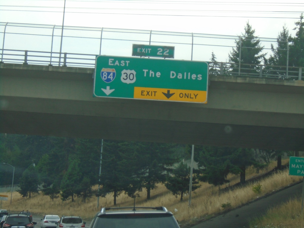
I-205 South - Exit 22
I-205 south approaching Exit 22 - I-84/US-30 East/The Dalles.
Taken 08-09-2024
Maywood Park
Multnomah County
Oregon
United States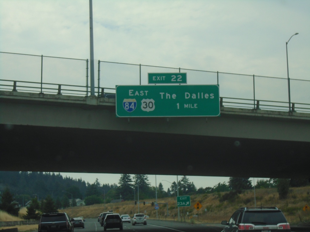
I-205 South - Exit 22
I-205 south approaching Exit 22 - I-84/US-30 East/The Dalles.
Taken 08-09-2024
Portland
Multnomah County
Oregon
United States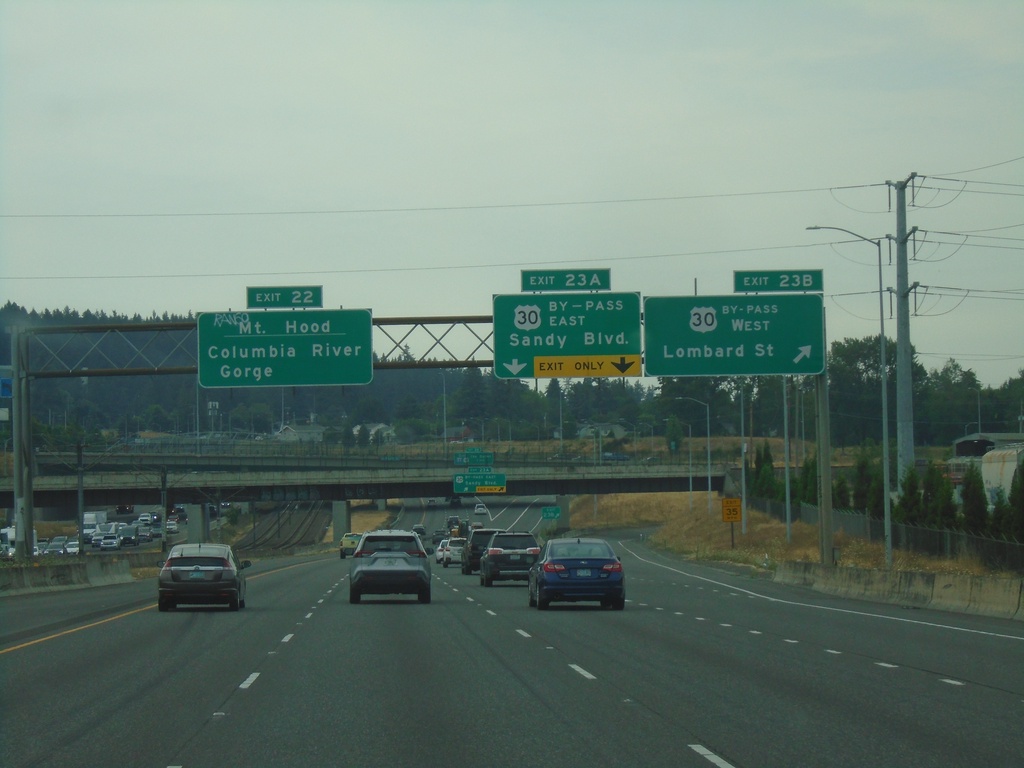
I-205 South - Exits 23B, 23A, and 22
I-205 South at Exit 23B - US-30 By-Pass West/Lombard St. Approaching Exit 23A - US-30 By-Pass East/Sandy Blvd. Use Exit 22 (I-84 East) to Mount Hood and Columbia River Gorge.
Taken 08-09-2024
 Portland
Multnomah County
Oregon
United States
Portland
Multnomah County
Oregon
United States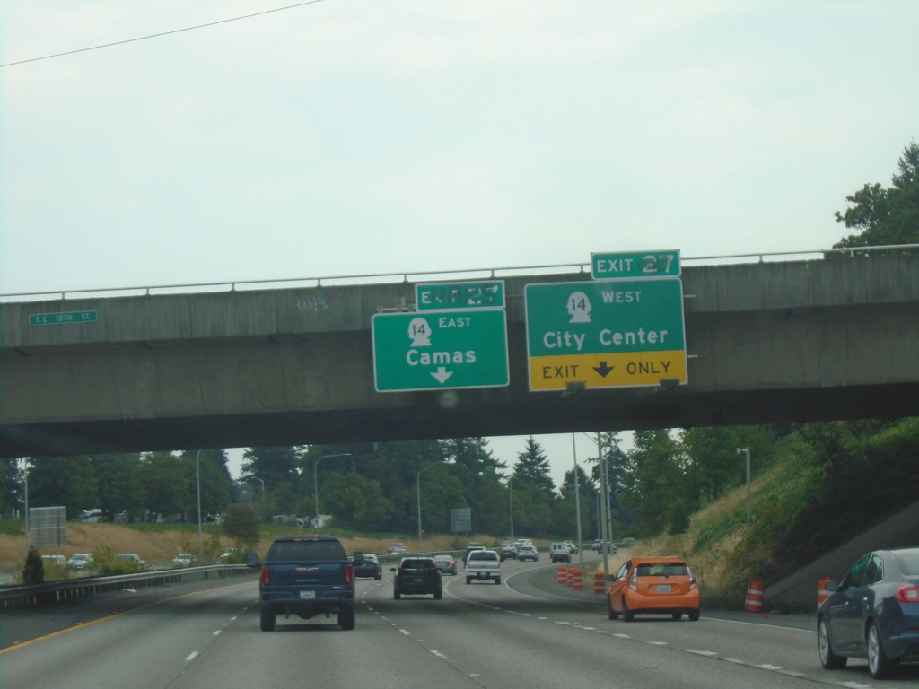
I-205 South - Exit 27
I-205 south approaching Exit 27 - WA-14 East/Camas and WA-14 West/(Vancouver)City Center.
Taken 08-09-2024
 Vancouver
Clark County
Washington
United States
Vancouver
Clark County
Washington
United States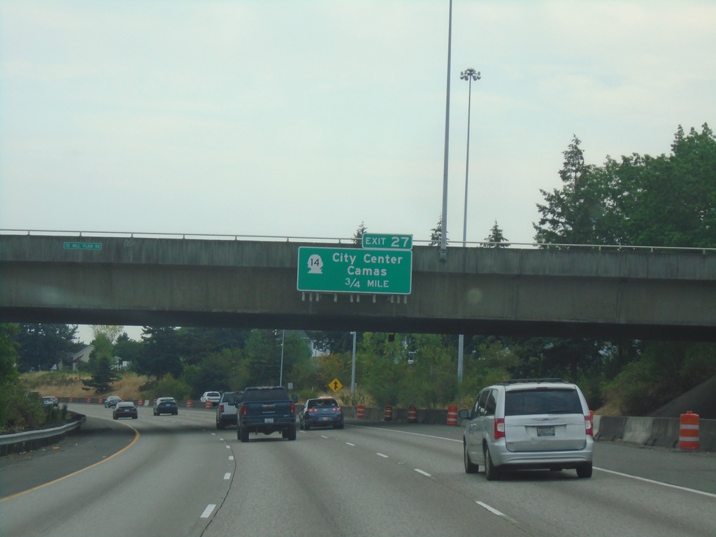
I-205 South - Exit 27
I-205 south approaching Exit 27 - WA-14/Camas/(Vancouver)City Center. WA-14 is the last exit on I-205 southbound in Washington.
Taken 08-09-2024
Vancouver
Clark County
Washington
United States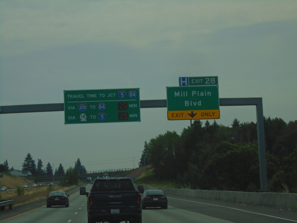
I-205 South - Exit 28
I-205 South approaching Exit 28 - Mill Plain Blvd. Travel times to I-84/I-5 Junction (Downtown Portland, Oregon) via I-84 and WA-14.
Taken 08-09-2024
 Vancouver
Clark County
Washington
United States
Vancouver
Clark County
Washington
United States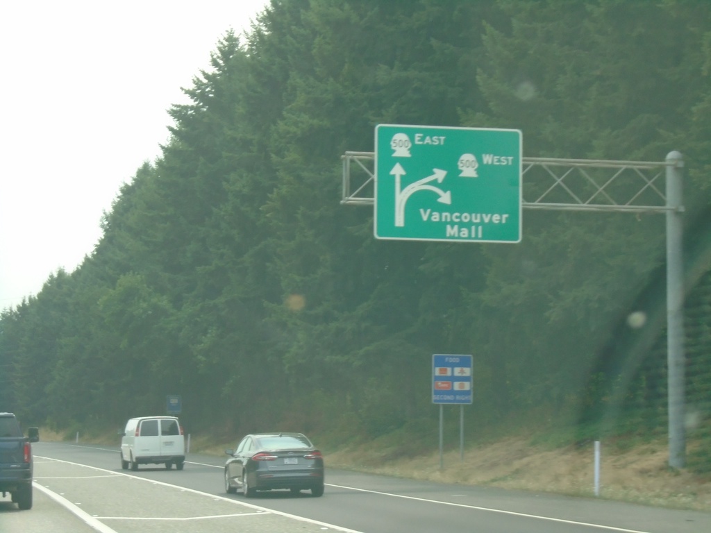
I-5 South - Exit 30
I-5 south at Exit 30. Exit diagram showing access to WA-500 and Vancouver Mall.
Taken 08-09-2024
 Vancouver
Clark County
Washington
United States
Vancouver
Clark County
Washington
United States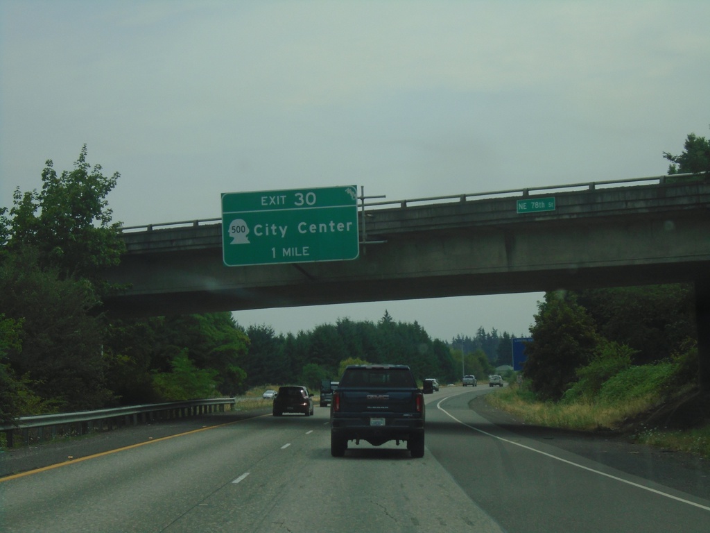
I-205 South - Exit 30
I-205 south approaching Exit 30 - WA-500/(Vancouver)City Center.
Taken 08-09-2024
Vancouver
Clark County
Washington
United States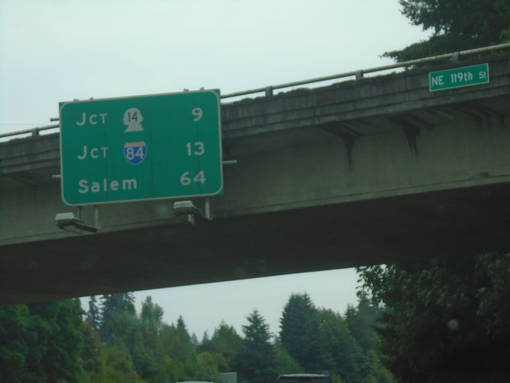
I-205 South - Distance Marker
Distance marker on I-205 south. Distance to Jct. WA-14, Jct. I-84, and Salem (Oregon).
Taken 08-09-2024
Vancouver
Clark County
Washington
United States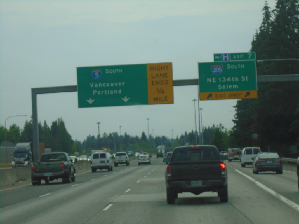
I-5 South - Exit 7
I-5 south approaching Exit 7 - I-205 South/NE 134th St./Salem (Oregon). Continue south on I-5 for Portland (Oregon) and Vancouver.
Taken 08-09-2024
Vancouver
Clark County
Washington
United States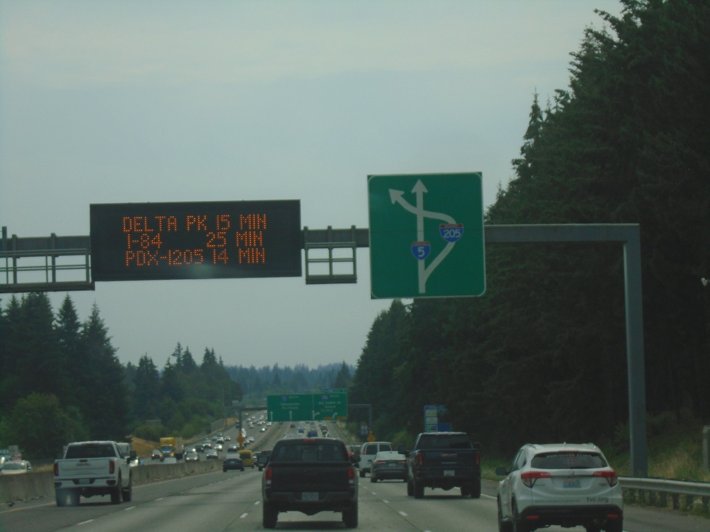
I-5 South Approaching Exit 7
I-5 South approaching Exit 7. Travel time for Portland Airport (via I-205), Delta Park and Downtown Portland. Route diagram for I-205/I-5 interchange.
Taken 08-09-2024
Vancouver
Clark County
Washington
United States
I-5 South - Exit 7
I-5 south approaching Exit 7 - I-205 South/NE 134th St./Salem (Oregon). Continue south on I-5 to Vancouver and Portland (Oregon).
Taken 08-09-2024
Ridgefield
Clark County
Washington
United States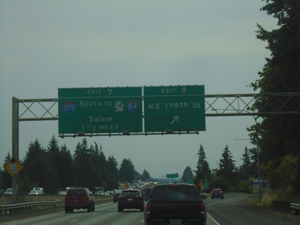
I-5 South - Exits 9 and 7
I-5 south at Exit 9 - NE 179th St. Approaching Exit 7 - I-205 South/To WA-14/To I-84/Salem.
Taken 08-09-2024
Ridgefield
Clark County
Washington
United States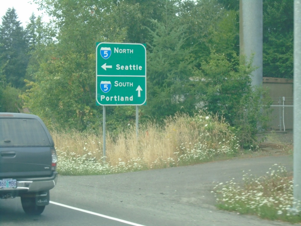
End WA-502 West at I-5
End WA-502 West at I-5. Use I-5 South to Portland (OR); I-5 North to Seattle.
Taken 08-09-2024
 Ridgefield
Clark County
Washington
United States
Ridgefield
Clark County
Washington
United States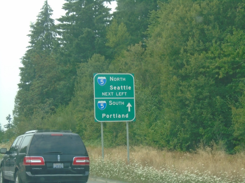
WA-502 West At I-5
WA-502 West at I-5. Turn left for I-5 North to Seattle; continue over freeway for I-5 South to Portland (OR).
Taken 08-09-2024
Ridgefield
Clark County
Washington
United States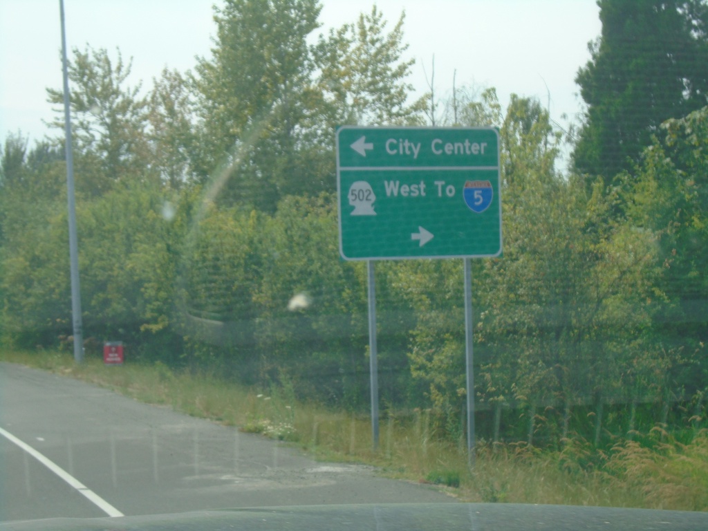
WA-503 South at WA-502 (Main St.)
WA-503 South at WA-502 (Main St.) in Battle Ground. Use WA-502 West to I-5; use Main St. east for City Center.
Taken 08-09-2024
 Battle Ground
Clark County
Washington
United States
Battle Ground
Clark County
Washington
United States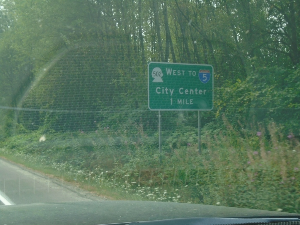
WA-503 South Approaching WA-502
WA-503 South approaching WA-502 in Battle Ground. Use WA-502 west to I-5 and City Center.
Taken 08-09-2024
Battle Ground
Clark County
Washington
United States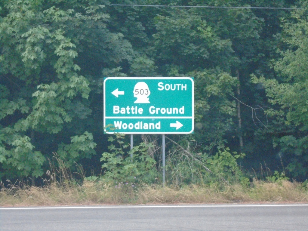
WA-503 South at NE 221st Ave.
WA-503 South at NE 221st Ave in Amboy. Turn right for Woodland; left to continue south on WA-503 to Battle Ground.
Taken 08-09-2024
Amboy
Clark County
Washington
United States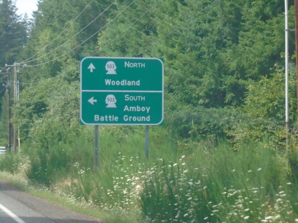
End WA-503 Spur West at WA-503
End WA-503 Spur West at WA-503. Turn left for WA-503 South to Amboy and Battle Ground. Continue straight for WA-503 North to Woodland.
Taken 08-09-2024
 Ariel
Cowlitz County
Washington
United States
Ariel
Cowlitz County
Washington
United States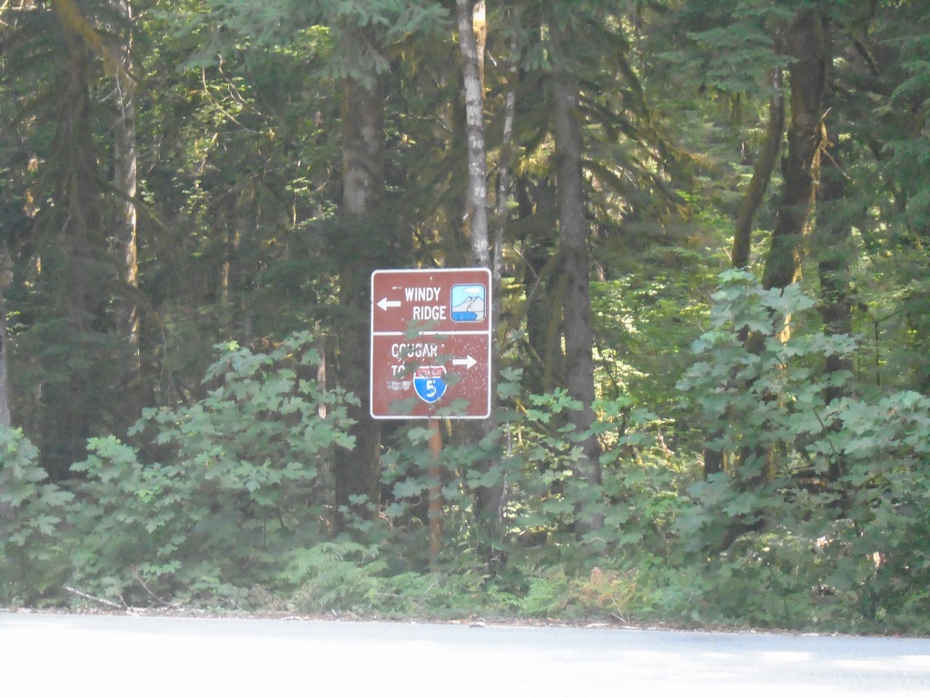
Lava Canyon Road South at Lewis River Road
Lava Canyon Road South at Lewis River Road. Turn left for Windy Ridge (part of the Mt. St. Helens National Monument). Turn right for I-5 and Cougar.
Taken 08-09-2024
Ariel
Skamania County
Washington
United States