Signs Tagged With Shield Inside Sign
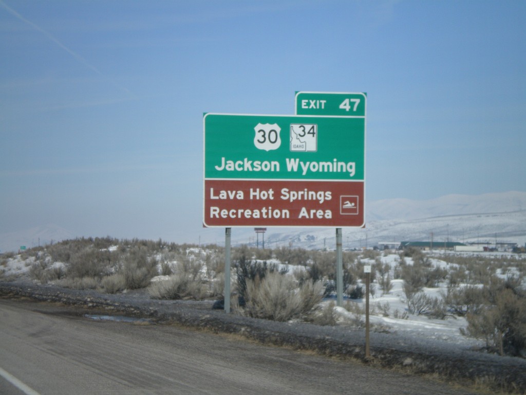
I-15 North - Use US-30/ID-34 for Jackson,WY
I-15 north approaching Exit 47. Use US-30 East and ID-34 North for Jackson, Wyoming. Access to Lava Hot Springs Rec. Area.
Taken 02-17-2008


 McCammon
Bannock County
Idaho
United States
McCammon
Bannock County
Idaho
United States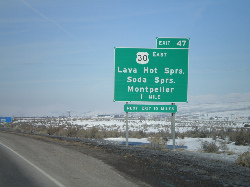
I-15 North - Exit 47
I-15 north approaching Exit 47 - US-30 East/Lava Hot Springs/Soda Springs/Montpelier
Taken 02-17-2008
McCammon
Bannock County
Idaho
United States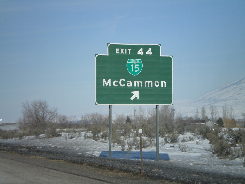
I-15 North - Exit 44
I-15 north at Exit 44 - BL-15/McCammon
Taken 02-17-2008
McCammon
Bannock County
Idaho
United States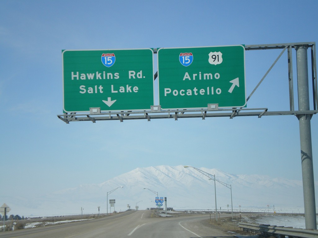
US-91 North At I-15
US-91 north approaching I-15. US-91 north joins I-15 here. I-15/US-91 north to Arimo and Pocatello. Continue over overpass for I-15 South to Salt Lake and Hawkins Road.
Taken 02-17-2008
Downey
Bannock County
Idaho
United States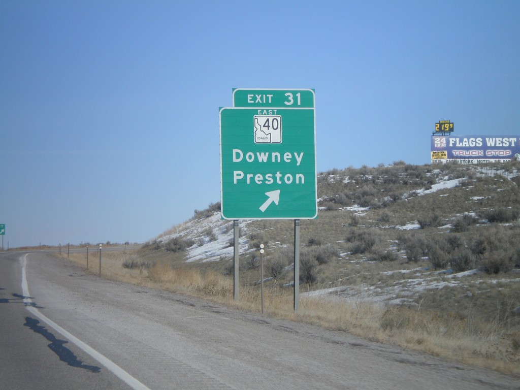
I-15 North - Exit 31
I-15 north at Exit 31 - ID-40 East/Downey/Preston.
Taken 02-17-2008
 Downey
Bannock County
Idaho
United States
Downey
Bannock County
Idaho
United States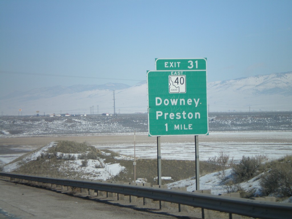
I-15 North - Exit 31
I-15 north approaching Exit 31 - ID-40 East/Downey/Preston.
Taken 02-17-2008
Downey
Bannock County
Idaho
United States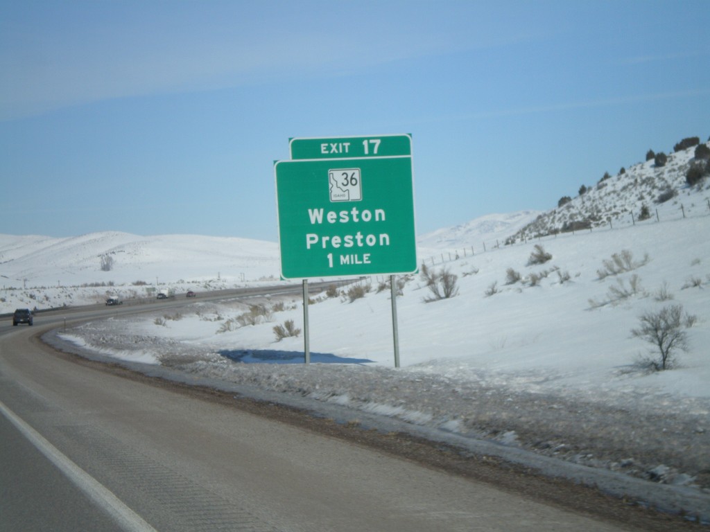
I-15 North - Exit 17
I-15 north approaching Exit 17 - ID-36/Weston/Preston.
Taken 02-17-2008
 Malad City
Oneida County
Idaho
United States
Malad City
Oneida County
Idaho
United States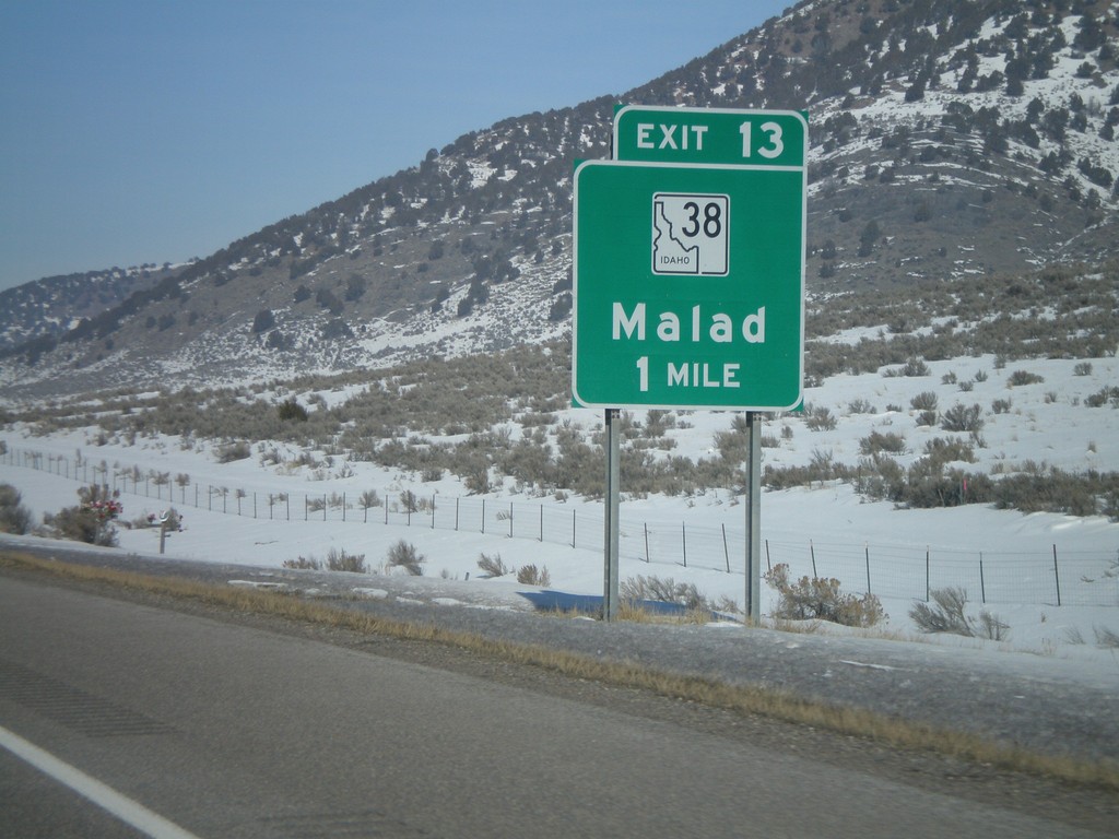
I-15 North - Exit 13
I-15 north approaching Exit 13 - ID-38/Malad
Taken 02-17-2008
 Malad City
Oneida County
Idaho
United States
Malad City
Oneida County
Idaho
United States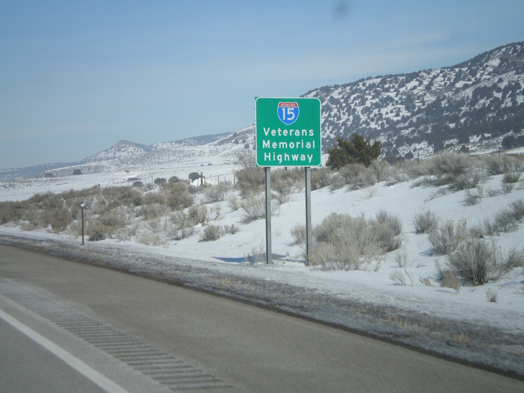
I-15 North - Veterans Memorial Highway
I-15 - Veterans Memorial Highway - just north of Idaho/Utah border. I-15 has this sign at both the Utah and Montana state lines.
Taken 02-17-2008
Malad City
Oneida County
Idaho
United States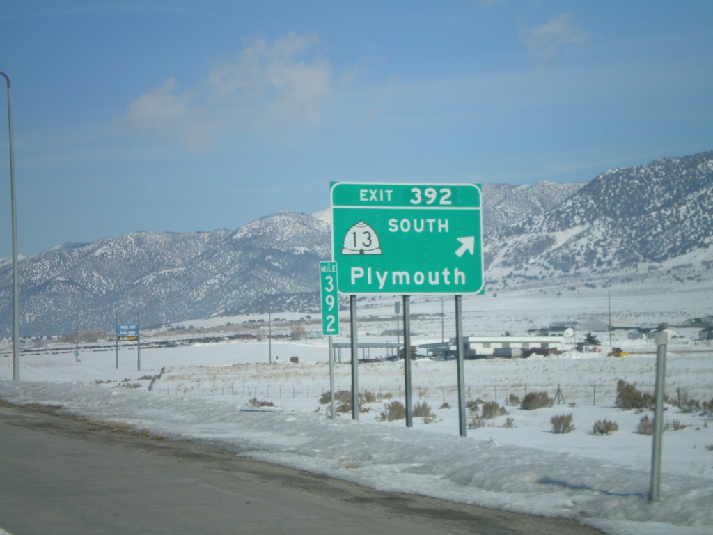
I-15 North - Exit 392
I-15 north at Exit 392 - UT-13 South/Plymouth.
Taken 02-17-2008
 Garland
Box Elder County
Utah
United States
Garland
Box Elder County
Utah
United States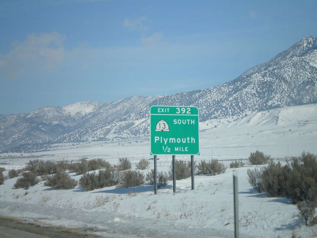
I-15 North - Exit 392
I-15 north approaching Exit 392 - UT-13 South/Plymouth.
Taken 02-17-2008
Garland
Box Elder County
Utah
United States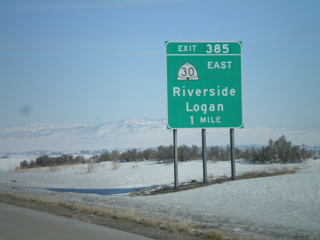
I-15 North - Exit 385
I-15 north approaching Exit 385 - UT-30 East/Riverside/Logan.
Taken 02-17-2008
 Garland
Box Elder County
Utah
United States
Garland
Box Elder County
Utah
United States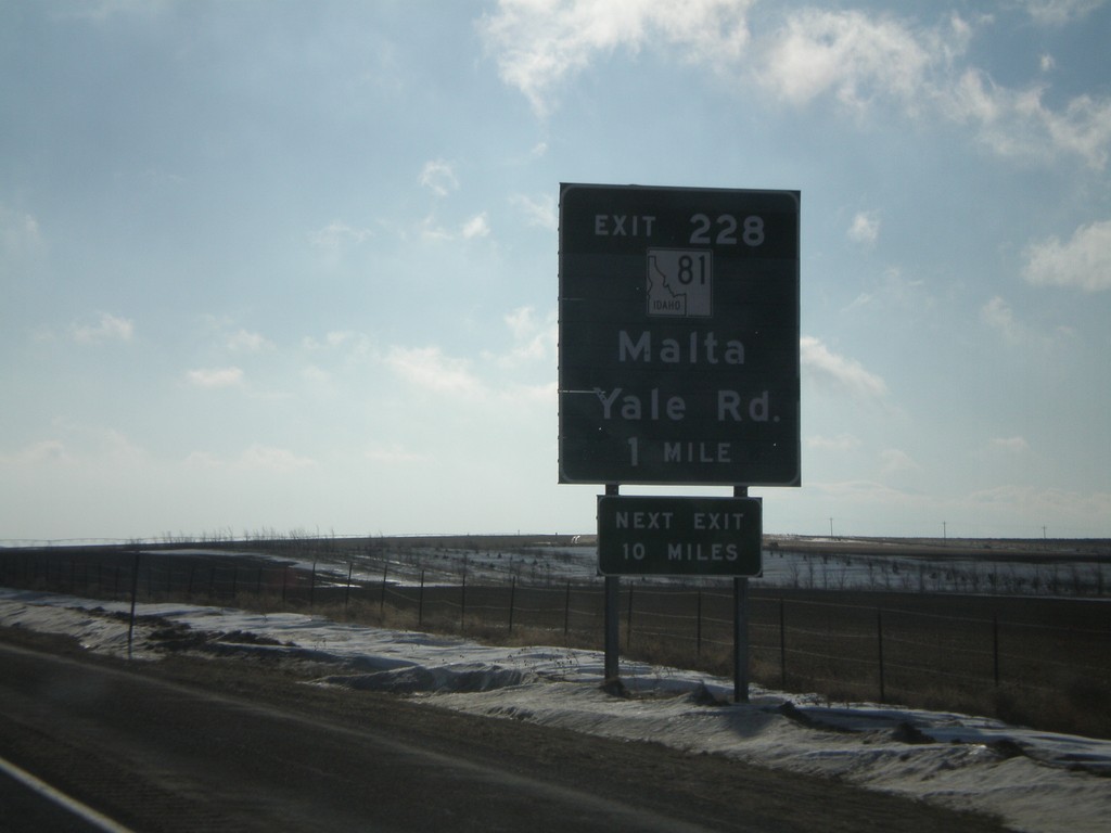
I-84 East - Exit 228
I-84 east approaching Exit 228 - ID-81/Yale Road/Malta.
Taken 02-17-2008

 Declo
Cassia County
Idaho
United States
Declo
Cassia County
Idaho
United States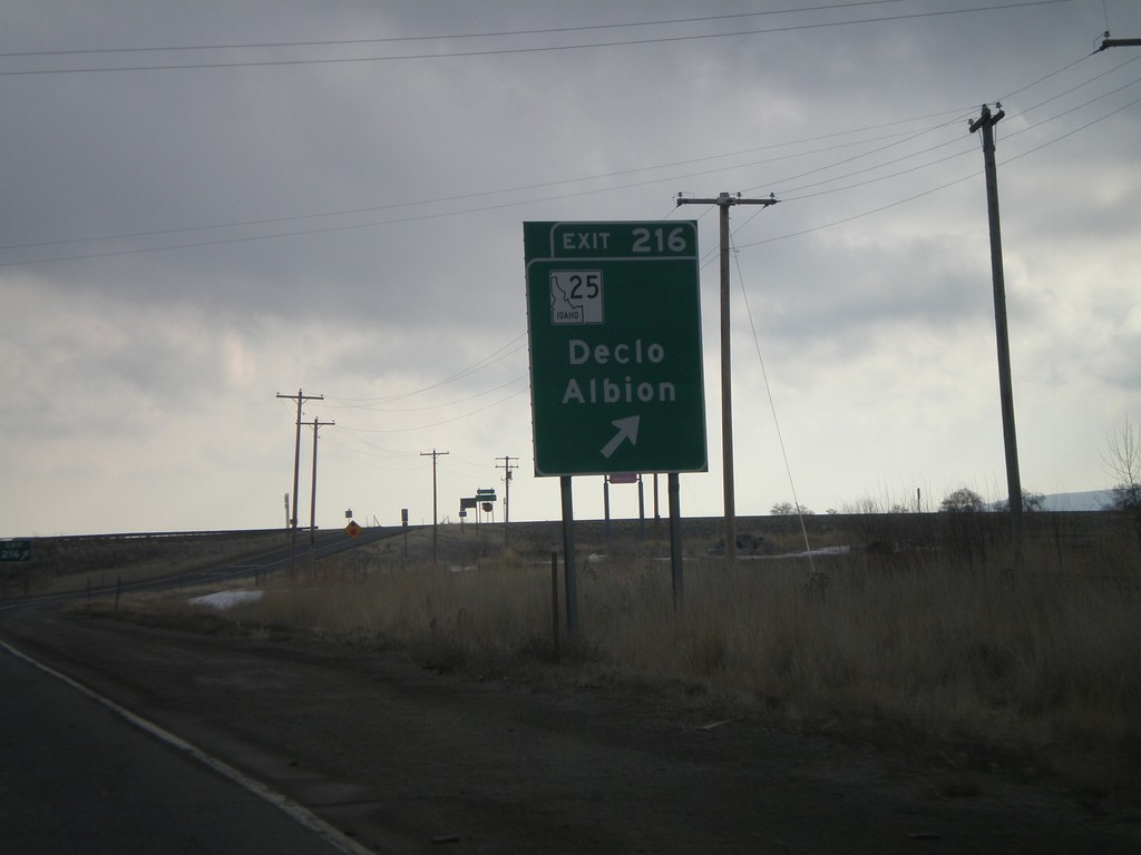
I-84 East - Exit 216
I-84 east at Exit 216 - ID-25/ID-77/Declo/Albion. The ID-77 shield is missing from this sign, but is present in the advance signage, as well as on signs on the other direction.
Taken 02-17-2008

 Rupert
Minidoka County
Idaho
United States
Rupert
Minidoka County
Idaho
United States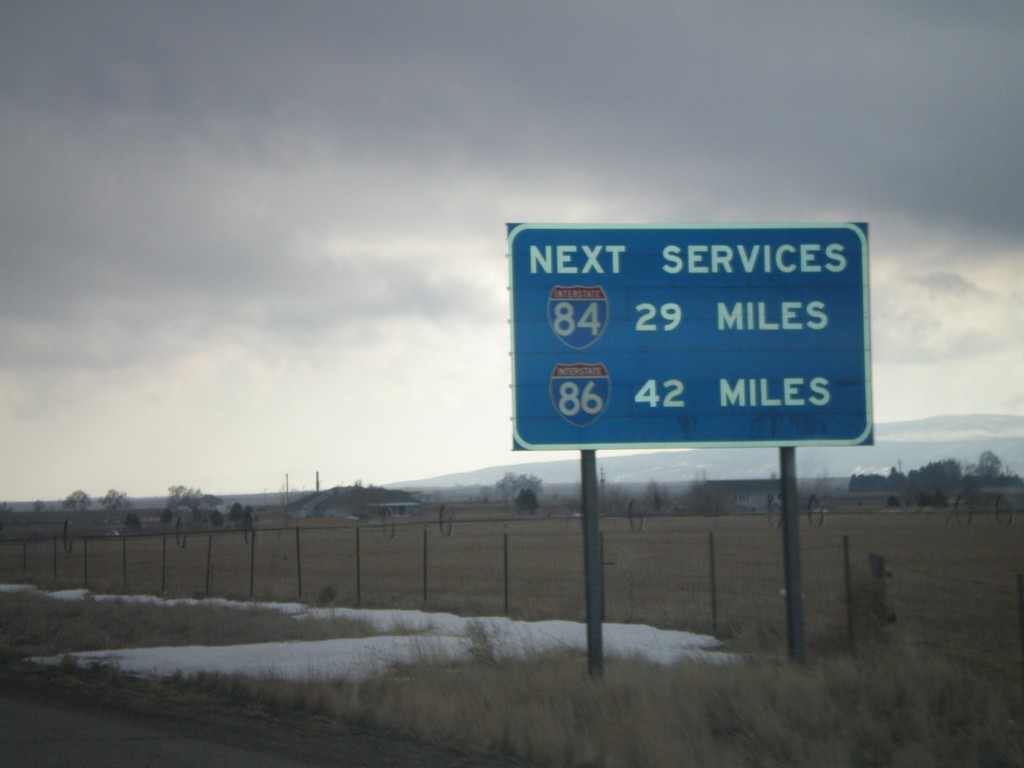
I-84 East - Next Services via I-84 and I-86
I-84 east approaching Exit 216. This sign shows the next services on I-84 and I-86. The next gas along I-86 is 42 miles (American Falls).
Taken 02-17-2008
 Rupert
Minidoka County
Idaho
United States
Rupert
Minidoka County
Idaho
United States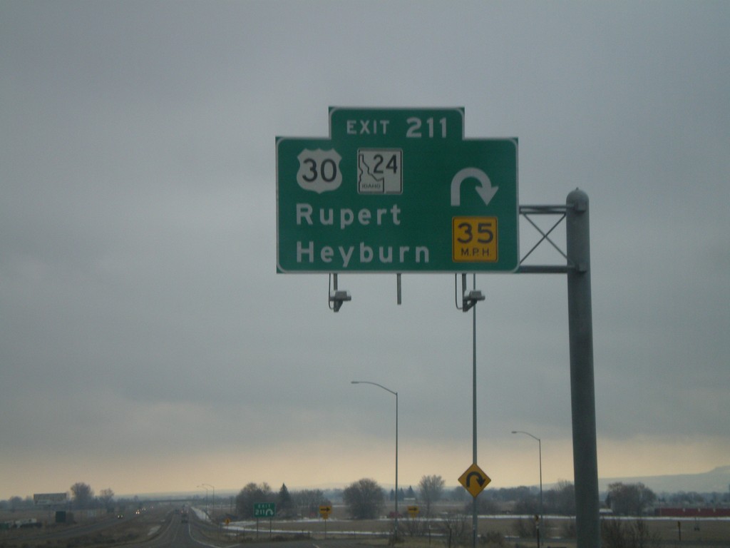
I-84 East - Exit 211
I-84 east at Exit 211 - US-30/ID-24/Rupert/Heyburn. This is one of the few overheads on Idaho highways outside of the metro. areas.
Taken 02-17-2008
 Rupert
Minidoka County
Idaho
United States
Rupert
Minidoka County
Idaho
United States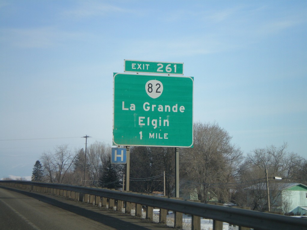
I-84 East - Exit 261
I-84 east approaching Exit 261 - OR-82/La Grande/Elgin.
Taken 01-22-2008
La Grande
Union County
Oregon
United States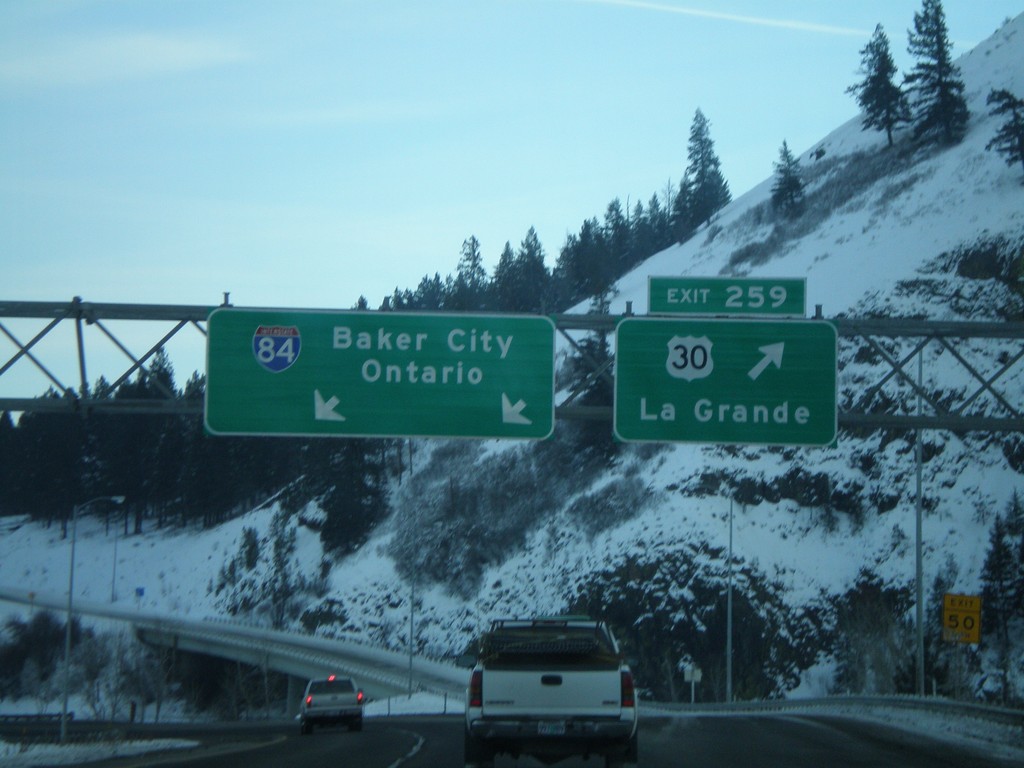
I-84 East - Exit 259
I-84 east at Exit 259 - US-30/La Grande. Overhead for I-84 to Baker City and Ontario.
Taken 01-22-2008
La Grande
Union County
Oregon
United States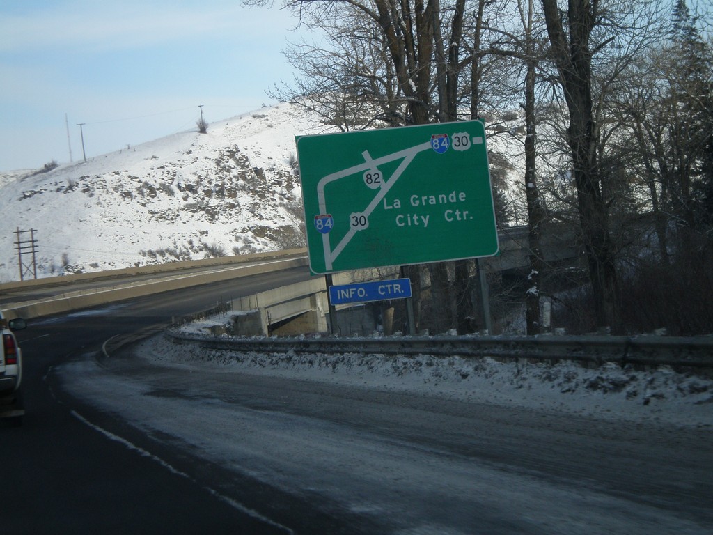
I-84 East - La Grande Route Diagram
Route diagram of La Grande routes on I-84 east approaching Exit 261.
Taken 01-22-2008
La Grande
Union County
Oregon
United States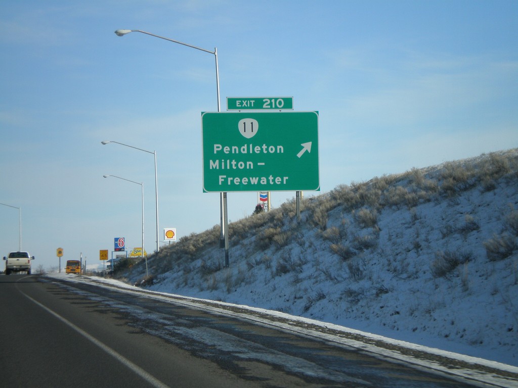
I-84 East - Exit 210
I-84 east at Exit 210 - OR-11/Pendleton/Milton-Freewater.
Taken 01-22-2008
 Pendleton
Umatilla County
Oregon
United States
Pendleton
Umatilla County
Oregon
United States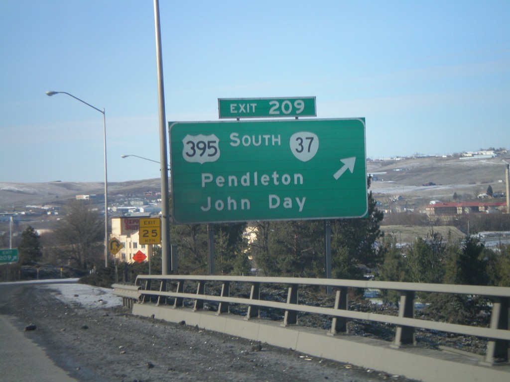
I-84 West - Exit 209
I-84 west at Exit 208 - US-395 South/OR-37/Pendleton/John Day. US-395 joins I-84 west to Stanfield, Oregon.
Taken 01-22-2008

 Pendleton
Umatilla County
Oregon
United States
Pendleton
Umatilla County
Oregon
United States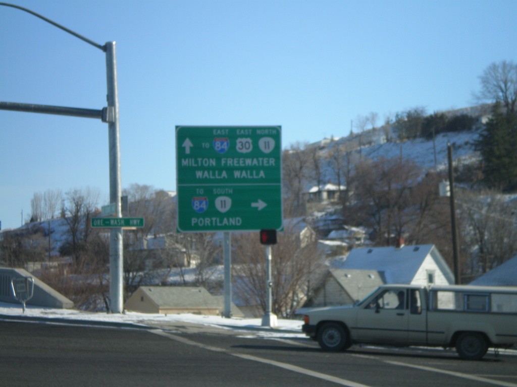
US-30 East at OR-11 (To I-84)
US-30 east at OR-11. Turn right for OR-11 south to I-84, and Portland. Continue straight for US-30 East/OR-11 North/To I-84 East/Milton Freewater/Walla Walla.
Taken 01-22-2008
Pendleton
Umatilla County
Oregon
United States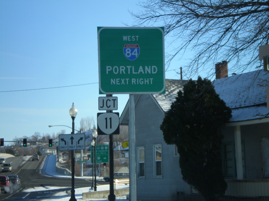
US-30 East Approaching OR-11
US-30 east approaching OR-11. Use OR-11 south to I-84 West/Portland.
Taken 01-22-2008
Pendleton
Umatilla County
Oregon
United States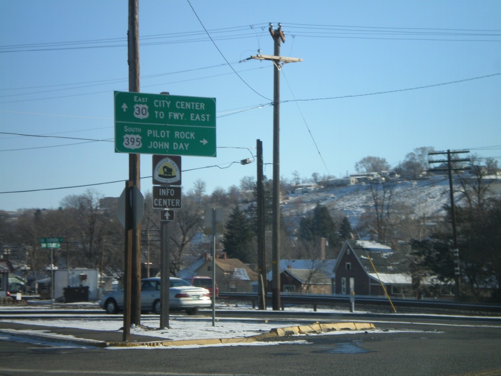
US-30 East to US-395 South - Pendleton
US-30 east at Court St. - To US-395 South/John Day/Pilot Rock. Continue east on US-30 for (Pendleton) City Center and (I-84) Freeway East.
Taken 01-22-2008
Pendleton
Umatilla County
Oregon
United States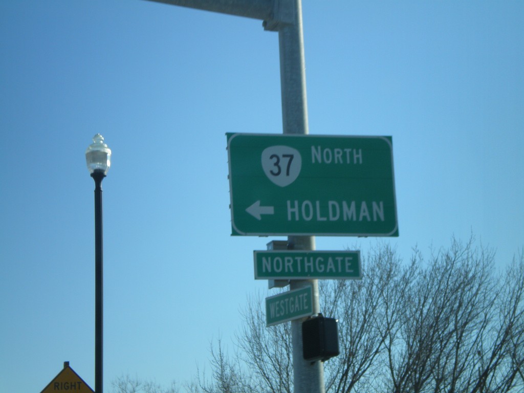
US-30 East at OR-37 North
US-30 east at at OR-37 north to Holdman.
Taken 01-22-2008
Pendleton
Umatilla County
Oregon
United States