Signs Tagged With Shield Inside Sign
US-160 West/BL-25 South at US-160 West
US-160 West/BL-25 South (Main Street) at US-160 West (7th St.) in Walsenburg.
Taken 06-18-2026

 Walsenburg
Huerfano County
Colorado
United States
Walsenburg
Huerfano County
Colorado
United States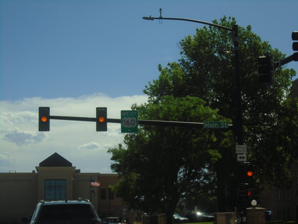
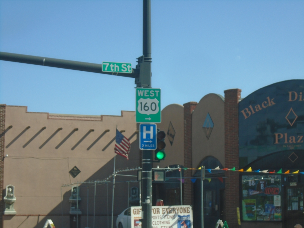
US-160 West at BL-25
US-160 West (E 5th St.) at BL-25 (Main Street) in Walsenburg. Turn left on Main Street to continue west on US-160.
Taken 06-18-2026
Walsenburg
Huerfano County
Colorado
United States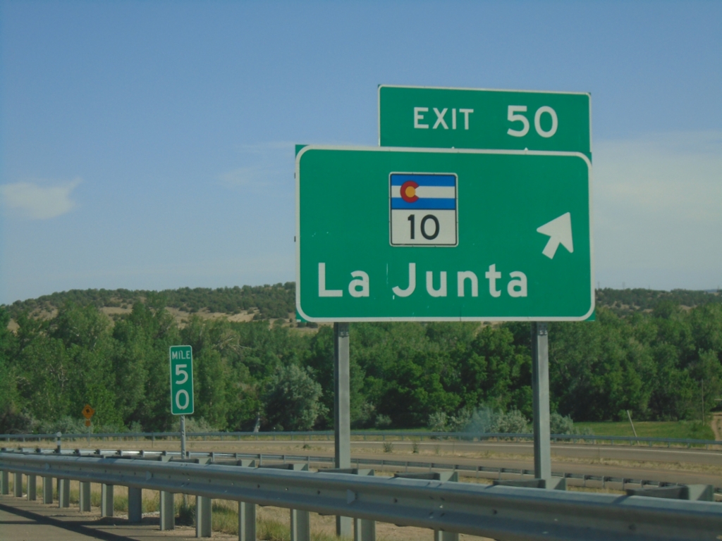
I-25 South - Exit 50
I-25 south at Exit 50 - CO-10/La Junta. US-160 joins I-25 south here to Trinidad.
Taken 06-18-2026


 Walsenburg
Huerfano County
Colorado
United States
Walsenburg
Huerfano County
Colorado
United States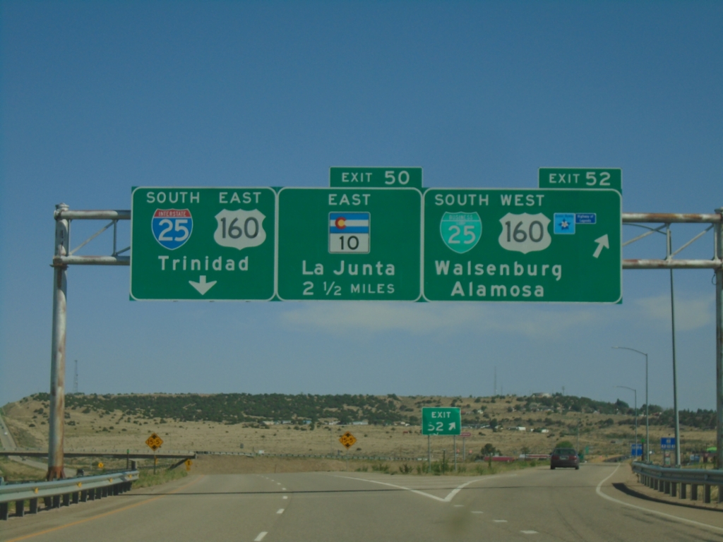
I-25 South - Exits 52 and 50
I-25 south at Exit 52 - BL-25 South/US-160 West/Walsenburg/Alamosa. Approaching Exit 50 - CO-10 East/La Junta. US-160 actually joins I-25 at Exit 50, but this is a quicker route from the north into Walsenburg. Continue south on I-25/US-160 East for Trinidad.
Taken 06-18-2026
Walsenburg
Huerfano County
Colorado
United States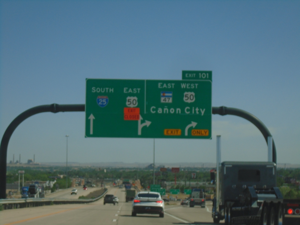
I-25 South - Exit 101
I-25 south at Exit 101 - US-50 West/CO-47 East/Cañon City. US-50 East joins I-25 South through Pueblo.
Taken 06-18-2026

 Pueblo
 County
Colorado
United States
Pueblo
Pueblo County
Colorado
United States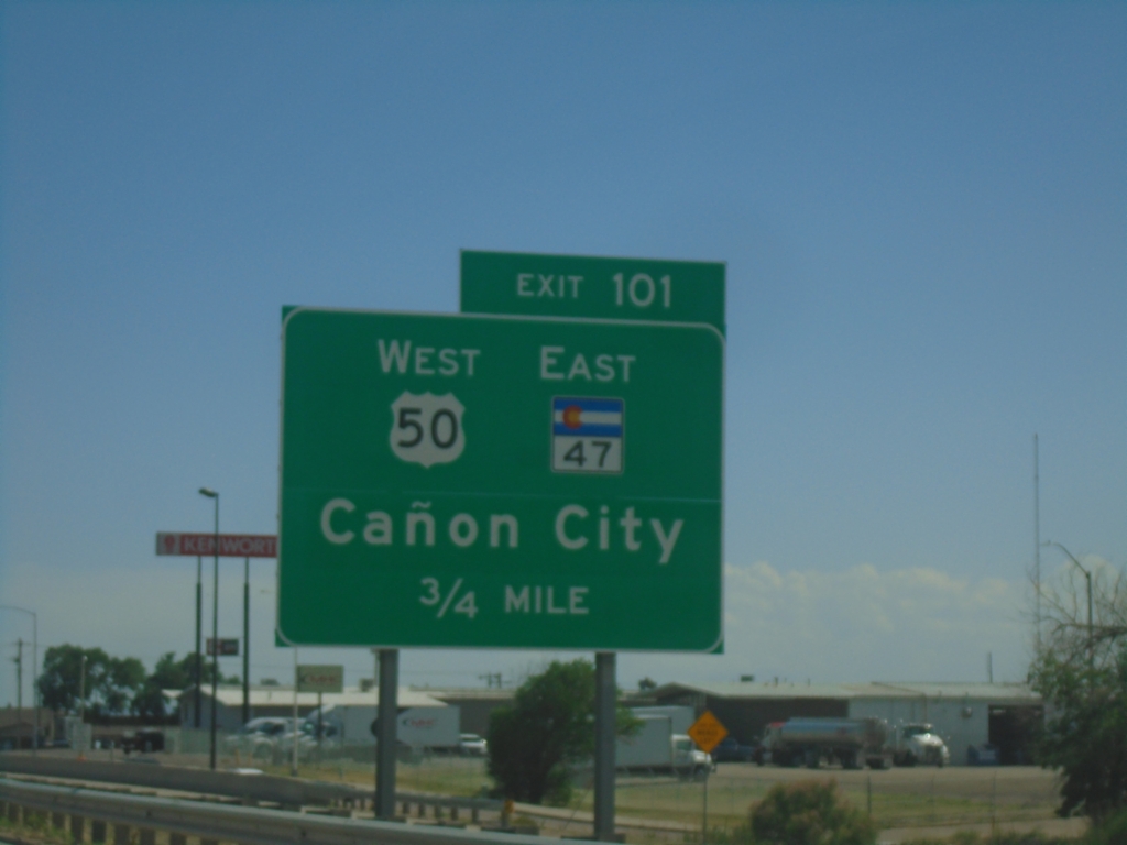
I-25 South - Exit 101
I-25 south approaching Exit 101 - US-50 West/CO-47 East/Cañon City. US-50 East joins I-25 Southbound through Pueblo.
Taken 06-18-2026
Pueblo
Pueblo County
Colorado
United States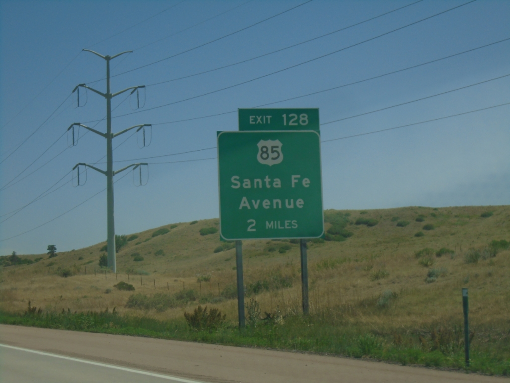
I-25 South - Exit 128
I-25 south approaching Exit 128 - US-85/Santa Fe Ave. US-85 joins I-25 southbound.
Taken 06-18-2026
Fountain
El Paso County
Colorado
United States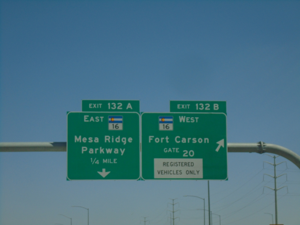
I-25 South - Exits 132A and 132B
I-25 south at Exit 132B - CO-16 West/Fort Carson Gate 20. Approaching Exit 132A - CO-16 East/Mesa Ridge Parkway.
Taken 06-18-2026
 Fountain
El Paso County
Colorado
United States
Fountain
El Paso County
Colorado
United States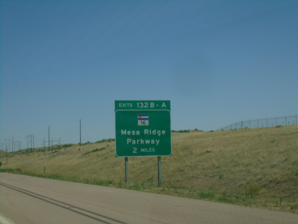
I-25 South - Exits 132B-A
I-25 South at Exits 132B-A - CO-16/Mesa Ridge Parkway.
Taken 06-18-2026
Fountain
El Paso County
Colorado
United States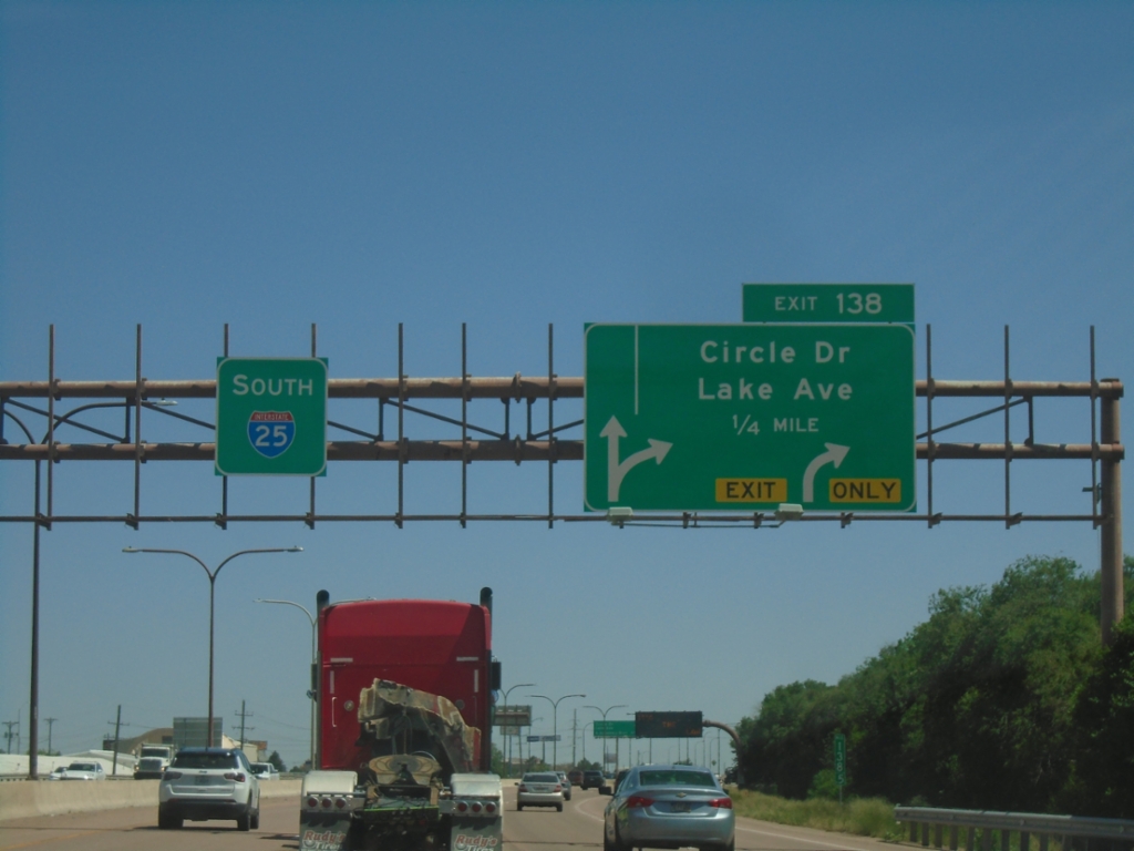
I-25 South - Exit 138
I-25 South approaching Exit 138 - Circle Drive/Lake Ave.
Taken 06-18-2026
Colorado Springs
El Paso County
Colorado
United States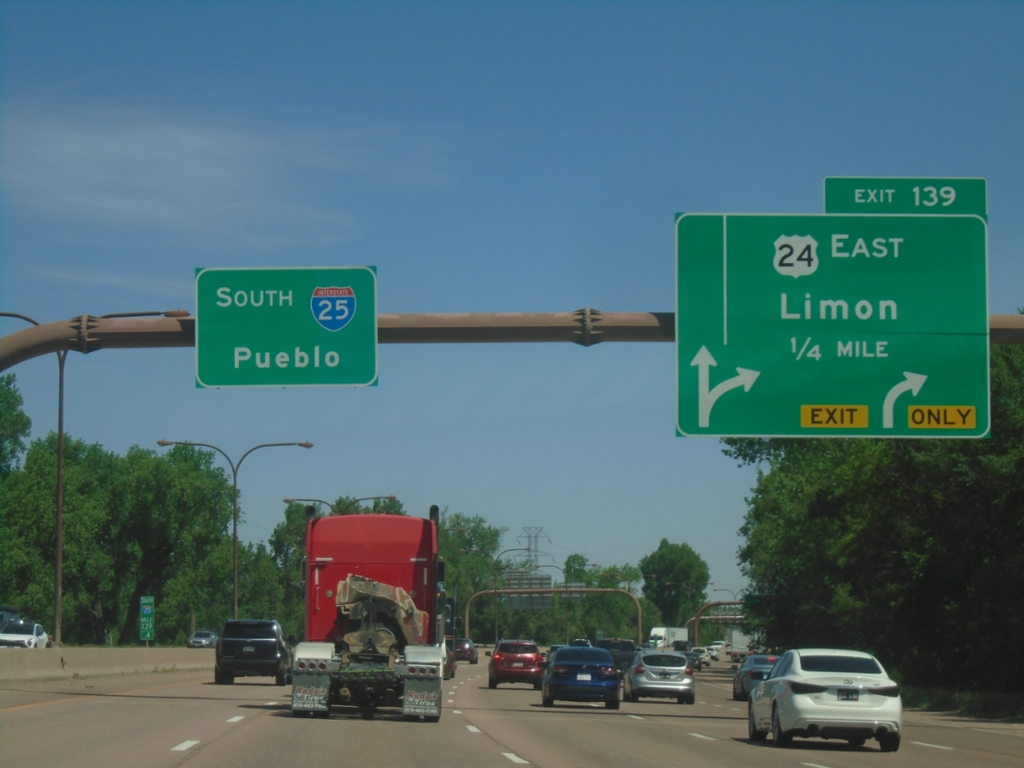
I-25 South - Exit 139
I-25 south approaching Exit 139 - US-24 East/Limon. I-25 continues south to Pueblo.
Taken 06-18-2026
 Colorado Springs
El Paso County
Colorado
United States
Colorado Springs
El Paso County
Colorado
United States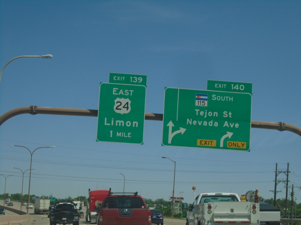
I-25 South/US-24 East - Exits 140 and 139
I-25 South/US-24 East at Exit 140 - CO-115 South/Tejon St./Nevada Ave. Approaching Exit 139 - US-24 East/Limon.
Taken 06-18-2026
 Colorado Springs
El Paso County
Colorado
United States
Colorado Springs
El Paso County
Colorado
United States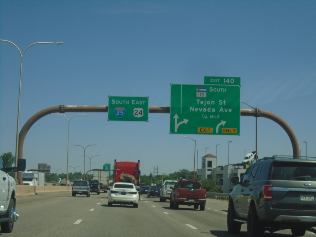
I-25 South - Exit 140
I-25 South/US-24 East approaching Exit 140 - CO-115 South/Tejon St./Nevada Ave.
Taken 06-18-2026
Colorado Springs
El Paso County
Colorado
United States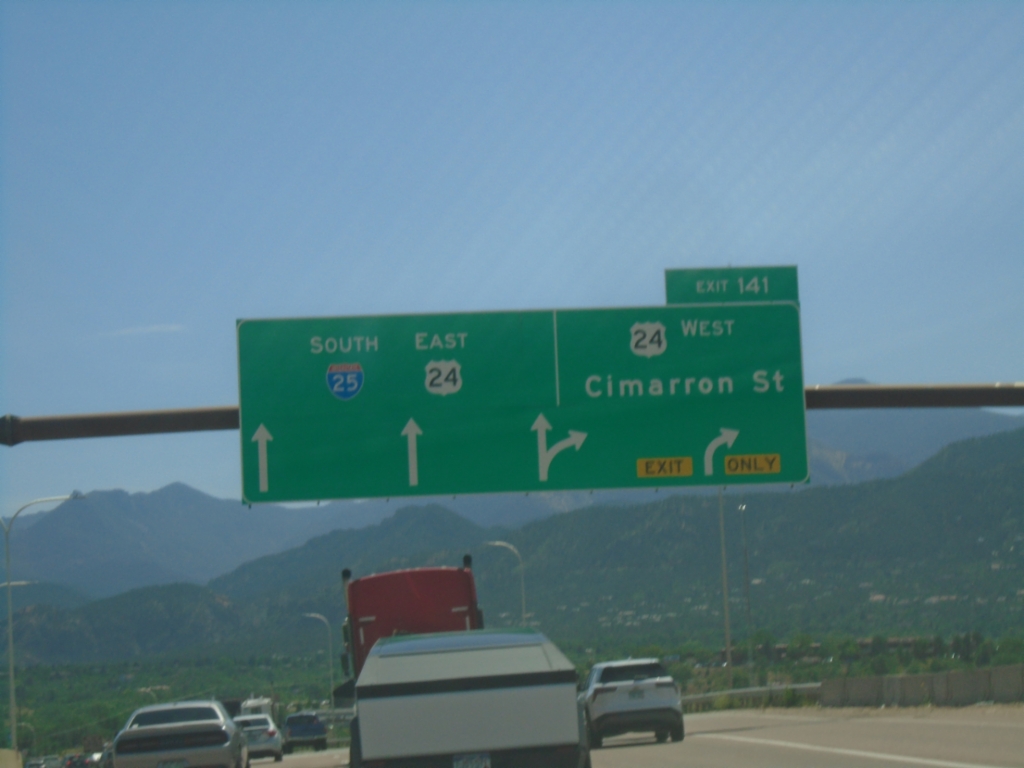
I-25 South - Exit 141
I-25 south at Exit 141 - US-24 West/Cimarron St. US-24 East joins I-25 Southbound.
Taken 06-18-2026
Colorado Springs
El Paso County
Colorado
United States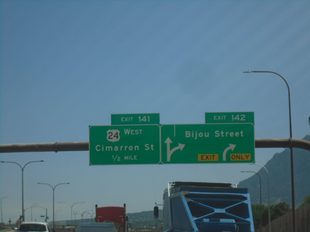
I-25 South - Exits 142 and 141
I-25 south at Exit 142 - Bijou St. Approaching Exit 141 - US-24 West/Cimarron St.
Taken 06-18-2026
Colorado Springs
El Paso County
Colorado
United States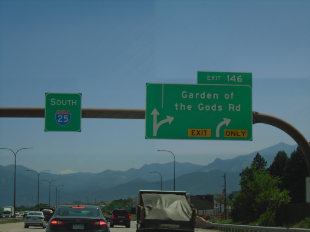
I-25 South - Exit 146
I-25 south at Exit 146 - Garden of the Gods Road.
Taken 06-18-2026
Colorado Springs
El Paso County
Colorado
United States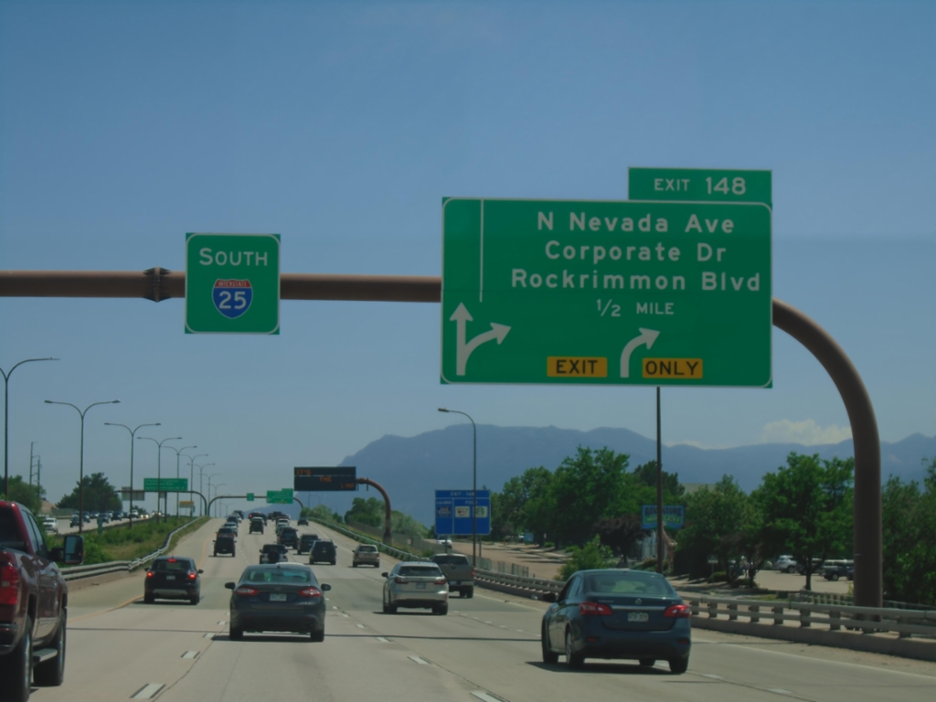
I-25 South - Exit 148
I-25 south approaching Exit 148 - N. Nevada Ave./Corporate Drive/Rockrimmon Blvd.
Taken 06-18-2026
Colorado Springs
El Paso County
Colorado
United States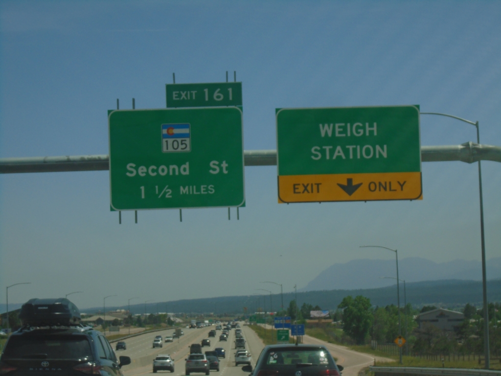
I-25 South - Weigh Station and Exit 161
I-25 south at Monument Weigh Station. Approaching Exit 161 - CO-105/Second St.
Taken 06-18-2026
 Monument
El Paso County
Colorado
United States
Monument
El Paso County
Colorado
United States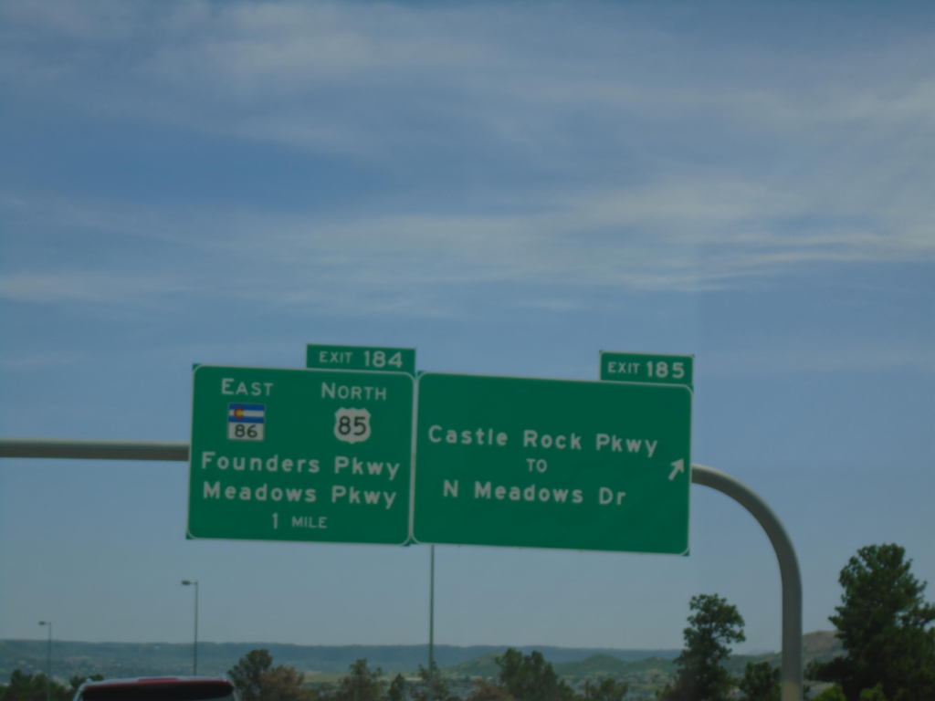
I-25 South - Exits 185 and 184
I-25 south at Exit 185 - Castle Rock Parkway/To N. Meadows Drive. Approaching Exit 184 - US-85 North/CO-86 East/Founders Parkway/Meadows Parkway. US-85 joins I-25/US-87 southbound.
Taken 06-18-2026
 Castle Rock
Douglas County
Colorado
United States
Castle Rock
Douglas County
Colorado
United States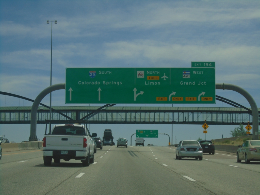
I-25 South - Exit 194
I-25 south at Exit 194 - E-470 North - Toll/Limon and CO-470 West/Grand Junction. E-470/CO-470 is a beltway around the Denver area. This is the southern point on the beltway. Continue south on I-25 to Colorado Springs.
Taken 06-18-2026
 Lone Tree
Douglas County
Colorado
United States
Lone Tree
Douglas County
Colorado
United States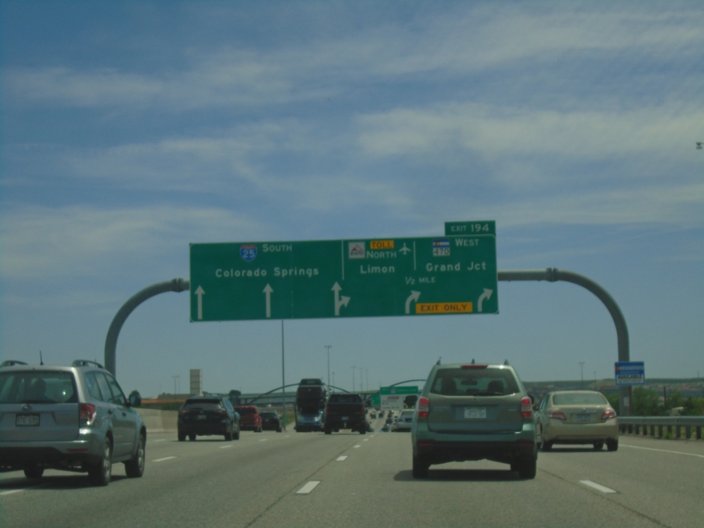
I-25 South - Exit 194
I-25 south approaching Exit 194 - E-470 North Toll/Limon and CO-470 West/Grand Junction. Continue south on I-25 for Colorado Springs.
Taken 06-18-2026
Lone Tree
Douglas County
Colorado
United States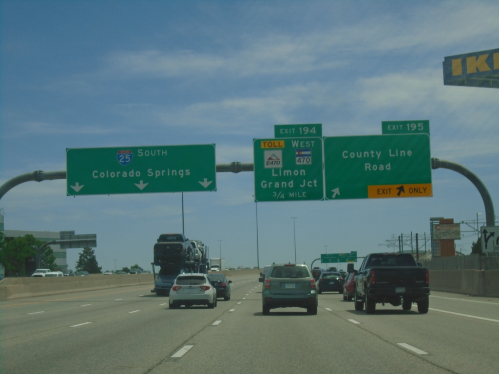
I-25 South - Exits 195 and 194
I-25 south at Exit 195 - County Line Road. Approaching Exit 194 - E-470 Toll/CO-470 West/Limon/Grand Junction. I-25 continues south to Colorado Springs.
Taken 06-18-2026
Centennial
Arapahoe County
Colorado
United States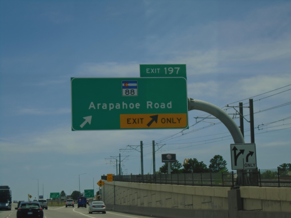
I-25 South - Exit 197
I-25 south at Exit 197 - CO-88/Arapahoe Road.
Taken 06-18-2026
 Greenwood Village
Arapahoe County
Colorado
United States
Greenwood Village
Arapahoe County
Colorado
United States
End I-225 South at I-25
End I-225 South at I-25 in Denver. Use I-25 South to Colorado Springs; I-25 North to Denver.
Taken 06-18-2026
 Denver
 County
Colorado
United States
Denver
Denver County
Colorado
United States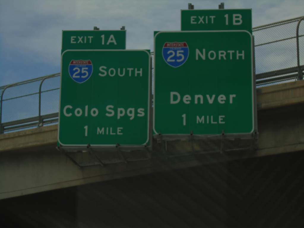
I-225 South Approaching I-25
I-225 South approaching Exit 1A - I-25 South/Colorado Springs, and Exit 1B - I-25 north/Denver. This is the southern end of I-225.
Taken 06-18-2026
Denver
Denver County
Colorado
United States