Signs Tagged With Shield Inside Sign
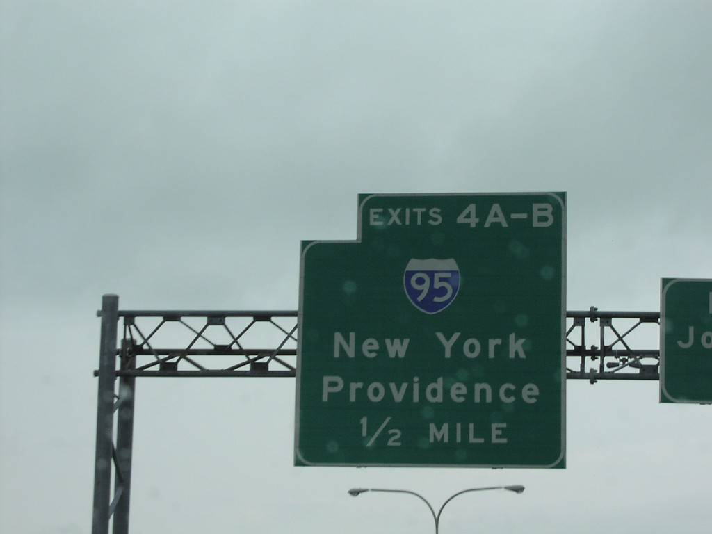
RI-37 East at Exits4AB - I-95 Jct.
RI-37 East at I-95 Junction to New York and Providence
Taken 07-01-2004

 Cranston
Providence County
Rhode Island
United States
Cranston
Providence County
Rhode Island
United States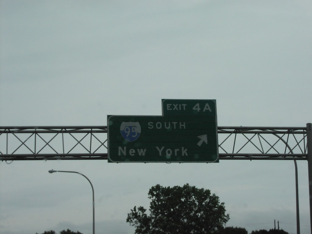
RI-37 East at Exit 4A - I-95 South
Exit 4A, I-95 South/New York on RI-37 East
Taken 07-01-2004
Warwick
Kent County
Rhode Island
United States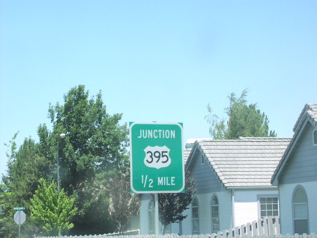
NV-88 North at US-395
NV-88 North Approaching US-395 in Minden.
Taken 07-01-2004

 Minden
Douglas County
Nevada
United States
Minden
Douglas County
Nevada
United States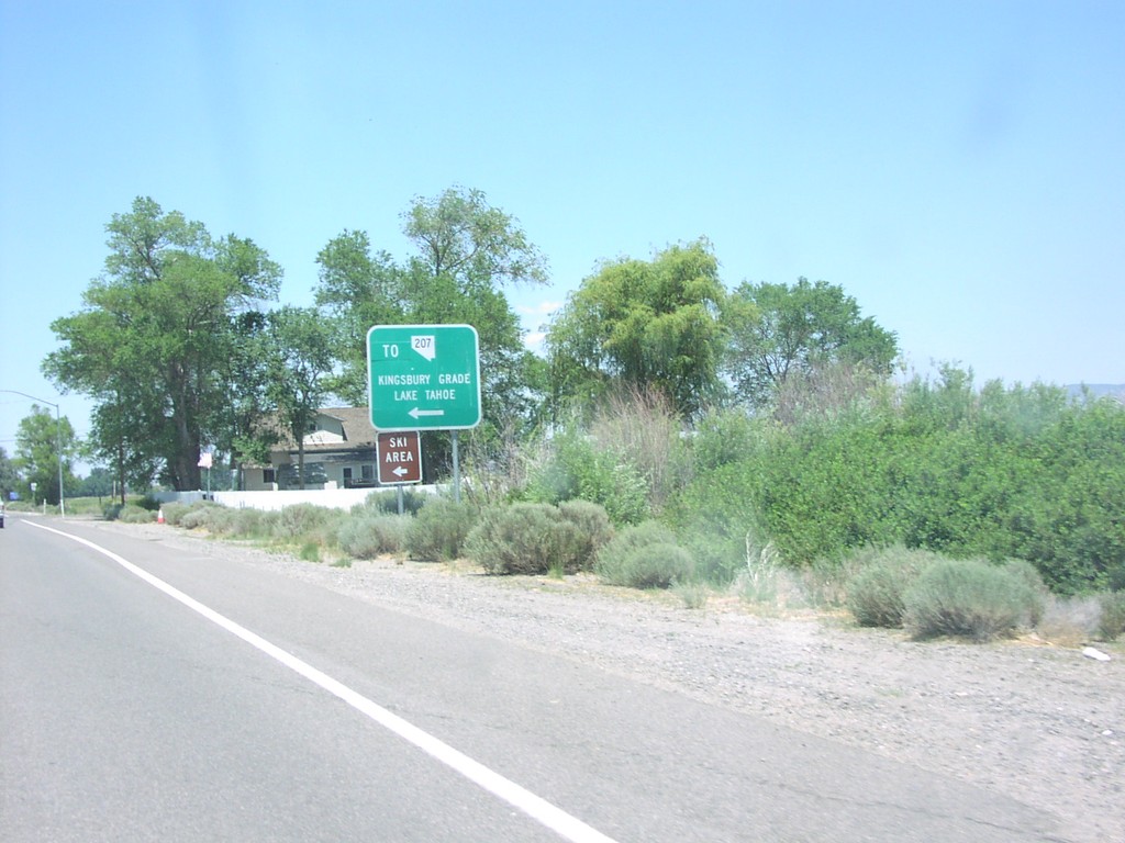
NV-88 North at To NV-207 Jct.
NV-88 North at To NV-207/Kingsbury Grade/Lake Tahoe Junction
Taken 07-01-2004
 Gardnerville
Douglas County
Nevada
United States
Gardnerville
Douglas County
Nevada
United States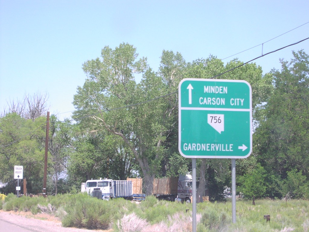
NV-88 North at NV-756 to Gardnerville
NV-88 North to Minden/Carson City at NV-756 to Gardnerville
Taken 07-01-2004
 Gardnerville
Douglas County
Nevada
United States
Gardnerville
Douglas County
Nevada
United States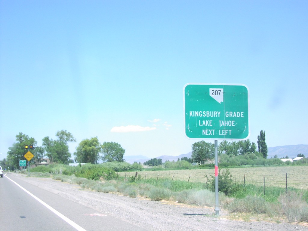
NV-88 North Approaching NV-207
NV-88 North Approaching NV-207 to Kingsbury Grade and Lake Tahoe.
Taken 07-01-2004
Gardnerville
Douglas County
Nevada
United States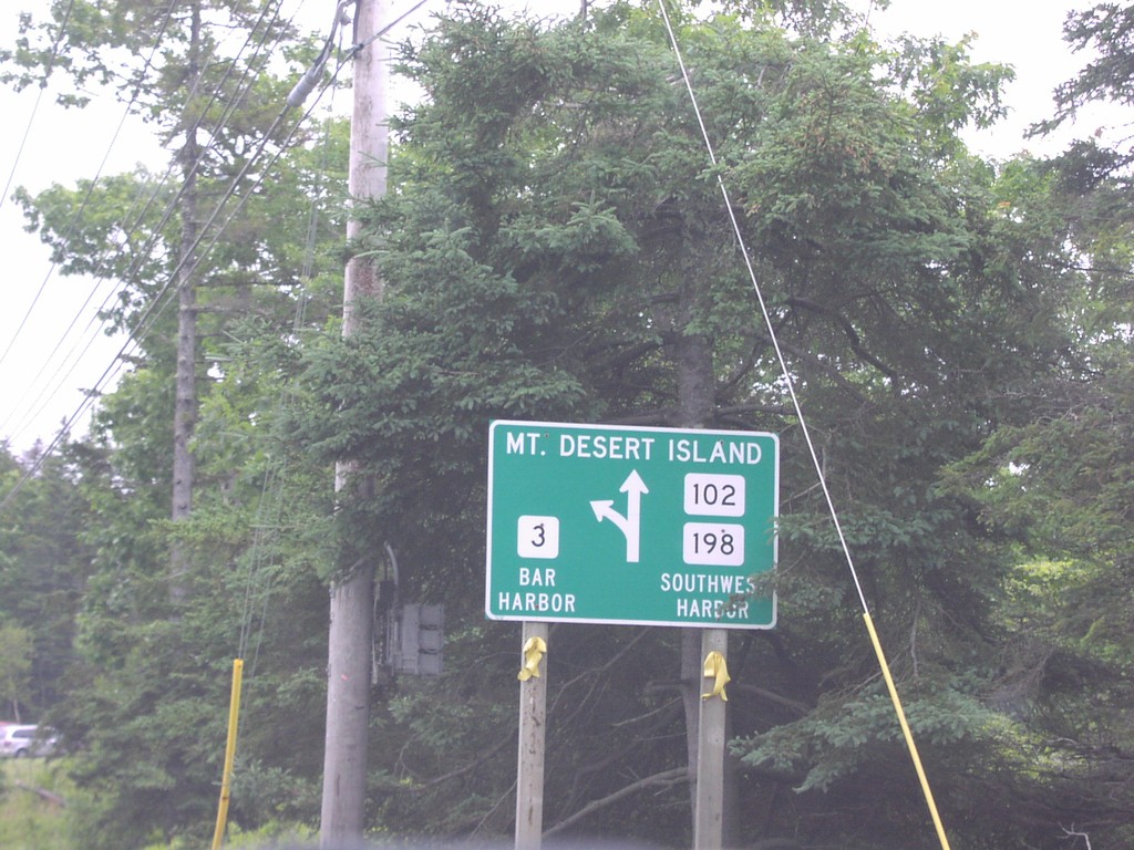
Mt. Desert Island Routes
Mt. Desert Island Routes at ME-3/ME-102/ME-198 Junction
Taken 07-01-2004


 Trenton
Hancock County
Maine
United States
Trenton
Hancock County
Maine
United States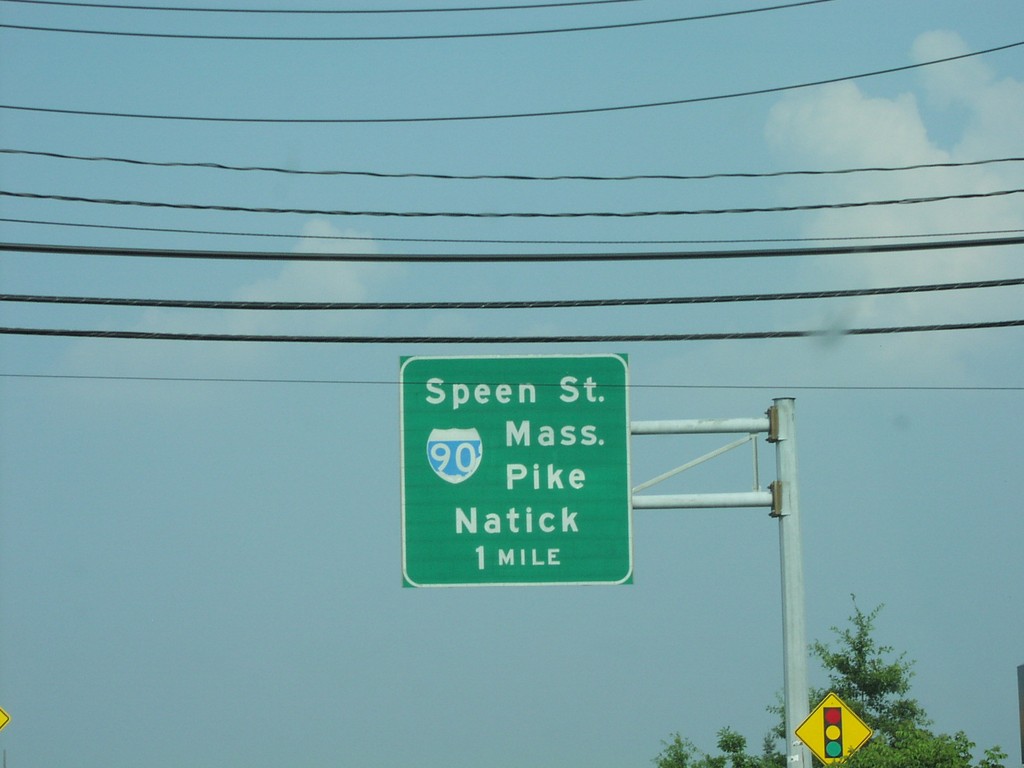
MA-9 West At Speen St. to MassPike
MA-9 East Approaching Speen St. to I-90
Taken 07-01-2004

 Natick
Middlesex County
Massachusetts
United States
Natick
Middlesex County
Massachusetts
United States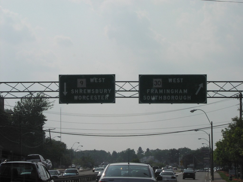
MA-9 West at MA-30 West
MA-9 West/MA-30 West Overhead in Framingham
Taken 07-01-2004
 Framingham
Middlesex County
Massachusetts
United States
Framingham
Middlesex County
Massachusetts
United States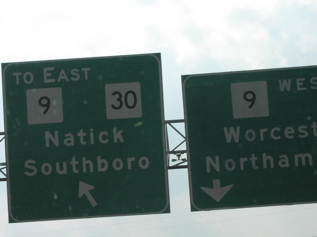
MA-9 East Turnaround
MA-9 West at MA-9 East Turnaround
Taken 07-01-2004
Framingham
Middlesex County
Massachusetts
United States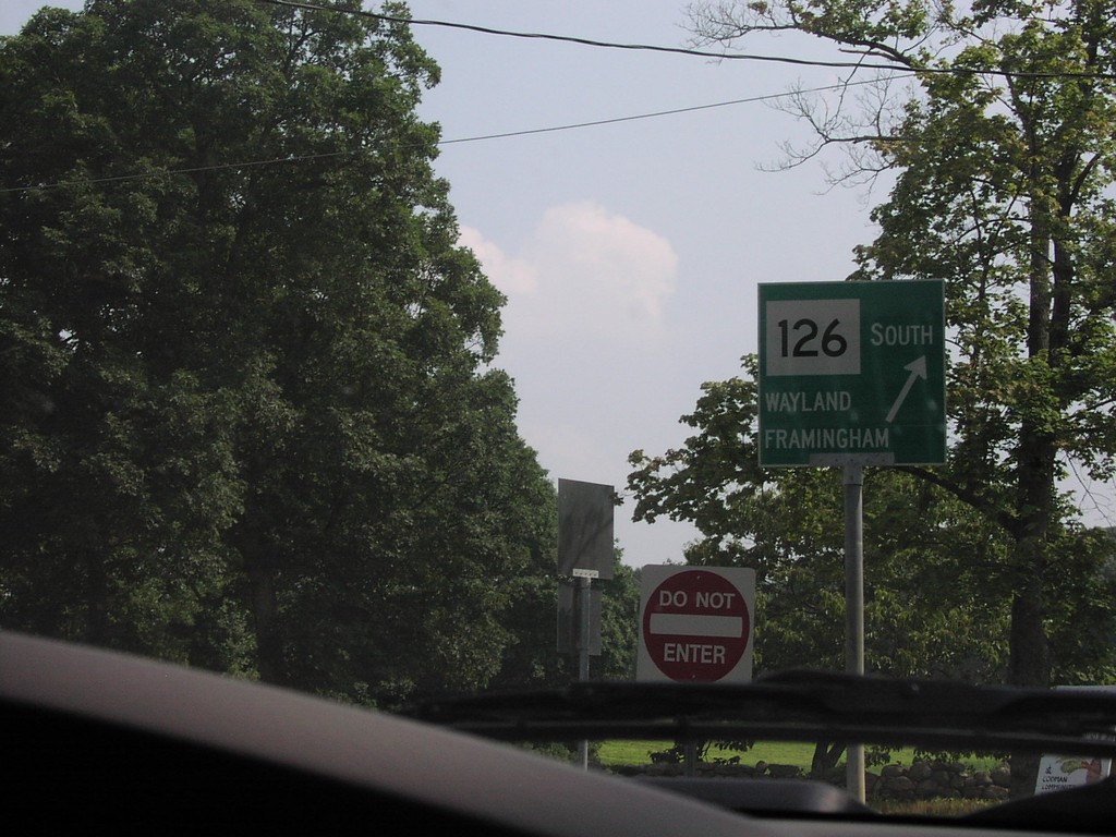
MA-126 South at Codman Road
MA-126 South at Codman Road. Merge right for MA-126 South to Wayland and Framingham
Taken 07-01-2004
 Lincoln
Middlesex County
Massachusetts
United States
Lincoln
Middlesex County
Massachusetts
United States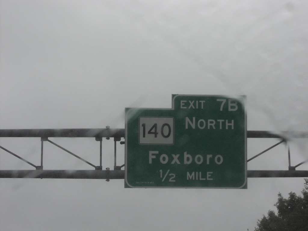
I-95 South Exit 7B
I-95 South at Exit 7B, MA-140 Junction
Taken 07-01-2004
 Foxborough
Norfolk County
Massachusetts
United States
Foxborough
Norfolk County
Massachusetts
United States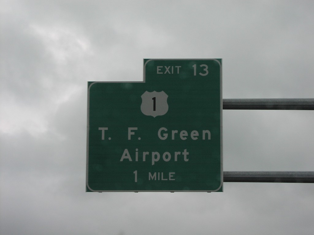
I-95 South Exit 13
I-95 South at Exit 13, US-1/TF Green Airport
Taken 07-01-2004
 Cranston
Providence County
Rhode Island
United States
Cranston
Providence County
Rhode Island
United States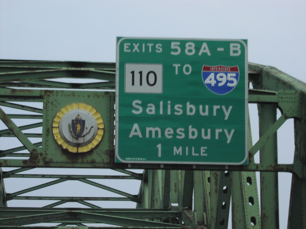
I-95 North Exits 58AB (I-495/MA-110)
I-95 North at Exits 58A-B, I-495/MA-110 Junction
Taken 07-01-2004

 Newburyport
Essex County
Massachusetts
United States
Newburyport
Essex County
Massachusetts
United States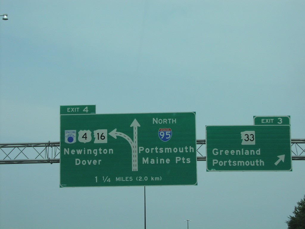
I-95 North Exits 4 and 3
I-95 North at Exit 3, NH-33 Junction, Approaching NH-16
Taken 07-01-2004


 Portsmouth
Rockingham County
New Hampshire
United States
Portsmouth
Rockingham County
New Hampshire
United States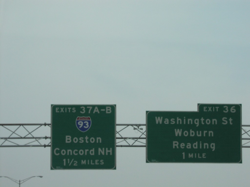
I-95 North Exits 37AB and 36 (I-93 Jct.)
I-95 North at Exit 36 and Approaching Exits 37A-B, I-93 Junction
Taken 07-01-2004
 Woburn
Middlesex County
Massachusetts
United States
Woburn
Middlesex County
Massachusetts
United States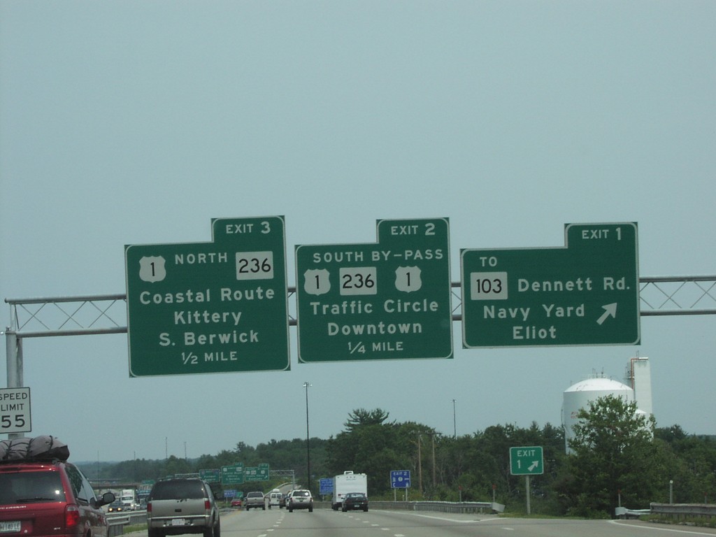
I-95 North Exits 1,2,3
I-95 North at Exits 1,2, and 3 in
Taken 07-01-2004

 Kittery
York County
Maine
United States
Kittery
York County
Maine
United States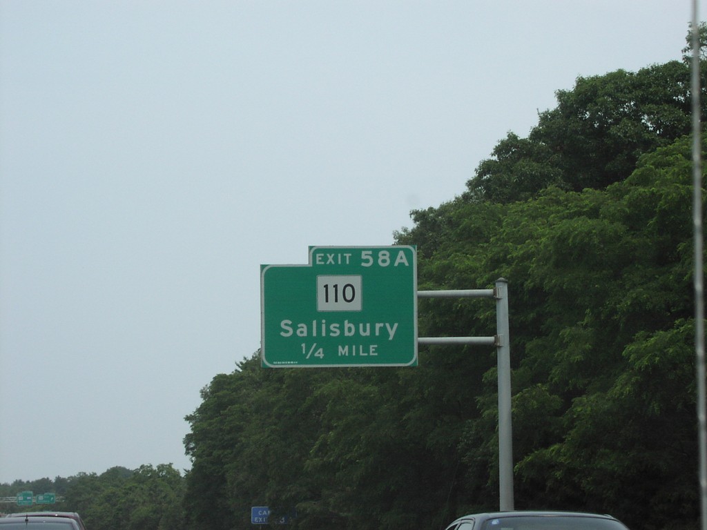
I-95 North Exit58A
I-95 North Approaching Exit 58A, MA-110 Junction
Taken 07-01-2004
Amesbury
Essex County
Massachusetts
United States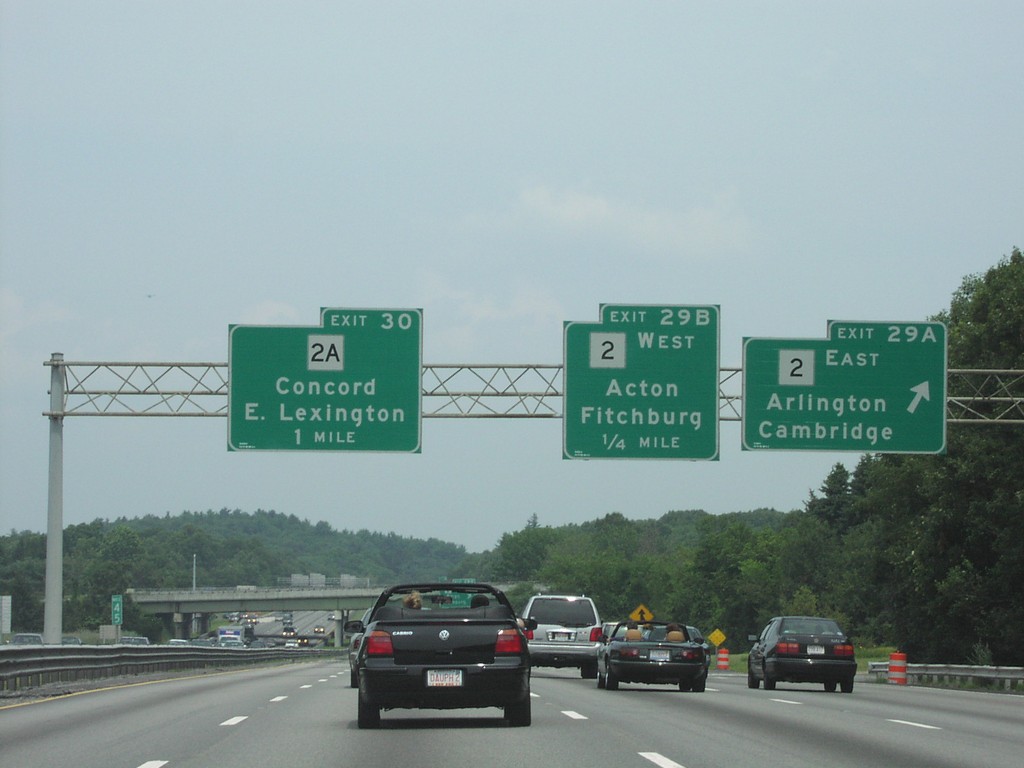
I-95 North Exit29AB/Exit 30
I-95 North at Exit 29A-B, MA-2 Junction and Approaching Exit 30
Taken 07-01-2004

 Lexington
Middlesex County
Massachusetts
United States
Lexington
Middlesex County
Massachusetts
United States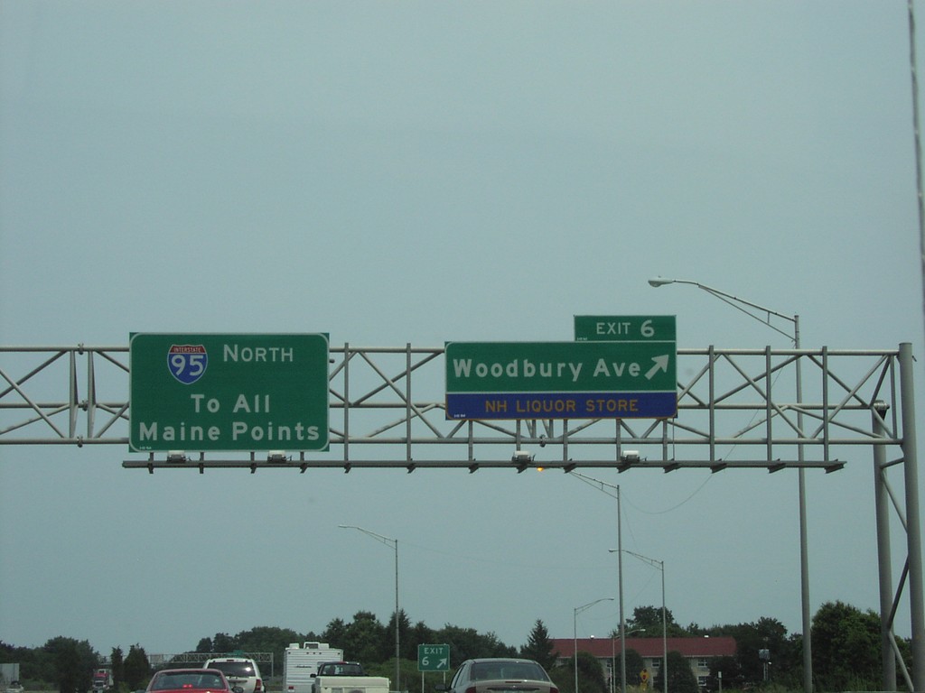
I-95 North Exit 6
I-95 North at Exit 6, Woodbury Ave./Liquor Store
Taken 07-01-2004
Portsmouth
Rockingham County
New Hampshire
United States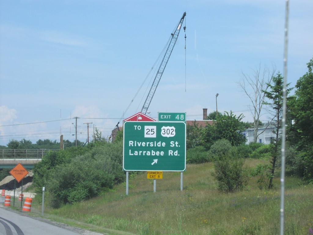
I-95 North Exit 48
I-95 North at Exit 48, ME-25/US-302 Jct.
Taken 07-01-2004

 Portland
Cumberland County
Maine
United States
Portland
Cumberland County
Maine
United States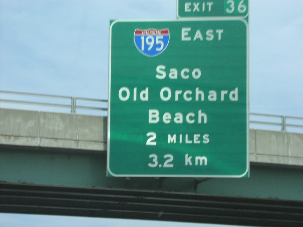
I-95 North Exit 36
I-95 North at Exit 36, I-195 East Junction
Taken 07-01-2004
 Saco
York County
Maine
United States
Saco
York County
Maine
United States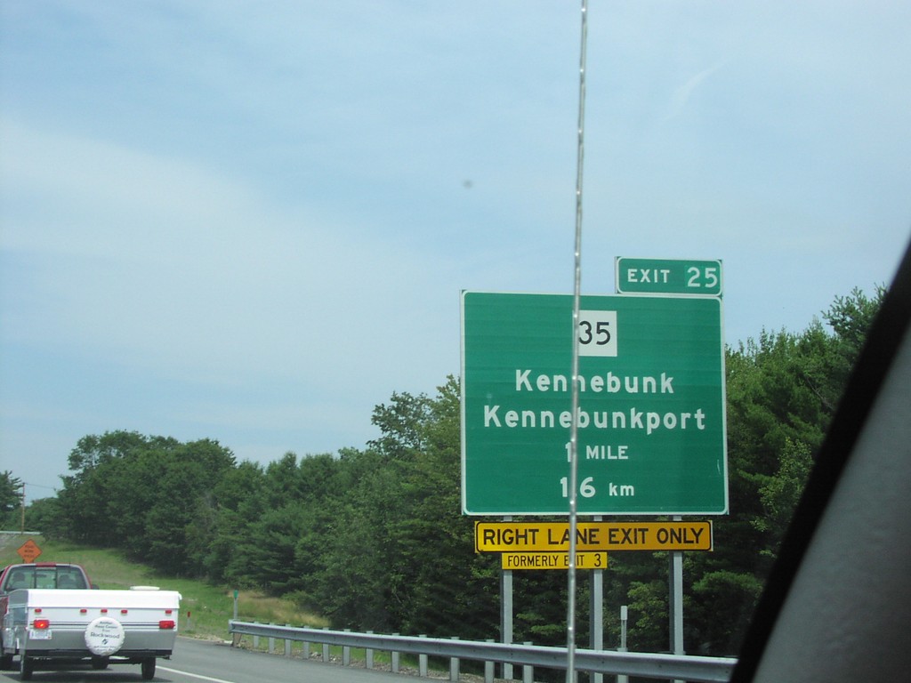
I-95 North Exit 25
I-95 North at ME-35 to Kennebunk and Kennebunkport
Taken 07-01-2004
 Kennebunk
York County
Maine
United States
Kennebunk
York County
Maine
United States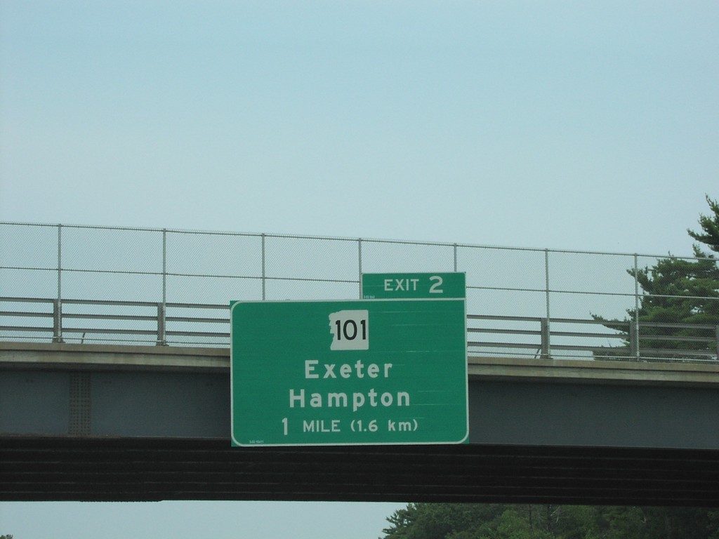
I-95 North Exit 2
I-95 North at Exit 2, NH-101 Junction
Taken 07-01-2004
 Hampton
Rockingham County
New Hampshire
United States
Hampton
Rockingham County
New Hampshire
United States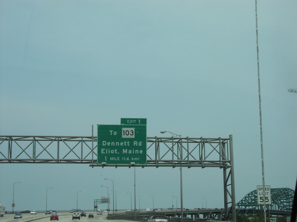
I-95 North Exit 1 (Maine)
I-95 North at Maine Exit 1, ME-103 Junction
Taken 07-01-2004
Portsmouth
Rockingham County
New Hampshire
United States