Signs Tagged With Shield Inside Sign
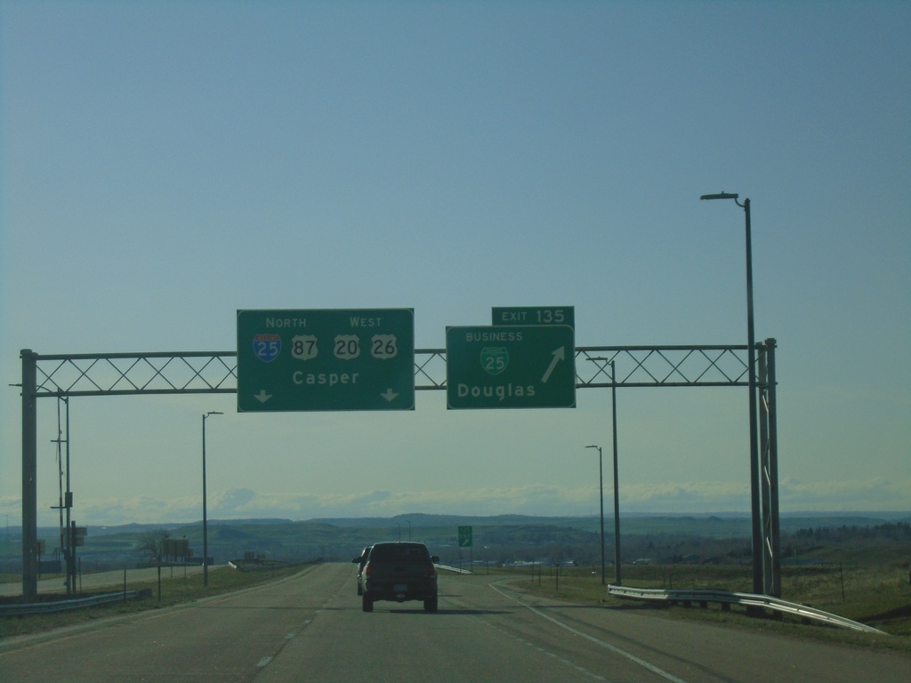
I-25 North - Exit 135
I-25 north at Exit 135 - BL-25/Douglas. Continue on I-25/US-87 North/US-20/US-26 West to Casper.
Taken 05-02-2022


 Douglas
Converse County
Wyoming
United States
Douglas
Converse County
Wyoming
United States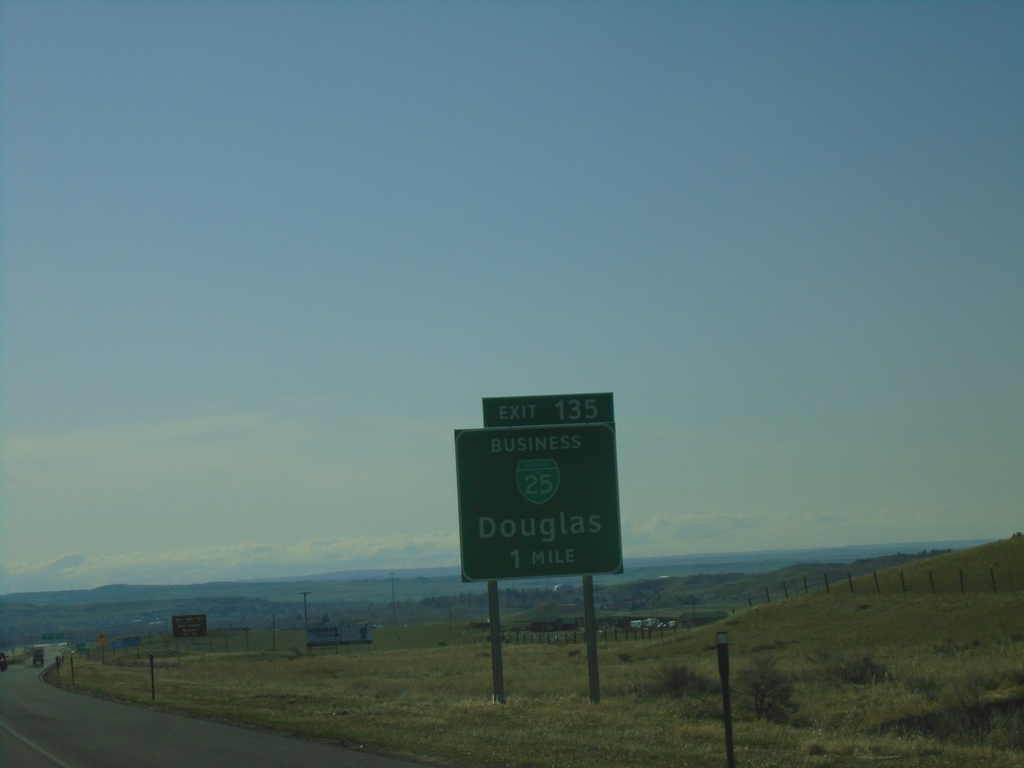
I-25 North - Exit 135
I-25 north approaching Exit 135 - BL-25/Douglas. This is the south end of the Douglas business loop.
Taken 05-02-2022
Douglas
Converse County
Wyoming
United States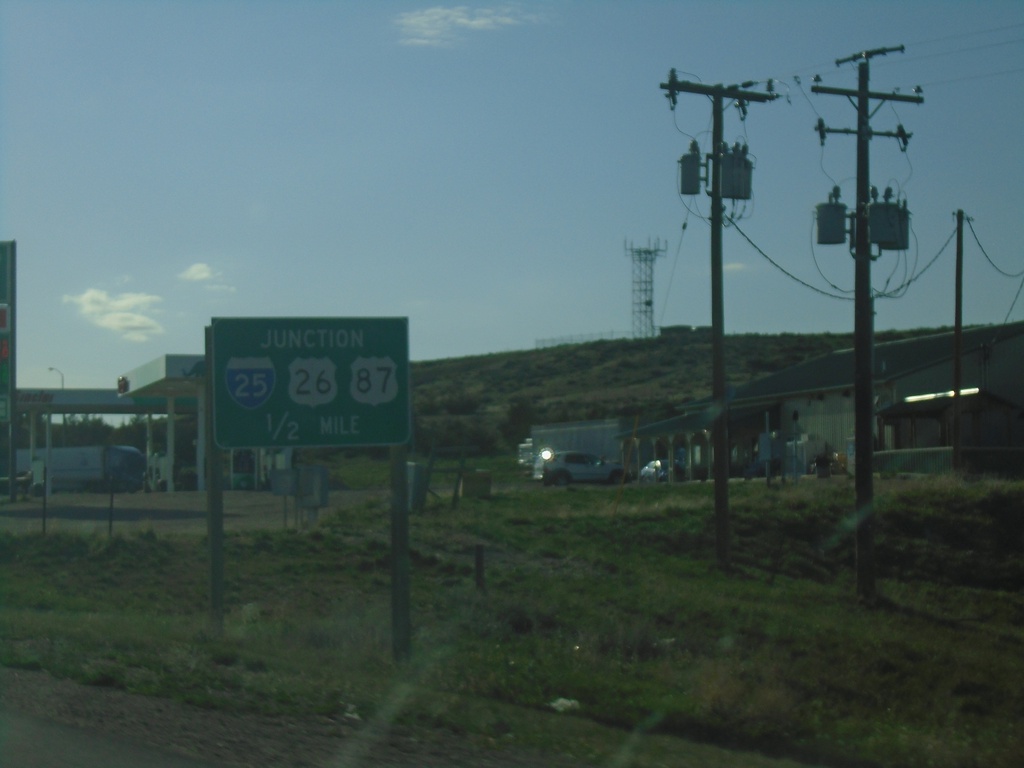
US-18/US-20 East Approaching I-25/US-26/US-87
US-18/US-20 East approaching I-25/US-26/US-87 at Orin Junction. US-20 west joins I-25/US-87 North/US-26 West to Glenrock. US-18 ends here.
Taken 05-02-2022
 Douglas
Converse County
Wyoming
United States
Douglas
Converse County
Wyoming
United States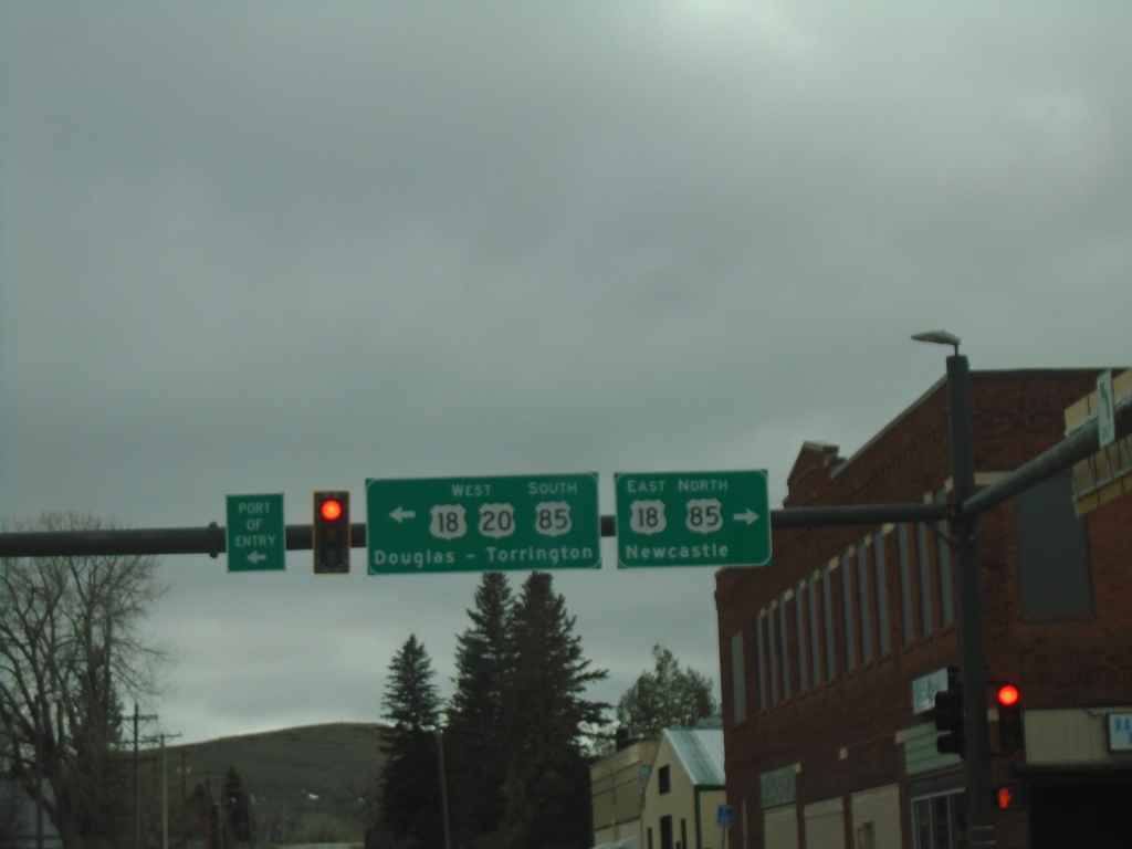
US-20 West at US-18/US-85 - Lusk
US-20 West at US-18/US-85 in Lusk. Use US-18 East/US-85 North to Newcastle. Use US-20 West/US-18-West/US-85 South to Douglas (via US-18/US-20) and Torrington (via US-85).
Taken 05-02-2022
 Lusk
Niobrara County
Wyoming
United States
Lusk
Niobrara County
Wyoming
United States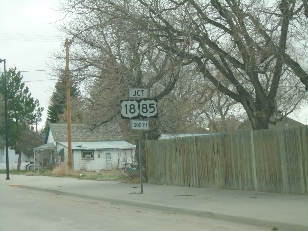
US-20 West Approaching US-18/US-85
US-20 West approaching US-18/US-85 in Lusk.
Taken 05-02-2022
Lusk
Niobrara County
Wyoming
United States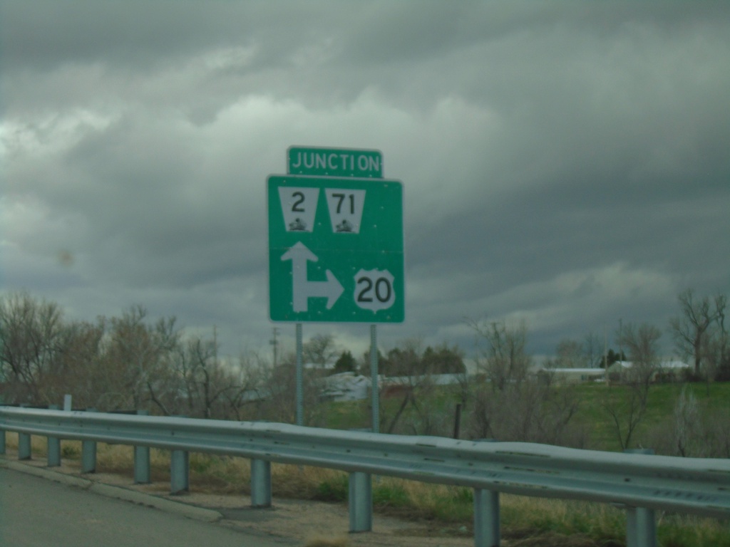
US-20 West/NE-2 East/NE-71 South at NE-2/NE-71
US-20 West/NE-2 East/NE-71 South at NE-2/NE-71 in Crawford.
Taken 05-02-2022

 Crawford
Dawes County
Nebraska
United States
Crawford
Dawes County
Nebraska
United States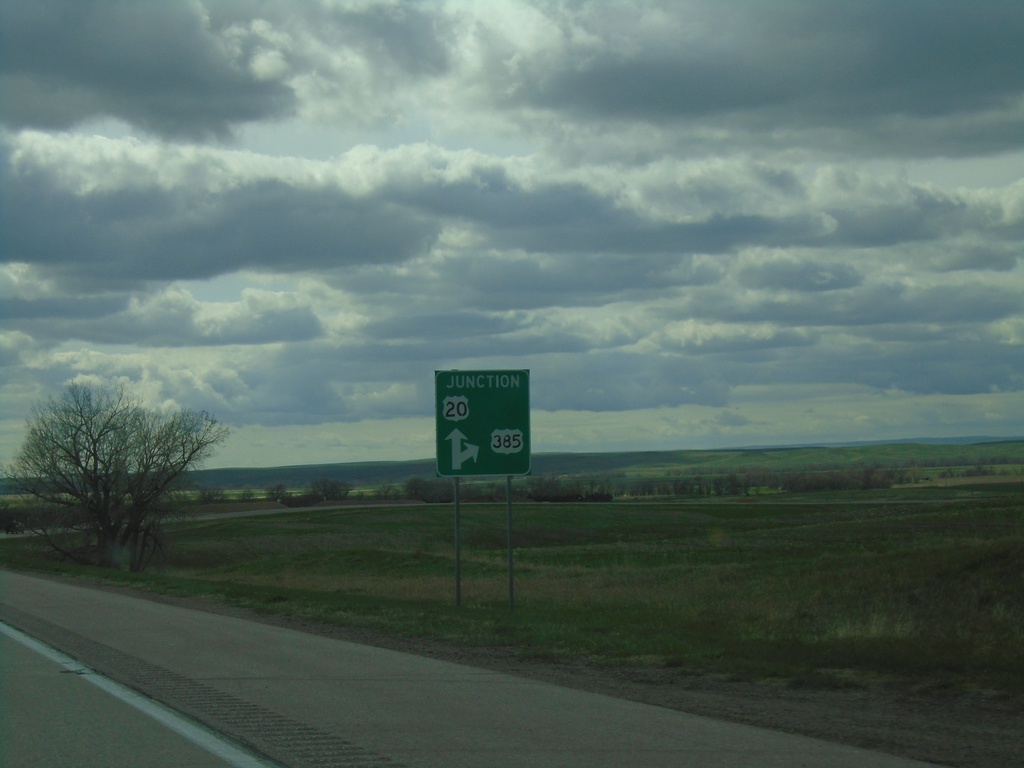
US-20 West/US-385 North Approaching US-20/US-385 Split
US-20 West/US-385 North approaching US-20/US-385 split in Dawes County.
Taken 05-02-2022
 Chadron
Dawes County
Nebraska
United States
Chadron
Dawes County
Nebraska
United States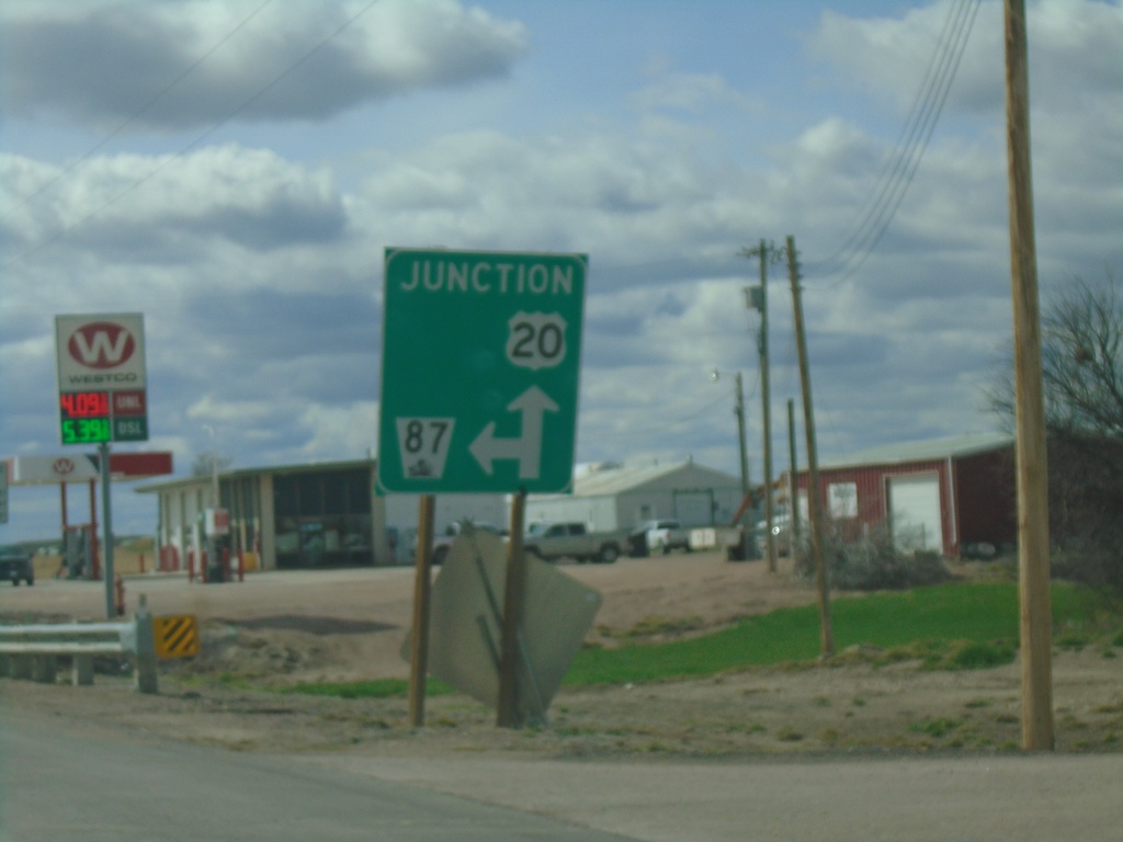
US-20 West/NE-87 South at US-20/NE-87 Split
US-20 West/NE-87 South at US-20/NE-87 split in Hay Springs.
Taken 05-02-2022
 Hay Springs
Sheridan County
Nebraska
United States
Hay Springs
Sheridan County
Nebraska
United States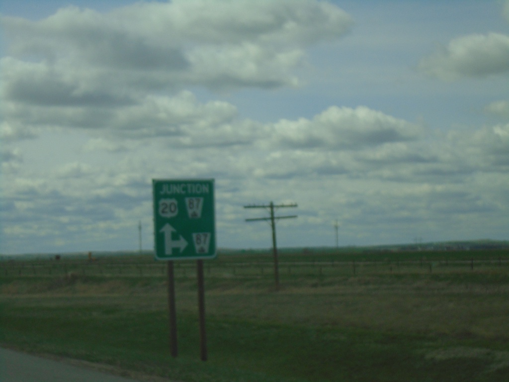
US-20 West Approaching NE-87
US-20 West approaching NE-87 in Sheridan County.
Taken 05-02-2022
Rushville
Sheridan County
Nebraska
United States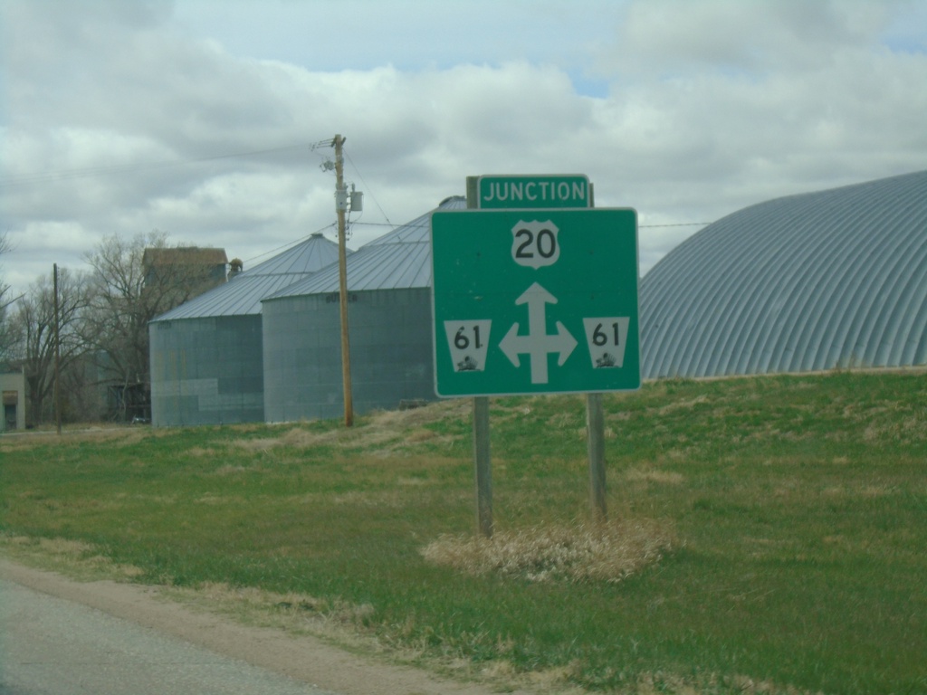
US-20 West Approaching NE-61
US-20 West Approaching NE-61 in Merriman.
Taken 05-02-2022
 Merriman
Cherry County
Nebraska
United States
Merriman
Cherry County
Nebraska
United States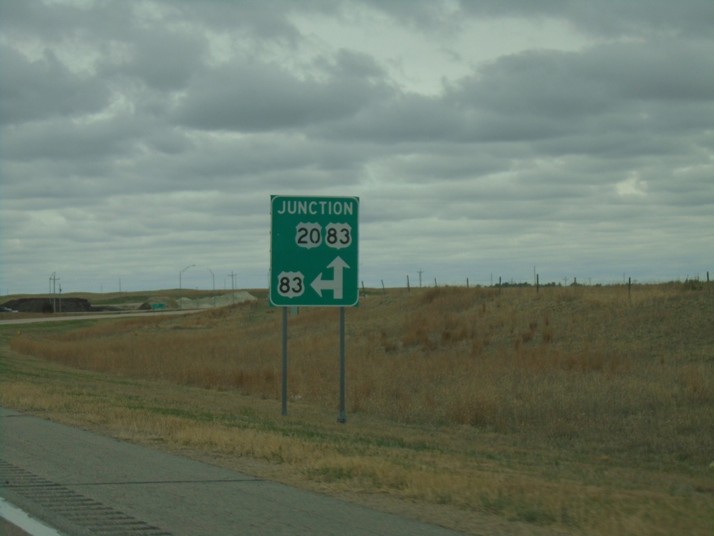
US-20 West Approaching US-83
US-20 West approaching US-83 in Cherry County. US-83 North joins US-20 West to Valentine.
Taken 05-02-2022
 Valentine
Cherry County
Nebraska
United States
Valentine
Cherry County
Nebraska
United States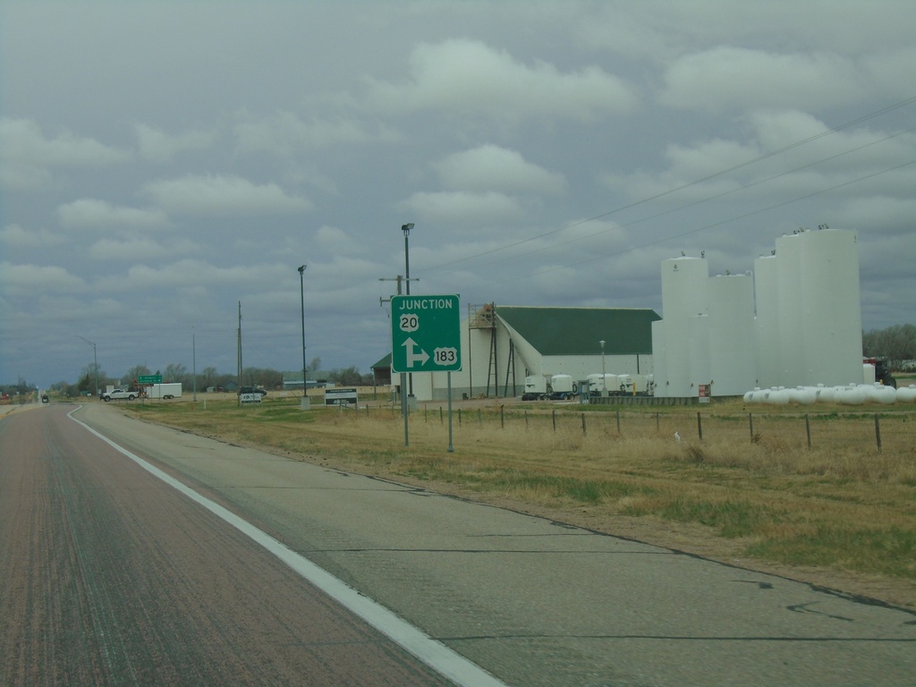
US-20 West/US-183 North/NE-7 South at at US-183 North
US-20 West/US-183 North/NE-7 South at at US-183 North in Brown County.
Taken 05-02-2022

 Long Pine
Brown County
Nebraska
United States
Long Pine
Brown County
Nebraska
United States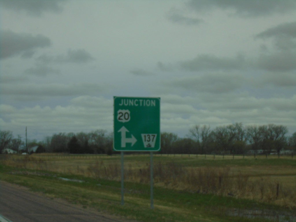
US-20 West Approaching NE-137
US-20 West approaching NE-137 in Newport.
Taken 05-02-2022
 Stuart
Rock County
Nebraska
United States
Stuart
Rock County
Nebraska
United States
US-20 West Approaching NE-11
US-20 West approaching NE-11 in Atkinson. NE-11 North joins US-20 West through Atkinson.
Taken 05-02-2022
 Atkinson
Holt County
Nebraska
United States
Atkinson
Holt County
Nebraska
United States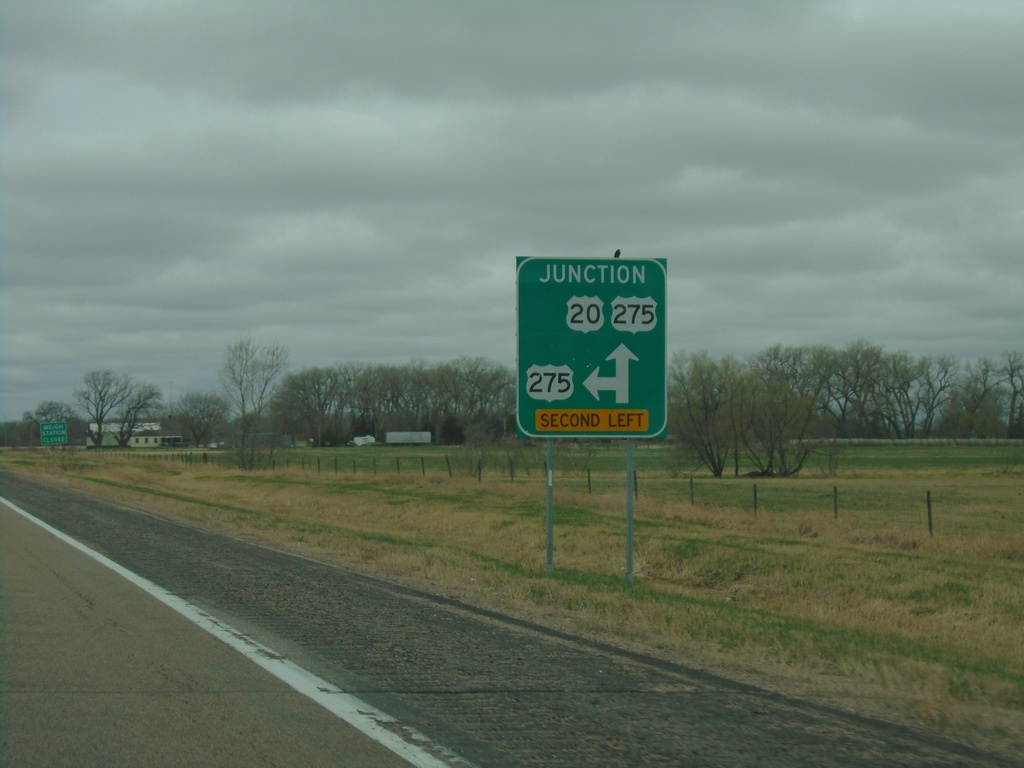
US-20 West Approaching US-275
US-20 West approaching US-275 in Holt County. US-275 West joins US-20 west to O’Neill.
Taken 05-02-2022
 Page
Holt County
Nebraska
United States
Page
Holt County
Nebraska
United States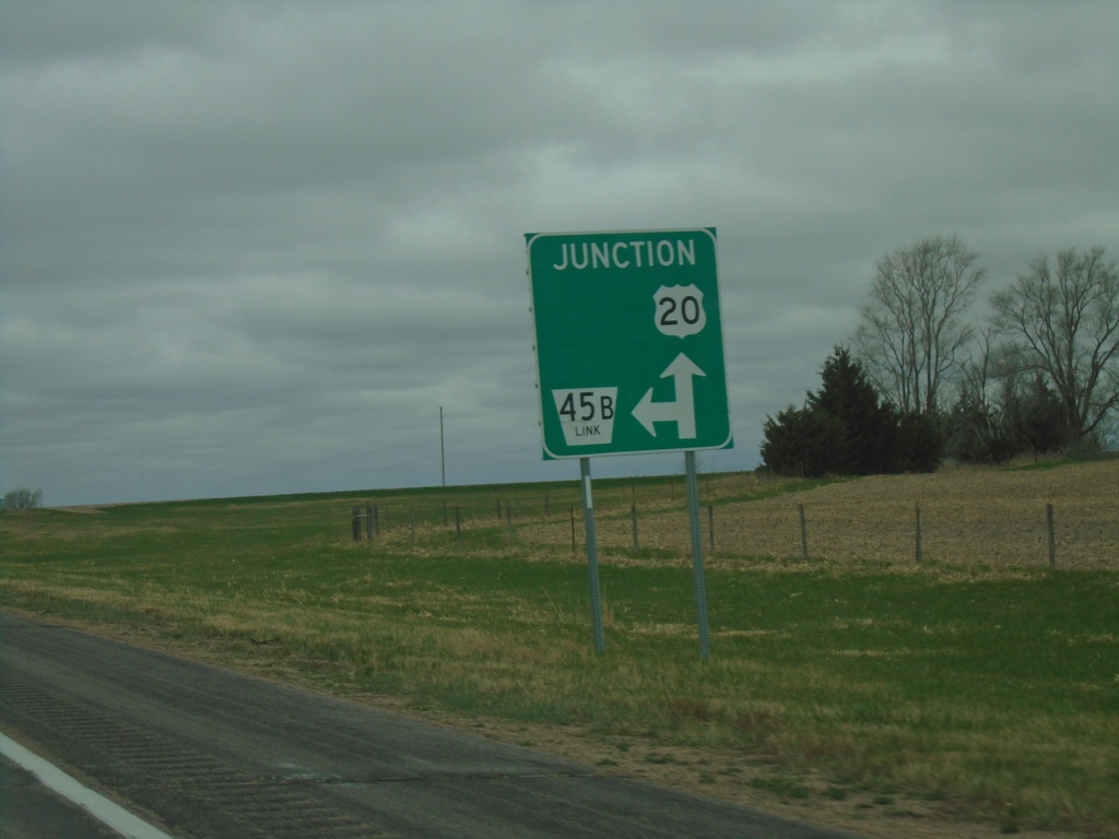
US-20 West Approaching NE-45B Link
US-20 West approaching NE-45B Link in Holt County.
Taken 05-02-2022
 Orchard
Holt County
Nebraska
United States
Orchard
Holt County
Nebraska
United States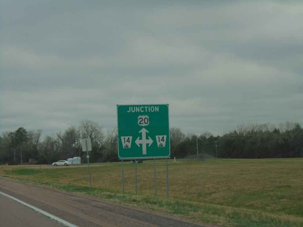
US-20 West Approaching NE-14
US-20 West approaching NE-14 in Antelope County.
Taken 05-02-2022
 Brunswick
Antelope County
Nebraska
United States
Brunswick
Antelope County
Nebraska
United States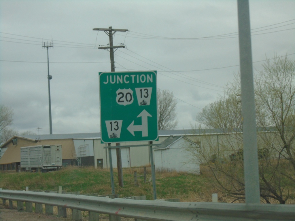
US-20 West Approaching NE-13
US-20 West approaching NE-13 in Plainview. NE-13 north joins US-20 westbound.
Taken 05-02-2022
 Plainview
Pierce County
Nebraska
United States
Plainview
Pierce County
Nebraska
United States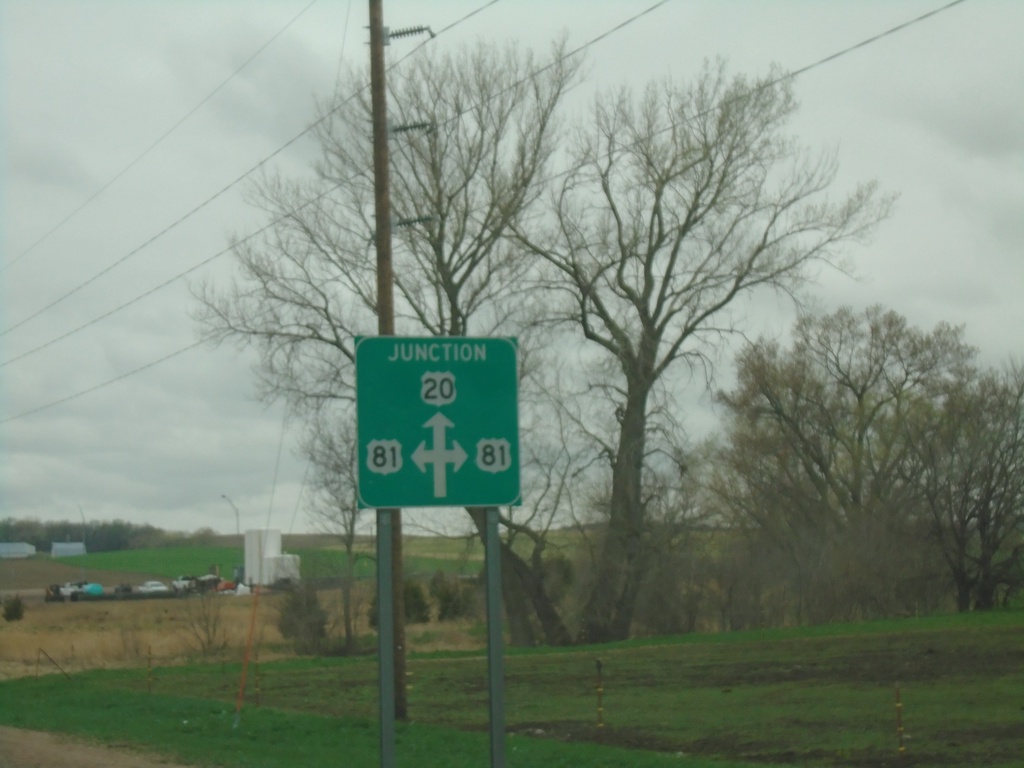
US-20 West Approaching US-81
US-20 West approaching US-81 in Pierce County.
Taken 05-02-2022
 McLean
Pierce County
Nebraska
United States
McLean
Pierce County
Nebraska
United States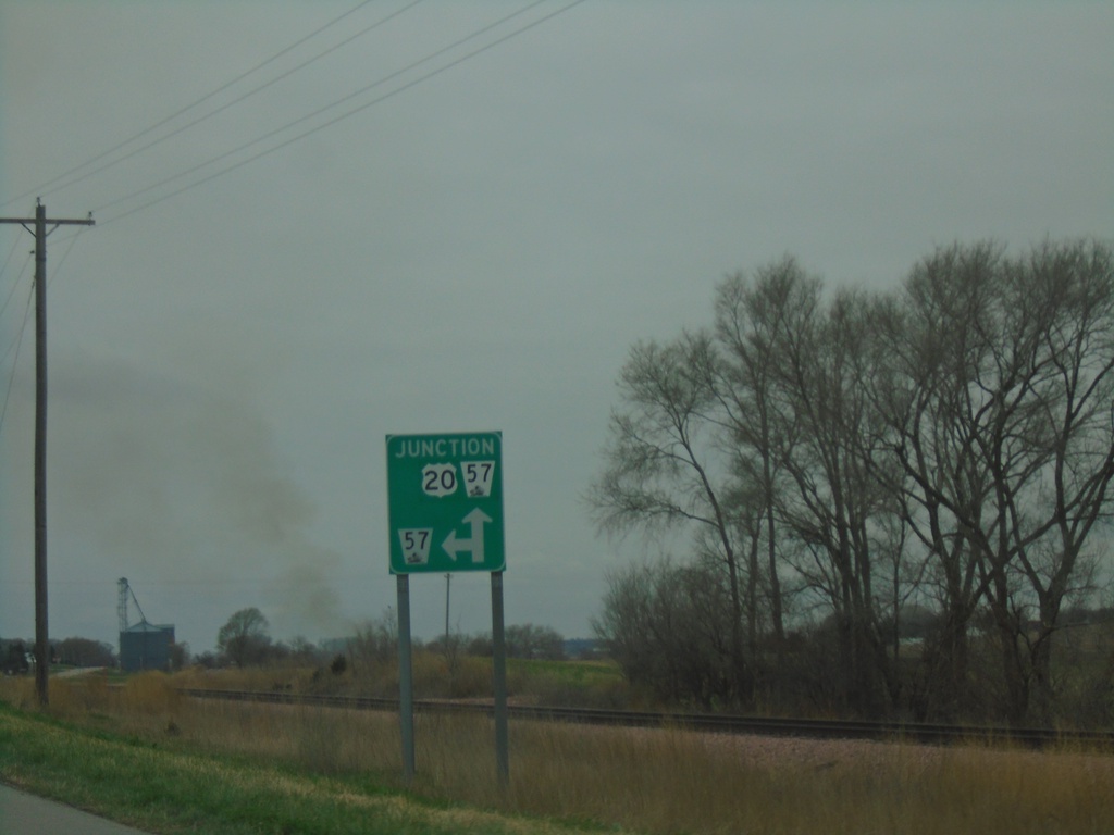
US-20 West Approaching NE-57
US-20 West approaching NE-57 in Cedar County. NE-57 north joins US-20 westbound.
Taken 05-02-2022
 Belden
Cedar County
Nebraska
United States
Belden
Cedar County
Nebraska
United States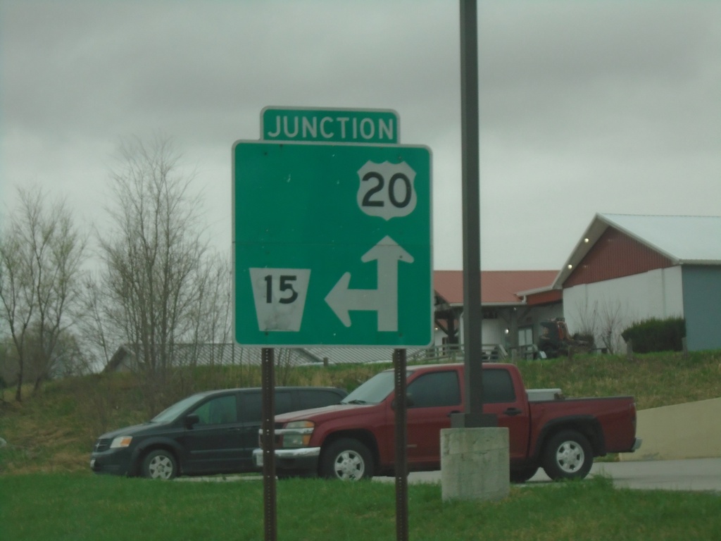
US-20 West/NE-15 South Approaching US-20/NE-15 Split
US-20 West/NE-15 South approaching US-20/NE-15 Split in Laurel.
Taken 05-02-2022
 Laurel
Cedar County
Nebraska
United States
Laurel
Cedar County
Nebraska
United States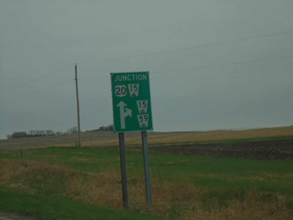
US-20 West Approaching NE-15 and NE-59
US-20 West approaching NE-15 and NE-59 in Cedar County. NE-15 South joins US-20 westbound.
Taken 05-02-2022
 Laurel
Cedar County
Nebraska
United States
Laurel
Cedar County
Nebraska
United States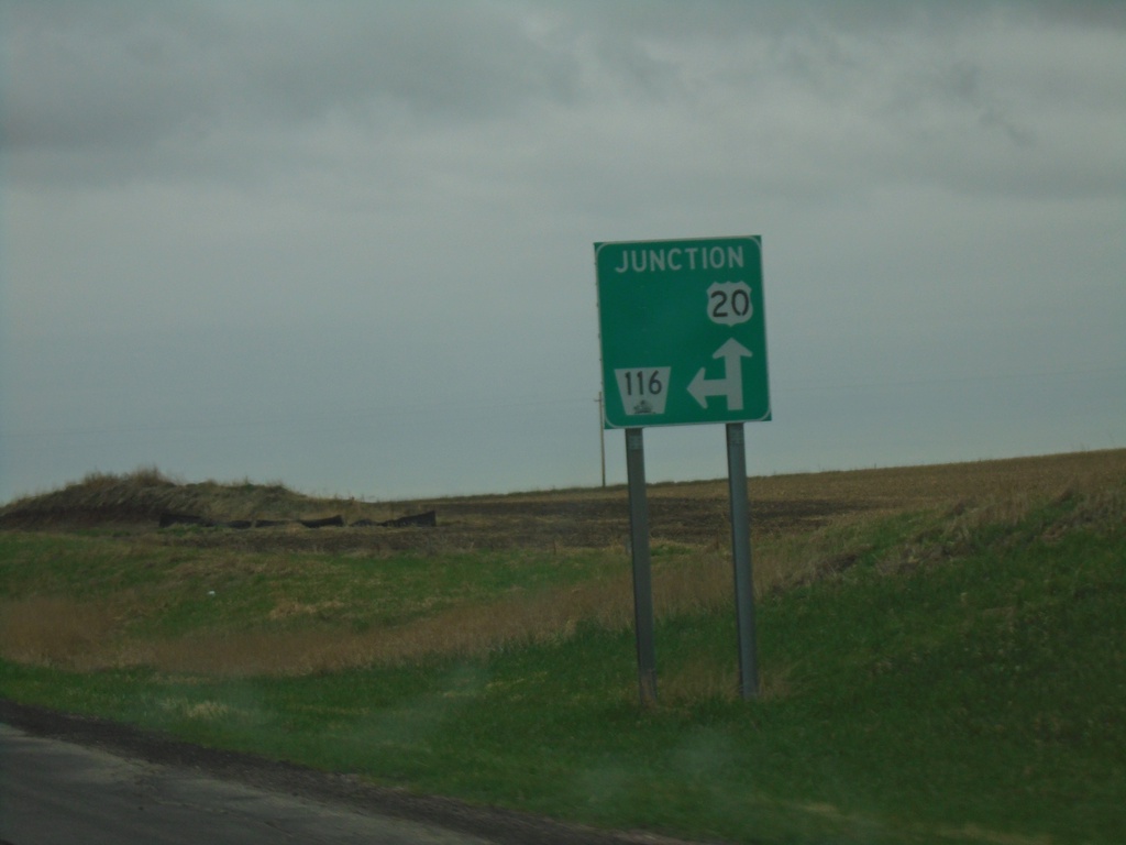
US-20 West Approaching NE-116
US-20 West approaching NE-116 in Dixon County.
Taken 05-02-2022
 Dixon
Dixon County
Nebraska
United States
Dixon
Dixon County
Nebraska
United States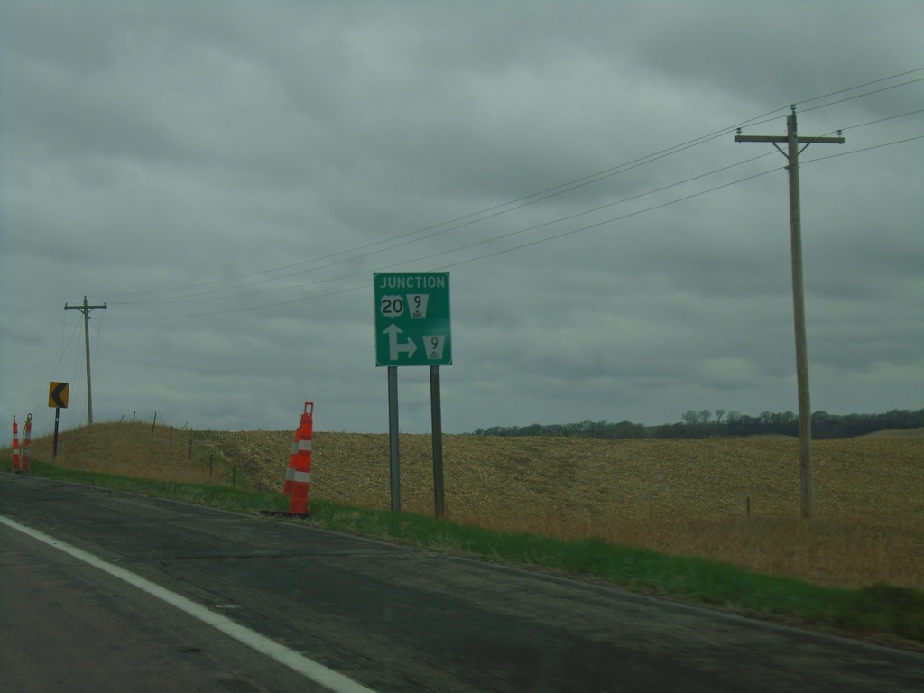
US-20 West Approaching NE-9
US-20 West approaching NE-9 in Dixon County. NE-9 south joins US-20 westbound.
Taken 05-02-2022
 Martinsburg
Dixon County
Nebraska
United States
Martinsburg
Dixon County
Nebraska
United States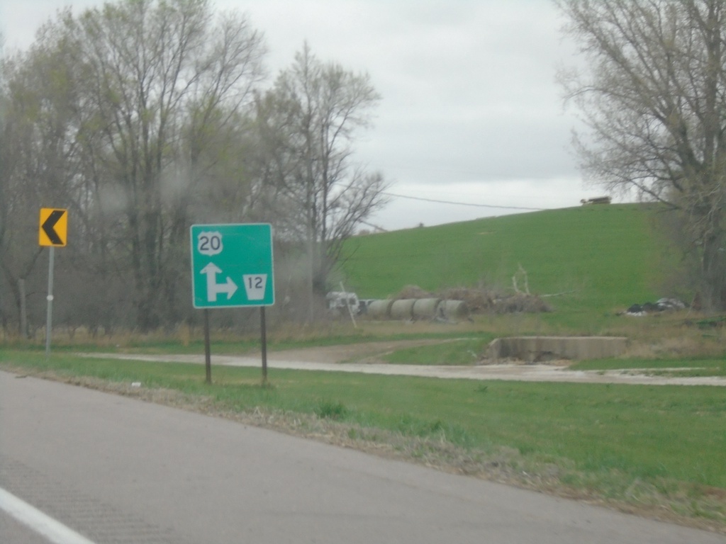
US-20 West Approaching NE-12
US-20 West approaching NE-12. The NE-12 shield is missing the covered wagon logo.
Taken 05-02-2022
 Jackson
Dakota County
Nebraska
United States
Jackson
Dakota County
Nebraska
United States