Signs Tagged With Shield Inside Sign
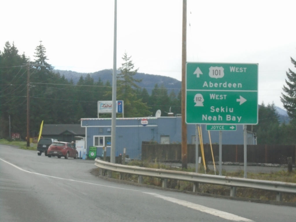
US-101 West at WA-112
US-101 West at WA-112 West to Sekiu and Neah Bay. Continue west on US-101 to Aberdeen.
Taken 12-23-2025

 Clallam County
Washington
United States
Clallam County
Washington
United States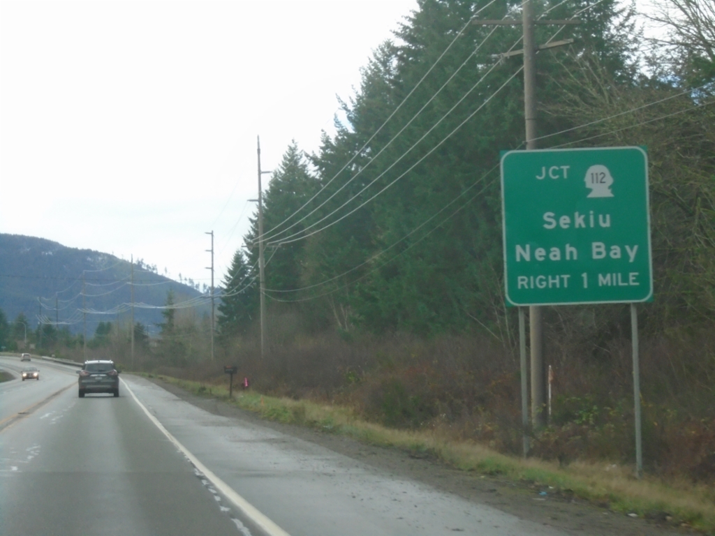
US-101 North Approaching WA-112
US-101 North approaching WA-112 to Sekiu and Neah Bay.
Taken 12-23-2025
Port Angeles
Clallam County
Washington
United States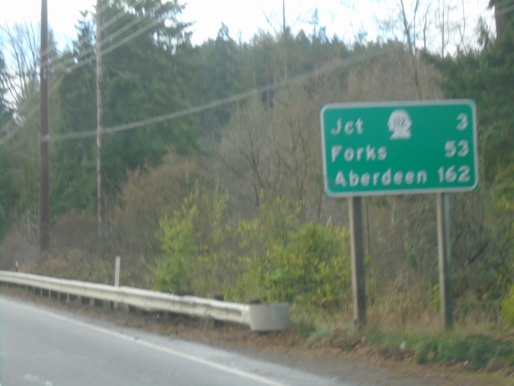
US-101 West - Distance Marker
Distance marker on US-101 west. Distance to WA-112 Junction, Forks, and Aberdeen.
Taken 12-23-2025
Port Angeles
Clallam County
Washington
United States
Marine Drive East at WA-117 South
Marine Drive East at WA-117 South (Tumwater Truck Route) to US-101 and WA-112.
Taken 12-22-2025
 Port Angeles
Clallam County
Washington
United States
Port Angeles
Clallam County
Washington
United States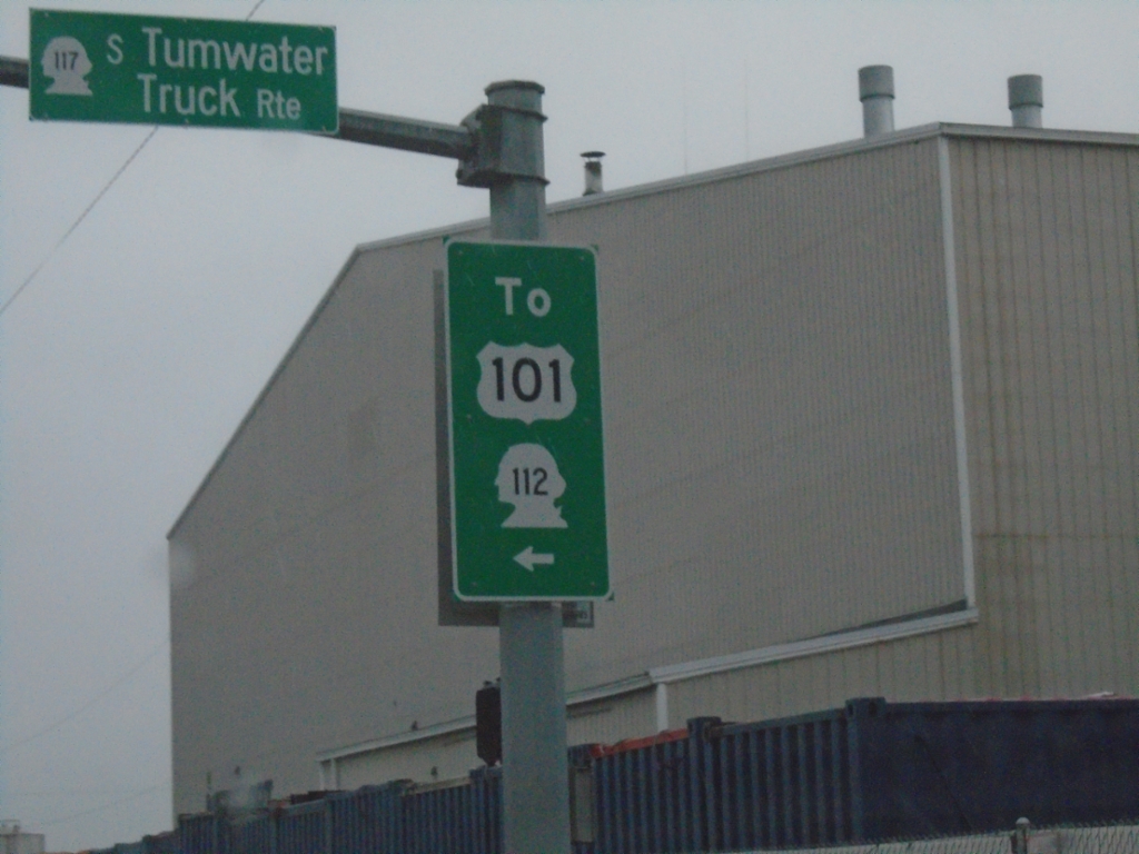
Marine Drive West at WA-117
Marine Drive West at WA-117 South (S Tumwater Truck Route). Use WA-117 South for US-101 and WA-112.
Taken 12-22-2025
Port Angeles
Clallam County
Washington
United States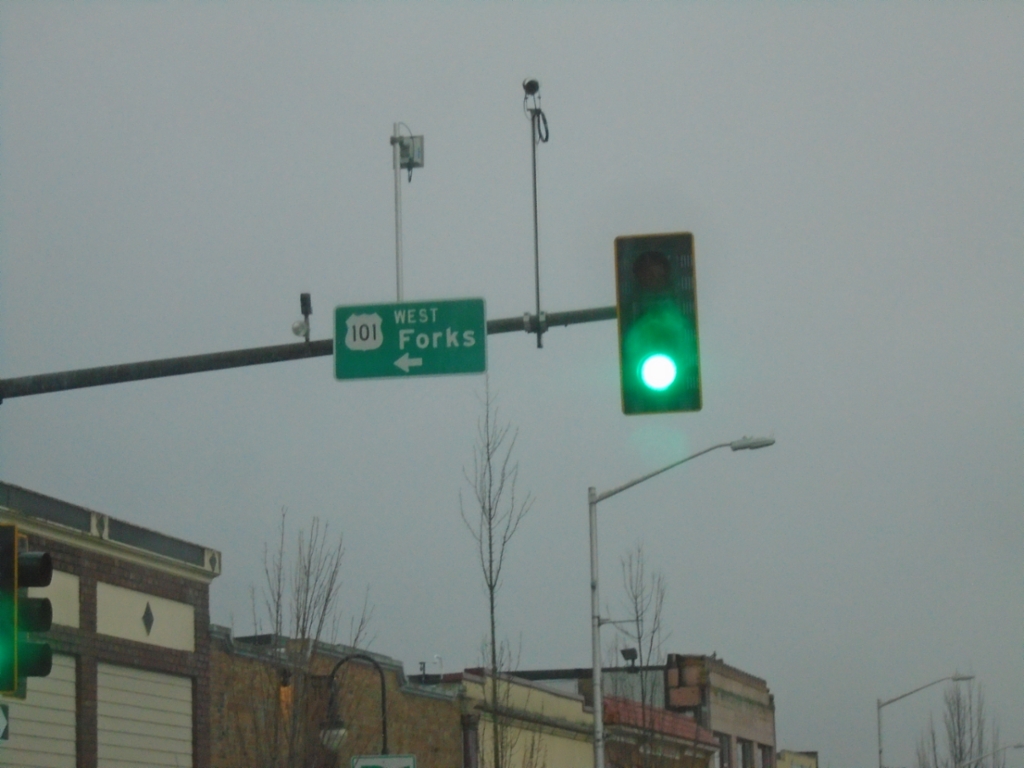
US-101 West at Lincoln St. - Port Angeles
US-101 West (Front St.) at Lincoln St. in Port Angeles. Turn left on Lincoln St. to continue west towards Forks.
Taken 12-22-2025
Port Angeles
Clallam County
Washington
United States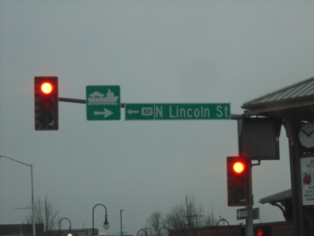
US-101 West - Port Angeles
US-101 west (Front St.) in Port Angeles. Turn left on Lincoln St. to continue west on US-101. Turn right for access to Victoria, BC Ferry
Taken 12-22-2025
Port Angeles
Clallam County
Washington
United States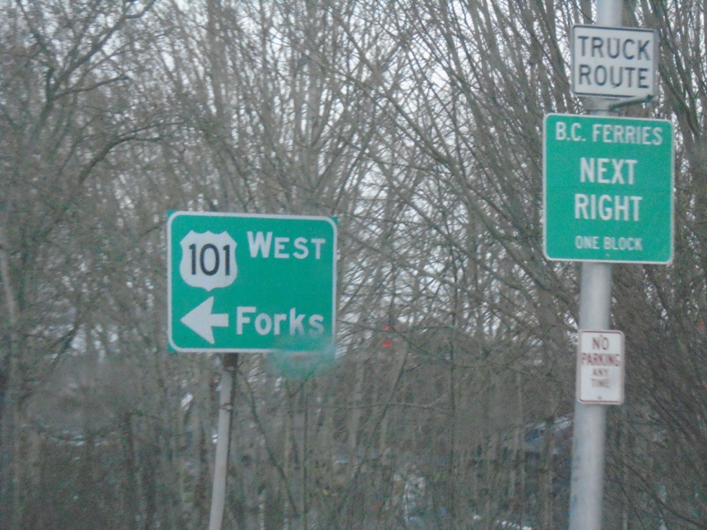
US-101 West Approaching Lincoln St.
US-101 West Approaching Lincoln St. in Port Angeles. Turn left to continue west on US-101 to Forks. Turn right on Lincoln St. for Ferry to BC (Canada).
Taken 12-22-2025
Port Angeles
Clallam County
Washington
United States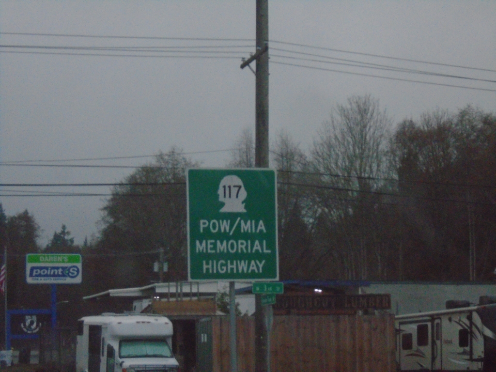
WA-117 South - POW/MIA Memorial Highway
WA-117 South (Tumwater Truck Route) - POW/MIA Memorial Highway
Taken 12-22-2025
Port Angeles
Clallam County
Washington
United States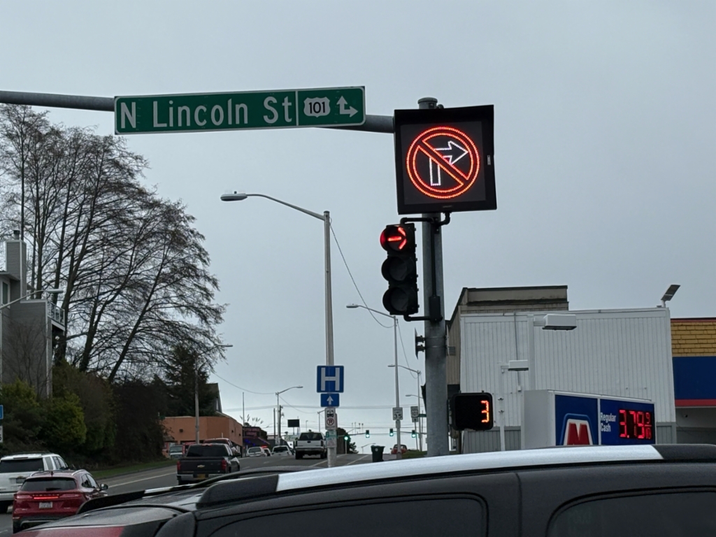
E 1st St. East at Lincoln St.
E 1st St. East at Lincoln St. Turn right for US-101 West; continue straight for US-101 East.
Taken 12-22-2025
Port Angeles
Clallam County
Washington
United States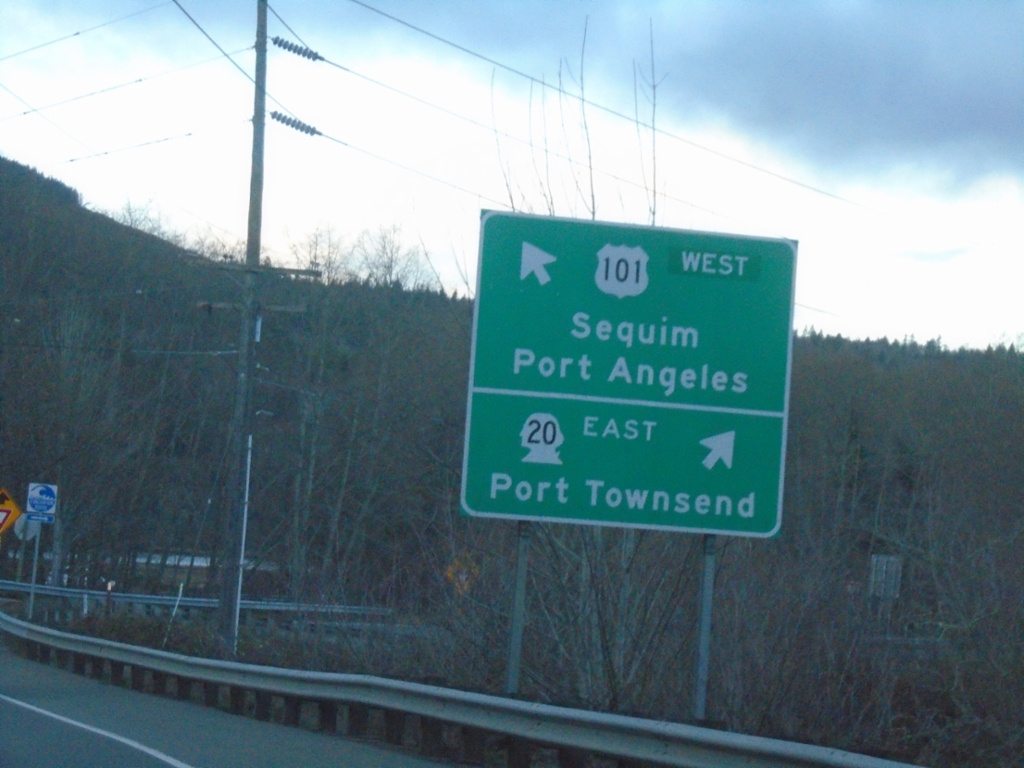
US-101 North at WA-20 East
US-101 north at WA-20 east to Port Townsend. Continue on US-101 west for Sequim and Port Angeles. US-101 is signed as an East-West highway between WA-20 and WA-113.
Taken 12-21-2025
 Port Townsend
Jefferson County
Washington
United States
Port Townsend
Jefferson County
Washington
United States
US-101 North Approaching WA-20
US-101 north approaching WA-20 to Port Townsend.
Taken 12-21-2025
Port Townsend
Jefferson County
Washington
United States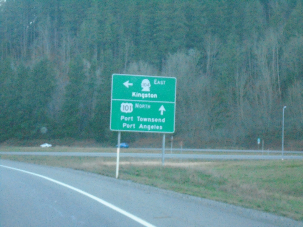
US-101 North at WA-104
US-101 North at WA-104 East to Kingston. Continue north on US-101 for Port Townsend and Port Angeles.
Taken 12-21-2025
 Quilcene
Jefferson County
Washington
United States
Quilcene
Jefferson County
Washington
United States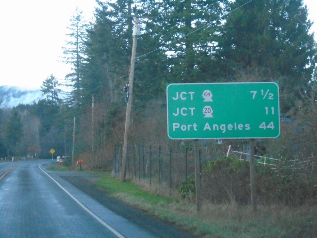
US-101 North - Distance Marker
Distance marker on US-101 north. Distance to WA-104, WA-20, and Port Angeles.
Taken 12-21-2025
Quilcene
Jefferson County
Washington
United States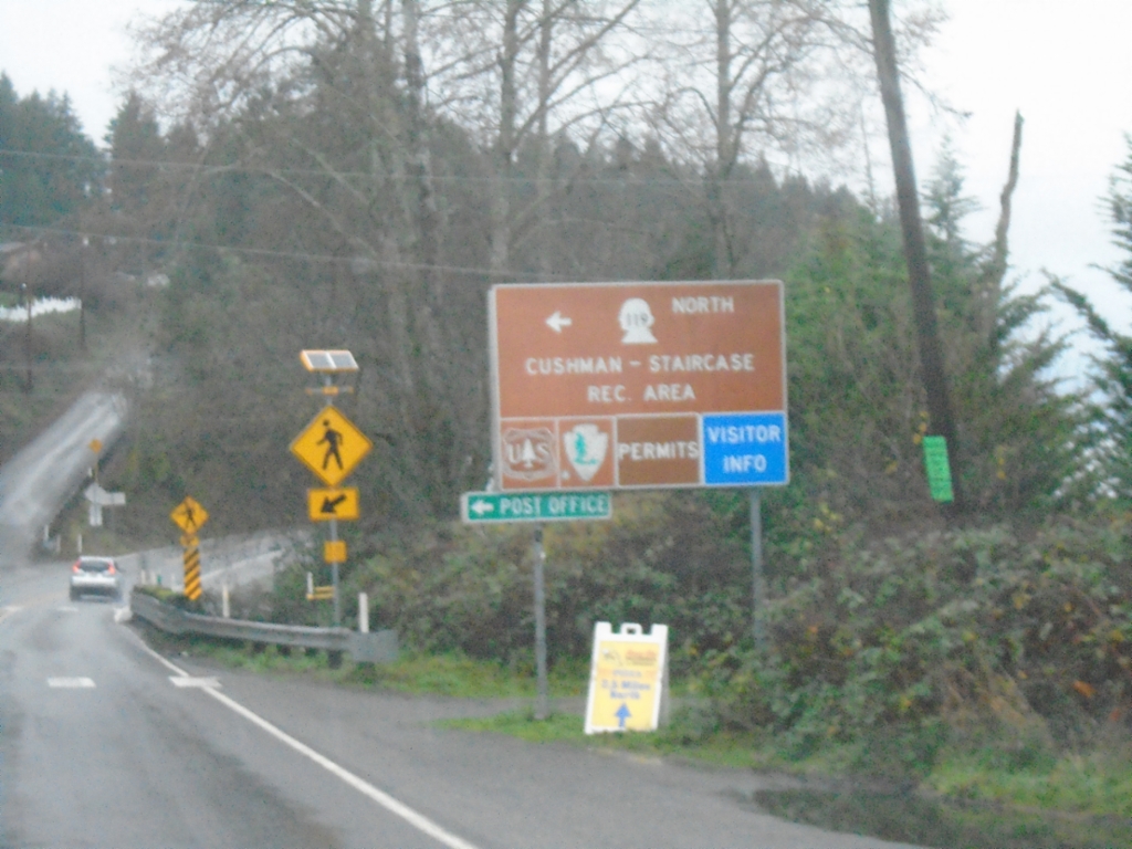
US-101 North at WA-119
US-101 North at WA-119 in Hoodsport. Use WA-119 North to Cushman-Staircase Recreation Area.
Taken 12-21-2025
 Hoodsport
Mason County
Washington
United States
Hoodsport
Mason County
Washington
United States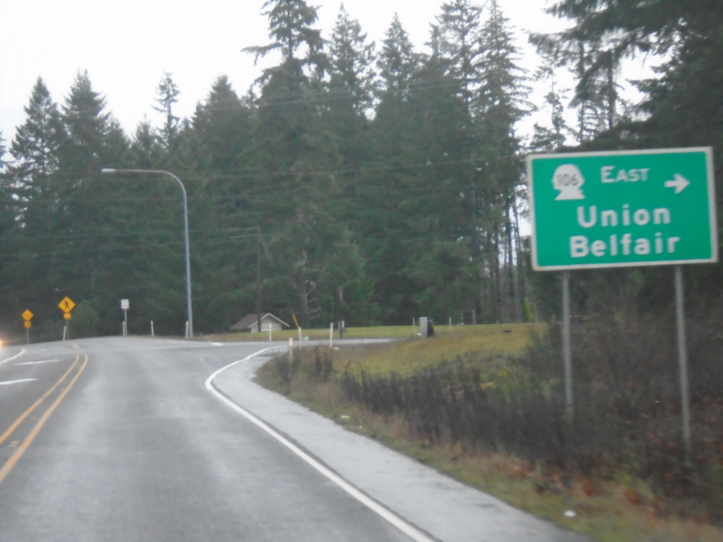
US-101 North at WA-106
US-101 North at WA-106 East to Union and Belfair.
Taken 12-21-2025
 Skokomish
Mason County
Washington
United States
Skokomish
Mason County
Washington
United States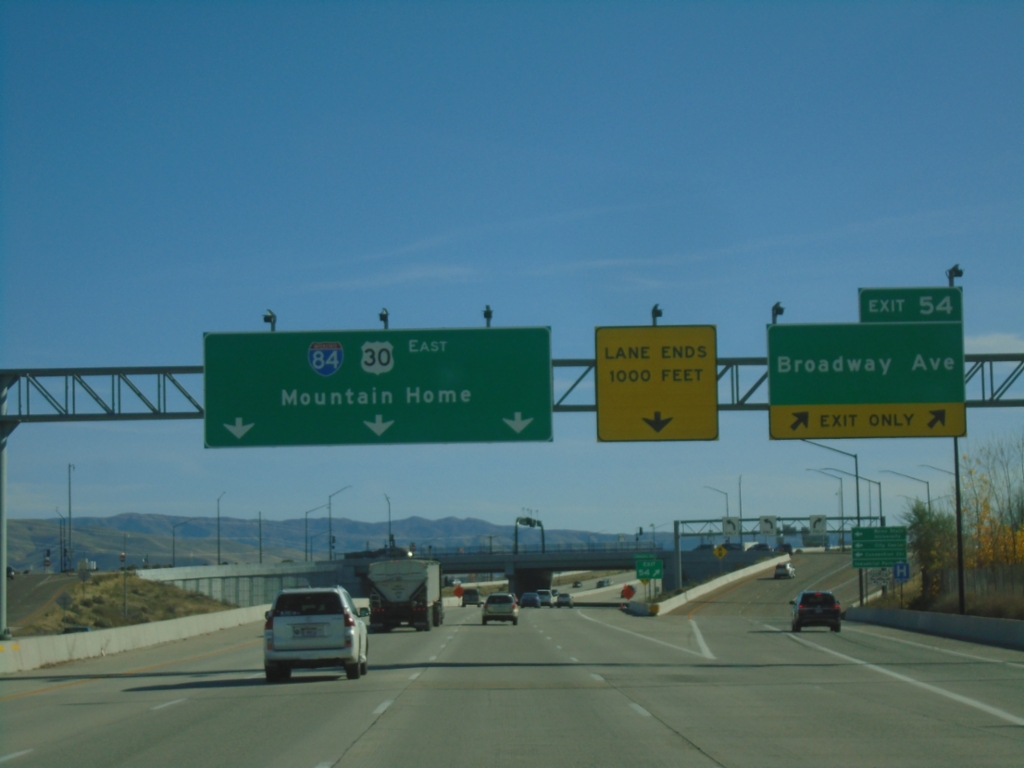
I-84 East - Exit 54
I-84 east at Exit 54 - Broadway Ave. I-84/US-30 continues east to Mountain Home. US-20 and US-26 join I-84 eastbound here.
Taken 11-09-2025


 Boise
Ada County
Idaho
United States
Boise
Ada County
Idaho
United States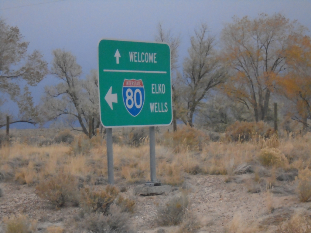
Frontage Road at I-80 Access Road
Frontage Road at I-80 Access Road. Turn left for I-80 to Elko and Wells. Continue straight on Frontage Road for Welcome.
Taken 10-26-2025
 Elko County
Nevada
United States
Elko County
Nevada
United States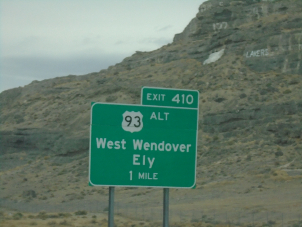
I-80 West Exit 410 (Nevada Exit)
I-80 before the Utah-Nevada stateline at Exit 410 - US-93 Alt/West Wendover/Ely. Exit 410 is a Nevada Interchange
Taken 10-25-2025
 Wendover
Tooele County
Utah
United States
Wendover
Tooele County
Utah
United States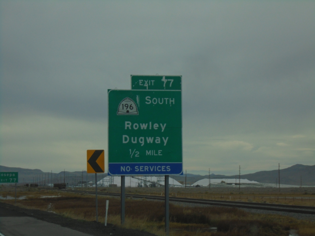
I-80 West - Exit 77
I-80 west approaching Exit 77 - UT-196 South/Rowley/Dugway.
Taken 10-25-2025
 Dugway
Tooele County
Utah
United States
Dugway
Tooele County
Utah
United States
End UT-179 North - Exit 3A-B
End UT-179 North (Midvalley Highway) at I-80. Exit 3B - I-80 East/Salt Lake City; Exit 3A - I-80 West/Reno (Nevada).
Taken 10-25-2025
 Tooele County
Utah
United States
Tooele County
Utah
United States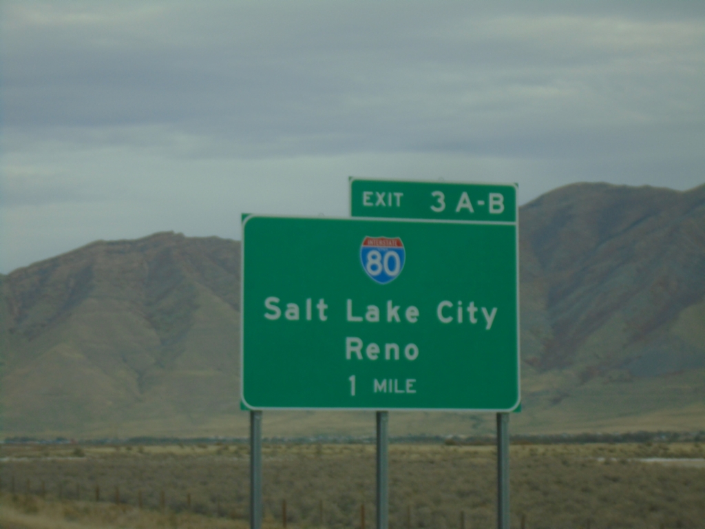
UT-179 North - Exit 3
UT-179 North (Midvalley Highway) approaching Exit 3A-B - I-80/Salt Lake City/Reno (Nevada).
Taken 10-25-2025
Tooele County
Utah
United States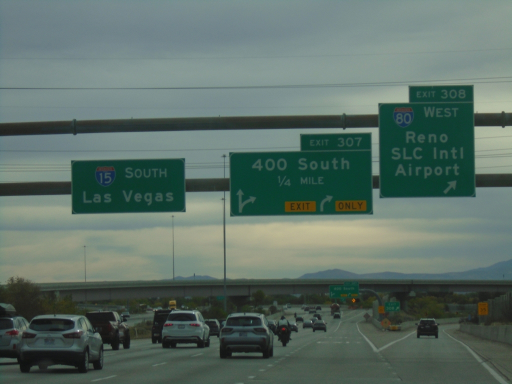
I-15 South - Exits 308 and 307
I-15 south at Exit 308 - I-80 West/Reno (Nevada)/Salt Lake City International Airport. I-15 south approaching Exit 307 - 400 South. I-15 South/Las Vegas (Nevada) overhead.
Taken 10-25-2025
 Salt Lake City
Salt Lake County
Utah
United States
Salt Lake City
Salt Lake County
Utah
United States
I-15 South - Exits 308 and 307
I-15 south approaching Exit 308 - I-80 West/Reno and Exit 307 - 400 South.
Taken 10-25-2025
Salt Lake City
Salt Lake County
Utah
United States
I-15 South - Exit 308
I-15 south approaching Exit 308 - I-80 West/Reno (Nevada)/Salt Lake City International Airport.
Taken 10-25-2025
Salt Lake City
Salt Lake County
Utah
United States