Signs Tagged With Shield Inside Sign
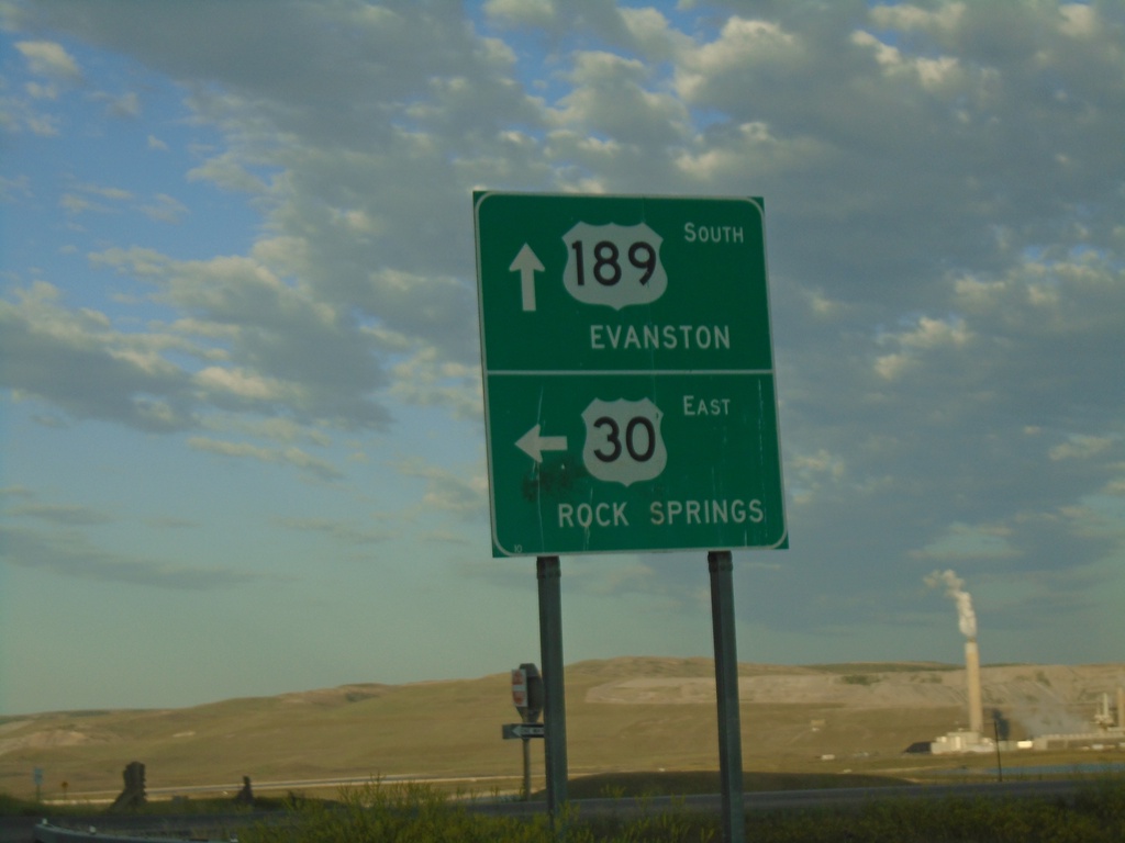
US-189 South/US-30 East at US-189/US-30 Split
US-189 South/US-30 East at US-189/US-30 Split. Turn left for US-30 East onramp to Rock Springs. Continue south on US-189 for Evanston. This is the east end of the Kemmerer US-30 Bypass.
Taken 07-18-2020


 Kemmerer
Lincoln County
Wyoming
United States
Kemmerer
Lincoln County
Wyoming
United States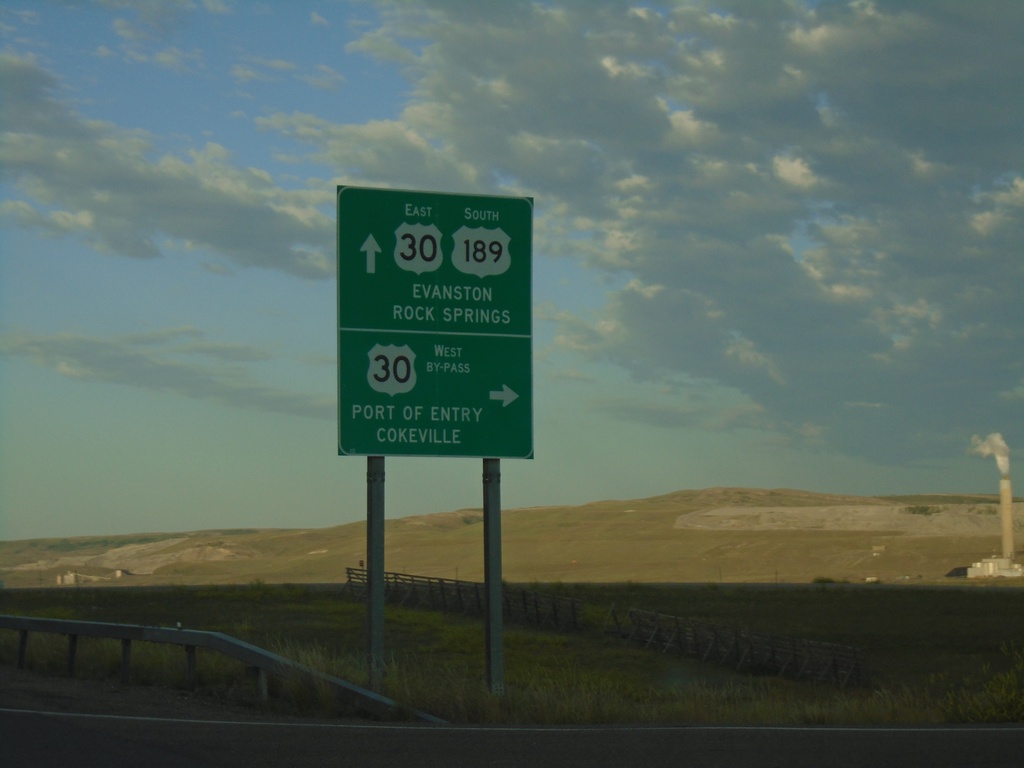
US-30 East/US-189 South at Split
US-30 East/US-189 South at US-30 By-Pass and US-30 ramps. Use US-189 South/US-30 East for Evanston. Turn right for the US-30 By-Pass West onramp for Port of Entry and Cokeville.
Taken 07-18-2020
Kemmerer
Lincoln County
Wyoming
United States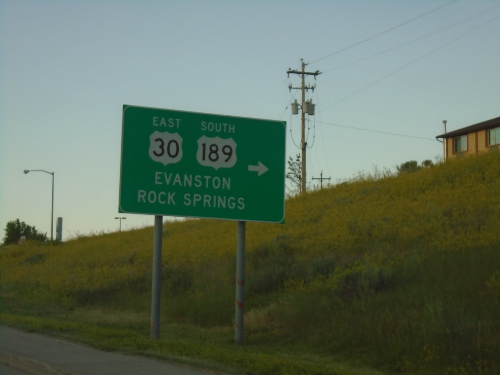
US-30 East/US-189 South - Diamondville
US-30 East/US-189 south in Diamondville. Turn right to continue on US-30 East/US-189 South. Use US-30 East/US-189 south for Evanston and Rock Springs.
Taken 07-18-2020
Kemmerer
Lincoln County
Wyoming
United States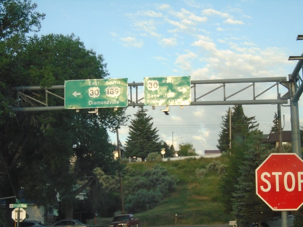
US-189 South at US-30
US-189 South at US-30 in Kemmerer. Turn right for US-30 west to Sage Junction and Port of Entry. Turn left for US-30 East/US-189 south to Diamondville. US-30 east joins US-189 south through Kemmerer and Diamondville.
Taken 07-18-2020
Kemmerer
Lincoln County
Wyoming
United States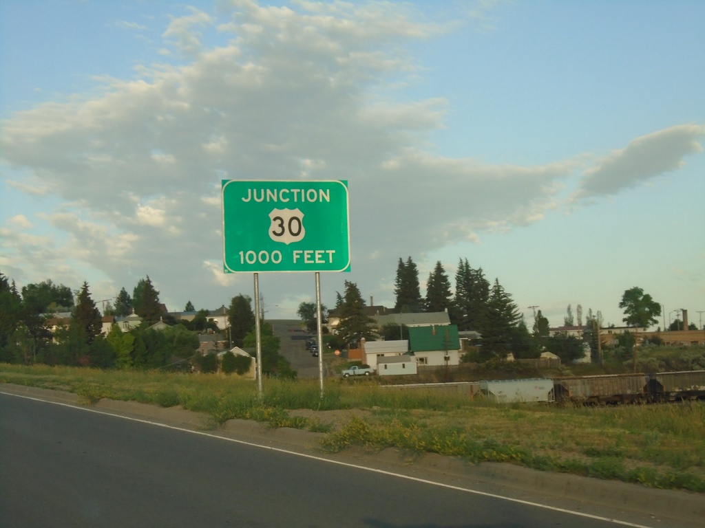
US-189 South approaching US-30
US-189 south approaching US-30 in Kemmerer.
Taken 07-18-2020
Kemmerer
Lincoln County
Wyoming
United States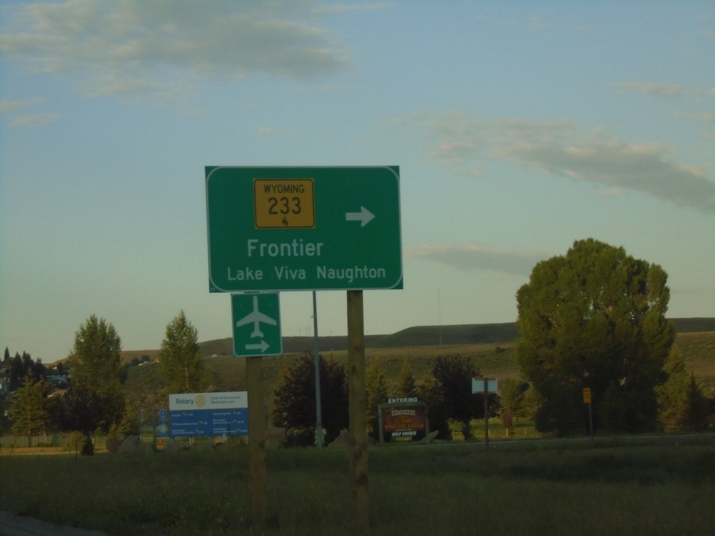
US-189 South at WY-233
US-189 south at WY-233 to Frontier and Lake Viva Naughton.
Taken 07-18-2020
 Kemmerer
Lincoln County
Wyoming
United States
Kemmerer
Lincoln County
Wyoming
United States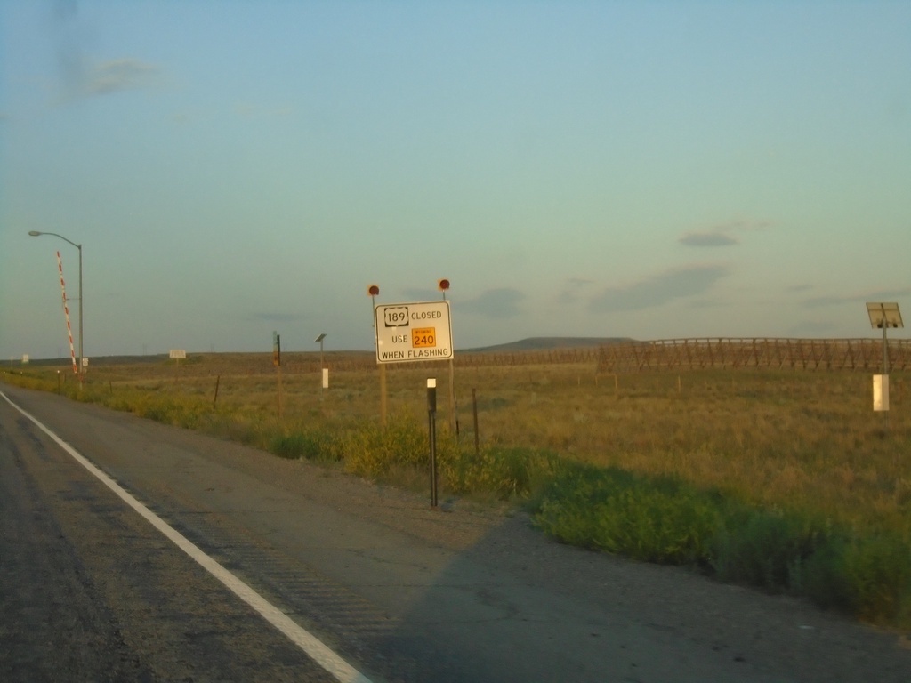
US-189 South - Road Closure Information
US-189 south approaching WY-240. When lights are flashing US-189 is closed - use WY-240.
Taken 07-18-2020
 Kemmerer
Lincoln County
Wyoming
United States
Kemmerer
Lincoln County
Wyoming
United States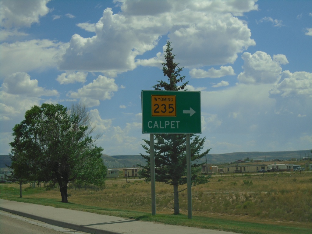
US-189 South at WY-235
US-189 south at WY-235 to Calpet.
Taken 07-17-2020
 La Barge
Lincoln County
Wyoming
United States
La Barge
Lincoln County
Wyoming
United States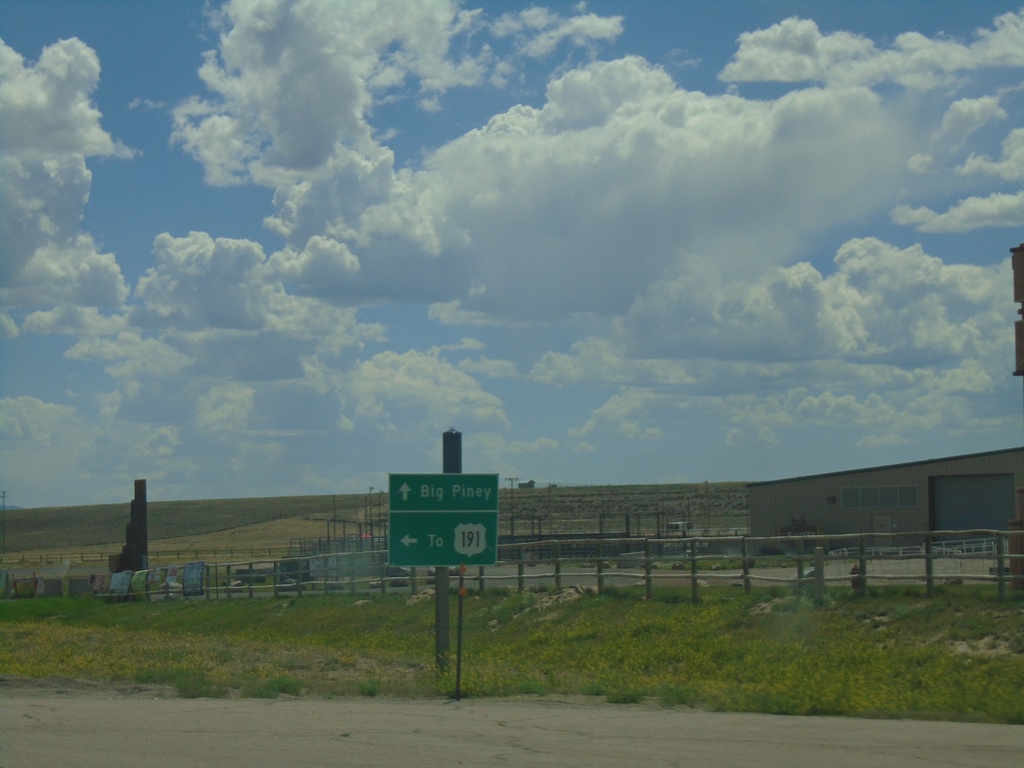
US-189 South at WY-351
US-189 South at WY-351 East to US-191. Continue south on US-189 to Big Piney.
Taken 07-17-2020

 Big Piney
Sublette County
Wyoming
United States
Big Piney
Sublette County
Wyoming
United States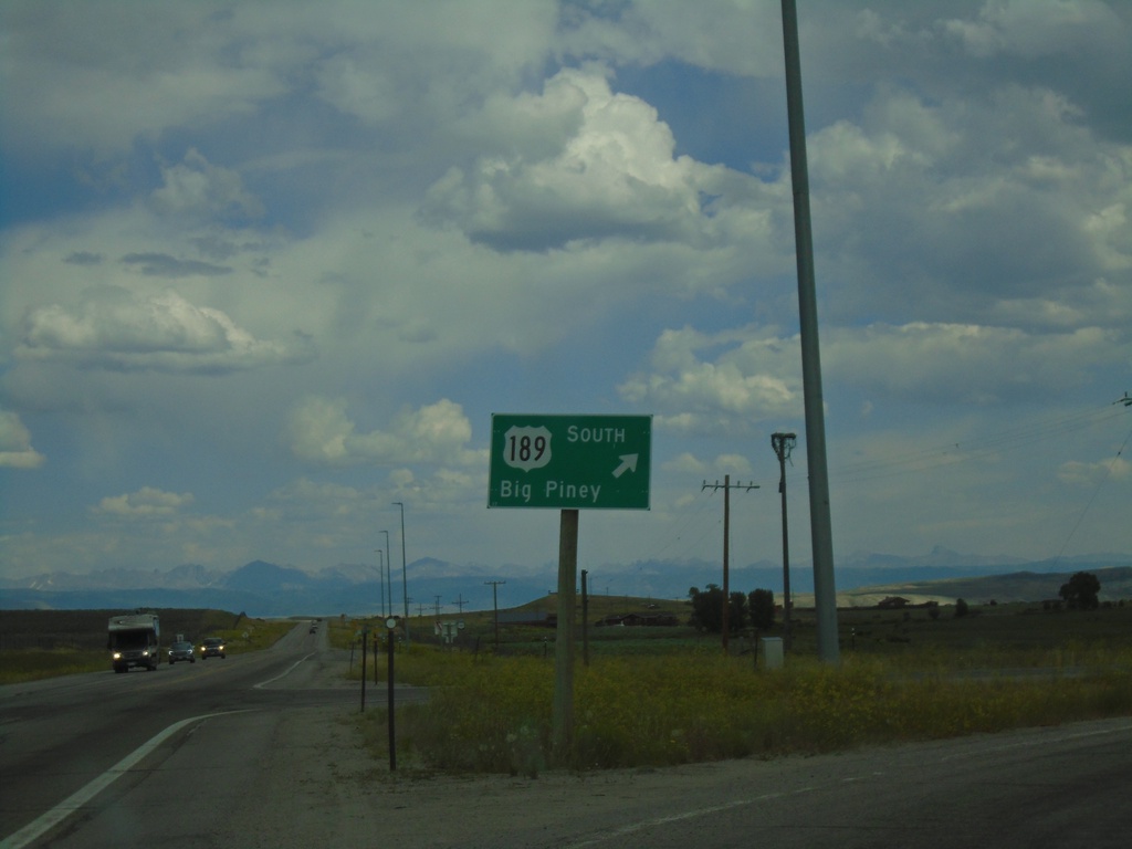
US-189/US-191 South - Daniel Junction
US-189/US-191 South at Daniel Junction. Turn right to continue south on US-189 to Big Piney.
Taken 07-17-2020
Daniel
Sublette County
Wyoming
United States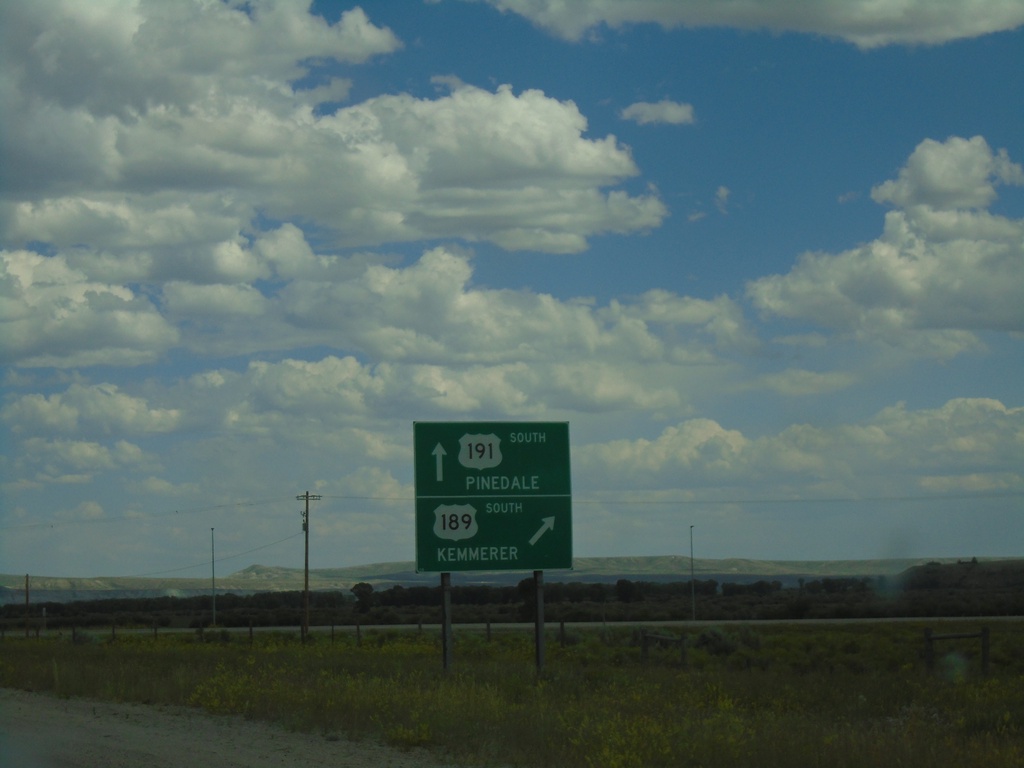
US-189/US-191 South - Daniel Junction
US-189/US-191 South at US-189/US-191 Split. Turn right for US-189 south to Kemmerer. Continue straight for US-191 south to Pinedale.
Taken 07-17-2020
Pinedale
Sublette County
Wyoming
United States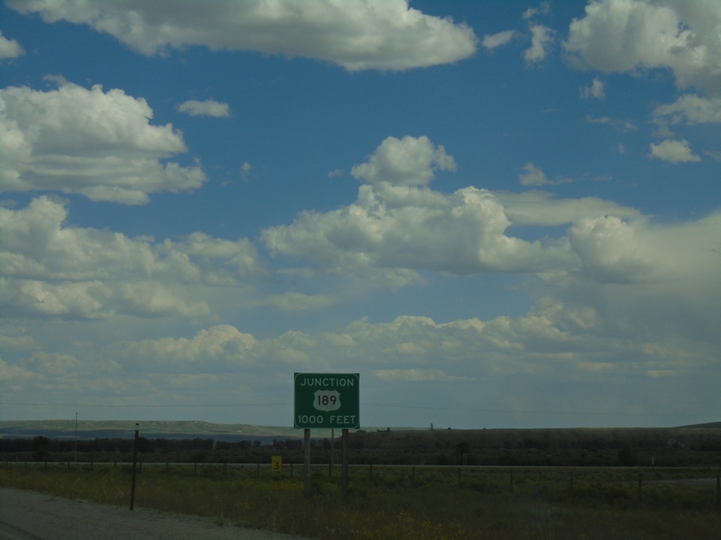
US-189/US-191 South - Daniel Junction
US-189/US-191 South approaching US-189/US-191 split.
Taken 07-17-2020
Pinedale
Sublette County
Wyoming
United States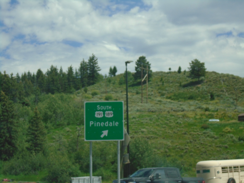
US-26 East - US-89/US-189/US-191 North in Hoback Jct. Roundabout
US-26 East - US-89/US-189/US-191 North in Hoback Jct. Roundabout. Merge right for (US-189 South/US-191 South) Pinedale.
Taken 07-17-2020

 Jackson
Teton County
Wyoming
United States
Jackson
Teton County
Wyoming
United States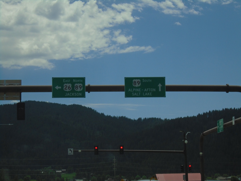
US-26 East at US-89 - Alpine Junction
US-26 East at US-89 at Alpine Junction. Turn right for US-89 South to Alpine, Afton and Salt Lake (Utah). Turn left for US-89 North/US-26 East to Jackson. US-26 joins US-89 east to Moran Jct.
Taken 07-17-2020
Alpine
Lincoln County
Wyoming
United States
US-26 East approaching US-89
US-26 East approaching US-89 in Alpine.
Taken 07-17-2020
Alpine
Lincoln County
Wyoming
United States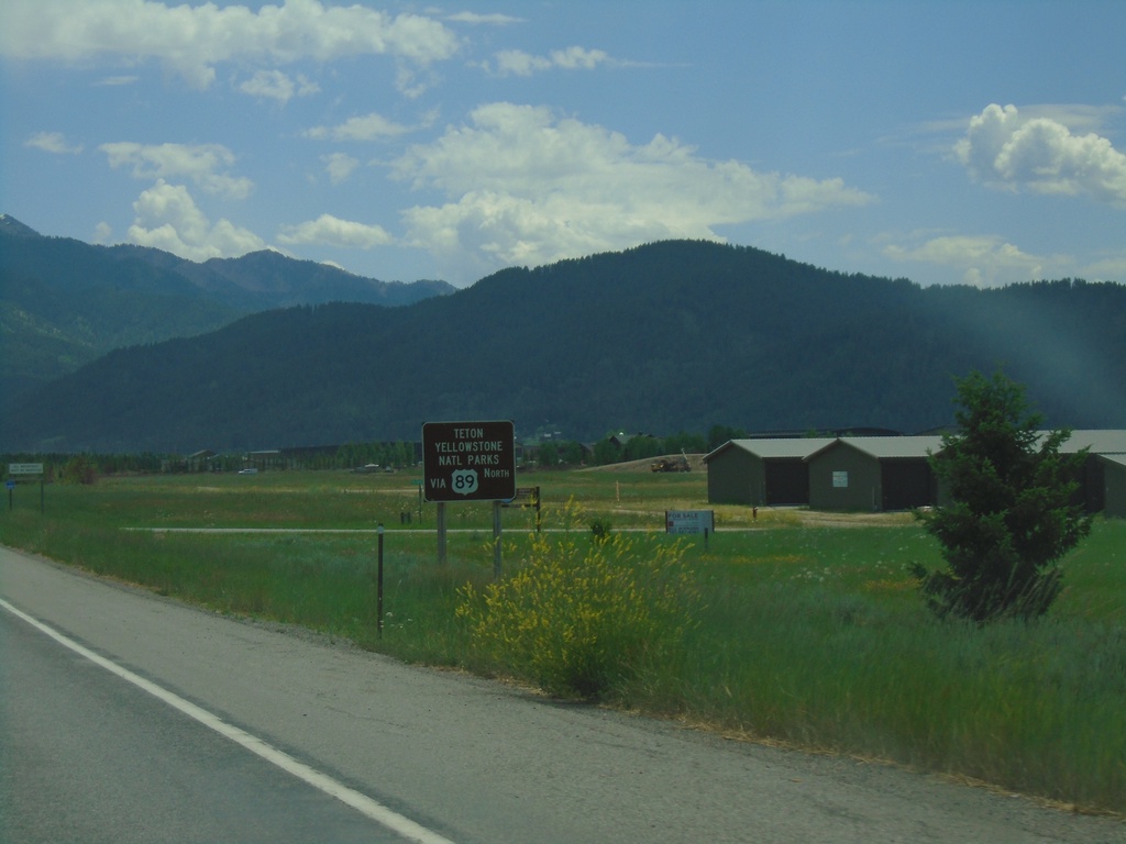
US-26 East - Use US-89 For Teton/Yellowstone Parks
US-26 East approaching US-89 in Alpine. Use US-89 North for Teton/Yellowstone Parks.
Taken 07-17-2020
Alpine
Lincoln County
Wyoming
United States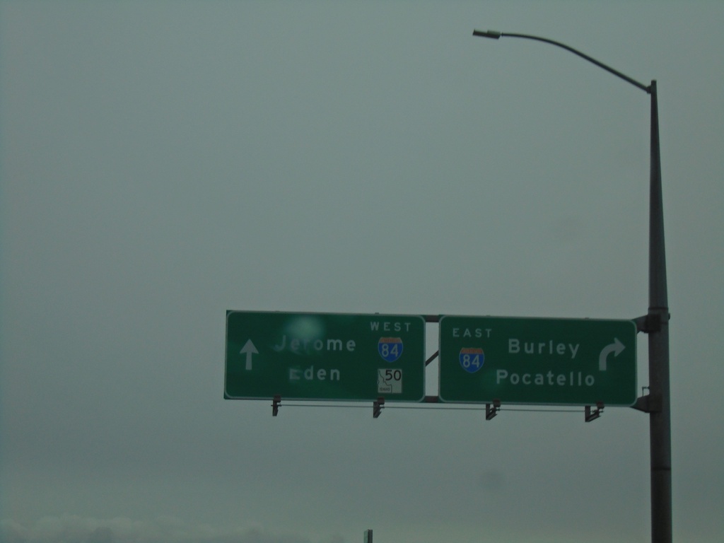
ID-50 East at I-84 (Exit 182)
ID-50 East at I-84 (Exit 182). Turn right for I-84 East to Burley and Pocatello; continue over freeway for I-84 West to Jerome. Continue on ID-50 east for Eden.
Taken 05-22-2020

 Eden
Jerome County
Idaho
United States
Eden
Jerome County
Idaho
United States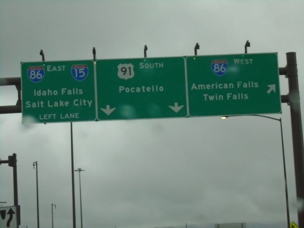
US-91 South at I-86
US-91 south at I-86 (Exit 61). Merge right for I-86 West to American Falls and Twin Falls. Use I-86 East/To I-15 for Idaho Falls and Salt Lake City (Utah). Continue south on US-91 for Pocatello.
Taken 05-22-2020


 Chubbuck
Bannock County
Idaho
United States
Chubbuck
Bannock County
Idaho
United States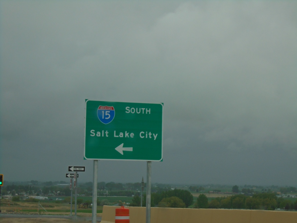
Northgate Parkway West at I-15 South
Northgate Parkway West at I-15 South to Salt Lake City (Utah).
Taken 05-22-2020
Chubbuck
Bannock County
Idaho
United States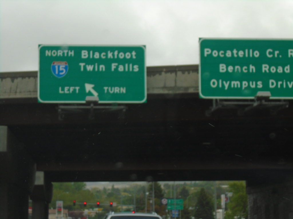
End BL-15 North at I-15 (Exit 71)
End BL-15 North at I-15 (Exit 71) in Pocatello. Use I-15 north for Blackfoot and Twin Falls. Continue straight for Pocatello Creek Road, Bench Road, and Olympus Drive.
Taken 05-22-2020
 Pocatello
Bannock County
Idaho
United States
Pocatello
Bannock County
Idaho
United States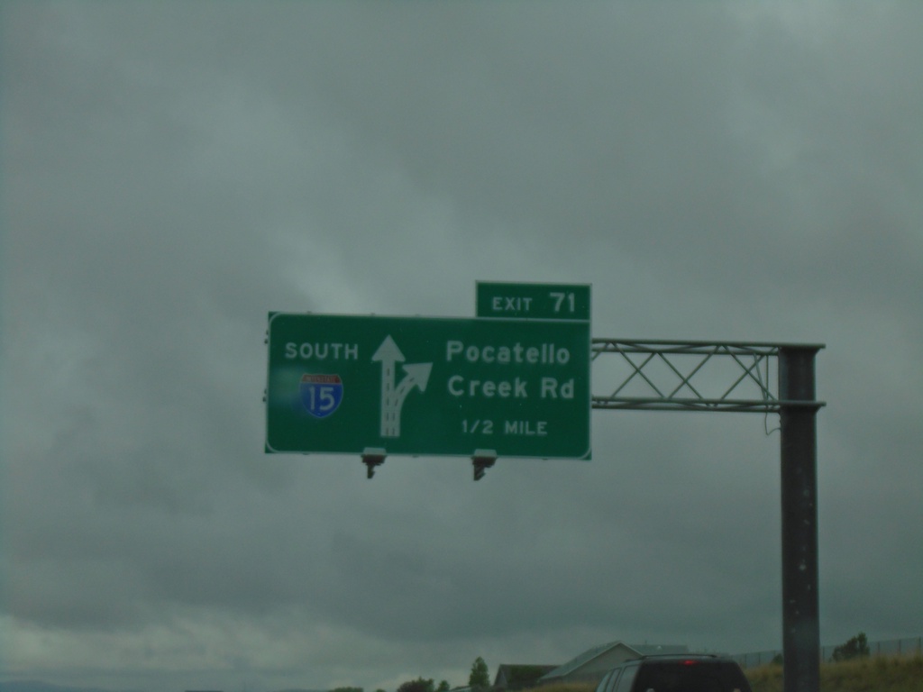
I-15 South - Exit 71
I-15 south approaching Exit 71 - Pocatello Creek Road.
Taken 05-22-2020
Pocatello
Bannock County
Idaho
United States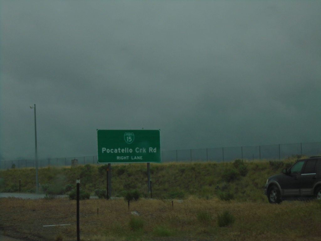
I-15 South Approaching Exit 71
I-15 south approaching Exit 71 - BL-15/Pocatello Creek Road.
Taken 05-22-2020
Pocatello
Bannock County
Idaho
United States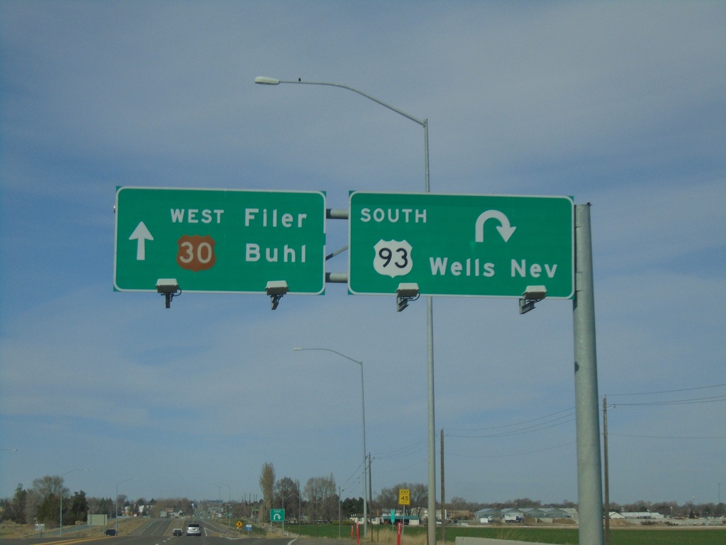
Bus. US-93 South/US-30 West at US-93 South
Bus. US-93 South/US-30 West at US-93. Exit for US-93 South to Wells, NV. Continue straight for US-30 west to Filer and Buhl.
Taken 04-04-2020

 Filer
Twin Falls County
Idaho
United States
Filer
Twin Falls County
Idaho
United States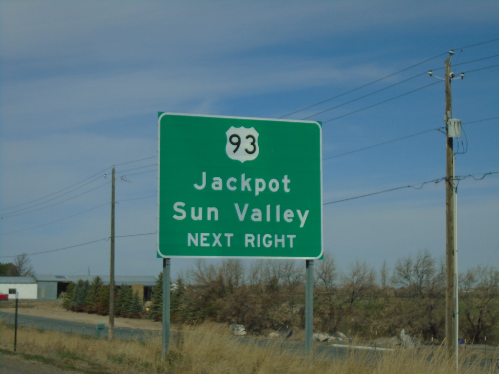
US-30 West/Bus. US-93 South at US-93 South
US-30 West/Bus. US-93 South at US-93. Use US-93 for Jackpot (NV) and Sun Valley.
Taken 04-04-2020
Curry
Twin Falls County
Idaho
United States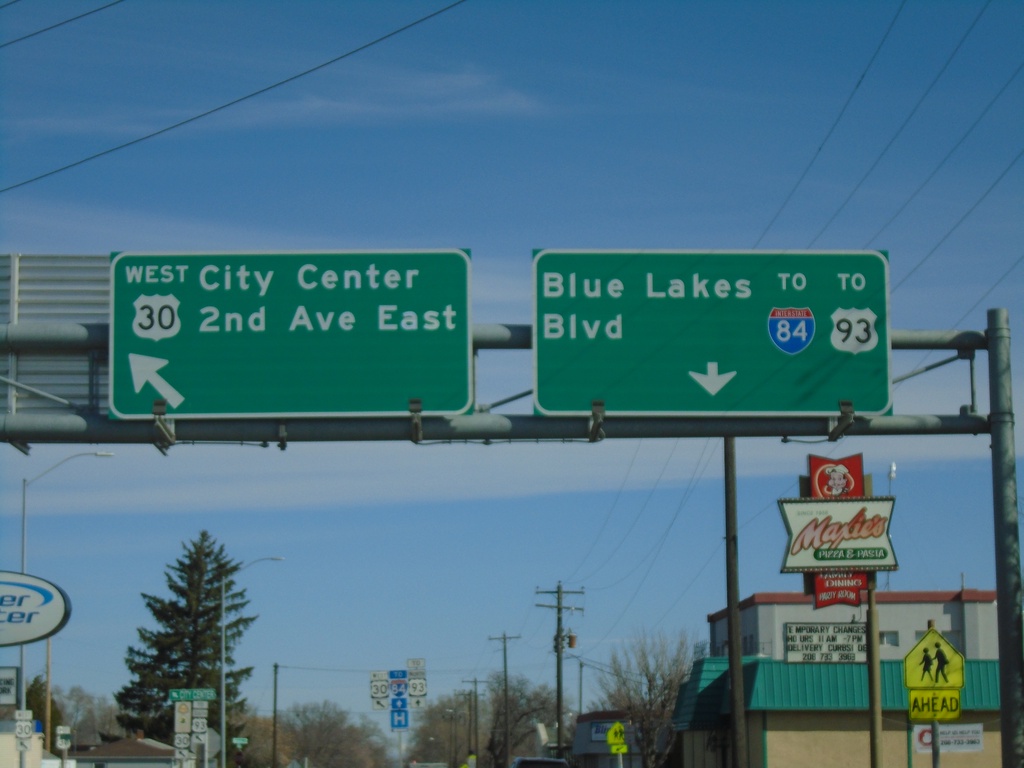
US-30 West - Blue Lakes Blvd. at 2nd Ave. E
US-30 West - Blue Lakes Blvd. at 2nd Ave. E in Twin Falls. Turn left to continue on US-30 West for City Center and 2nd Ave E. Continue north on Blue Lakes Blvd. for US-93 North at I-84.
Taken 04-04-2020
Twin Falls
Twin Falls County
Idaho
United States