Signs Tagged With Shield Inside Sign
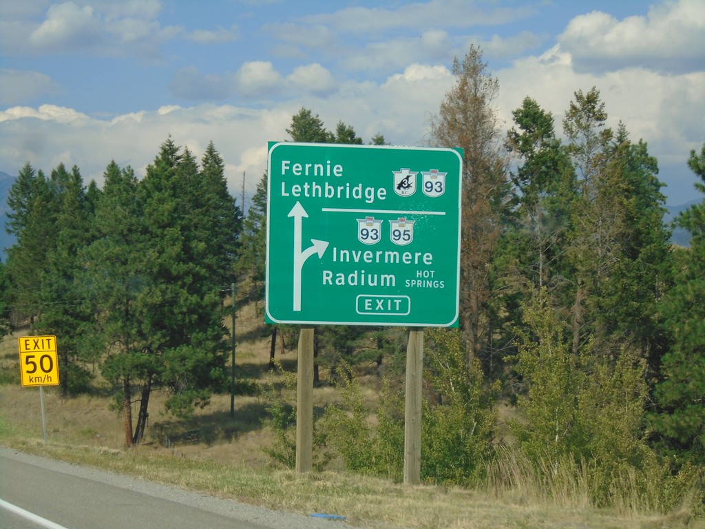
BC-3 East/BC-95 North at BC-93/BC-95 Junction
BC-3 East/BC-95 North at BC-93/BC-95 Junction. Exit for BC-93/BC-95 north to Invermere and Radium Hot Springs. Continue straight for BC-3 East/BC-93 South to Fernie and Lethbridge (Alberta). BC-93 south joins BC-3 east to Elko.
Taken 08-05-2018


 Cranbrook
East Kootenay
British Columbia
Canada
Cranbrook
East Kootenay
British Columbia
Canada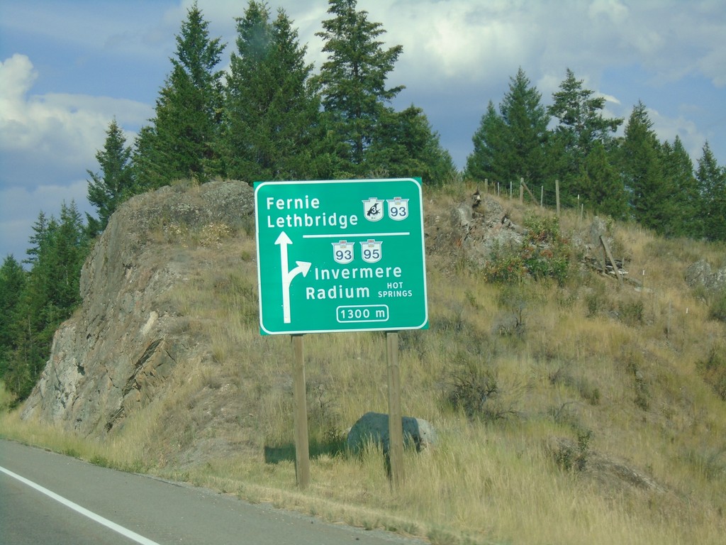
BC-3 East/BC-95 North at BC-93/BC-95
Approaching BC-3 East/BC-95 North split in 1300 metres. BC-3 East joins BC-93 South to Fernie and Lethbridge (AB). BC-95/BC-93 north to Invermere and Radium Hot Springs.
Taken 08-05-2018
Cranbrook
East Kootenay
British Columbia
Canada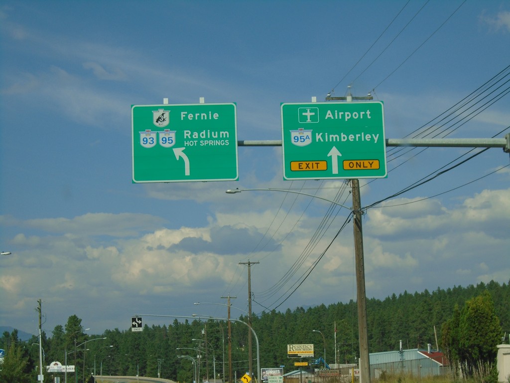
BC-3 East/BC-95 North at BC-95A
BC-3/BC-95 west to Fernie and Radium Hot Springs at BC-95A to Kimberley and Airport.
Taken 08-05-2018
 Cranbrook
East Kootenay
British Columbia
Canada
Cranbrook
East Kootenay
British Columbia
Canada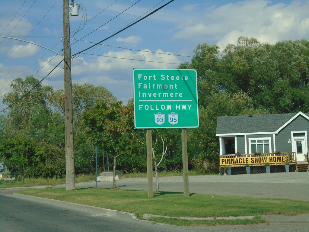
BC-3 East Approaching BC-95A
Use BC-93/BC-95 north for Fort Steele, Fairmont, and Invermere, approaching BC-95A on BC-3 east.
Taken 08-05-2018
Cranbrook
East Kootenay
British Columbia
Canada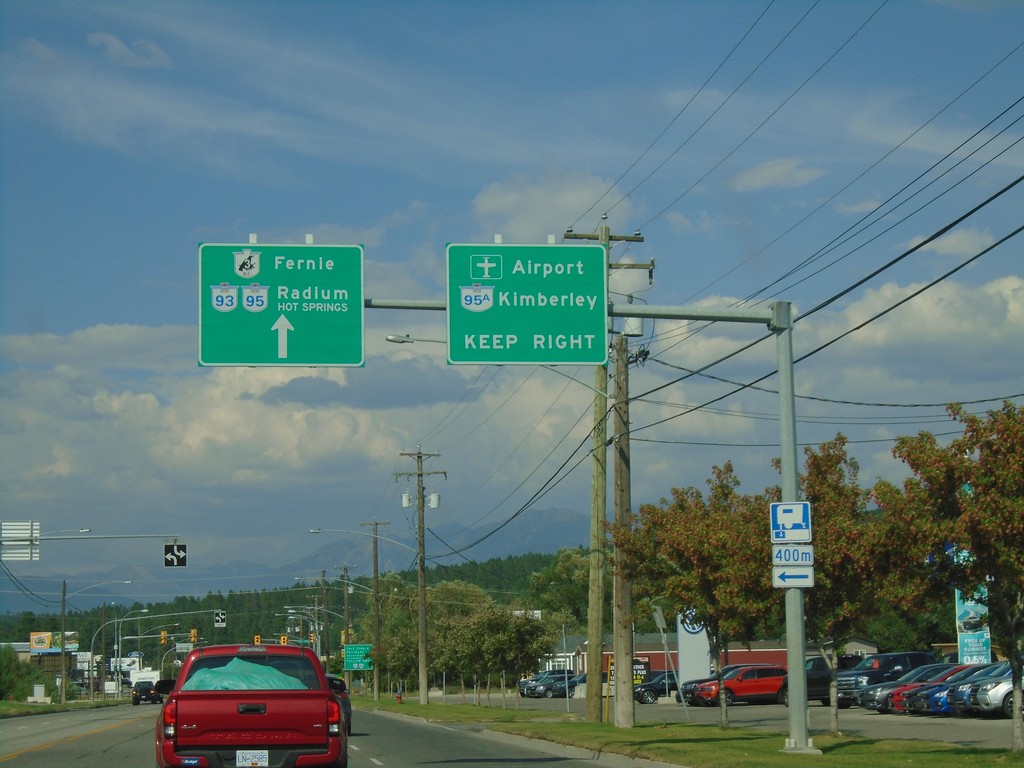
BC-3 East/BC-95 North Approaching BC-95A
BC-3 East/BC-95 North approaching BC-95A. Use BC-95A North for Kimberley and (Canadian Rockies International) Airport. Continue on BC-3 East/BC-95 North for Radium and Fernie.
Taken 08-05-2018
Cranbrook
East Kootenay
British Columbia
Canada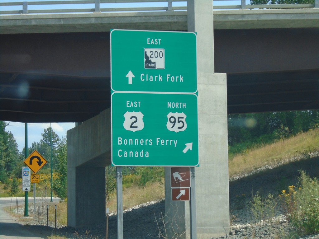
US-2 East at US-95 and ID-200
US-2 East at US-95 and ID-200. Continue straight for ID-200 East to Clark Fork. Merge right for US-2 East/US-95 North for Bonners Ferry and Canada. US-2 east joins US-95 north to Bonners Ferry.
Taken 08-05-2018


 Ponderay
Bonner County
Idaho
United States
Ponderay
Bonner County
Idaho
United States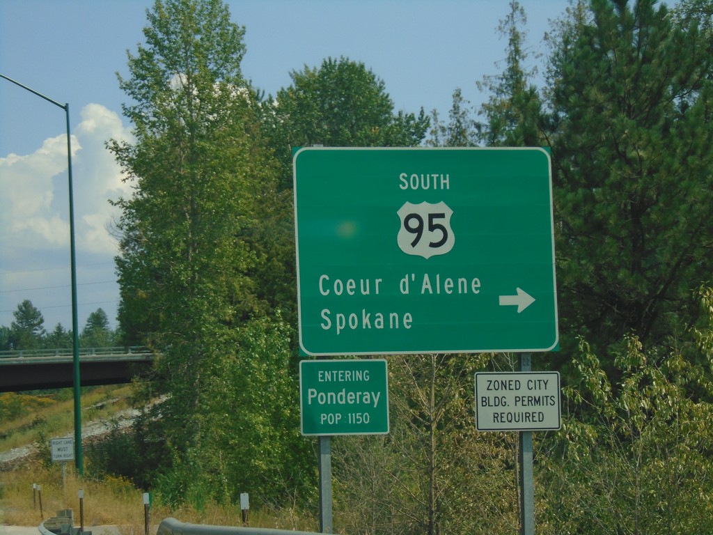
US-2 East at US-95 South
US-2 East at US-95 South to Spokane and Coeur d’Alene. Entering Ponderay.
Taken 08-05-2018
Ponderay
Bonner County
Idaho
United States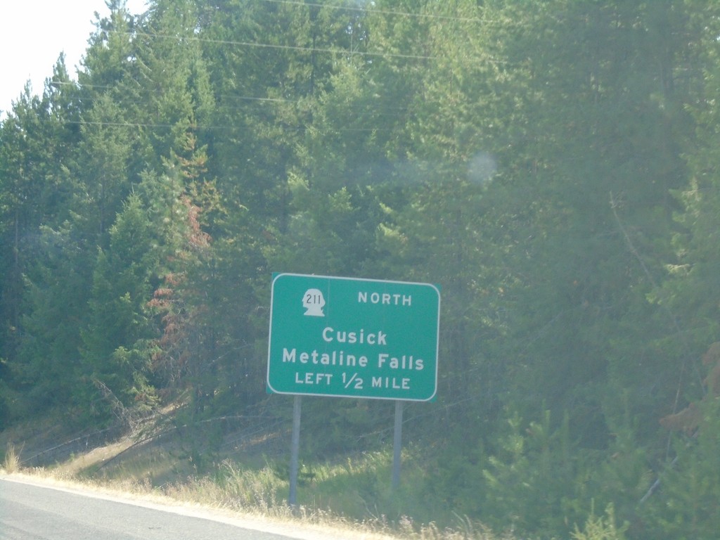
US-2 East Approaching WA-211 North
US-2 East approaching WA-211 North to Cusick and Metaline Falls.
Taken 08-05-2018
 Newport
Pend Oreille County
Washington
United States
Newport
Pend Oreille County
Washington
United States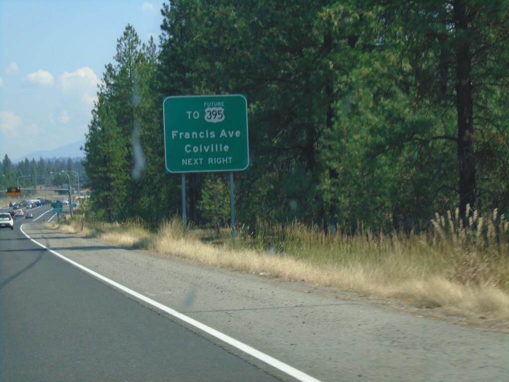
US-2 East Approaching Future US-395
US-2 East approaching Farwell Road to Future US-395/Colville/Francis Ave.
Taken 08-05-2018
 Spokane
 County
Washington
United States
Spokane
Spokane County
Washington
United States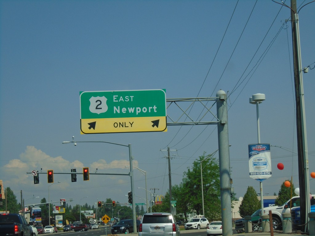
US-2 East/US-395 North at US-2/US-395 Split
US-2 East/US-395 North at US-2/US-395 split in Spokane. Turn right for US-2 East to Newport.
Taken 08-05-2018
 Spokane
 County
Washington
United States
Spokane
Spokane County
Washington
United States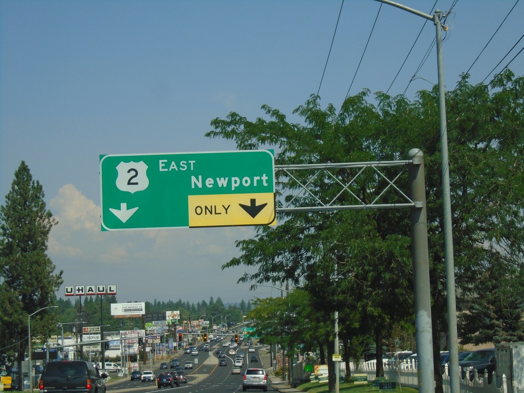
US-2 East/US-395 North Approaching US-2/US-395 Split
US-2 East/US-395 North (Division St.) approaching US-2 East to Newport.
Taken 08-05-2018
Spokane
Spokane County
Washington
United States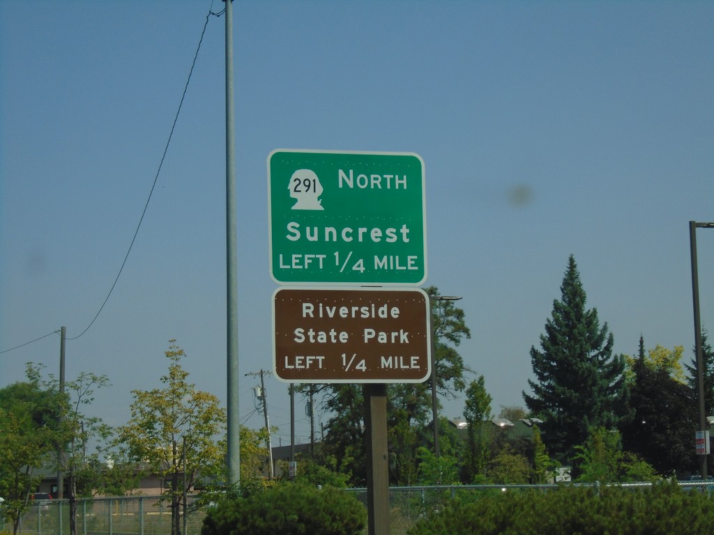
US-2 East/US-395 North Approaching WA-291
US-2 East/US-395 North (Division St.) approaching WA-291 North (Francis Ave.) to Suncrest and Riverside State Park.
Taken 08-05-2018
 Spokane
 County
Washington
United States
Spokane
Spokane County
Washington
United States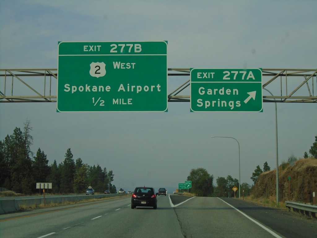
I-90 East - Exits 277A and 277B
I-90 east at Exit 277A - Garden Springs. Approaching Exit 277B - US-2 West/Spokane Airport. US-2 east follows I-90 from here into downtown Spokane.
Taken 08-04-2018
 Spokane
 County
Washington
United States
Spokane
Spokane County
Washington
United States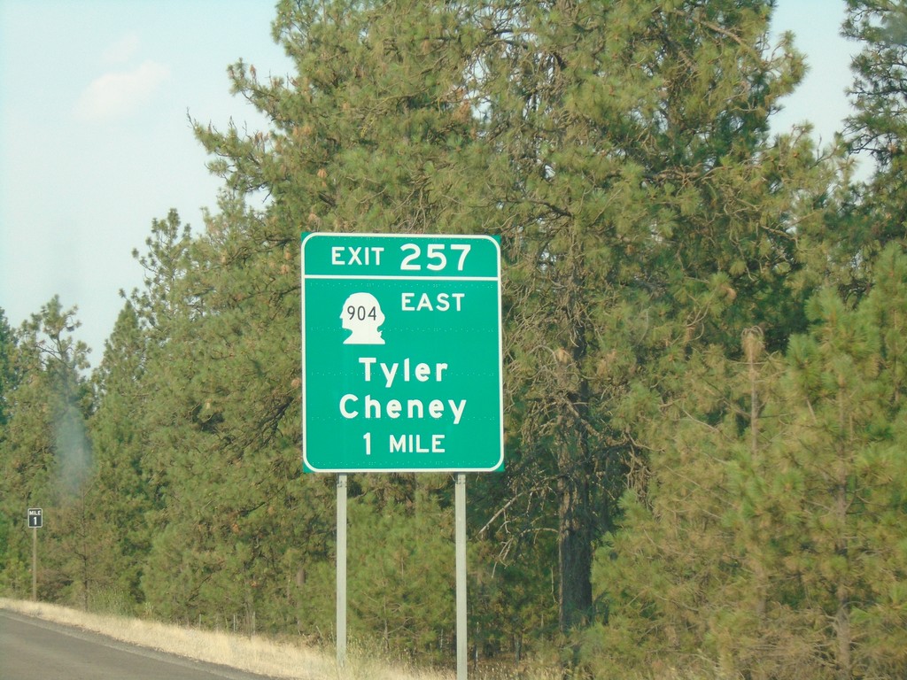
I-90 East - Exit 257
I-90 east approaching Exit 257 - WA-904/Tyler/Cheney.
Taken 08-04-2018
 Sprague
Spokane County
Washington
United States
Sprague
Spokane County
Washington
United States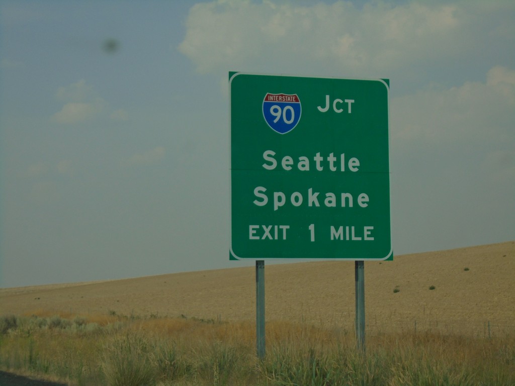
US-395 North Approaching I-90
US-395 North approaching I-90 near Ritzville. Use I-90 for Seattle and Spokane.
Taken 08-04-2018
Ritzville
Adams County
Washington
United States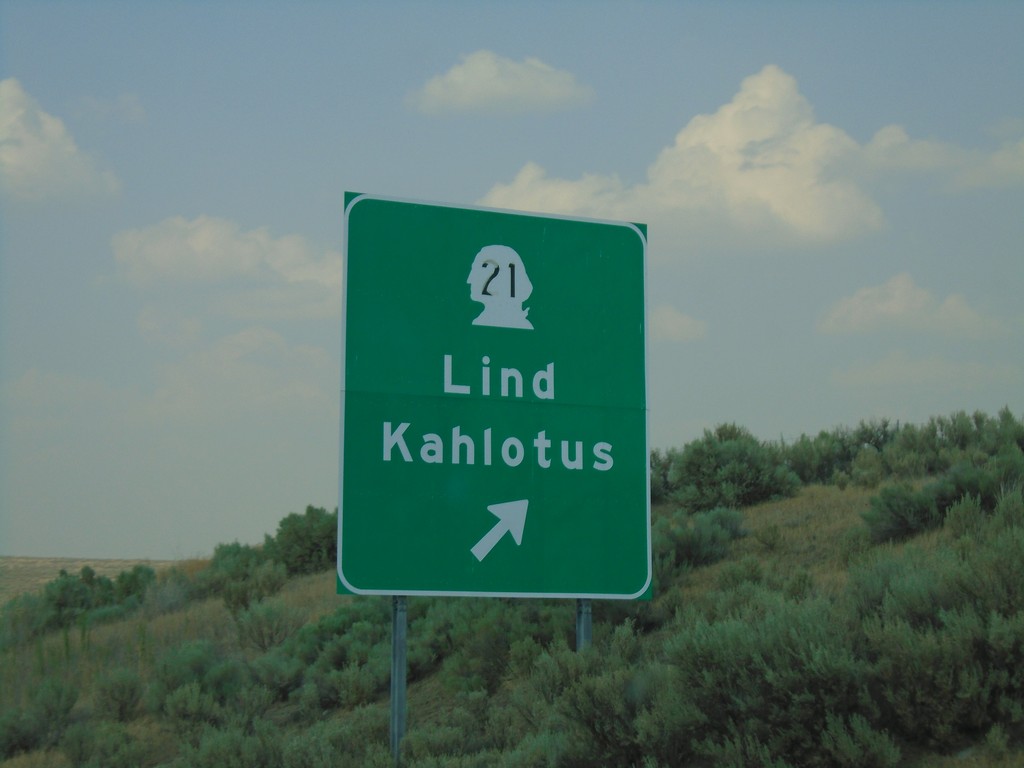
US-395 North - WA-21 Interchange
US-395 north at WA-21/Lind/Kahlotus interchange.
Taken 08-04-2018
 Ritzville
Adams County
Washington
United States
Ritzville
Adams County
Washington
United States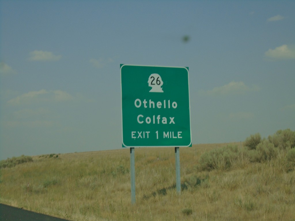
US-395 North - WA-26 Interchange
US-395 north approaching WA-26/Othello/Colfax interchange.
Taken 08-04-2018
 Lind
Adams County
Washington
United States
Lind
Adams County
Washington
United States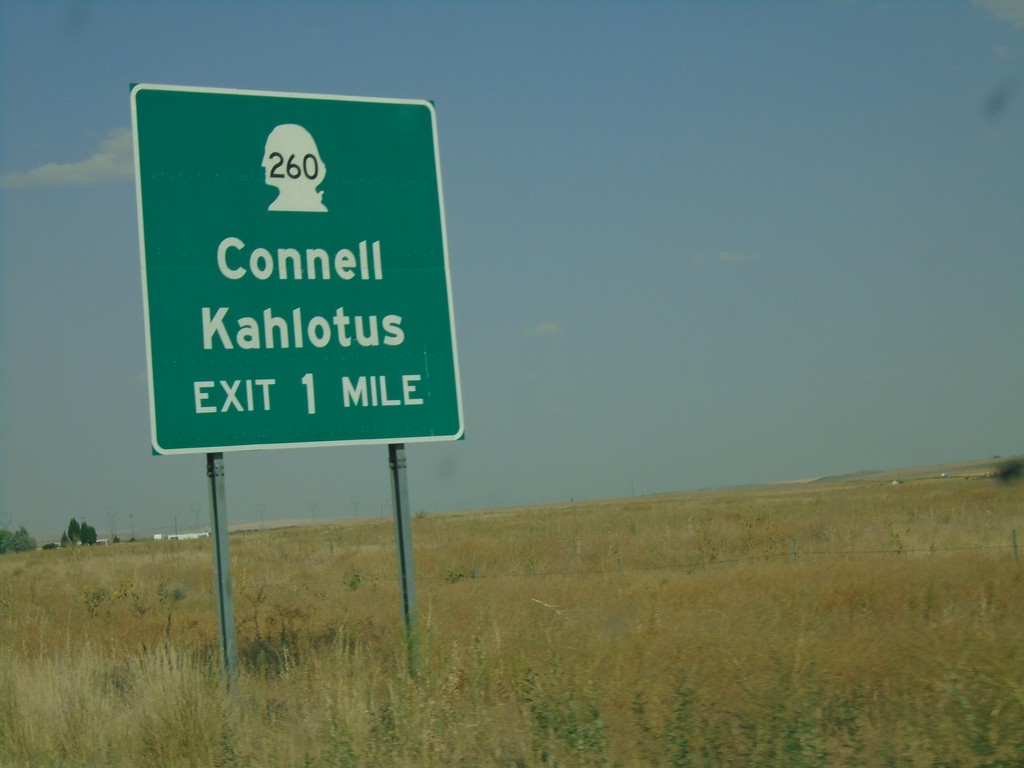
US-395 North - WA-260 Interchange
US-395 north approaching WA-260/Connell/Kahlotus.
Taken 08-04-2018
 Mesa
Franklin County
Washington
United States
Mesa
Franklin County
Washington
United States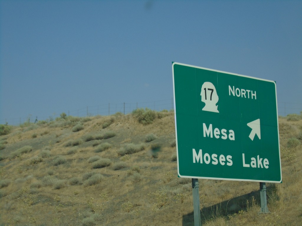
US-395 North - WA-17 Interchange
US-395 North at WA-17 North to Mesa and Moses Lake.
Taken 08-04-2018
 Mesa
Franklin County
Washington
United States
Mesa
Franklin County
Washington
United States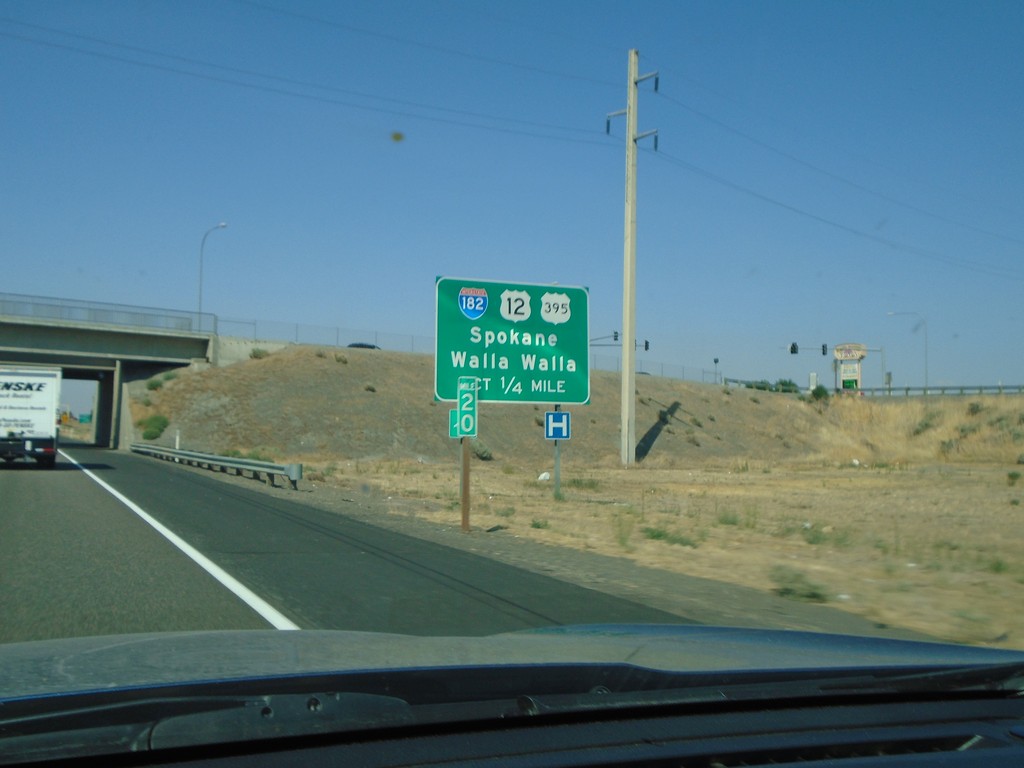
US-395 North Approaching I-182/US-12
US-395 North approaching I-182 (West)/US-12 (West) to Spokane and Walla Walla. US-395 north joins US-12 and I-182 west briefly through Pasco.
Taken 08-04-2018

 Pasco
Franklin County
Washington
United States
Pasco
Franklin County
Washington
United States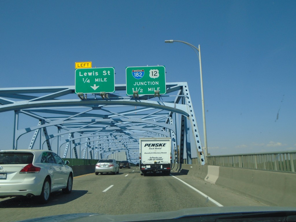
US-395 North - Blue Bridge
Crossing the Blue Bridge over the Columbia River on US-395 north from Kennewick to Pasco Washington. Approaching left exit to Lewis St. Also approaching US-12 and I-182.
Taken 08-04-2018
Kennewick
Benton County
Washington
United States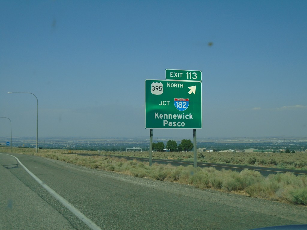
I-82 West - Exit 113
I-82 west at Exit 113 - US-395 North/Jct I-182/Kennewick/Pasco. US-395 leaves I-82 westbound.
Taken 08-04-2018
 Kennewick
Benton County
Washington
United States
Kennewick
Benton County
Washington
United States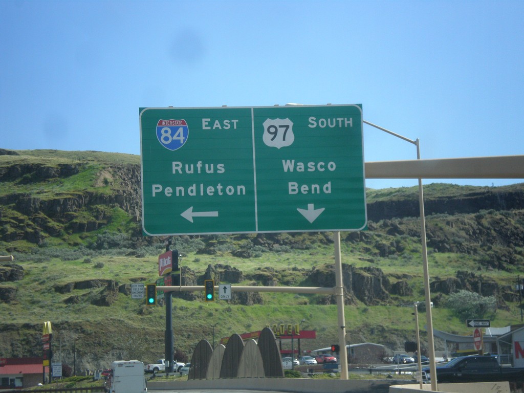
US-97 South at I-84/US-30 East (Exit 104)
US-97 south at I-84/US-30 East (Exit 104) junction. Turn left on I-84/US-30 east for Rufus and Pendleton. Continue south on US-97 for Wasco and Bend.
Taken 04-30-2018


 Wasco
Sherman County
Oregon
United States
Wasco
Sherman County
Oregon
United States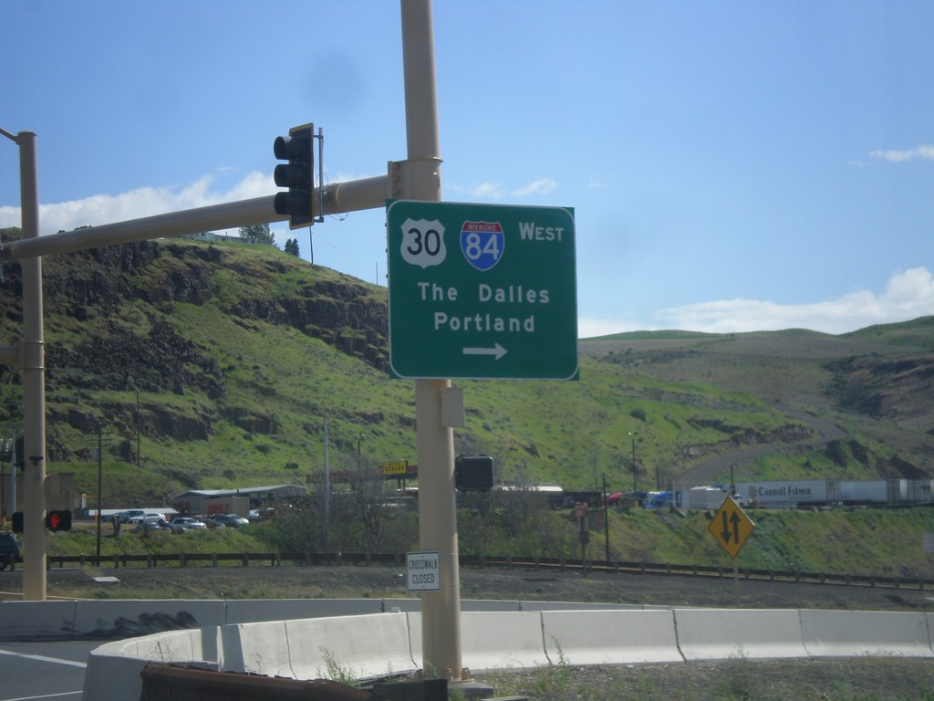
US-97 South at I-84/US-30 West
US-97 north at I-84/US-30 West (Exit 104). Turn right for I-84/US-30 west to The Dalles and Portland. The Columbia River and the hills of Washington state are in the background of this photograph.
Taken 04-30-2018
Biggs Junction
Sherman County
Oregon
United States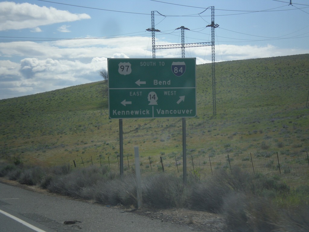
US-97 South at WA-14
Turn right for WA-14 West to Vancouver. Turn left for WA-14 East to Kennwick and US-97 South/To I-84 to Bend (Oregon). US-97 south joins WA-14 east for a short distance.
Taken 04-30-2018
 Maryhill
Klickitat County
Washington
United States
Maryhill
Klickitat County
Washington
United States