Signs Tagged With Shield Inside Sign
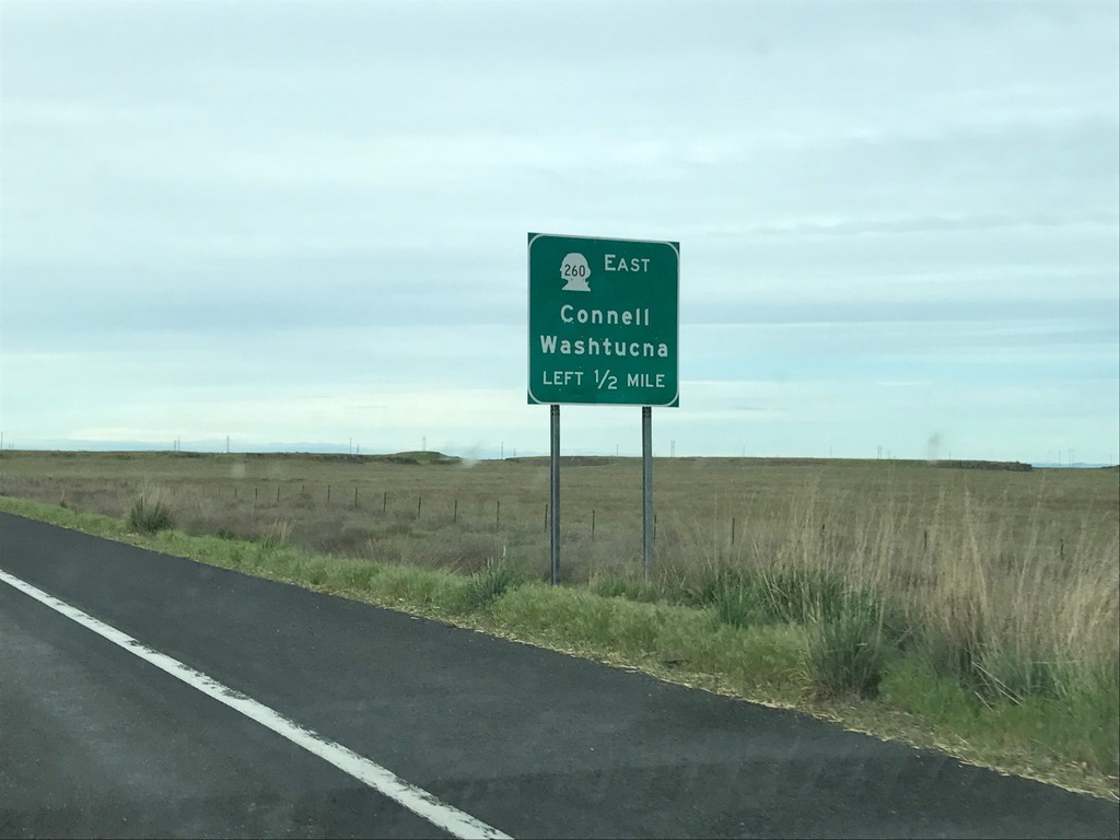
WA-17 South Approaching WA-260
WA-17 south approaching WA-260 east to Connell and Washtucna.
Taken 04-30-2017

 Connell
Franklin County
Washington
United States
Connell
Franklin County
Washington
United States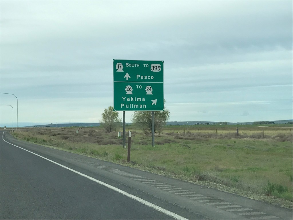
WA-17 South at WA-26
WA-17 south at WA-26 in Adams County. Use WA-26 for WA-24/Yakima/Pullman. Continue south on WA-17 for US-395/Pasco.
Taken 04-30-2017


 Othello
Adams County
Washington
United States
Othello
Adams County
Washington
United States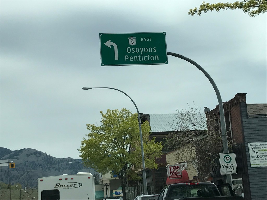
BC-3 East - Keremeos
BC-3 East in Keremeos. Turn left to continue east on BC-3 to Penticton and Osoyoos. The BC-3 shield on the overhead sign does not use the Crowsnest Highway logo.
Taken 04-29-2017
 Keremeos
Okanagan-Similkameen
British Columbia
Canada
Keremeos
Okanagan-Similkameen
British Columbia
Canada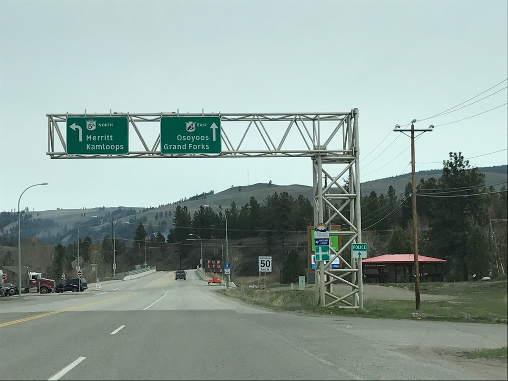
BC-3 East at BC-5A - Princeton
BC-3 East at BC-5A in Princeton. Turn left for BC-5A North to Merritt and Kamloops. Continue east on BC-3 for Osoyoos and Grand Forks.
Taken 04-29-2017
 Princeton
Okanagan-Similkameen
British Columbia
Canada
Princeton
Okanagan-Similkameen
British Columbia
Canada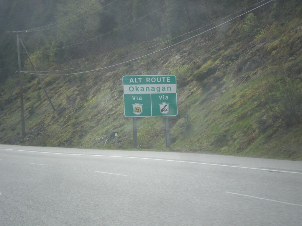
BC-5 North/BC-3 East - Alternate Routes To the Okanagan
Alternate Routes To the Okanagan BC-5 North (via BC-97D) and BC-3 East.
Taken 04-29-2017
 Hope
Fraser Valley
British Columbia
Canada
Hope
Fraser Valley
British Columbia
Canada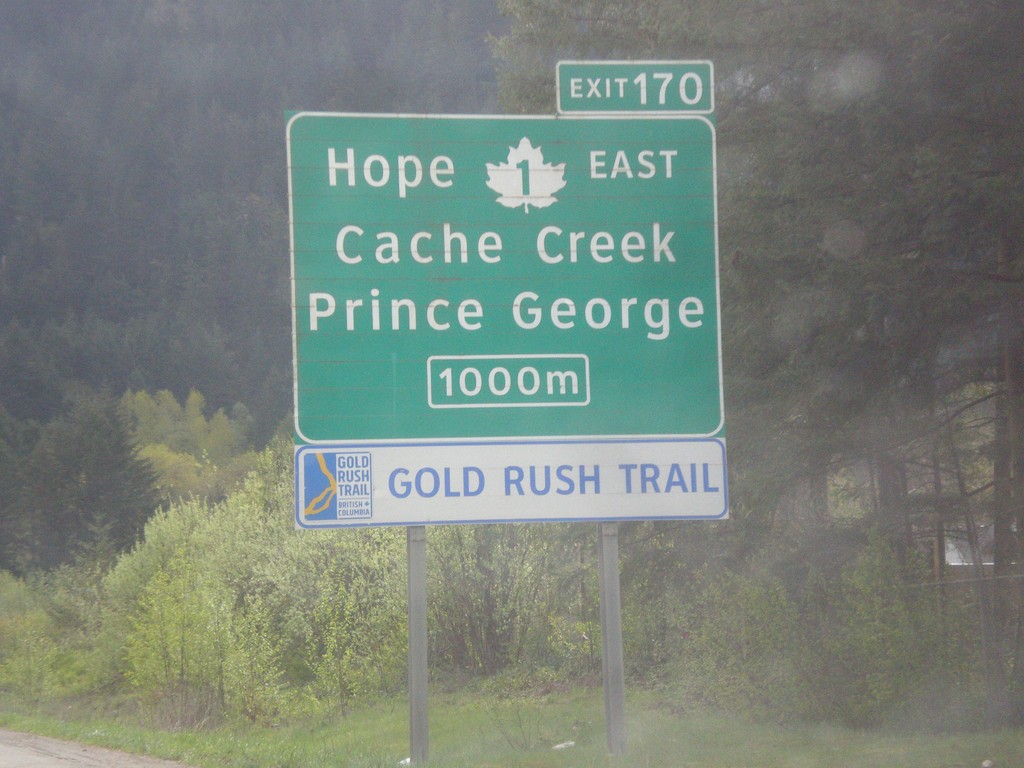
TC-1 East - Exit 170
TC-1 east approaching Exit 170 - TC-1 East/Hope/Cache Creek/Prince George. TC-1 leaves the freeway at Exit 170 and turns north up the Fraser River Canyon. The freeway continues east as BC-5 (Coquihalla Highway) and BC-3 (Crowsnest Highway).
Taken 04-29-2017
 Hope
Fraser Valley
British Columbia
Canada
Hope
Fraser Valley
British Columbia
Canada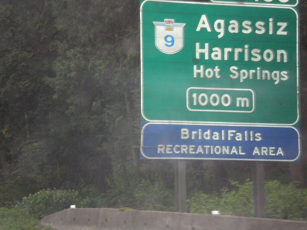
TC-1 East - Exit 135
TC-1 east approaching Exit 135 - BC-9/Agassiz/Harrison Hot Springs.
Taken 04-29-2017
 Chilliwack
Fraser Valley
British Columbia
Canada
Chilliwack
Fraser Valley
British Columbia
Canada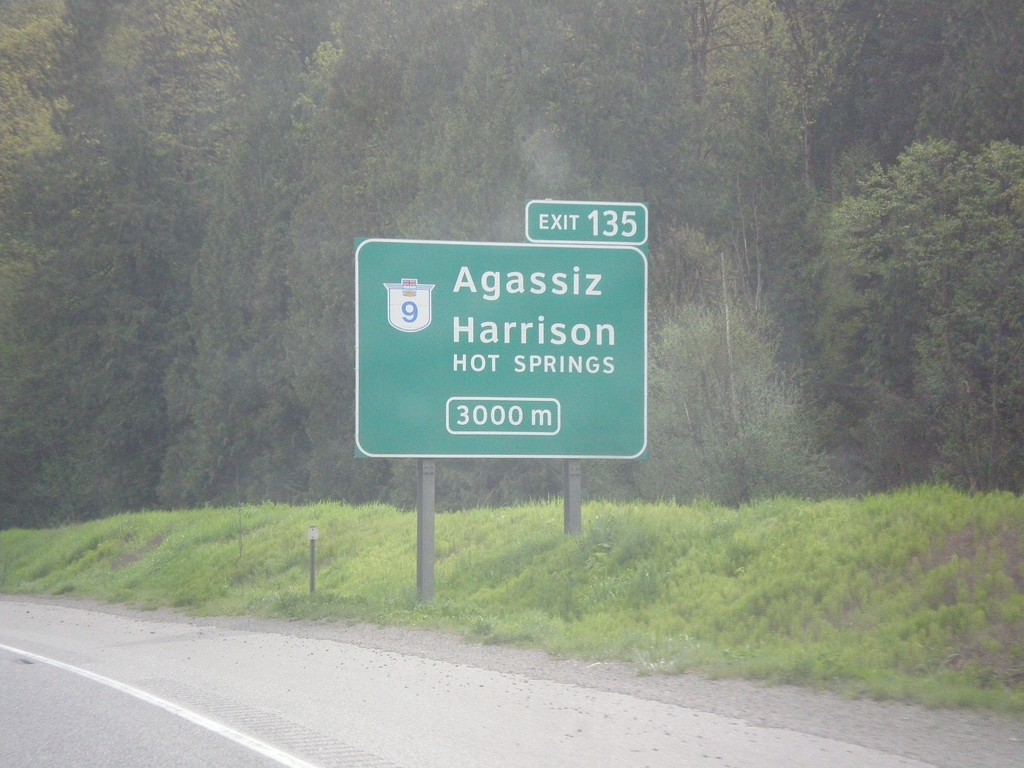
TC-1 East - Exit 135
TC-1 east approaching Exit 135 - BC-9/Agassiz/Harrison Hot Springs.
Taken 04-29-2017
Chilliwack
Fraser Valley
British Columbia
Canada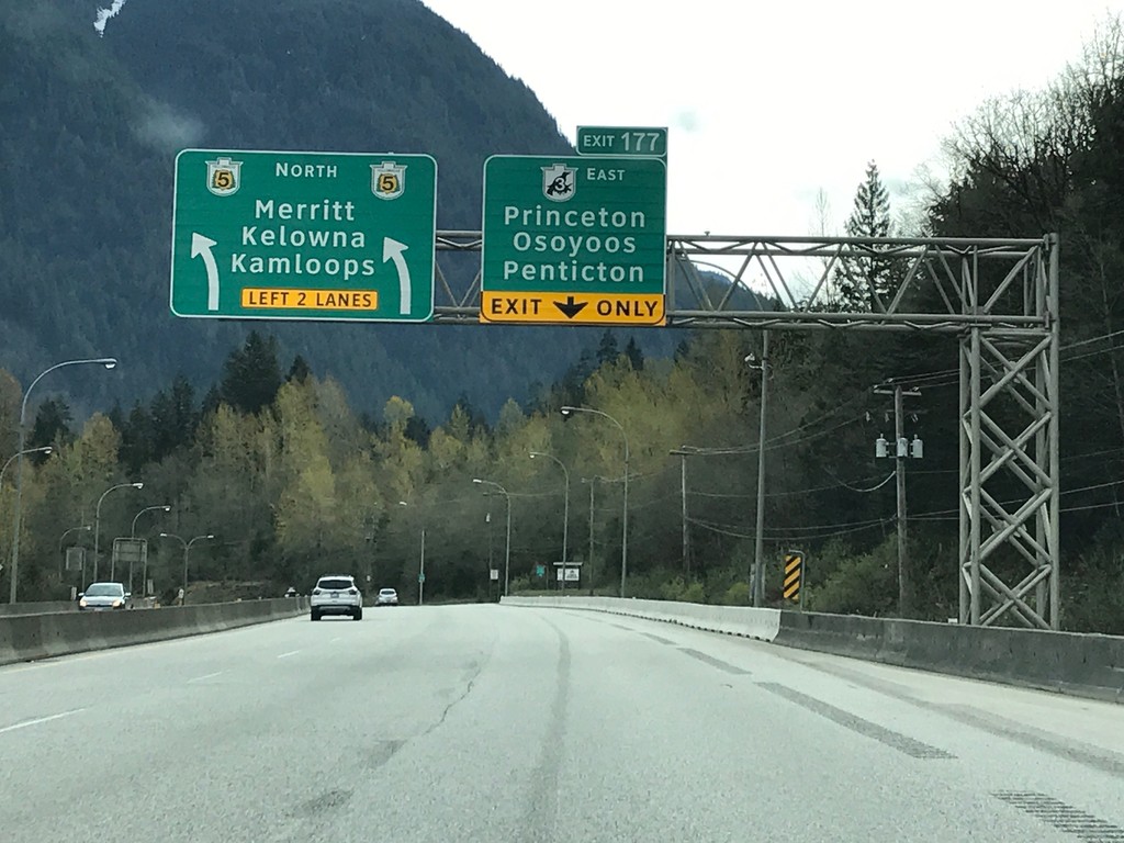
BC-3 East / BC-5 North at Split
BC-3 East / BC-5 North at BC-3/BC-5 Split - Exit 177. Merge right for Exit 177 - BC-3 East (Crowsnest Highway) to Princeton/Osoyoos/Penticton. Merge left for BC-5 North (Coquihalla Highway) to Merritt/Kelowna/Kamloops. The freeway continues along BC-5 north.
Taken 04-29-2017
Hope
Fraser Valley
British Columbia
Canada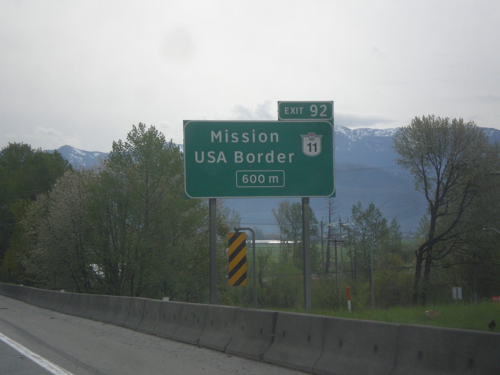
TC-1 East - Exit 92
TC-1 east approaching Exit 92 - BC-11/Mission/USA Border (Huntington/Sumas Crossing).
Taken 04-29-2017
 Abbotsford
Fraser Valley
British Columbia
Canada
Abbotsford
Fraser Valley
British Columbia
Canada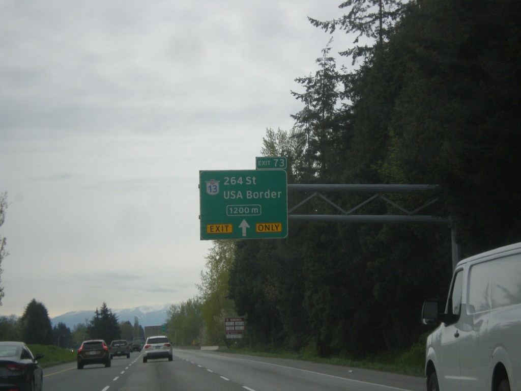
TC-1 East - Exit 73
TC-1 east approaching Exit 73 - BC-13 South/264 St./USA Border. Use BC-13 South for the Aldergrove/Lynden border crossing.
Taken 04-29-2017
 Langley Township
Metro Vancouver
British Columbia
Canada
Langley Township
Metro Vancouver
British Columbia
Canada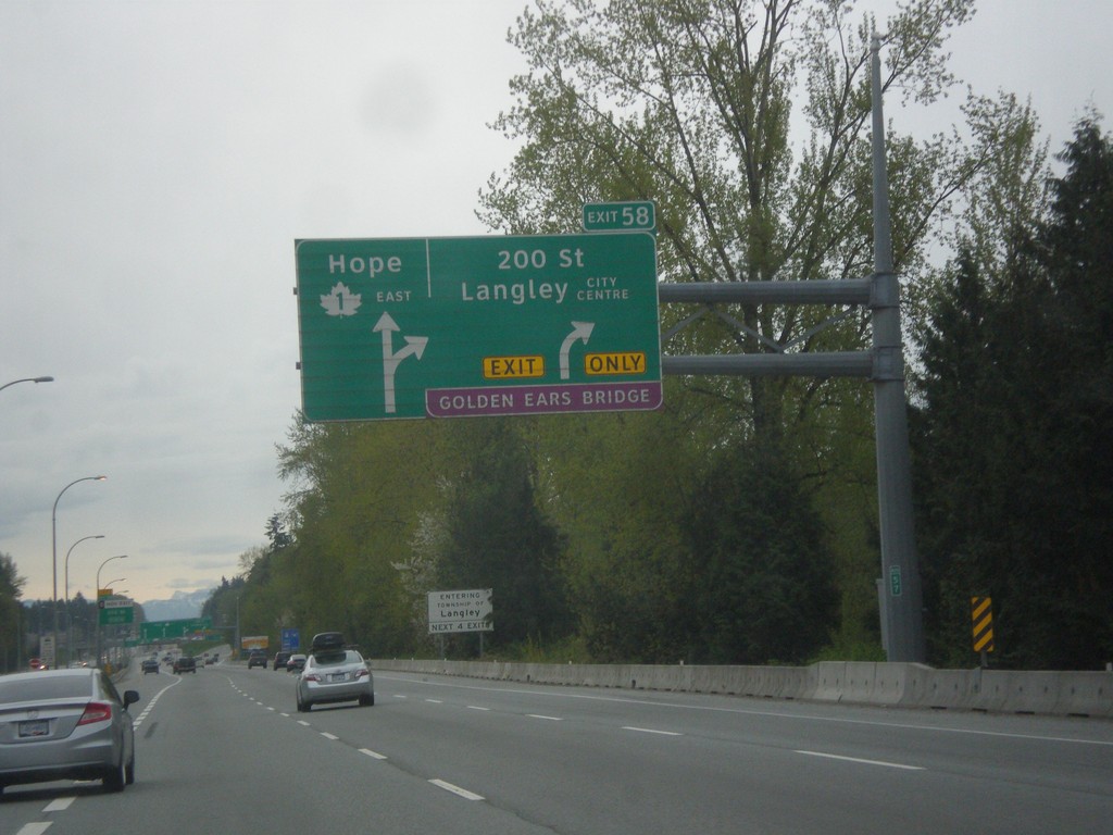
TC-1 East - Exit 58
TC-1 east approaching Exit 58 - 200 St./Langley City Center./Golden Ears (Toll) Bridge. Continue east on TC-1 for Hope.
Taken 04-29-2017
Langley Township
Metro Vancouver
British Columbia
Canada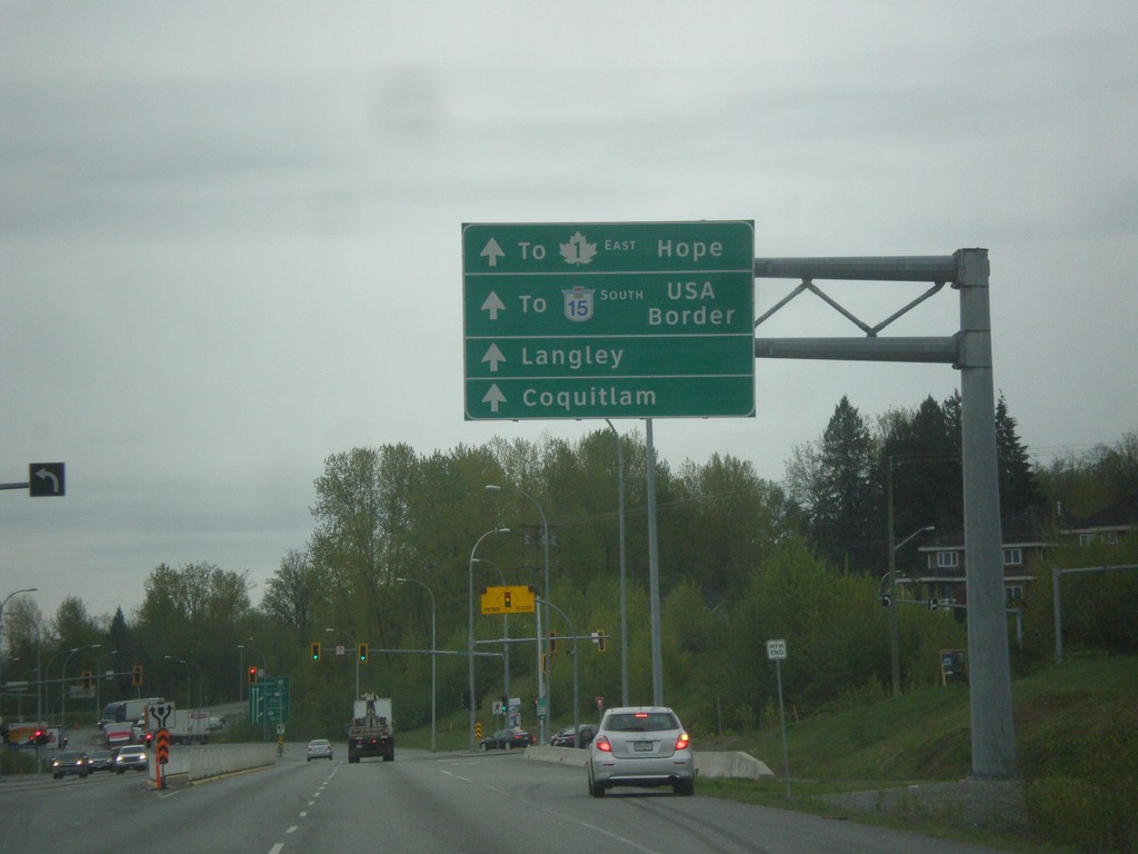
BC-17 East - 104 Ave
BC-17 East (South Fraser Perimeter Road) at 104 Ave. Continue east on BC-17 for BC-15 South to USA Border, TC-1 East to Hope, Langley, and Coquitlam.
Taken 04-29-2017

 Surrey
Metro Vancouver
British Columbia
Canada
Surrey
Metro Vancouver
British Columbia
Canada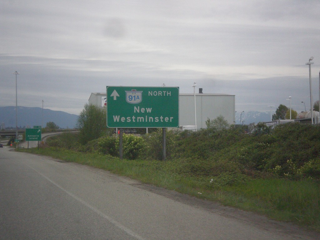
BC-91A North - New Westminster
BC-91A North to New Westminster, on offramp from BC-91 to BC-91A.
Taken 04-29-2017
 Richmond
Metro Vancouver
British Columbia
Canada
Richmond
Metro Vancouver
British Columbia
Canada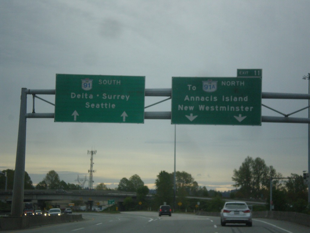
BC-91 South - Exit 11
BC-91 south at Exit 11 - To BC-91A North/Annacis Island/New Westminster. Continue south on BC-91 for Delta, Surrey, and Seattle (WA).
Taken 04-29-2017
 Richmond
Metro Vancouver
British Columbia
Canada
Richmond
Metro Vancouver
British Columbia
Canada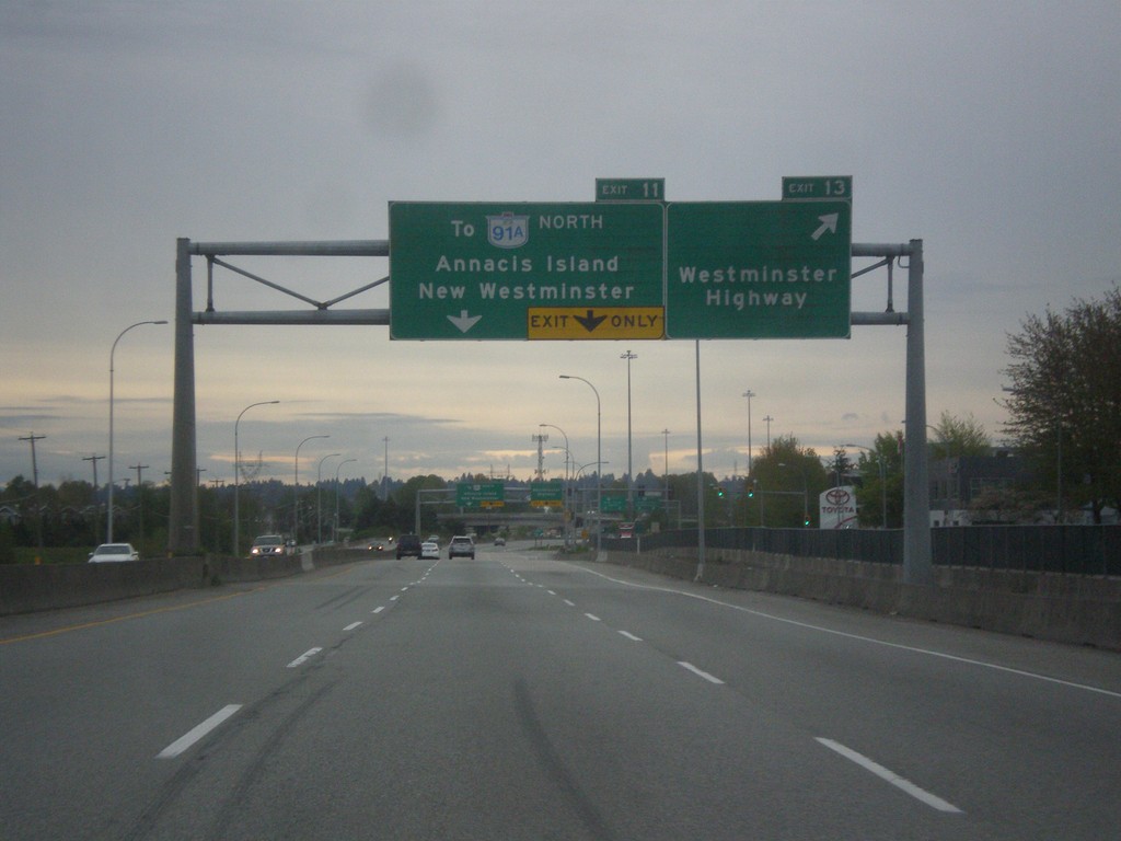
BC-91 South - Exits 13 and 11
BC-91 south at Exit 13 - Westminster Highway. Approaching Exit 11 - To BC-91A North/Annacis Island/New Westminster.
Taken 04-29-2017
Richmond
Metro Vancouver
British Columbia
Canada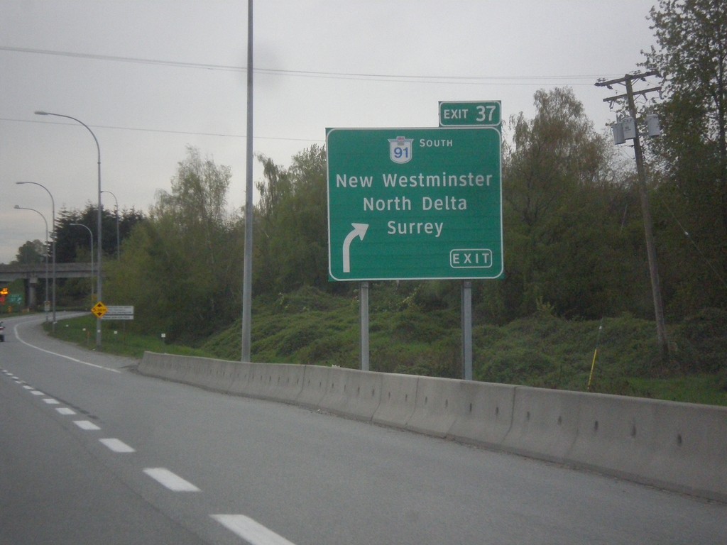
BC-99 South - Exit 37
BC-99 south at Exit 37 - BC-91 South/New Westminster/North Delta/Surrey.
Taken 04-29-2017
 Richmond
Metro Vancouver
British Columbia
Canada
Richmond
Metro Vancouver
British Columbia
Canada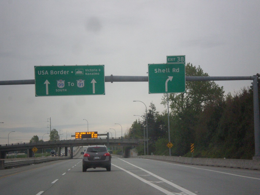
BC-99 South - Exit 39A
BC-99 south at Exit 39A - Shell Road. Continue south on BC-99 for BC-91, USA Border, and Ferry to Victoria and Nanaimo.
Taken 04-29-2017
Richmond
Metro Vancouver
British Columbia
Canada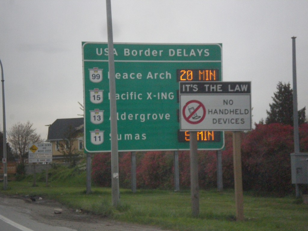
BC-99 South - Border Crossing Times
Vancouver area border crossing times into the USA on BC-99 south. Border crossing times via Peace Arch (BC-99), Pacific X-ING (BC-15), Aldergrove (BC-13), and Sumas (BC-11).
Taken 04-29-2017
Richmond
Metro Vancouver
British Columbia
Canada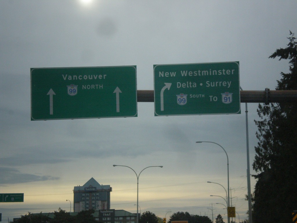
Sea Island Way at BC-99
Sea Island Way east at BC-99. Merge right for BC-99 South/To BC-91/New Westminster/Delta/Surrey. Use BC-99 north for Vancouver.
Taken 04-29-2017
Richmond
Metro Vancouver
British Columbia
Canada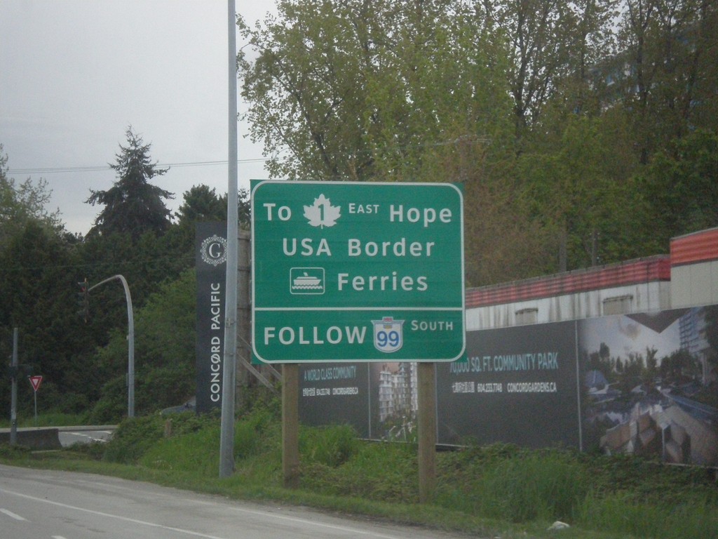
Sea Island Way Approaching BC-99
Sea Island Way approaching BC-99. Use BC-99 south for TC-1 East to Hope.
Taken 04-29-2017
Richmond
Metro Vancouver
British Columbia
Canada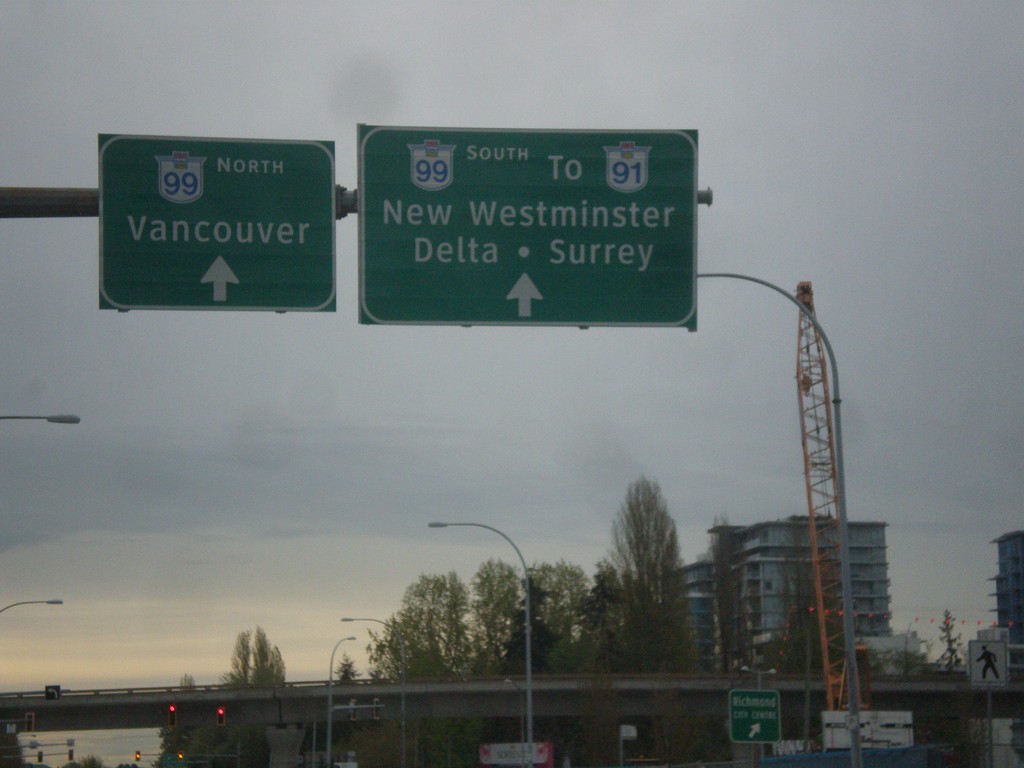
Sea Island Way at Number 3 Road
Sea Island Way at Number 3 Road. Continue east on Sea Island Way for BC-99 North/Vancouver and BC-99 South/To BC-91/New Westminster/Delta/Surrey.
Taken 04-29-2017
Richmond
Metro Vancouver
British Columbia
Canada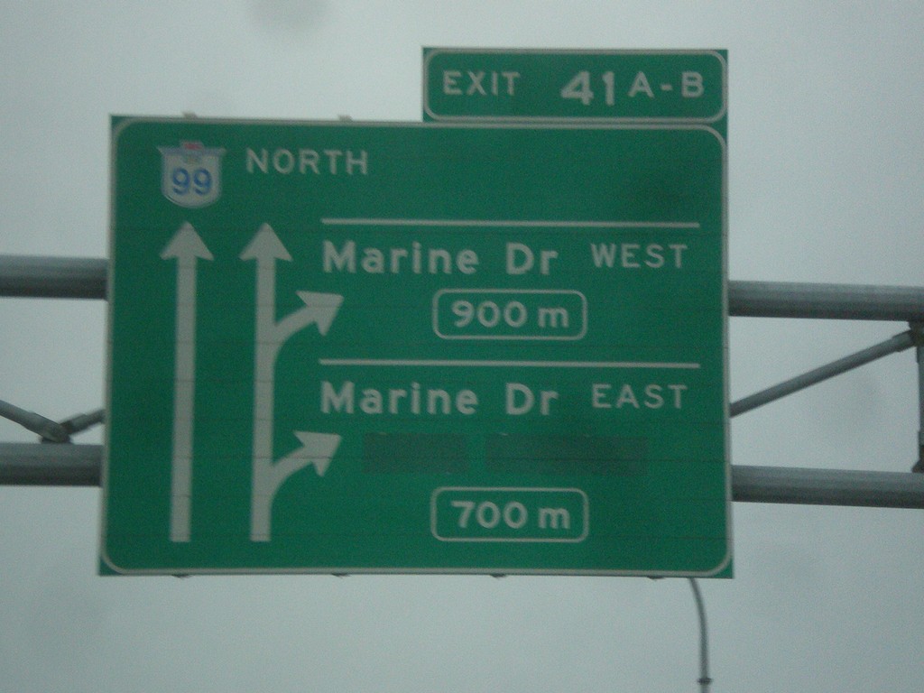
BC-99 North - Exits 41A-B
BC-99 north approaching Exit 41A - Marine Drive East and Exit 41B - Marine Drive West.
Taken 04-29-2017
Vancouver
Metro Vancouver
British Columbia
Canada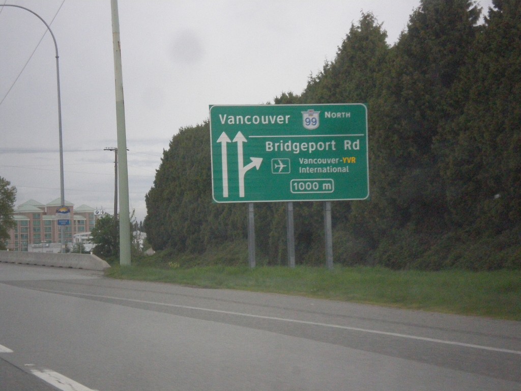
BC-99 North - Exit 39
BC-99 north approaching Exit 39 - Bridgeport Road/Vancouver - YVR International. Continue north on BC-99 for Vancouver.
Taken 04-29-2017
Richmond
Metro Vancouver
British Columbia
Canada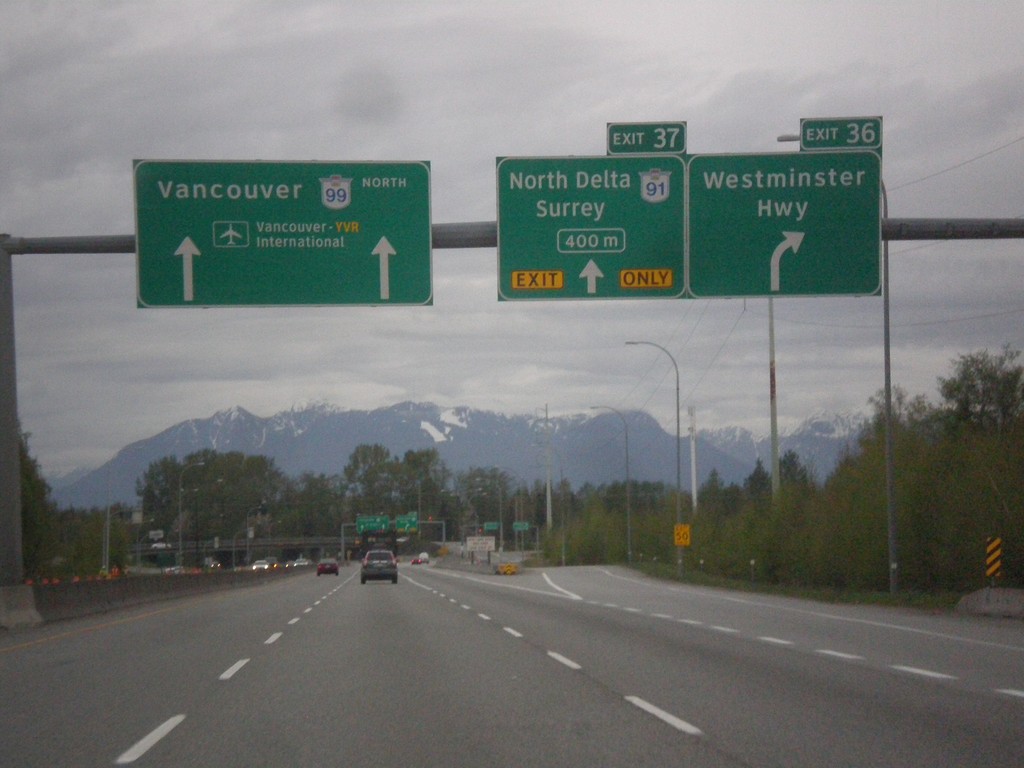
BC-99 North - Exits 36 and 37
BC-99 north at Exit 36 - Westminster Highway. Approaching Exit 37 - BC-91/North Delta/Surrey. Continue north on BC-99 for Vancouver and Vancouver International Airport.
Taken 04-29-2017
Richmond
Metro Vancouver
British Columbia
Canada