Signs Tagged With Shield Inside Sign
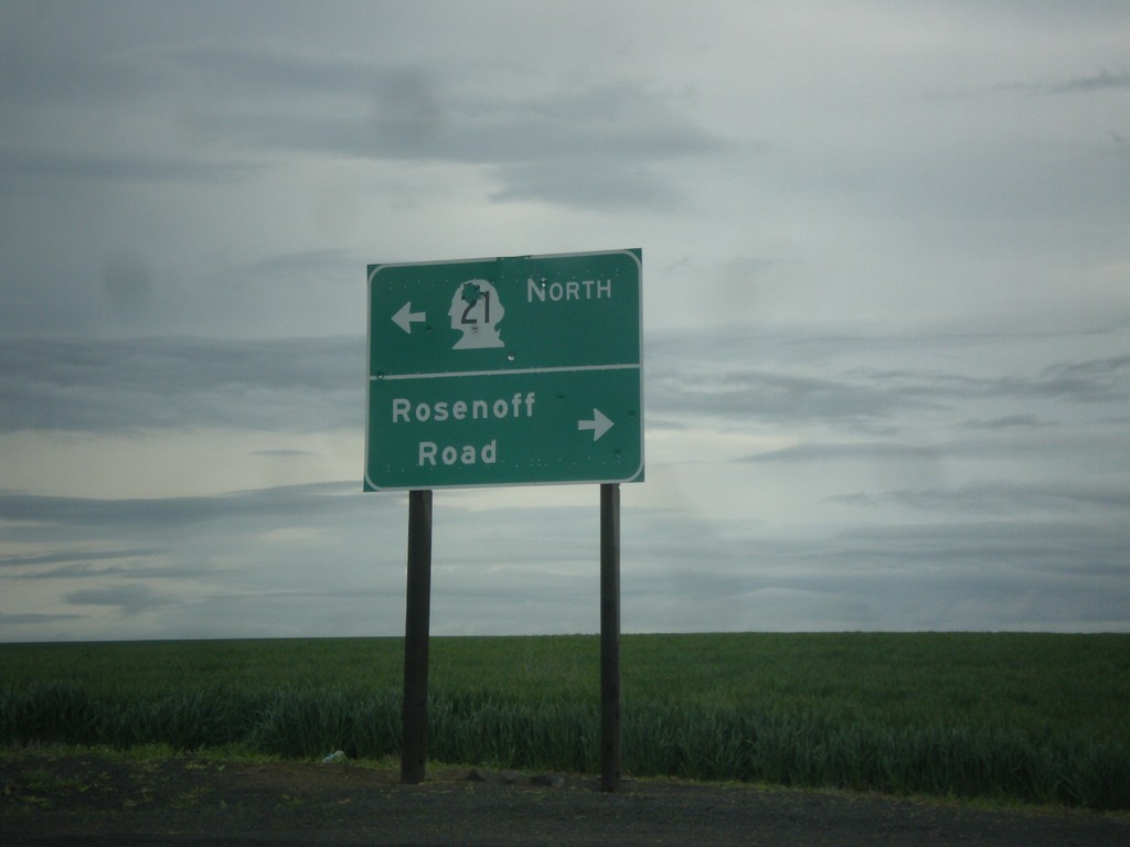
WA-21 North at Rosenoff Road
WA-21 North at Rosenoff Road. Turn right for Rosenoff Road; turn left to continue north on WA-21.
Taken 04-30-2018
 Reiman
Adams County
Washington
United States
Reiman
Adams County
Washington
United States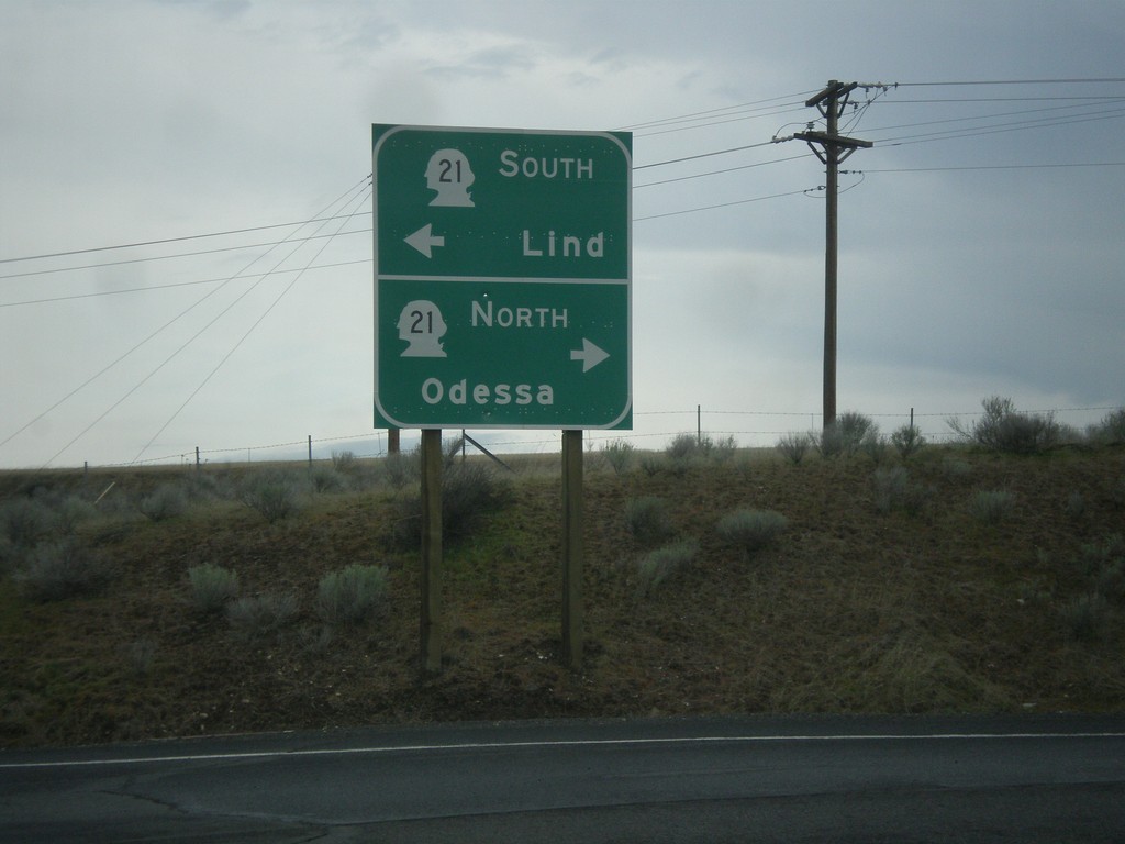
I-90 West Exit 206 Offramp at WA-21
I-90 West Exit 206 Offramp at WA-21. Use WA-21 north for Odessa; WA-21 south for Lind.
Taken 04-30-2018
 Ritzville
Adams County
Washington
United States
Ritzville
Adams County
Washington
United States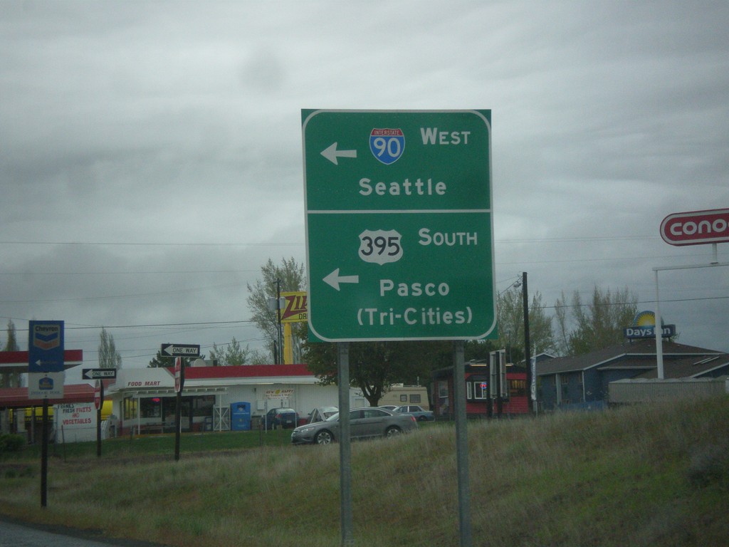
End WA-261 North at I-90 West/US-395 South
End WA-261 North at I-90 West/US-395 South in Ritzville. Turn left (on Weber St.) for onramps to I-90 West/Seattle and US-395 South/Pasco/(Tri-Cities).
Taken 04-30-2018

 Ritzville
Adams County
Washington
United States
Ritzville
Adams County
Washington
United States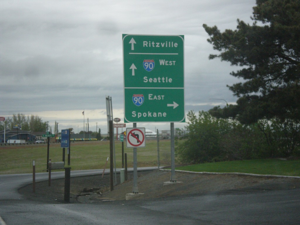
WA-261 North at I-90 East
WA-261 North at I-90 East to Spokane. Continue over the freeway for I-90 West to Seattle and Ritzville. WA-261 North ends at I-90.
Taken 04-30-2018
Ritzville
Adams County
Washington
United States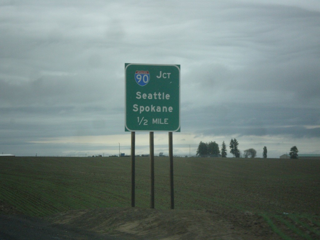
WA-261 North Approaching I-90
WA-261 North approaching I-90/US-395 to Seattle and Spokane.
Taken 04-30-2018
Ritzville
Adams County
Washington
United States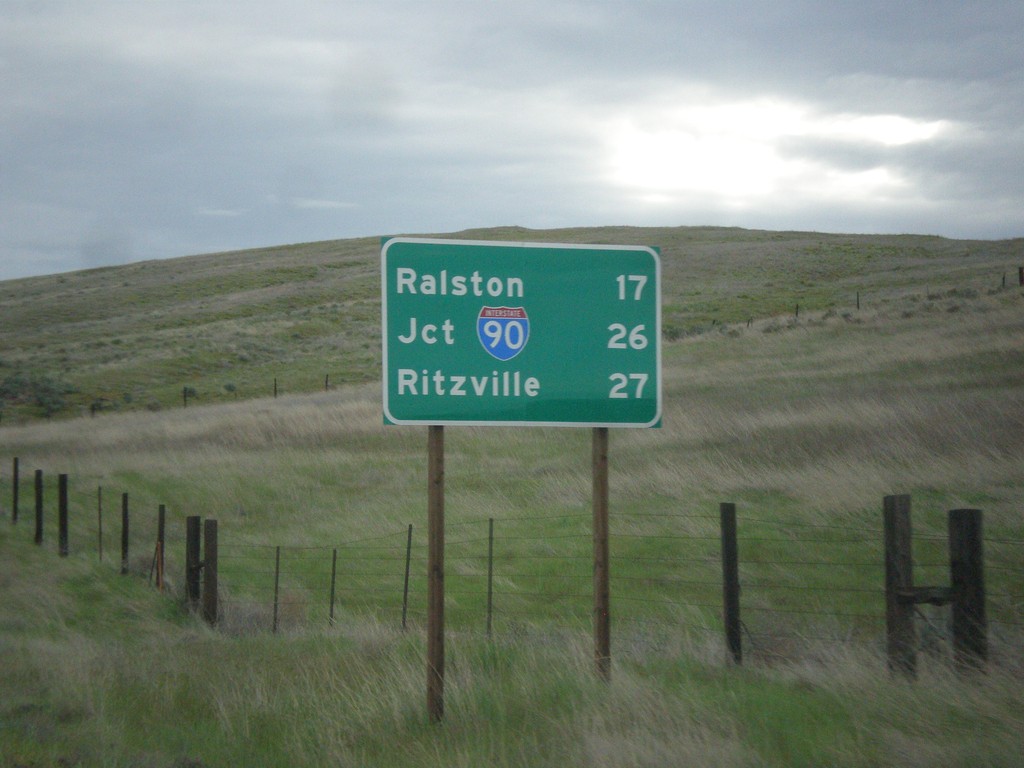
WA-261 North - Distance Marker
Distance marker on WA-261 north. Distance to Ralston, Jct. I-90, and Ritzville.
Taken 04-30-2018
Washtucna
Adams County
Washington
United States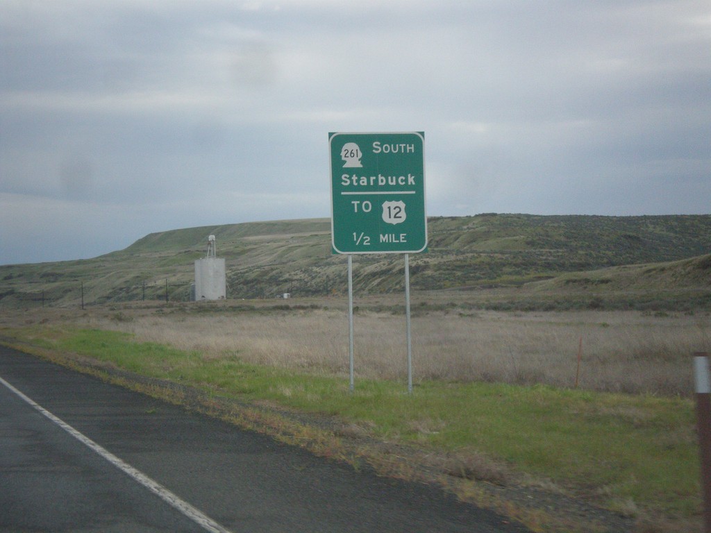
WA-260 North Approaching WA-261 South
WA-260 North Approaching WA-261 South to Starbuck and US-12. WA-261 joins WA-260 north to Washtucna.
Taken 04-30-2018

 Washtucna
Franklin County
Washington
United States
Washtucna
Franklin County
Washington
United States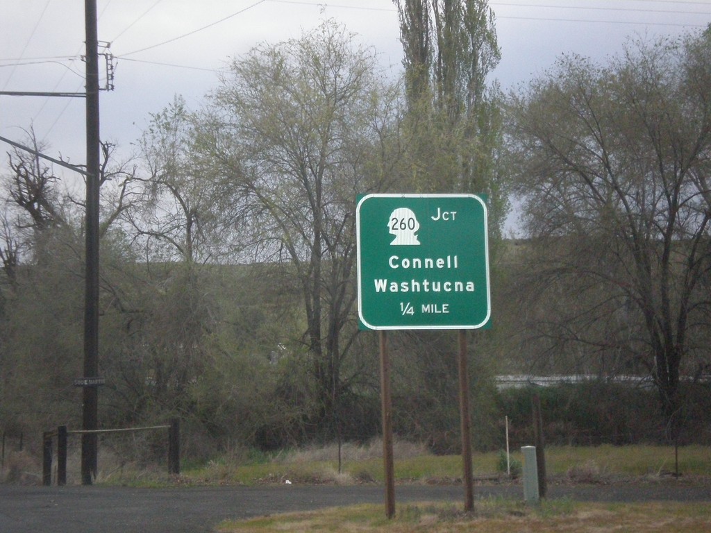
WA-263 North Approaching WA-260
WA-263 North approaching WA-260 to Connell and Washtucna in Kahlotus.
Taken 04-30-2018
 Kahlotus
Franklin County
Washington
United States
Kahlotus
Franklin County
Washington
United States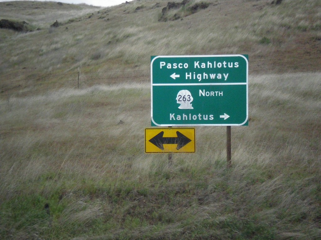
WA-263 North at Pasco Kahlotus Highway
WA-263 North at Pasco Kahlotus Highway in Franklin County. Turn left for Pasco Kahlotus Highway; right to continue north on WA-263 to Kahlotus.
Taken 04-30-2018
Pasco
Franklin County
Washington
United States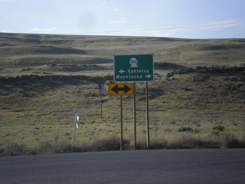
WA-261 North at WA-260
WA-261 North at WA-260 in Franklin County. Turn right for WA-260/WA-261 North to Washtucna; left for WA-261 South to Kahlotus. WA-260 joins WA-261 north to Washtucna.
Taken 04-29-2018
Washtucna
Franklin County
Washington
United States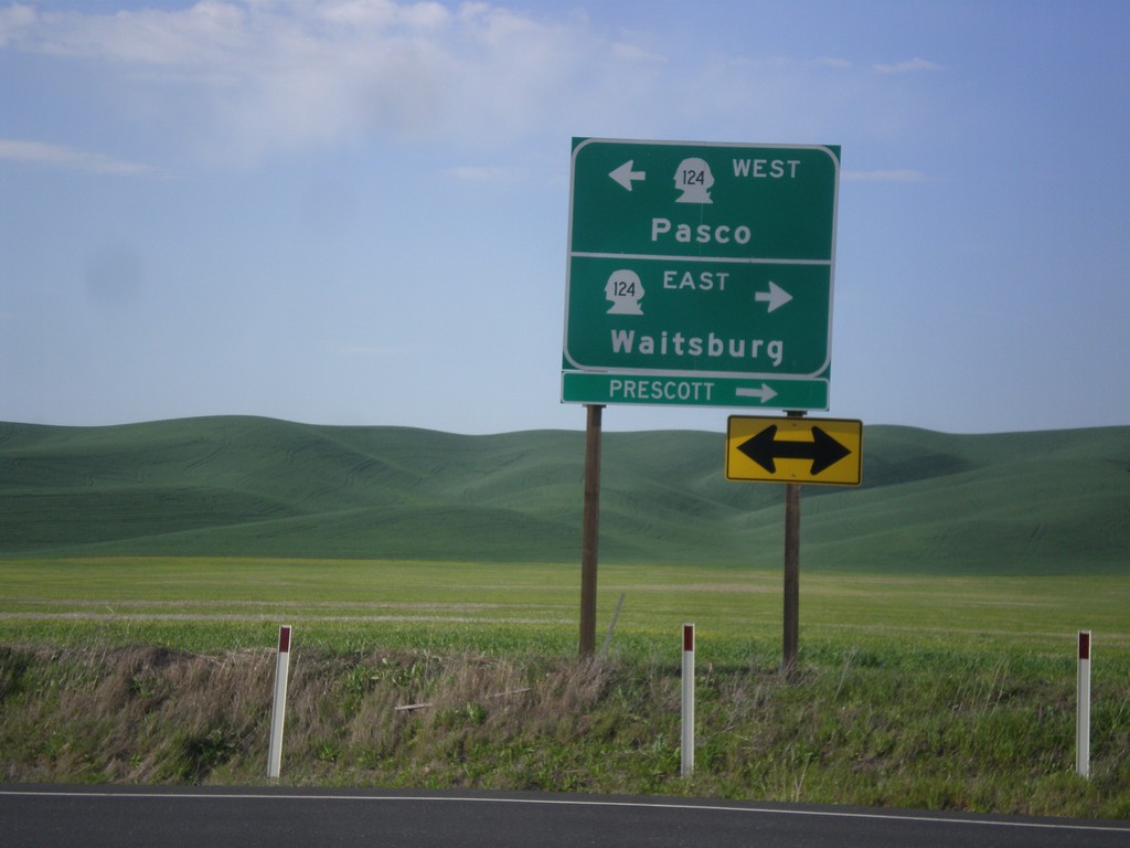
End WA-125 North at WA-124
End WA-125 North at WA-124. Turn right for WA-124 east to Waitsburg and Prescott. Turn left for WA-124 west to Pasco.
Taken 04-29-2018

 Prescott
Walla Walla County
Washington
United States
Prescott
Walla Walla County
Washington
United States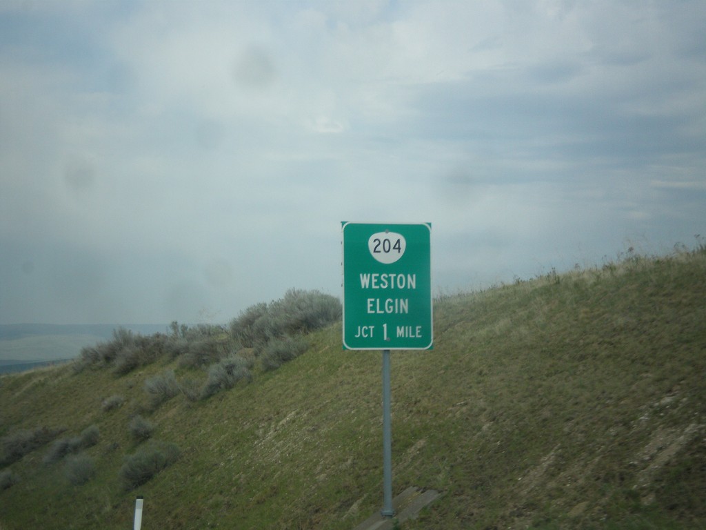
OR-11 North Approaching OR-204
OR-11 North Approaching OR-204 east to Weston and Elgin.
Taken 04-29-2018

 Weston
Umatilla County
Oregon
United States
Weston
Umatilla County
Oregon
United States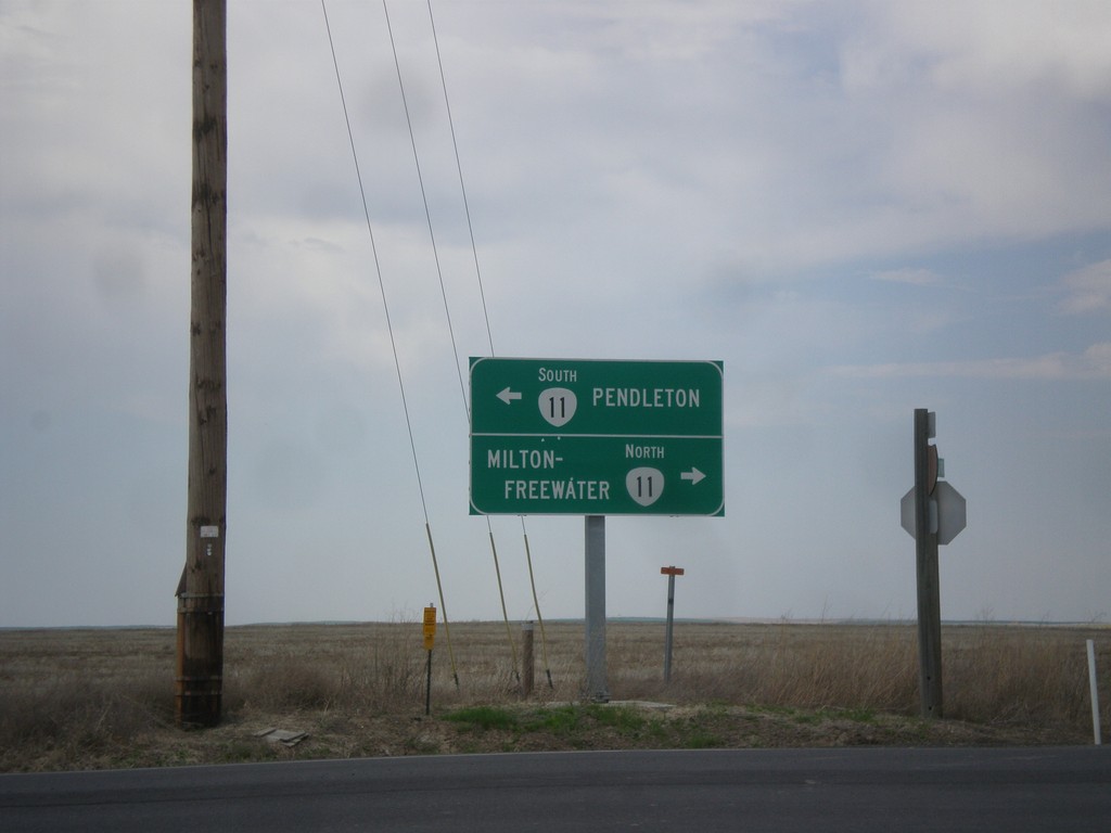
End OR-331 North at OR-11
End OR-331 North at OR-11 in Umatilla County. Turn right for OR-11 north to Milton-Freewater; turn left for OR-11 south to Pendleton.
Taken 04-29-2018
 Pendleton
Umatilla County
Oregon
United States
Pendleton
Umatilla County
Oregon
United States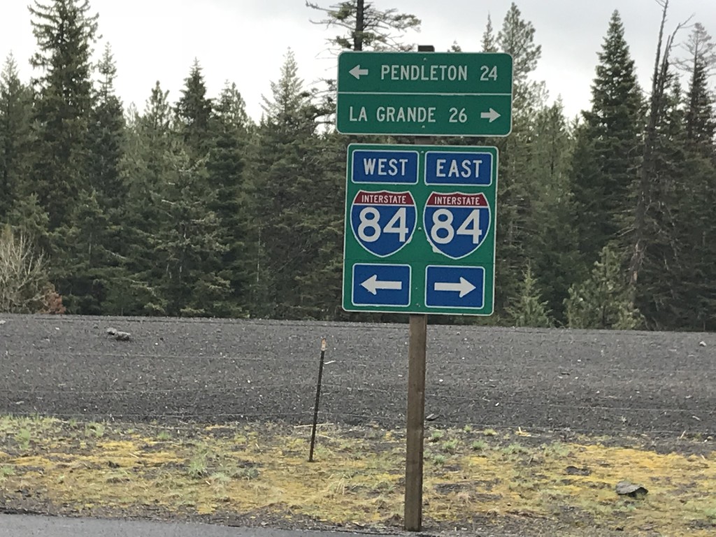
Emigrant Springs State Park Road at Frontage Road
Emigrant Springs State Park Road at Frontage Road. Turn right for access to I-84 east to La Grande; left for access to I-84 west to Pendleton.
Taken 04-29-2018
 Meacham
Umatilla County
Oregon
United States
Meacham
Umatilla County
Oregon
United States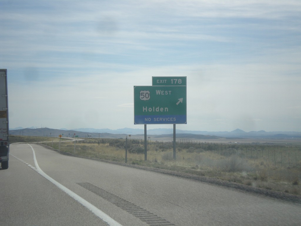
I-15 South - Exit 178
I-15 south at Exit 178 - US-50 West/Holden. US-50 west leaves I-15 southbound here. US-50 joins I-15 northbound to Scipio.
Taken 03-29-2018

 Holden
Millard County
Utah
United States
Holden
Millard County
Utah
United States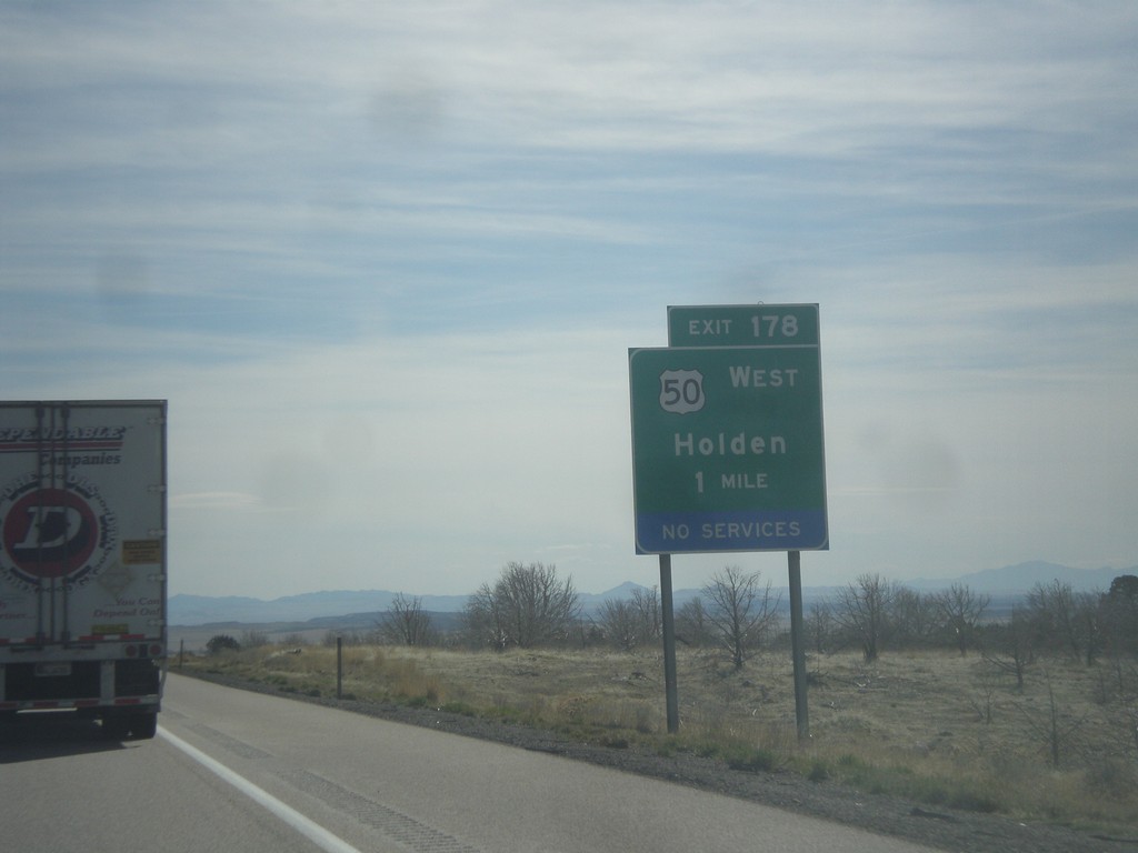
I-15 South - Exit 178
I-15 south approaching Exit 178 - US-50 West/Holden. US-50 leaves I-15 southbound here.
Taken 03-29-2018
Holden
Millard County
Utah
United States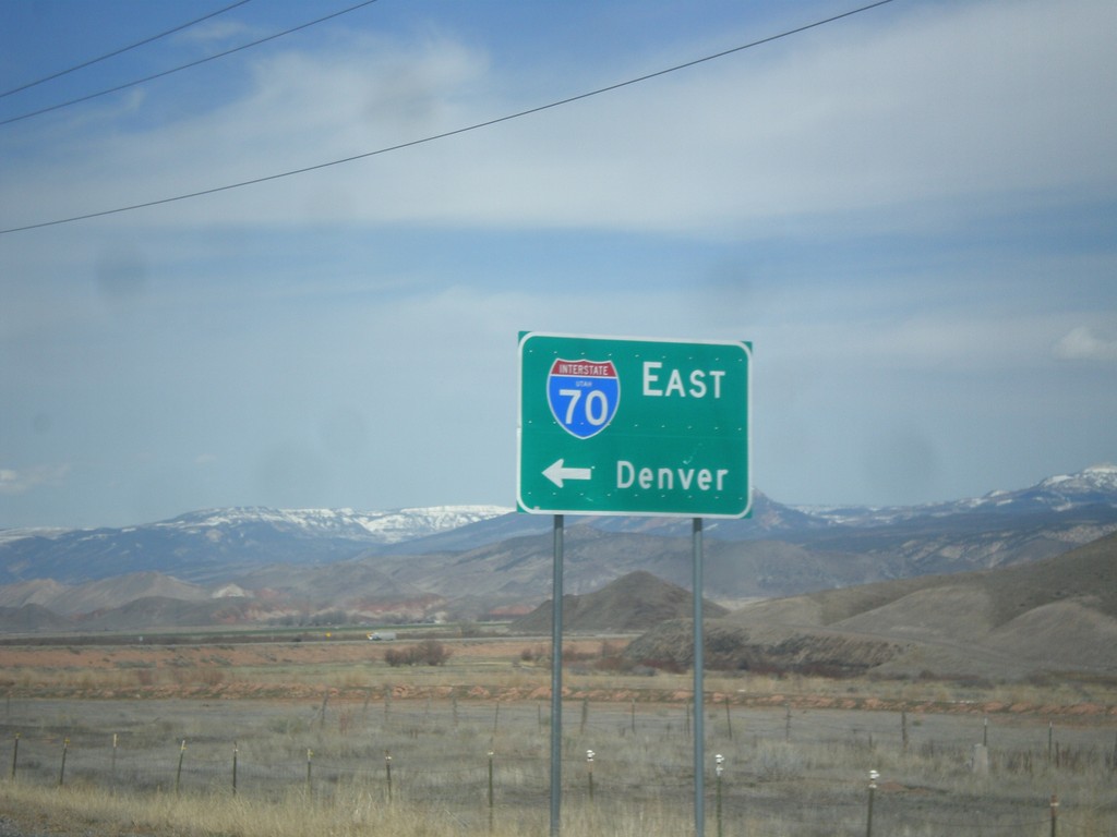
UT-24 West at I-70 (UT-259)
UT-24 west at I-70 east to Denver. There is a signed state highway, UT-259, that connects UT-24 to the I-70 ramps. This sign has been replaced in recent years to include the UTAH text in the I-70 shield.
Taken 03-29-2018


 Sigurd
Sevier County
Utah
United States
Sigurd
Sevier County
Utah
United States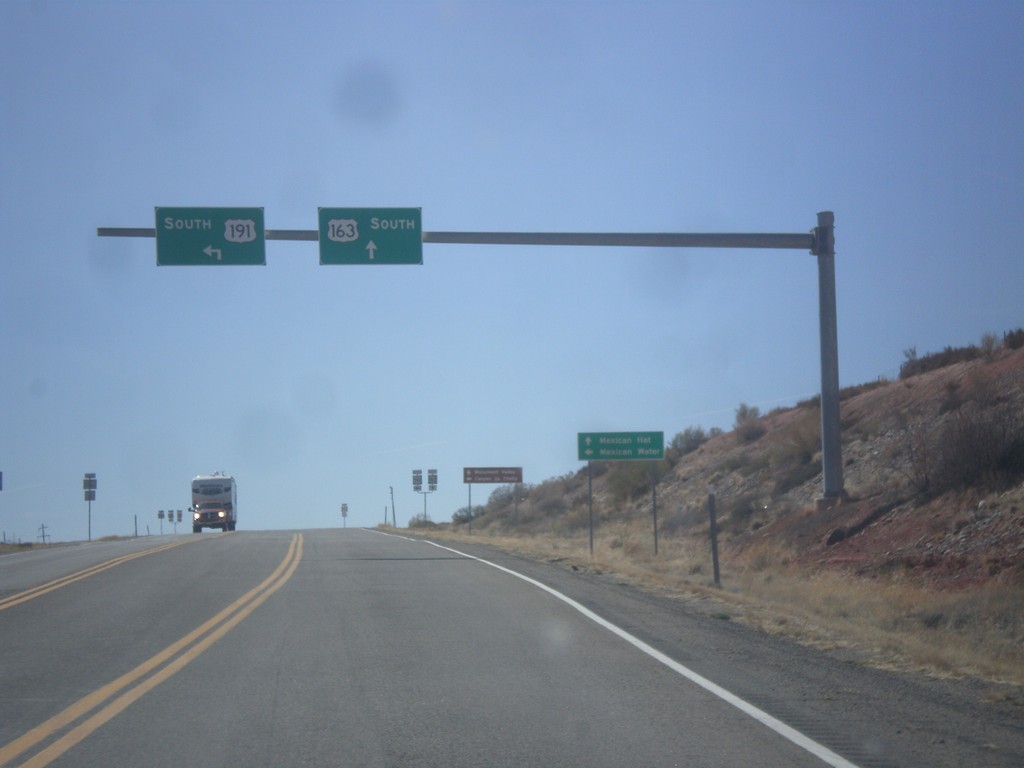
US-191 South at US-163
US-191 South at US-163 in San Juan County. Turn left to continue south on US-191 to Mexican Water (Arizona). Continue straight for US-163 west to Mexican Hat. This is the eastern end of US-163 west.
Taken 03-28-2018

 Bluff
San Juan County
Utah
United States
Bluff
San Juan County
Utah
United States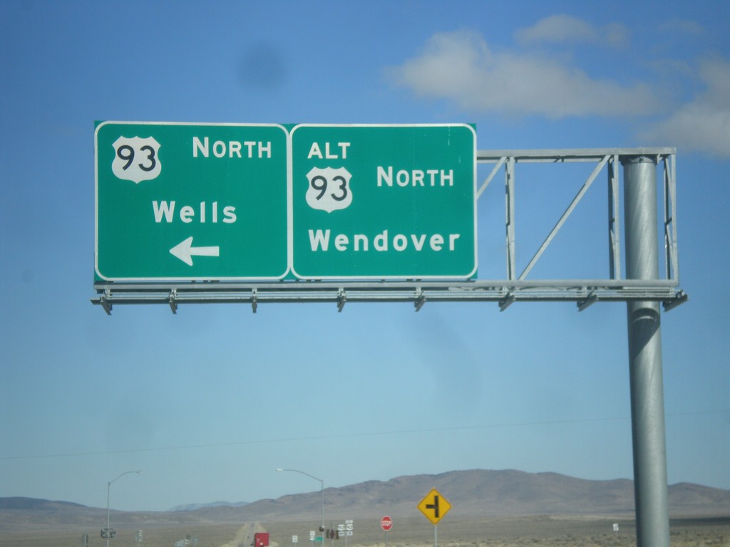
US-93 North at US-93 Alt. North
US-93 North at US-93 Alt. North. Continue straight for US-93 Alt. north to Wendover; turn left for US-93 north to Wells.
Taken 02-13-2018

 Ely
White Pine County
Nevada
United States
Ely
White Pine County
Nevada
United States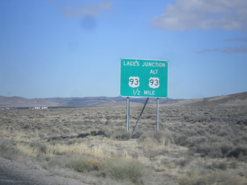
US-93 North Approaching Lages Junction
US-93 North approaching Lages Junction - US-93/Alt. US-93 Jct.
Taken 02-13-2018
Ely
White Pine County
Nevada
United States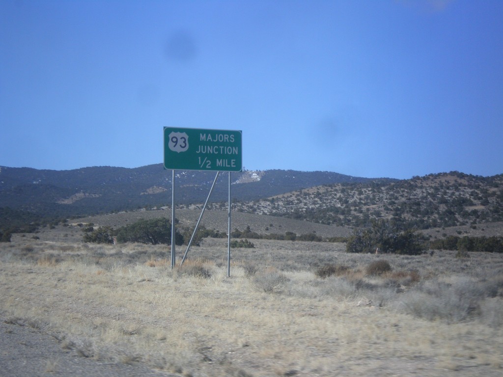
US-6/US-50 West Approaching US-93
US-6/US-50 West approaching US-93 - Majors Junction.
Taken 02-13-2018
 Ely
White Pine County
Nevada
United States
Ely
White Pine County
Nevada
United States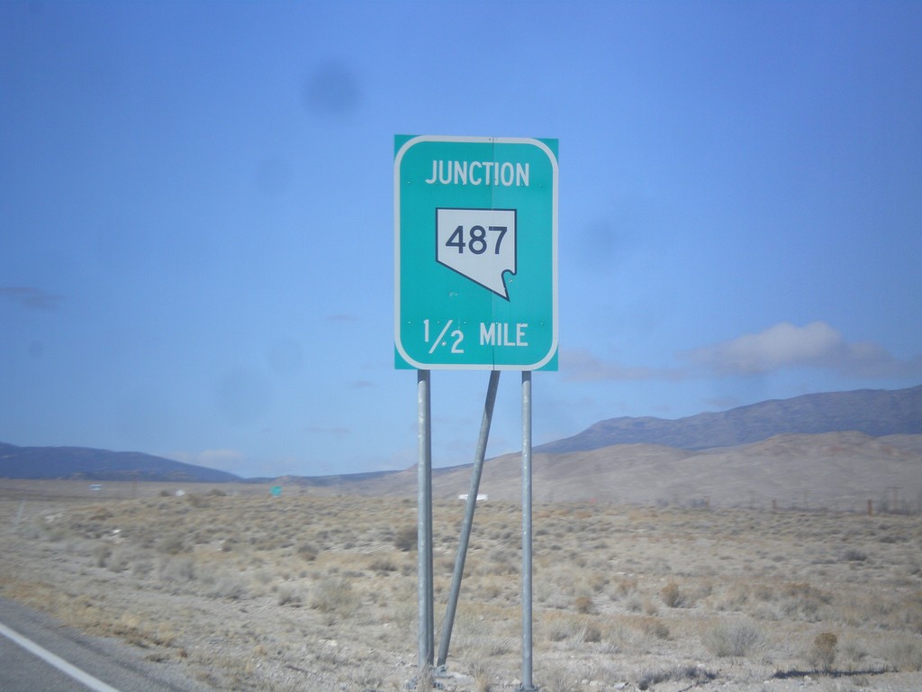
US-6/US-50 West Approaching NV-487
US-6/US-50 West approaching NV-487 in White Pine County.
Taken 02-13-2018
 Baker
White Pine County
Nevada
United States
Baker
White Pine County
Nevada
United States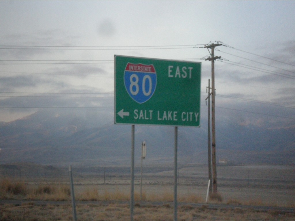
7200 South at I-80 East
7200 South at I-80 East to Salt Lake City.
Taken 02-13-2018
 Salt Lake City
Salt Lake County
Utah
United States
Salt Lake City
Salt Lake County
Utah
United States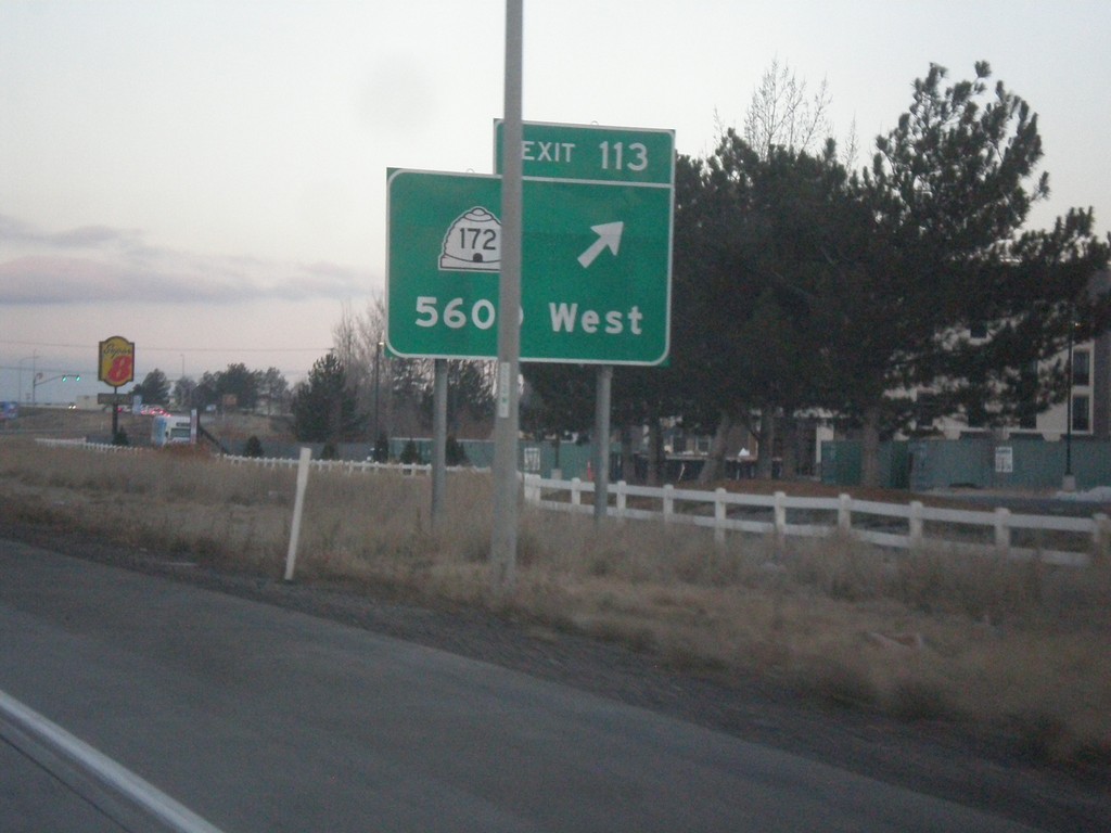
I-80 West - Exit 113
I-80 west at Exit 113 - UT-172/5600 West.
Taken 02-13-2018
 Salt Lake City
Salt Lake County
Utah
United States
Salt Lake City
Salt Lake County
Utah
United States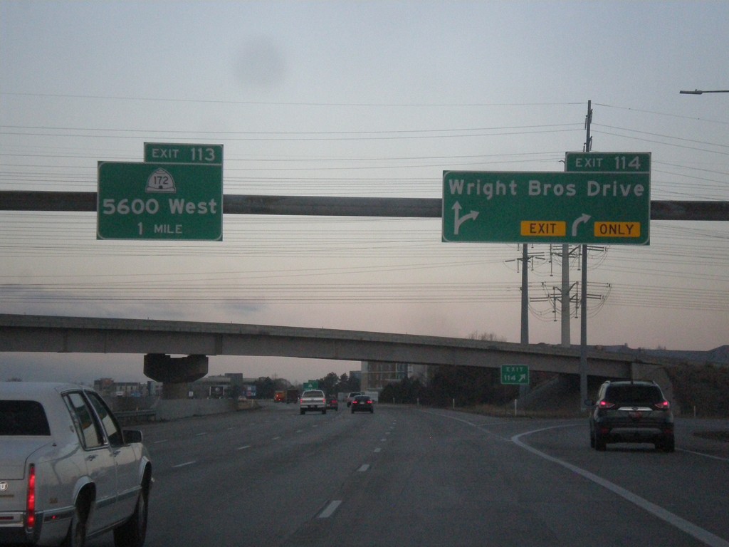
I-80 West - Exits 114 and 113
I-80 West at Exit 114 - Wright Brothers Drive and approaching Exit 113 - UT-172/5600 West.
Taken 02-13-2018
Salt Lake City
Salt Lake County
Utah
United States