Signs Tagged With Shield Inside Sign
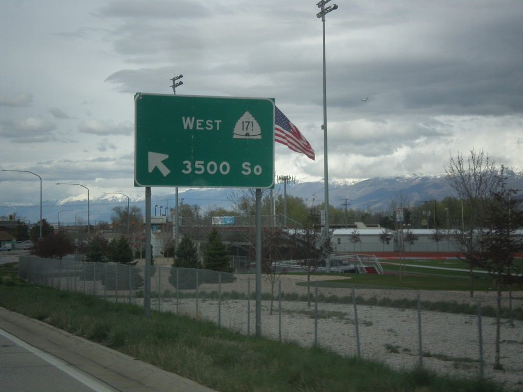
UT-154 North at UT-171 West
UT-154 North (Bangerter Highway) at UT-171 West/3500 South in West Valley City.
Taken 03-31-2017

 West Valley City
Salt Lake County
Utah
United States
West Valley City
Salt Lake County
Utah
United States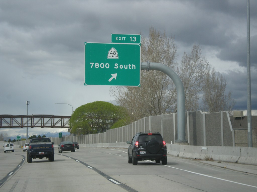
UT-154 North - Exit 13
UT-154 North (Bangerter Highway) at Exit 13 - UT-48/7800 South.
Taken 03-31-2017
 West Jordan
Salt Lake County
Utah
United States
West Jordan
Salt Lake County
Utah
United States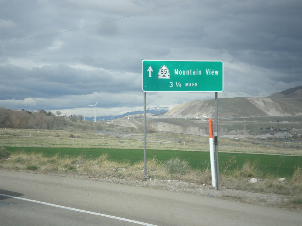
UT-68 North/UT-85 West - Mountain View
UT-68 North/UT-85 West - UT-85/Mountain View (Corridor) - 3.5 miles north.
Taken 03-31-2017

 Saratoga Springs
Utah County
Utah
United States
Saratoga Springs
Utah County
Utah
United States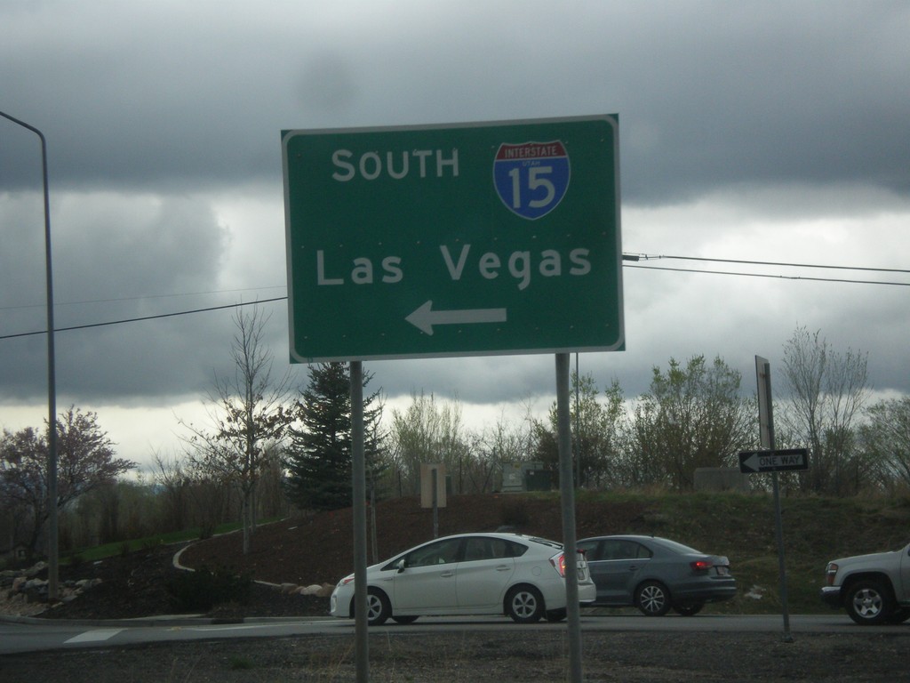
US-6 West at I-15 South (Exit 244)
US-6 West at I-15 South (Exit 244) in Santaquin. Use I-15 south for Las Vegas, NV.
Taken 03-31-2017

 Santaquin
Utah County
Utah
United States
Santaquin
Utah County
Utah
United States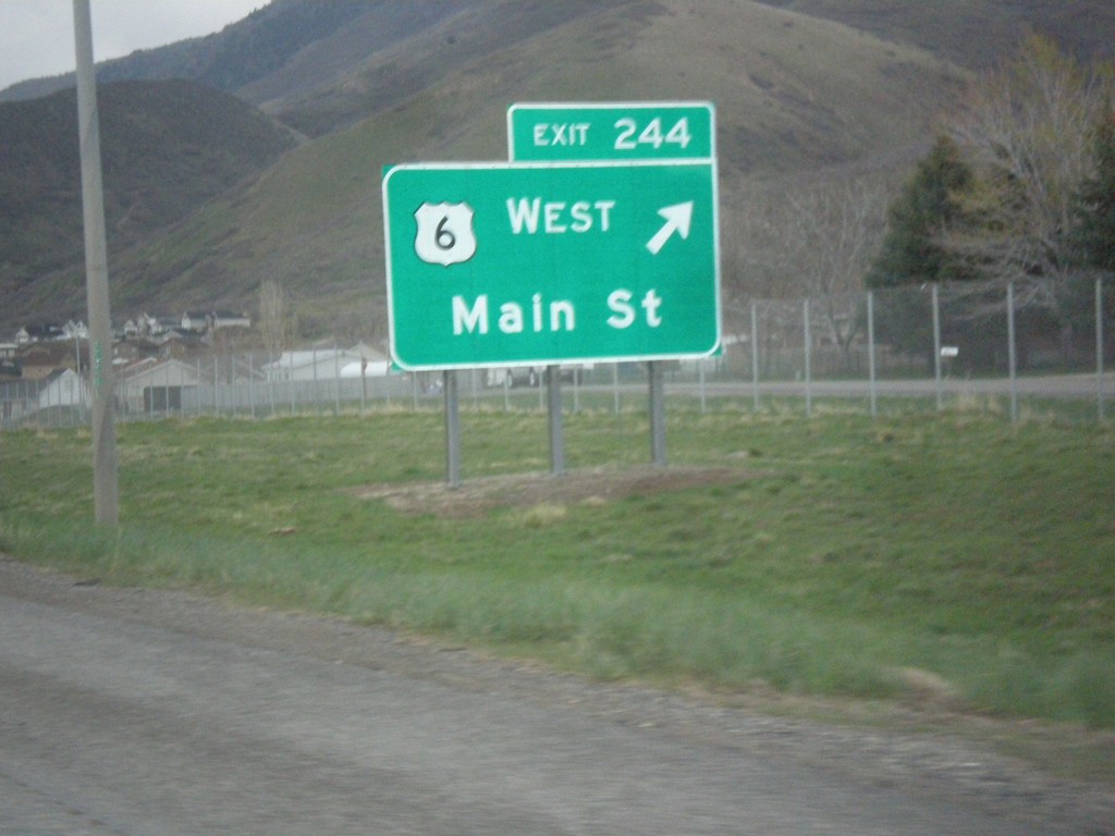
I-15 North - Exit 244
I-15 north at Exit 244 - US-6 West/Main St. US-6 joins I-15 northbound to Spanish Fork. This interchange used to be labeled US-6 West/Santaquin.
Taken 03-31-2017
Santaquin
Utah County
Utah
United States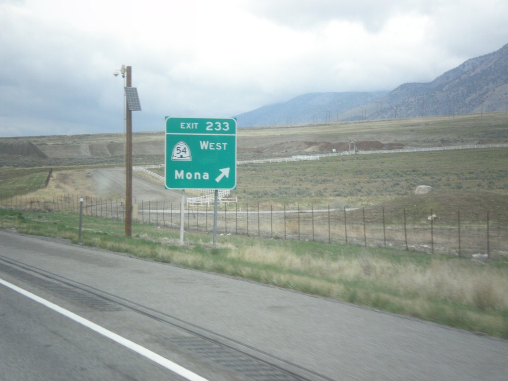
I-15 North - Exit 233
I-15 north at Exit 233 - UT-54 West/Mona.
Taken 03-31-2017
 Mona
Juab County
Utah
United States
Mona
Juab County
Utah
United States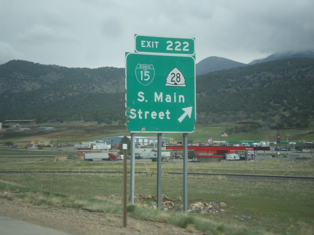
I-15 North - Exit 222
I-15 north at Exit 222 - BL-15/UT-28/S. Main St.
Taken 03-31-2017

 Nephi
Juab County
Utah
United States
Nephi
Juab County
Utah
United States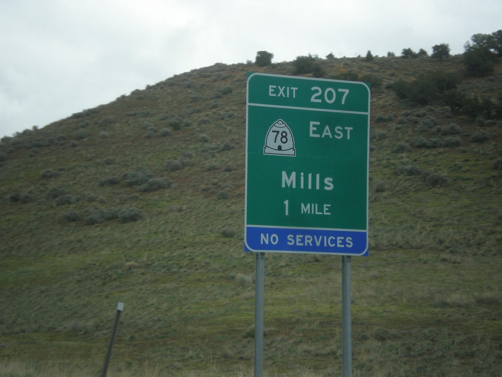
I-15 North - Exit 207
I-15 north approaching Exit 207 - UT-78 East/Mills.
Taken 03-31-2017
 Levan
Juab County
Utah
United States
Levan
Juab County
Utah
United States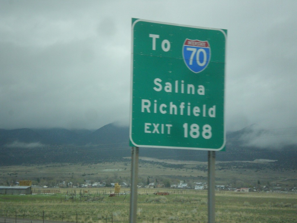
I-15 North - Use Exit 188 For I-70
I-15 North approaching Exit 188. Use Exit 188 For I-70 to Salina and Richfield, via US-50.
Taken 03-31-2017

 Scipio
Millard County
Utah
United States
Scipio
Millard County
Utah
United States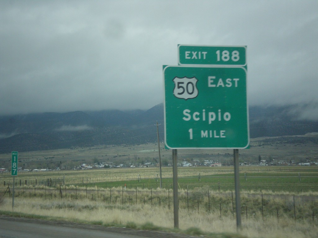
I-15 North - Exit 188
I-15 north at Exit 188 - US-50 East/Scipio. US-50 leaves I-15 north here.
Taken 03-31-2017
Scipio
Millard County
Utah
United States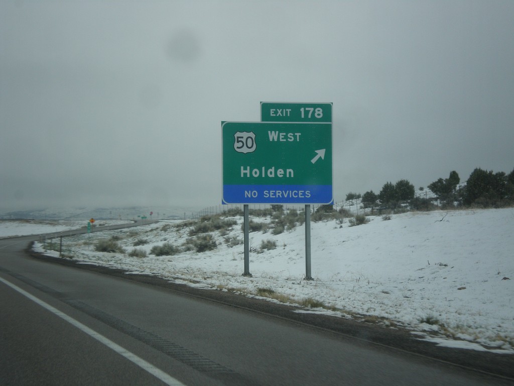
I-15 North - Exit 178
I-15 north at Exit 178 - US-50 West/Holden. US-50 joins I-15 northbound to Scipio.
Taken 03-31-2017
Holden
Millard County
Utah
United States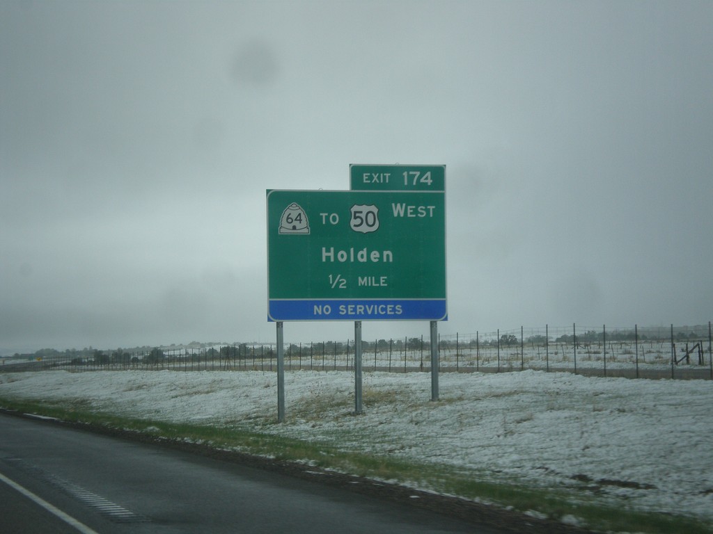
I-15 North - Exit 174
I-15 north approaching Exit 174 - UT-64/To US-50 West/Holden.
Taken 03-31-2017
 Fillmore
Millard County
Utah
United States
Fillmore
Millard County
Utah
United States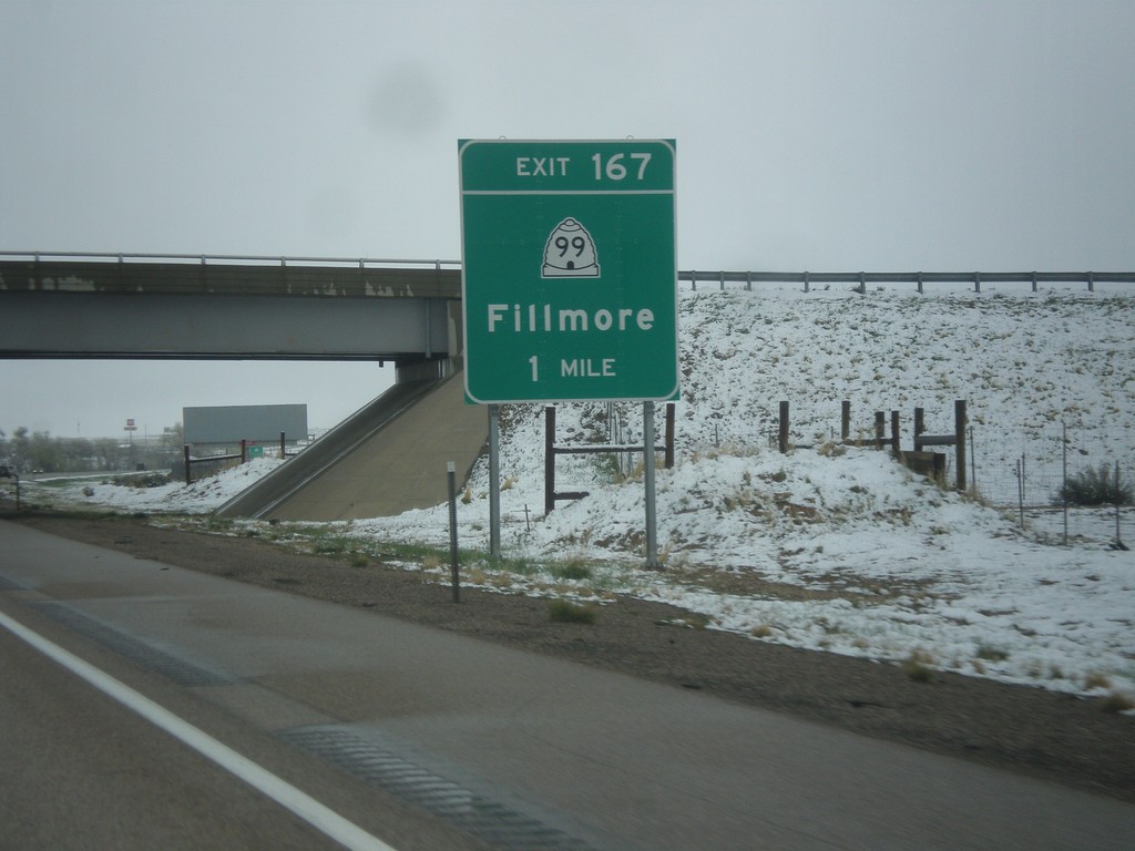
I-15 North - Exit 167
I-15 north approaching Exit 167 - UT-99/Fillmore. This is the northern end of the Fillmore business loop.
Taken 03-31-2017
 Fillmore
Millard County
Utah
United States
Fillmore
Millard County
Utah
United States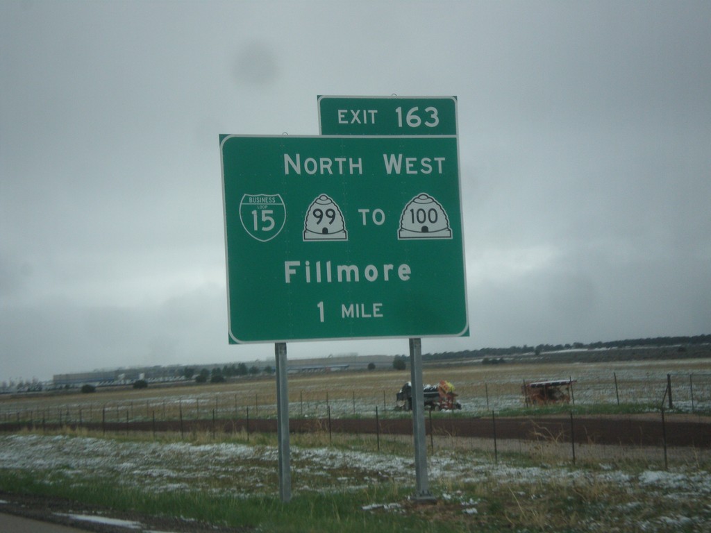
I-15 North - Exit 163
I-15 north approaching Exit 163 - BL-15/UT-99 North/To UT-100 West/Fillmore. Fillmore is the county seat of Millard County, and was the original territorial capital of Utah. This is the southern end of the Fillmore business loop.
Taken 03-31-2017
 Fillmore
Millard County
Utah
United States
Fillmore
Millard County
Utah
United States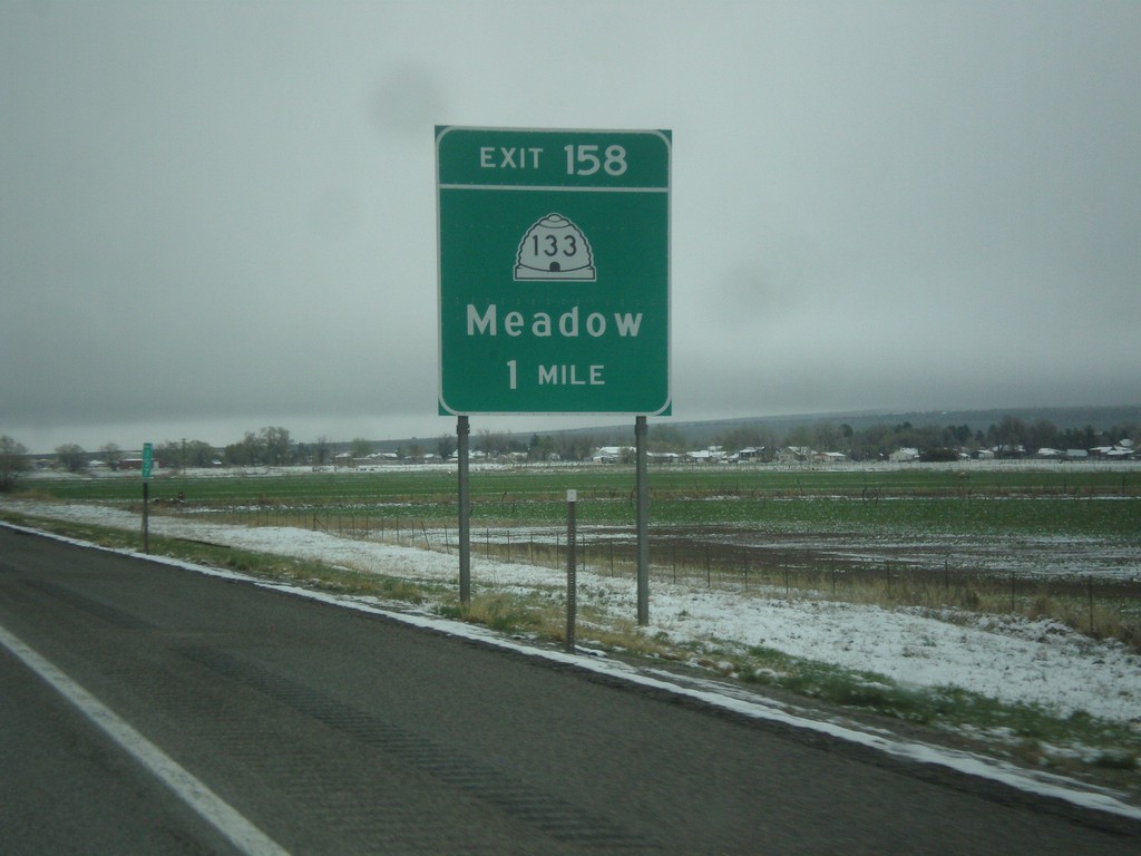
I-15 North - Exit 158
I-15 north approaching Exit 158 - UT-133/Meadow.
Taken 03-31-2017
 Meadow
Millard County
Utah
United States
Meadow
Millard County
Utah
United States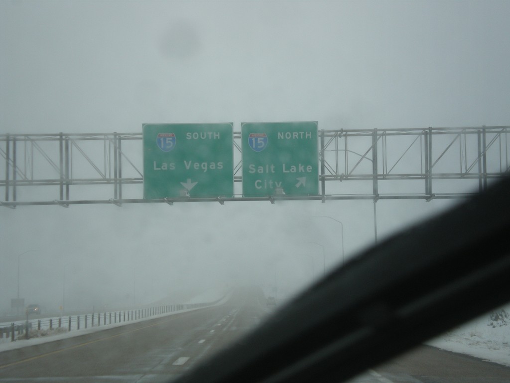
End I-70 West at I-15
End I-70 West at I-15. Use I-15 north for Salt Lake CIty; I-15 South for Las Vegas (Nevada).
Taken 03-31-2017
Sulphurdale
Beaver County
Utah
United States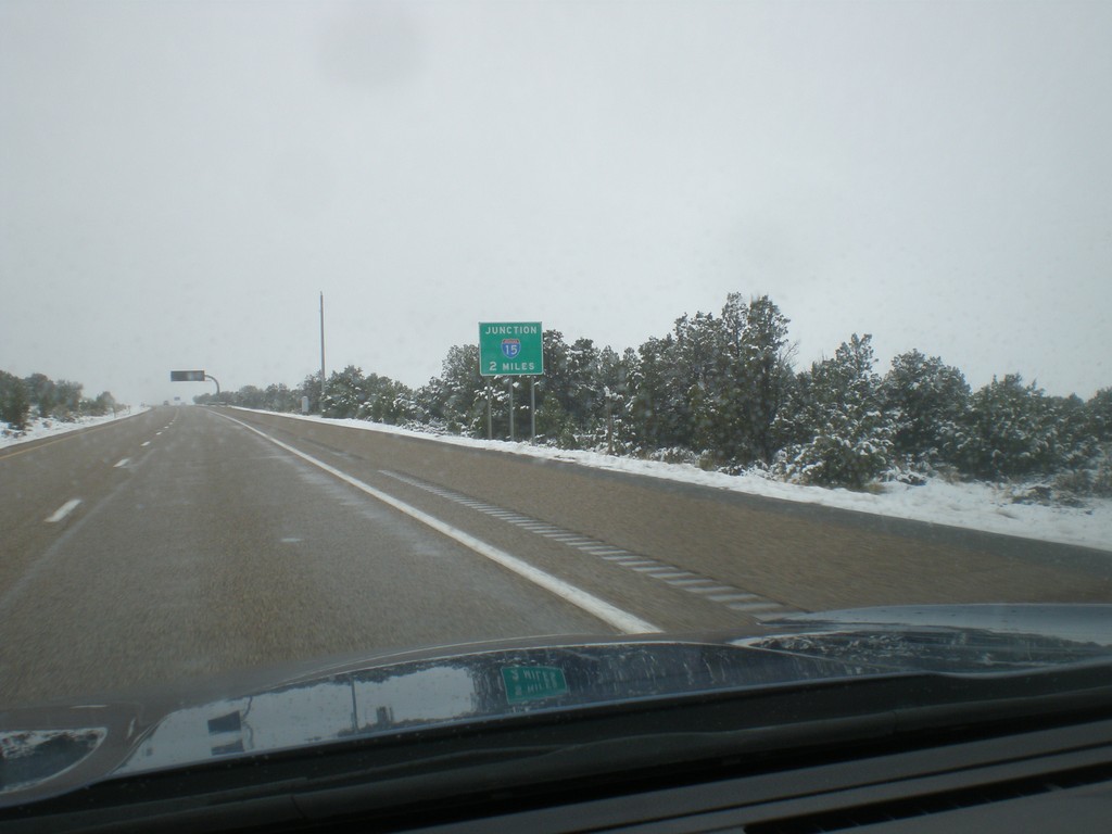
I-70 West Approaching I-15
I-70 West approaching I-15 in Millard County. This is the western end of I-70.
Taken 03-31-2017
Beaver
Millard County
Utah
United States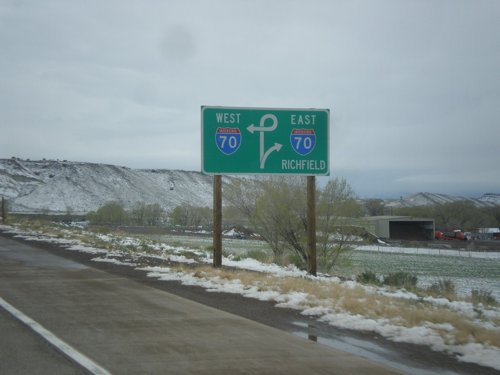
US-89 North Approaching I-70
US-89 North approaching I-70. Use I-70 east for Richfield.
Taken 03-31-2017
 Sevier
 County
Utah
United States
Sevier
Sevier County
Utah
United States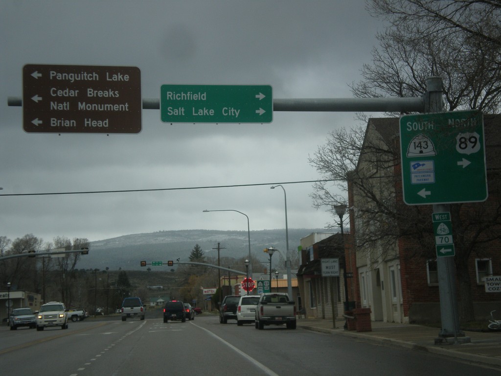
US-89 North at UT-143
US-89 north at UT-143 south. Turn left for UT-143 south to Cedar Breaks National Monument, Brian Head, and Panguitch Lake. Turn right to continue north on US-89 to Richfield and Salt Lake City. UT-143 is part of the Utah’s Patchwork Parkway National Scenic Byway.
Taken 03-31-2017
 Panguitch
Garfield County
Utah
United States
Panguitch
Garfield County
Utah
United States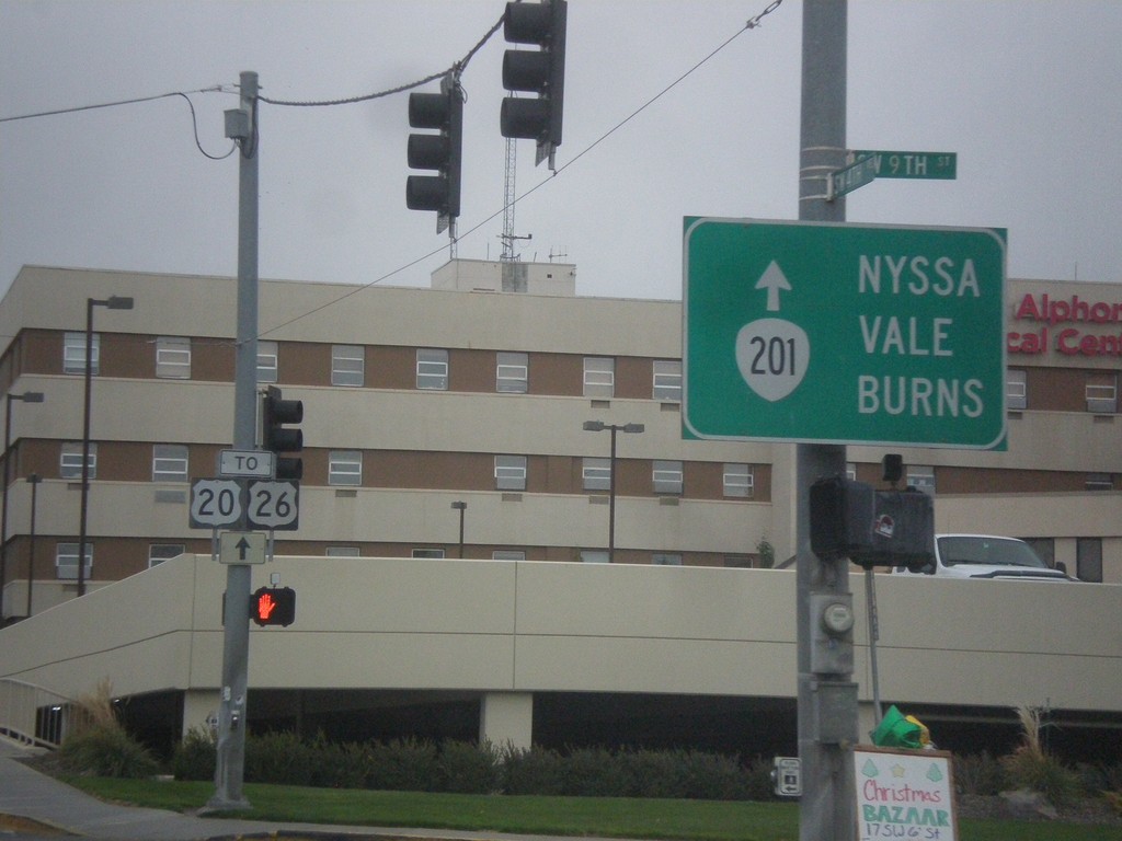
SW 4th Ave West - To OR-201/US-20/US-26
SW 4th Ave West in Ontario at 9th St. Continue west on 4th Ave. for To OR-201/US-20/US-26 to Nyssa, Vale, and Burns.
Taken 11-19-2016


 Ontario
Malheur County
Oregon
United States
Ontario
Malheur County
Oregon
United States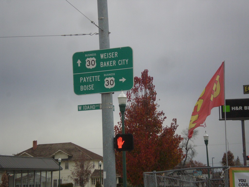
Oregon St. North at Idaho Ave. - Bus. US-30 Jct.
Oregon St. North at Idaho Ave. - Bus. US-30 Jct. in Ontario. Turn right on Bus. US-30 East for Payette (Idaho) and Boise (Idaho). Continue north on Oregon St. for Bus. US-30 West to Baker City and Weiser (Idaho).
Taken 11-19-2016
 Ontario
Malheur County
Oregon
United States
Ontario
Malheur County
Oregon
United States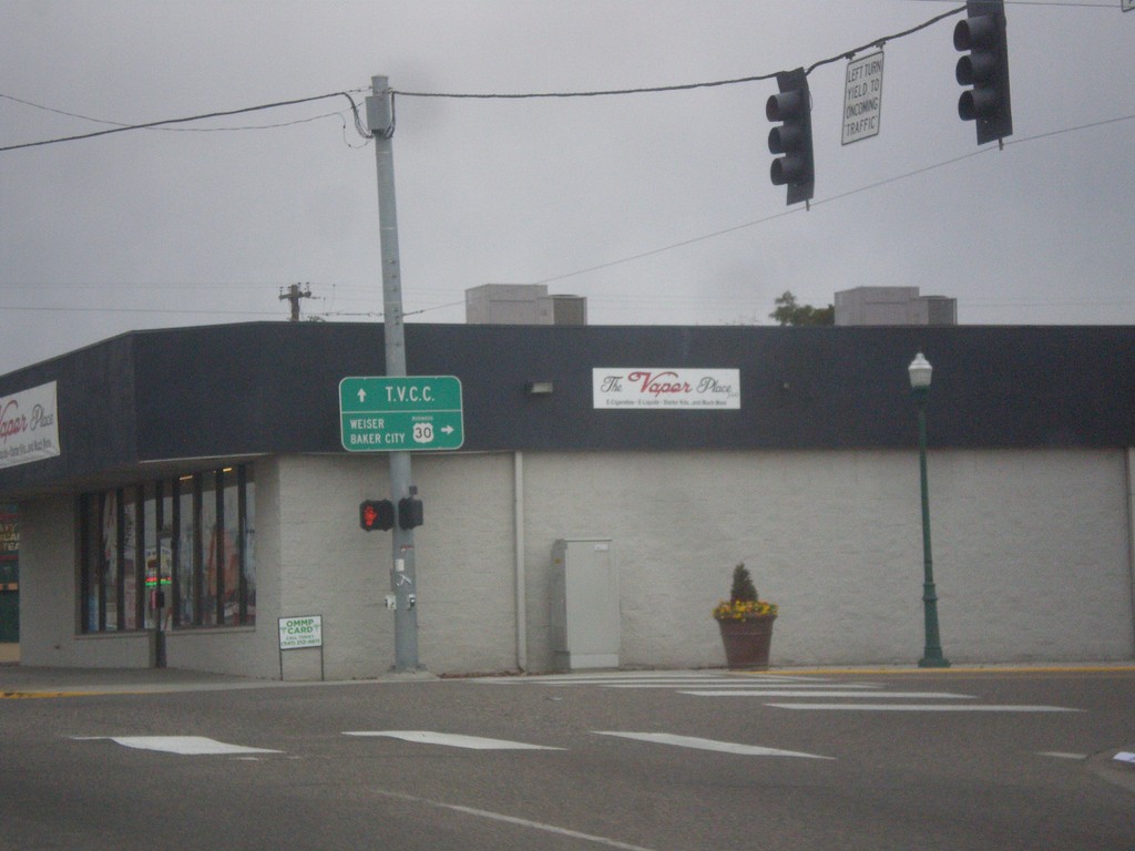
Bus. US-30 West (Idaho Ave.) at Oregon St.
Bus. US-30 West (Idaho Ave.) at Oregon St. in Ontario. Turn right to continue west on Bus. US-30 towards Weiser (Idaho) and Baker City. Continue straight on Idaho Ave. for Treasure Valley Community College.
Taken 11-19-2016
Ontario
Malheur County
Oregon
United States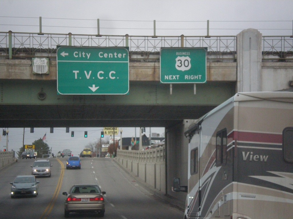
Bus. US-30 West - Ontario
Bus. US-30 West (Idaho Ave.) approaching Oregon St. in Ontario. Turn right on Oregon St. to continue west on Bus. US-30. Turn left on Oregon St. for (Ontario) City Center; continue west on Idaho St. for Treasure Valley Community College. Signs are attached to railroad overpass.
Taken 11-19-2016
Ontario
Malheur County
Oregon
United States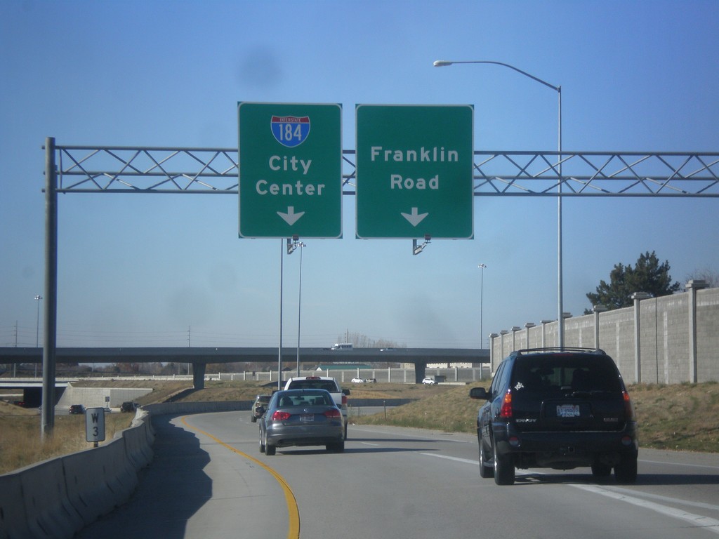
I-184 East / I-84 West Separation
I-184 East / I-84 West Separation. Use right lane for Franklin Road (Exit 1A) and left lane for I-184 East/City Center.
Taken 11-11-2016
 Boise
Ada County
Idaho
United States
Boise
Ada County
Idaho
United States
I-84 West - Nampa/Ontario
Overhead for I-84 West - Nampa/Ontario (Oregon) on I-84 just west of the I-84/I-184 junction.
Taken 11-11-2016

 Boise
Ada County
Idaho
United States
Boise
Ada County
Idaho
United States