Signs Tagged With Shield Inside Sign
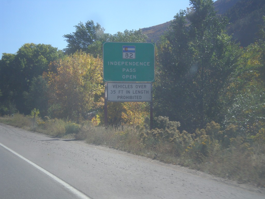
CO-82 East - Independence Pass Status
Independence Pass Status on CO-82 east leaving Glenwood Springs. Typically Independence Pass, just east of Aspen closes between November and May. Independence Pass is one of the highest highway passes in Colorado.
Taken 10-07-2016
 Glenwood Springs
Garfield County
Colorado
United States
Glenwood Springs
Garfield County
Colorado
United States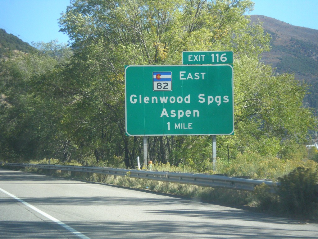
I-70 East - Exit 116
I-70 east approaching Exit 116 - CO-82 East/Glenwood Springs/Aspen.
Taken 10-07-2016

 Glenwood Springs
Garfield County
Colorado
United States
Glenwood Springs
Garfield County
Colorado
United States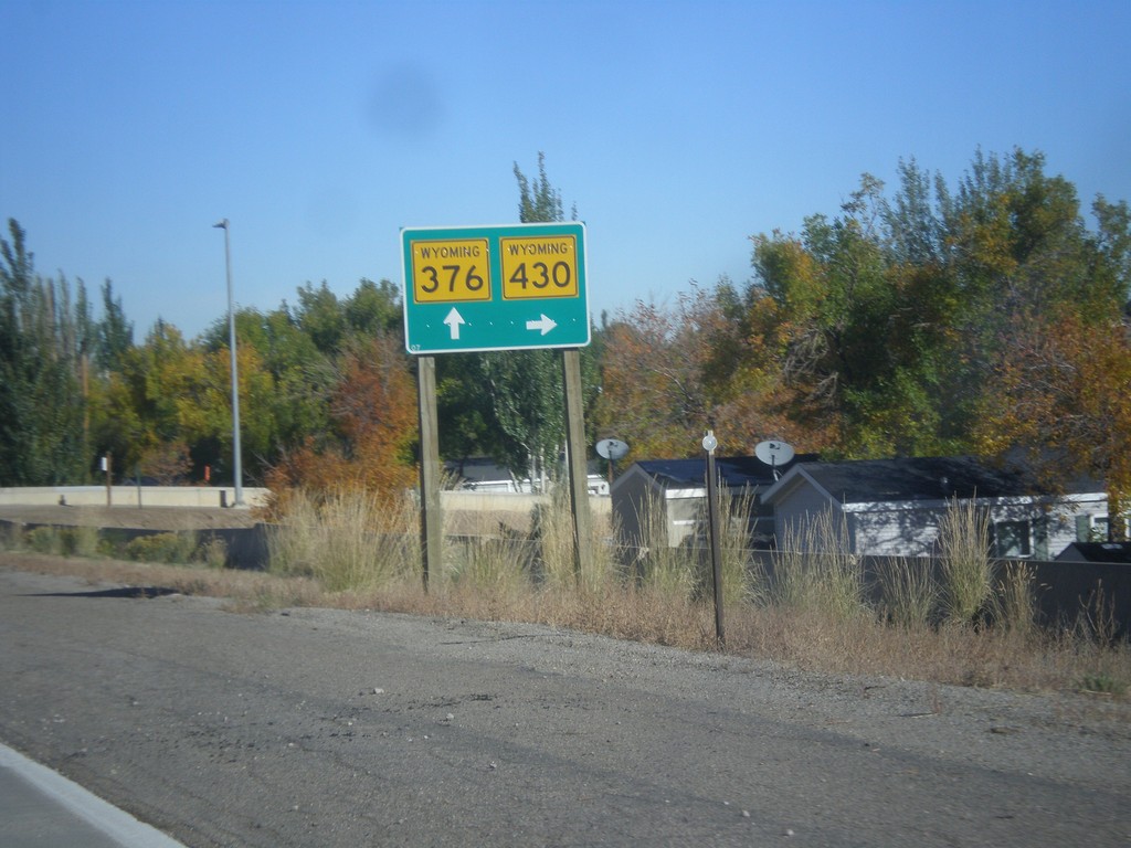
WY-376 East at WY-430 South
WY-376 East (South Side Belt Route) at WY-430 South.
Taken 10-07-2016

 Rock Springs
Sweetwater County
Wyoming
United States
Rock Springs
Sweetwater County
Wyoming
United States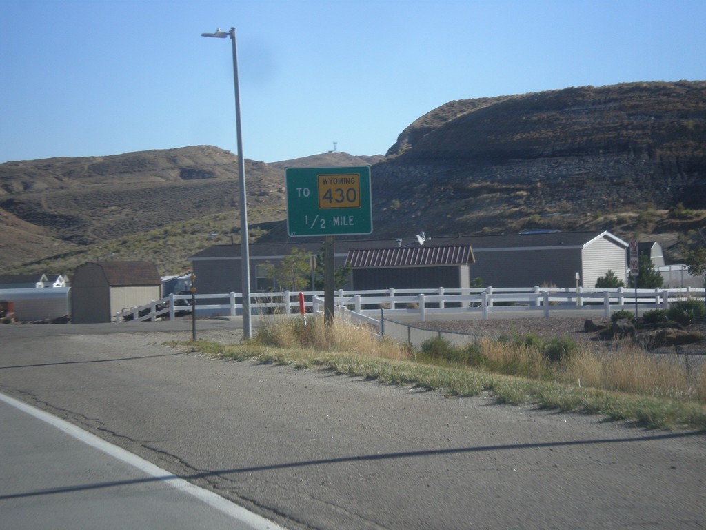
WY-376 East Approaching WY-430
WY-376 East (South Side Belt Route) approaching WY-430 south.
Taken 10-07-2016
Rock Springs
Sweetwater County
Wyoming
United States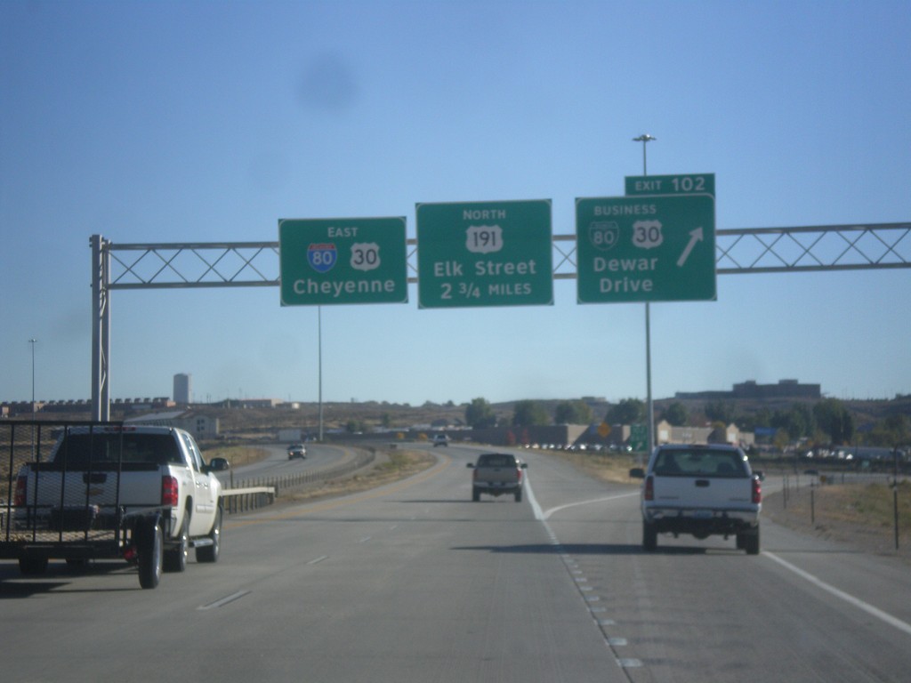
I-80 East - Exits 102 and 104
I-80 East at Exit 102 - BL-80/Bus. US-30/Dewar Drive. Next exit is College Drive which is unsigned on this assembly. The exit after that is Exit 104 - US-191 North/Elk St. I-80/US-30 continues east towards Cheyenne.
Taken 10-07-2016


 Rock Springs
Sweetwater County
Wyoming
United States
Rock Springs
Sweetwater County
Wyoming
United States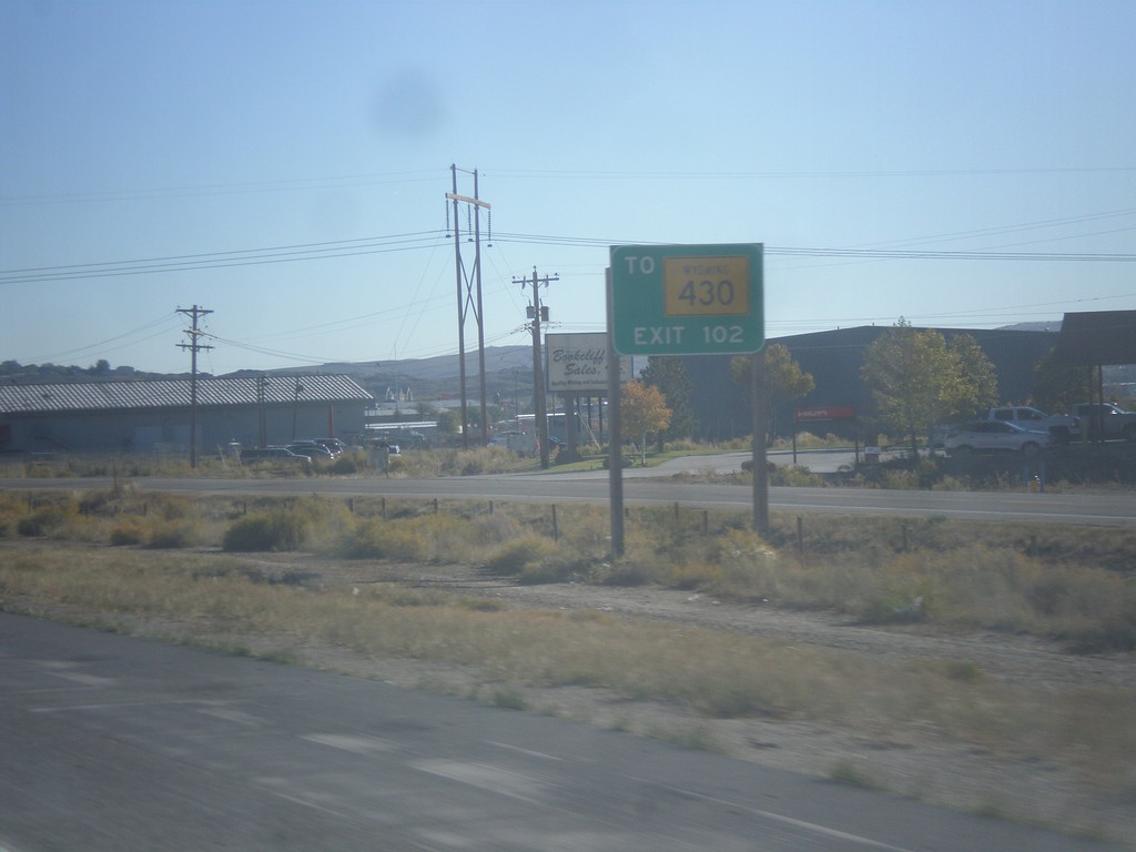
I-80 East Approaching Exit 102
I-80 east approaching Exit 102. Use Exit 102 for WY-430 south.
Taken 10-07-2016
Rock Springs
Sweetwater County
Wyoming
United States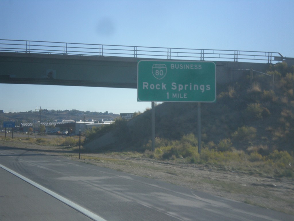
I-80 East - Exit 102
I-80 east approaching Exit 102 - BL-80/Rock Springs.
Taken 10-07-2016
Rock Springs
Sweetwater County
Wyoming
United States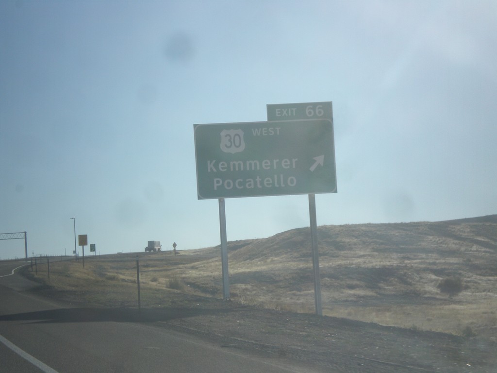
I-80 East - Exit 66
I-80 East at Exit 66 - US-30 West/Kemmerer/Pocatello. US-30 joins I-80 eastbound to just east of Rawlins.
Taken 10-07-2016
Little America
Sweetwater County
Wyoming
United States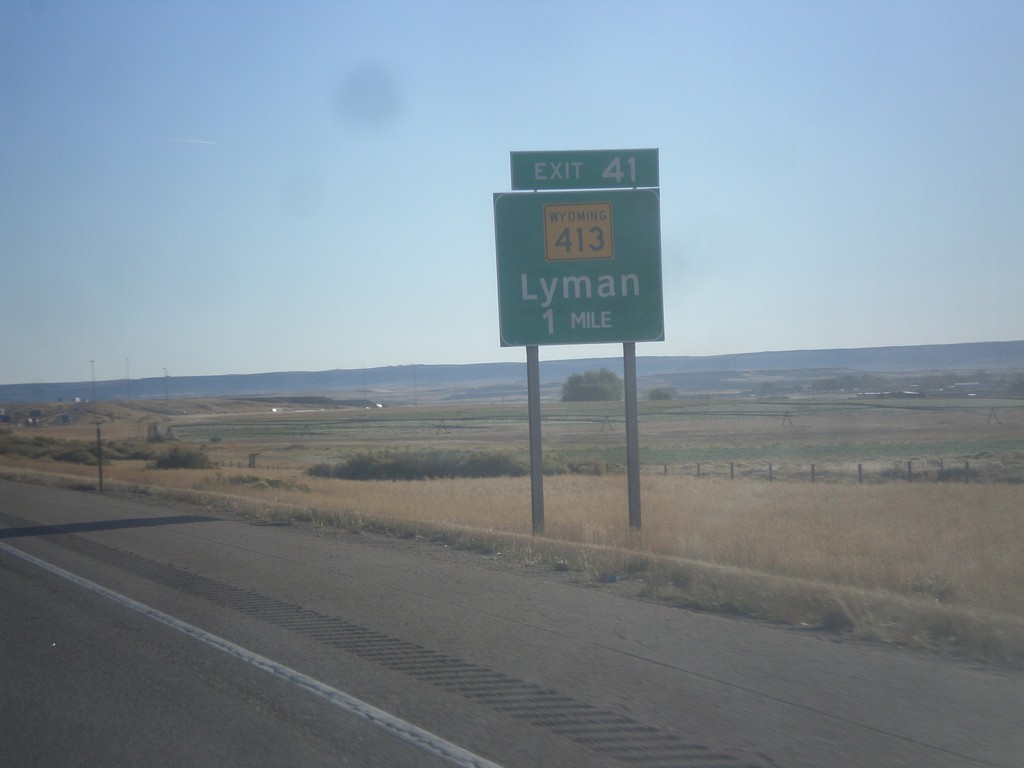
I-80 East - Exit 41
I-80 east approaching Exit 41 - WY-413/Lyman.
Taken 10-07-2016
 Lyman
Uinta County
Wyoming
United States
Lyman
Uinta County
Wyoming
United States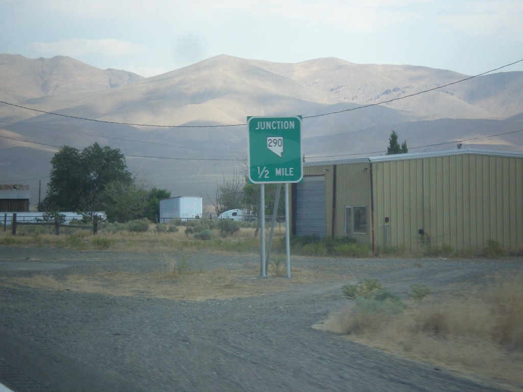
US-95 North Approaching NV-290
US-95 north approaching NV-290 to Paradise Valley.
Taken 08-16-2016

 Winnemucca
Humboldt County
Nevada
United States
Winnemucca
Humboldt County
Nevada
United States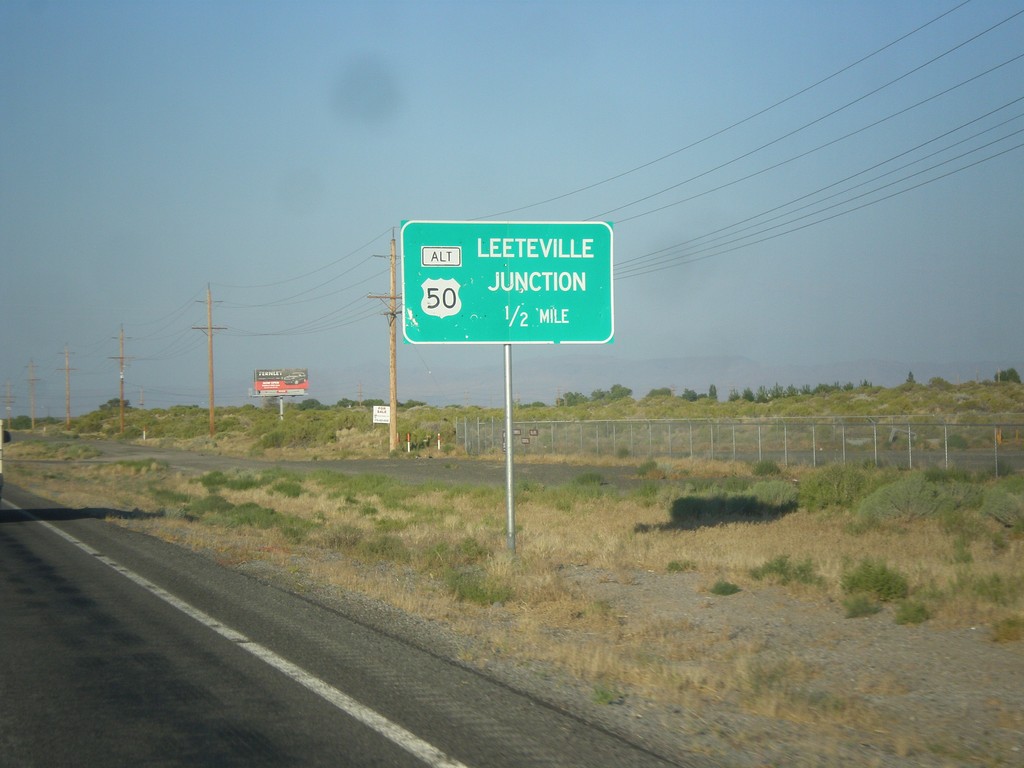
US-50 East Approaching Leeteville Junction
US-50 East Approaching Leeteville Junction (US-50 Alt. Junction). Many intersections in rural Nevada are referred to by name.
Taken 08-15-2016

 Fallon
Churchill County
Nevada
United States
Fallon
Churchill County
Nevada
United States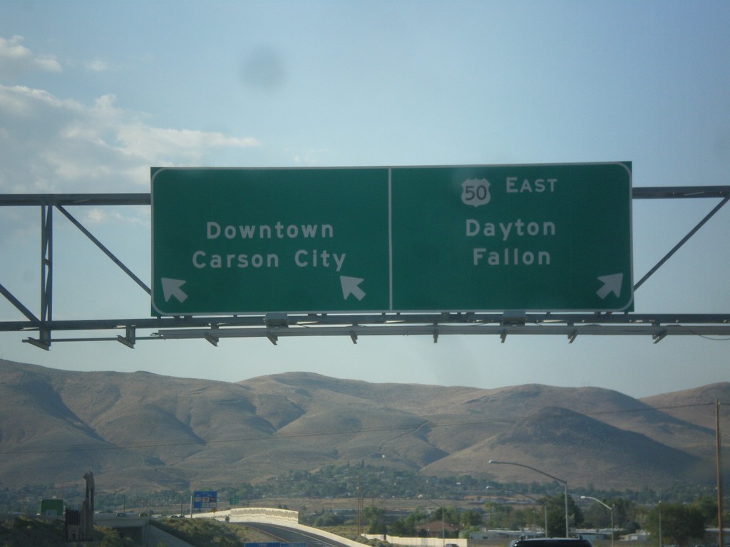
US-395 North/US-50 East on Exit 39 Offramp
US-395 North/US-50 East on Exit 39 Offramp. Use left lane for Carson City Downtown; left lane for US-50 east to Dayton and Fallon.
Taken 08-15-2016

 Carson City
Nevada
United States
Carson City
Nevada
United States
US-50 East Approaching US-395
US-50 East approaching US-395 in Carson City.
Taken 08-15-2016
Carson City
Nevada
United States
US-50 East Approaching NV-28
US-50 East approaching NV-28 in Douglas County. NV-28 loops around the northeast side of Lake Tahoe.
Taken 08-15-2016
 Glenbrook
Douglas County
Nevada
United States
Glenbrook
Douglas County
Nevada
United States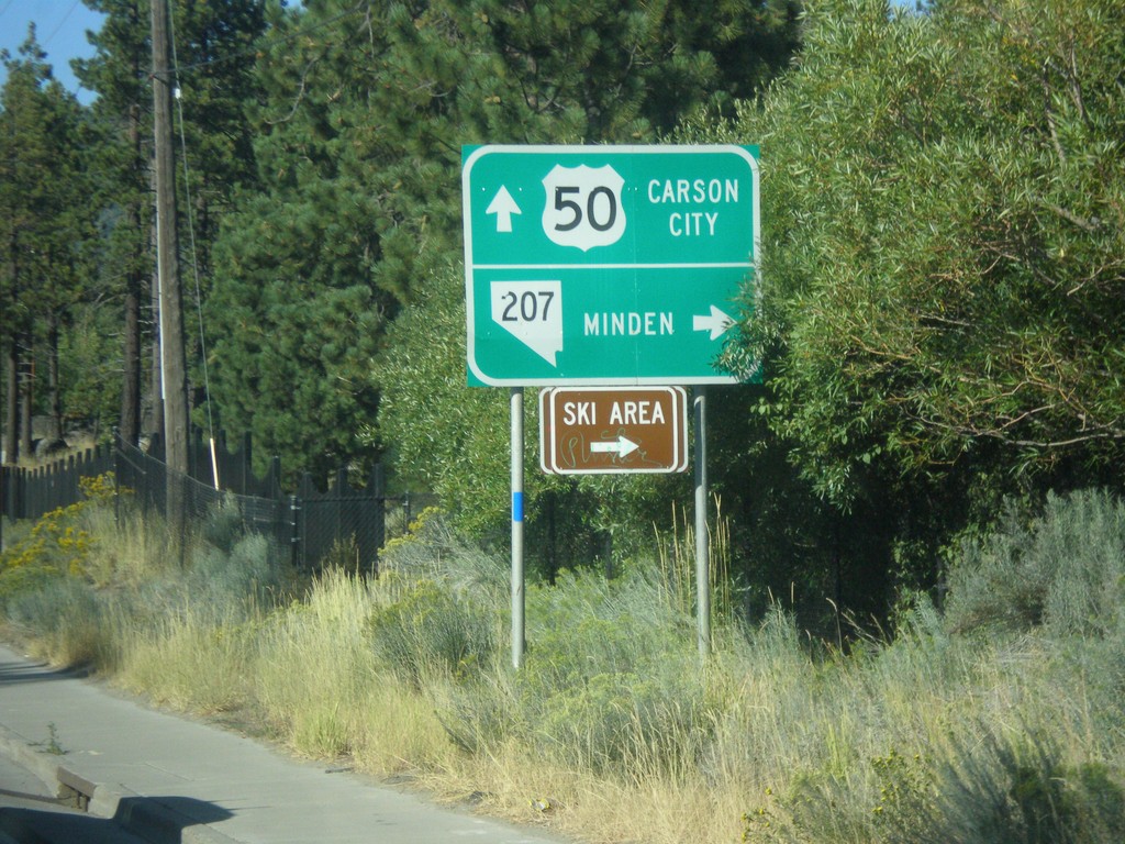
US-50 East at NV-207 East
US-50 East at NV-207 East to Minden and (Heavenly Valley) Ski Area. Continue east on US-50 for Carson City.
Taken 08-15-2016
 Stateline
Douglas County
Nevada
United States
Stateline
Douglas County
Nevada
United States
US-50 East Approaching NV-207
US-50 East approaching NV-207 (Kingsbury Grade).
Taken 08-15-2016
Stateline
Douglas County
Nevada
United States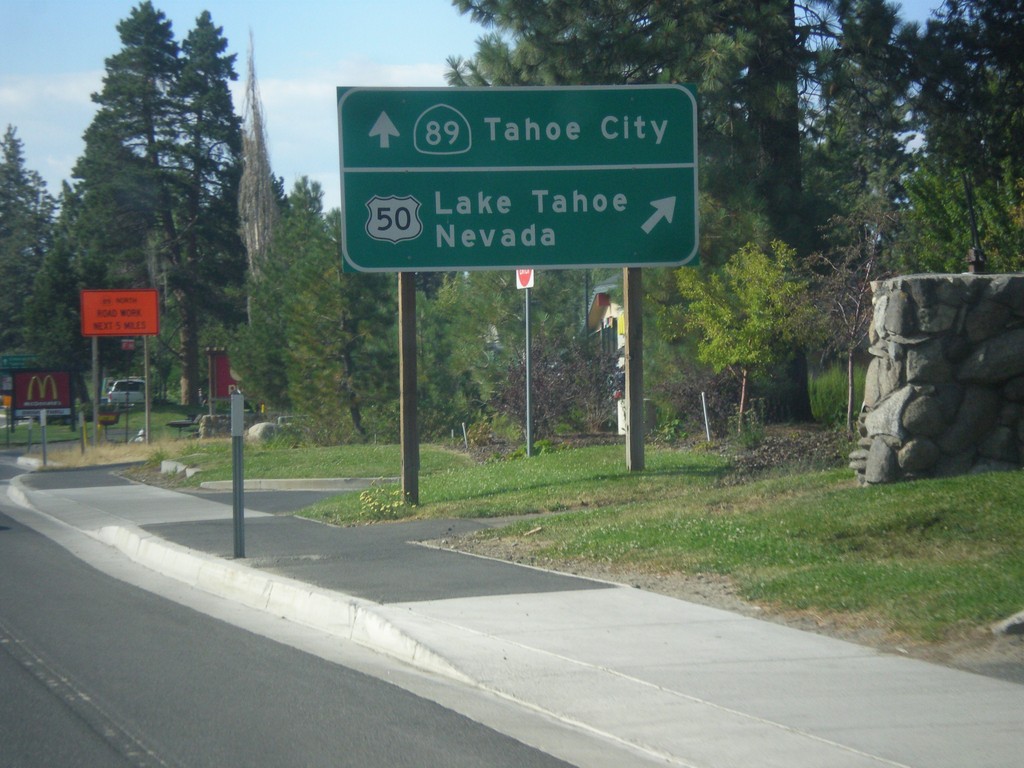
US-50 East/CA-89 North Approaching Split
US-50 East/CA-89 North Approaching US-50/CA-89 split. Merge right for US-50 east to Lake Tahoe Nevada; continue straight for CA-89 north to Tahoe City.
Taken 08-15-2016
 South Lake Tahoe
El Dorado County
California
United States
South Lake Tahoe
El Dorado County
California
United States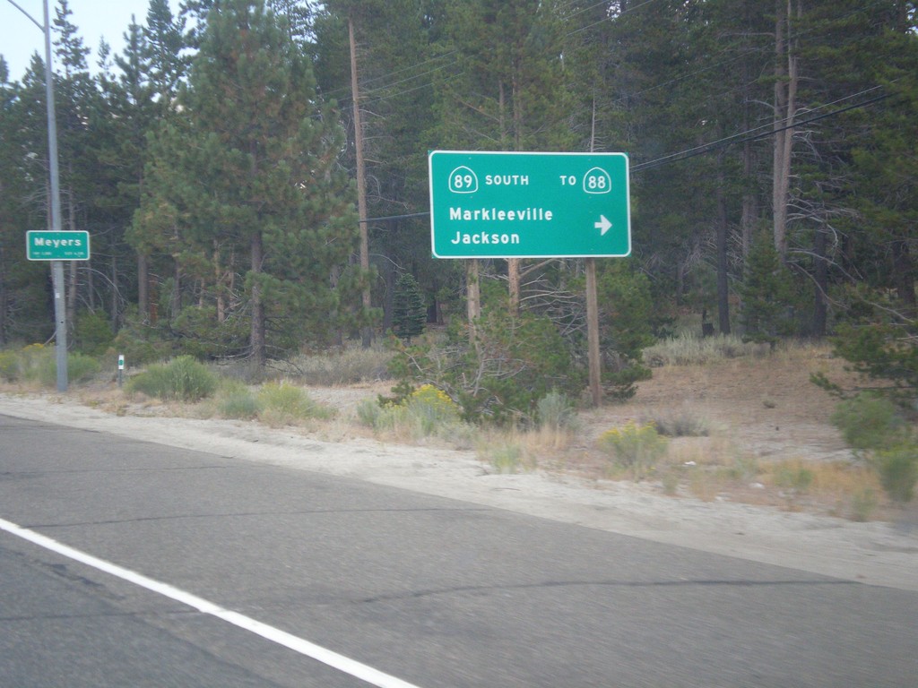
US-50 East At CA-89 South
US-50 east at CA-89 south/Markleeville/Jackson to CA-88. CA-89 north joins US-50 east to South Lake Tahoe. Entering Meyers.
Taken 08-15-2016
 South Lake Tahoe
El Dorado County
California
United States
South Lake Tahoe
El Dorado County
California
United States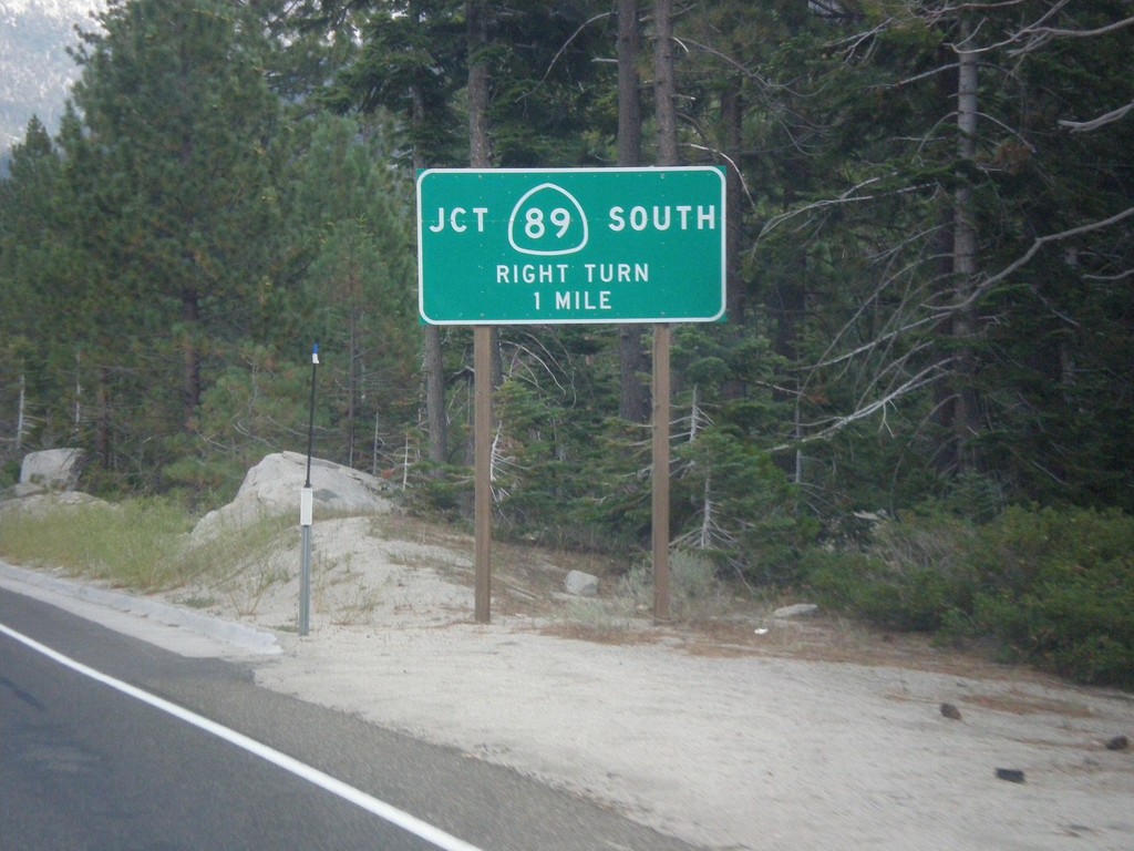
US-50 East at CA-89
US-50 east at CA-89. Turn right for CA-89 south. CA-89 north joins US-50 eastbound to South Lake Tahoe.
Taken 08-15-2016
South Lake Tahoe
El Dorado County
California
United States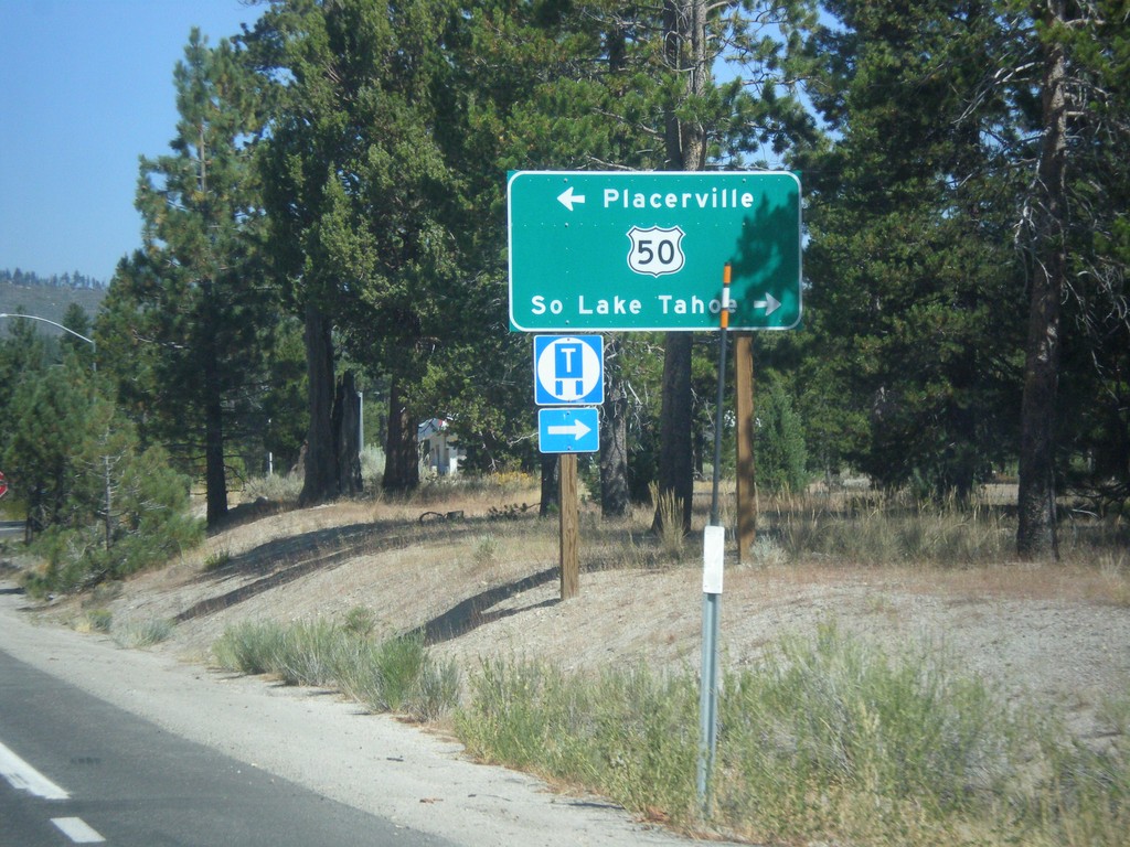
CA-89 North at US-50
CA-89 North at US-50 in Meyers. Turn left on US-50 west for Placerville; right for US-50 East/CA-89 North to South Lake Tahoe.
Taken 08-12-2016
South Lake Tahoe
El Dorado County
California
United States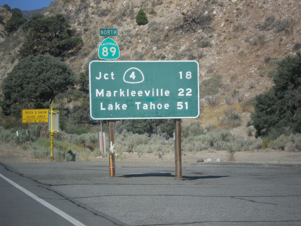
CA-89 North - Distance Marker
First distance marker on CA-89 north. Distance to CA-4 Jct., Markleeville, and Lake Tahoe.
Taken 08-12-2016
 Coleville
Mono County
California
United States
Coleville
Mono County
California
United States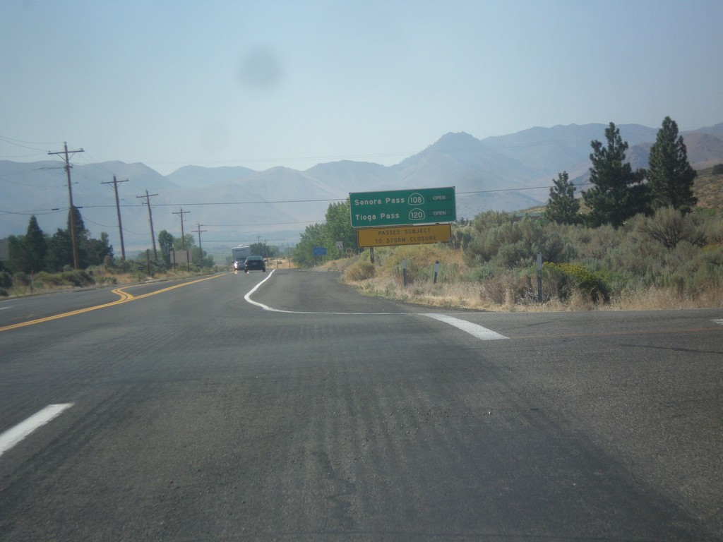
US-395 South - Sierra Pass Information
Sierra pass closure information on US-395 south. Information for Sonora Pass (CA-108) and Tioga Pass (CA-120). At the time this photo was taken both passes were open.
Taken 08-12-2016

 Coleville
Mono County
California
United States
Coleville
Mono County
California
United States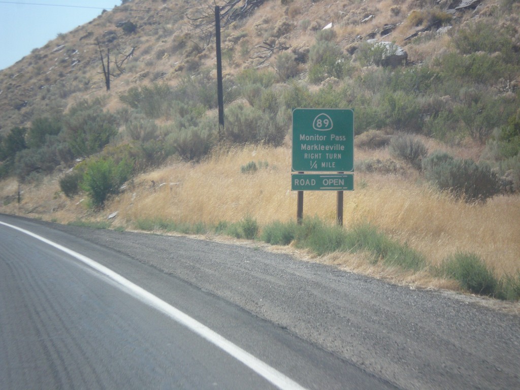
US-395 South at CA-89
US-395 south at CA-89 North to Markleeville and Monitor Pass. Monitor Pass was open when this was taken. This is the southern end of CA-89.
Taken 08-12-2016
Coleville
Mono County
California
United States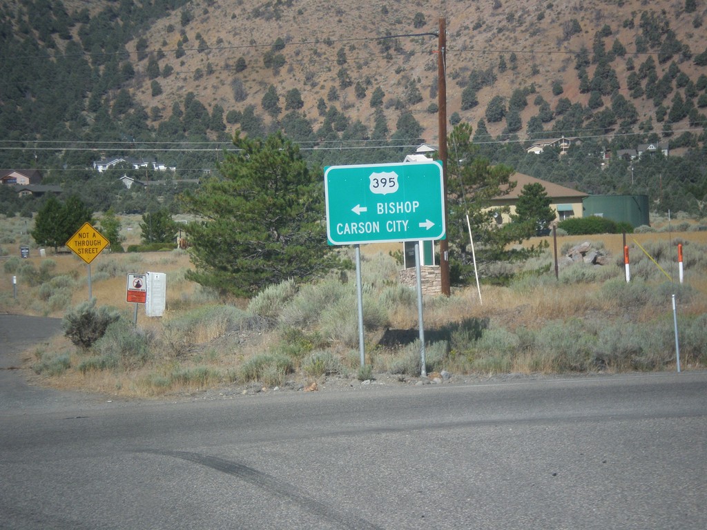
End NV-208 West at US-395
End NV-208 West at US-395. Turn right for US-395 north to Carson City; left for US-395 south to Bishop (California).
Taken 08-12-2016
 Gardnerville
Douglas County
Nevada
United States
Gardnerville
Douglas County
Nevada
United States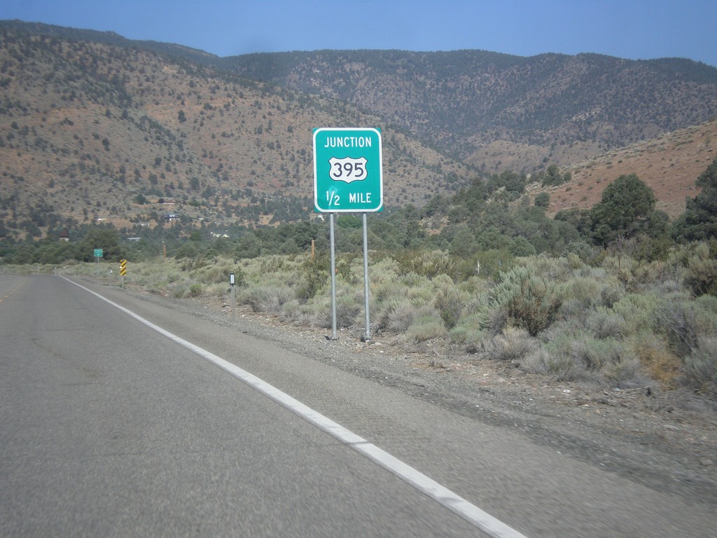
NV-208 West Approaching US-395
NV-208 West approaching US-395 in Douglas County.
Taken 08-12-2016
Topaz Lake
Douglas County
Nevada
United States