Signs Tagged With Shield Inside Sign
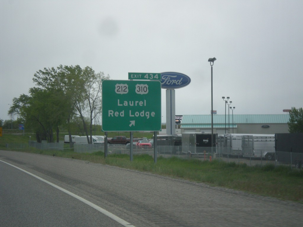
I-90 West - Exit 434
I-90 west at Exit 434 - US-212/US-310/Laurel/Red Lodge. US-212 west leaves I-90 westbound here. Eastbound US-212 east joins I-90 to Crow Agency. This is the northern terminus of US-310.
Taken 05-15-2016


 Laurel
Yellowstone County
Montana
United States
Laurel
Yellowstone County
Montana
United States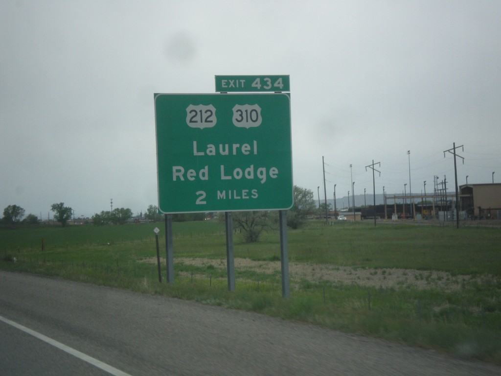
I-90 West - Exit 434
I-90 west approaching Exit 434 - US-212/US-310/Red Lodge/Laurel.
Taken 05-15-2016
Laurel
Yellowstone County
Montana
United States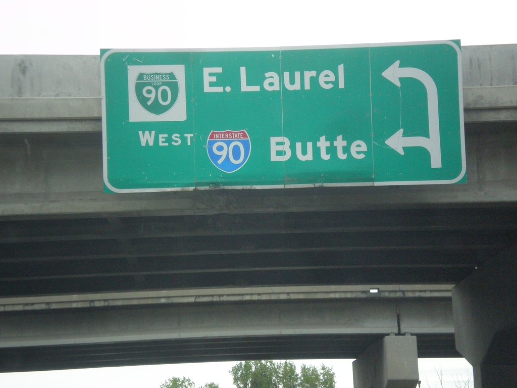
Begin BL-90 West at I-90 West
Begin BL-90 West at I-90 West to Butte (first left). Use second left for BL-90 to East Laurel.
Taken 05-15-2016
 Laurel
Yellowstone County
Montana
United States
Laurel
Yellowstone County
Montana
United States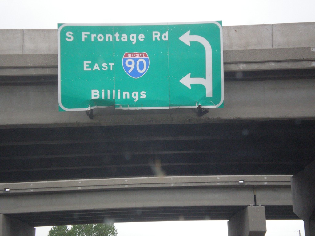
End BL-90 East at South Frontage Road and I-90 East
End BL-90 East at South Frontage Road and I-90 East to Billings.
Taken 05-15-2016
Laurel
Yellowstone County
Montana
United States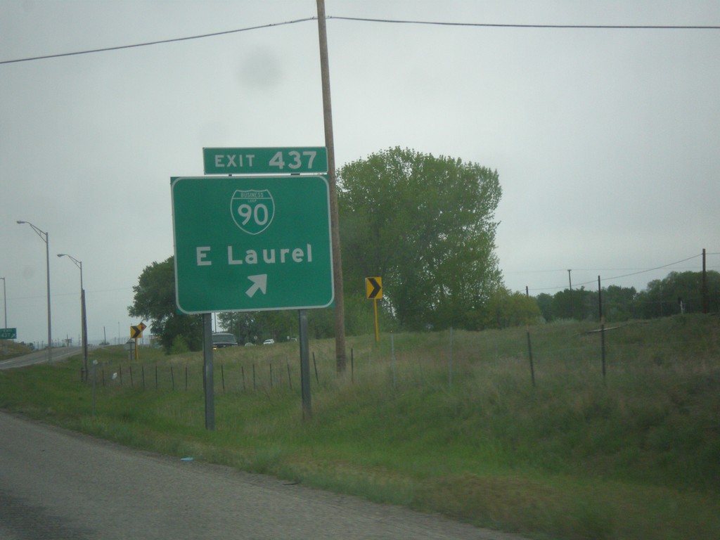
I-90 West - Exit 437
I-90 west at Exit 437 - BL-90/East Laurel. This is the eastern end of the Laurel business loop.
Taken 05-15-2016
Laurel
Yellowstone County
Montana
United States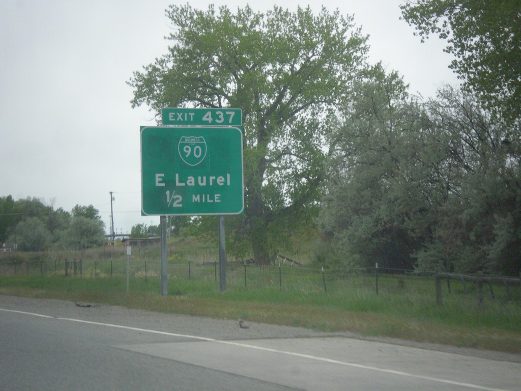
I-90 West - Exit 437
I-90 west approaching Exit 437 - BL-90/East Laurel.
Taken 05-15-2016
Mossmain
Yellowstone County
Montana
United States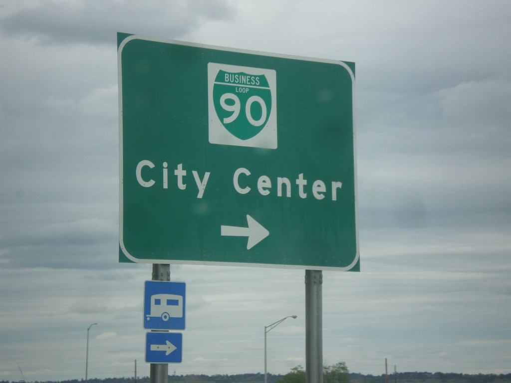
King Ave. West at BL-90 (Laurel Road)
King Ave. West at BL-90 (Laurel Road) to (Billings) City Center.
Taken 05-15-2016
Billings
Yellowstone County
Montana
United States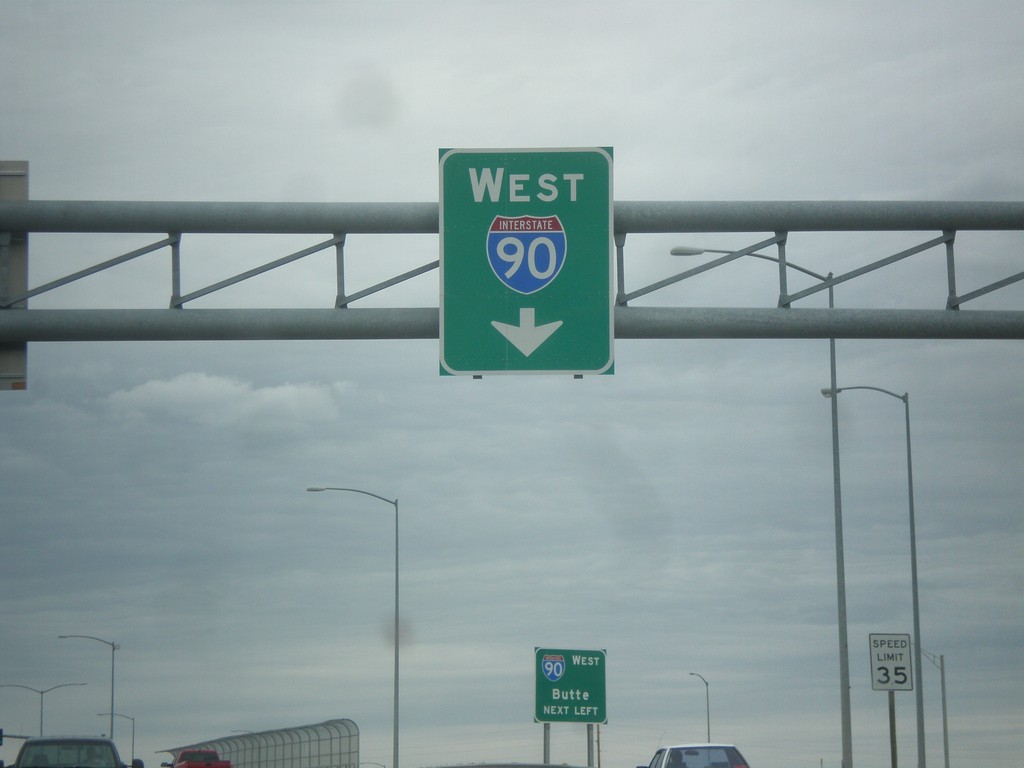
King Ave. West Approaching I-90 West
King Ave. West Approaching I-90 West in Billings.
Taken 05-15-2016
Billings
Yellowstone County
Montana
United States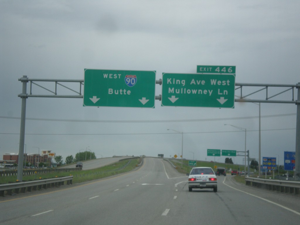
I-90 West - Exit 446
I-90 west at Exit 446 - King Ave. West/Mullowney Lane. I-90 continues west towards Butte.
Taken 05-15-2016
Billings
Yellowstone County
Montana
United States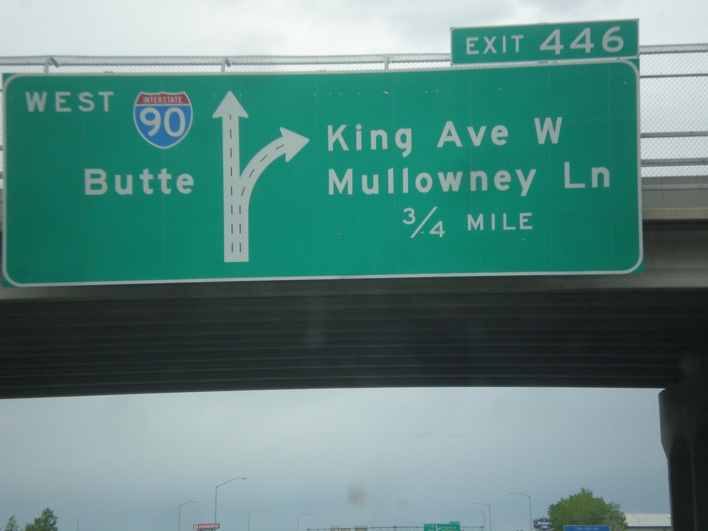
I-90 West - Exit 446
I-90 west approaching Exit 446 - King Ave W./Mullowney Lane. I-90 continues west towards Butte. This is the western end of the Billings business loop.
Taken 05-15-2016
Billings
Yellowstone County
Montana
United States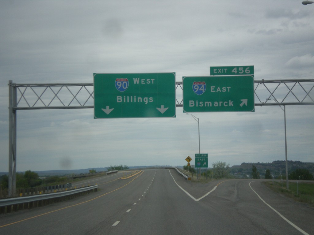
I-90 West at I-94 East - Yellowstone County
I-90 West at Exit 456 - I-94 East/Bismarck (North Dakota). Continue west on I-90 for Billings. This is the western terminus of I-94.
Taken 05-15-2016

 Lockwood
Yellowstone County
Montana
United States
Lockwood
Yellowstone County
Montana
United States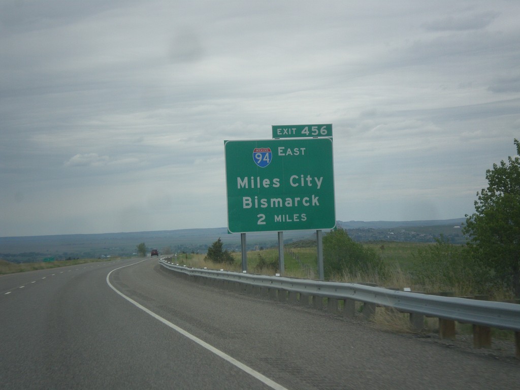
I-90 West - Approaching I-94 (Exit 456)
I-90 West - approaching Exit 456 - I-94 East/Miles City/Bismarck (North Dakota)
Taken 05-15-2016
Billings
Yellowstone County
Montana
United States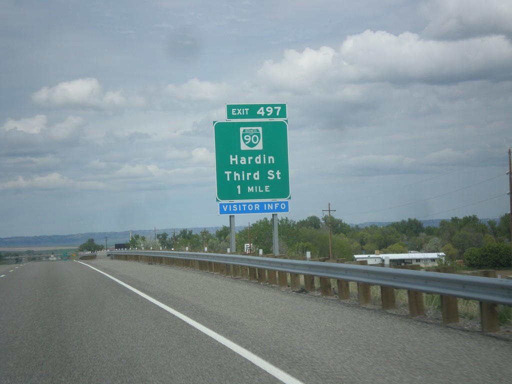
I-90 West - Exit 497
I-90 west approaching Exit 497 - BL-90/Hardin/Third St. Hardin is the county seat of Big Horn County.
Taken 05-15-2016
Hardin
Big Horn County
Montana
United States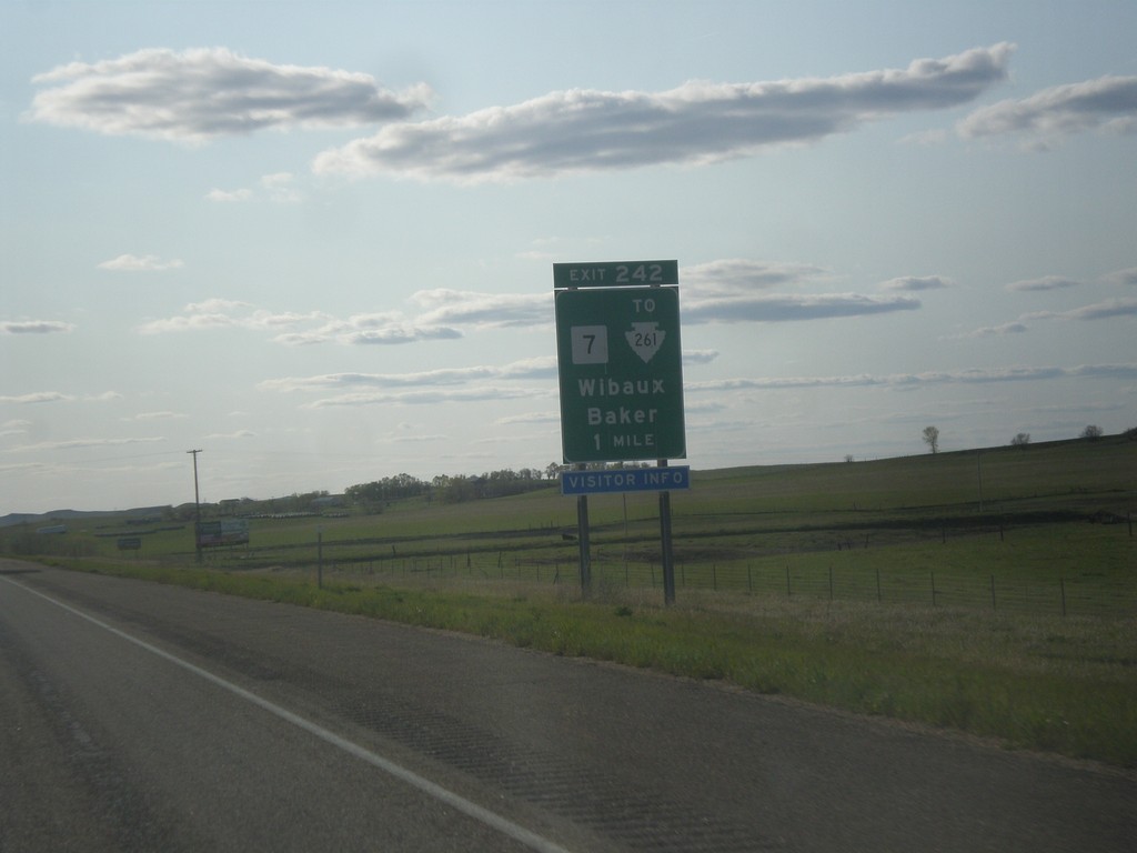
I-94 West - Exit 242
I-94 west approaching Exit 242 - MT-7/To MTS-261/Wibaux/Baker.
Taken 05-14-2016

 Wibaux
 County
Montana
United States
Wibaux
Wibaux County
Montana
United States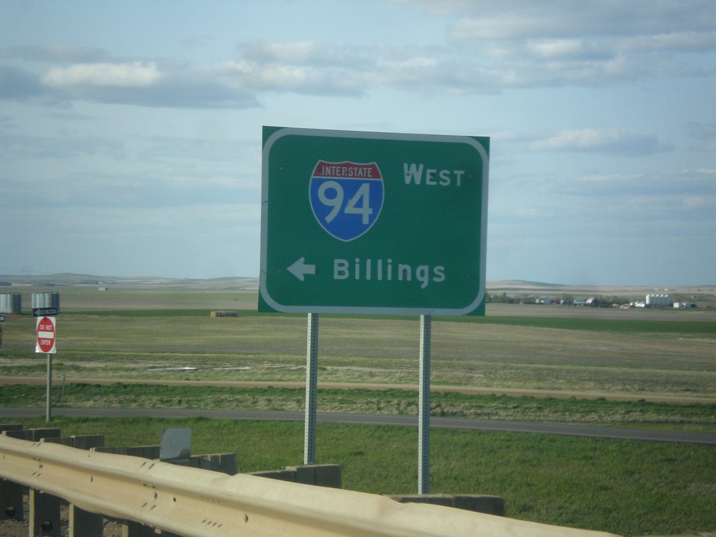
ND-16 North at I-94 West
ND-16 North at I-94 West to Billings, Montana.
Taken 05-14-2016
 Beach
Golden Valley County
North Dakota
United States
Beach
Golden Valley County
North Dakota
United States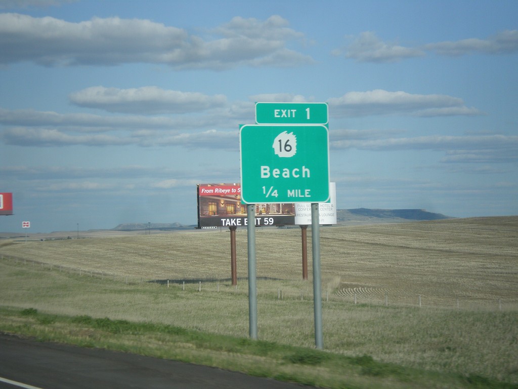
I-94 East - Exit 1
I-94 east approaching Exit 1 - ND-16/Beach
Taken 05-14-2016
Beach
Golden Valley County
North Dakota
United States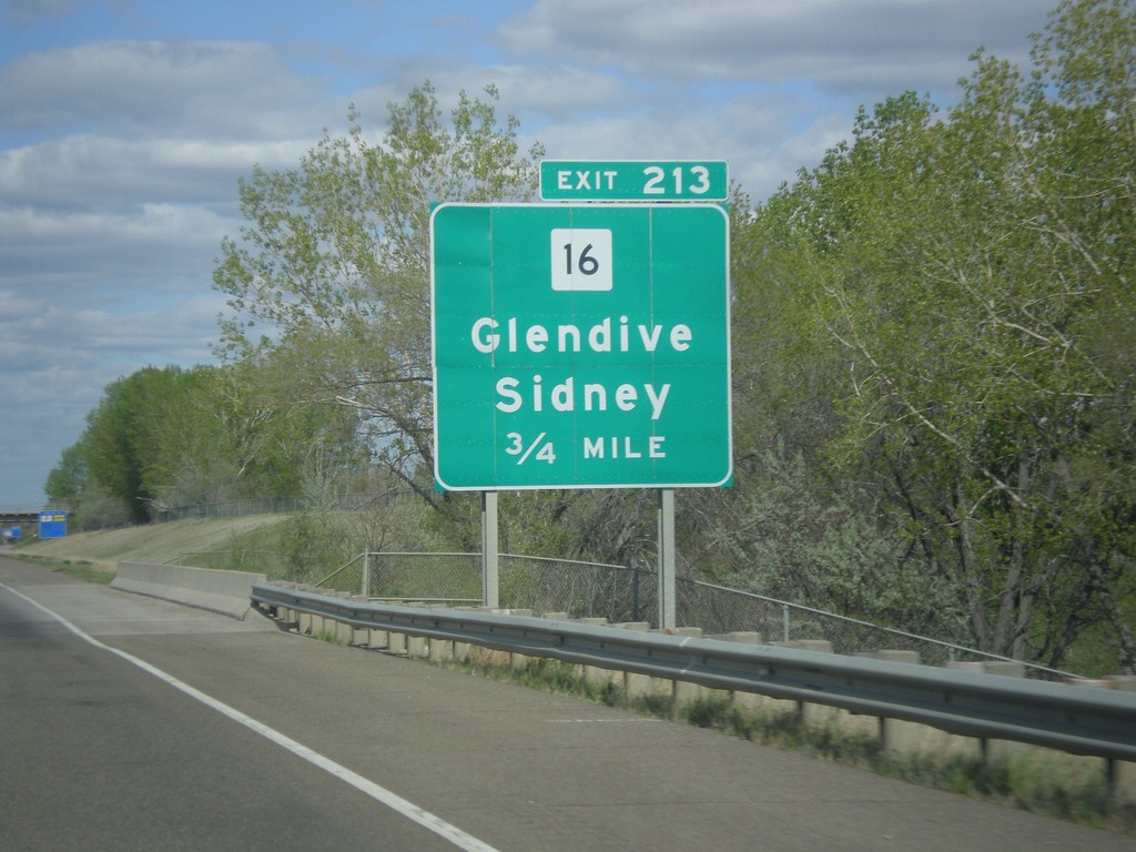
I-94 East - Exit 213
I-94 east approaching Exit 213 - MT-16/Glendive/Sidney.
Taken 05-14-2016
Glendive
Dawson County
Montana
United States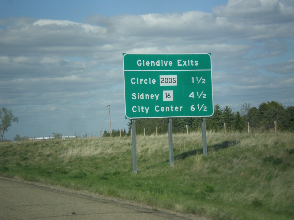
I-94 East - Glendive Exits
Glendive exits on I-94 east. MT-200S/Circle, MT-16/Sidney, and City Center.
Taken 05-14-2016

 Glendive
Dawson County
Montana
United States
Glendive
Dawson County
Montana
United States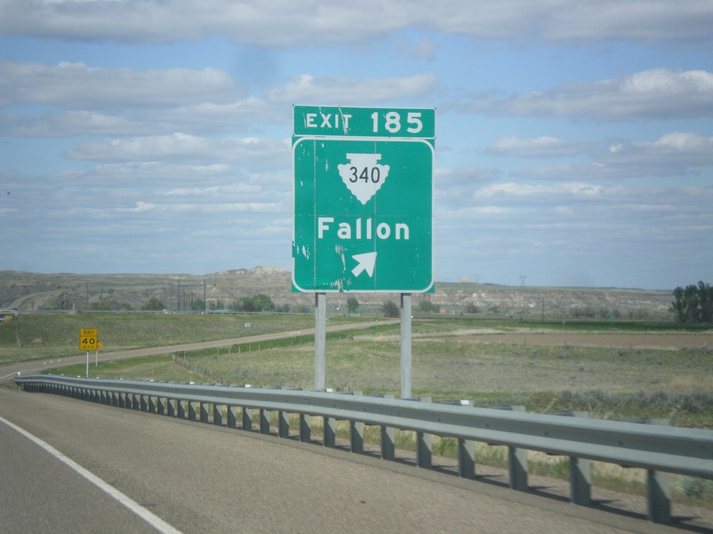
I-94 East - Exit 185
I-94 east approaching Exit 185 - MTS-340/Fallon.
Taken 05-14-2016
 Fallon
Prairie County
Montana
United States
Fallon
Prairie County
Montana
United States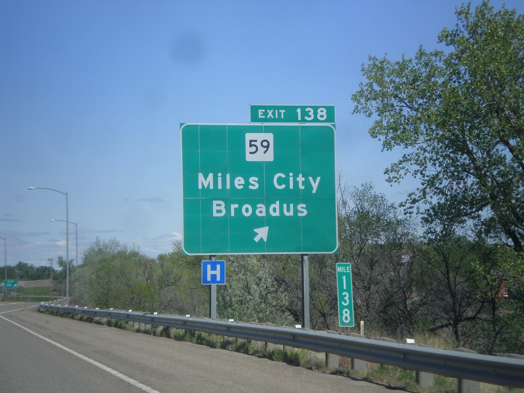
I-94 East - Exit 138
I-94 east at Exit 138 - MT-59/Miles City/Broadus.
Taken 05-14-2016

 Miles City
Custer County
Montana
United States
Miles City
Custer County
Montana
United States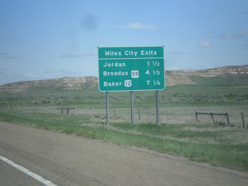
I-94 East - Miles City Exits
Miles City Exits on I-94 east. The three exits all show the destination city accessed by that exit. The first exit is to Jordan (via MT-59 north), the second exit is to Broadus (via MT-59 south), and the third exit is to Baker (via US-12 east).
Taken 05-14-2016
Miles City
Custer County
Montana
United States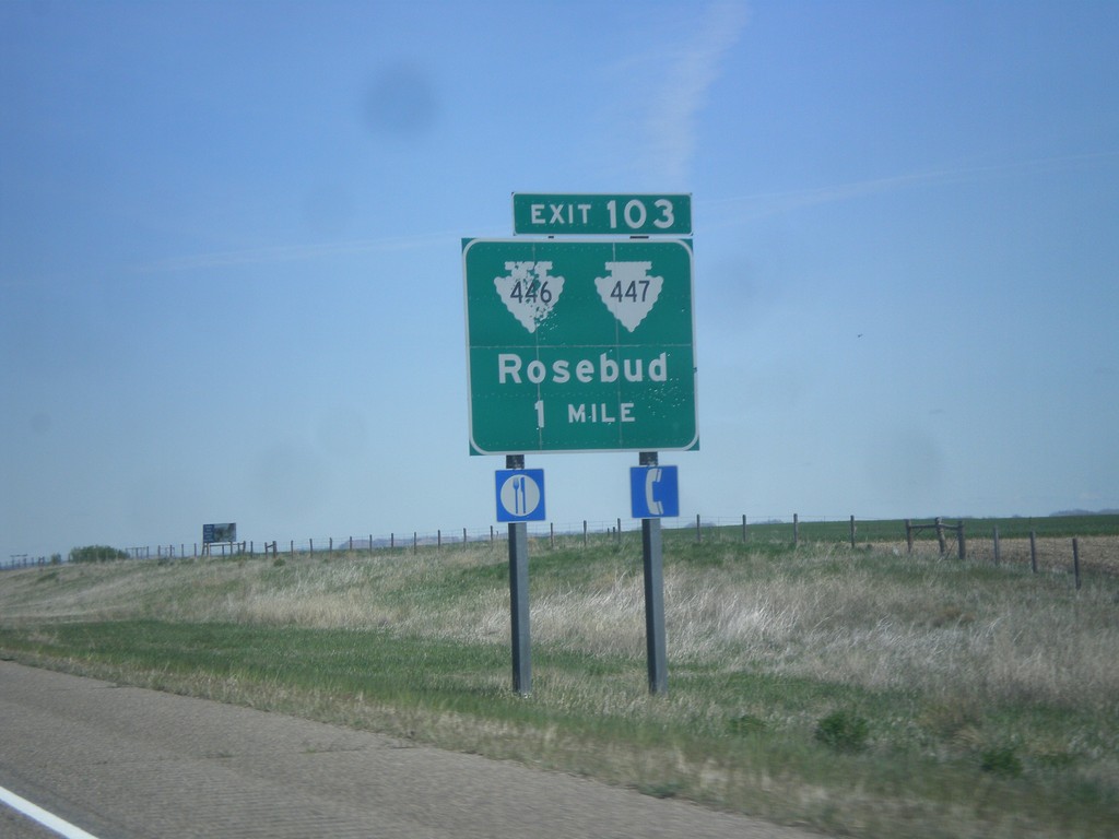
I-94 East - Exit 103
I-94 east approaching Exit 103 - MTS-446/MTS-447/Rosebud.
Taken 05-14-2016

 Forsyth
Rosebud County
Montana
United States
Forsyth
Rosebud County
Montana
United States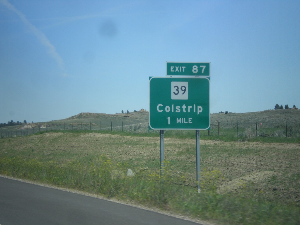
I-94 East - Exit 87
I-94 east approaching Exit 87 - MT-39/Colstrip.
Taken 05-14-2016
 Forsyth
Rosebud County
Montana
United States
Forsyth
Rosebud County
Montana
United States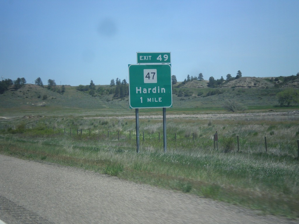
I-94 East - Exit 49
I-94 east approaching Exit 49 - MT-47/Hardin.
Taken 05-14-2016
 Custer
Yellowstone County
Montana
United States
Custer
Yellowstone County
Montana
United States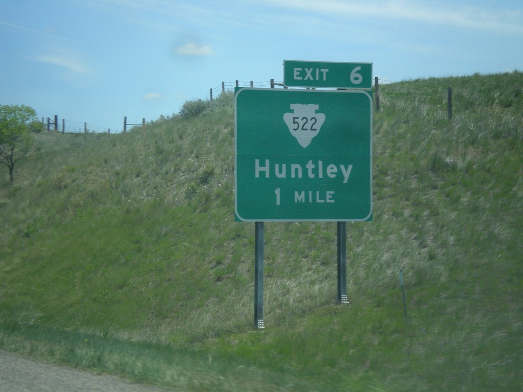
I-94 East - Exit 6
I-94 east approaching Exit 6 - MTS-522/Huntley
Taken 05-14-2016
 Huntley
Yellowstone County
Montana
United States
Huntley
Yellowstone County
Montana
United States