Signs Tagged With Shield Inside Sign
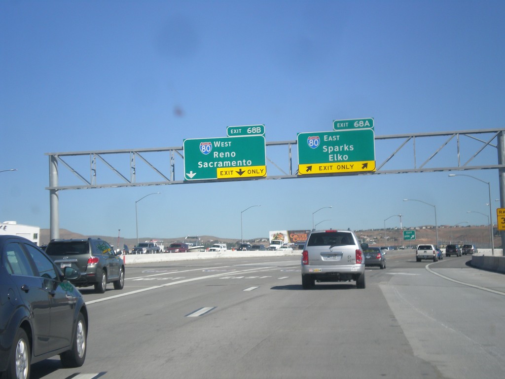
I-580/US-395 North - Exits 68A and 68B
I-580/US-395 north at Exits 68A and 68B. Exit 68A - I-80 East/Sparks/Elko. Exit 68B - I-80 West/Reno/Sacramento (California). US-395 continues north towards Susanville (California). This is the north end of I-580.
Taken 06-15-2015


 Reno
Washoe County
Nevada
United States
Reno
Washoe County
Nevada
United States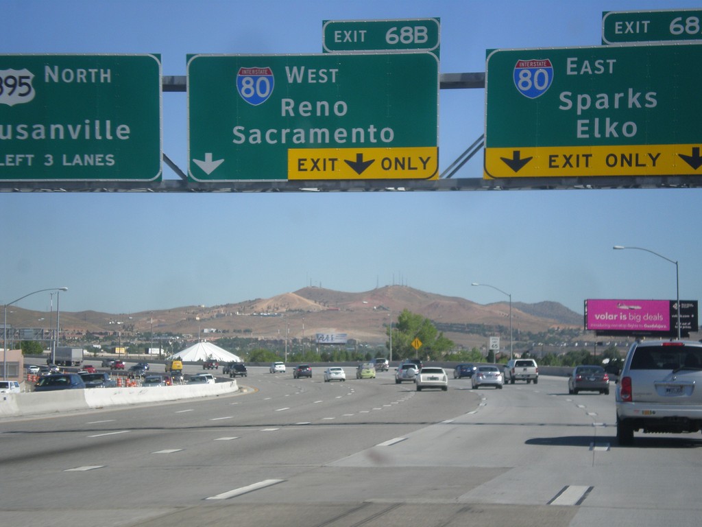
I-580/US-395 North - Exits 68A and 68B
I-580/US-395 north approaching Exits 68A and 68B. Exit 68A - I-80 East/Sparks/Elko. Exit 68B - I-80 West/Reno/Sacramento (California). US-395 continues north towards Susanville (California). I-580 ends at I-80. The freeway continues as US-395.
Taken 06-15-2015
Reno
Washoe County
Nevada
United States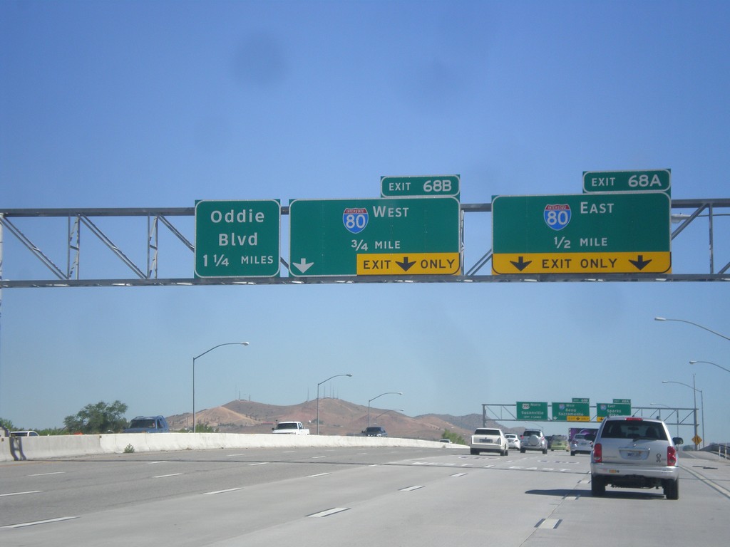
I-580/US-395 North Approaching Exits 68AB and 69
I-580/US-395 north approaching Exit 68A - I-80 East; Exit 68B - I-80 West, and Exit 69 (exit number not shown) - Oddie Blvd.
Taken 06-15-2015
Reno
Washoe County
Nevada
United States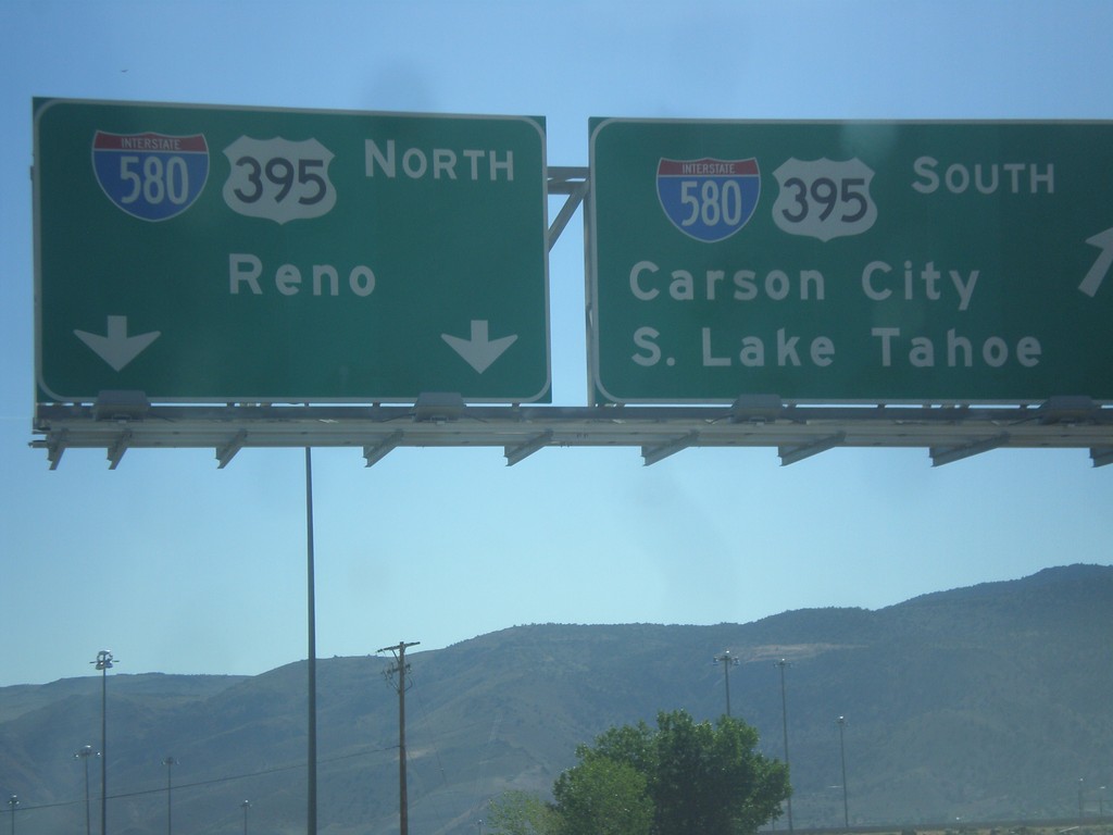
NV-431 East at US-395
NV-431 east at I-580/US-395. For I-580/US-395 north to Reno continue straight. Merge right for I-580/US-395 south to Carson City and South Lake Tahoe.
Taken 06-15-2015
 Reno
Washoe County
Nevada
United States
Reno
Washoe County
Nevada
United States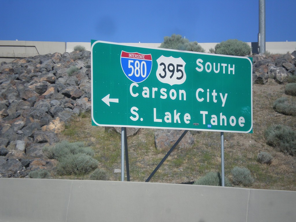
NV-431 East at I-580/US-395 South
NV-431 East at I-580/US-395 South to South Lake Tahoe and Carson City.
Taken 06-15-2015
Reno
Washoe County
Nevada
United States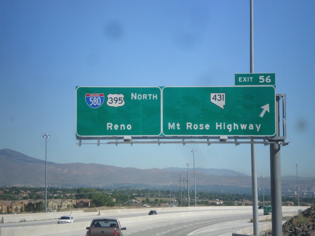
I-580/US-395 North - Exit 56
I-580/US-395 North at Exit 56 - NV-431/Mount Rose Highway. Continue north on I-580/US-395 for Reno.
Taken 06-15-2015
Reno
Washoe County
Nevada
United States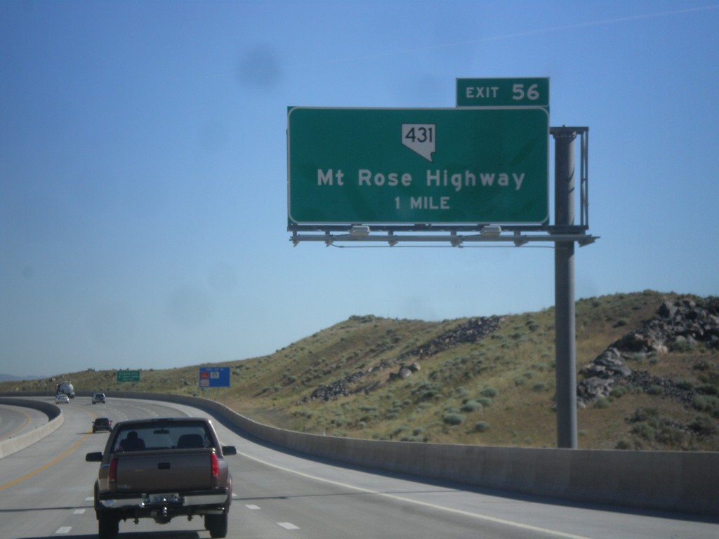
I-580/US-395 North - Exit 56
I-580/US-395 North approaching Exit 56 - NV-431/Mount Rose Highway.
Taken 06-15-2015
Reno
Washoe County
Nevada
United States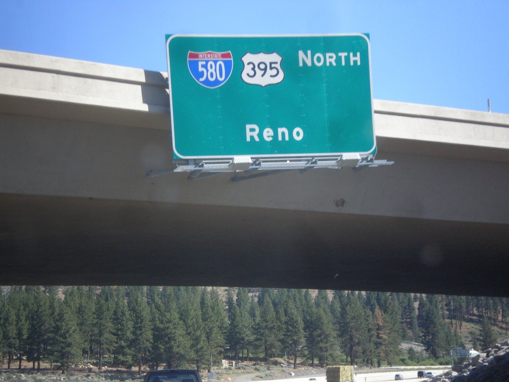
I-580/US-395 North - Reno
I-580/US-395 North - Reno, on overpass of Exit 50.
Taken 06-15-2015
New Washoe City
Washoe County
Nevada
United States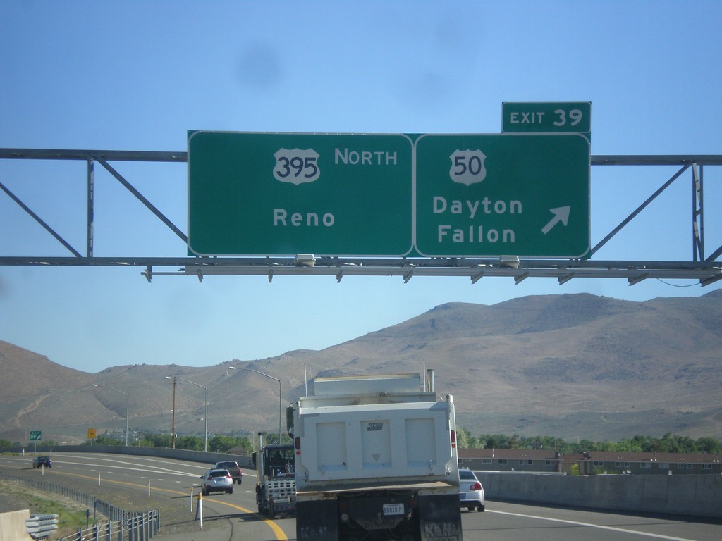
US-395 North - Exit 39
US-395 north at Exit 39 - US-50/Dayton/Fallon. Continue north on I-580/US-395 for Reno. The US-50/US-395 split ends here. I-580 begins here northbound, although it is not listed on the overhead. The first I-580 shield is north of this interchange.
Taken 06-15-2015
 Carson City
Nevada
United States
Carson City
Nevada
United States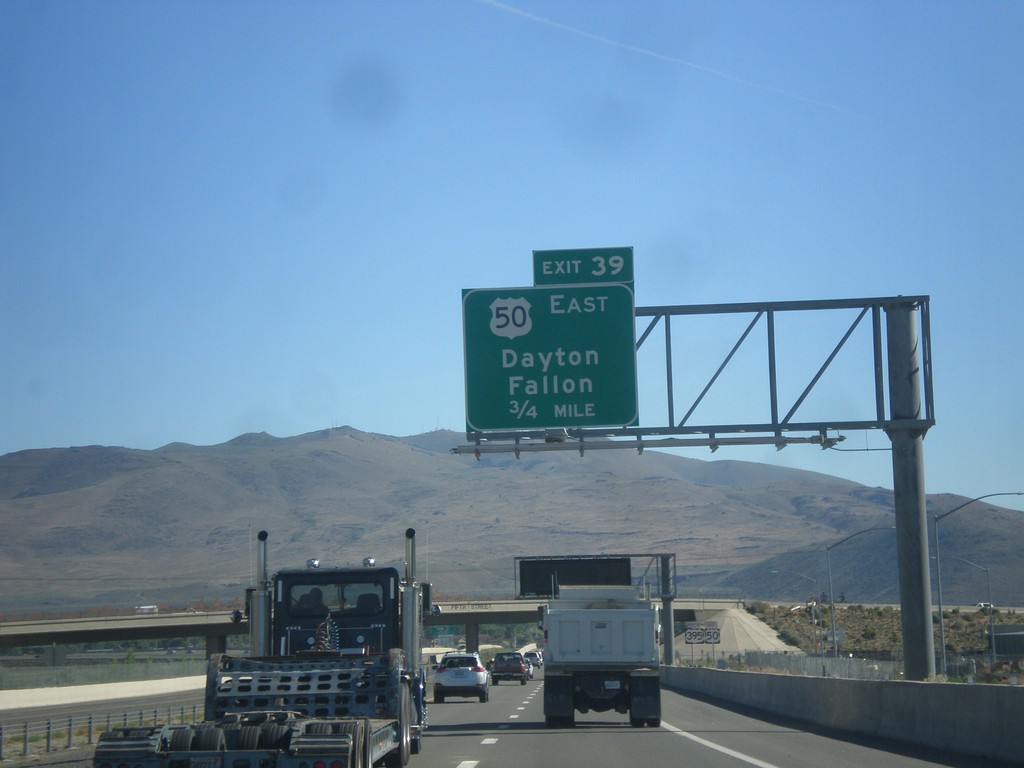
US-395 North/US-50 East - Exit 39
US-395 North/US-50 East approaching Exit 39 - US-50 East/Dayton/Fallon.
Taken 06-15-2015
Carson City
Nevada
United States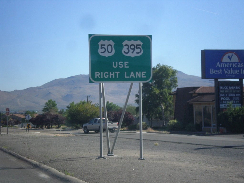
US-395 North/US-50 East Approaching Fairview Lane
US-395 North/US-50 East approaching Fairview Lane. Use right lane to continue on US-395/US-50.
Taken 06-15-2015
Carson City
Nevada
United States
US-395 North Approaching US-50
US-395 North approaching US-50 in Carson City.
Taken 06-15-2015
Carson City
Nevada
United States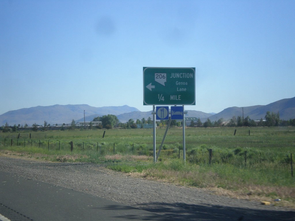
US-395 North Approaching NV-206
US-395 north approaching NV-206 - Genoa Lane.
Taken 06-15-2015
 Minden
Douglas County
Nevada
United States
Minden
Douglas County
Nevada
United States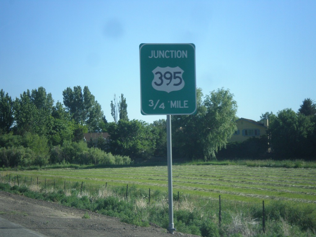
NV-88 North Approaching US-395
NV-88 North approaching US-395 in Minden.
Taken 06-15-2015
 Minden
Douglas County
Nevada
United States
Minden
Douglas County
Nevada
United States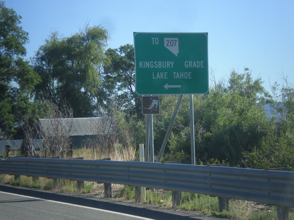
NV-88 North at Mottsville Lane/Waterloo Lane
NV-88 North at Mottsville Lane/Waterloo Lane. Use Mottsville Lane west for NV-207/Kingsbury Grade/Lake Tahoe.
Taken 06-15-2015
 Gardnerville
Douglas County
Nevada
United States
Gardnerville
Douglas County
Nevada
United States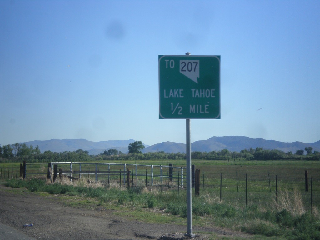
NV-88 North approaching Mottsville Lane/Waterloo Lane Jct.
NV-88 North approaching Mottsville Lane/Waterloo Lane junction. Use Mottsville Lane west for NV-207 and Lake Tahoe (via Kingsbury Grade).
Taken 06-15-2015
Gardnerville
Douglas County
Nevada
United States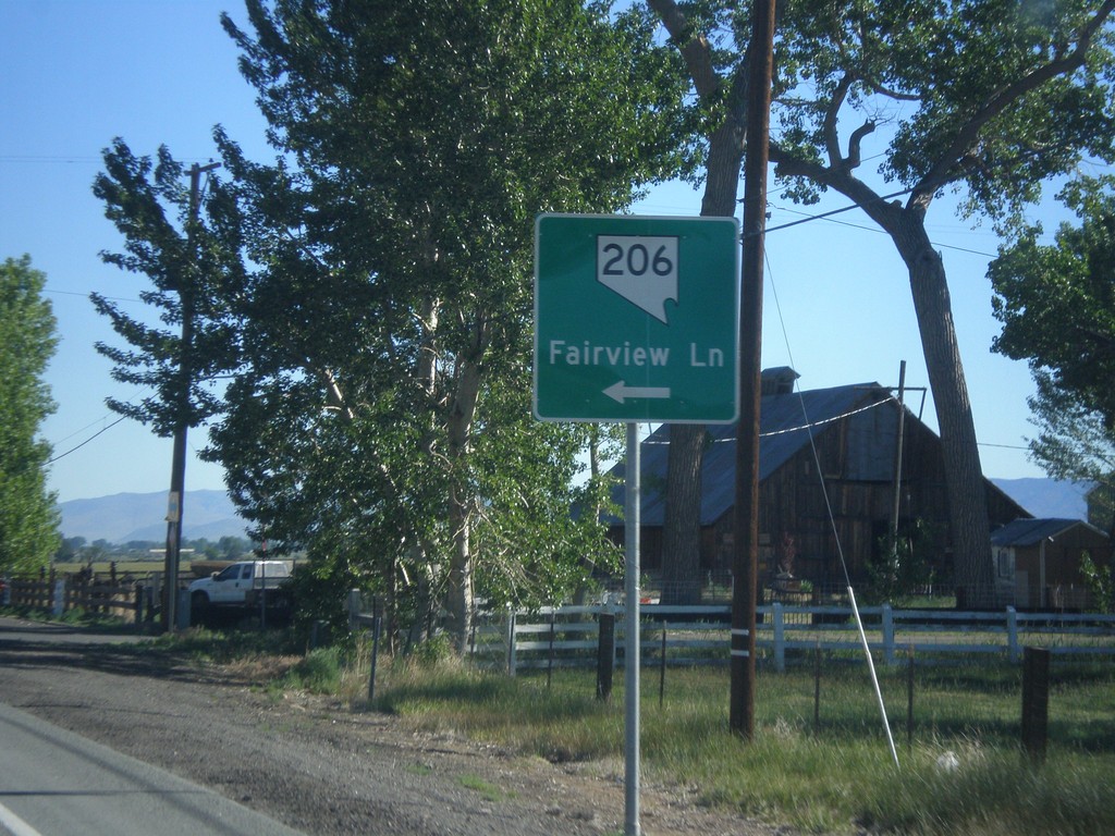
NV-88 North at NV-206
NV-88 north at NV-206/Fairview Lane.
Taken 06-15-2015
Gardnerville
Douglas County
Nevada
United States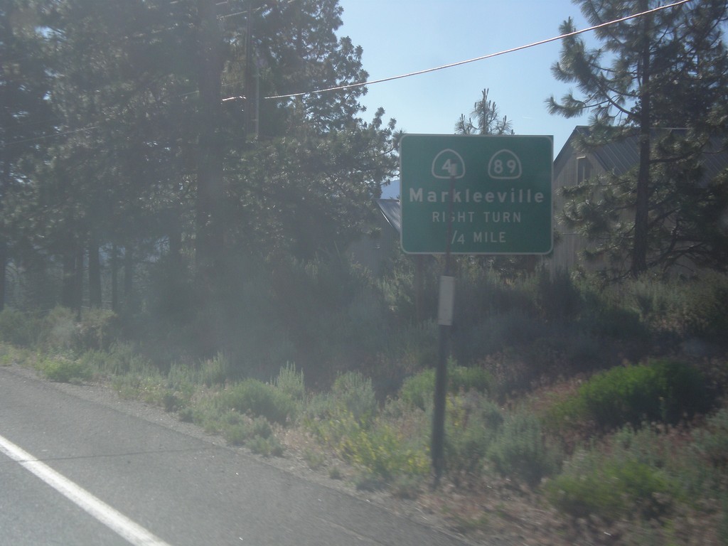
CA-88 East/CA-89 South Approaching CA-89 Jct.
CA-88 East/CA-89 South approaching CA-89/(To) CA-4 junction. Use CA-89 south for CA-4 and Markleeville.
Taken 06-15-2015


 Markleeville
Alpine County
California
United States
Markleeville
Alpine County
California
United States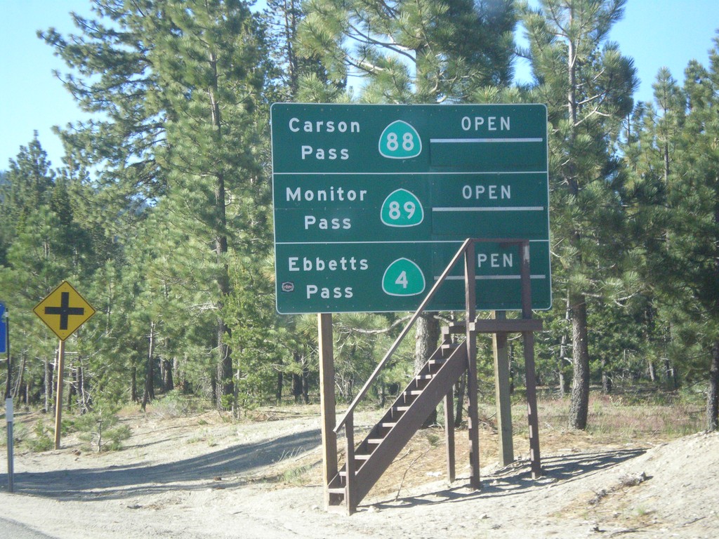
CA-89 South - Summit Information
Summit closure information on CA-89 south. Information for Ebbetts Pass (via CA-4), Monitor Pass (via CA-89) and Carson Pass (via CA-88). This photograph was taken in mid-June, and all of the passes are open. Carson Pass on CA-88 is the only pass that is typically opened year round.
Taken 06-15-2015
South Lake Tahoe
El Dorado County
California
United States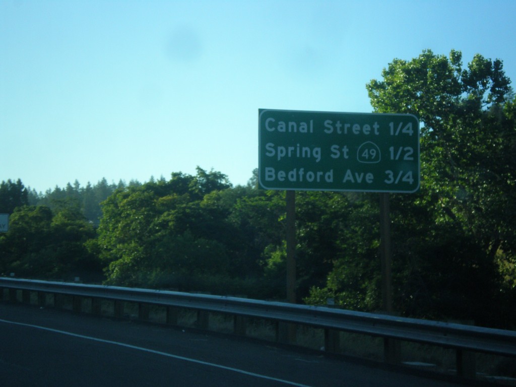
US-50 East - Placerville Intersections
Distance marker showing major cross streets in Placerville.
Taken 06-15-2015
Placerville
El Dorado County
California
United States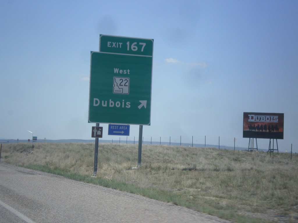
I-15 South - Exit 167
I-15 south at Exit 167 - ID-22 West/Dubois.
Taken 05-10-2015


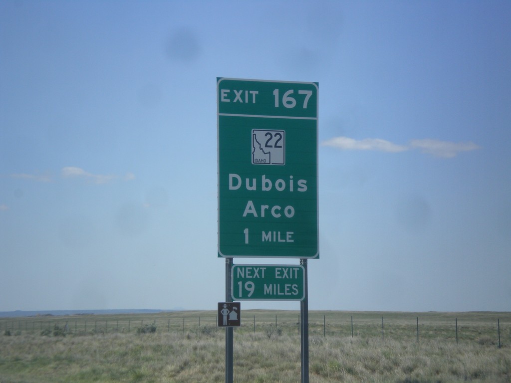
I-15 South - Exit 167
I-15 South approaching Exit 167 - ID-22/Dubois/Arco. The actual sign at the exit omits Arco from the destination.
Taken 05-10-2015
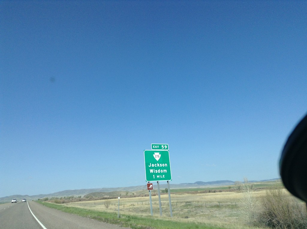
I-15 South - Exit 62
I-15 south approaching Exit 62 - MTS-278/Jackson/Wisdom.
Taken 05-10-2015
 Dillon
Beaverhead County
Montana
United States
Dillon
Beaverhead County
Montana
United States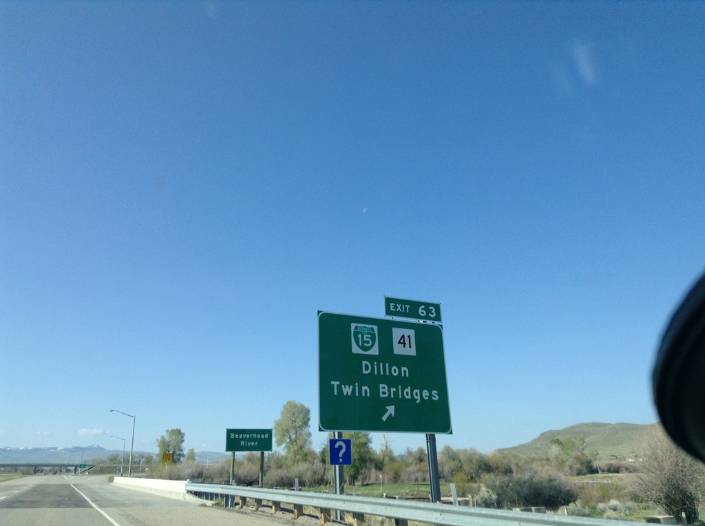
I-15 South - Exit 63
I-15 south at Exit 63 - BL-15/MT-41/Dillon/Twin Bridges. This is the northern end of the Dillon business loop.
Taken 05-10-2015

 Dillon
Beaverhead County
Montana
United States
Dillon
Beaverhead County
Montana
United States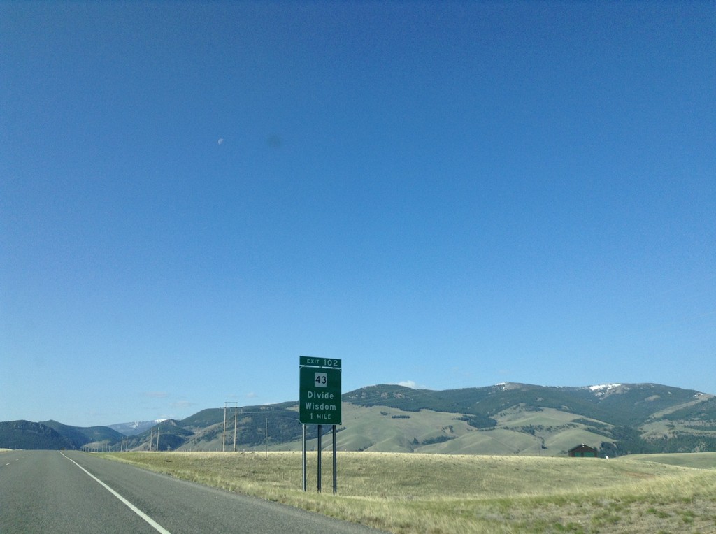
I-15 South - Exit 102
I-15 south approaching Exit 102 - MT-43/Divide/Wisdom.
Taken 05-10-2015
 Butte
Silver Bow County
Montana
United States
Butte
Silver Bow County
Montana
United States