Signs Tagged With Shield Inside Sign
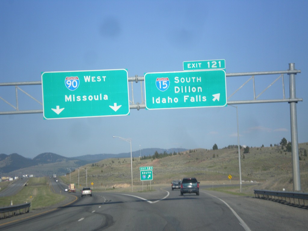
I-15 South/I-90 West - Exit 121
I-15 South/I-90 West at Exit 121 - I-15 South/Dillon/Idaho Falls. Continue west on I-90 for Missoula.
Taken 05-10-2015

 Butte
Silver Bow County
Montana
United States
Butte
Silver Bow County
Montana
United States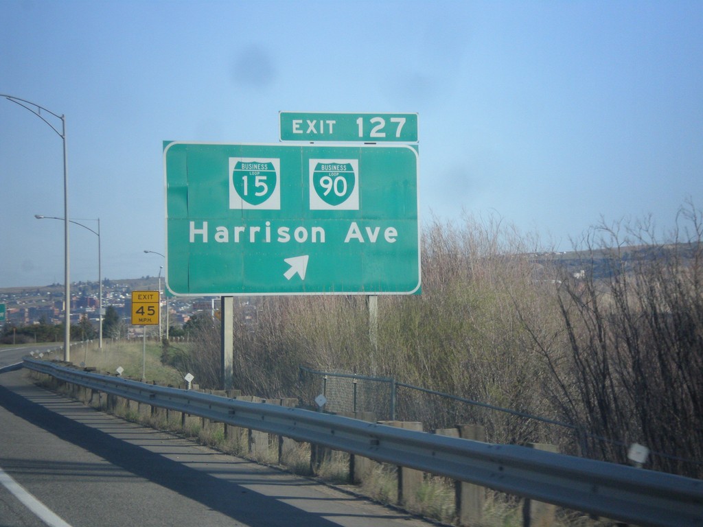
I-15 South/I-90 West - Exit 127
I-15 South/I-90 West at Exit 127 - BL-15/BL-90/Harrison Blvd.
Taken 05-10-2015


 Butte
Silver Bow County
Montana
United States
Butte
Silver Bow County
Montana
United States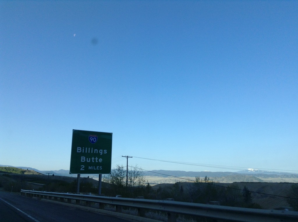
I-15 South Approaching I-90
I-15 south approaching I-90 (Exit 129) to Billings and Butte. I-15 joins I-90 westbound through Butte.
Taken 05-10-2015
Butte
Silver Bow County
Montana
United States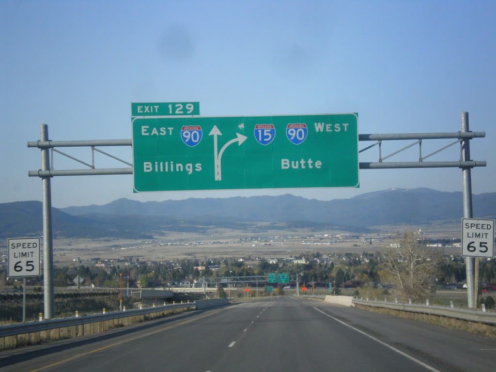
I-15 South - Exit 129
I-15 south approaching Exit 129 - I-90 East/Billings. Continue south on I-15/I-90 West to Butte. I-15 joins I-90 through Butte.
Taken 05-10-2015
Butte
Silver Bow County
Montana
United States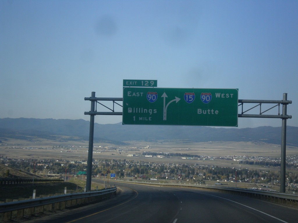
I-15 South - Exit 129
I-15 south approaching Exit 129 - I-90 East/Billings. I-15 South joins I-90 West to Butte.
Taken 05-10-2015
Butte
Silver Bow County
Montana
United States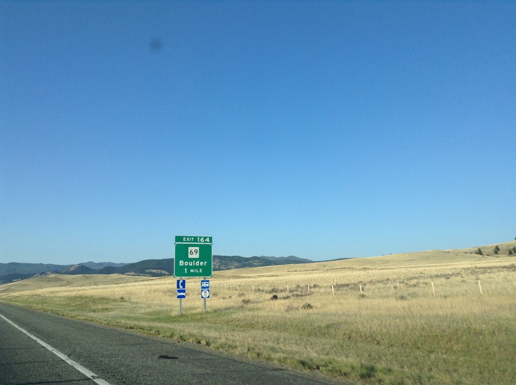
I-15 South - Exit 164
I-15 south approaching Exit 164 - MT-69/Boulder.
Taken 05-10-2015
 Boulder
Jefferson County
Montana
United States
Boulder
Jefferson County
Montana
United States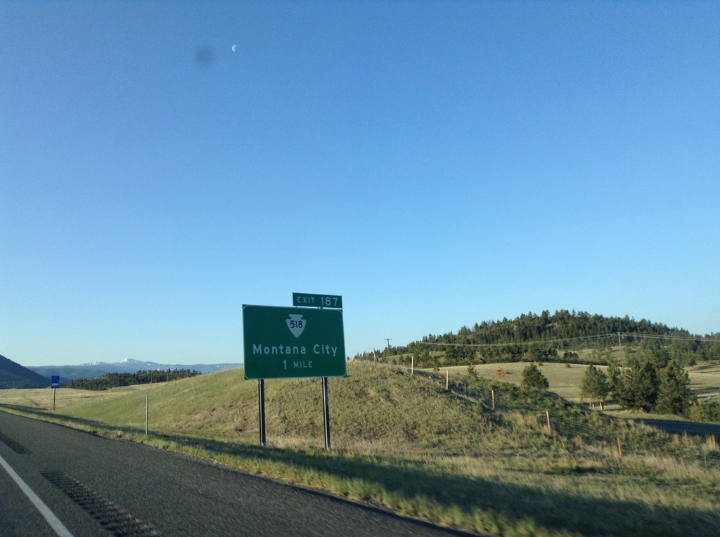
I-15 South - Exit 187
I-15 south approaching Exit 187 - MTS-518/Montana City.
Taken 05-10-2015
 Montana City
Jefferson County
Montana
United States
Montana City
Jefferson County
Montana
United States
US-12 East at I-15 South Onramp
US-12 east at I-15 south to Butte. US-287 joins US-12 eastbound here. This is the southern end of the I-15 Business Loop in Helena.
Taken 05-10-2015

 Helena
Lewis and Clark County
Montana
United States
Helena
Lewis and Clark County
Montana
United States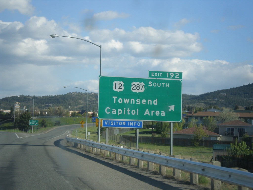
I-15 South - Exit 192
I-15 south at Exit 192 - US-12/US-287 South/Townsend/Capitol Area. US-287 leaves I-15 southbound here.
Taken 05-09-2015
Helena
Lewis and Clark County
Montana
United States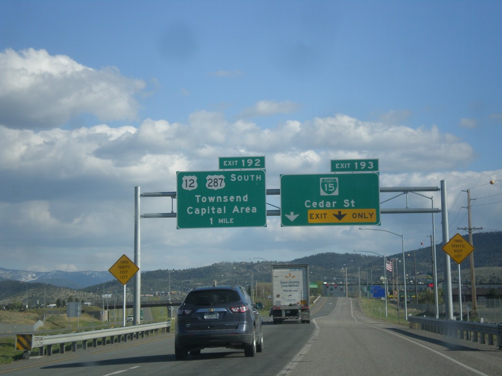
I-15 South - Exits 193 and 192
I-15 south at Exit 193 - BL-15/Cedar St. Approaching Exit 192 - US-12/US-287 South/Townsend/Capital Area.
Taken 05-09-2015
Helena
Lewis and Clark County
Montana
United States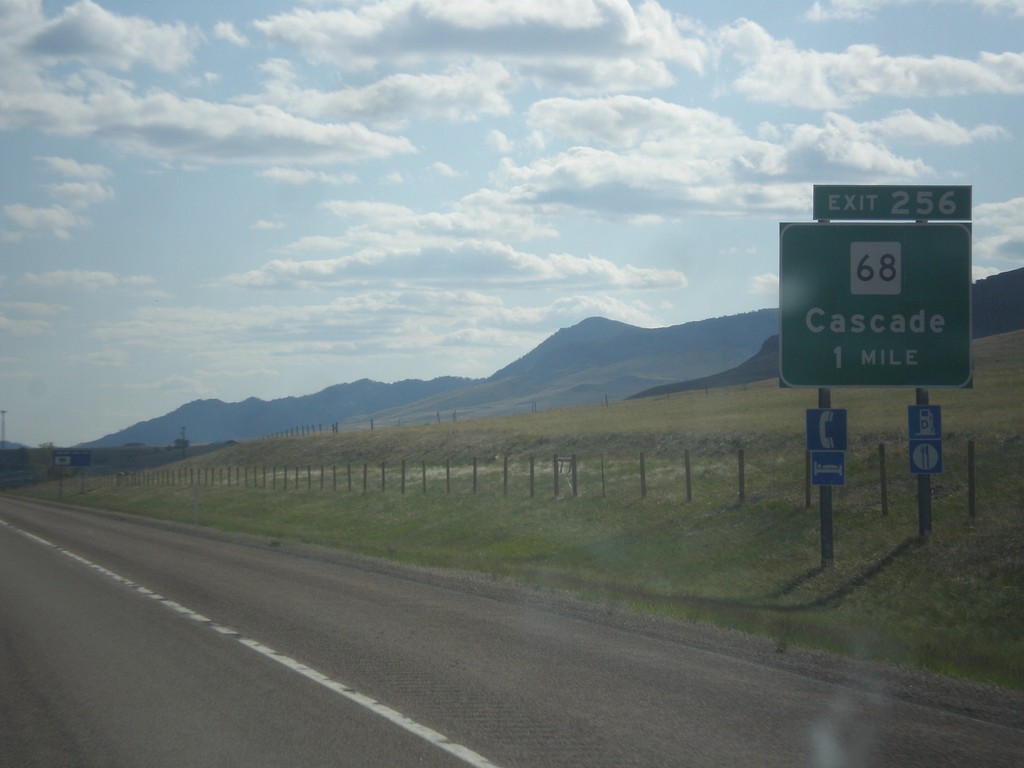
I-15 South - Exit 256
I-15 south approaching Exit 256 - MT-68/Cascade.
Taken 05-09-2015
 Cascade
 County
Montana
United States
Cascade
Cascade County
Montana
United States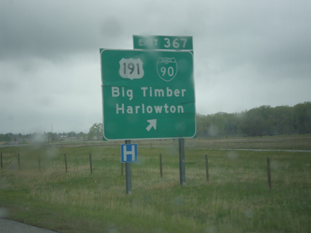
I-90 East - Exit 367
I-90 east at Exit 367 - US-191/BL-90/Big Timber/Harlowton. US-191 leaves I-90 eastbound here. Typically on a freeway junction assembly in Montana, the business loop shield is surrounded in a white box.
Taken 05-08-2015
 Big Timber
Sweet Grass County
Montana
United States
Big Timber
Sweet Grass County
Montana
United States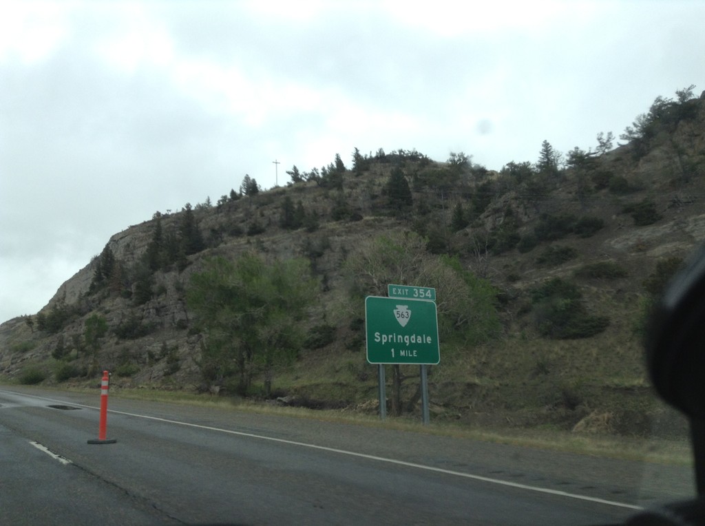
I-90 East - Exit 354
I-90 east approaching Exit 354 - MTS-563/Springdale.
Taken 05-08-2015
 Big Timber
Park County
Montana
United States
Big Timber
Park County
Montana
United States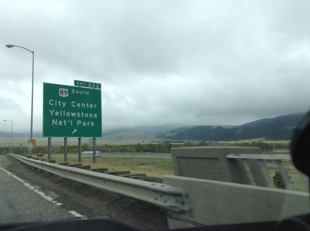
I-90 East - Exit 333
I-90 east at Exit 333 - US-89 South/City Center/Yellowstone National Park. US-89 heads south along the Yellowstone River to the Gardiner, Montana entrance to Yellowstone. US-89 joins I-90/US-191 east through Livingston.
Taken 05-08-2015
 Livingston
Park County
Montana
United States
Livingston
Park County
Montana
United States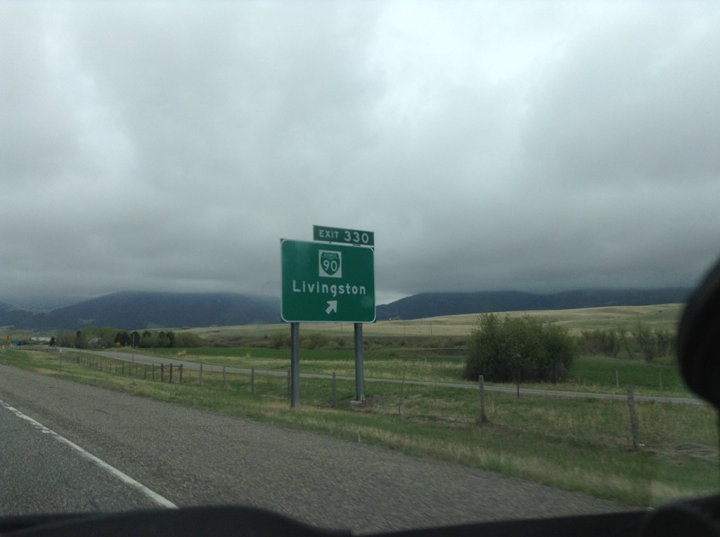
I-90 East - Exit 330
I-90 East at Exit 330 - BL-90/Livingston. This is the west end of the Livingston business loop.
Taken 05-08-2015
Livingston
Park County
Montana
United States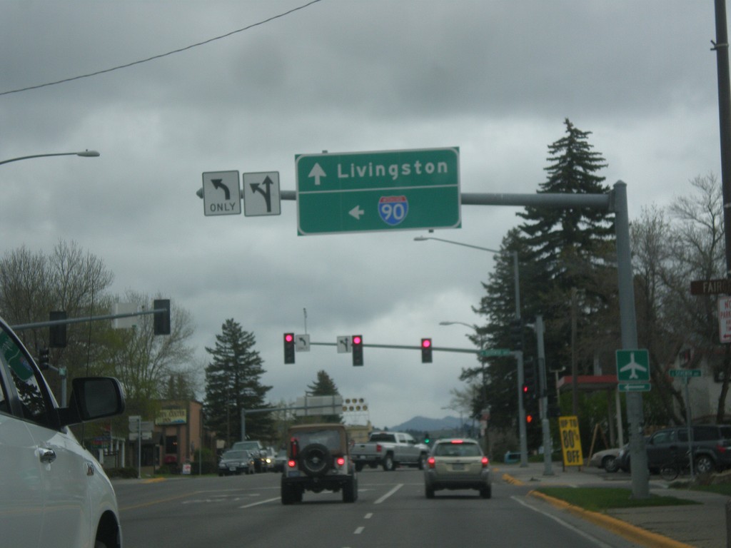
US-191 North at BL-90 - Bozeman
US-191 North (Main St.) at BL-90 (7th St.) in Bozeman. Turn left for BL-90 west to I-90 (West); continue straight for US-191 North/BL-90 East to Livingston (via I-90 east).
Taken 05-08-2015
Bozeman
Gallatin County
Montana
United States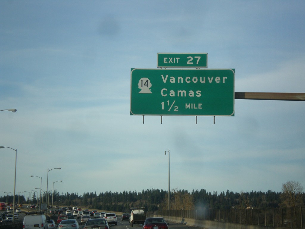
I-205 North - Exit 27
I-205 north approaching Exit 27 - WA-14/Vancouver/Camas. The milemarkers and exit numbers along I-205 do not reset back to zero when crossing into Washington. They continue on the Oregon numbering scheme. Although this is a Washington exit, this sign is still within Oregon.
Taken 02-16-2015

 Portland
Multnomah County
Oregon
United States
Portland
Multnomah County
Oregon
United States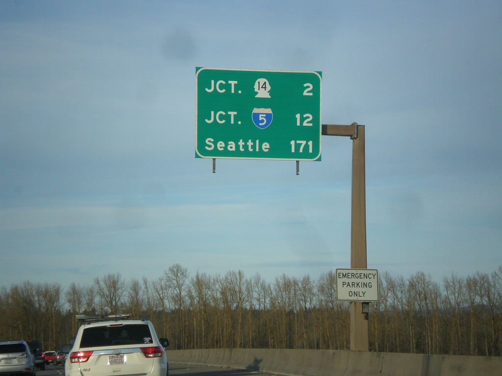
I-205 North - Distance Marker
Last distance marker on I-205 north in Oregon. Distance to WA-14, I-5, and Seattle.
Taken 02-16-2015
Portland
Multnomah County
Oregon
United States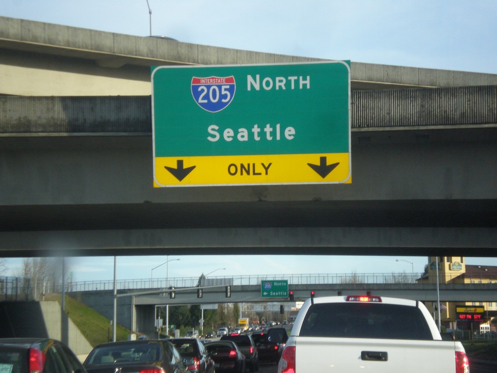
NE Airport Way at I-205 North
NE Airport Way at I-205 North to Seattle.
Taken 02-16-2015
Portland
Multnomah County
Oregon
United States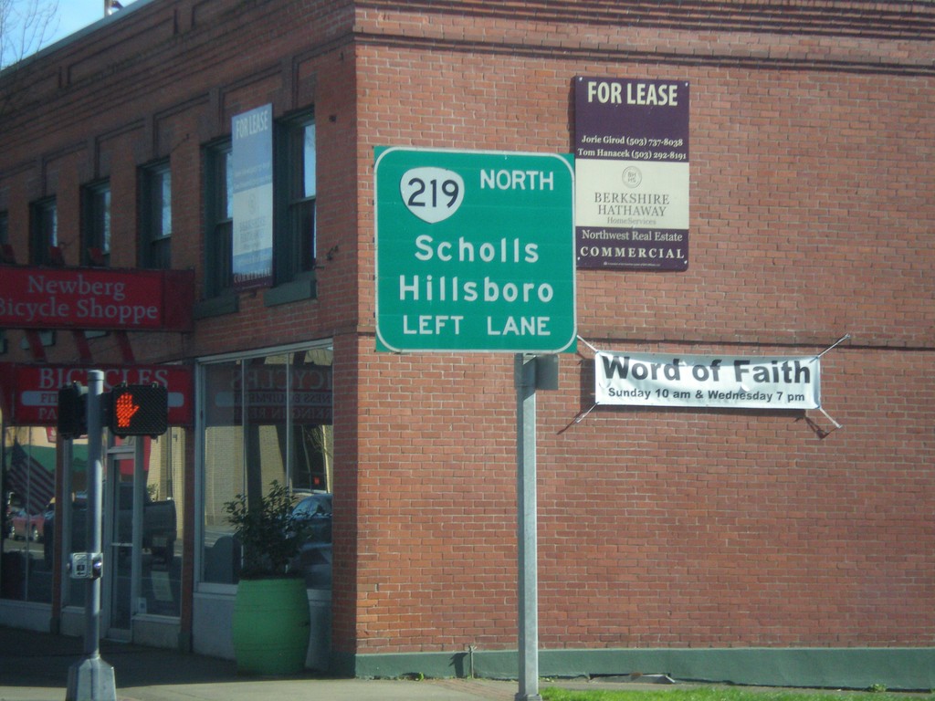
OR-99W North Approaching OR-219
OR-99W North Approaching OR-219 North to Scholls and Hillsboro. OR-219 joins OR-99W through Newberg.
Taken 02-16-2015

 Newberg
Yamhill County
Oregon
United States
Newberg
Yamhill County
Oregon
United States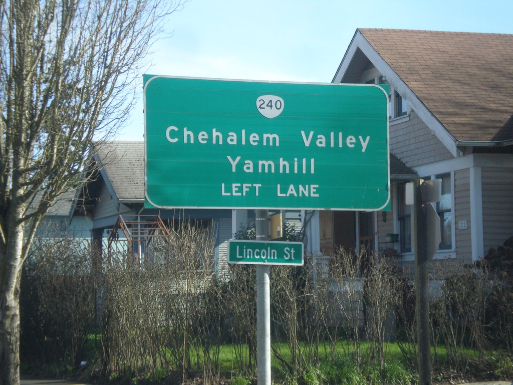
OR-99W North Approaching OR-240
OR-99W north approaching OR-240 north to Chehalem Valley and Yamhill. Use left lanes for OR-240 North.
Taken 02-16-2015
 Newberg
Yamhill County
Oregon
United States
Newberg
Yamhill County
Oregon
United States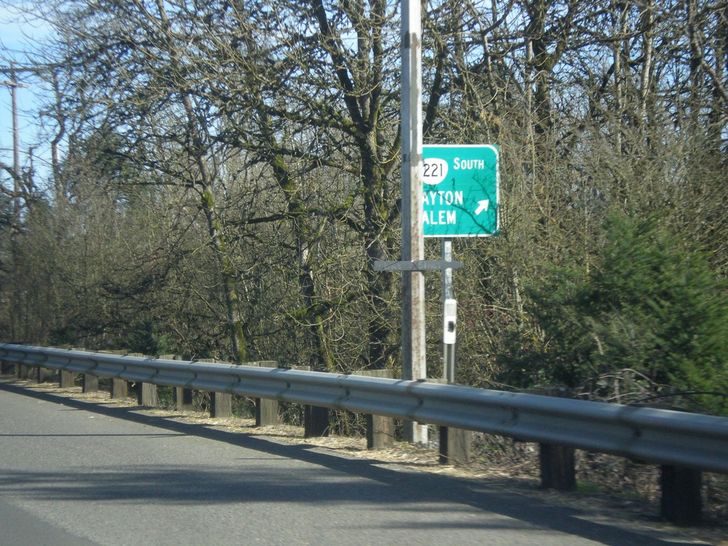
OR-18 East/OR-233 North at OR-221 South
OR-18 East/OR-233 North at OR-221 South to Dayton and Salem.
Taken 02-16-2015


 Dayton
Yamhill County
Oregon
United States
Dayton
Yamhill County
Oregon
United States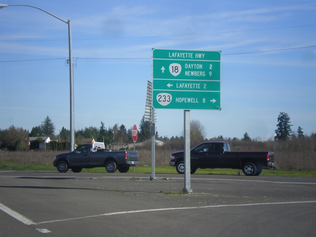
OR-18 East at OR-233 (Lafayette Highway)
OR-18 east at OR-233 (Lafayette Highway). Use OR-233 south for Hopewell. Turn north on Lafayette Highway for Lafayette. Continue east on OR-18 for Dayton and Newberg. OR-233 follows OR-18 north to OR-99W junction.
Taken 02-16-2015
Dayton
Yamhill County
Oregon
United States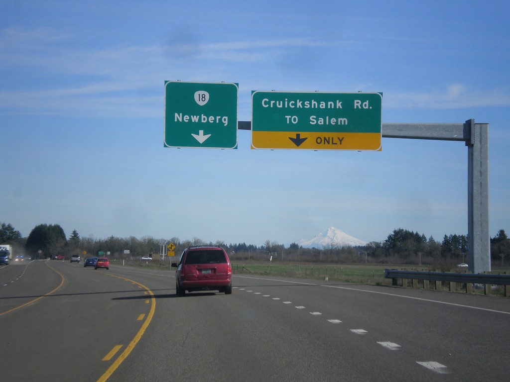
OR-18 East - Cruickshank Road Jct.
OR-18 east at Cruickshank Road/To Salem Jct. Continue east on OR-18 for Newberg.
Taken 02-16-2015
McMinnville
Yamhill County
Oregon
United States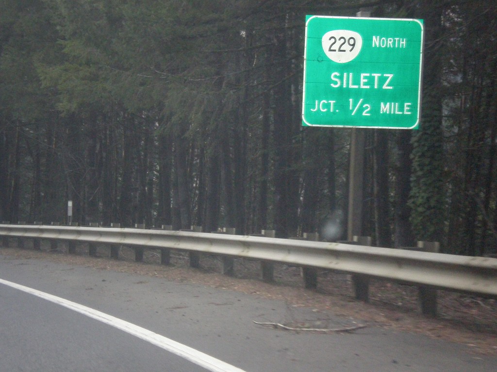
US-20 West Approaching OR-229 North
US-20 west approaching OR-229 north to Siletz.
Taken 02-13-2015

 Toledo
Lincoln County
Oregon
United States
Toledo
Lincoln County
Oregon
United States