Signs Tagged With Shield Inside Sign
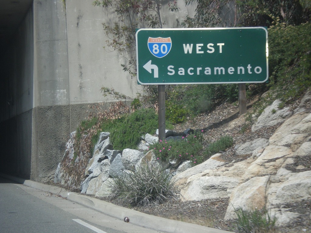
Rocklin Road West at I-80 West
Rocklin Road West at I-80 West to Sacramento (Exit 108).
Taken 05-04-2014
 Rocklin
Placer County
California
United States
Rocklin
Placer County
California
United States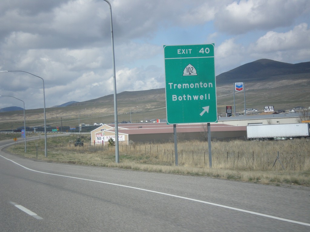
I-84 West - Exit 40
I-84 west at Exit 40 - UT-102/Tremonton/Bothwell.
Taken 03-31-2014

 Tremonton
Box Elder County
Utah
United States
Tremonton
Box Elder County
Utah
United States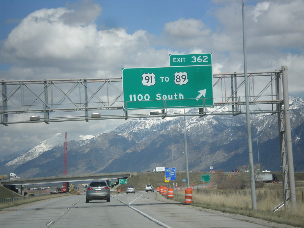
I-15 North/I-84 West - Exit 362
I-15 North/I-84 West at Exit 362 - US-91/To US-89/1100 South St.
Taken 03-31-2014


 Perry
Box Elder County
Utah
United States
Perry
Box Elder County
Utah
United States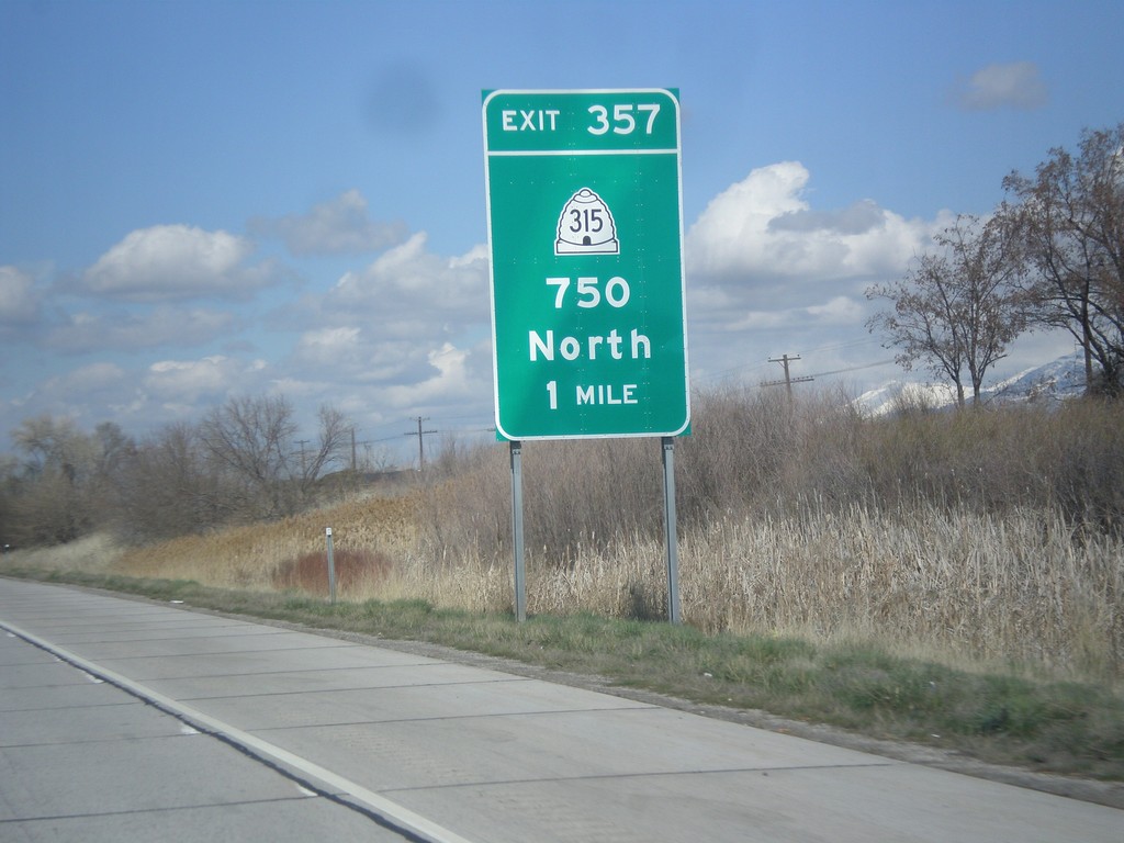
I-15 North/I-84 West - Exit 357
I-15 North/I-84 West approaching Exit 357 - UT-315/750 North.
Taken 03-31-2014
 Willard
Box Elder County
Utah
United States
Willard
Box Elder County
Utah
United States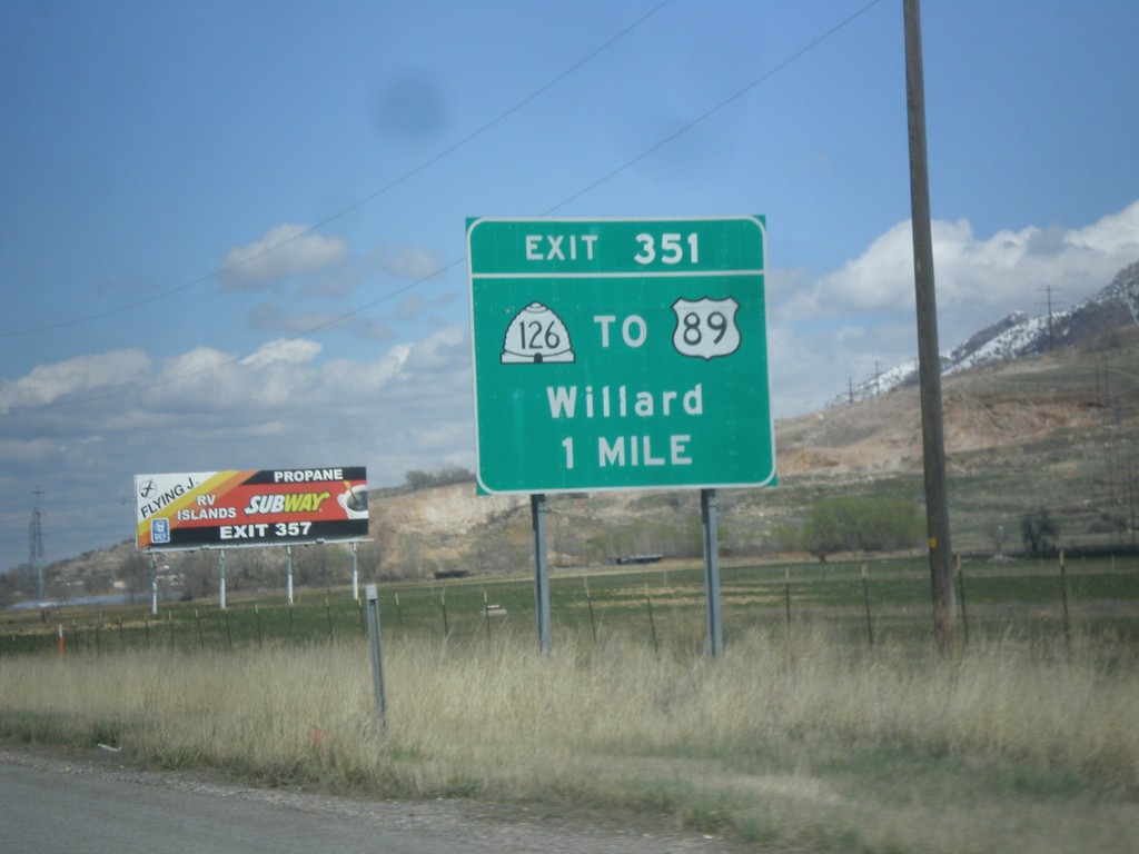
I-15 North/I-84 West - Exit 351
I-15 North/I-84 West approaching Exit 351 - UT-126/To US-89/Willard.
Taken 03-31-2014
 Ogden
Weber County
Utah
United States
Ogden
Weber County
Utah
United States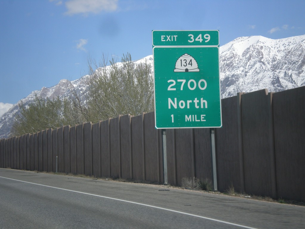
I-15 North/I-84 West - Exit 349
I-15 North/I-84 West approaching Exit 349 - UT-134/2700 North.
Taken 03-31-2014
 Farr West
Weber County
Utah
United States
Farr West
Weber County
Utah
United States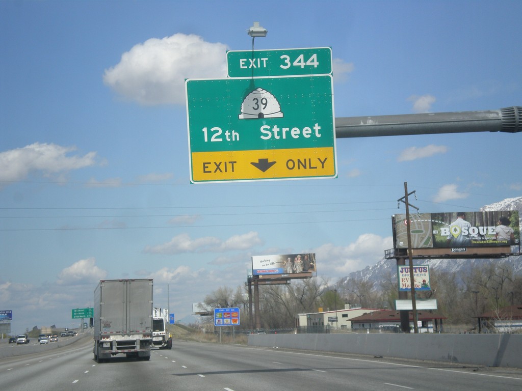
I-15 North/I-84 West - Exit 344
I-15 North/I-84 West approaching Exit 344 - UT-39/12th St.
Taken 03-31-2014
 West Haven
Weber County
Utah
United States
West Haven
Weber County
Utah
United States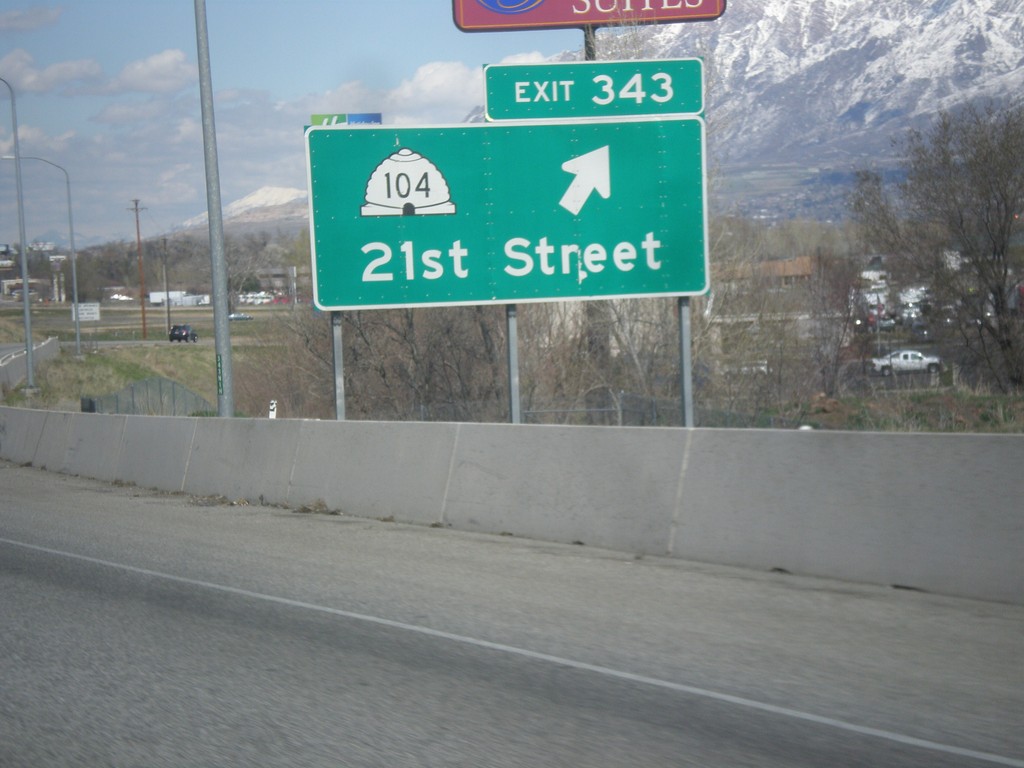
I-15 North/I-84 West - Exit 343
I-15 North/I-84 West at Exit 343 - UT-104/21st St.
Taken 03-31-2014
 Ogden
Weber County
Utah
United States
Ogden
Weber County
Utah
United States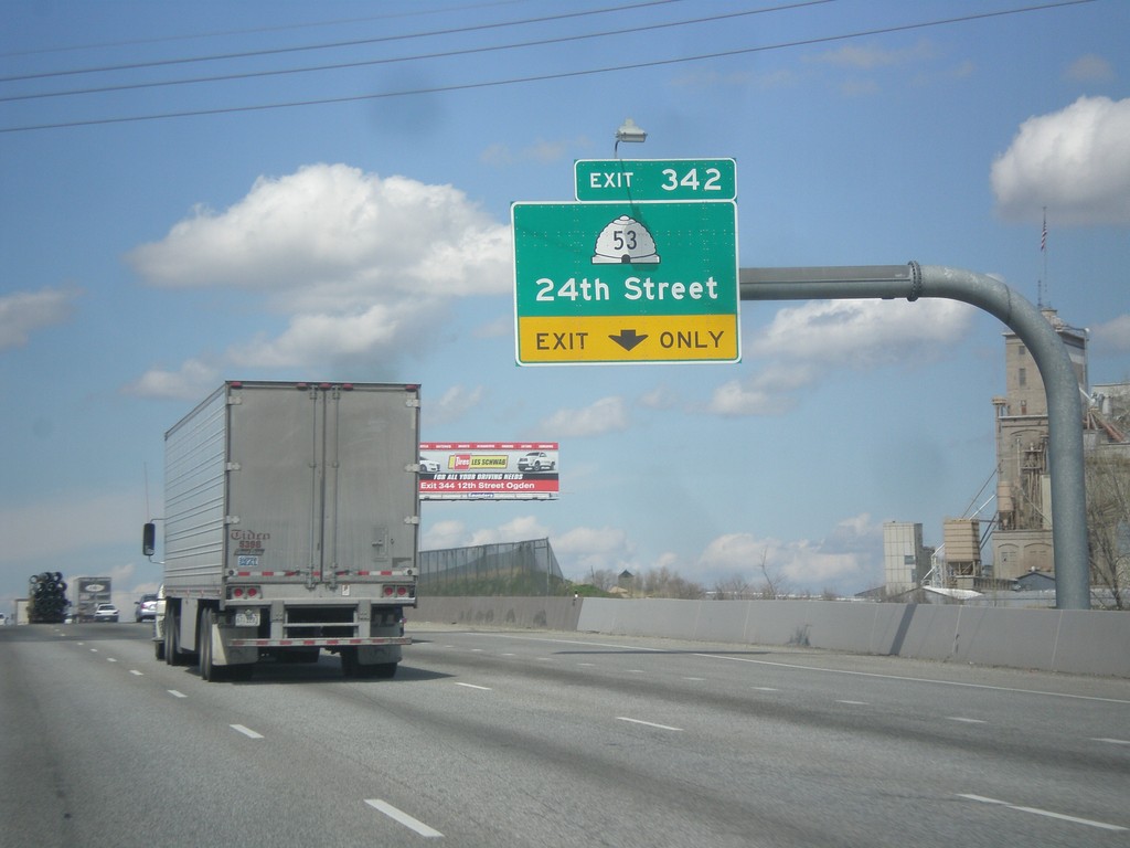
I-15 North/I-84 West - Exit 342
I-15 North/I-84 West approaching Exit 342 - UT-53/24th St.
Taken 03-31-2014
 Ogden
Weber County
Utah
United States
Ogden
Weber County
Utah
United States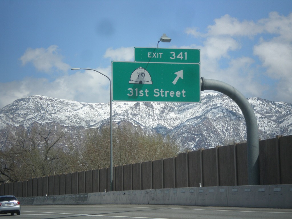
I-15 North - Exit 341
I-15 north at Exit 341 - UT-79/31st St.
Taken 03-31-2014
 Riverdale
Weber County
Utah
United States
Riverdale
Weber County
Utah
United States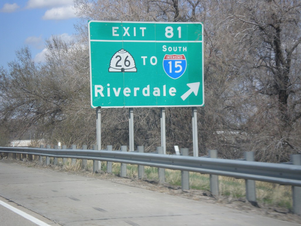
I-84 West - Exit 81
I-84 west at Exit 81 - UT-26/To I-15 South/Riverdale.
Taken 03-31-2014
 Ogden
Weber County
Utah
United States
Ogden
Weber County
Utah
United States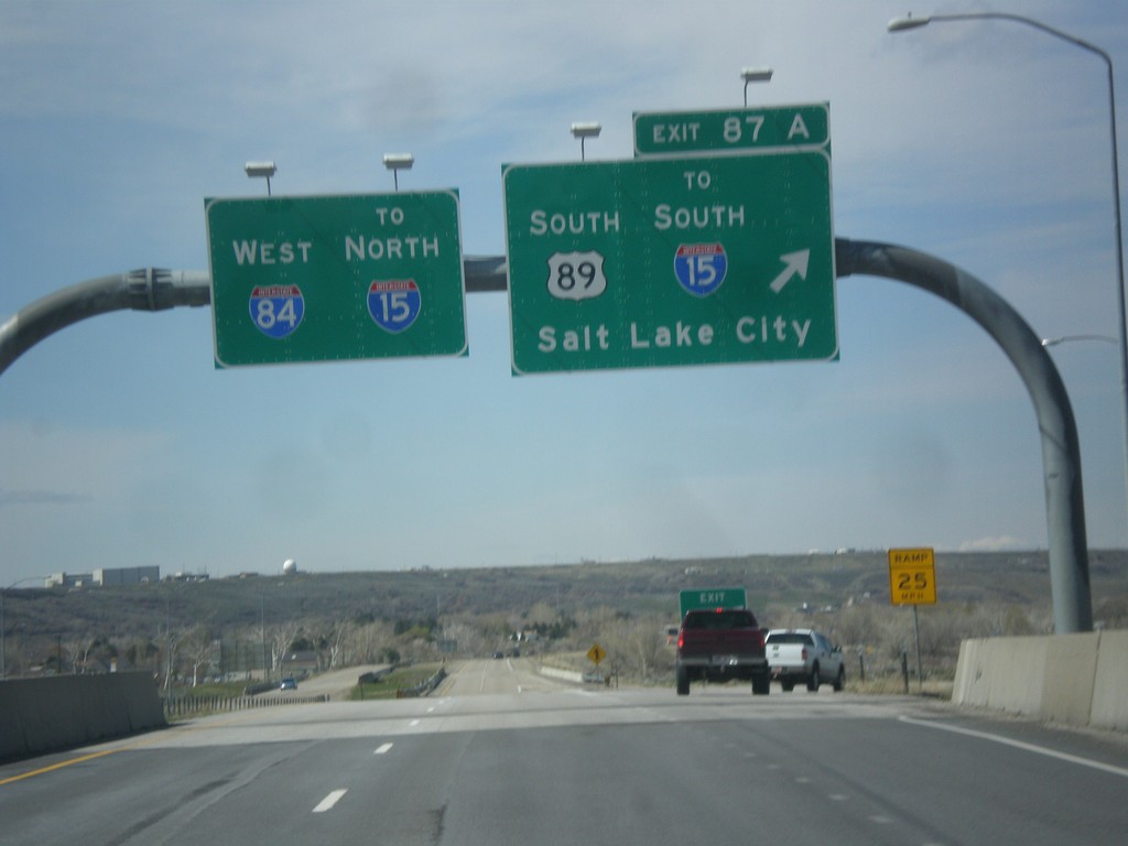
I-84 West - Exit 87A
I-84 west at Exit 87A - US-89 South/To I-15 South/Salt Lake City. Continue west on I-84 for I-15 North.
Taken 03-31-2014
Uintah
Weber County
Utah
United States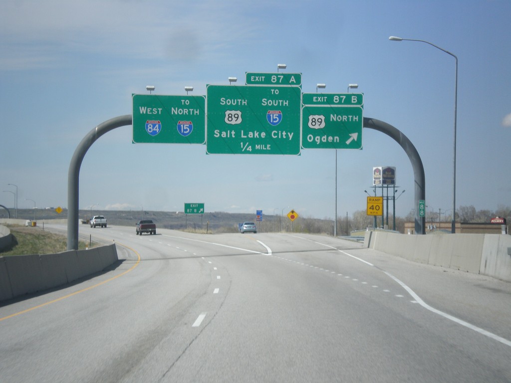
I-84 West - Exits 87A and 87B
I-84 west at Exit 87B - US-89 North/Ogden. Approaching US-89 South/To I-15 South/Salt Lake City. Continue west on I-84 for I-15 north.
Taken 03-31-2014
Uintah
Weber County
Utah
United States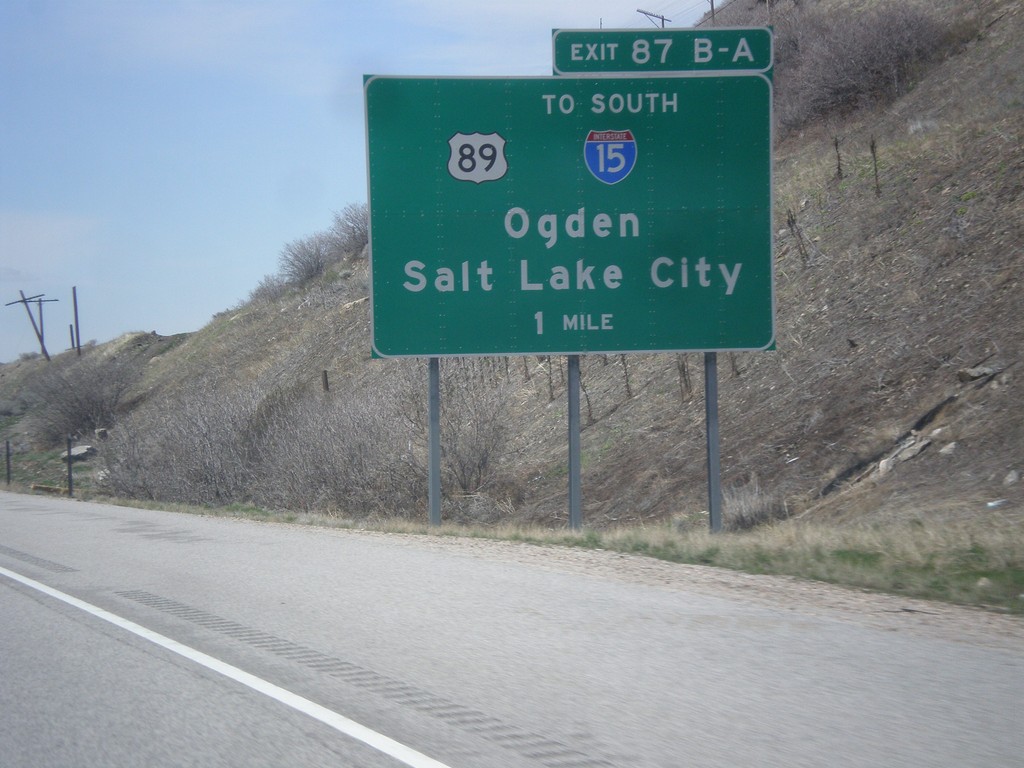
I-84 West - Exits 87A-B
I-84 west approaching Exits 87A-B - US-89/To I-15 South/Ogden/Salt Lake City.
Taken 03-31-2014
South Weber
Davis County
Utah
United States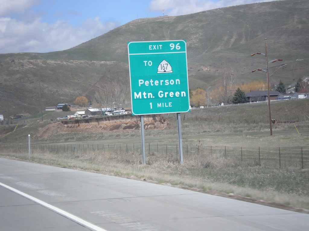
I-84 West - Exit 96
I-84 west approaching Exit 96 - To UT-167/Mountain Green/Peterson.
Taken 03-31-2014
 Morgan
 County
Utah
United States
Morgan
Morgan County
Utah
United States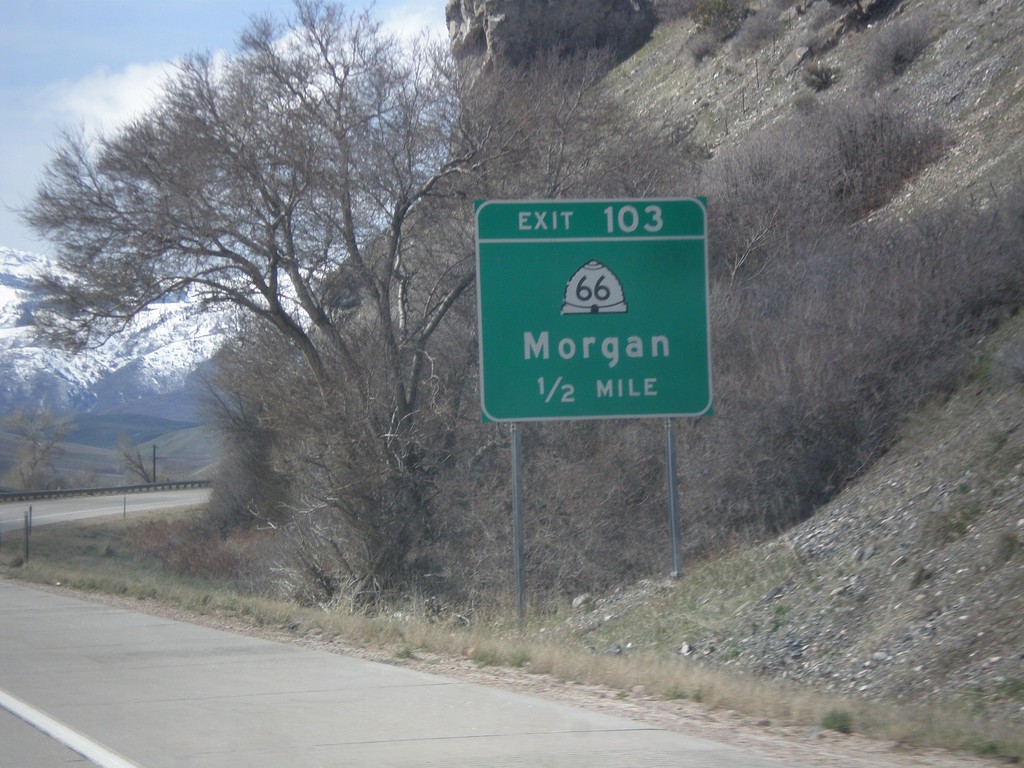
I-84 West - Exit 103
I-84 west approaching Exit 103 - UT-66/Morgan.
Taken 03-31-2014
 Morgan
 County
Utah
United States
Morgan
Morgan County
Utah
United States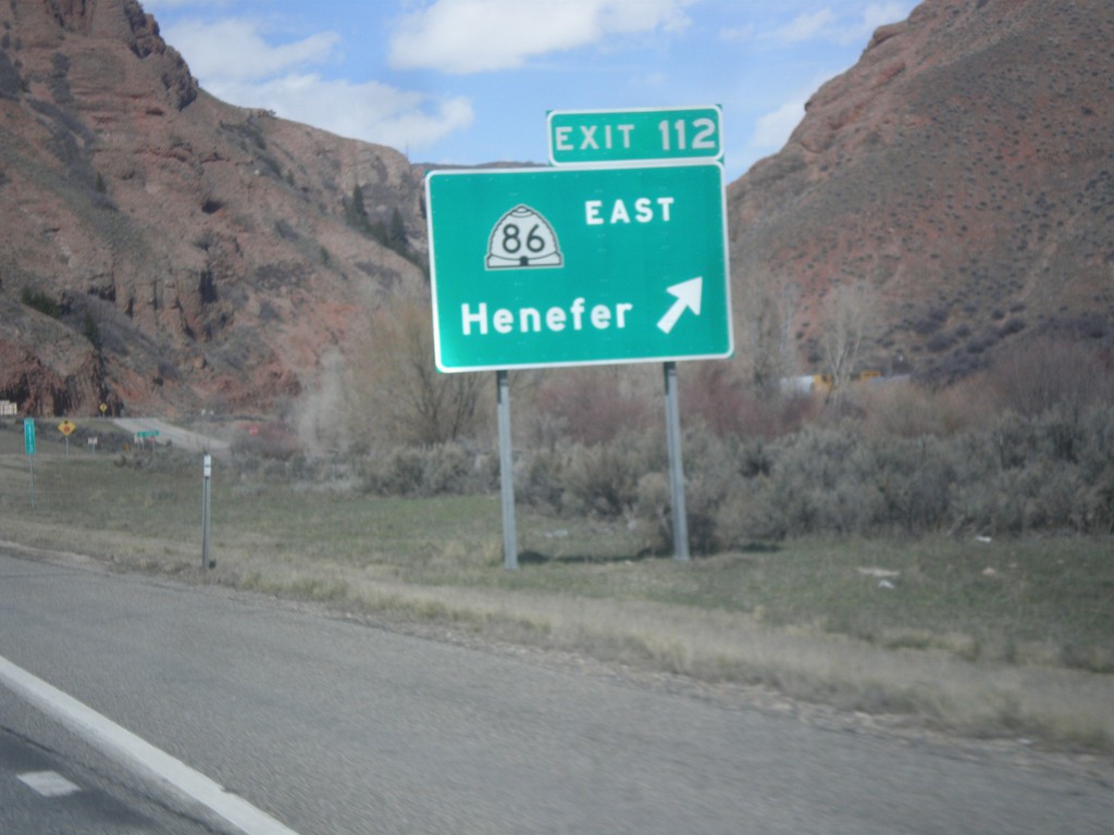
I-84 West - Exit 112
I-84 west at Exit 112 - UT-86 East/Henefer.
Taken 03-31-2014
 Henefer
Summit County
Utah
United States
Henefer
Summit County
Utah
United States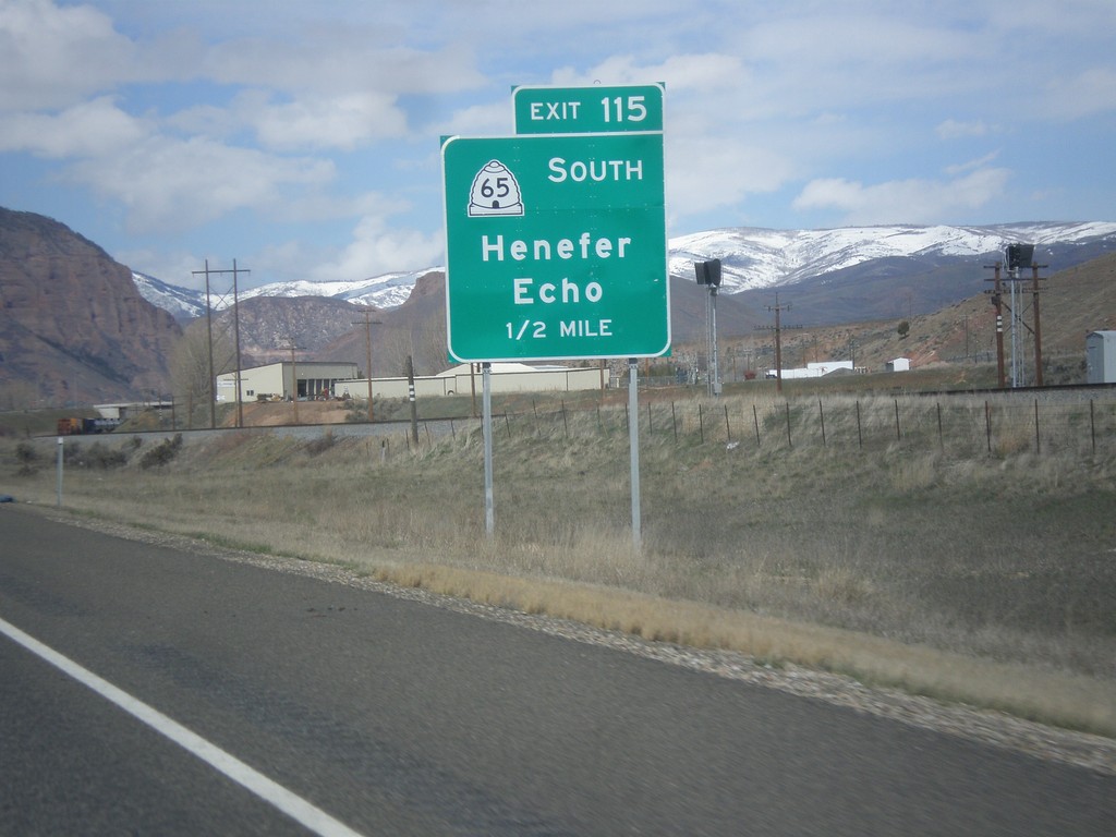
I-84 West - Exit 115
I-84 west at Exit 115 - UT-65 South/Henefer/Echo.
Taken 03-31-2014
 Henefer
Summit County
Utah
United States
Henefer
Summit County
Utah
United States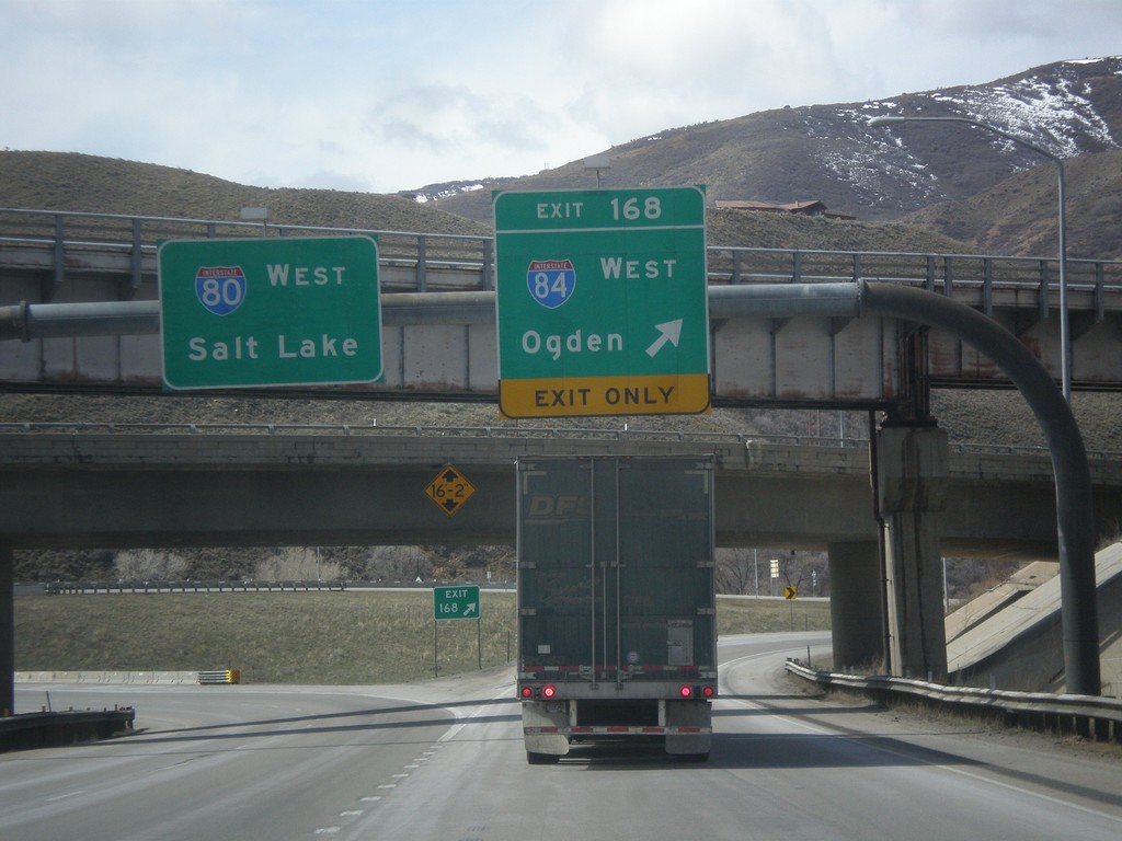
I-80 West at I-84
I-80 west at I-84 junction. Use Exit 168 for I-84 West/Ogden; continue west on I-80 for Salt Lake.
Taken 03-31-2014
Echo
Summit County
Utah
United States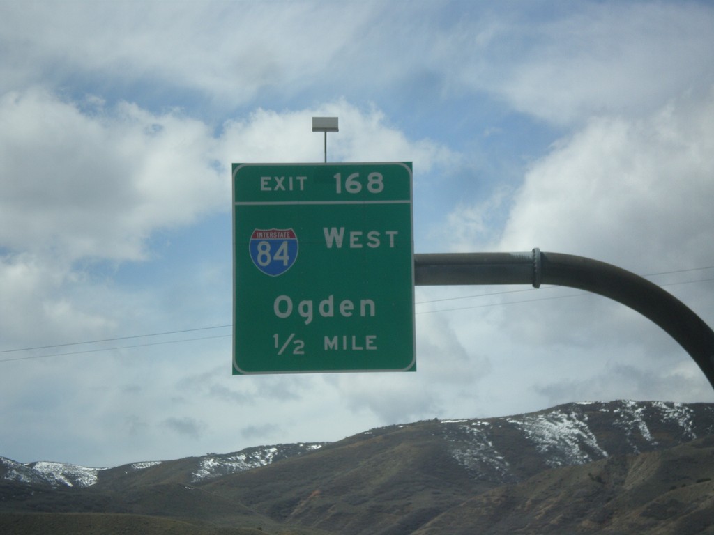
I-80 West - Exit 168
I-80 west approaching Exit 168 - I-84 West/Ogden.
Taken 03-31-2014
Coalville
Summit County
Utah
United States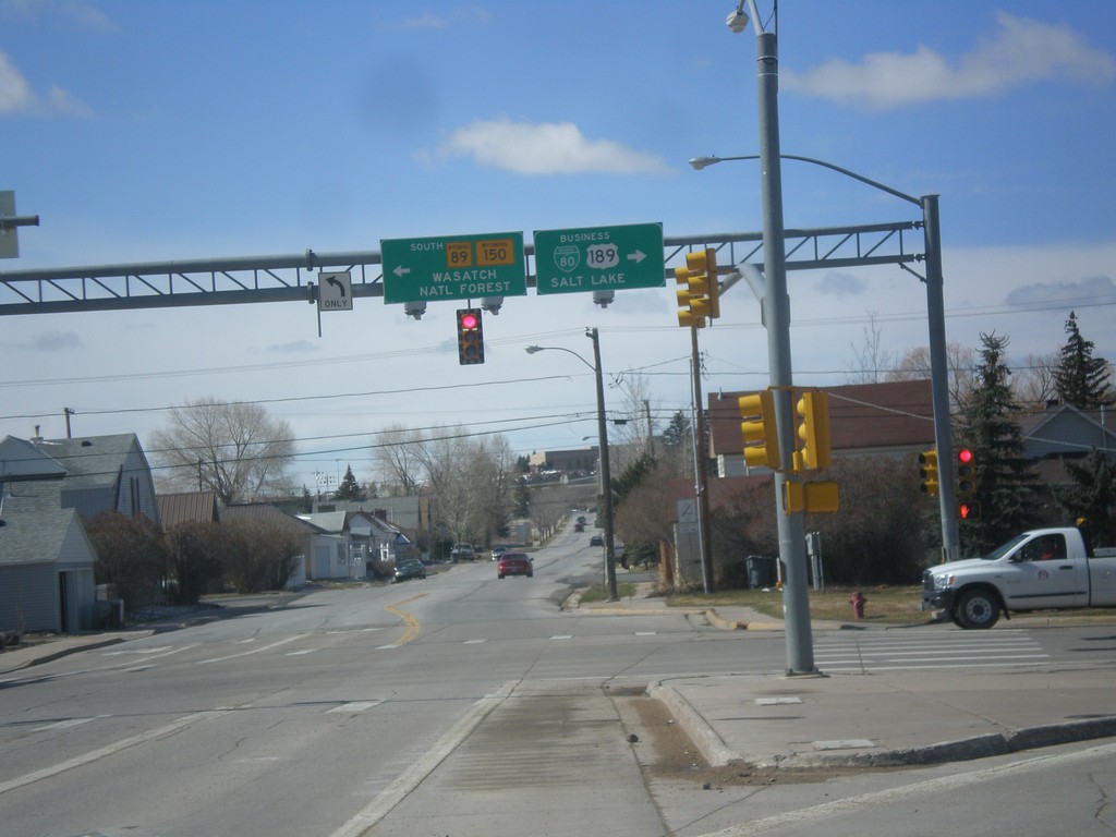
BL-80/Bus US-189 at WY-89/To WY-150
BL-80/Bus US-189 at WY-89/To WY-150. Turn left for WY-89 South/(To)WY-150 to Wasatch National Forest. Turn right for BL-80 East/Bus. US-189 South to Salt Lake.
Taken 03-31-2014


 Evanston
Uinta County
Wyoming
United States
Evanston
Uinta County
Wyoming
United States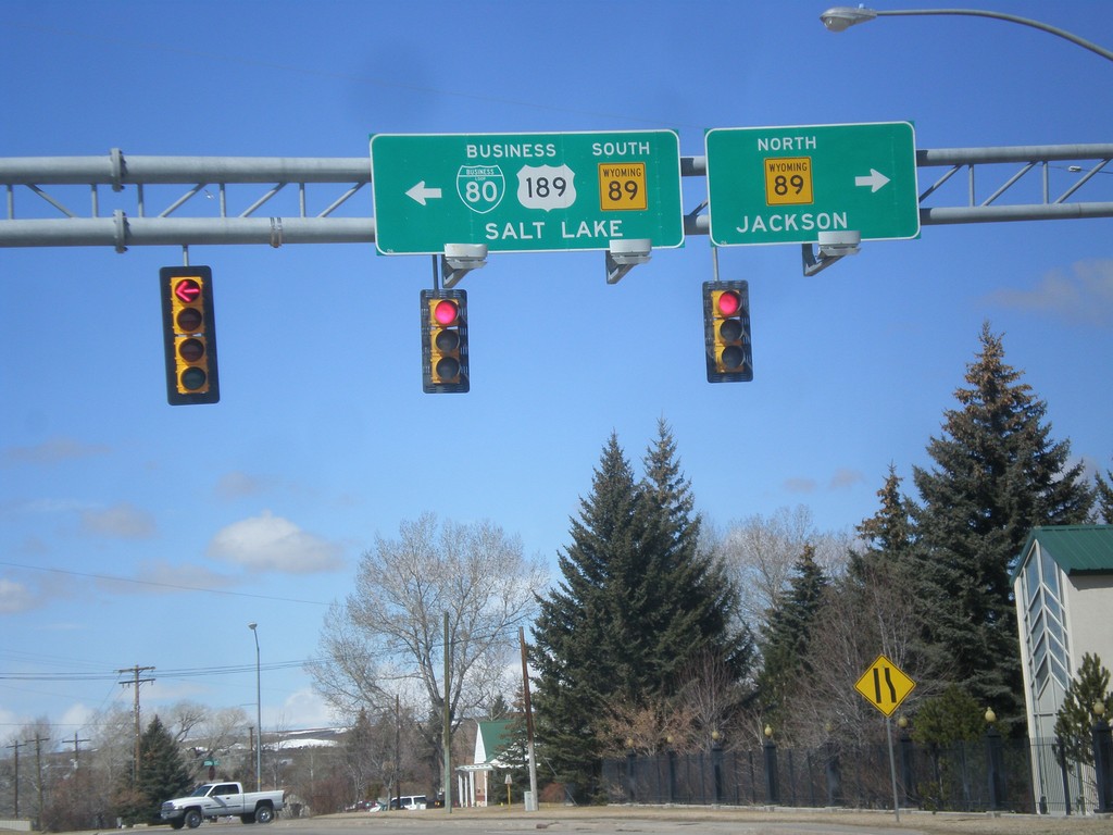
BL-80/Bus. US-189 West At WY-89
BL-80/Bus. US-189 West at WY-89. Turn right for WY-89 North to Jackson; left for WY-89 South/BL-80/Bus. US-189 to Salt Lake.
Taken 03-31-2014
Evanston
Uinta County
Wyoming
United States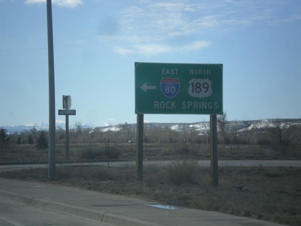
End BL-80/Bus. US-189 East at I-80 East
End BL-80/Bus. US-189 East at I-80 East/US-189 North to Rock Springs.
Taken 03-31-2014
 Evanston
Uinta County
Wyoming
United States
Evanston
Uinta County
Wyoming
United States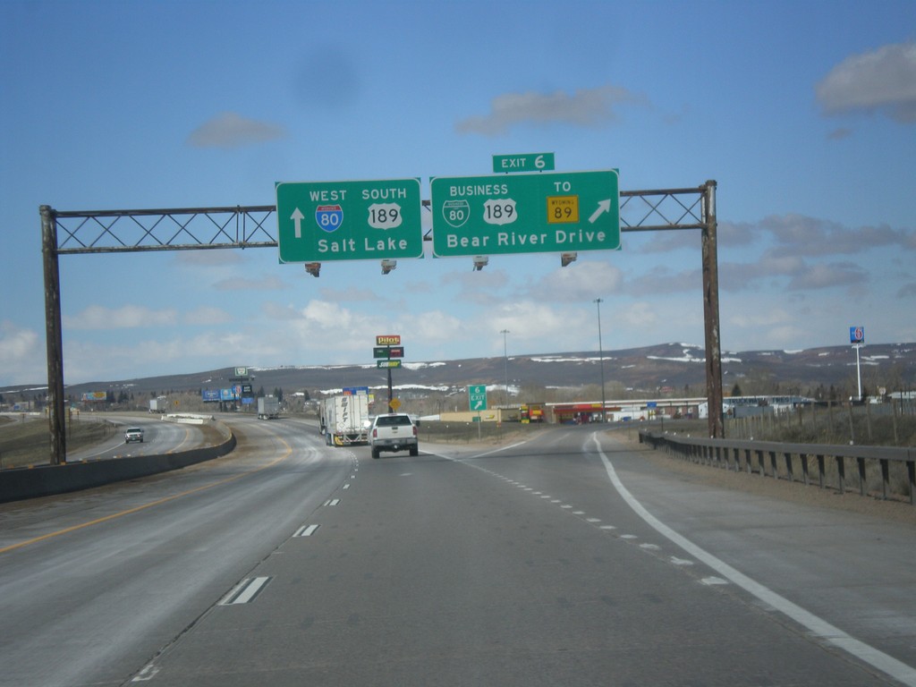
I-80 West - Exit 6
I-80 west at Exit 6 - BL-80/Business US-189/To WY-89/Bear River Drive. This is the eastern end of the Evanston business loop. Evanston is the last city in Wyoming along I-80 west.
Taken 03-31-2014
Evanston
Uinta County
Wyoming
United States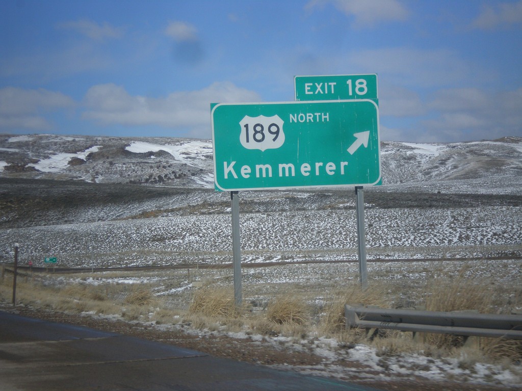
I-80 West - Exit 18
I-80 west at Exit 18 - US-189 North/Kemmerer. US-189 south joins I-80 west into Utah.
Taken 03-31-2014
Aspen
Uinta County
Wyoming
United States