Signs Tagged With Interstate Shield with State Name
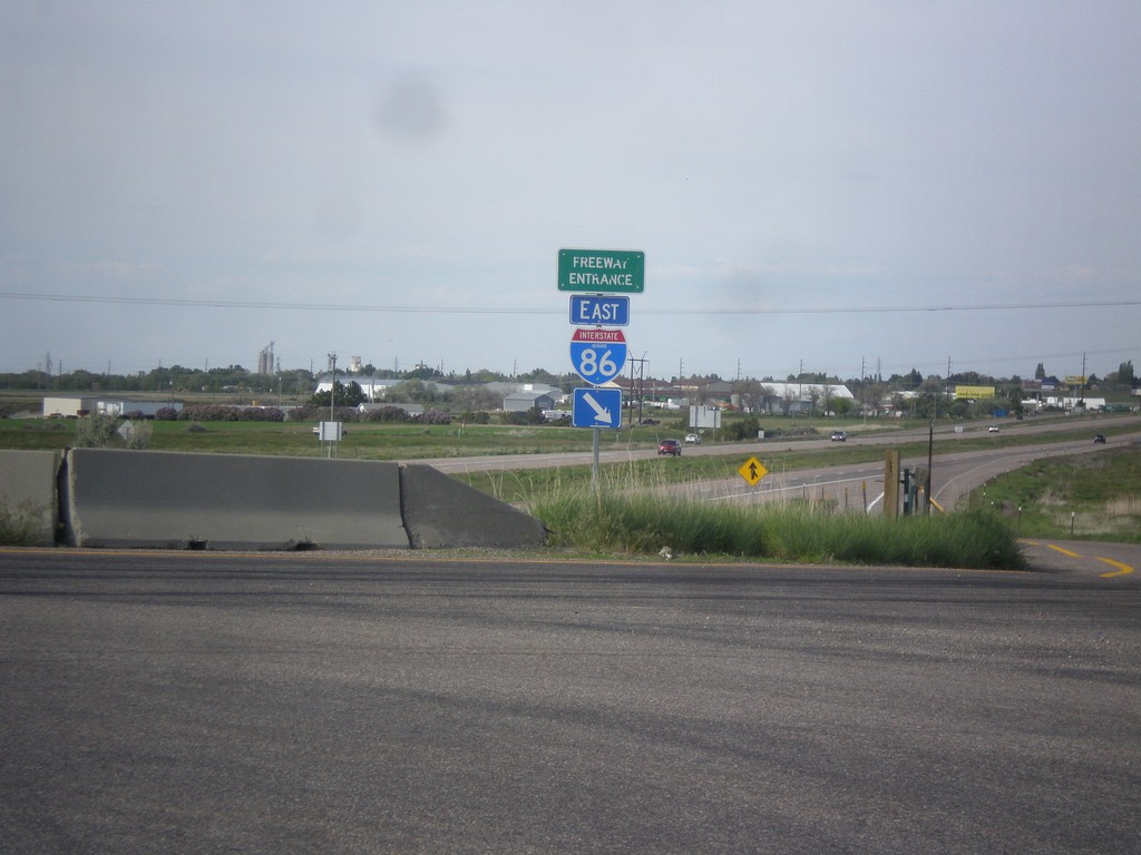
I-86 East - Freeway Entrance
Freeway Entrance on I-86 east. This style sign assembly for freeway entrances is not very common in Idaho. Also, note that the I-86 shield has the text IDAHO in it, which is also pretty rare. Most of the interstate shields that have the text IDAHO in them are older. This sign appears to be newer.
Taken 05-13-2016


 American Falls
Power County
Idaho
United States
American Falls
Power County
Idaho
United States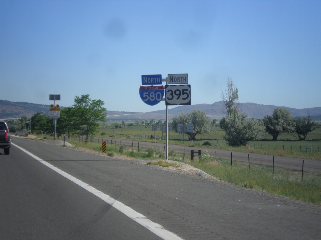
I-580 North/US-395 North - Washoe County
I-580 North/US-395 North in Washoe County.
Taken 06-15-2015

 New Washoe City
Washoe County
Nevada
United States
New Washoe City
Washoe County
Nevada
United States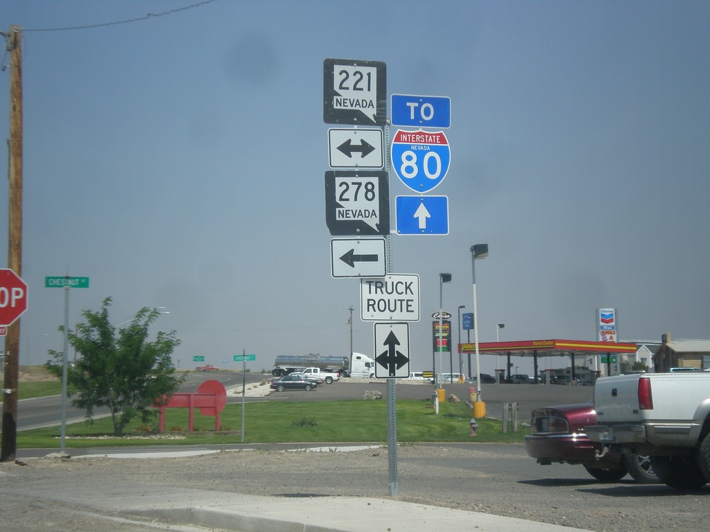
10th St. North at Chestnut St.
10th St. northbound at Chestnut St. (BL-80/NV-221) in Carlin. Use westbound Chestnut St. for NV-278. Continue north on 10th St. (NV-766) for I-80.
Taken 08-31-2014


 Carlin
Elko County
Nevada
United States
Carlin
Elko County
Nevada
United States
NV-225 North at I-80 West
NV-225 north at I-80 West (Exit 301).
Taken 06-21-2014
 Elko
Elko County
Nevada
United States
Elko
Elko County
Nevada
United States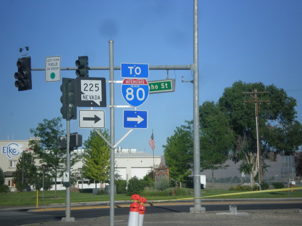
BL-80 West at NV-225 (To I-80)
BL-80 West at NV-225 North. Continue west on BL-80 (Idaho St.) for I-80.
Taken 06-21-2014
Elko
Elko County
Nevada
United States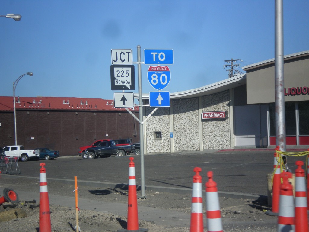
BL-80 West To NV-225/I-80
BL-80 West (Idaho St.), to NV-225 and I-80.
Taken 06-21-2014
Elko
Elko County
Nevada
United States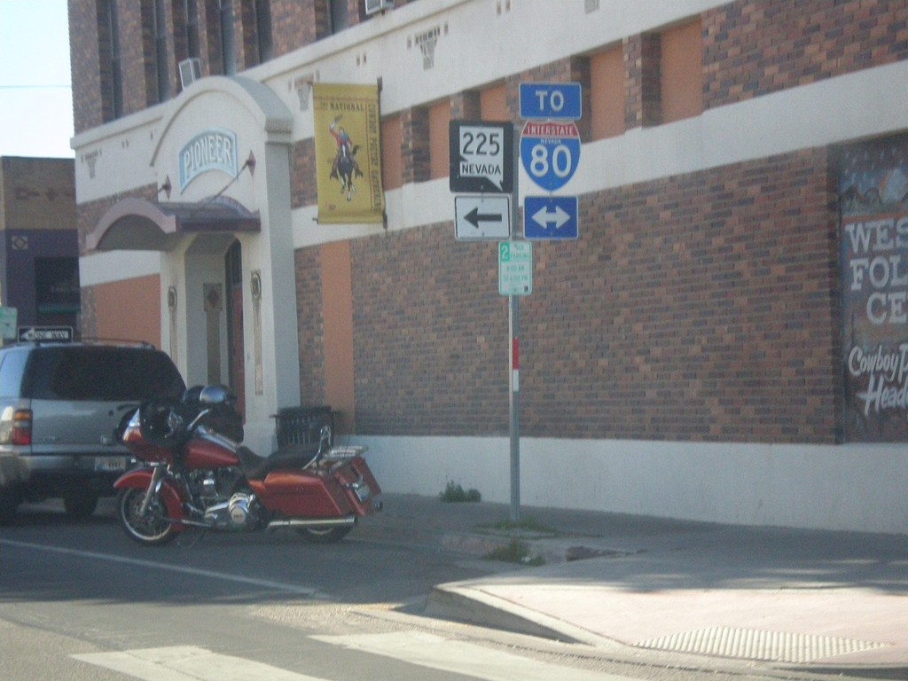
End NV-227 at BL-80 (Idaho St.)
End NV-227 west at BL-80 (Idaho St.) in downtown Elko. Use Idaho St. for access to I-80. Use Idaho St. west for access to NV-225.
Taken 06-21-2014
 Elko
Elko County
Nevada
United States
Elko
Elko County
Nevada
United States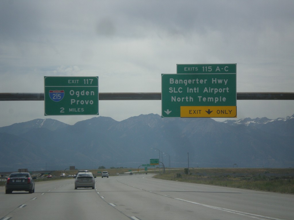
I-80 East - Exits 115 and Exit 117.
I-80 east at Exit 115 A-C - Bangerter Highway/SLC International Airport/North Temple. Approaching Exit 117 - I-215/Ogden/Provo. In the I-215 shield is the text UTAH. More and more of these types of shields with the state names are appearing around Utah.
Taken 06-20-2014
 Salt Lake City
Salt Lake County
Utah
United States
Salt Lake City
Salt Lake County
Utah
United States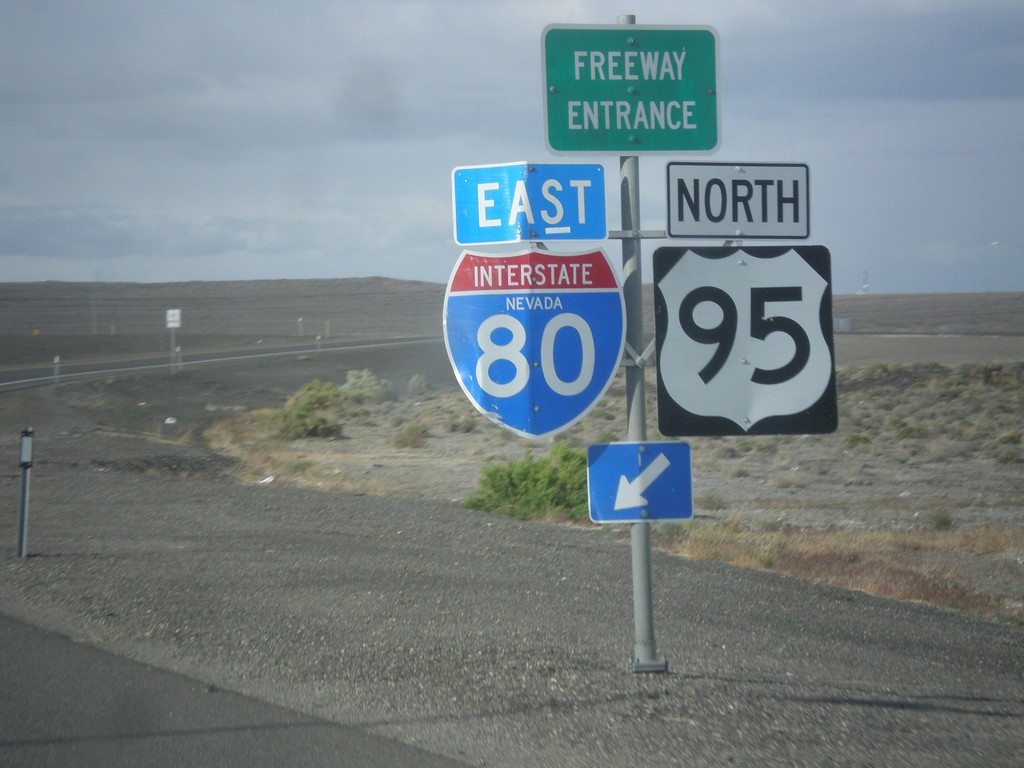
US-95 North at I-80 East (Exit 83)
US-95 north at I-80 (Exit 83) onramp. US-95 north joins I-80 east to Winnemucca.
Taken 05-05-2014

 Churchill County
Nevada
United States
Churchill County
Nevada
United States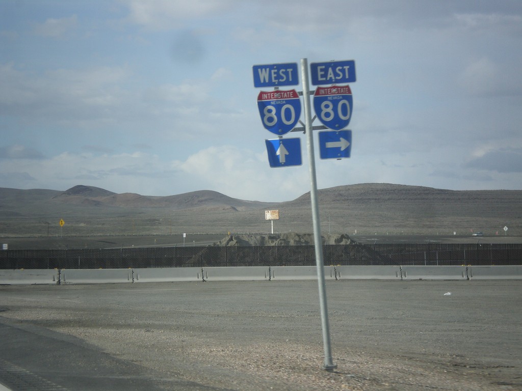
US-95 North Approaching I-80
US-95 north approaching I-80 in Churchill County.
Taken 05-05-2014
Churchill County
Nevada
United States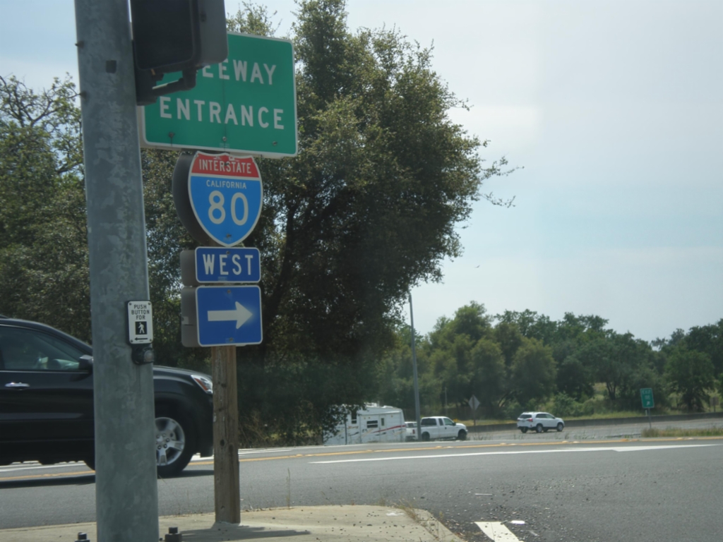
Horseshoe Bar Road East at I-80 West
Horseshoe Bar Road east at I-80 west onramp (Exit 110) in Loomis.
Taken 05-04-2014
Loomis
Placer County
California
United States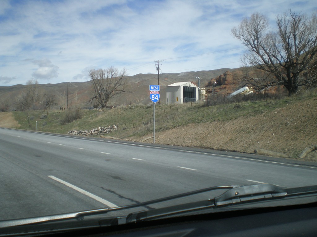
I-84 West - Utah
First shield on I-84 west. The picture is fuzzy, but the shield contains the word UTAH.
Taken 03-31-2014
 Coalville
Summit County
Utah
United States
Coalville
Summit County
Utah
United States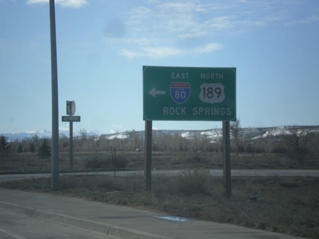
End BL-80/Bus. US-189 East at I-80 East
End BL-80/Bus. US-189 East at I-80 East/US-189 North to Rock Springs.
Taken 03-31-2014

 Evanston
Uinta County
Wyoming
United States
Evanston
Uinta County
Wyoming
United States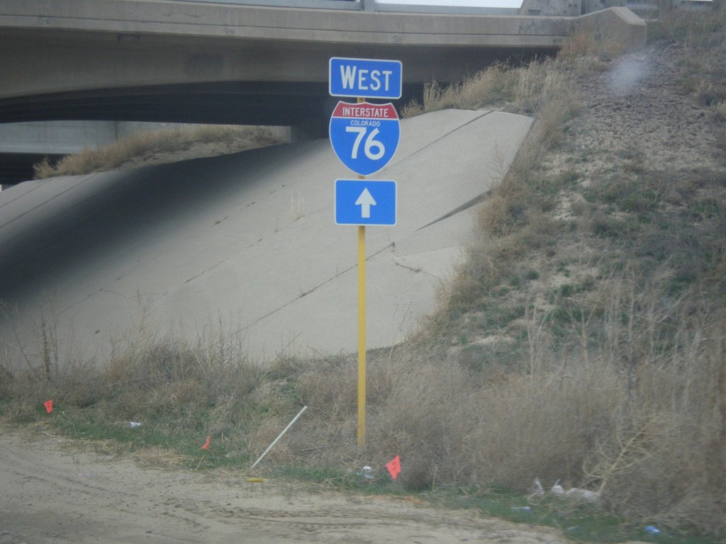
Hospital Road North at I-76 West
Hospital Road north approaching I-76 west.
Taken 03-30-2014
 Brush
Morgan County
Colorado
United States
Brush
Morgan County
Colorado
United States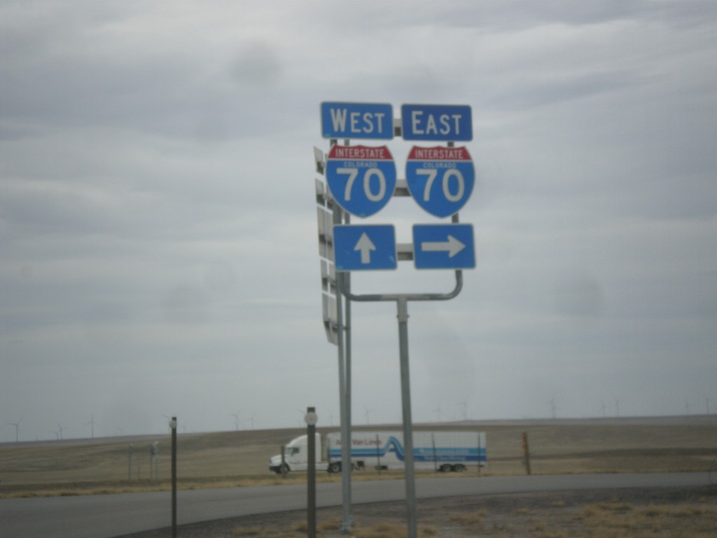
BL-70/US-40 West/US-287 North at I-70
BL-70/US-40 West/US-287 North at I-70. Turn right for I-70 East; continue over overpass for I-70/US-40 East/US-287 North. This is the western end of the Limon business loop.
Taken 03-30-2014


 Limon
Lincoln County
Colorado
United States
Limon
Lincoln County
Colorado
United States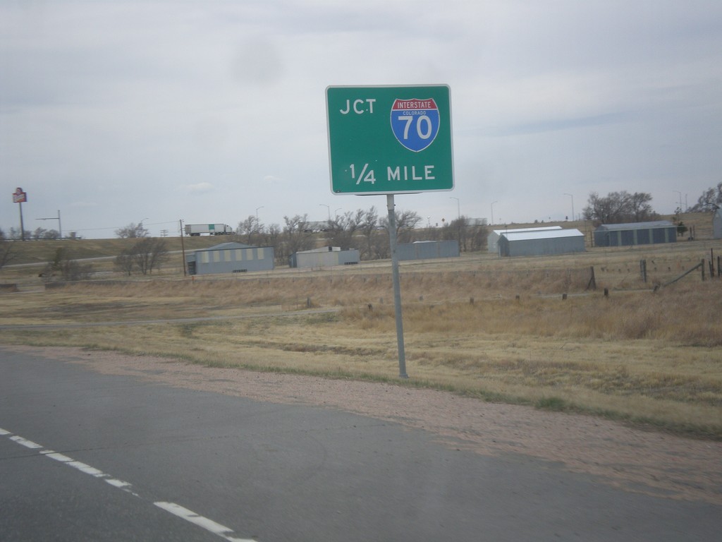
BL-70/US-24/US-40 West/US-287 North Approaching I-70
BL-70/US-24/US-40 West/US-287 North approaching I-70 (Exit 361).
Taken 03-30-2014
 Limon
Lincoln County
Colorado
United States
Limon
Lincoln County
Colorado
United States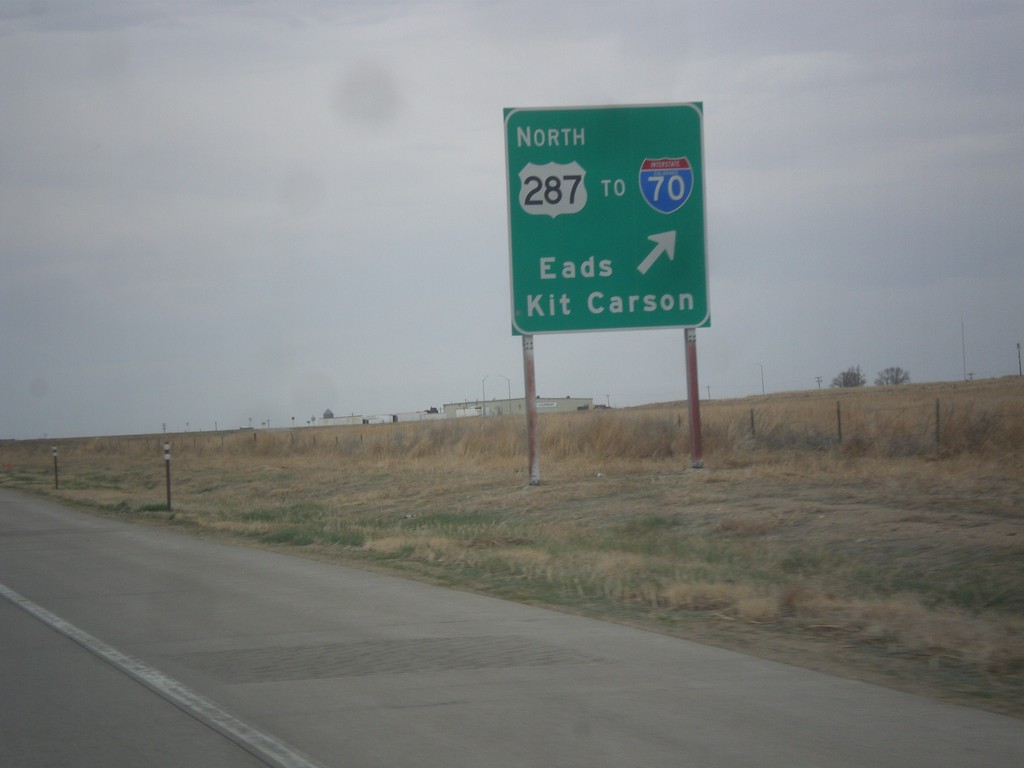
US-50 West/US-287 North at US-287 North
US-50 West/US-287 North at US-287 North/To I-70/Eads/Kit Carson.
Taken 03-30-2014
 Wiley
Prowers County
Colorado
United States
Wiley
Prowers County
Colorado
United States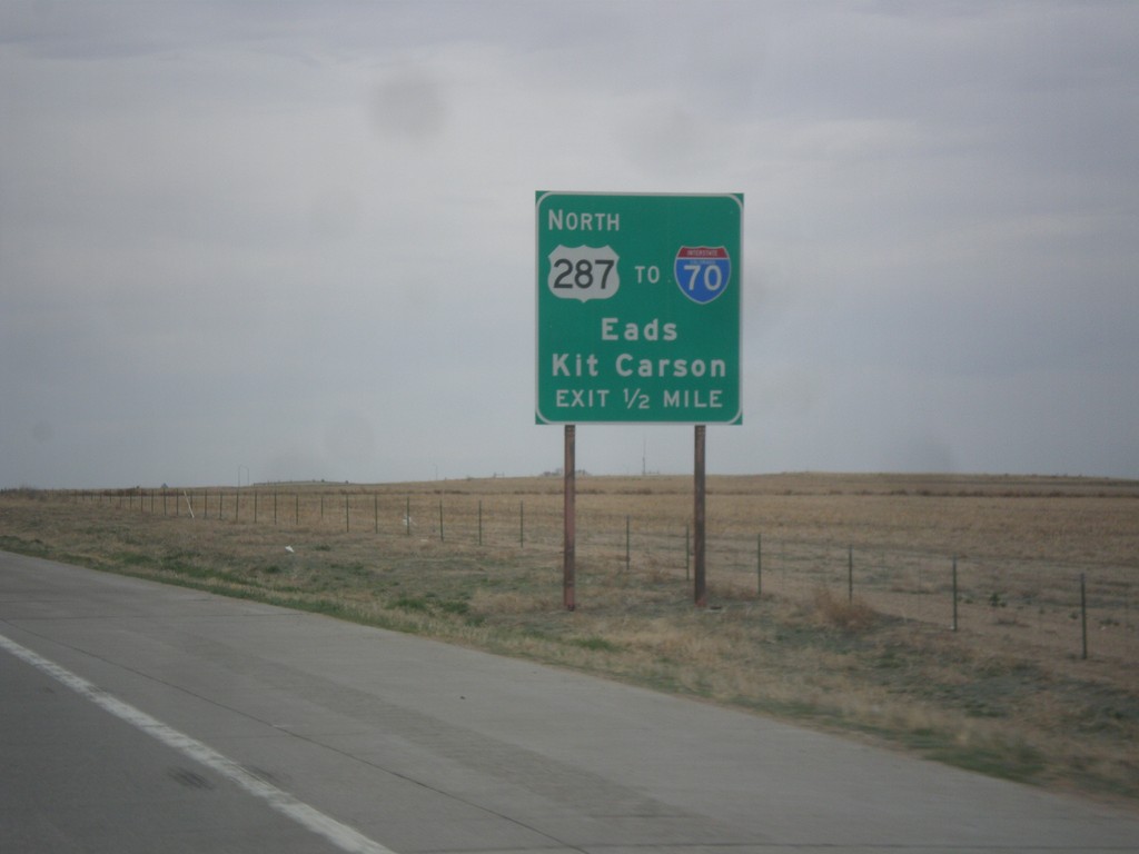
US-50 West/US-287 North Approaching US-287 North
US-50 West/US-287 North approaching US-287 North. Use US-287 north for I-70/Eads/Kit Carson.
Taken 03-30-2014
Wiley
Prowers County
Colorado
United States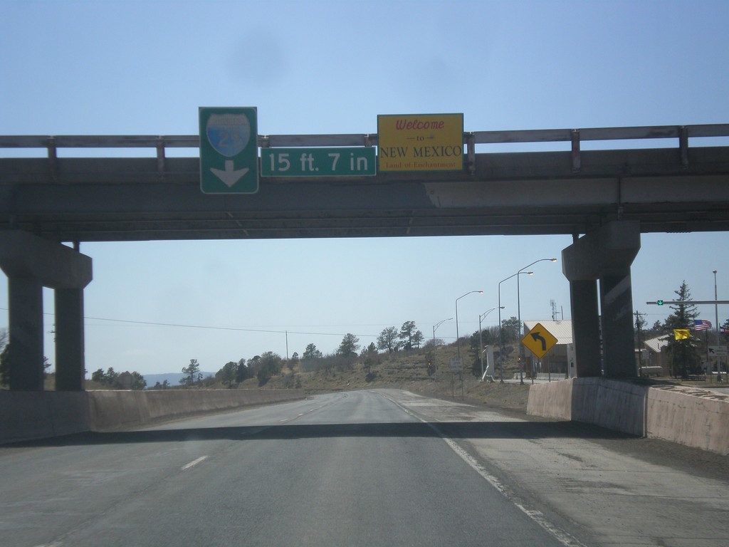
I-25 South - Welcome To New Mexico
Welcome to New Mexico - The Land of Enchantment at Raton Pass.
Taken 03-29-2014
 Raton
Colfax County
New Mexico
United States
Raton
Colfax County
New Mexico
United States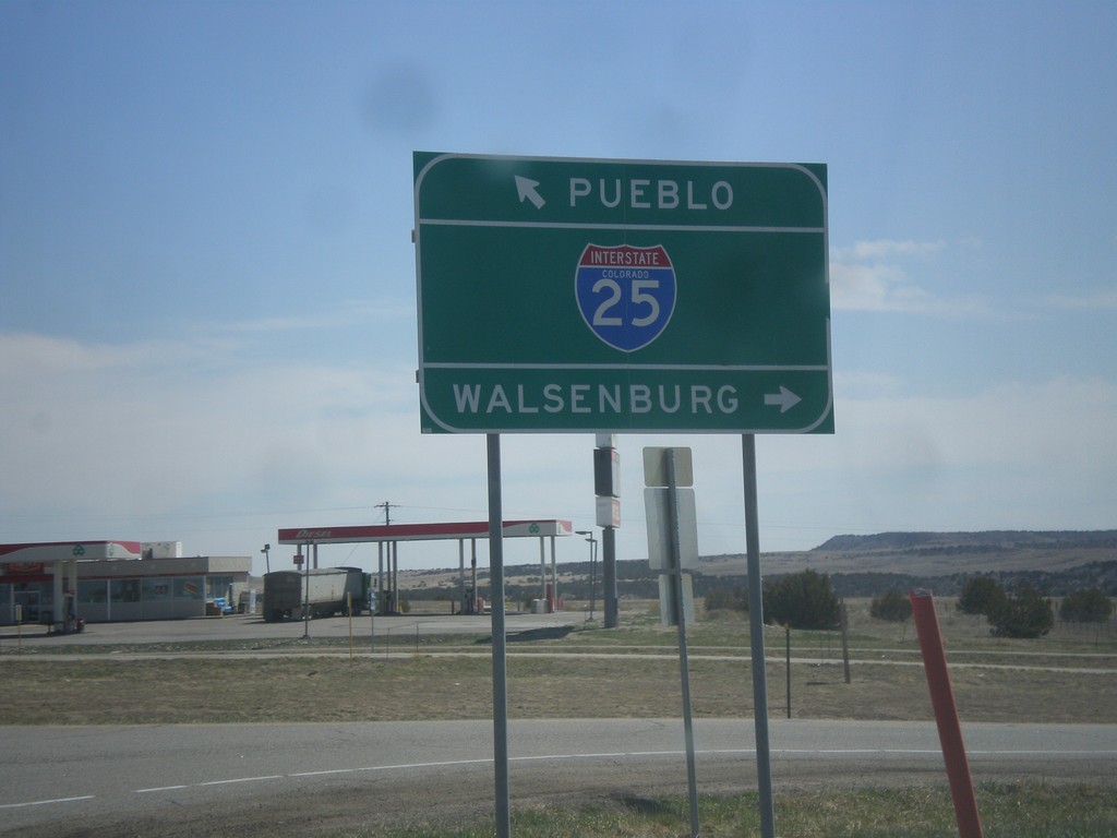
End CO-165 East at I-25
End CO-165 East at I-25. Use I-25 south for Walsenburg; I-25 north for Pueblo.
Taken 03-29-2014

 Pueblo
 County
Colorado
United States
Pueblo
Pueblo County
Colorado
United States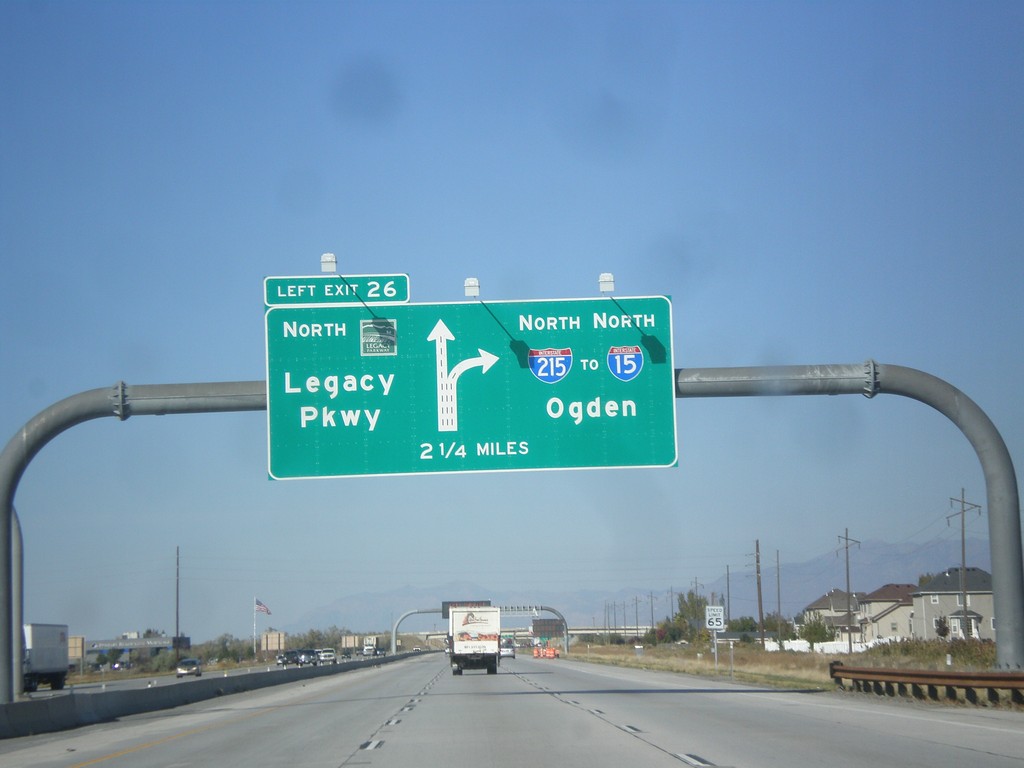
I-215 North - Exit 26
I-215 north approaching Exit 26 - UT-67/Legacy Parkway. Continue north on I-215 for I-15 and Ogden.
Taken 10-18-2013

 Salt Lake City
Salt Lake County
Utah
United States
Salt Lake City
Salt Lake County
Utah
United States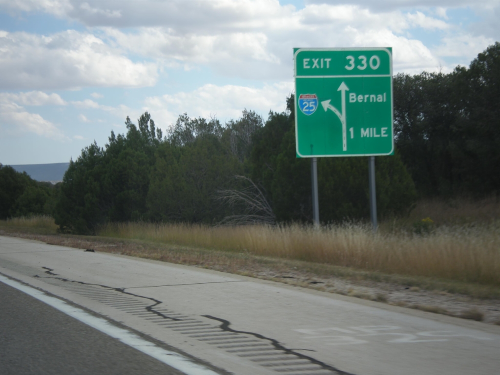
I-25 North - Exit 330
I-25 North approaching Exit 330 - Bernal.
Taken 10-10-2013
 Serafina
San Miguel County
New Mexico
United States
Serafina
San Miguel County
New Mexico
United States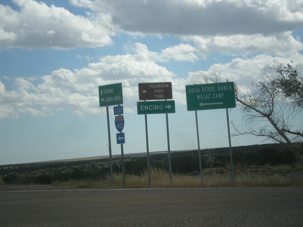
I-40 East at NM-3
I-40 east Exit 230 at NM-3. Turn right on NM-3 for Encino; turn left for Villanueva State Park, Agua Verde Ranch, and Melaz Camp.
Taken 10-10-2013

 Encino
Torrance County
New Mexico
United States
Encino
Torrance County
New Mexico
United States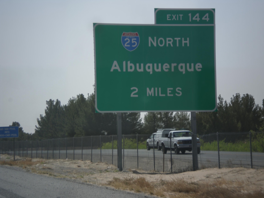
I-10 East Approaching I-25
I-10 east approaching Exit 144 - I-25 North/Albuquerque.
Taken 04-15-2013
 Las Cruces
Doña Ana County
New Mexico
United States
Las Cruces
Doña Ana County
New Mexico
United States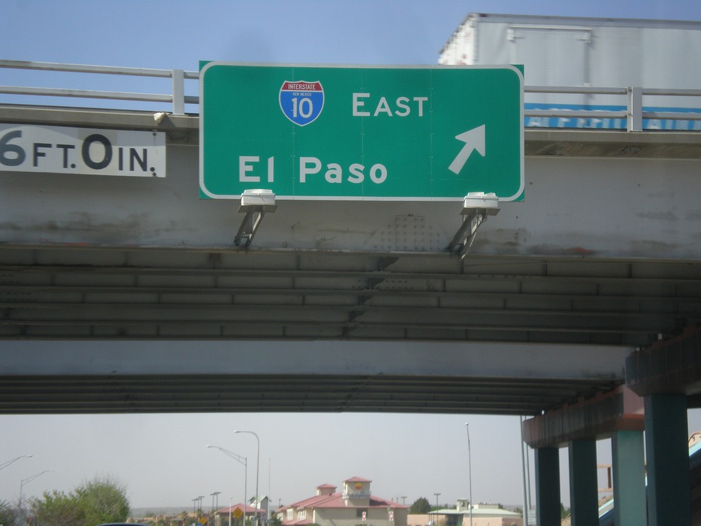
NM-28 South at I-10 East
NM-28 south at I-10 east to El Paso (Exit 140).
Taken 04-15-2013
 Las Cruces
Doña Ana County
New Mexico
United States
Las Cruces
Doña Ana County
New Mexico
United States