Signs Tagged With Interstate Shield with State Name
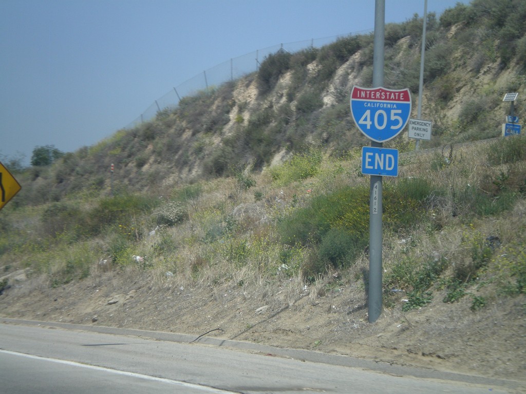
End I-405 North at I-5
End I-405 north at I-5 junction in the San Fernando Valley.
Taken 05-06-2012

 Los Angeles
 County
California
United States
Los Angeles
Los Angeles County
California
United States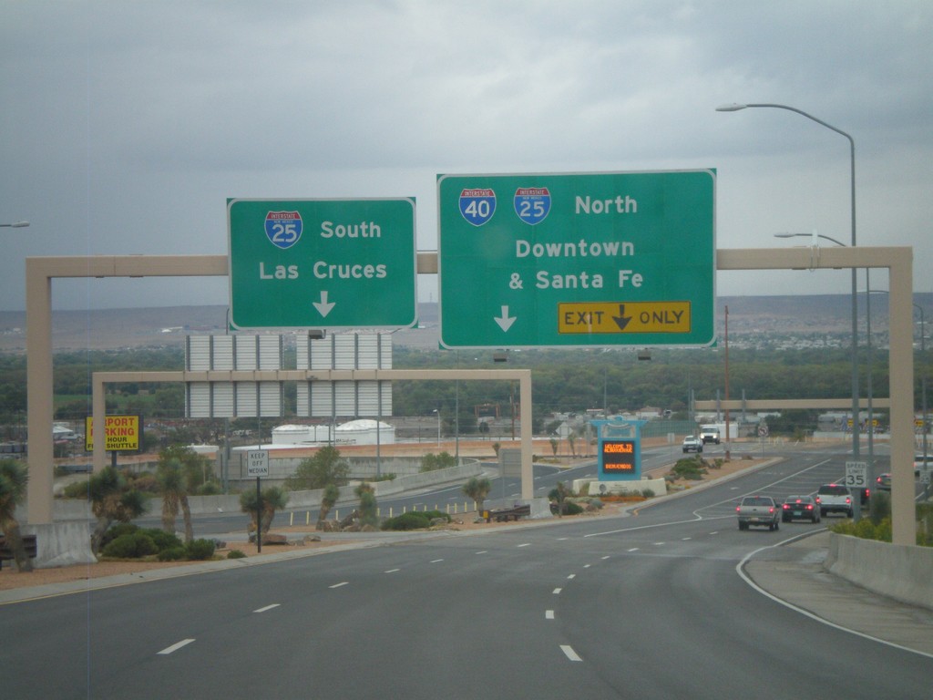
Sunport Blvd. West Approaching I-25
Sunport Blvd. West approaching I-25. Use right lanes for I-25 North/(To)I-40/Downtown (Albuquerque)/Santa Fe. Use left lanes for I-25 South/Las Cruces.
Taken 10-04-2011

 Albuquerque
Bernalillo County
New Mexico
United States
Albuquerque
Bernalillo County
New Mexico
United States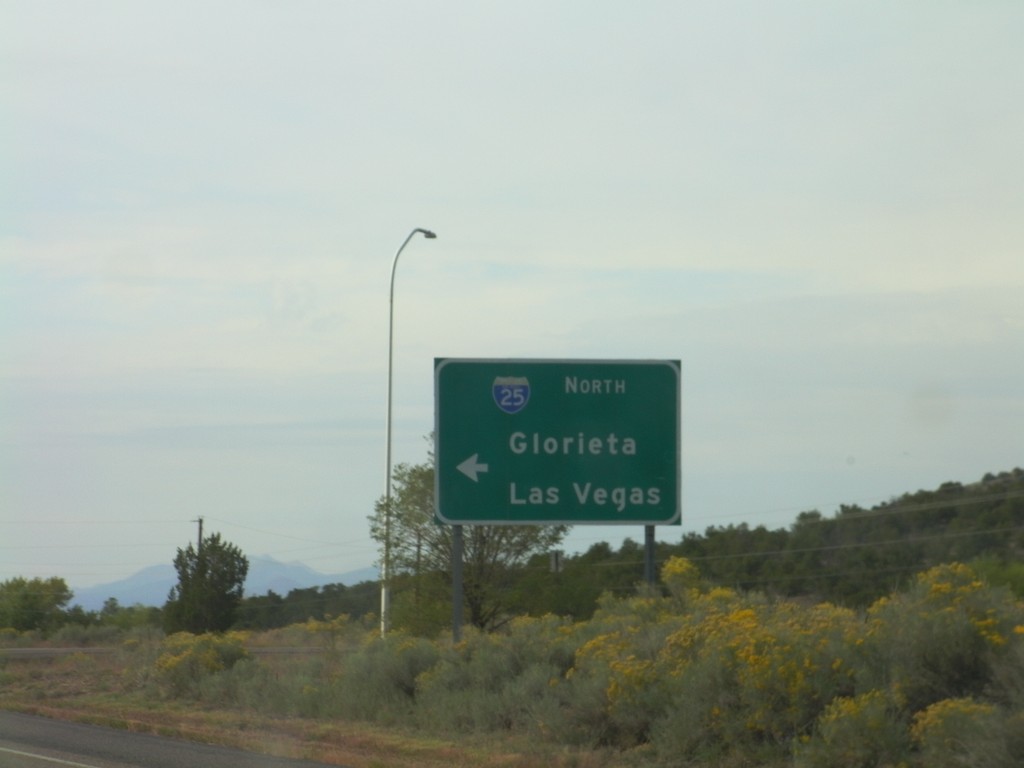
US-285 South at I-25 North
US-285 south at I-25 North (and US-84) onramp to Glorieta and Las Vegas.
Taken 10-04-2011

 Santa Fe
 County
New Mexico
United States
Santa Fe
Santa Fe County
New Mexico
United States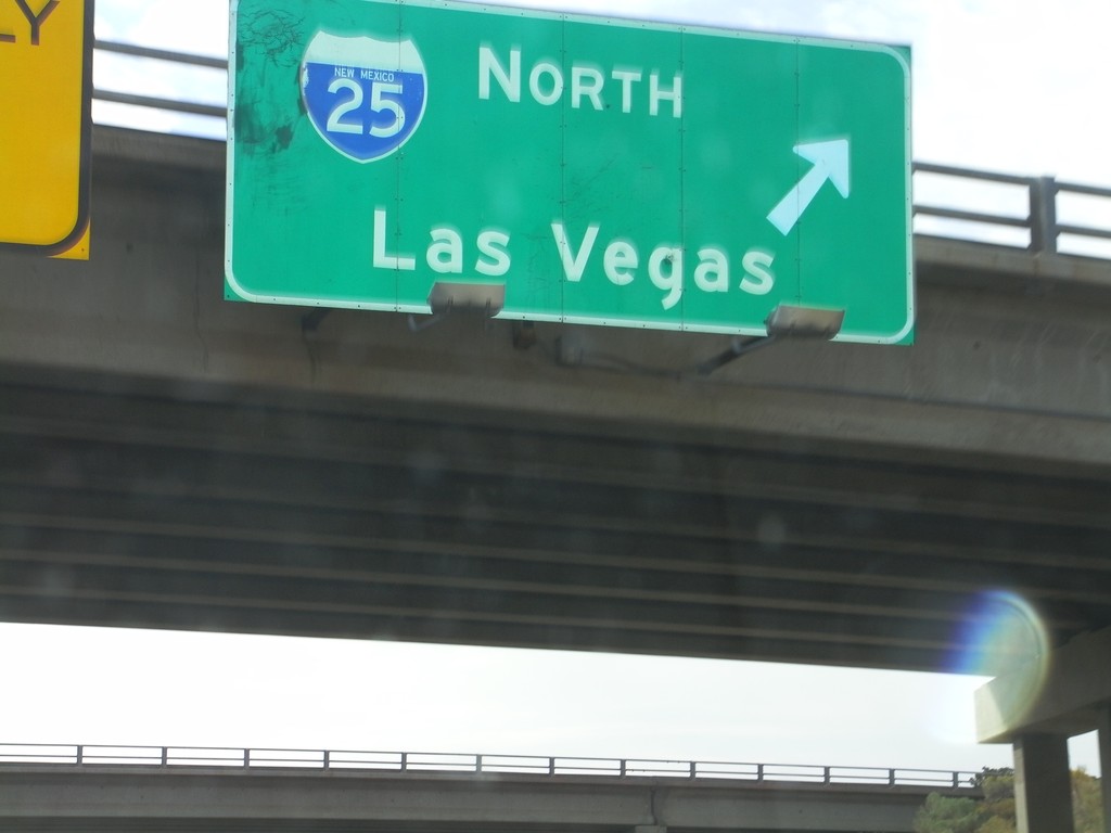
US-84/US-285 South at I-25 North
US-84/US-285 South (St. Francis Drive) at I-25 North to Las Vegas. US-285 South joins I-25 north for 8 miles. US-84 east joins I-25 north to just south of Las Vegas.
Taken 10-04-2011
Santa Fe
Santa Fe County
New Mexico
United States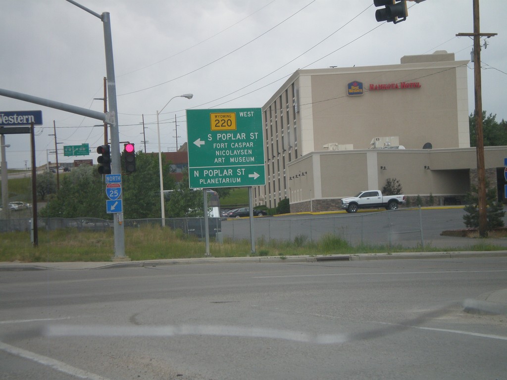
I-25 North Exit 188B at WY-220
I-25 North at Exit 188B, WY-220 Jct. Turn left for WY-220 West towards S. Poplar St., Fort Casper, and Nicolaysen Art Museum. Turn north on Poplar St. for the Casper Planetarium.
Taken 07-04-2011


 Casper
Natrona County
Wyoming
United States
Casper
Natrona County
Wyoming
United States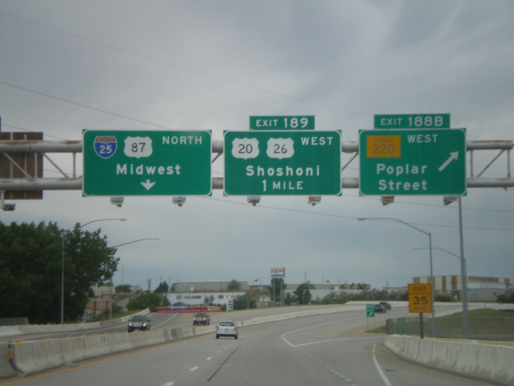
I-25 North - Exits 188B and 189
I-25 North at Exit 188B - WY-220 West/Poplar St. Approaching Exit 189 - US-20/US-26 West/Shoshoni. Continue north on I-25/US-87 North for Midwest.
Taken 07-04-2011
Casper
Natrona County
Wyoming
United States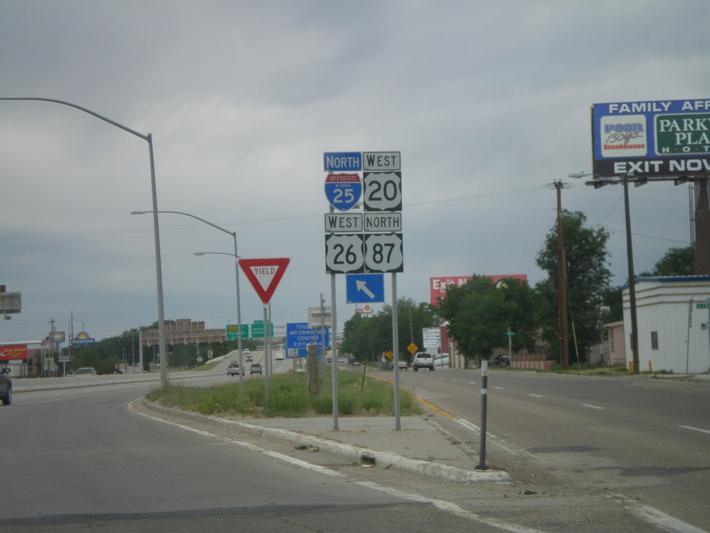
I-25/US-87 North/US-20/US-26 West Onramp
I-25/US-87 North/US-20/US-26 West Exit 187 onramp in Casper.
Taken 07-04-2011
Casper
Natrona County
Wyoming
United States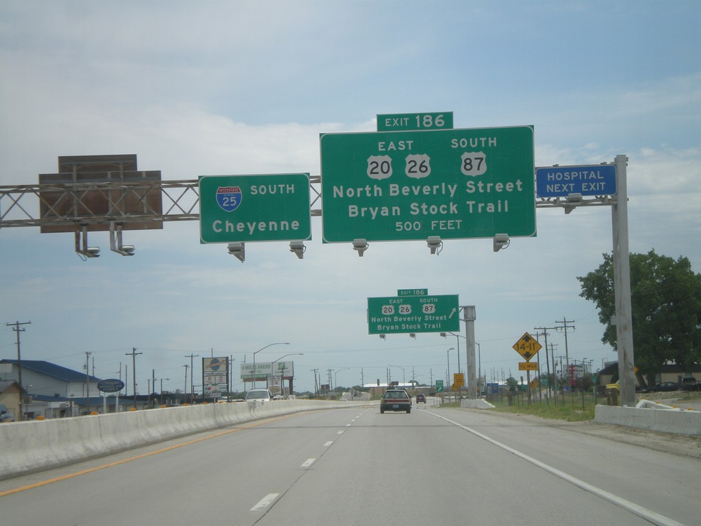
I-25 South Approaching Exit 186
I-25/US-87 South/US-20/US-26 East approaching Exit 186 - US-20/US-26 East/US-87 South/North Beverly St./Bryan Stock Trail. I-25 continues south towards Cheyenne.
Taken 07-04-2011


 Casper
Natrona County
Wyoming
United States
Casper
Natrona County
Wyoming
United States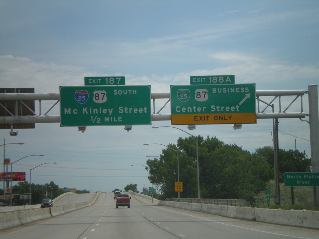
I-25 South - Exits 188A and 187
I-25 south at Exit 188A - BL-25/BL-87/Center St. Approaching Exit 187 - McKinley St. Exit 187 is signed as I-25 and US-87 south, but this is an error. Neither highway exit at McKinley St.
Taken 07-04-2011
Casper
Natrona County
Wyoming
United States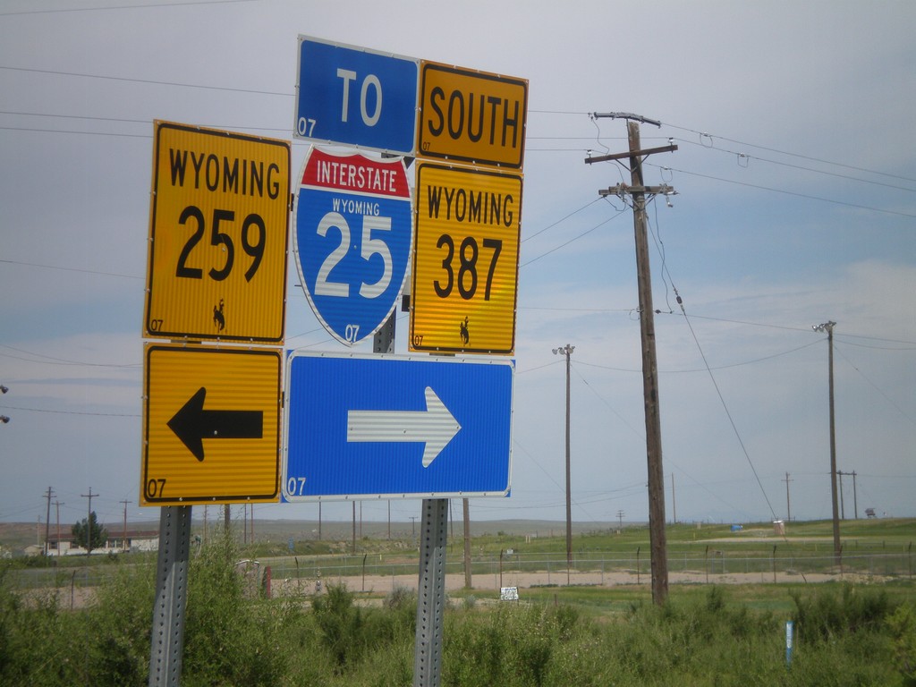
WY-387 West at WY-258
WY-387 south at WY-258 in Midwest. Turn right to continue west on WY-387, and for I-25 traffic. It is probably shorter for I-25 south traffic to use WY-259 south, even though it is signed otherwise.
Taken 07-04-2011

 Midwest
Natrona County
Wyoming
United States
Midwest
Natrona County
Wyoming
United States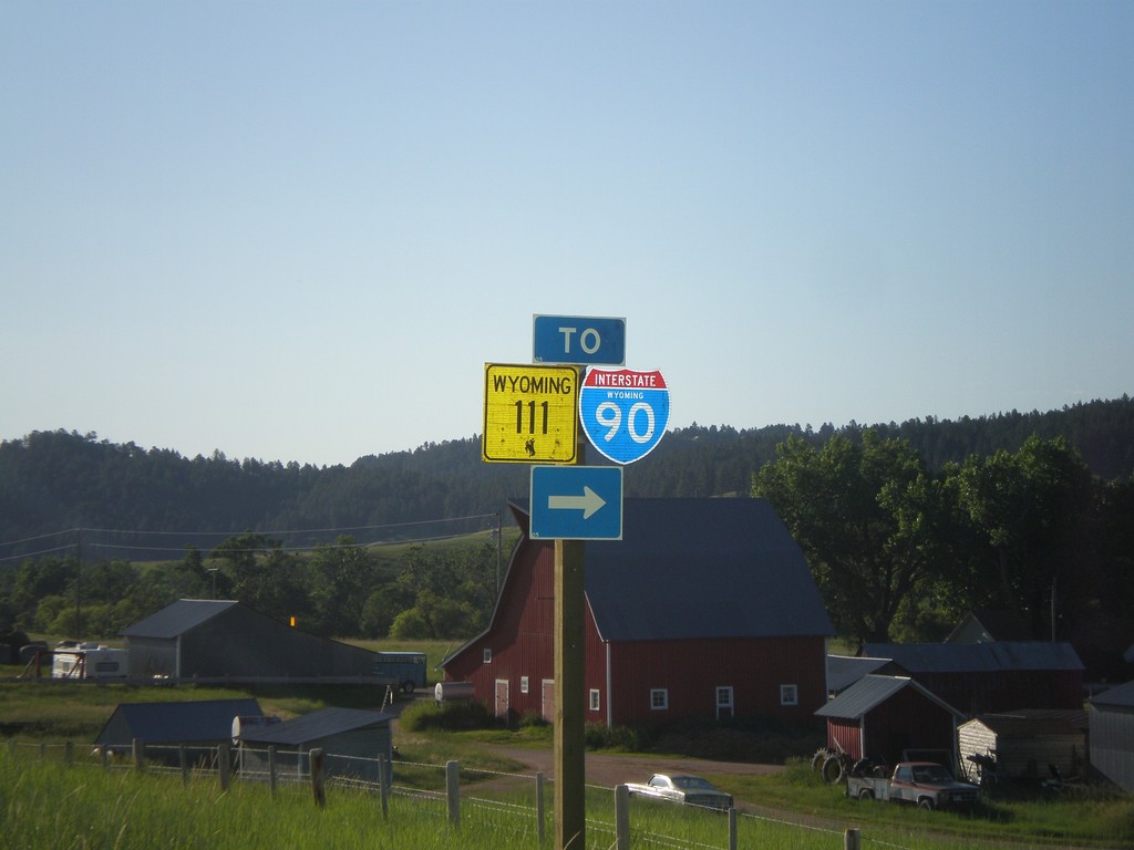
WY-24 East at WY-111 (To I-90)
WY-24 east at WY-111 to I-90.
Taken 07-04-2011


 Aladdin
Crook County
Wyoming
United States
Aladdin
Crook County
Wyoming
United States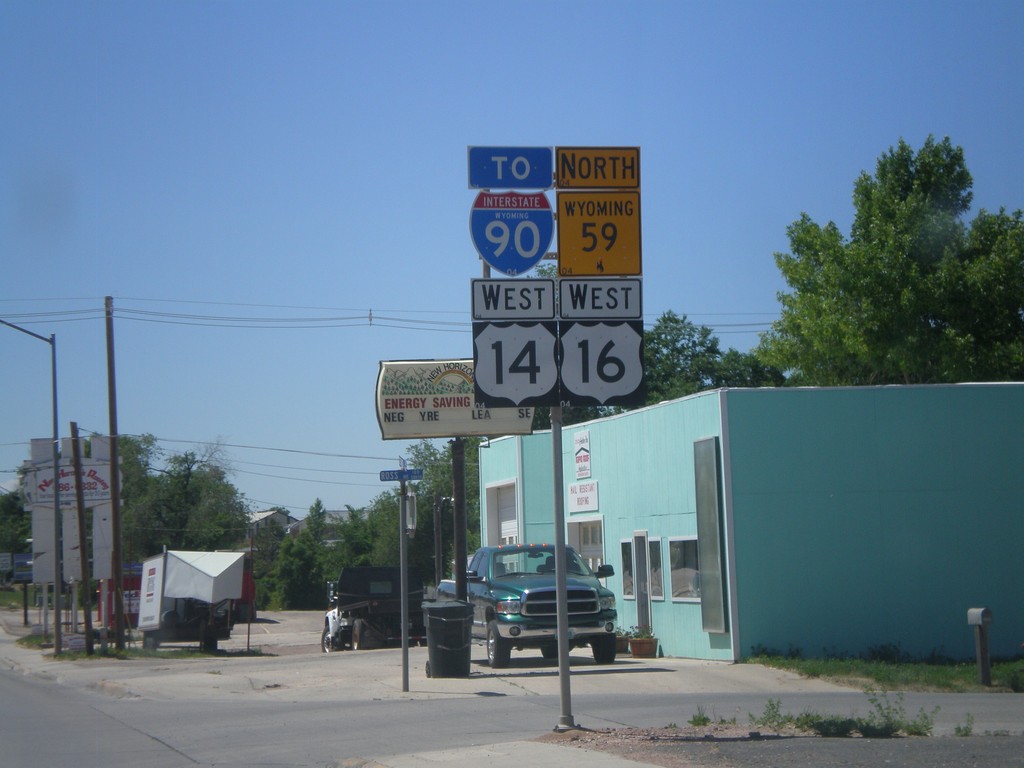
US-14/US-16 West/WY-59 North/To I-90
US-14/US-16 West, WY-59 North, To I-90 (Business I-90) in Gillette.
Taken 07-03-2011


 Gillette
Campbell County
Wyoming
United States
Gillette
Campbell County
Wyoming
United States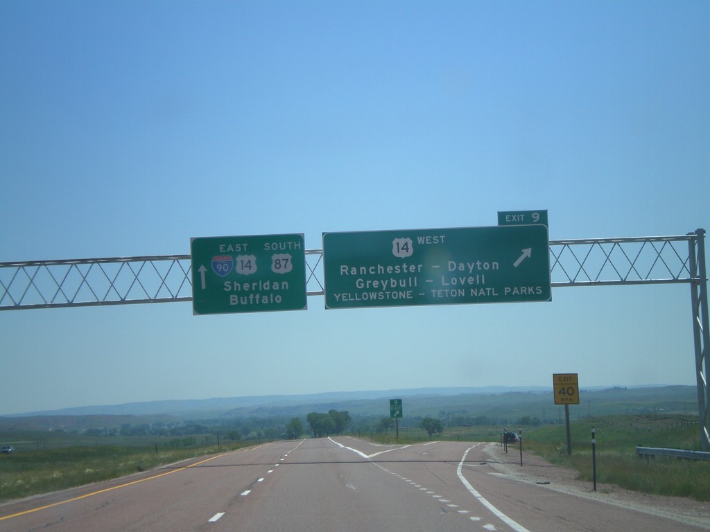
I-90 East - Exit 9
I-90 east at Exit 9 - US-14 West/Ranchester/Dayton/Greybull/Lovell/Yellowstone - Teton National Parks. I-90/US-14/US-87 continues east towards Sheridan and Buffalo. US-14 joins I-90 east to Sheridan.
Taken 07-03-2011
Ranchester
Sheridan County
Wyoming
United States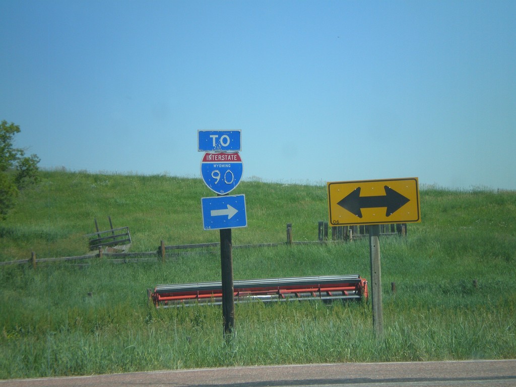
End WY-343 at WY-345
End WY-343 at WY-345. Use WY-345 east for I-90.
Taken 07-03-2011

 Parkman
Sheridan County
Wyoming
United States
Parkman
Sheridan County
Wyoming
United States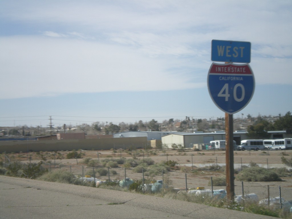
I-40 West - Last I-40 Shield
Last I-40 shield on I-40 west, just west of Exit 1.
Taken 02-25-2011
Barstow
San Bernardino County
California
United States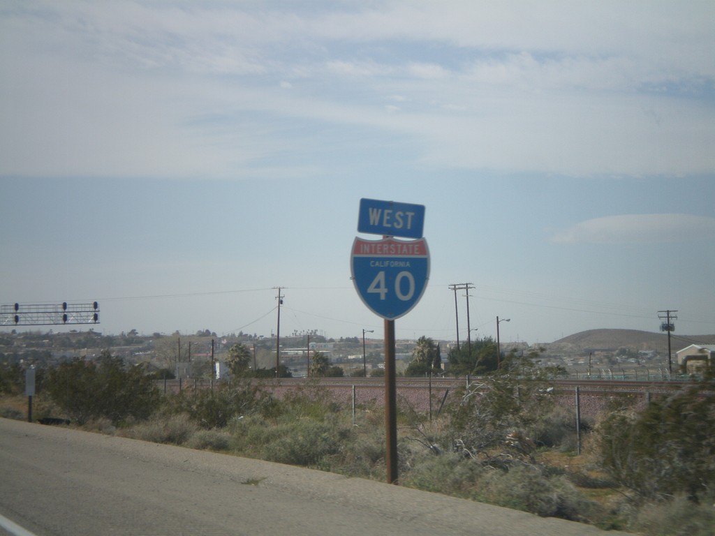
I-40 West - California
I-40 West - California shield in Barstow.
Taken 02-25-2011
Barstow
San Bernardino County
California
United States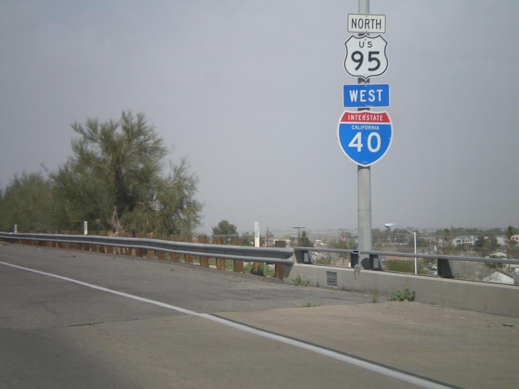
I-40 West/US-95 North Shields
I-40 West/US-95 North shields in Needles.
Taken 02-25-2011
 Needles
San Bernardino County
California
United States
Needles
San Bernardino County
California
United States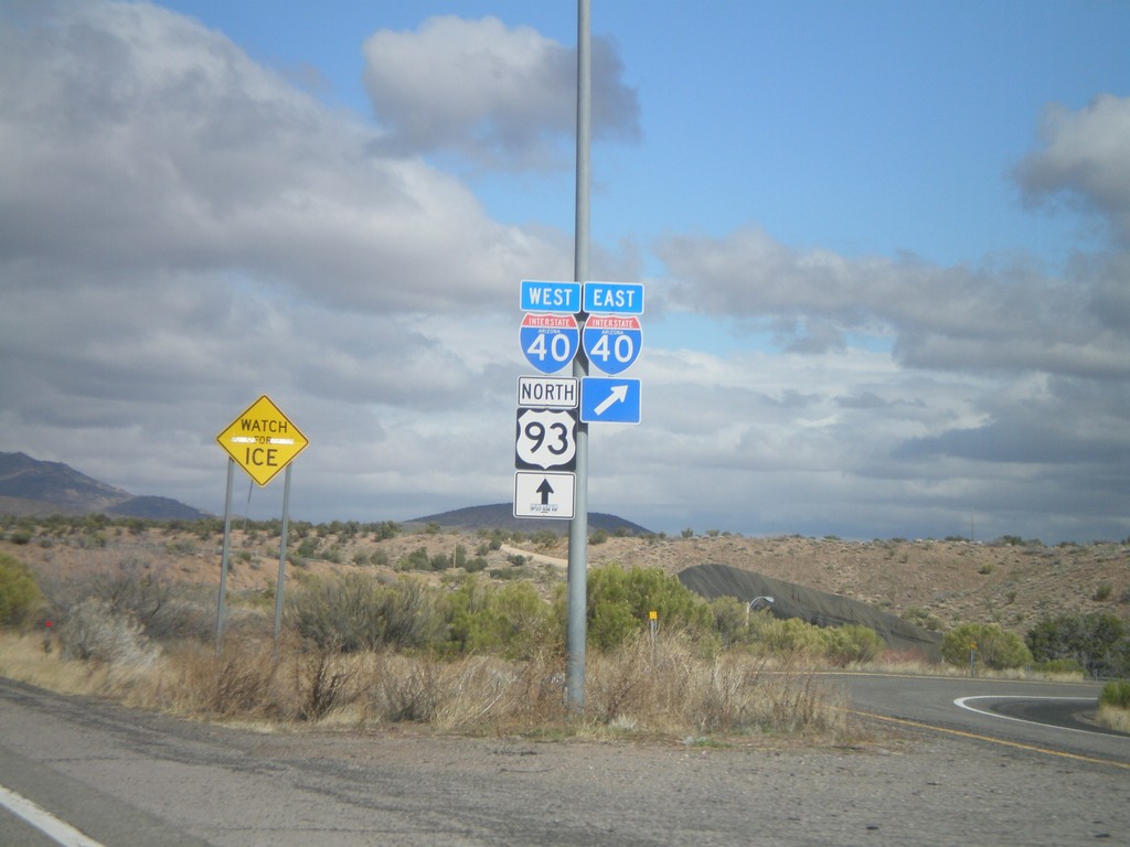
US-93 North at I-40
US-93 north at I-40. US-93 north joins I-40 west through Kingman.
Taken 02-25-2011
 Kingman
Mohave County
Arizona
United States
Kingman
Mohave County
Arizona
United States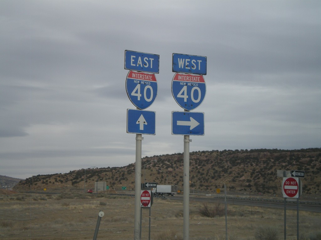
NM-118 West at I-40 East
NM-118 west at I-40 east (Exit 8) onramp. Continue west on NM-118 for westbound I-40 access.
Taken 02-24-2011
 Gallup
McKinley County
New Mexico
United States
Gallup
McKinley County
New Mexico
United States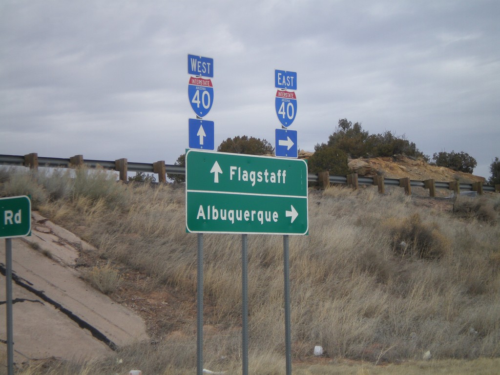
I-40 Onramp at Exit 346
I-40 onramp at Exit 346. Use I-40 west for Flagstaff; use I-40 east for Albuquerque.
Taken 02-24-2011
Houck
Apache County
Arizona
United States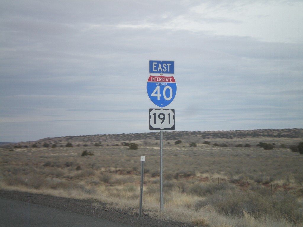
I-40 East/US-191 South
I-40 East/US-191 south in Apache County, Arizona. The US-191 shield is actually in error, because US-191 does not join I-40 eastbound for another 3 miles.
Taken 02-24-2011
 Chambers
Apache County
Arizona
United States
Chambers
Apache County
Arizona
United States
I-40 East Shield
I-40 East, Arizona, shield in Holbrook.
Taken 02-24-2011
 Holbrook
Navajo County
Arizona
United States
Holbrook
Navajo County
Arizona
United States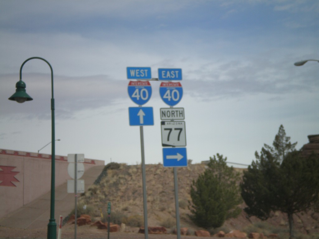
BL-40 East/AZ-77 North at I-40
BL-40 East/AZ-77 North at I-40 freeway entrance. Use I-40 west for Flagstaff; use I-40 east for Albuquerque. AZ-77 joins I-40 east through Holbrook.
Taken 02-24-2011
 Holbrook
Navajo County
Arizona
United States
Holbrook
Navajo County
Arizona
United States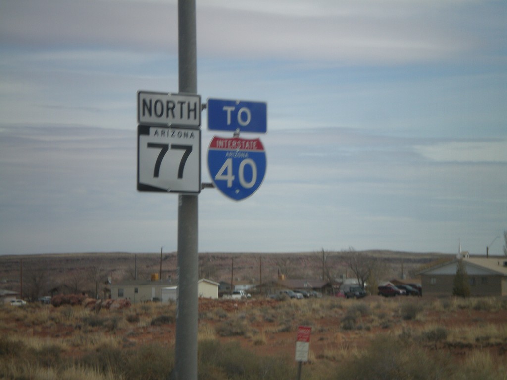
AZ-77 North To I-40
AZ-77 north to I-40 (and US-180 west which is not signed) in Holbrook.
Taken 02-24-2011
 Holbrook
Navajo County
Arizona
United States
Holbrook
Navajo County
Arizona
United States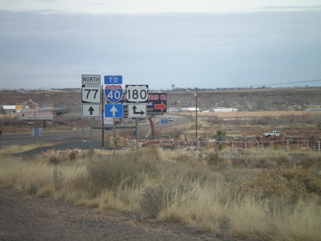
AZ-77 North at US-180
AZ-77 north at US-180. Turn right for US-180 east; continue north on AZ-77 for US-180 east to I-40.
Taken 02-24-2011
Holbrook
Navajo County
Arizona
United States