Signs Tagged With Interstate Shield with State Name
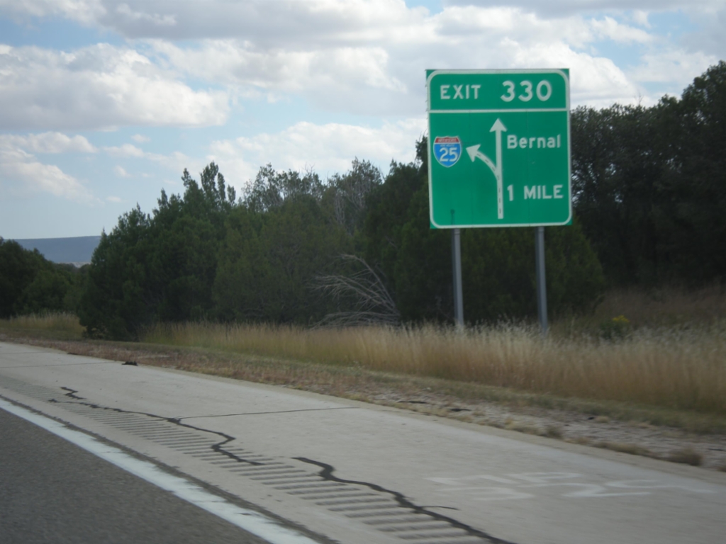
I-25 North - Exit 330
I-25 North approaching Exit 330 - Bernal.
Taken 10-10-2013

 Serafina
San Miguel County
New Mexico
United States
Serafina
San Miguel County
New Mexico
United States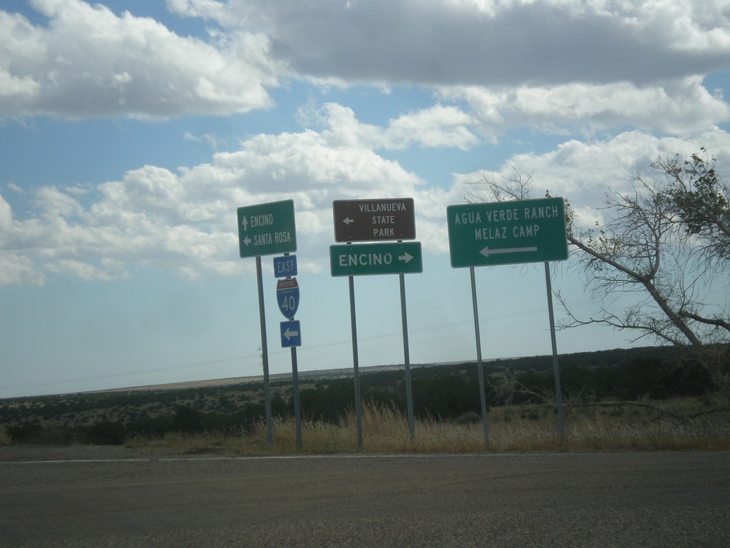
I-40 East at NM-3
I-40 east Exit 230 at NM-3. Turn right on NM-3 for Encino; turn left for Villanueva State Park, Agua Verde Ranch, and Melaz Camp.
Taken 10-10-2013

 Encino
Torrance County
New Mexico
United States
Encino
Torrance County
New Mexico
United States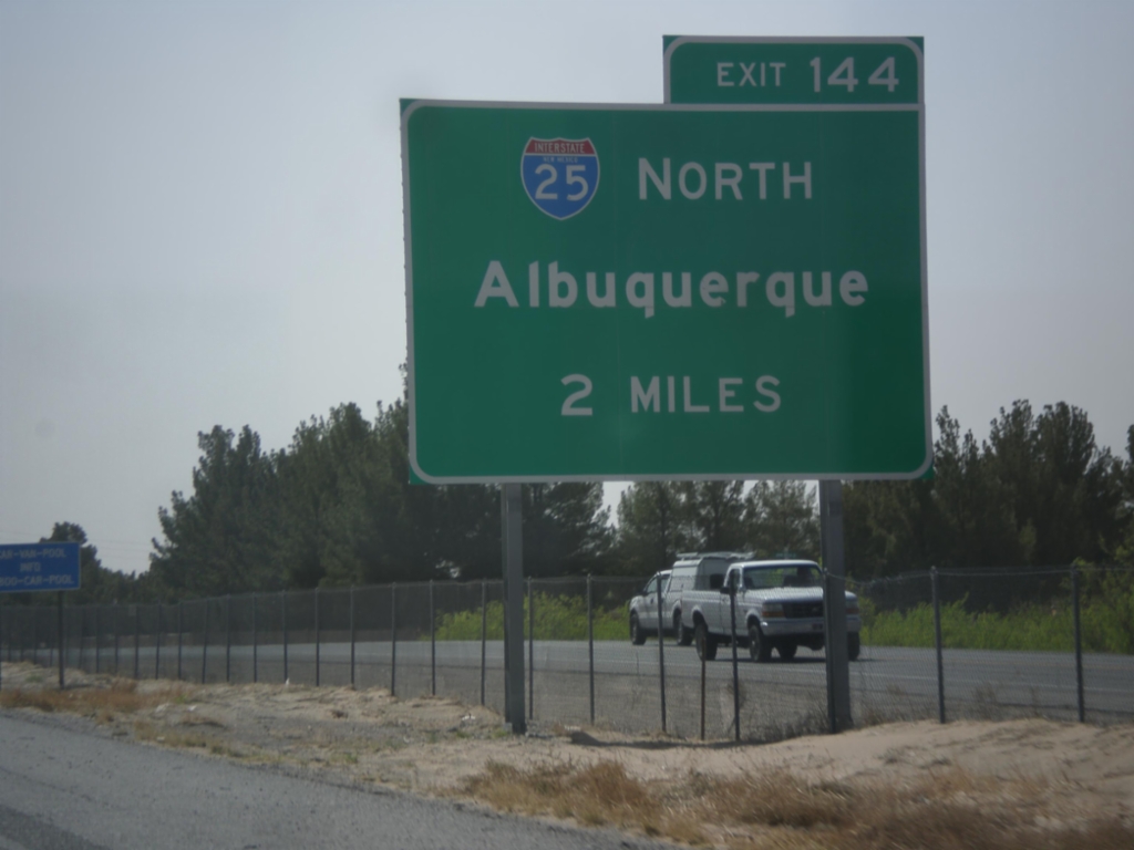
I-10 East Approaching I-25
I-10 east approaching Exit 144 - I-25 North/Albuquerque.
Taken 04-15-2013
 Las Cruces
Doña Ana County
New Mexico
United States
Las Cruces
Doña Ana County
New Mexico
United States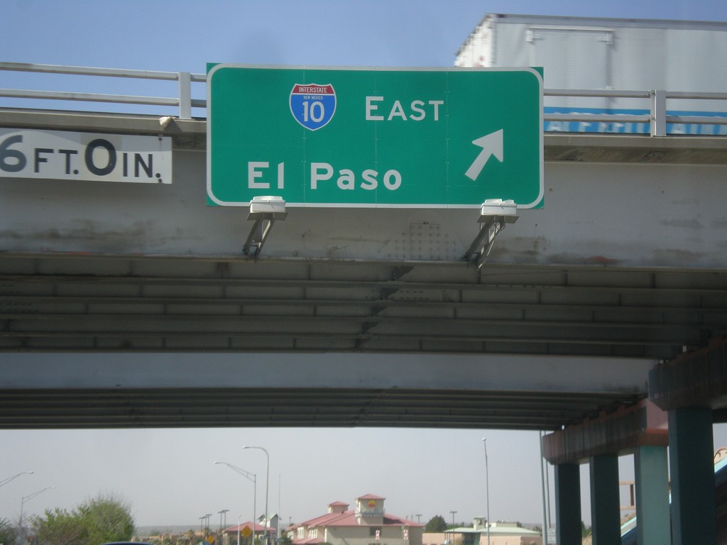
NM-28 South at I-10 East
NM-28 south at I-10 east to El Paso (Exit 140).
Taken 04-15-2013
 Las Cruces
Doña Ana County
New Mexico
United States
Las Cruces
Doña Ana County
New Mexico
United States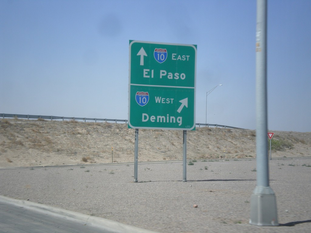
NM-28 South at I-10
NM-28 south at I-10 (Exit 140). Merge right for I-10 west to Deming; continue under freeway for I-10 east to El Paso.
Taken 04-15-2013
Las Cruces
Doña Ana County
New Mexico
United States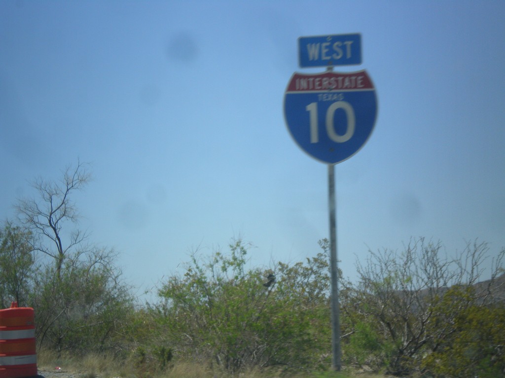
I-10 West - Texas
I-10 west with the word Texas in the shield. The only I-10 shields with the state name I saw were in Hudspeth County.
Taken 04-15-2013
Sierra Blanca
Hudspeth County
Texas
United States
NM-152 West at I-25
NM-152 West at I-25 in rural Sierra County.
Taken 04-15-2013
 Caballo
Sierra County
New Mexico
United States
Caballo
Sierra County
New Mexico
United States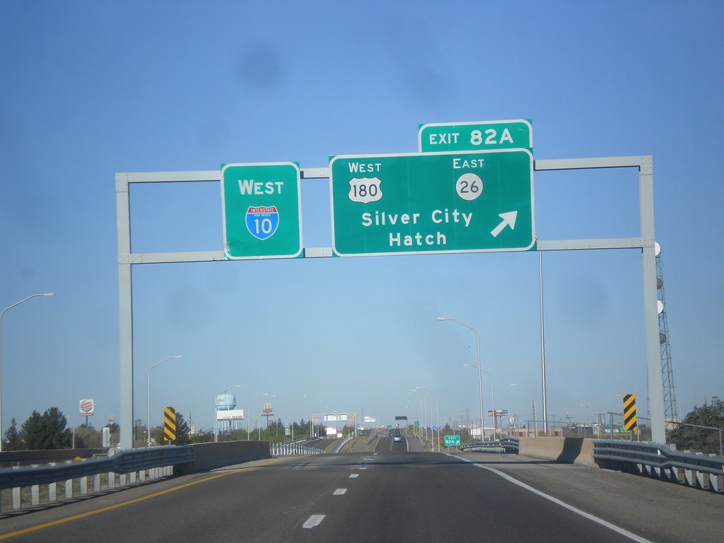
I-10 West - Exit 82A
I-10 west at Exit 82A - US-180 West/NM-26 East/Silver City/Hatch.
Taken 04-14-2013
Deming
Luna County
New Mexico
United States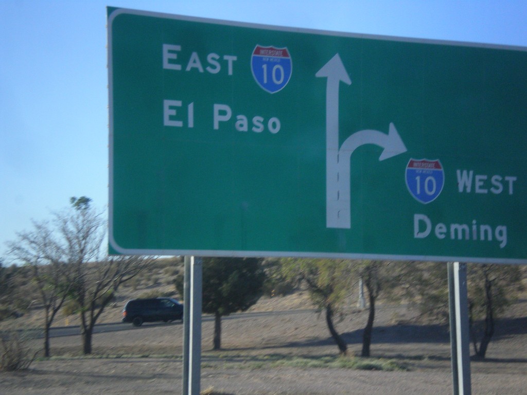
End NM-188 at I-10
End NM-188 at I-10 junction. Use right lanes for I-10 west to Deming; left lanes for I-10 east to El Paso (Texas).
Taken 04-14-2013
 Las Cruces
Doña Ana County
New Mexico
United States
Las Cruces
Doña Ana County
New Mexico
United States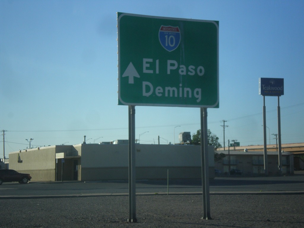
NM-188 East Approaching I-10
NM-188 east approaching I-10. Use I-10 for El Paso (Texas) and Deming.
Taken 04-14-2013
Las Cruces
Doña Ana County
New Mexico
United States
US-6 West Approaching I-15
US-6 west approaching I-15 onramps. Notice the the I-15 shield inside the I-15 Jct. big green sign has the word Utah in it. There are a few of these shields around the Provo area that appear to be newly posted.
Taken 10-20-2012

 Spanish Fork
Utah County
Utah
United States
Spanish Fork
Utah County
Utah
United States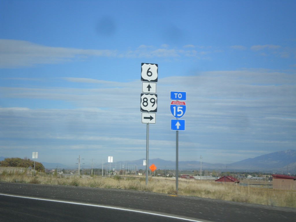
US-6 West/US-89 North Approaching Split
US-6 West/US-89 North approaching US-89/US-6 split. Continue west on US-6 for I-15 junction. The I-15 shield contains the word Utah. This is one of the many I-15 shields in the Provo area that have the word Utah in it.
Taken 10-20-2012
 Spanish Fork
Utah County
Utah
United States
Spanish Fork
Utah County
Utah
United States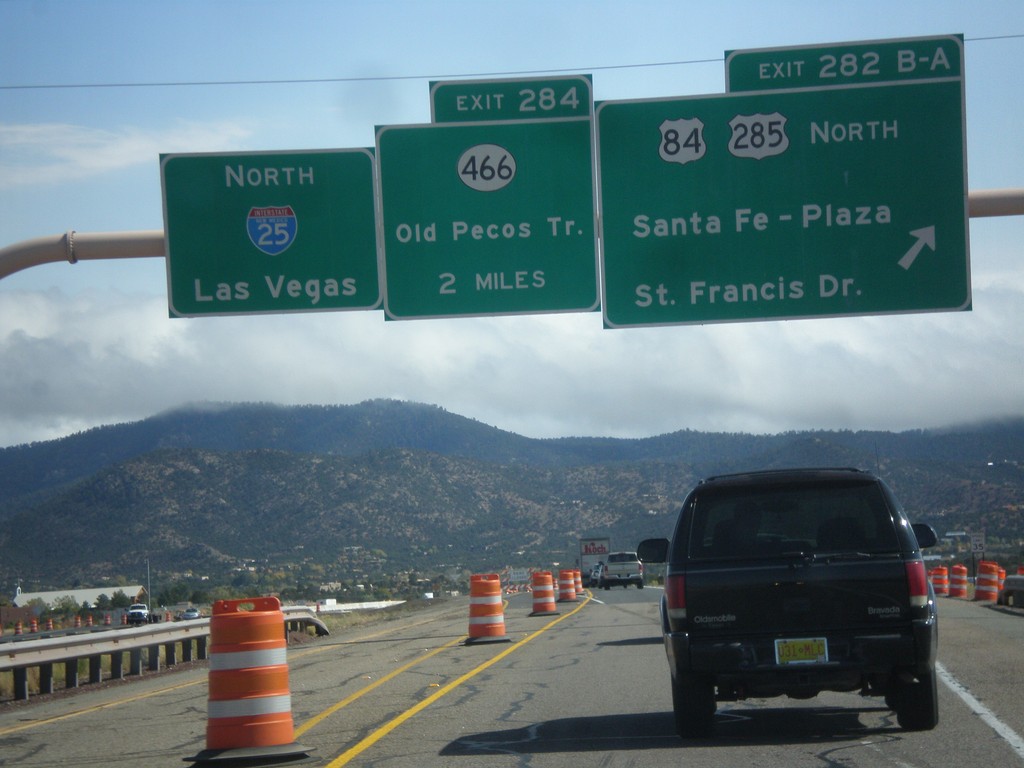
I-25 North - Exits 282B-A and 284
I-25 north at Exit 282B-A - US-84/US-285 North/Santa Fe - Plaza/St. Francis Drive. Approaching Exit 284 - NM-466/Old Pecos Trail. Continue north on I-25 for Las Vegas. US-84 joins I-25 north towards Las Vegas; US-285 joins I-25 north for 8 miles.
Taken 10-12-2012

 Santa Fe
 County
New Mexico
United States
Santa Fe
Santa Fe County
New Mexico
United States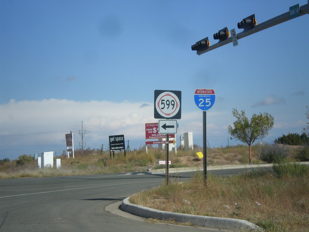
NM-14 North at NM-599
NM-14 north at NM-599. Use NM-599 for I-25. Northbound I-25 traffic can continue north on NM-14, although NM-599 is a shortcut to the freeway. This is the southern end of the Santa Fe Relief Route.
Taken 10-12-2012

 Santa Fe
 County
New Mexico
United States
Santa Fe
Santa Fe County
New Mexico
United States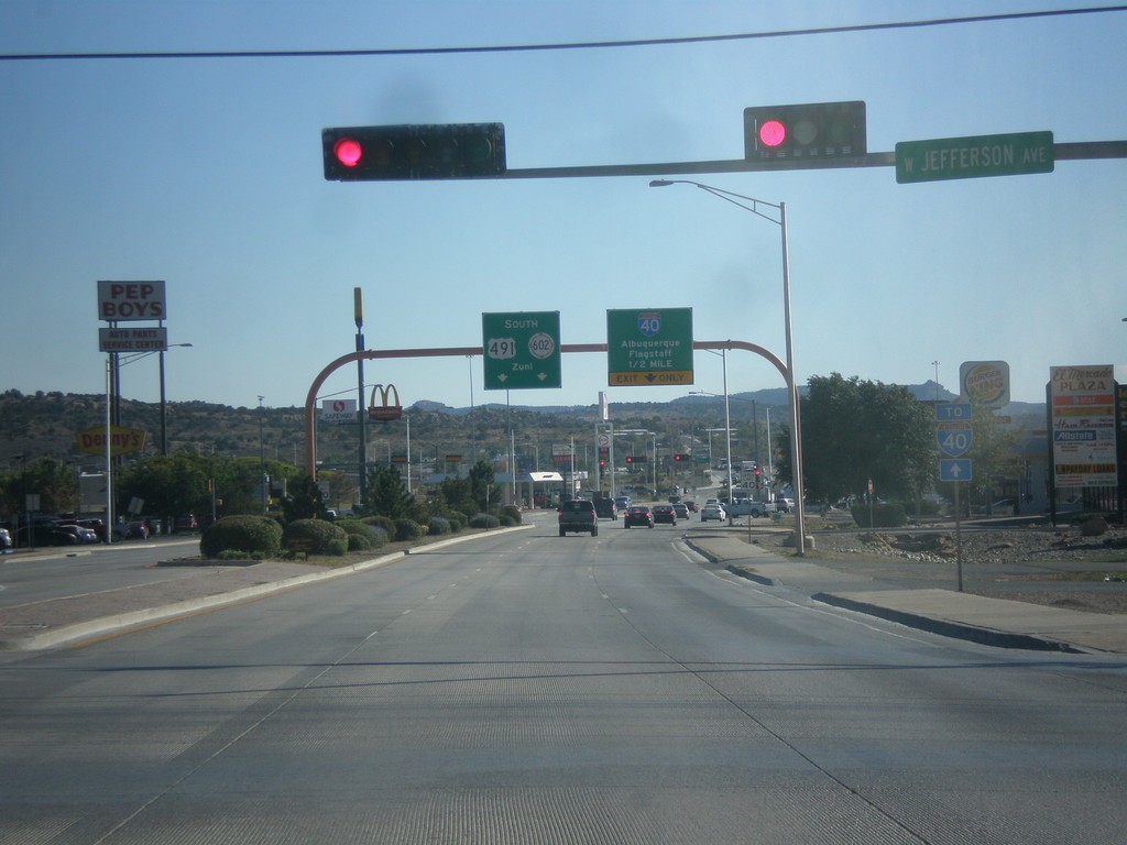
US-491 South Approaching I-40/NM-602
US-491 south approaching I-40 to Albuquerque and Flagstaff (Arizona). US-491 ends at I-40, and turns into NM-602 towards Zuni.
Taken 10-10-2012

 Gallup
McKinley County
New Mexico
United States
Gallup
McKinley County
New Mexico
United States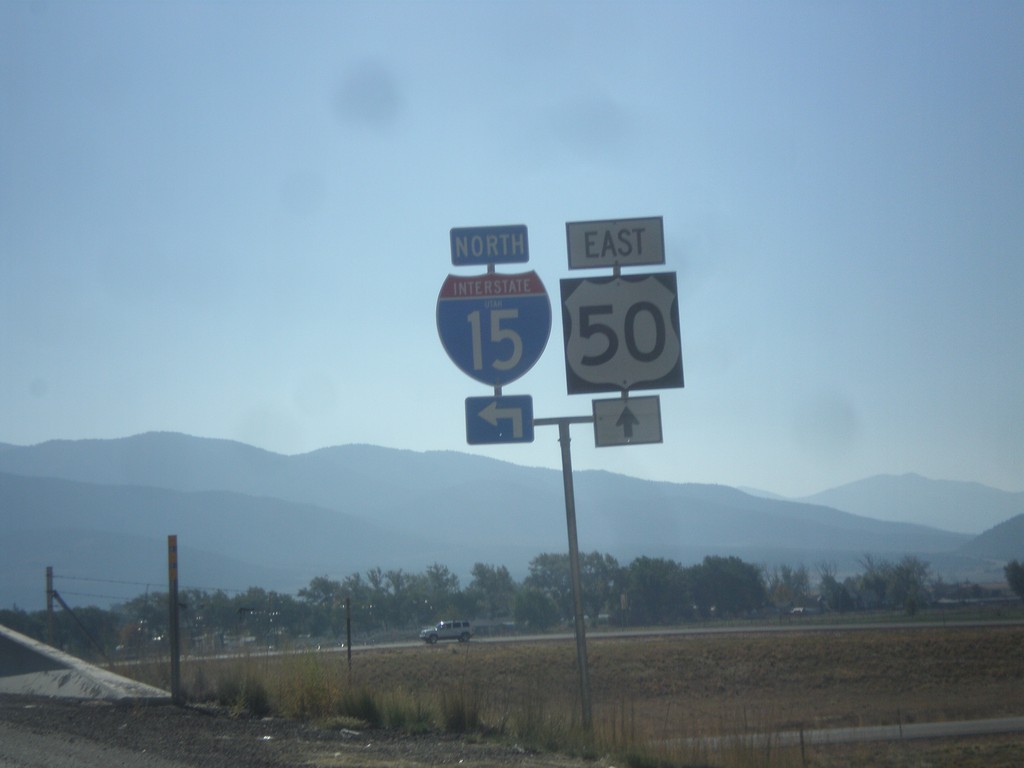
US-50 East at I-15 North
US-50 east at I-15 north. Notice the word UTAH in the I-15 shield. On this trip I noticed the word UTAH in signs in the Provo area, in addition to this shield. Before this I have never seen a Utah interstate shield containing the state name.
Taken 10-07-2012
 Scipio
Millard County
Utah
United States
Scipio
Millard County
Utah
United States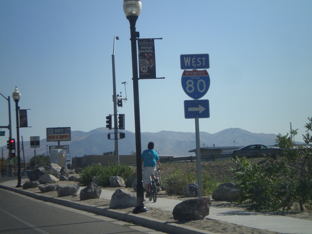
NV-294 South at NV-787
NV-294 South at NV-787 (Hanson St.) NV-787 is not signed at this intersection, and is instead signed as to I-80 (via Winnemucca Blvd.).
Taken 07-28-2012


 Winnemucca
Humboldt County
Nevada
United States
Winnemucca
Humboldt County
Nevada
United States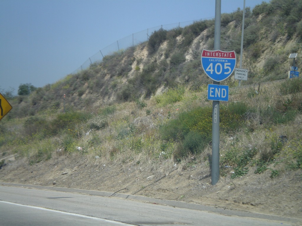
End I-405 North at I-5
End I-405 north at I-5 junction in the San Fernando Valley.
Taken 05-06-2012

 Los Angeles
 County
California
United States
Los Angeles
Los Angeles County
California
United States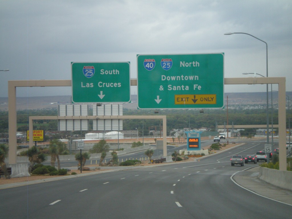
Sunport Blvd. West Approaching I-25
Sunport Blvd. West approaching I-25. Use right lanes for I-25 North/(To)I-40/Downtown (Albuquerque)/Santa Fe. Use left lanes for I-25 South/Las Cruces.
Taken 10-04-2011
Albuquerque
Bernalillo County
New Mexico
United States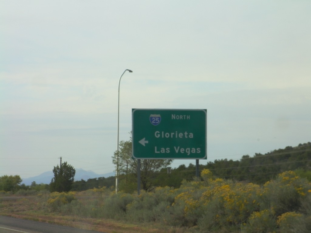
US-285 South at I-25 North
US-285 south at I-25 North (and US-84) onramp to Glorieta and Las Vegas.
Taken 10-04-2011
Santa Fe
Santa Fe County
New Mexico
United States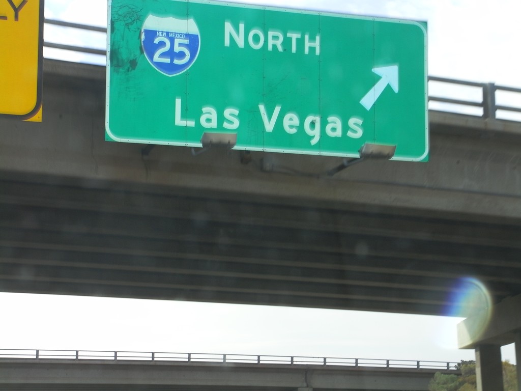
US-84/US-285 South at I-25 North
US-84/US-285 South (St. Francis Drive) at I-25 North to Las Vegas. US-285 South joins I-25 north for 8 miles. US-84 east joins I-25 north to just south of Las Vegas.
Taken 10-04-2011
Santa Fe
Santa Fe County
New Mexico
United States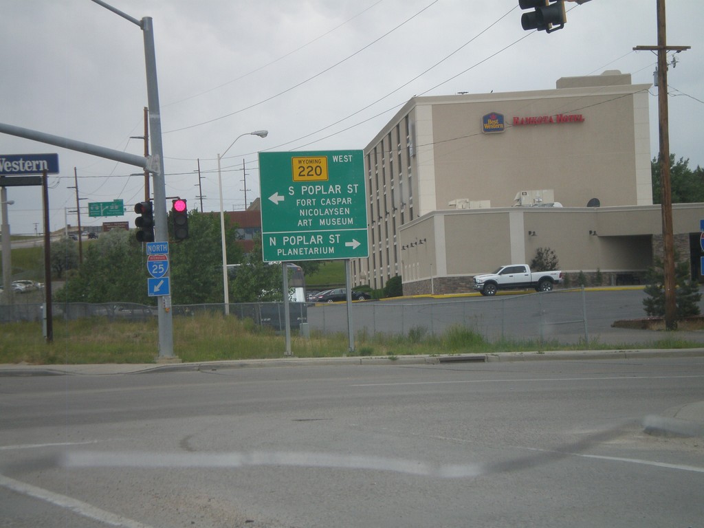
I-25 North Exit 188B at WY-220
I-25 North at Exit 188B, WY-220 Jct. Turn left for WY-220 West towards S. Poplar St., Fort Casper, and Nicolaysen Art Museum. Turn north on Poplar St. for the Casper Planetarium.
Taken 07-04-2011


 Casper
Natrona County
Wyoming
United States
Casper
Natrona County
Wyoming
United States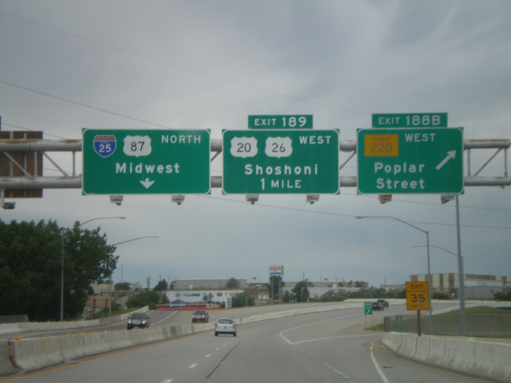
I-25 North - Exits 188B and 189
I-25 North at Exit 188B - WY-220 West/Poplar St. Approaching Exit 189 - US-20/US-26 West/Shoshoni. Continue north on I-25/US-87 North for Midwest.
Taken 07-04-2011
Casper
Natrona County
Wyoming
United States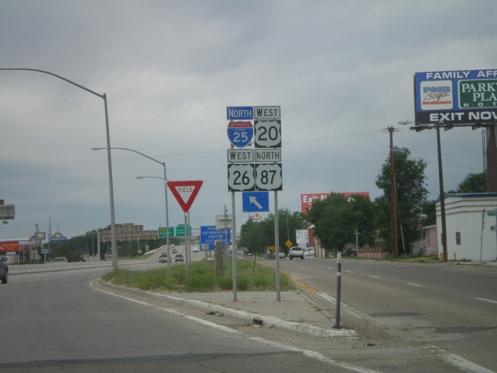
I-25/US-87 North/US-20/US-26 West Onramp
I-25/US-87 North/US-20/US-26 West Exit 187 onramp in Casper.
Taken 07-04-2011
Casper
Natrona County
Wyoming
United States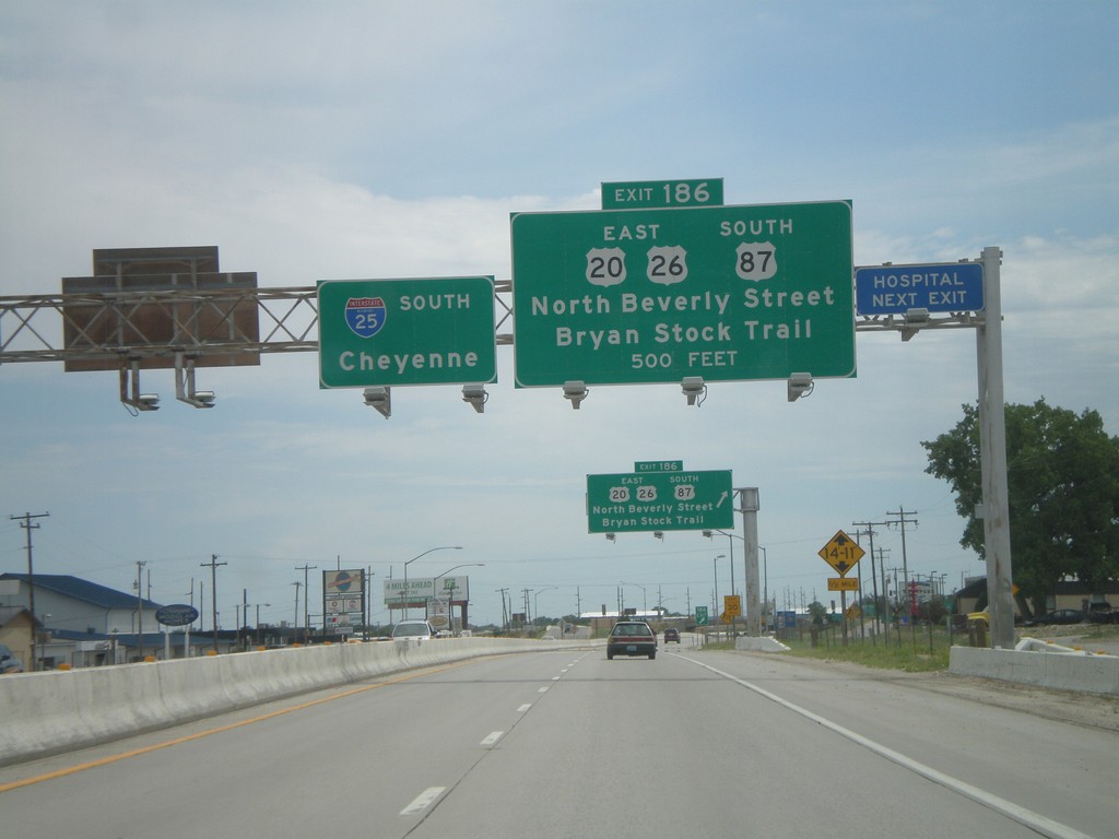
I-25 South Approaching Exit 186
I-25/US-87 South/US-20/US-26 East approaching Exit 186 - US-20/US-26 East/US-87 South/North Beverly St./Bryan Stock Trail. I-25 continues south towards Cheyenne.
Taken 07-04-2011


 Casper
Natrona County
Wyoming
United States
Casper
Natrona County
Wyoming
United States