Signs Tagged With Other Shield
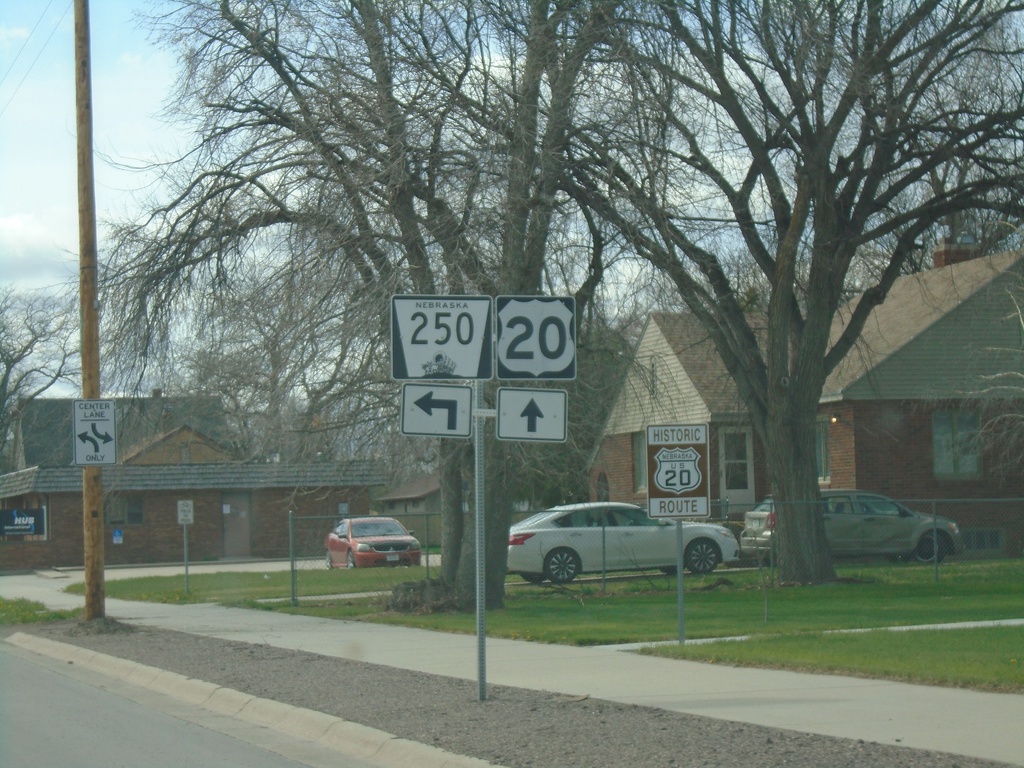
US-20 West at NE-250
US-20 West at NE-250 South in Rushville.
Taken 05-02-2022

 Rushville
Sheridan County
Nebraska
United States
Rushville
Sheridan County
Nebraska
United States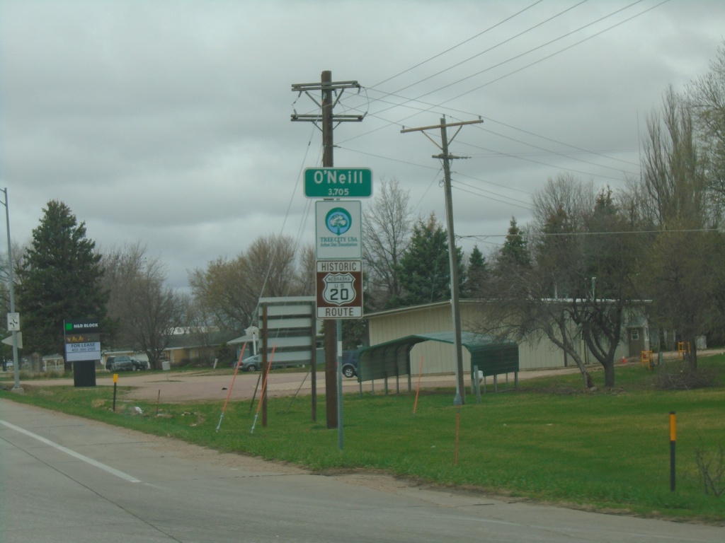
US-20/US-275 West - O'Neill
Entering O’Neill on US-20/US-275 West. O’Neill is the county seat of Holt County. A historic US-20 route marker is also displayed below the city limit sign. This marker is seen along US-20 in central and western Nebraska.
Taken 05-02-2022
 O'Neill
Holt County
Nebraska
United States
O'Neill
Holt County
Nebraska
United States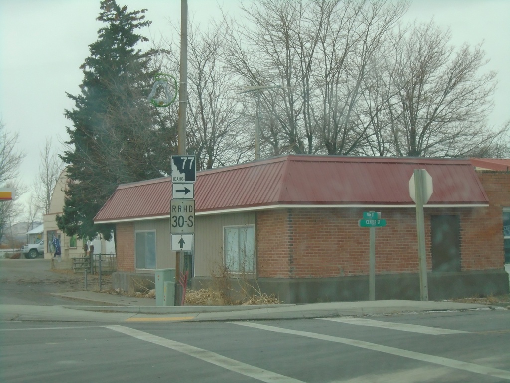
End ID-81 South at ID-77
End ID-81 South at ID-77 in Malta. Turn right for ID-77 north. Roadway continues southbound as RRHD (Raft River Highway District) 30S, following the former route of US-30S to the Utah state line.
Taken 12-30-2020


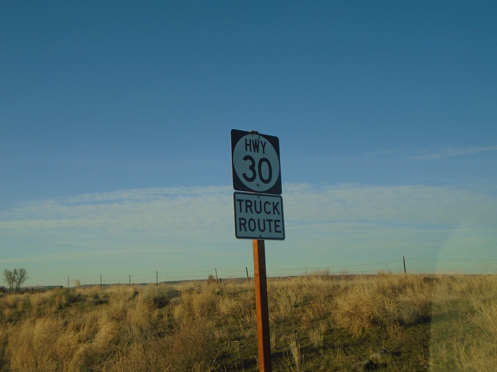
(Old) Hwy 30 Shield
(Old) Hwy 30 Shield on King Hill Highway.
Taken 04-04-2020
King Hill Elmore County Idaho United States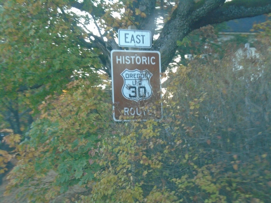
Historic US-30 East - Wasco County
Historic US-30 East in Wasco County. US-30 is signed like this throughout the Columbia River Gorge.
Taken 10-14-2018
 Mosier
Wasco County
Oregon
United States
Mosier
Wasco County
Oregon
United States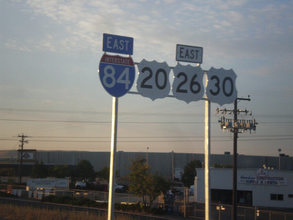
I-84/US-20/US-26/US-30 East Shields
I-84/US-20/US-26/US-30 east shields. Four highways join together between Boise and Mountain Home, which is the most overlaps of any stretch of highway in Idaho. Notice the US highway shields are missing the surrounding black box. This stretch of highway was recently widened, and it was probably incorrectly placed by a contractor.
Taken 10-03-2015

 Boise
Ada County
Idaho
United States
Boise
Ada County
Idaho
United States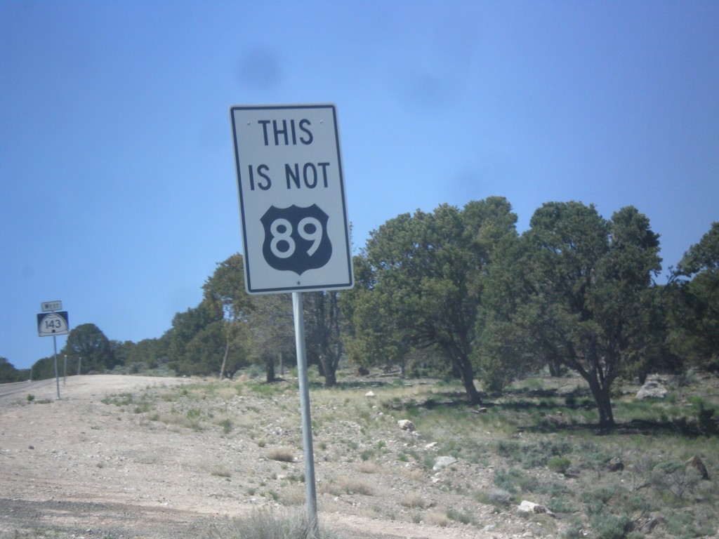
UT-143 South - This is not US-89
This is not US-89 sign on UT-143 south. US-89 southbound traffic in Panguitch who do not turn left at the stoplight in town will end up on UT-143. This sign notifies travelers that they are not on US-89. There are also many oversizes UT-143 signs on the first few miles out of Panguitch as a reminder as well.
Taken 05-21-2014
 Panguitch
Garfield County
Utah
United States
Panguitch
Garfield County
Utah
United States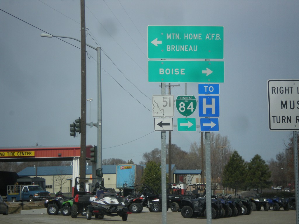
S 3rd St. (Old BL-84) at ID-51
S 3rd St. (Old BL-84) at ID-51 (to BL-84). Turn left for ID-51 south to Mountain Home AFB and Bruneau. Turn right for ID-51 north (to BL-84) to Boise. BL-84 was formerly routed along S 3rd St. into Mountain Home.
Taken 03-16-2013

 Mountain Home
Elmore County
Idaho
United States
Mountain Home
Elmore County
Idaho
United States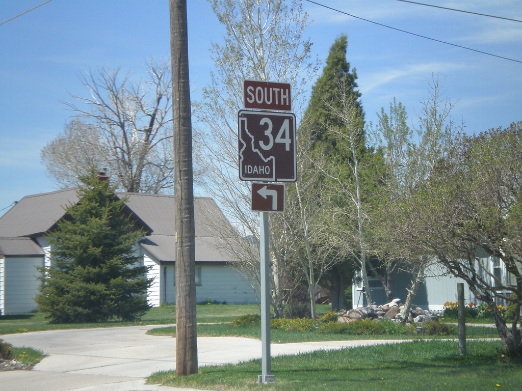
ID-34 South - Soda Springs
ID-34 south (East Hooper Ave.) at North 3rd St. Turn left to continue south on ID-34.
Taken 05-19-2008
 Soda Springs
Caribou County
Idaho
United States
Soda Springs
Caribou County
Idaho
United States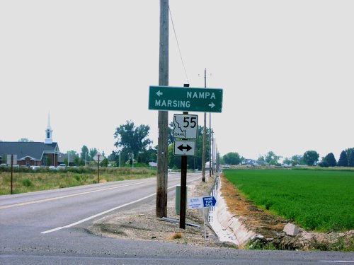
Farmway Road South at ID-55
Farmway Road at ID-55. ID-55 shield is all white instead of solid black for the upper right portion.
Taken 09-01-2006
 Caldwell
Canyon County
Idaho
United States
Caldwell
Canyon County
Idaho
United States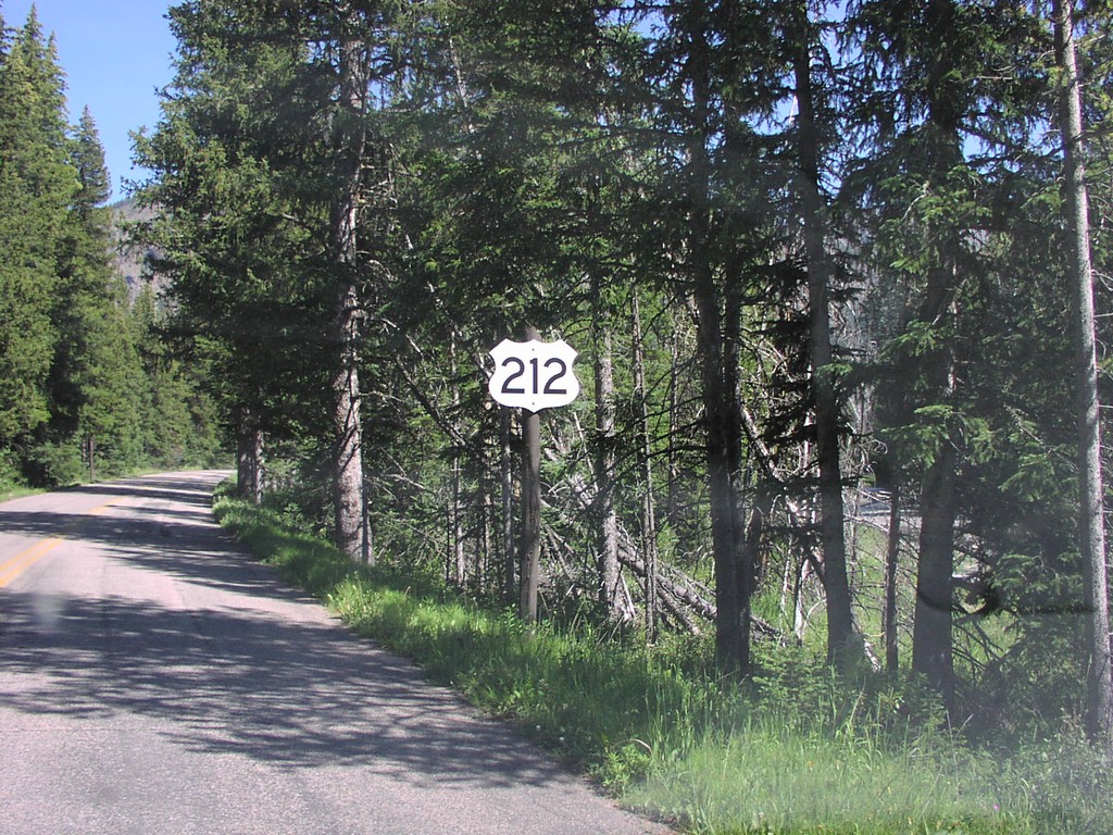
Begin US-212 East
Begin US-212 east at the Yellowstone NP boundary. First US-212 shield eastbound.
Taken 07-01-2006
 Silver Gate
Park County
Montana
United States
Silver Gate
Park County
Montana
United States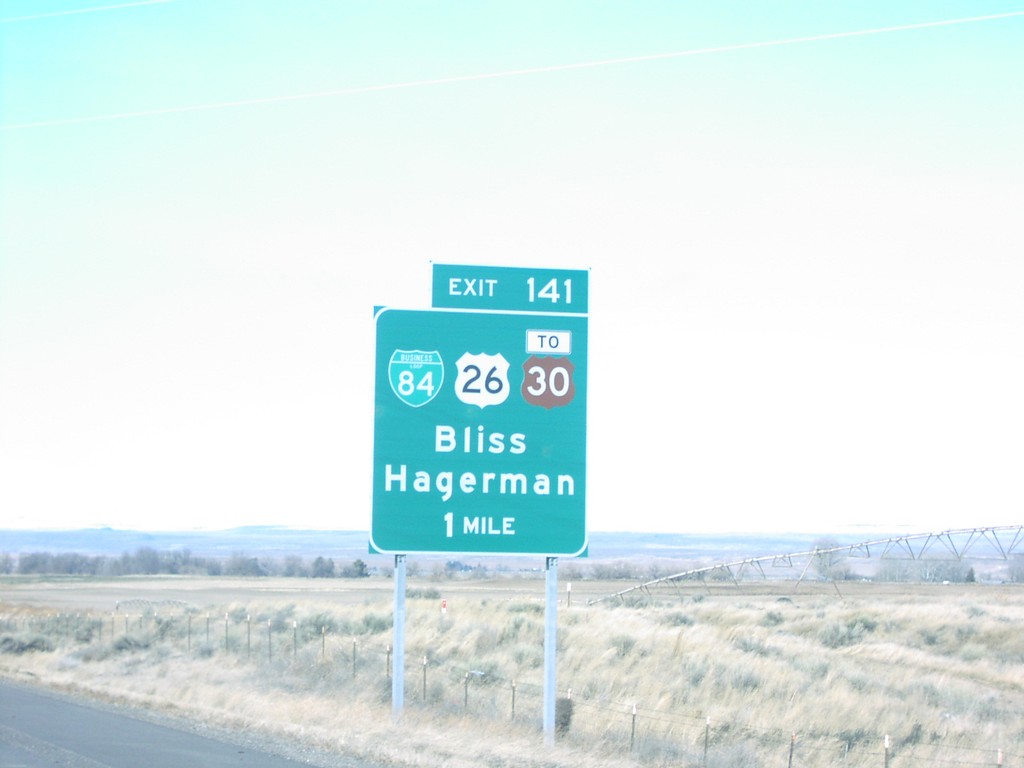
I-84 West Exit 141
I-84 west at Exit 141, US-26/US-30 junction
Taken 01-15-2006
Bliss
Gooding County
Idaho
United States