Signs Tagged With Shield Text
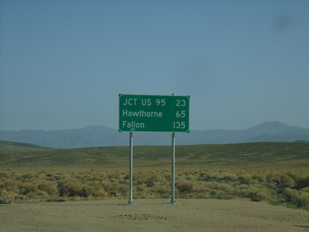
NV-360 North - Distance Marker
Distance marker on NV-360 north. Distance to Jct. US-95, Hawthorne, and Fallon.
Taken 07-22-2025
 Dyer
Mineral County
Nevada
United States
Dyer
Mineral County
Nevada
United States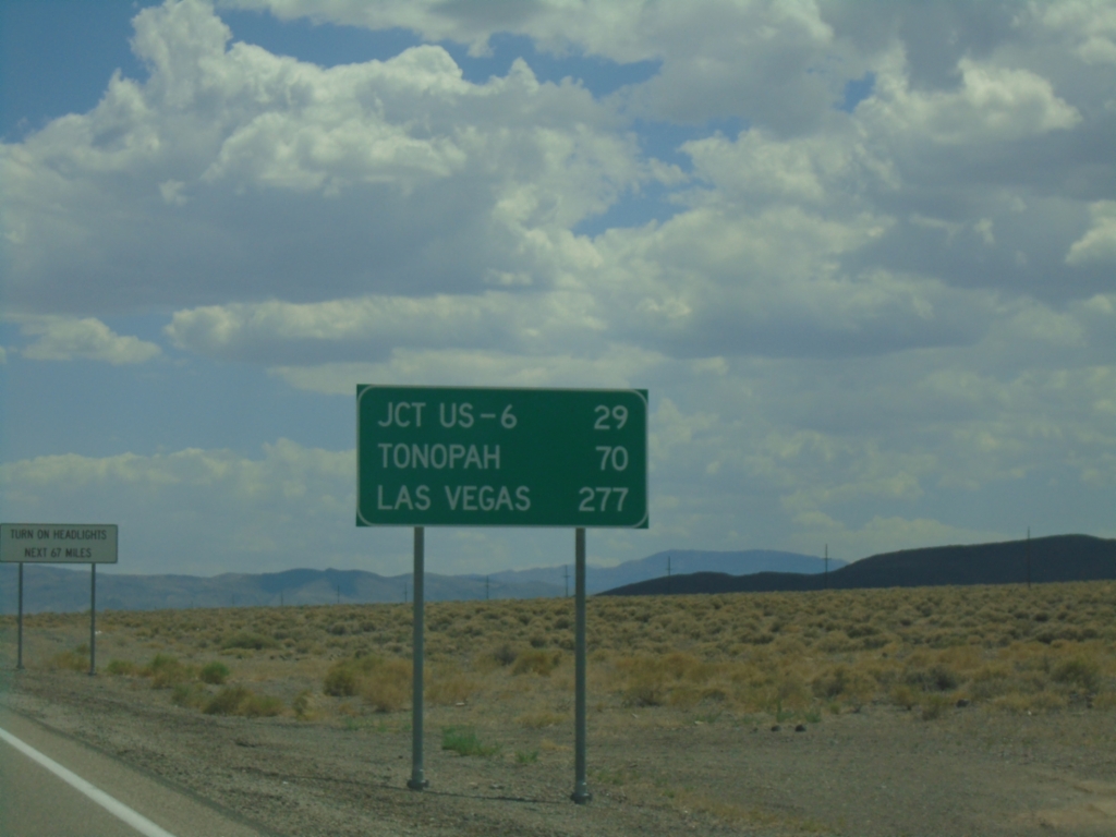
US-95 South - Distance Marker
Distance marker on US-95 south. Distance to Jct. US-6, Tonopah, and Las Vegas.
Taken 07-20-2025
 Mina
Mineral County
Nevada
United States
Mina
Mineral County
Nevada
United States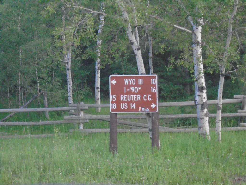
Bear Lodge Road at Farrall Road
Bear Lodge Road at Farrall Road. Use Farrall Road west to Reuter Campground and US-14; Farrall Road east to WYO-111 and I-90.
Taken 07-02-2025
Farrall Crook County Wyoming United States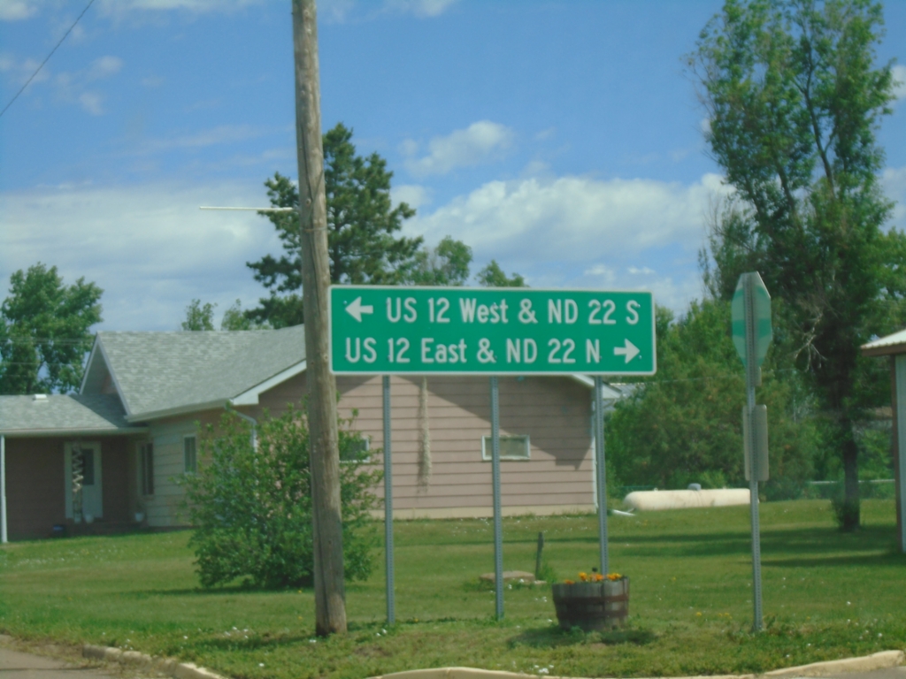
Main St. and 2nd Ave. - Reeder
Main St. north at 2nd Ave. in Reeder. Use 2nd Ave. West for US-12 West and ND-22 South; 2nd Ave. East for US-12 East and ND-22 North.
Taken 06-29-2025

 Reeder
Adams County
North Dakota
United States
Reeder
Adams County
North Dakota
United States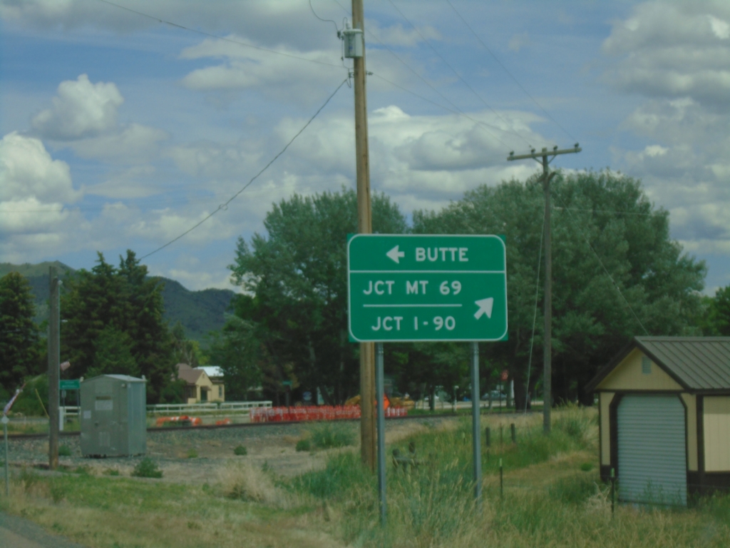
MT-55 North at MT-2
MT-55 North at MT-2 in Whitehall. Use MT-2 west to Butte; MT-2 East/MT-55 North to Jct I-90 and Jct. MT-69.
Taken 06-28-2025

 Whitehall
Jefferson County
Montana
United States
Whitehall
Jefferson County
Montana
United States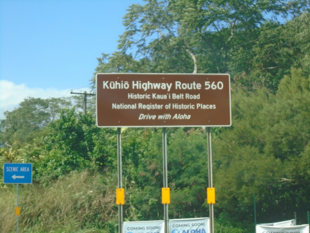
HI-560 West - Kūhiō Highway
Kūhiō Highway Route 560 - Historic Kauaʻi Belt Road. HI-560 is the northwestern segment of the Kauaʻi Belt Route and connects Princeville with Hāʻena State Park.
Taken 02-20-2025
 Princeville
Kauai County
Hawaii
United States
Princeville
Kauai County
Hawaii
United States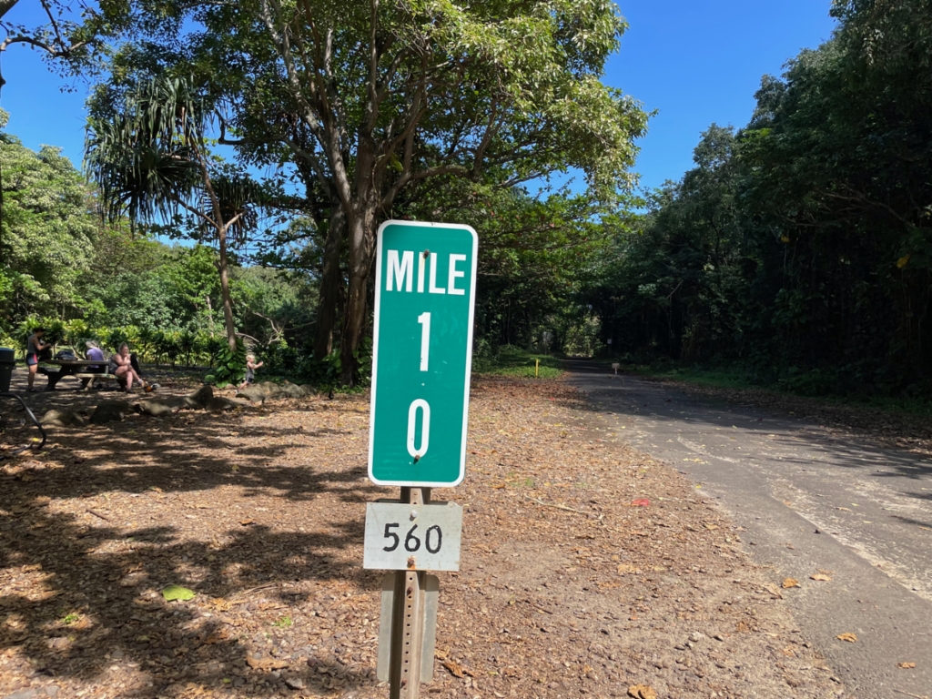
Mile 10 - Begin/End of HI-560
Mile 10 - HI-560 in Ha’ena State Park. The mile markers in Hawaii have the route number listed on a separate sign at the bottom of the mile marker assembly. This is the end/beginning of HI-560 and is the end of the road system on the northwest side of the island of Kauaʻi.
Taken 02-19-2025
Haena
Kauai County
Hawaii
United States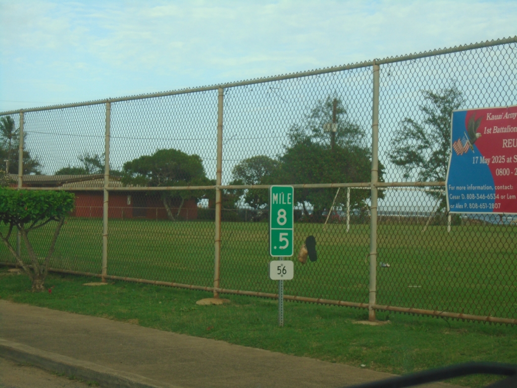
HI-56 North - Milemarker
Mile 8.5 on HI-56 North (Kūhiō Highway) in Kapa’a.
Taken 02-18-2025
 Kapaʻa
Kauai County
Hawaii
United States
Kapaʻa
Kauai County
Hawaii
United States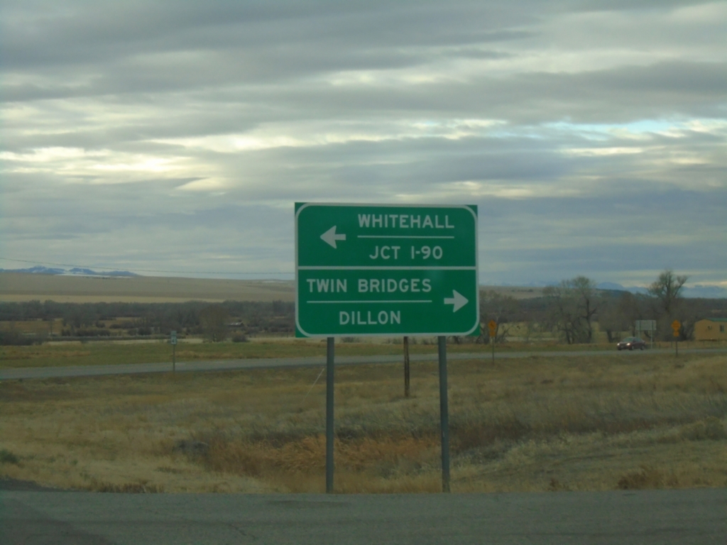
MT-41 South at MT-55
MT-41 South at MT-55 in Madison County. Use MT-55 north to Whitehall and I-90; MT-41 south to Twin Bridges and Dillon.
Taken 12-01-2024
 Silver Star
Madison County
Montana
United States
Silver Star
Madison County
Montana
United States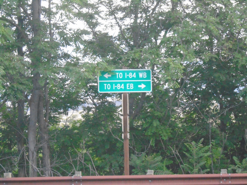
Deschutes State Park Access Road at OR-206
Deschutes State Park Access Road at OR-206. Use OR-206 East for I-84 Eastbound; OR-206 West for I-84 Westbound.
Taken 08-10-2024

 Wasco
Sherman County
Oregon
United States
Wasco
Sherman County
Oregon
United States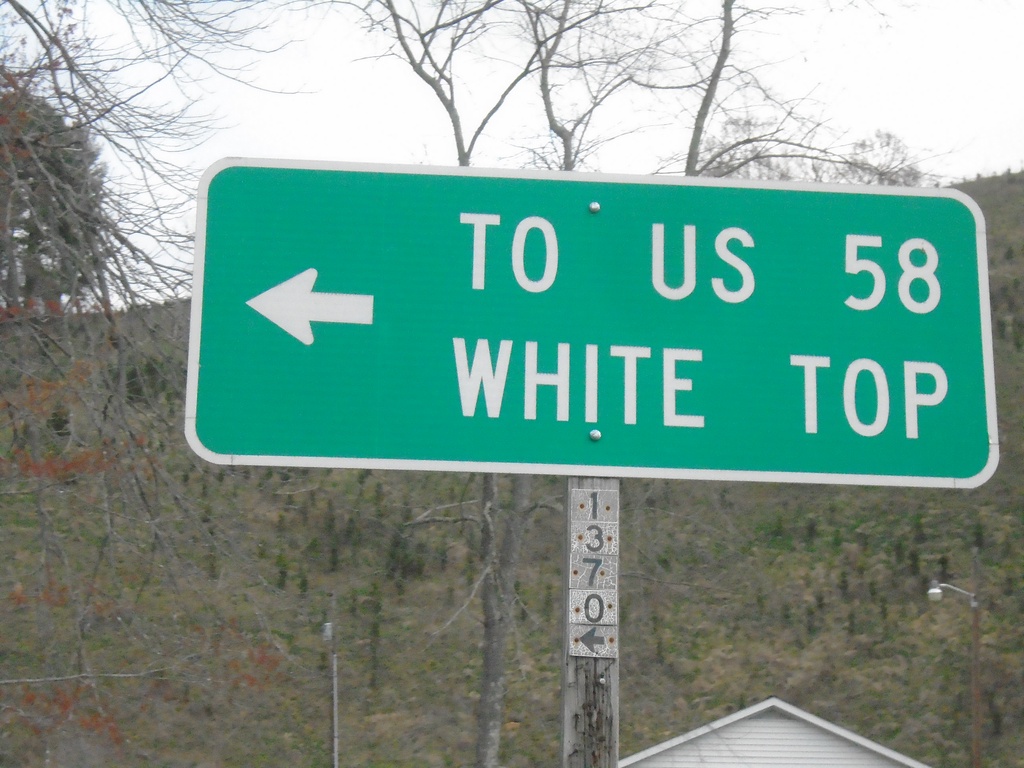
NC-194 South at Helton Creek Road (SR-1370)
NC-194 South at Helton Creek Road (SR-1370) to White Top and US-58
Taken 03-31-2024
 Lansing
Ashe County
North Carolina
United States
Lansing
Ashe County
North Carolina
United States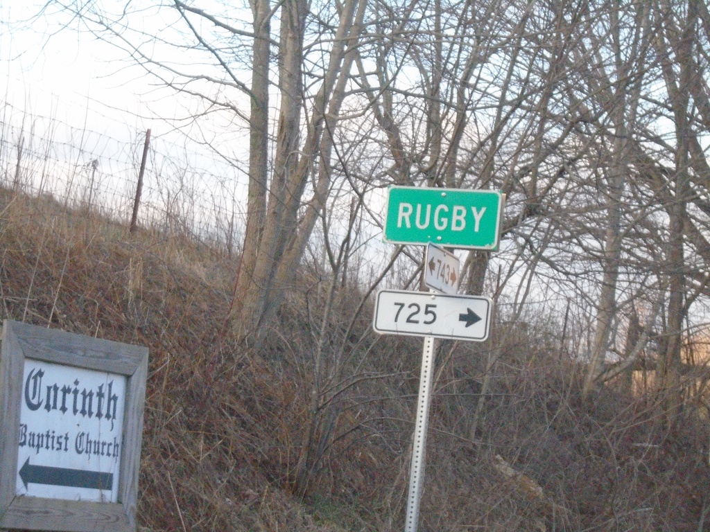
VAS-743 South at VAS-725 - Rugby
VAS-743 South at VAS-725 in Rugby. These smaller rectangular numbers also denote Virginia State Secondary Highways.
Taken 03-31-2024

 Mouth of Wilson
Grayson County
Virginia
United States
Mouth of Wilson
Grayson County
Virginia
United States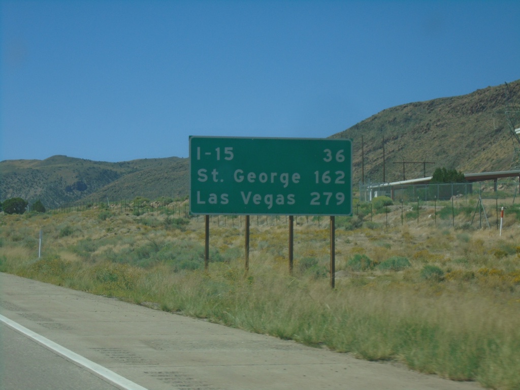
I-70 West - Distance Marker
Distance marker on I-70 west. Distance to I-15, St. George, and Las Vegas (Nevada). The last two destinations are via I-15 south.
Taken 09-07-2023

 Richfield
Sevier County
Utah
United States
Richfield
Sevier County
Utah
United States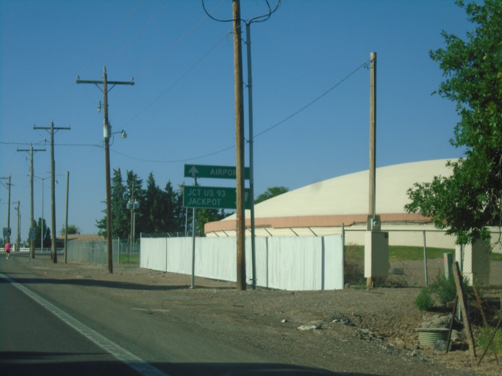
ID-74 South Approaching E 3600 N
ID-74 South (Washington St.) approaching E 3600 N. Turn right to continue south on ID-74 to Jct. US-93 and Jackpot (Nevada). Continue south on Washington St. to (Magic Valley Regional) Airport.
Taken 07-19-2023
 Twin Falls
 County
Idaho
United States
Twin Falls
Twin Falls County
Idaho
United States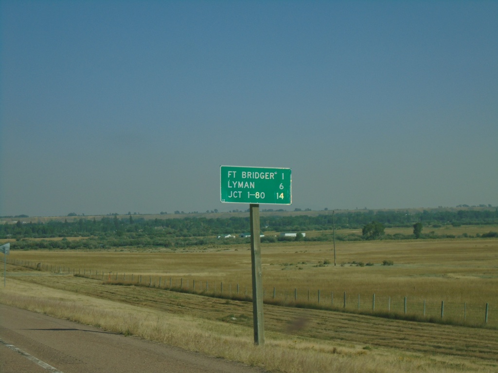
BL-80 East - Distance Marker
Distance marker on BL-80 east. Distance to Fort Bridger, Lyman, and Jct. I-80.
Taken 09-10-2022
 Fort Bridger
Uinta County
Wyoming
United States
Fort Bridger
Uinta County
Wyoming
United States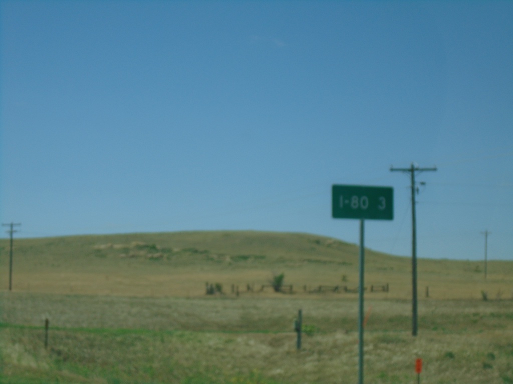
NE-53C Link South - Distance Marker
Distance Marker on NE-53C Link South. Distance to I-80.
Taken 07-11-2022
 Bushnell
Kimball County
Nebraska
United States
Bushnell
Kimball County
Nebraska
United States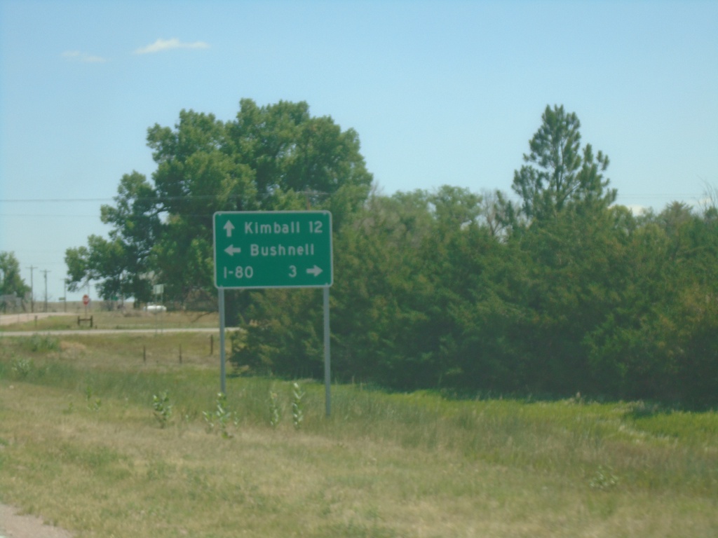
US-30 East at NE-53C Link South - Bushnell
US-30 East at NE-53C Link South in Bushnell. Use NE-53C Link for I-80; continue east on US-30 for Kimball. Turn left for Bushnell.
Taken 07-11-2022
 Bushnell
Kimball County
Nebraska
United States
Bushnell
Kimball County
Nebraska
United States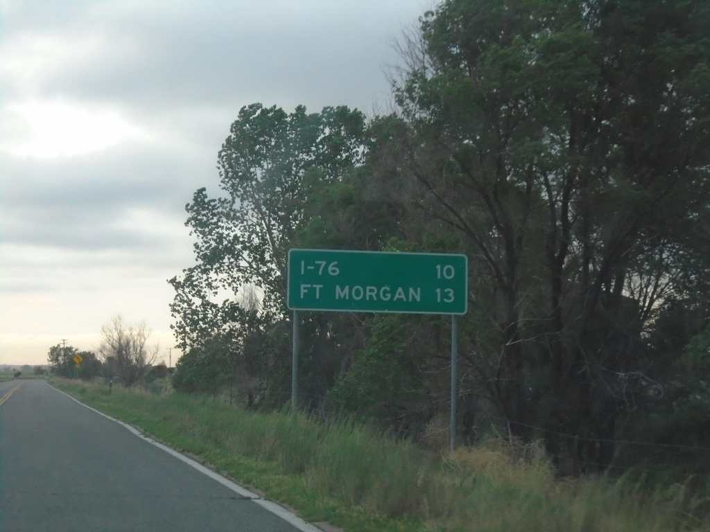
CO-144 East - Distance Marker
Distance marker on CO-144 East. Distance to I-76 and Fort Morgan.
Taken 07-11-2022
 Weldona
Morgan County
Colorado
United States
Weldona
Morgan County
Colorado
United States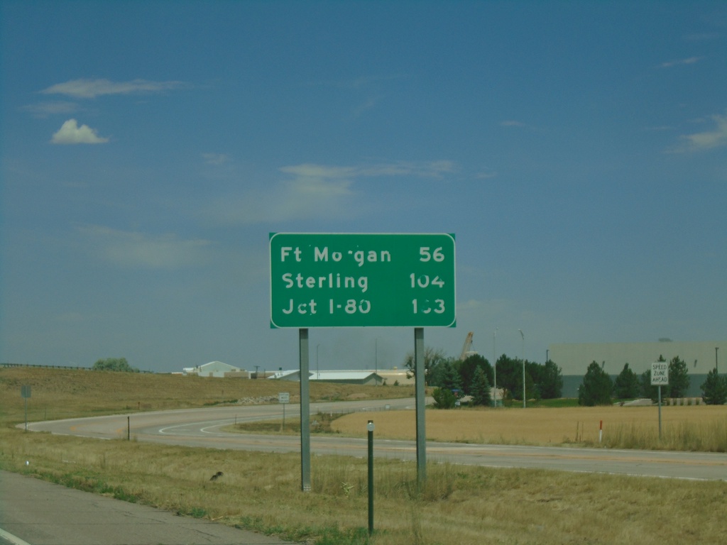
I-76 East - Distance Marker
Distance marker on I-76 east. Distance to Fort Morgan, Sterling, and I-80 (in Nebraska).
Taken 07-10-2022

 Brighton
Adams County
Colorado
United States
Brighton
Adams County
Colorado
United States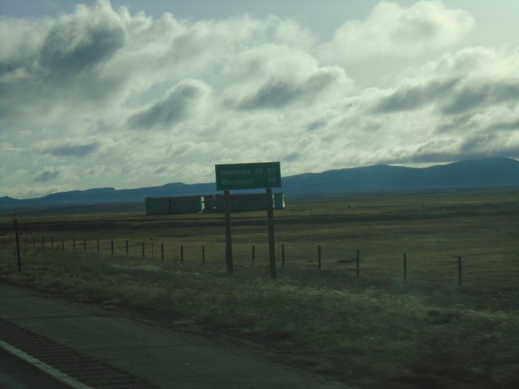
WY-34 East - Distance Marker
Distance marker on WY-34 east. Distance to I-25 and Wheatland (via I-25).
Taken 04-30-2022
 Laramie
Albany County
Wyoming
United States
Laramie
Albany County
Wyoming
United States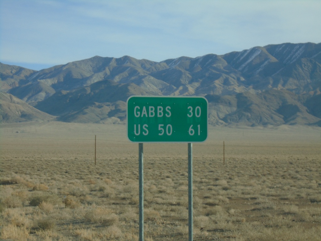
NV-361 North - Distance Marker
Distance marker on NV-361 north. Distance to Gabbs and US-50 (Middlegate Junction).
Taken 01-15-2022
 Luning
Mineral County
Nevada
United States
Luning
Mineral County
Nevada
United States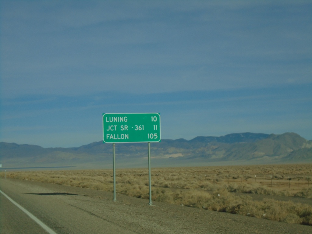
US-95 North - Distance Marker
Distance marker on US-95 north. Distance to Luning, Jct. SR-361, and Fallon.
Taken 01-15-2022
Mina
Mineral County
Nevada
United States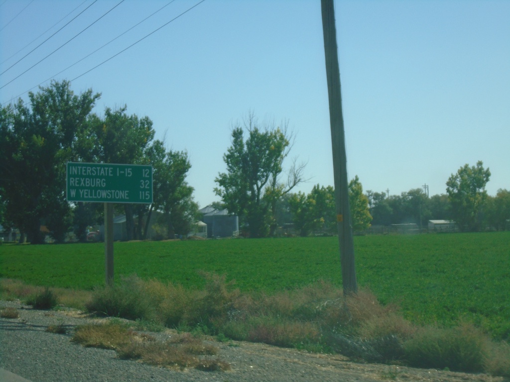
ID-33 East - Distance Marker
Distance marker on ID-33 east. Distance to I-15, Rexburg, and West Yellowstone (Montana - via US-20 East)
Taken 09-24-2021
 Terreton
Jefferson County
Idaho
United States
Terreton
Jefferson County
Idaho
United States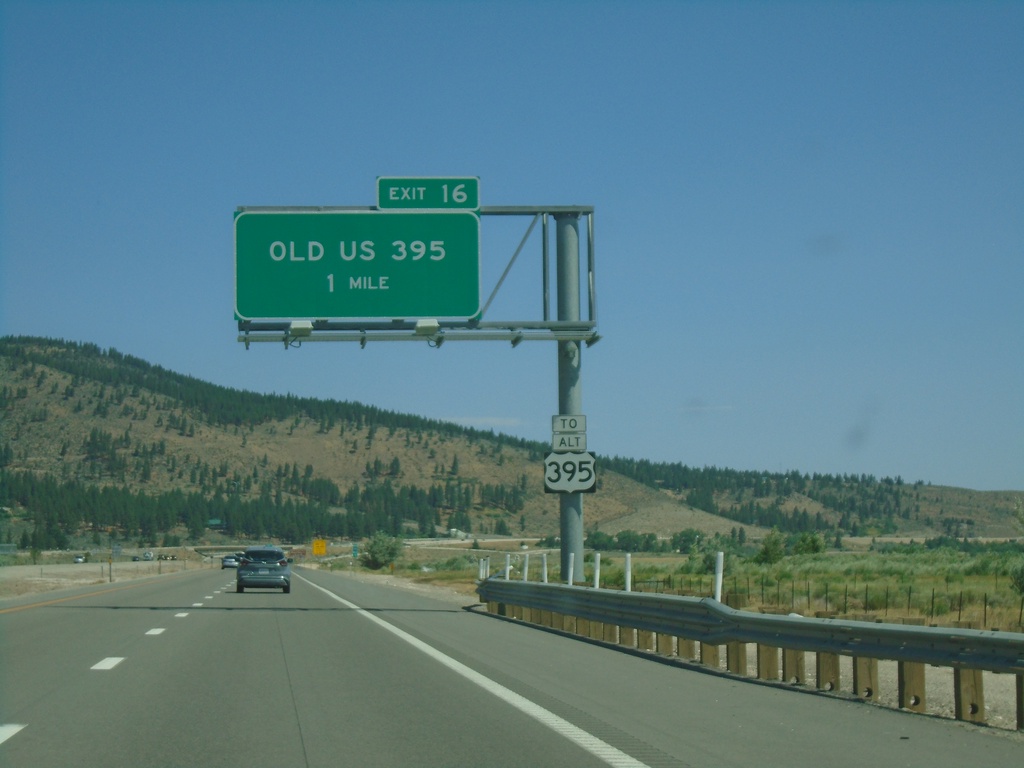
I-580 North - Exit 16
I-580/US-395 North approaching Exit 16 - Old US 395. Use Exit 16 for Alt. US-395.
Taken 07-12-2021


 New Washoe City
Washoe County
Nevada
United States
New Washoe City
Washoe County
Nevada
United States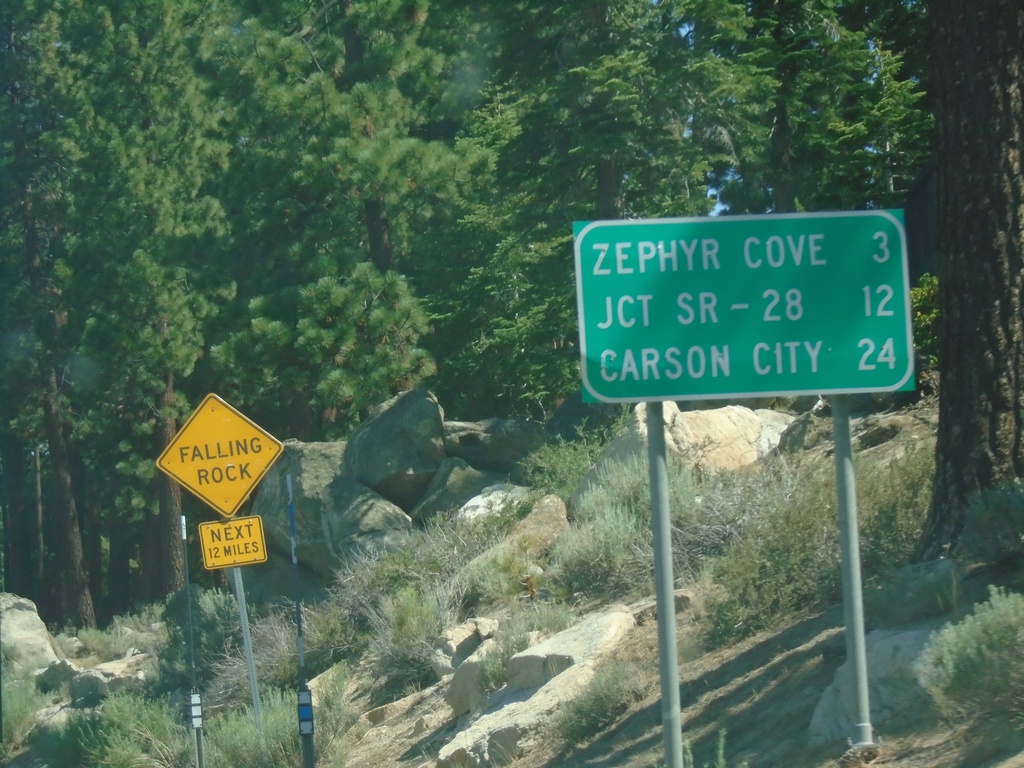
US-50 East - Distance Marker
First distance marker on US-50 east in Nevada. Distance to Zephyr Cove, Jct SR-28, and Carson City.
Taken 07-12-2021
 Stateline
Douglas County
Nevada
United States
Stateline
Douglas County
Nevada
United States