Signs Tagged With Shield Text
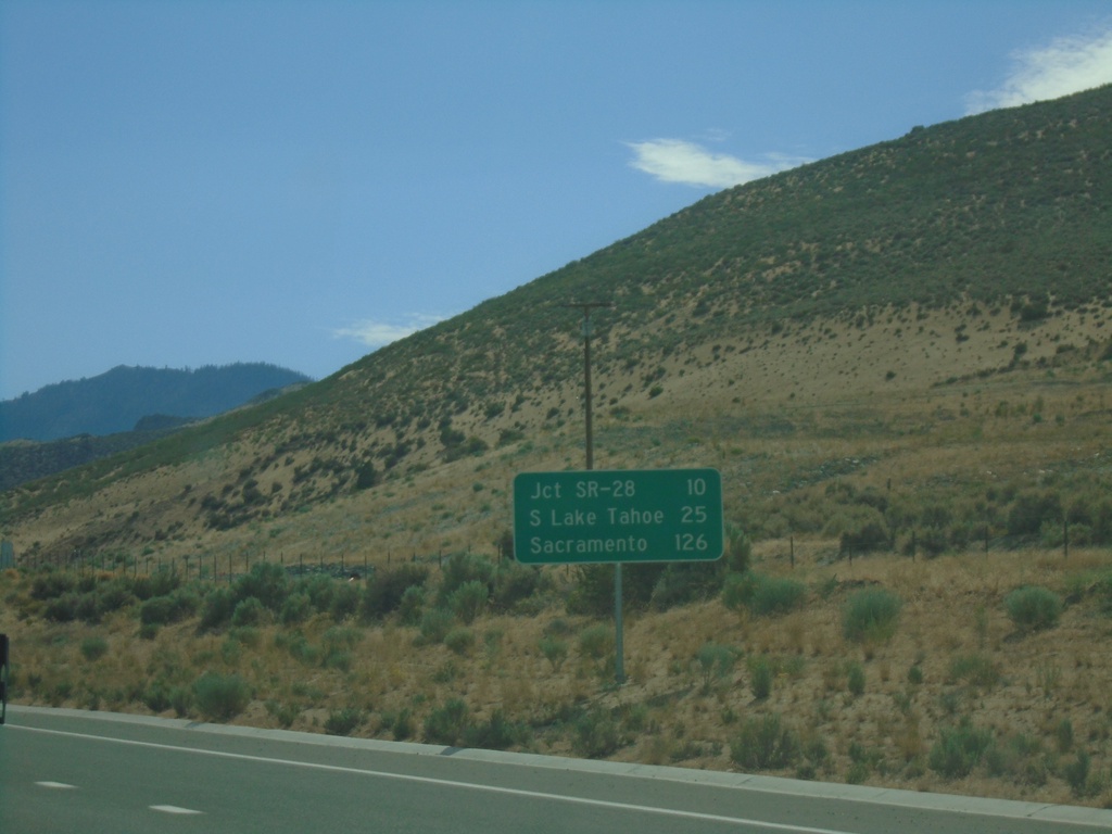
US-50 West - Distance Marker
Distance marker on US-50 west. Distance to Jct. SR-28, South Lake Tahoe (CA), and Sacramento (CA).
Taken 07-09-2021
 Carson City
Nevada
United States
Carson City
Nevada
United States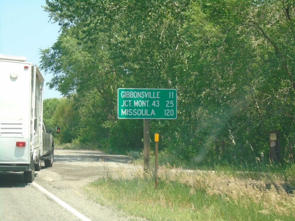
US-93 North - Distance Marker
Distance marker on US-93 north. Distance to Gibbonsville, Jct. Mont. 43 (at Lost Trail Pass), and Missoula (Montana).
Taken 07-02-2021
 North Fork
Lemhi County
Idaho
United States
North Fork
Lemhi County
Idaho
United States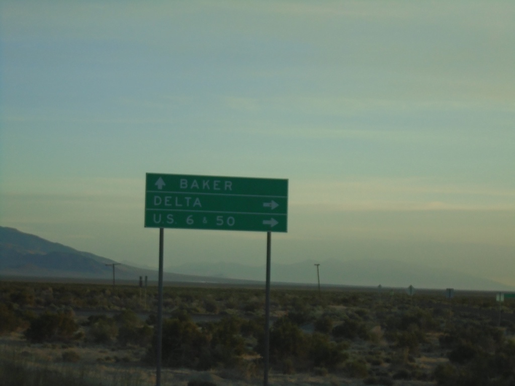
UT-21 West Approaching UT-159 North
UT-21 West approaching UT-159 North to Delta and US-6/US-50 Jct. Continue west on UT-21 for Baker (Nevada). UT-159 parallels the Utah-Nevada state line northwards.
Taken 05-29-2021

 Garrison
Millard County
Utah
United States
Garrison
Millard County
Utah
United States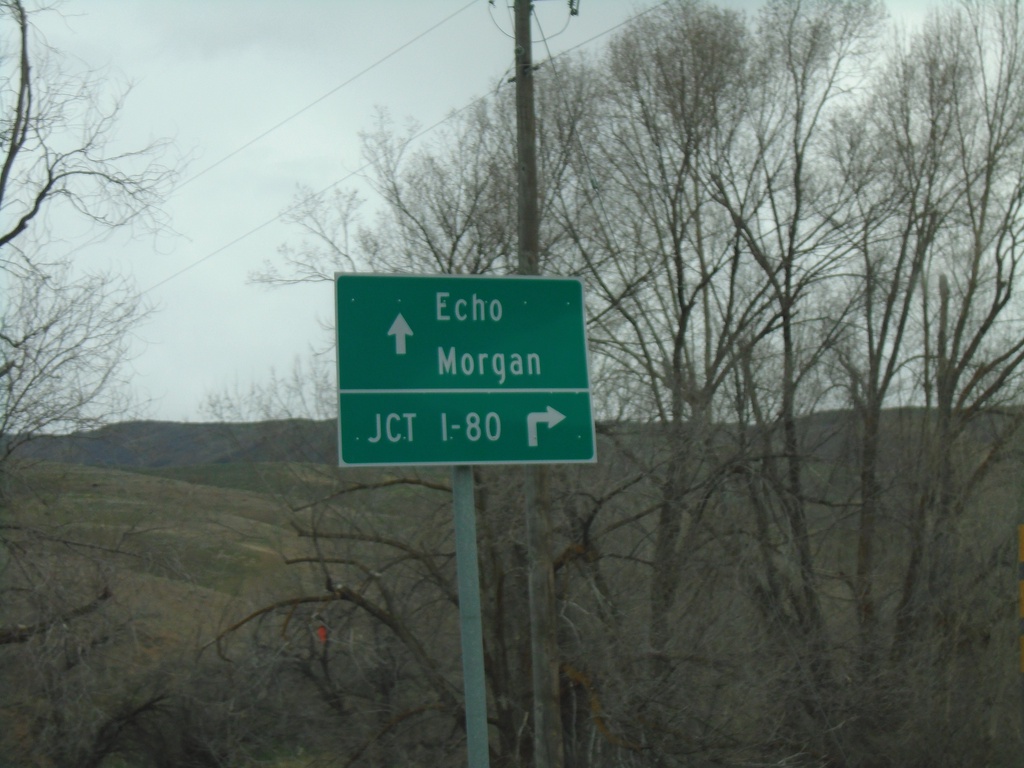
End UT-65 North at I-84 (Exit 115)
End UT-65 North at I-84 (Exit 115) in Henefer. Use I-84 East to I-80 junction (next exit). Continue over freeway for Echo (via County Road) and Morgan (via I-84 West).
Taken 04-24-2021


 Henefer
Summit County
Utah
United States
Henefer
Summit County
Utah
United States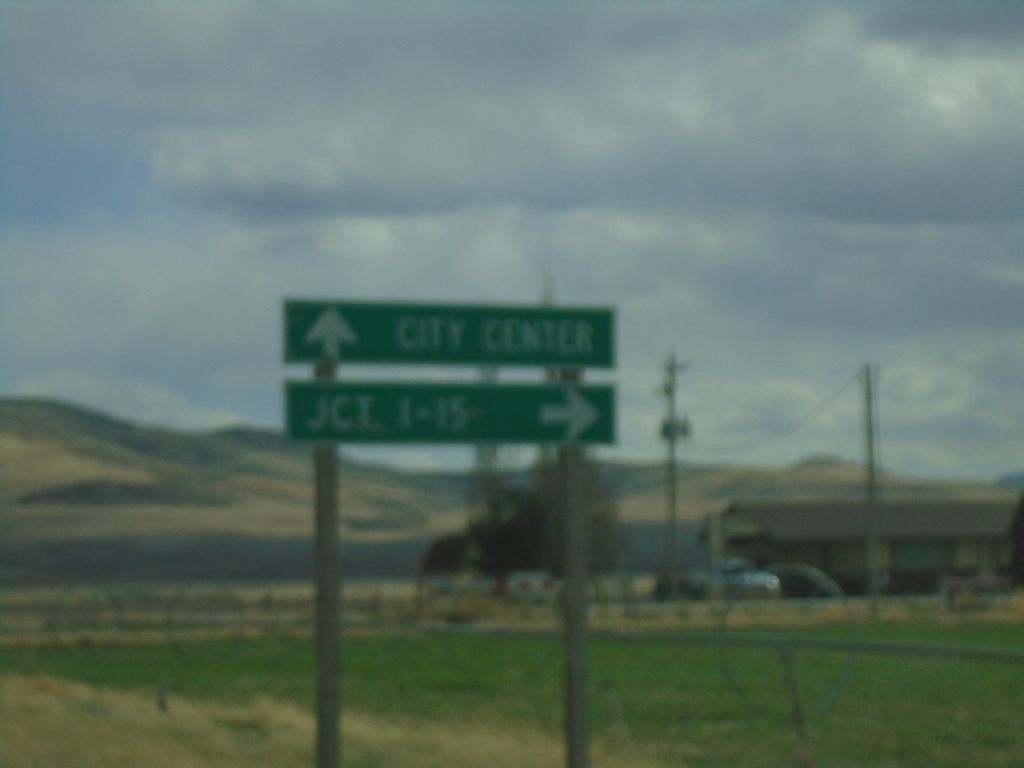
ID-36 West (Westside Highway) at Weston Canyon Road
ID-36 West (Westside Highway) at Weston Canyon Road. Turn right to continue west on ID-36 to I-15 Jct. Continue south on Westside Highway to (Weston) City Center.
Taken 04-23-2021
 Weston
Franklin County
Idaho
United States
Weston
Franklin County
Idaho
United States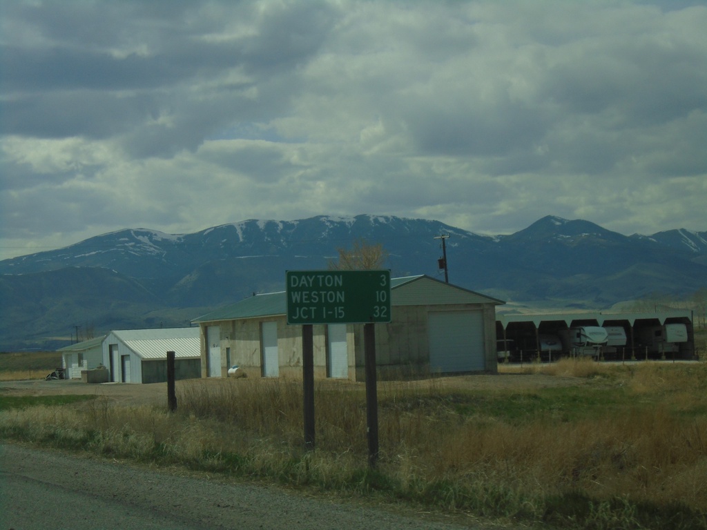
ID-36 West - Distance Marker
Distance marker on ID-36 west. Distance to Dayton, Weston, and Jct. I-15.
Taken 04-23-2021
Preston
Franklin County
Idaho
United States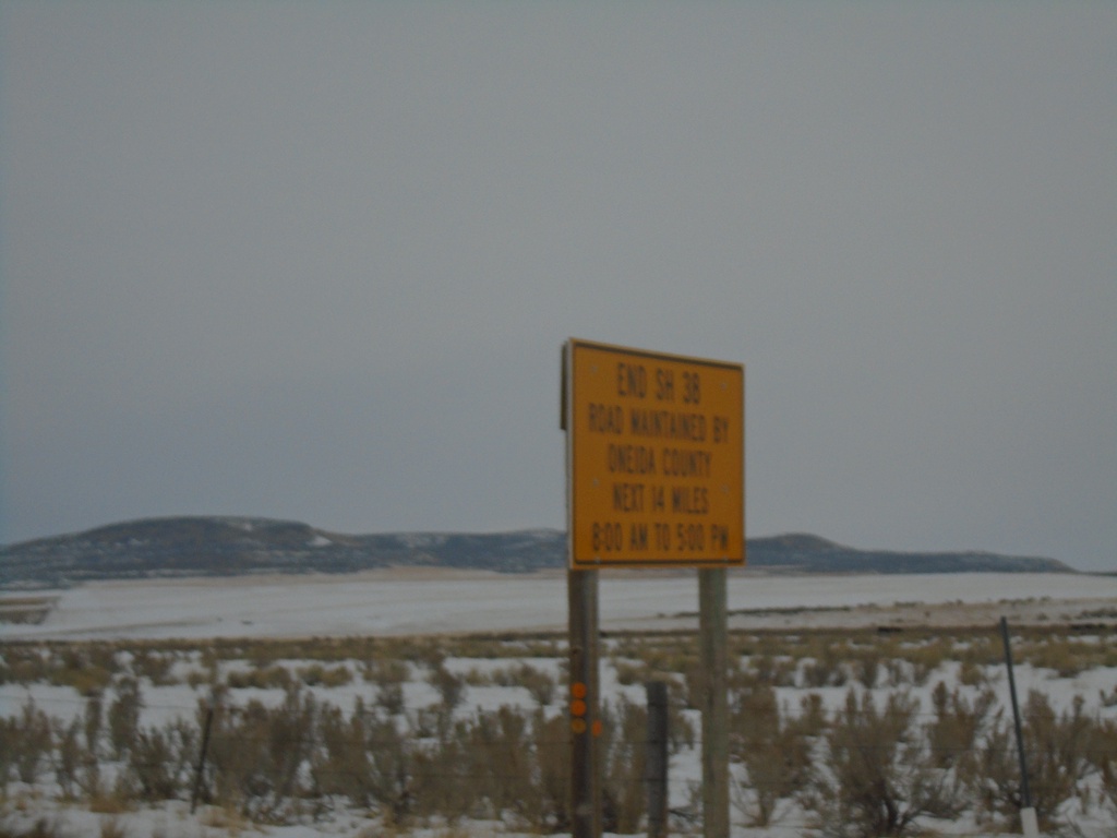
End ID-38 - Old Highway 37 Winter Maintenance
End ID-38 / Begin Old Highway 37. Road is maintained by Oneida County next 14 miles from 8:00 AM to 5:00PM.
Taken 12-30-2020
 Holbrook
Oneida County
Idaho
United States
Holbrook
Oneida County
Idaho
United States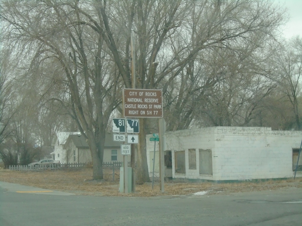
End ID-81 South at ID-77
End ID-81 South at ID-77 in Malta. Use ID-77 north for City of Rocks National Preserve and Castle Rocks State Park.
Taken 12-30-2020

 Malta
Cassia County
Idaho
United States
Malta
Cassia County
Idaho
United States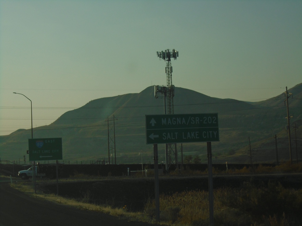
UT-202 South at I-80 East
UT-202 South at I-80 East to Salt Lake City. Continue south on UT-202 for Magna. UT-202 is spelled out on the sign as SR-202.
Taken 10-03-2020
 Magna
Salt Lake County
Utah
United States
Magna
Salt Lake County
Utah
United States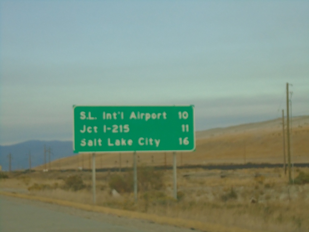
I-80 East - Distance Marker
Distance marker on I-80 east. Distance to Salt Lake International Airport, Jct. I-215, and Salt Lake City.
Taken 10-02-2020
Tooele
Salt Lake County
Utah
United States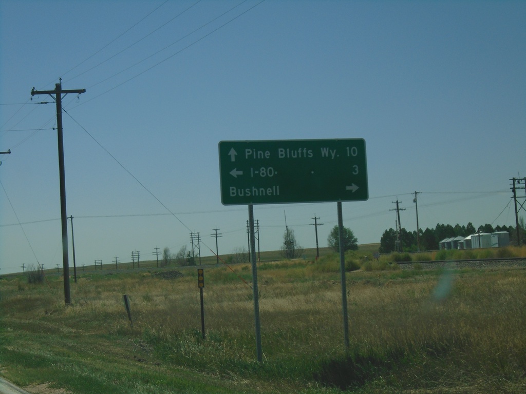
US-30 West at NE-53C Link
US-30 West at NE-53C Link south to I-80. Turn right on Birch St. for Bushnell. Continue west on US-30 for Pine Bluffs, WY.
Taken 08-14-2020

 Bushnell
Kimball County
Nebraska
United States
Bushnell
Kimball County
Nebraska
United States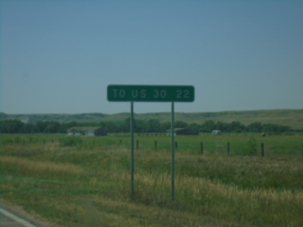
NE-27 South - Distance Marker
Distance marker on NE-27 south. Distance to US-30 Junction.
Taken 08-14-2020
 Oshkosh
Garden County
Nebraska
United States
Oshkosh
Garden County
Nebraska
United States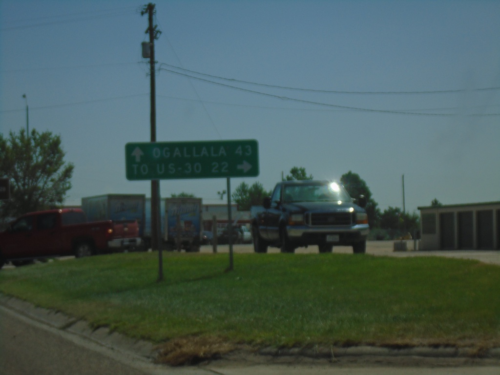
US-26 East/NE-92 East At NE-27
US-26 East/NE-92 East at NE-27 South in Oshkosh. Turn right for NE-27 to US-30 Jct; continue straight on US-26 East/NE-92 East for Ogallala.
Taken 08-14-2020

 Oshkosh
Garden County
Nebraska
United States
Oshkosh
Garden County
Nebraska
United States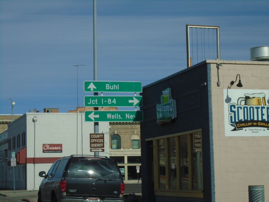
US-30 West at ID-74
US-30 west (2nd Ave N) at ID-74 (Shoshone St E) in Twin Falls. Turn left on ID-74 south for Wells, Nev. (via US-93 south); turn right on ID-74 north for Jct. I-84 (via Bus. US-93 and US-93 North). Continue straight on US-30 West for Buhl.
Taken 04-04-2020
 Twin Falls
 County
Idaho
United States
Twin Falls
Twin Falls County
Idaho
United States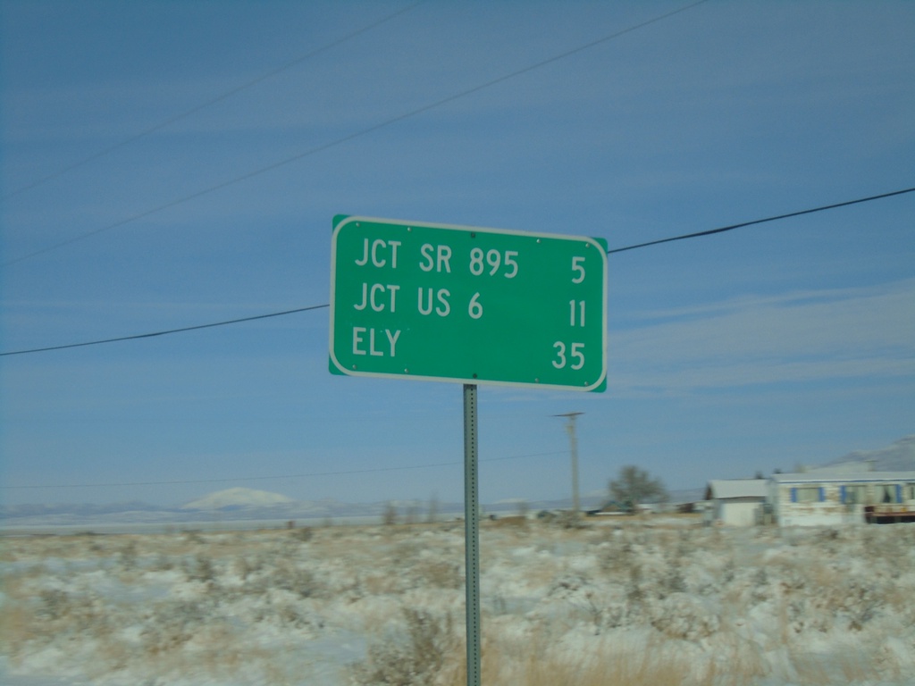
NV-318 North - Distance Marker
Distance marker on NV-318 north. Distance to SR-895, US-6, and Ely.
Taken 11-30-2019
 Lund
White Pine County
Nevada
United States
Lund
White Pine County
Nevada
United States
NV-318 North - Distance Marker
Distance marker on NV-318 north. Distance to Lund, Jct. US-6, and Ely.
Taken 11-30-2019
Lincoln County
Nevada
United States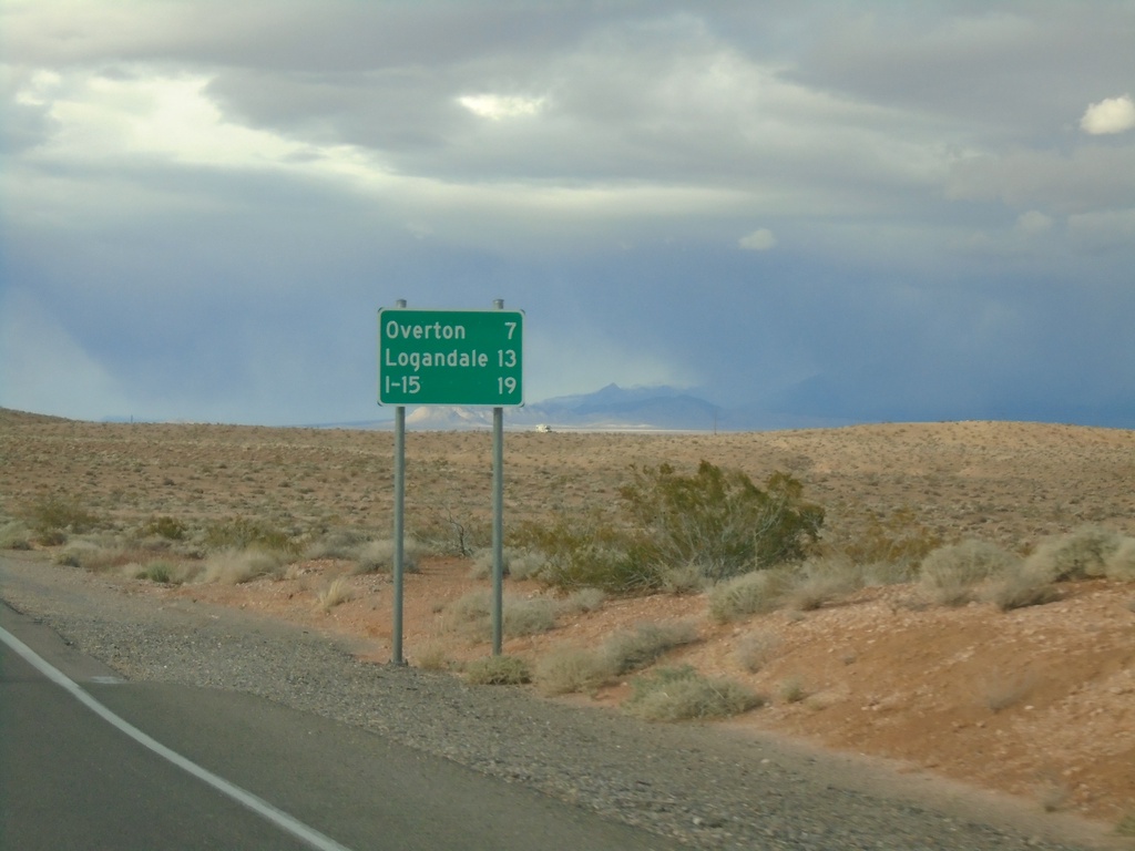
Begin NV-169 Northbound
Distance marker at beginning of NV-169 northbound. Distance to Overton, Logandale, and I-15.
Taken 11-29-2019
 Moapa Valley
Clark County
Nevada
United States
Moapa Valley
Clark County
Nevada
United States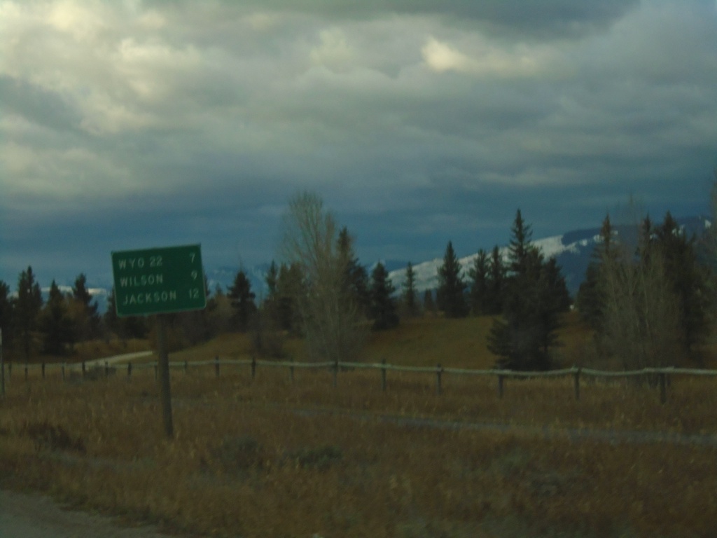
WY-390 South - Distance Marker
Distance marker on WY-390 south. Distance to WYO-22, Wilson, and Jackson.
Taken 10-26-2019
 Wilson
Teton County
Wyoming
United States
Wilson
Teton County
Wyoming
United States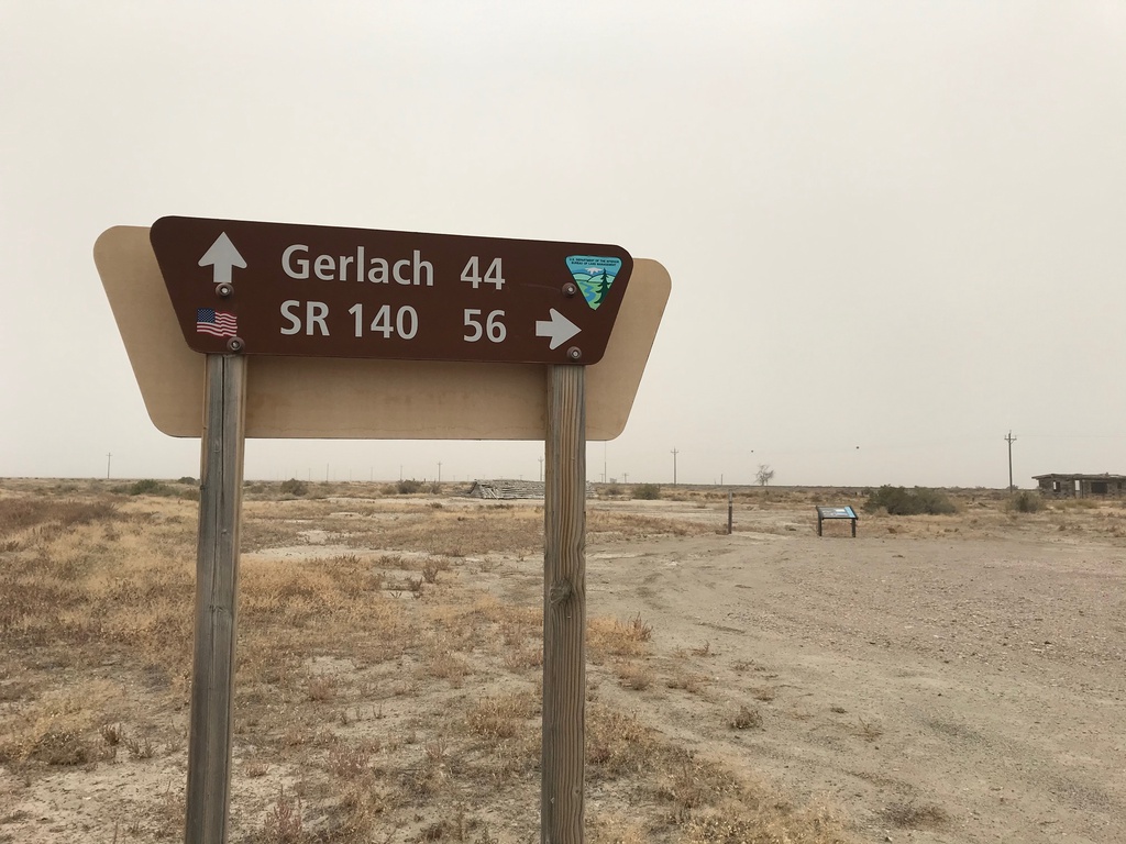
Jungo Road at Jackson Creek Ranch Road
Jungo Road West at Jackson Creek Ranch Road. Use Jackson Creek Ranch Road north for NV-140; continue on Jungo Road west for Gerlach.
Taken 10-19-2019
Sulphur Humboldt County Nevada United States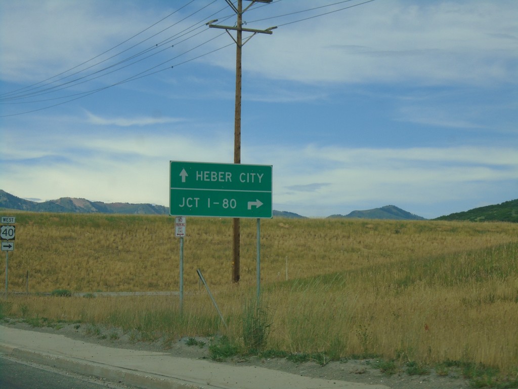
UT-248 West at US-40
UT-248 West at US-40 in Summit County. Use US-40 west for Jct. I-80; US-40 east for Heber City.
Taken 08-03-2019

 Park City
Summit County
Utah
United States
Park City
Summit County
Utah
United States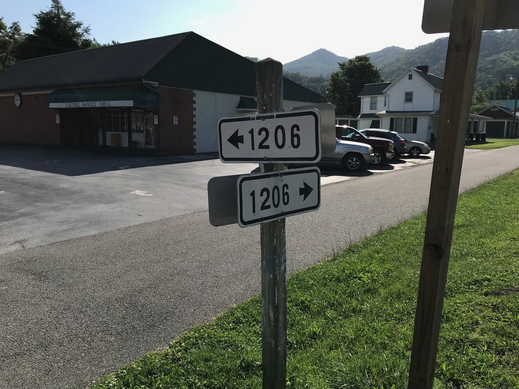
VAS-1206 at VAS-716 - Damascus
VAS-1206 (Creepers Way) at VAS-716 (Shady Ave.) in Damascus
Taken 06-24-2019

 Damascus
Washington County
Virginia
United States
Damascus
Washington County
Virginia
United States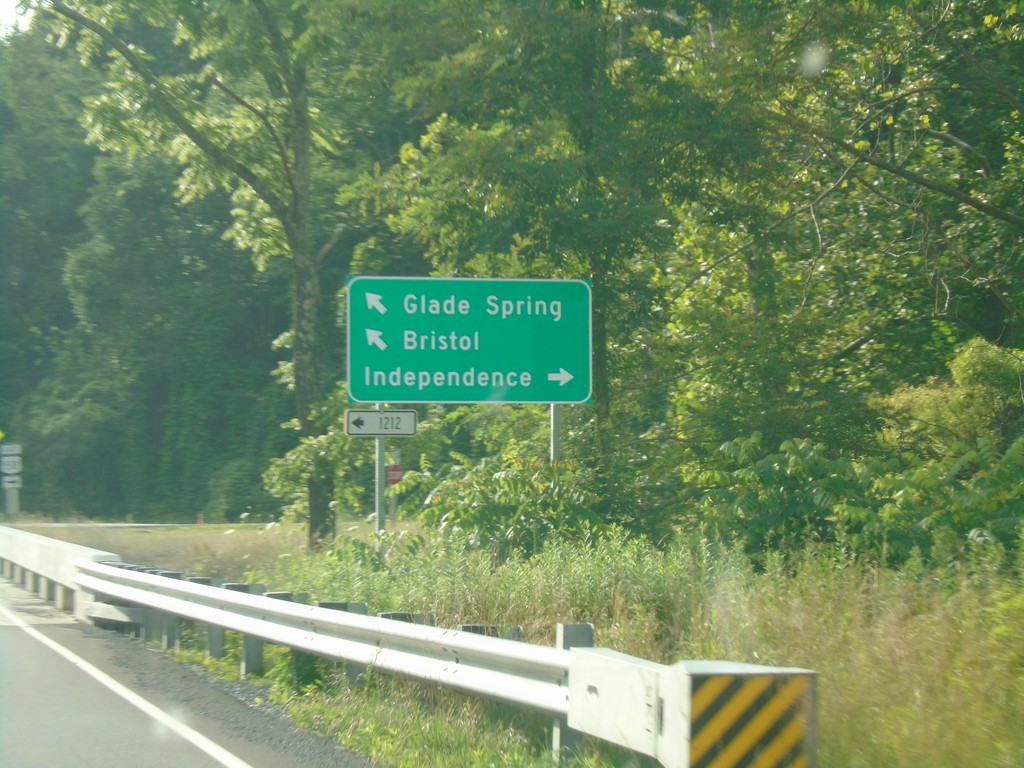
VA-91 North at VAS-1212; Approaching US-58
VA-91 north at VAS-1212. VA-91 north approaching US-58. Turn right for US-58 East to Independence; turn left for US-58 West/VA-91 North to Bristol and Glade Spring.
Taken 06-23-2019


 Damascus
Washington County
Virginia
United States
Damascus
Washington County
Virginia
United States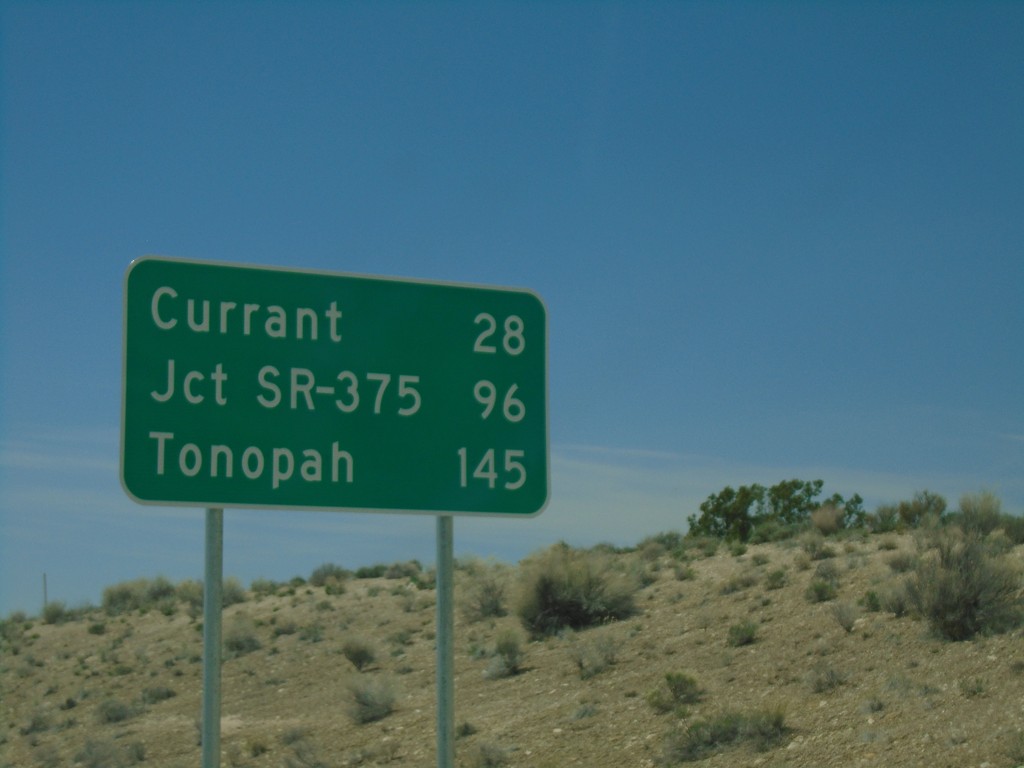
US-6 West - Distance Marker
Distance marker on US-6 West. Distance to Currant, Jct. SR-375, and Tonopah.
Taken 04-26-2019

 Lund
White Pine County
Nevada
United States
Lund
White Pine County
Nevada
United States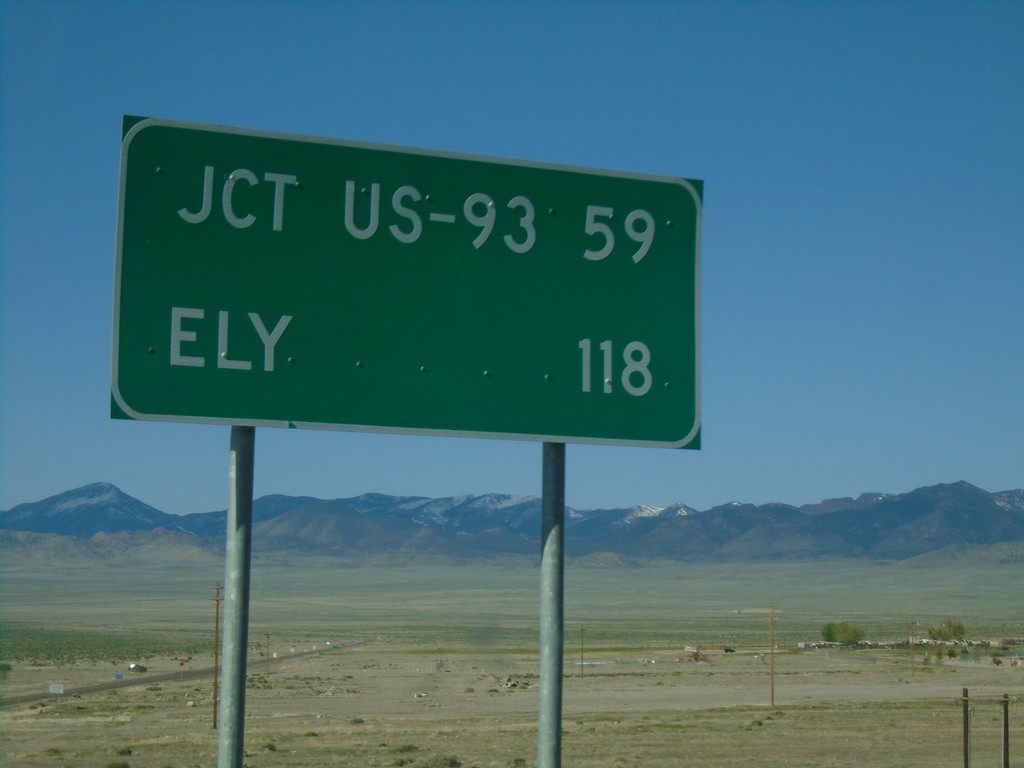
US-93 Alt. South - Distance Marker
Distance marker on US-93 Alt. South. Distance to Jct. US-93 and Ely.
Taken 04-26-2019
 West Wendover
Elko County
Nevada
United States
West Wendover
Elko County
Nevada
United States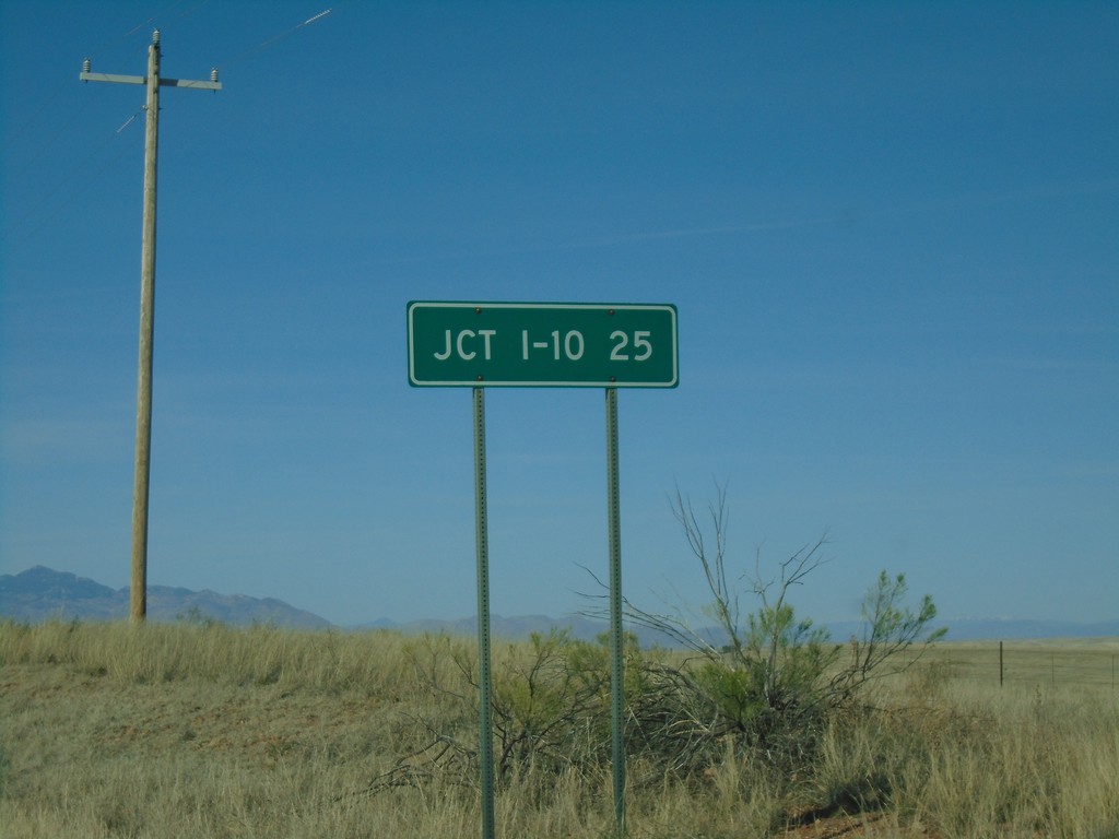
AZ-83 North - Distance Marker
Distance marker on AZ-83 north. Distance to I-10.
Taken 03-23-2019

 Sonoita
Santa Cruz County
Arizona
United States
Sonoita
Santa Cruz County
Arizona
United States