Signs Tagged With Shield Text
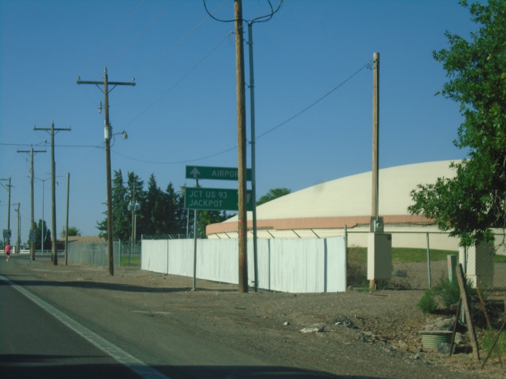
ID-74 South Approaching E 3600 N
ID-74 South (Washington St.) approaching E 3600 N. Turn right to continue south on ID-74 to Jct. US-93 and Jackpot (Nevada). Continue south on Washington St. to (Magic Valley Regional) Airport.
Taken 07-19-2023
 Twin Falls
 County
Idaho
United States
Twin Falls
Twin Falls County
Idaho
United States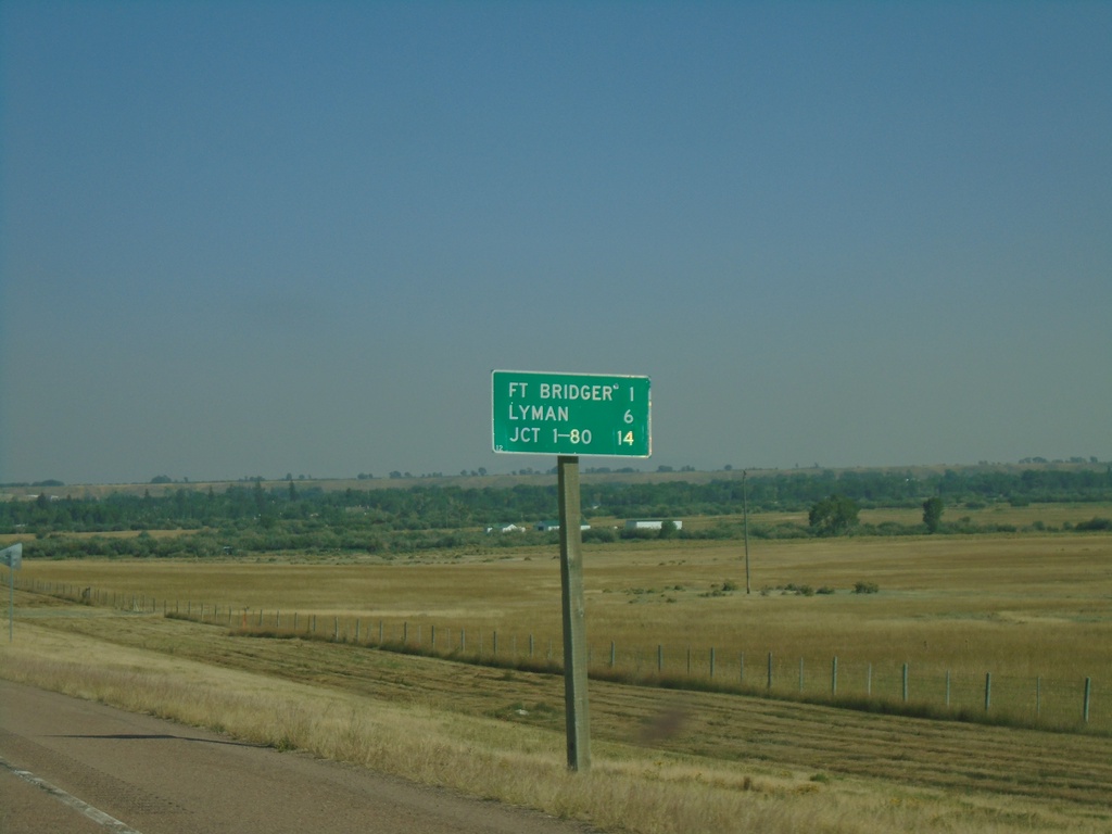
BL-80 East - Distance Marker
Distance marker on BL-80 east. Distance to Fort Bridger, Lyman, and Jct. I-80.
Taken 09-10-2022
 Fort Bridger
Uinta County
Wyoming
United States
Fort Bridger
Uinta County
Wyoming
United States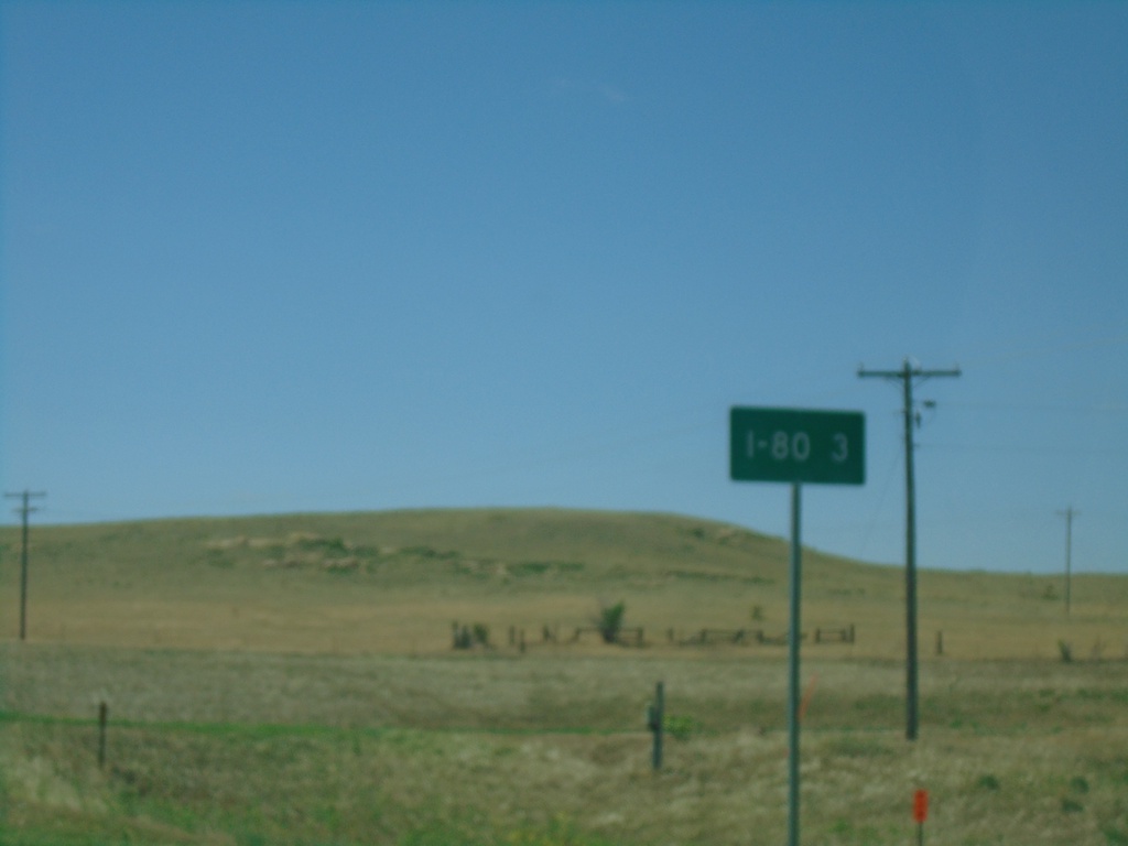
NE-53C Link South - Distance Marker
Distance Marker on NE-53C Link South. Distance to I-80.
Taken 07-11-2022
 Bushnell
Kimball County
Nebraska
United States
Bushnell
Kimball County
Nebraska
United States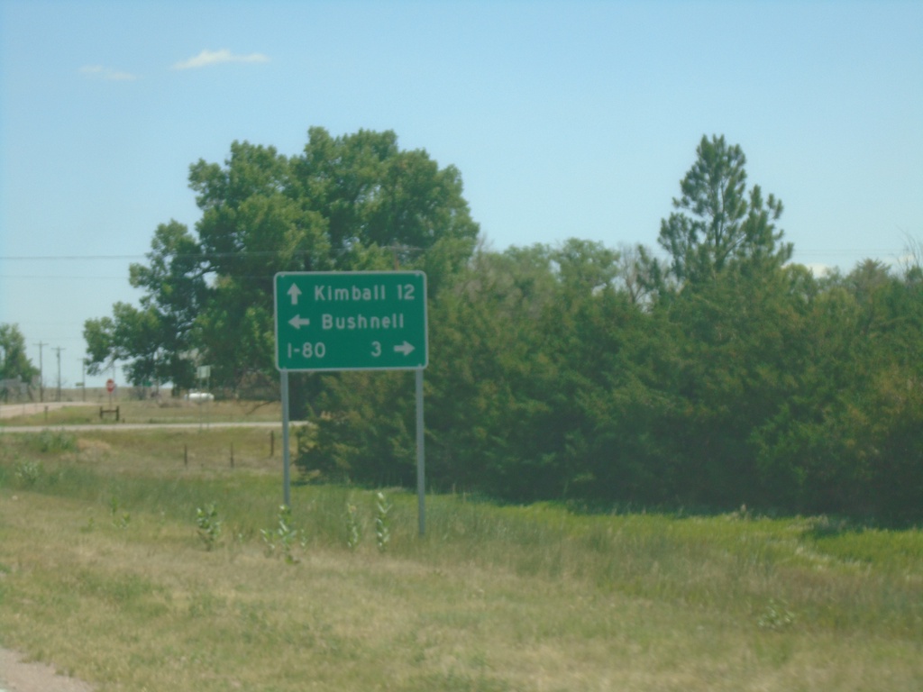
US-30 East at NE-53C Link South - Bushnell
US-30 East at NE-53C Link South in Bushnell. Use NE-53C Link for I-80; continue east on US-30 for Kimball. Turn left for Bushnell.
Taken 07-11-2022
 Bushnell
Kimball County
Nebraska
United States
Bushnell
Kimball County
Nebraska
United States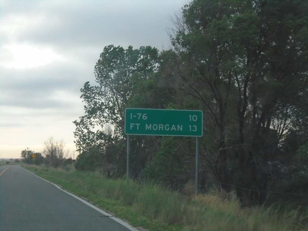
CO-144 East - Distance Marker
Distance marker on CO-144 East. Distance to I-76 and Fort Morgan.
Taken 07-11-2022
 Weldona
Morgan County
Colorado
United States
Weldona
Morgan County
Colorado
United States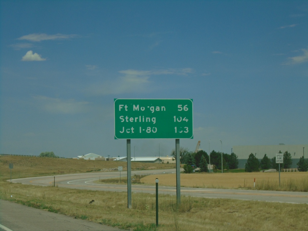
I-76 East - Distance Marker
Distance marker on I-76 east. Distance to Fort Morgan, Sterling, and I-80 (in Nebraska).
Taken 07-10-2022

 Brighton
Adams County
Colorado
United States
Brighton
Adams County
Colorado
United States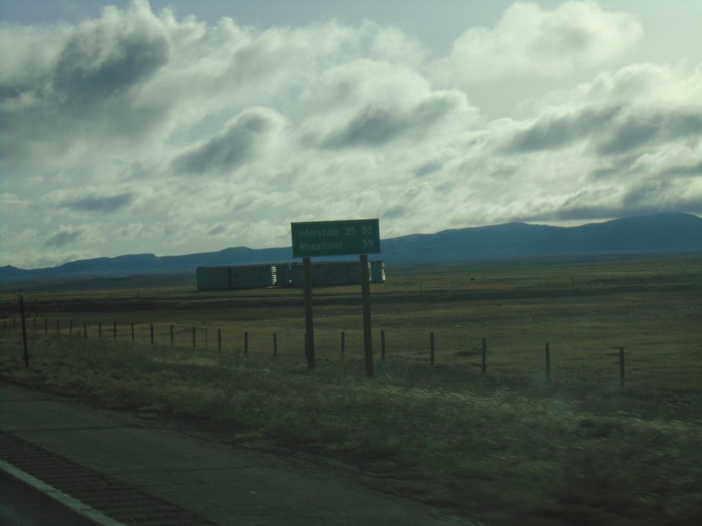
WY-34 East - Distance Marker
Distance marker on WY-34 east. Distance to I-25 and Wheatland (via I-25).
Taken 04-30-2022
 Laramie
Albany County
Wyoming
United States
Laramie
Albany County
Wyoming
United States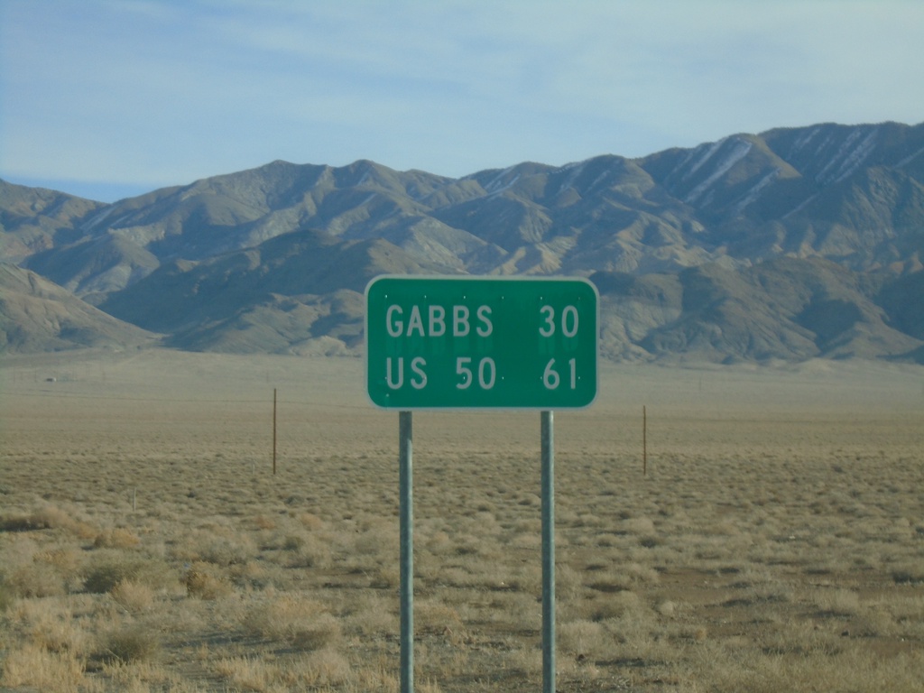
NV-361 North - Distance Marker
Distance marker on NV-361 north. Distance to Gabbs and US-50 (Middlegate Junction).
Taken 01-15-2022
 Luning
Mineral County
Nevada
United States
Luning
Mineral County
Nevada
United States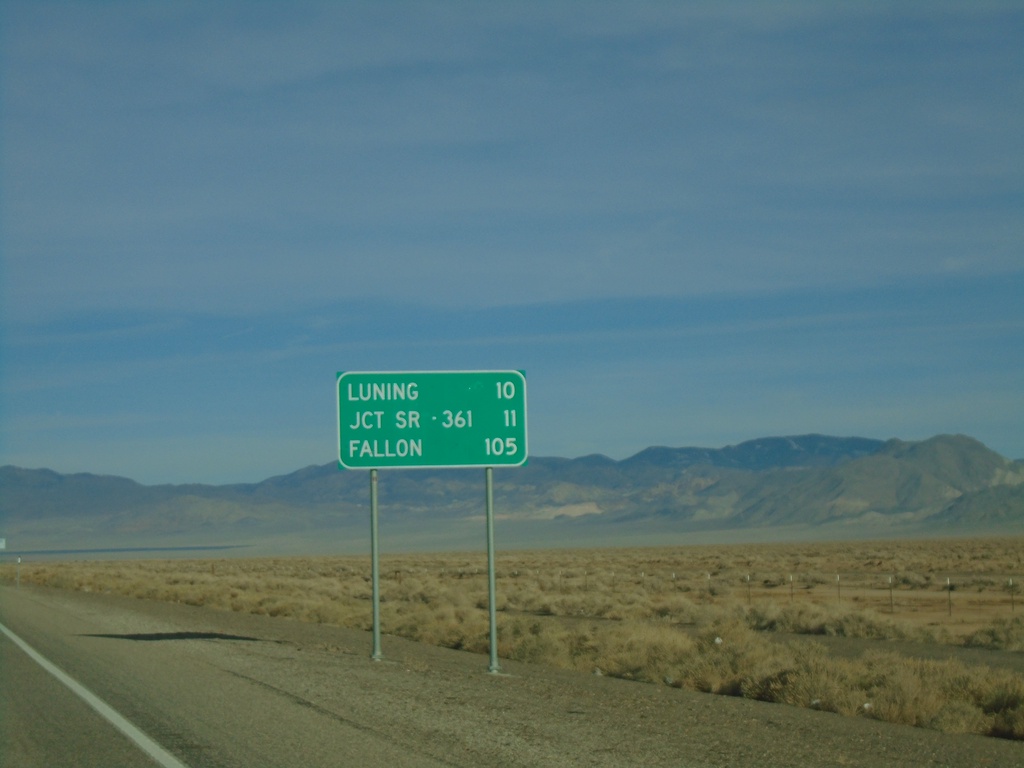
US-95 North - Distance Marker
Distance marker on US-95 north. Distance to Luning, Jct. SR-361, and Fallon.
Taken 01-15-2022
 Mina
Mineral County
Nevada
United States
Mina
Mineral County
Nevada
United States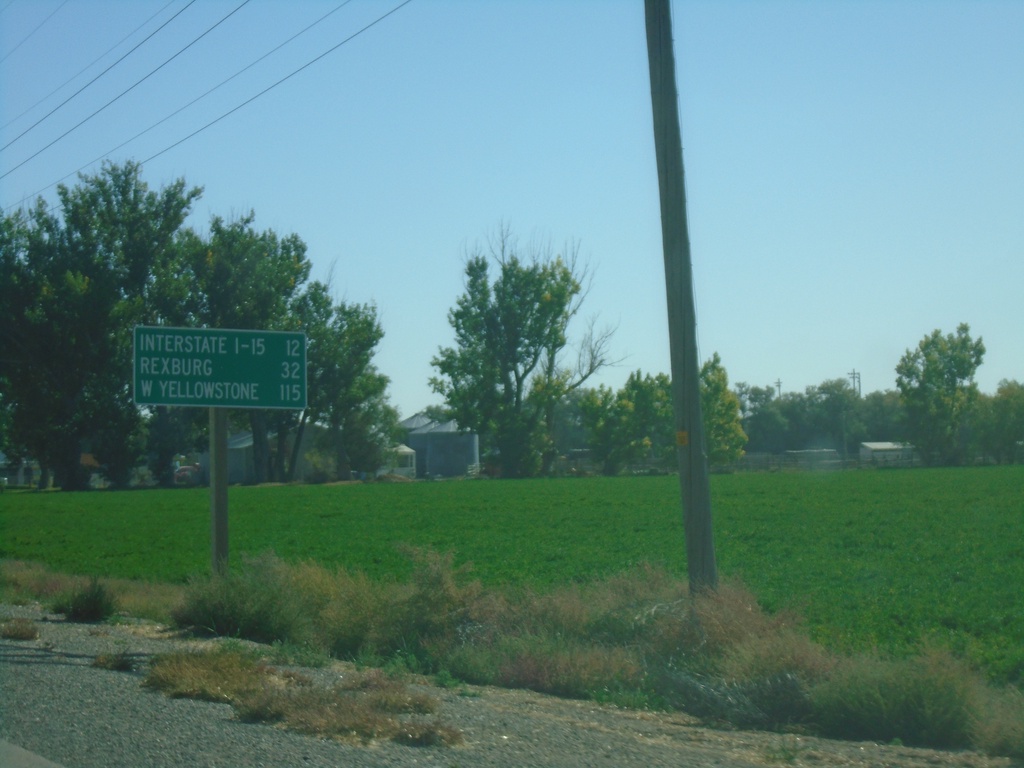
ID-33 East - Distance Marker
Distance marker on ID-33 east. Distance to I-15, Rexburg, and West Yellowstone (Montana - via US-20 East)
Taken 09-24-2021
 Terreton
Jefferson County
Idaho
United States
Terreton
Jefferson County
Idaho
United States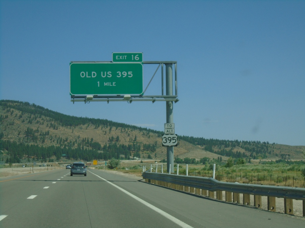
I-580 North - Exit 16
I-580/US-395 North approaching Exit 16 - Old US 395. Use Exit 16 for Alt. US-395.
Taken 07-12-2021


 New Washoe City
Washoe County
Nevada
United States
New Washoe City
Washoe County
Nevada
United States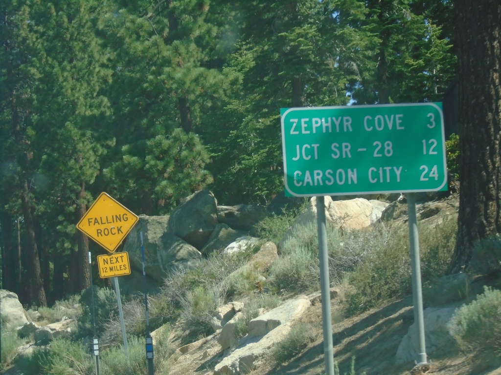
US-50 East - Distance Marker
First distance marker on US-50 east in Nevada. Distance to Zephyr Cove, Jct SR-28, and Carson City.
Taken 07-12-2021
 Stateline
Douglas County
Nevada
United States
Stateline
Douglas County
Nevada
United States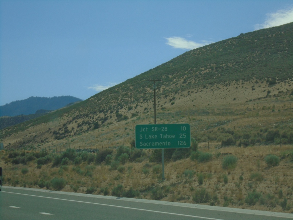
US-50 West - Distance Marker
Distance marker on US-50 west. Distance to Jct. SR-28, South Lake Tahoe (CA), and Sacramento (CA).
Taken 07-09-2021
Carson City
Nevada
United States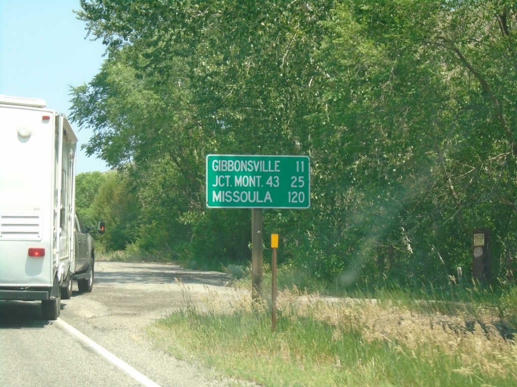
US-93 North - Distance Marker
Distance marker on US-93 north. Distance to Gibbonsville, Jct. Mont. 43 (at Lost Trail Pass), and Missoula (Montana).
Taken 07-02-2021
 North Fork
Lemhi County
Idaho
United States
North Fork
Lemhi County
Idaho
United States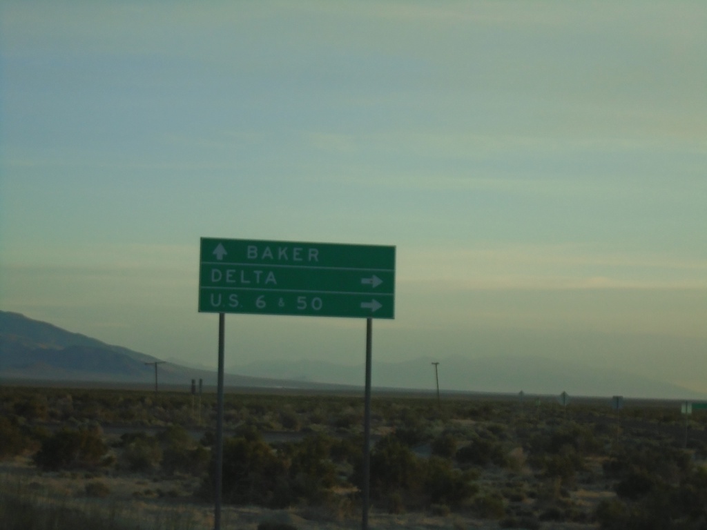
UT-21 West Approaching UT-159 North
UT-21 West approaching UT-159 North to Delta and US-6/US-50 Jct. Continue west on UT-21 for Baker (Nevada). UT-159 parallels the Utah-Nevada state line northwards.
Taken 05-29-2021

 Garrison
Millard County
Utah
United States
Garrison
Millard County
Utah
United States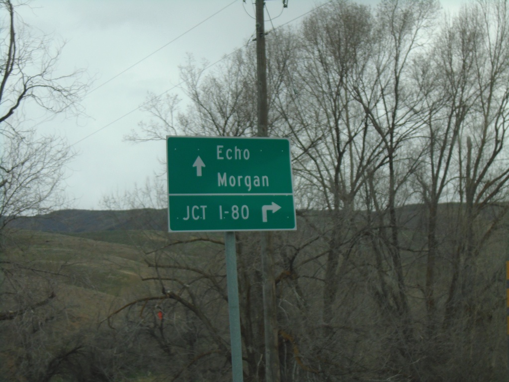
End UT-65 North at I-84 (Exit 115)
End UT-65 North at I-84 (Exit 115) in Henefer. Use I-84 East to I-80 junction (next exit). Continue over freeway for Echo (via County Road) and Morgan (via I-84 West).
Taken 04-24-2021


 Henefer
Summit County
Utah
United States
Henefer
Summit County
Utah
United States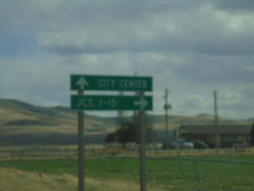
ID-36 West (Westside Highway) at Weston Canyon Road
ID-36 West (Westside Highway) at Weston Canyon Road. Turn right to continue west on ID-36 to I-15 Jct. Continue south on Westside Highway to (Weston) City Center.
Taken 04-23-2021
 Weston
Franklin County
Idaho
United States
Weston
Franklin County
Idaho
United States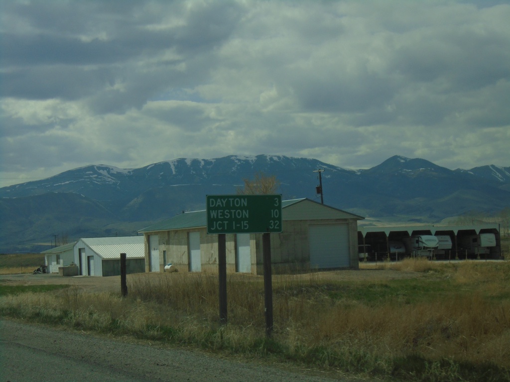
ID-36 West - Distance Marker
Distance marker on ID-36 west. Distance to Dayton, Weston, and Jct. I-15.
Taken 04-23-2021
Preston
Franklin County
Idaho
United States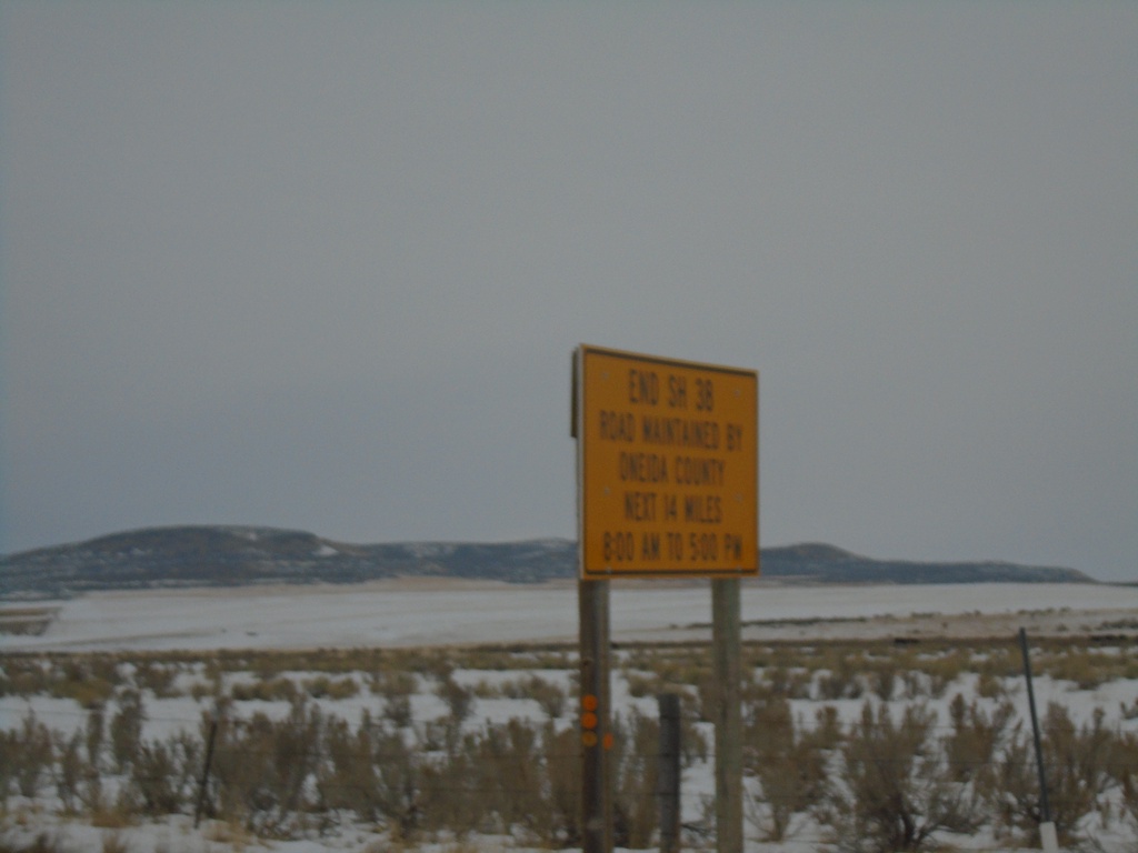
End ID-38 - Old Highway 37 Winter Maintenance
End ID-38 / Begin Old Highway 37. Road is maintained by Oneida County next 14 miles from 8:00 AM to 5:00PM.
Taken 12-30-2020
 Holbrook
Oneida County
Idaho
United States
Holbrook
Oneida County
Idaho
United States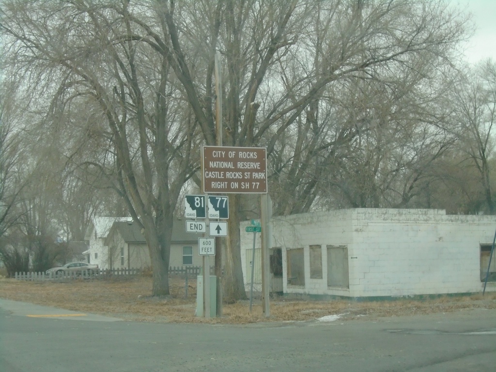
End ID-81 South at ID-77
End ID-81 South at ID-77 in Malta. Use ID-77 north for City of Rocks National Preserve and Castle Rocks State Park.
Taken 12-30-2020

 Malta
Cassia County
Idaho
United States
Malta
Cassia County
Idaho
United States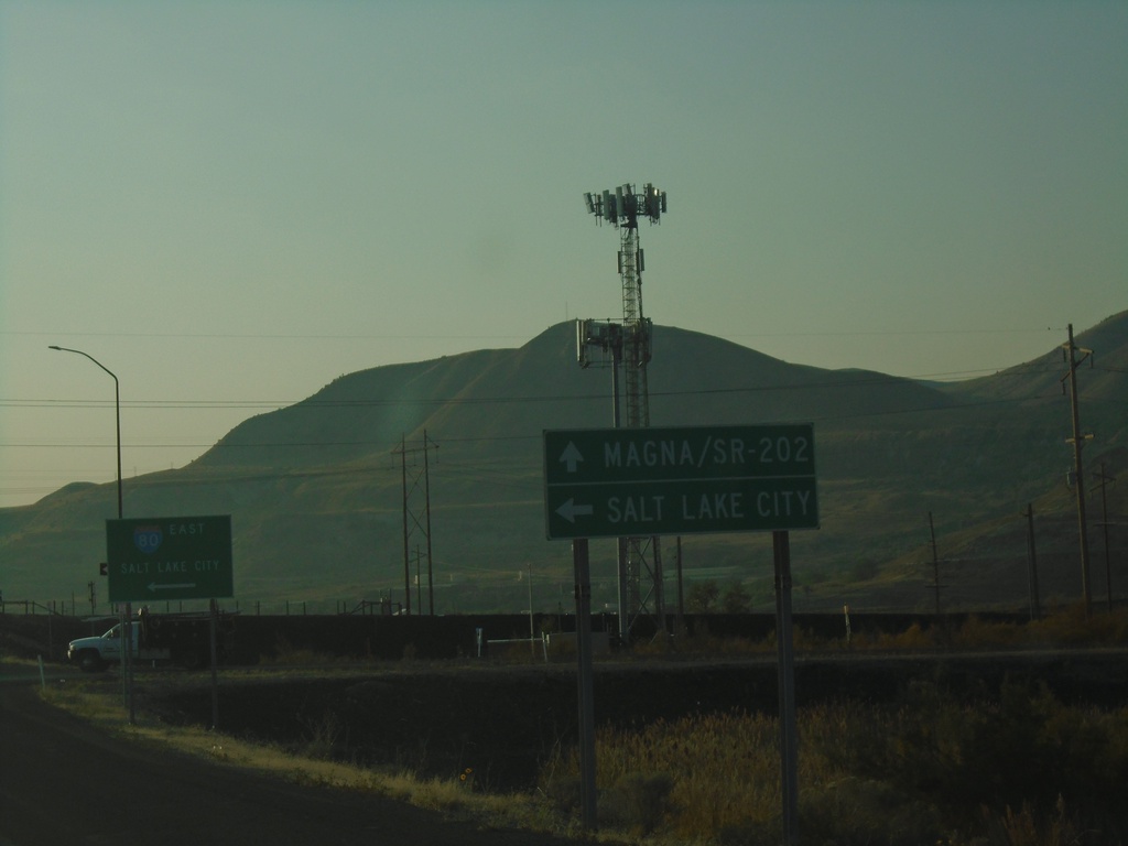
UT-202 South at I-80 East
UT-202 South at I-80 East to Salt Lake City. Continue south on UT-202 for Magna. UT-202 is spelled out on the sign as SR-202.
Taken 10-03-2020
 Magna
Salt Lake County
Utah
United States
Magna
Salt Lake County
Utah
United States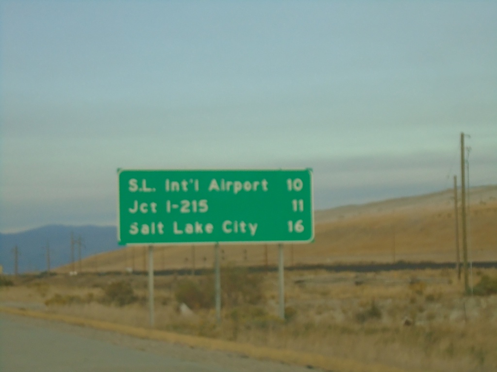
I-80 East - Distance Marker
Distance marker on I-80 east. Distance to Salt Lake International Airport, Jct. I-215, and Salt Lake City.
Taken 10-02-2020
Tooele
Salt Lake County
Utah
United States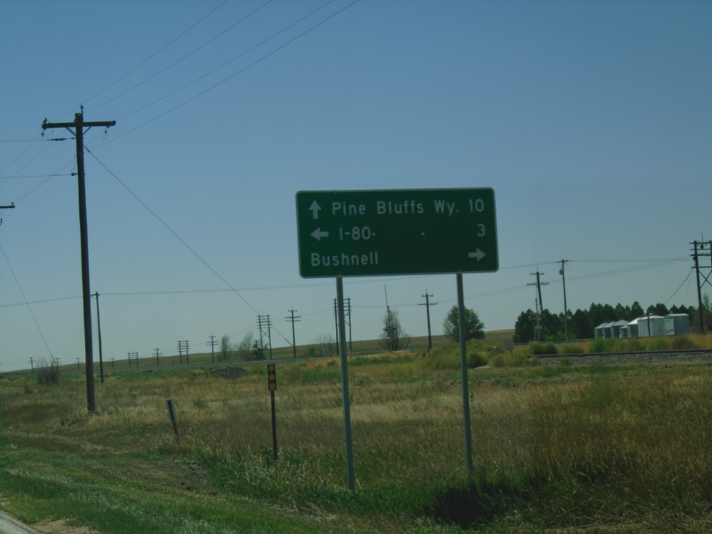
US-30 West at NE-53C Link
US-30 West at NE-53C Link south to I-80. Turn right on Birch St. for Bushnell. Continue west on US-30 for Pine Bluffs, WY.
Taken 08-14-2020
Bushnell
Kimball County
Nebraska
United States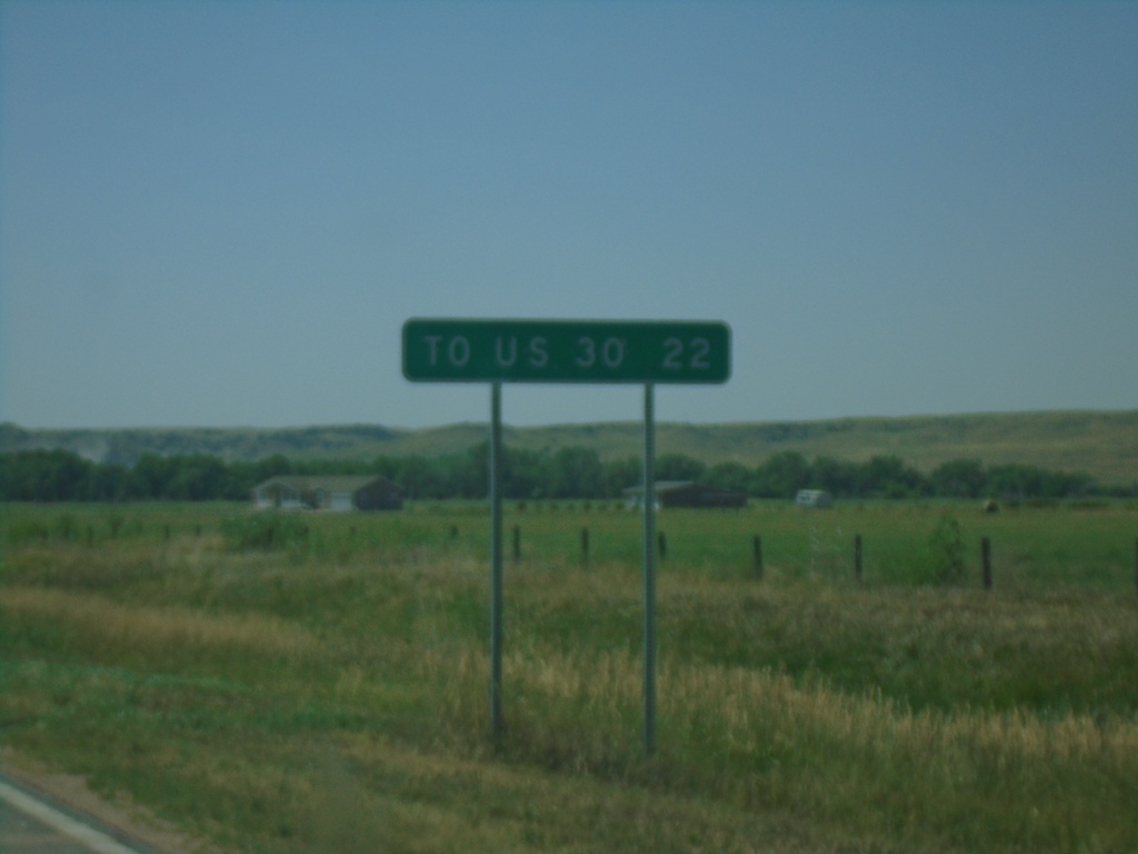
NE-27 South - Distance Marker
Distance marker on NE-27 south. Distance to US-30 Junction.
Taken 08-14-2020
 Oshkosh
Garden County
Nebraska
United States
Oshkosh
Garden County
Nebraska
United States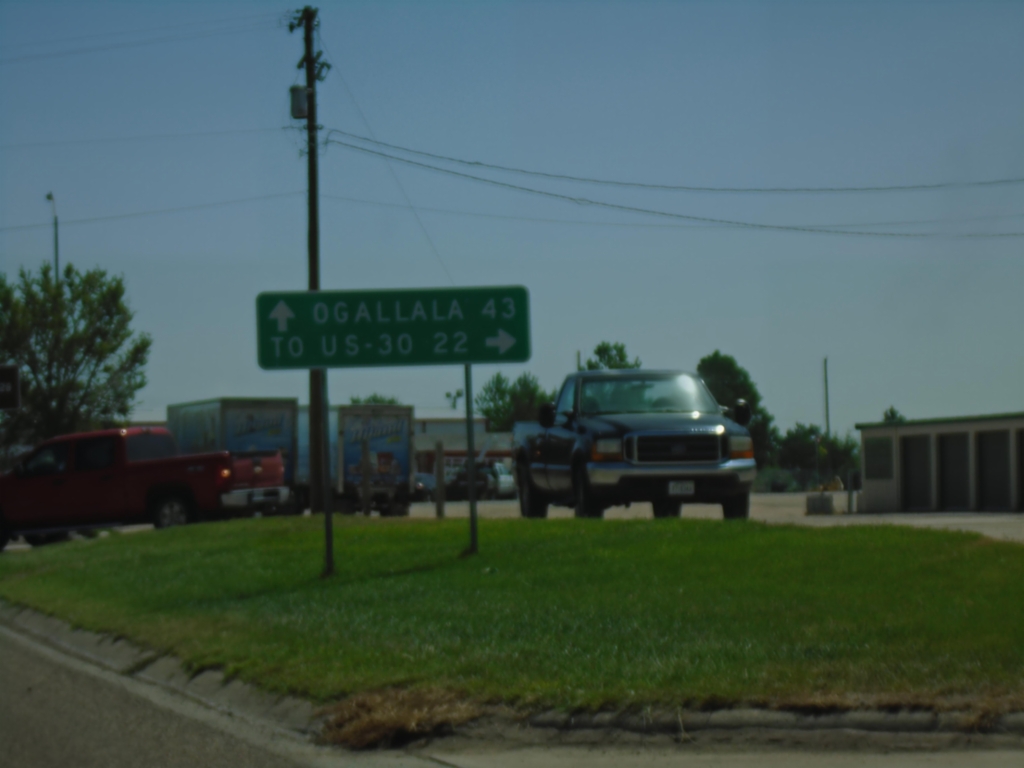
US-26 East/NE-92 East At NE-27
US-26 East/NE-92 East at NE-27 South in Oshkosh. Turn right for NE-27 to US-30 Jct; continue straight on US-26 East/NE-92 East for Ogallala.
Taken 08-14-2020

 Oshkosh
Garden County
Nebraska
United States
Oshkosh
Garden County
Nebraska
United States