Signs Tagged With Shield Text
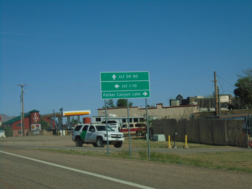
AZ-82 East Approaching AZ-83
AZ-82 east approaching AZ-83. Use AZ-83 north for I-10. Continue east on AZ-82 for SR-90. Turn right on county road for Parker Canyon Lake.
Taken 03-23-2019

 Sonoita
Santa Cruz County
Arizona
United States
Sonoita
Santa Cruz County
Arizona
United States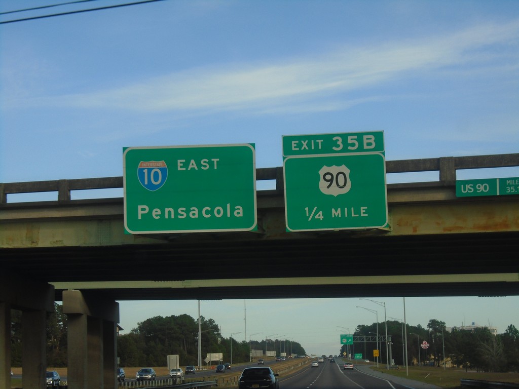
I-10 East - Exit 35B
I-10 east approaching Exit 35B - US-90.
Taken 12-23-2018

 Spanish Fort
Baldwin County
Alabama
United States
Spanish Fort
Baldwin County
Alabama
United States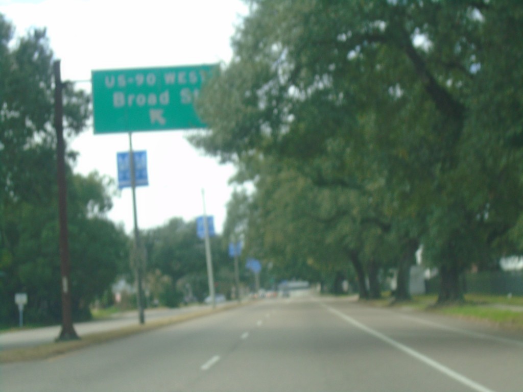
US-90 West - Gentilly Blvd. at Broad St.
US-90 West - Gentilly Blvd. at Broad St.
Taken 12-23-2018
New Orleans
Orleans Parish
Louisiana
United States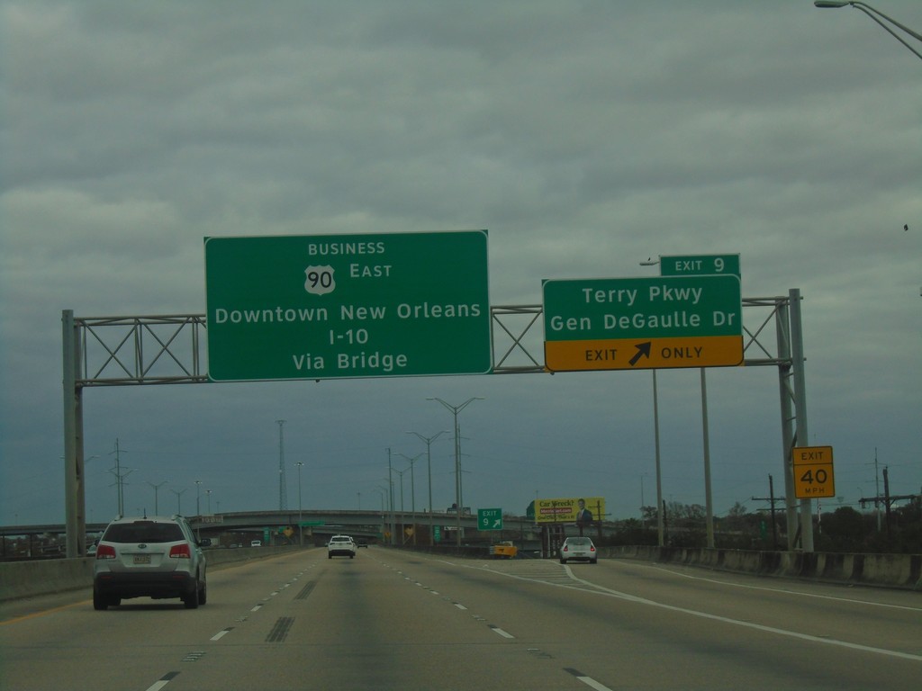
Bus. US-90 East - Exit 9
Bus. US-90 East at Exit 9 - Terry Parkway/Gen. DeGaulle Drive. Continue east on Bus. US-90 to Downtown New Orleans and I-10 via (Mississippi River) Bridge.
Taken 12-23-2018
 Gretna
Jefferson Parish
Louisiana
United States
Gretna
Jefferson Parish
Louisiana
United States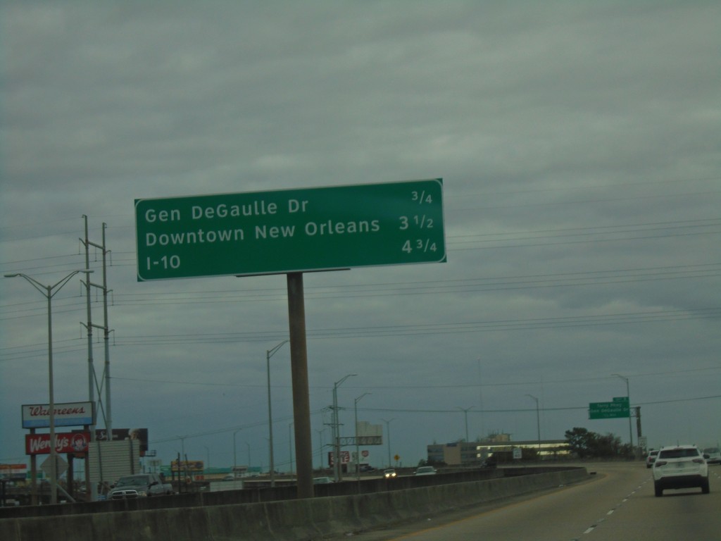
Bus. US-90 East - Distance Marker
Distance marker on Bus. US-90 East. Distance to Gen. DeGaulle Drive, Downtown New Orleans, and I-10.
Taken 12-23-2018
Gretna
Jefferson Parish
Louisiana
United States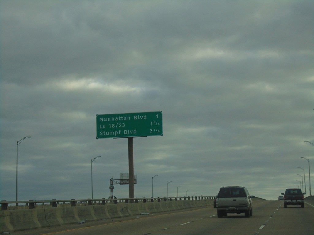
Bus. US-90 East - Next 3 Exits
Next 3 Exits on Bus. US-90 East. Manhattan Blvd./LA-18 and LA-23/Stumpf Blvd.
Taken 12-23-2018
Harvey
Jefferson Parish
Louisiana
United States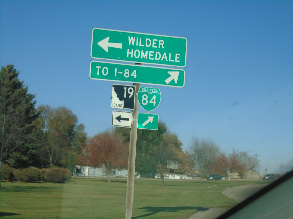
BL-84 West at ID-19 - Caldwell
BL-84 West at ID-19 in Caldwell. Turn left for ID-19 West to Wilder and Homedale. Turn right to continue on BL-84 West to I-84.
Taken 11-10-2018


 Caldwell
Canyon County
Idaho
United States
Caldwell
Canyon County
Idaho
United States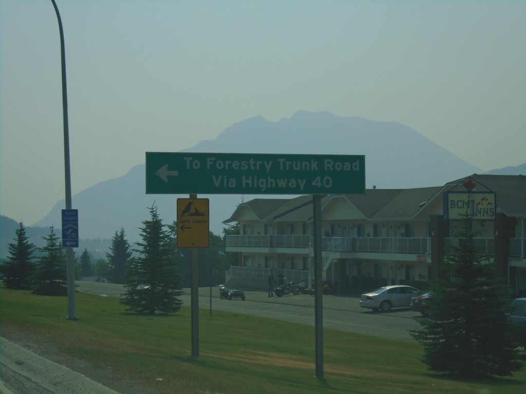
AB-3 East at AB-40 North - Coleman
AB-3 East at AB-40 North in Coleman. Use AB-40 north for Forestry Trunk Road.
Taken 08-10-2018

 Frank
Crowsnest Pass
Alberta
Canada
Frank
Crowsnest Pass
Alberta
Canada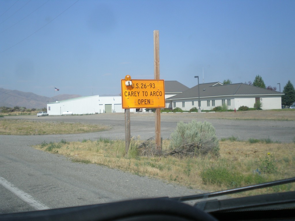
US-20 East/US-26 East/US-93 North - Road Closure Info
US-20 East/US-26 East/US-93 North - Road Closure Information in Carey. US-26/US-26/US-93 between Carey and Arco is open.
Taken 07-21-2018


 Carey
Blaine County
Idaho
United States
Carey
Blaine County
Idaho
United States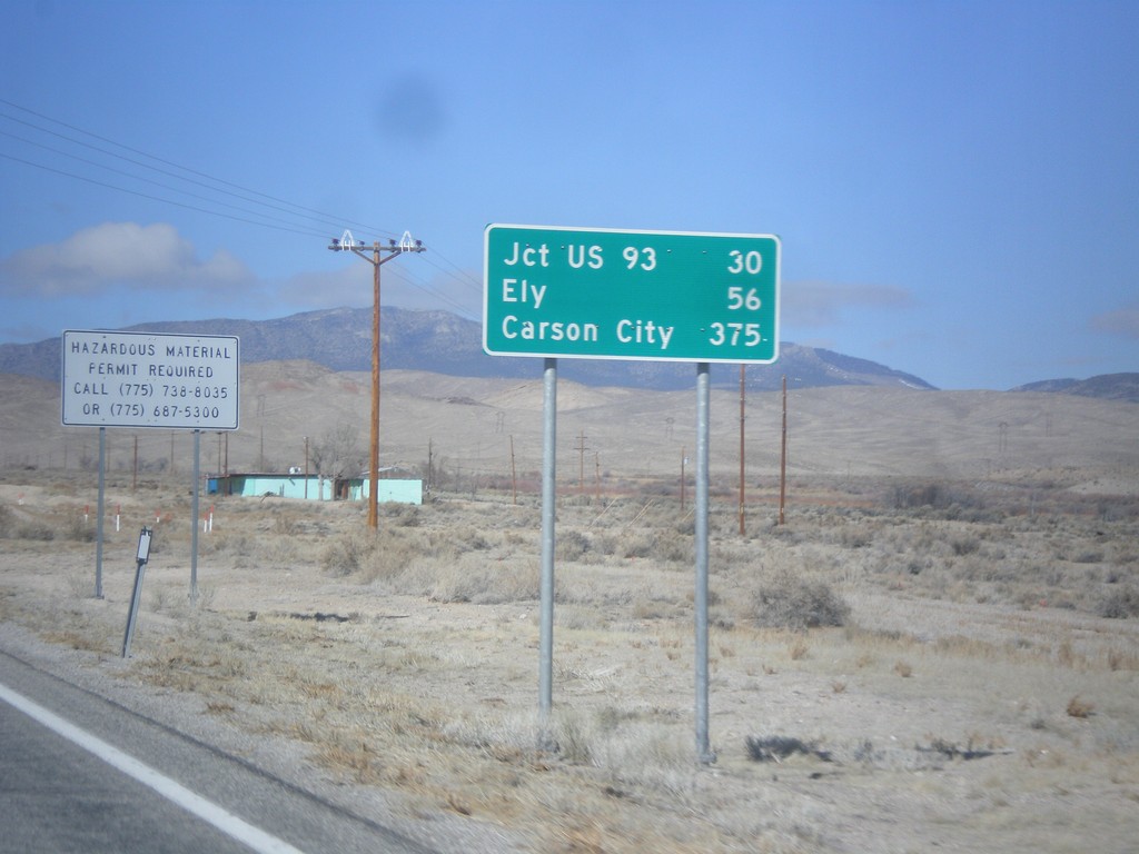
US-6/US-50 West - Distance Marker
Distance Marker on US-6/US-50 west. Distance to Jct. US-93, Ely, and Carson City (via US-50).
Taken 02-13-2018

 Baker
White Pine County
Nevada
United States
Baker
White Pine County
Nevada
United States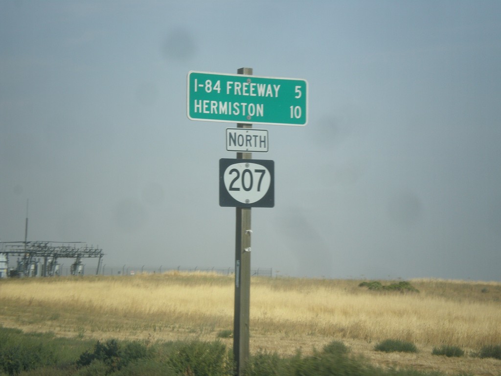
OR-207 North - Distance Marker
Distance marker on OR-207 north to I-84 Freeway and Hermiston.
Taken 09-09-2017
 Echo
Umatilla County
Oregon
United States
Echo
Umatilla County
Oregon
United States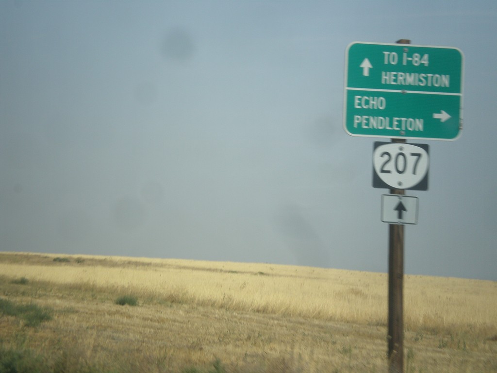
OR-207 North at Echo Jct.
OR-207 North at Echo Jct. Turn right for Echo and Pendleton, and to continue north on the Lexington-Echo Highway #320. Continue north on OR-207 for I-84 Freeway and Hermiston. OR-207 northbound becomes the Hermiston Highway #333.
Taken 09-09-2017
Echo
Umatilla County
Oregon
United States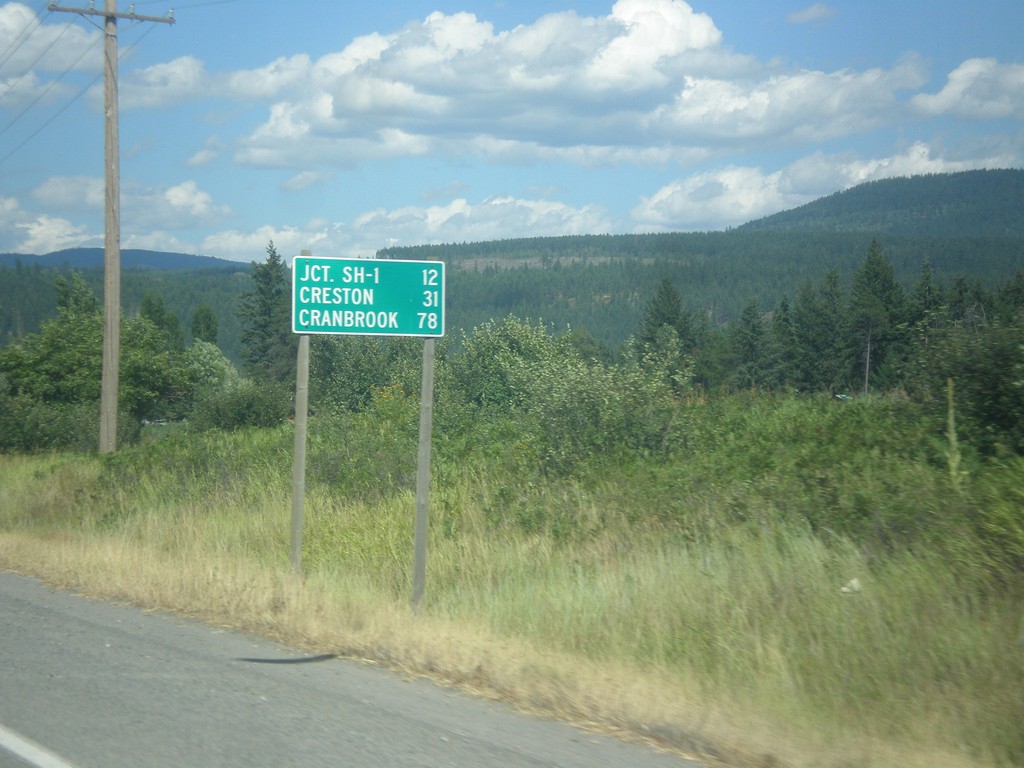
US-95 North - Distance Marker
Distance marker on US-95 north. Distance to Jct. SH-1, Creston (BC via ID-1), and Cranbrook (BC via US-95).
Taken 07-23-2017
 Bonners Ferry
Boundary County
Idaho
United States
Bonners Ferry
Boundary County
Idaho
United States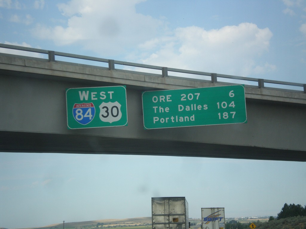
I-84/US-30 West - Distance Marker
Distance Marker on I-84/US-30 West in Stanfield. Distance to OR 207, The Dalles, and Portland.
Taken 07-15-2017
 Echo
Umatilla County
Oregon
United States
Echo
Umatilla County
Oregon
United States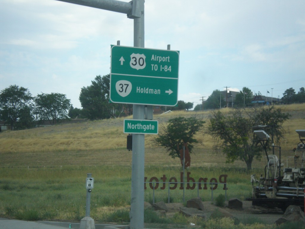
US-30 West at OR-37 North
US-30 west at OR-37 north to Holdman. Continue west on US-30 for Airport and I-84.
Taken 07-15-2017
 Pendleton
Umatilla County
Oregon
United States
Pendleton
Umatilla County
Oregon
United States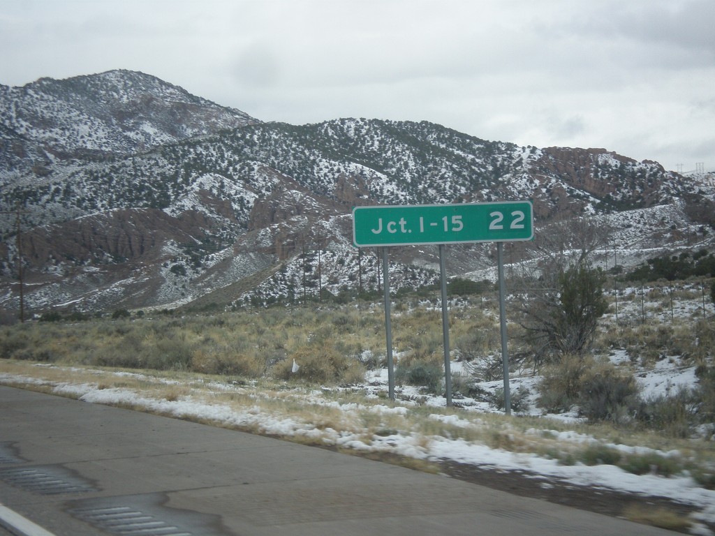
I-70 West - Distance Marker
Distance marker on I-70 west. Distance to Junction I-15.
Taken 03-31-2017
 Sevier
 County
Utah
United States
Sevier
Sevier County
Utah
United States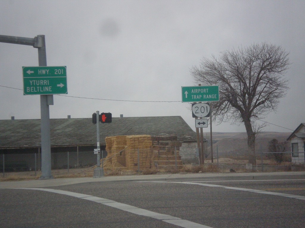
SW 4th Ave. West at OR-201
SW 4th Ave. West at OR-201. Continue straight on SW 4th Ave. for the Ontario Airport and Trap Range.
Taken 11-19-2016
 Ontario
Malheur County
Oregon
United States
Ontario
Malheur County
Oregon
United States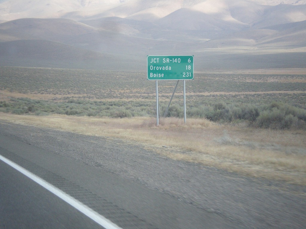
US-95 North - Distance Marker
Distance marker on US-95 north. Distance to Jct. SR-140, Orovada, and Boise (Idaho).
Taken 08-16-2016
Winnemucca
Humboldt County
Nevada
United States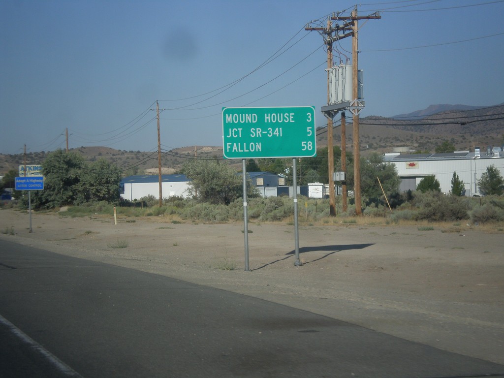
US-50 East - Distance Marker
Distance marker on US-50 east. Distance to Mound House, Jct. SR-341, and Fallon.
Taken 08-15-2016
Carson City
Nevada
United States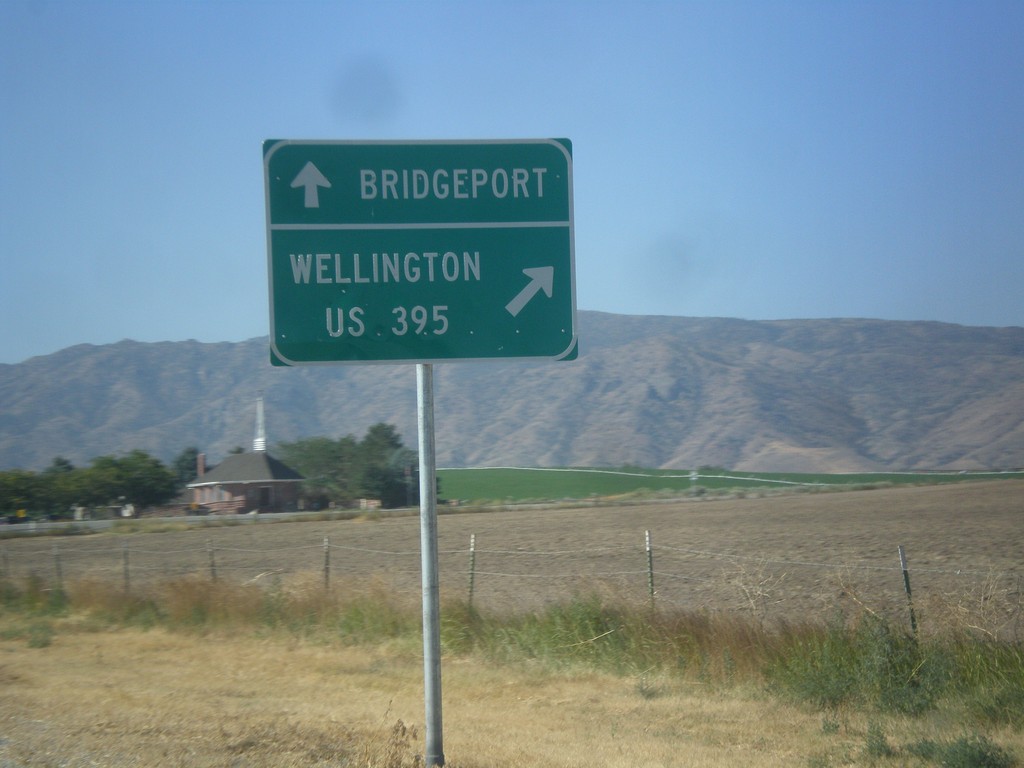
NV-208 West at NV-338
NV-208 west at NV-338 south to Bridgeport (California). Merge right to continue west on NV-208 to Wellington and US-395.
Taken 08-12-2016

 Smith Valley
Lyon County
Nevada
United States
Smith Valley
Lyon County
Nevada
United States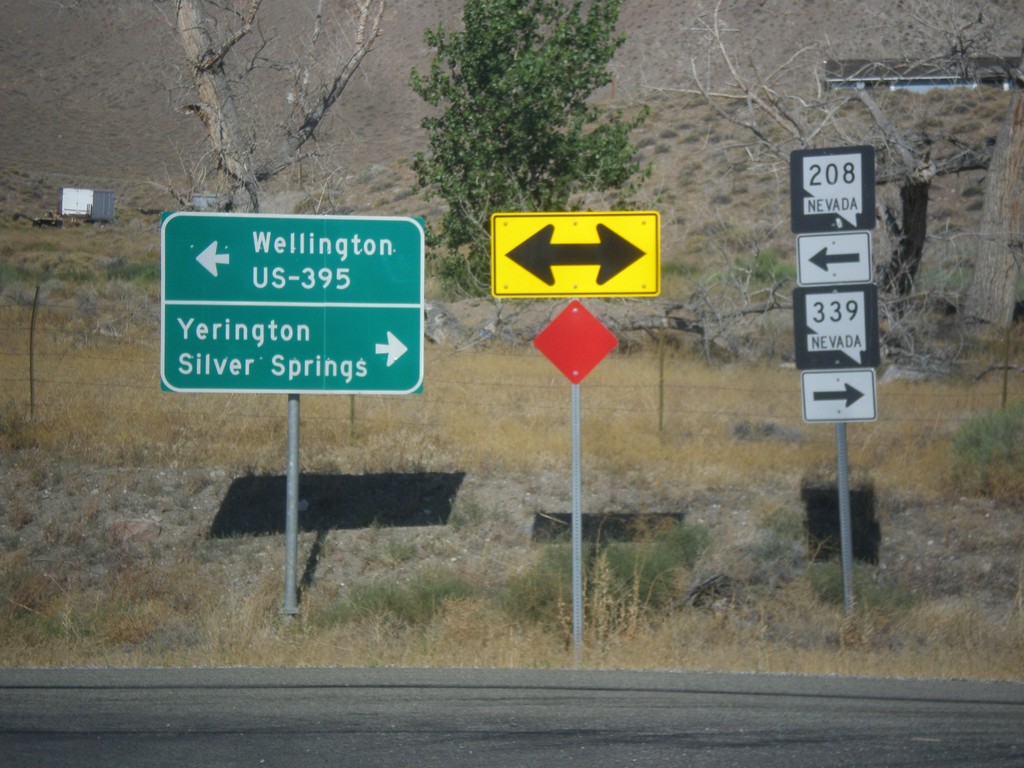
NV-208 West at NV-339
NV-208 west at NV-339. Turn right for NV-339 north to Yerington and Silver Springs. Turn left to continue west on NV-208 for Wellington and US-395 Jct.
Taken 08-12-2016
 Yerington
Lyon County
Nevada
United States
Yerington
Lyon County
Nevada
United States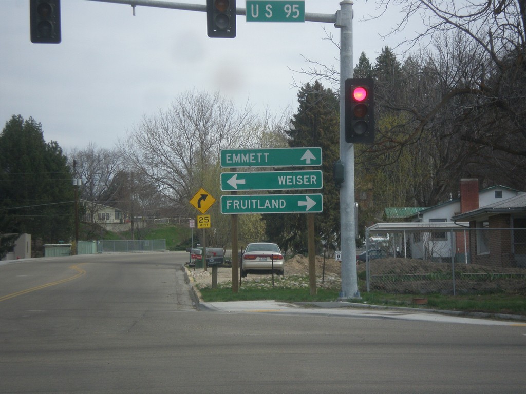
ID-52 East at US-95
ID-52 west at US-95 to Fruitland and Weiser. Continue west on ID-52 for Emmett.
Taken 03-20-2016
 Payette
 County
Idaho
United States
Payette
Payette County
Idaho
United States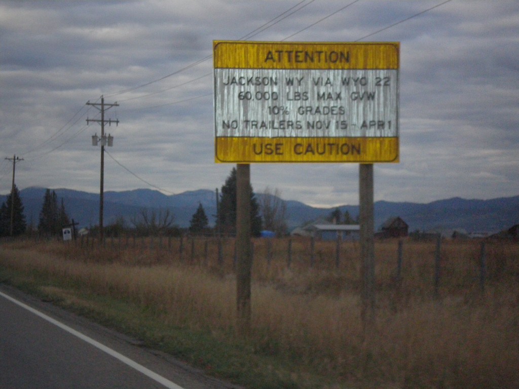
ID-33 East - Teton Pass Restrictions
Sign listing restrictions on Teton Pass in Wyoming. 60,000 lbs GVW over Teton Pass; no trailers 11-15 to 4-1. 10% grades over Teton Pass.
Taken 10-04-2015
 Tetonia
Teton County
Idaho
United States
Tetonia
Teton County
Idaho
United States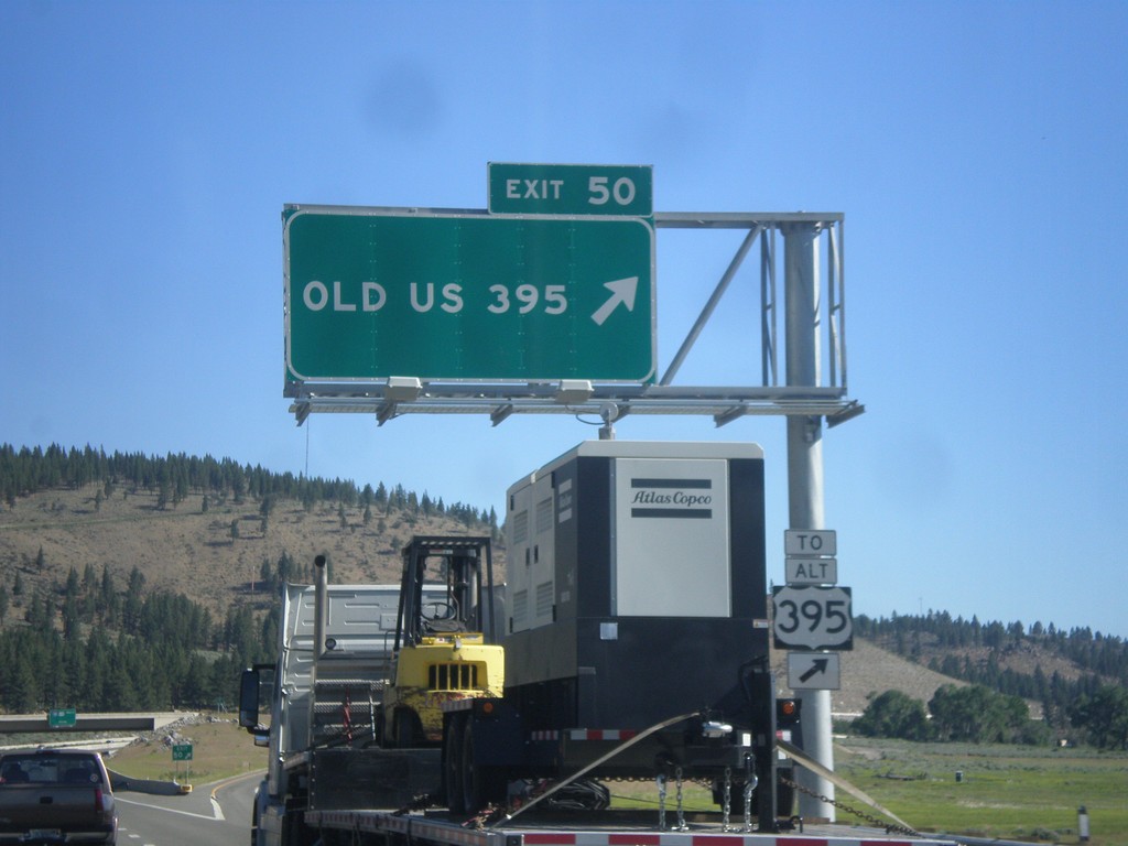
I-580/US-395 North - Exit 50
I-580/US-395 North at Exit 50 - Old US 395. Use Exit 50 for Alt. US-395.
Taken 06-15-2015


 New Washoe City
Washoe County
Nevada
United States
New Washoe City
Washoe County
Nevada
United States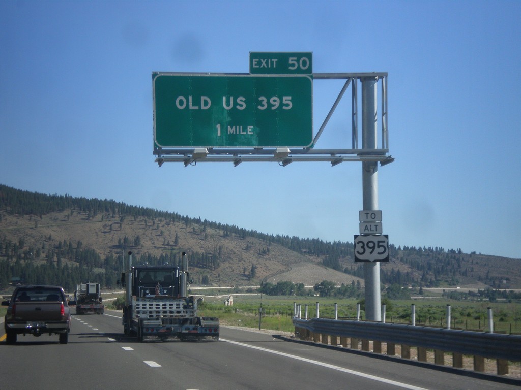
I-580/US-395 North - Exit 50
I-580/US-395 North approaching Exit 50 - Old US 395. Use Exit 50 for Alt. US-395.
Taken 06-15-2015
New Washoe City
Washoe County
Nevada
United States