Signs Tagged With Shield Text
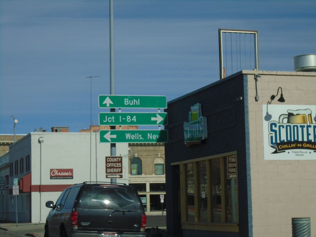
US-30 West at ID-74
US-30 west (2nd Ave N) at ID-74 (Shoshone St E) in Twin Falls. Turn left on ID-74 south for Wells, Nev. (via US-93 south); turn right on ID-74 north for Jct. I-84 (via Bus. US-93 and US-93 North). Continue straight on US-30 West for Buhl.
Taken 04-04-2020

 Twin Falls
 County
Idaho
United States
Twin Falls
Twin Falls County
Idaho
United States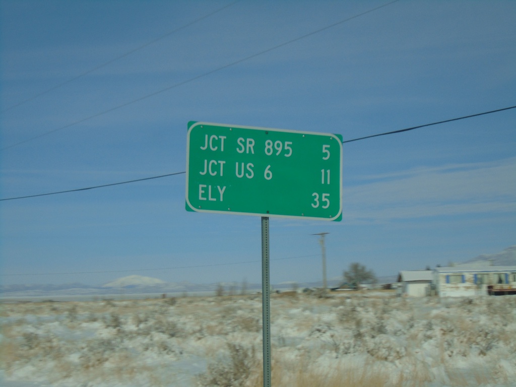
NV-318 North - Distance Marker
Distance marker on NV-318 north. Distance to SR-895, US-6, and Ely.
Taken 11-30-2019
 Lund
White Pine County
Nevada
United States
Lund
White Pine County
Nevada
United States
NV-318 North - Distance Marker
Distance marker on NV-318 north. Distance to Lund, Jct. US-6, and Ely.
Taken 11-30-2019
Lincoln County
Nevada
United States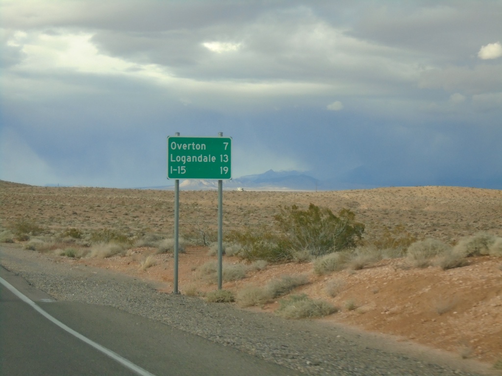
Begin NV-169 Northbound
Distance marker at beginning of NV-169 northbound. Distance to Overton, Logandale, and I-15.
Taken 11-29-2019
 Moapa Valley
Clark County
Nevada
United States
Moapa Valley
Clark County
Nevada
United States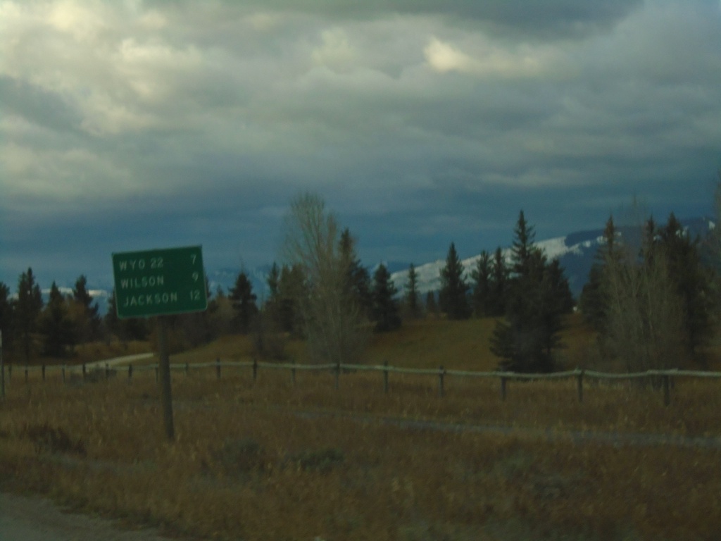
WY-390 South - Distance Marker
Distance marker on WY-390 south. Distance to WYO-22, Wilson, and Jackson.
Taken 10-26-2019
 Wilson
Teton County
Wyoming
United States
Wilson
Teton County
Wyoming
United States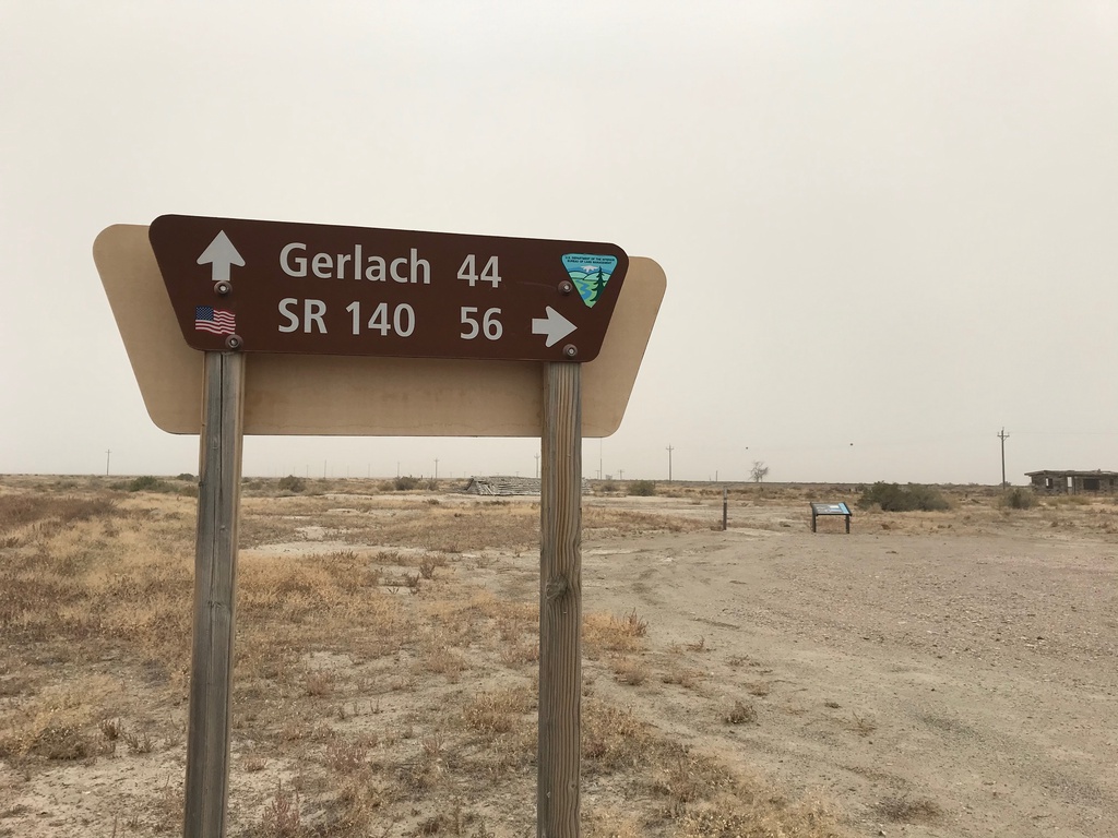
Jungo Road at Jackson Creek Ranch Road
Jungo Road West at Jackson Creek Ranch Road. Use Jackson Creek Ranch Road north for NV-140; continue on Jungo Road west for Gerlach.
Taken 10-19-2019
Sulphur Humboldt County Nevada United States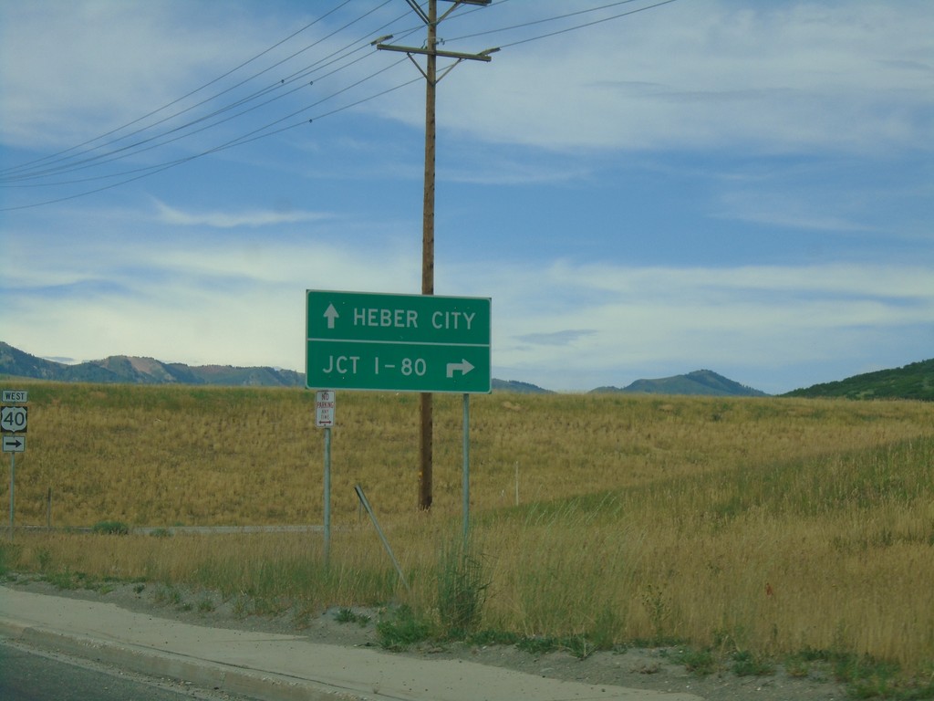
UT-248 West at US-40
UT-248 West at US-40 in Summit County. Use US-40 west for Jct. I-80; US-40 east for Heber City.
Taken 08-03-2019

 Park City
Summit County
Utah
United States
Park City
Summit County
Utah
United States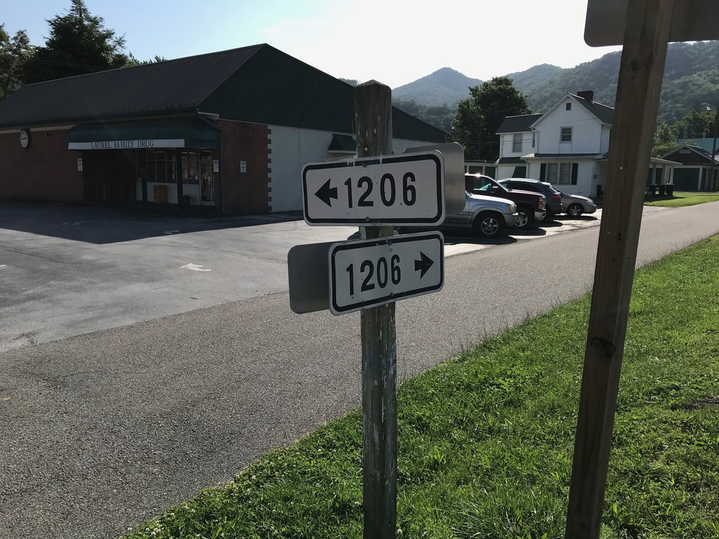
VAS-1206 at VAS-716 - Damascus
VAS-1206 (Creepers Way) at VAS-716 (Shady Ave.) in Damascus
Taken 06-24-2019

 Damascus
Washington County
Virginia
United States
Damascus
Washington County
Virginia
United States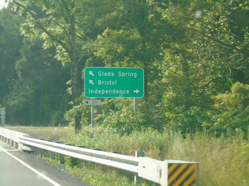
VA-91 North at VAS-1212; Approaching US-58
VA-91 north at VAS-1212. VA-91 north approaching US-58. Turn right for US-58 East to Independence; turn left for US-58 West/VA-91 North to Bristol and Glade Spring.
Taken 06-23-2019


 Damascus
Washington County
Virginia
United States
Damascus
Washington County
Virginia
United States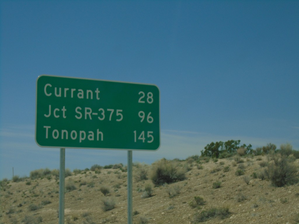
US-6 West - Distance Marker
Distance marker on US-6 West. Distance to Currant, Jct. SR-375, and Tonopah.
Taken 04-26-2019

 Lund
White Pine County
Nevada
United States
Lund
White Pine County
Nevada
United States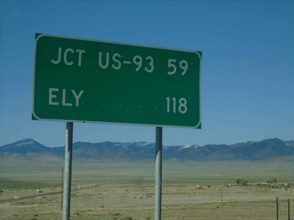
US-93 Alt. South - Distance Marker
Distance marker on US-93 Alt. South. Distance to Jct. US-93 and Ely.
Taken 04-26-2019

 West Wendover
Elko County
Nevada
United States
West Wendover
Elko County
Nevada
United States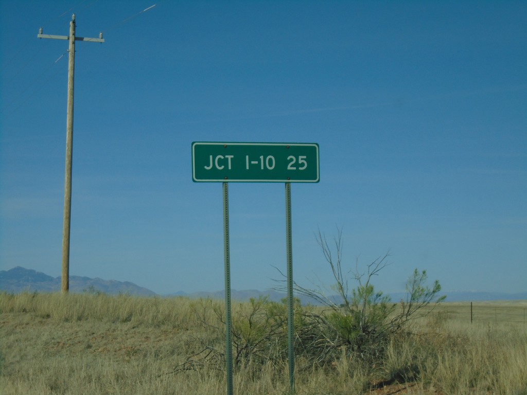
AZ-83 North - Distance Marker
Distance marker on AZ-83 north. Distance to I-10.
Taken 03-23-2019

 Sonoita
Santa Cruz County
Arizona
United States
Sonoita
Santa Cruz County
Arizona
United States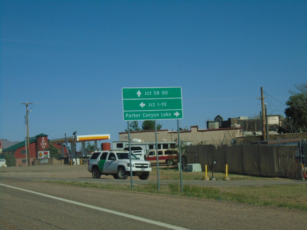
AZ-82 East Approaching AZ-83
AZ-82 east approaching AZ-83. Use AZ-83 north for I-10. Continue east on AZ-82 for SR-90. Turn right on county road for Parker Canyon Lake.
Taken 03-23-2019
 Sonoita
Santa Cruz County
Arizona
United States
Sonoita
Santa Cruz County
Arizona
United States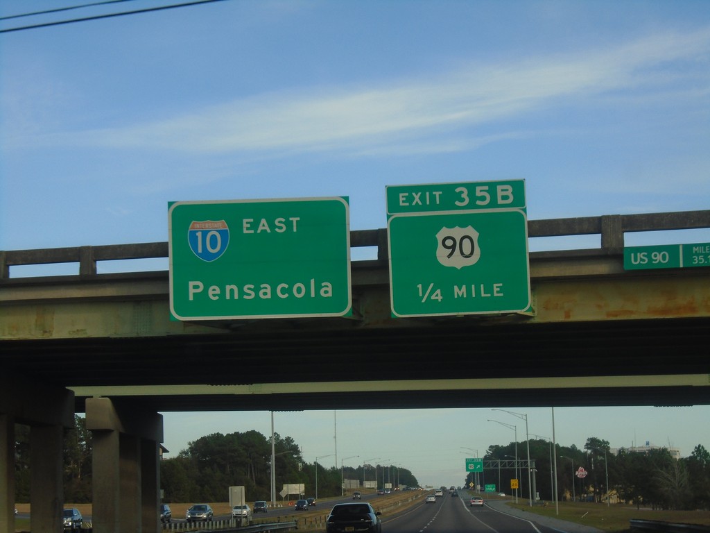
I-10 East - Exit 35B
I-10 east approaching Exit 35B - US-90.
Taken 12-23-2018
 Spanish Fort
Baldwin County
Alabama
United States
Spanish Fort
Baldwin County
Alabama
United States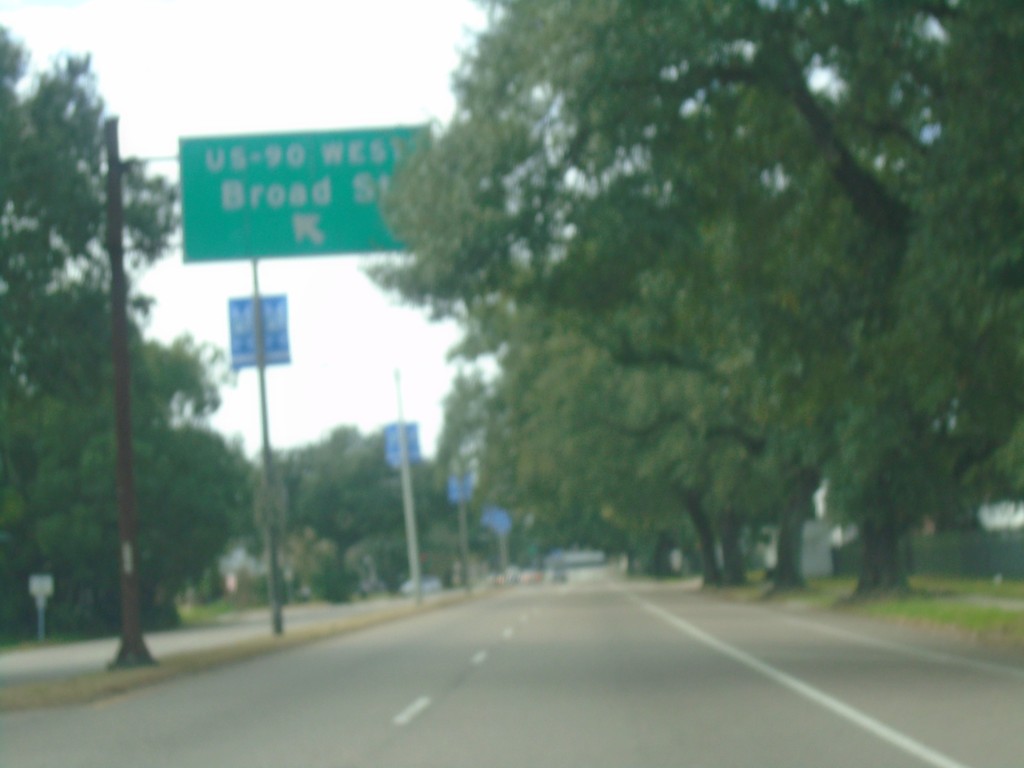
US-90 West - Gentilly Blvd. at Broad St.
US-90 West - Gentilly Blvd. at Broad St.
Taken 12-23-2018
New Orleans
Orleans Parish
Louisiana
United States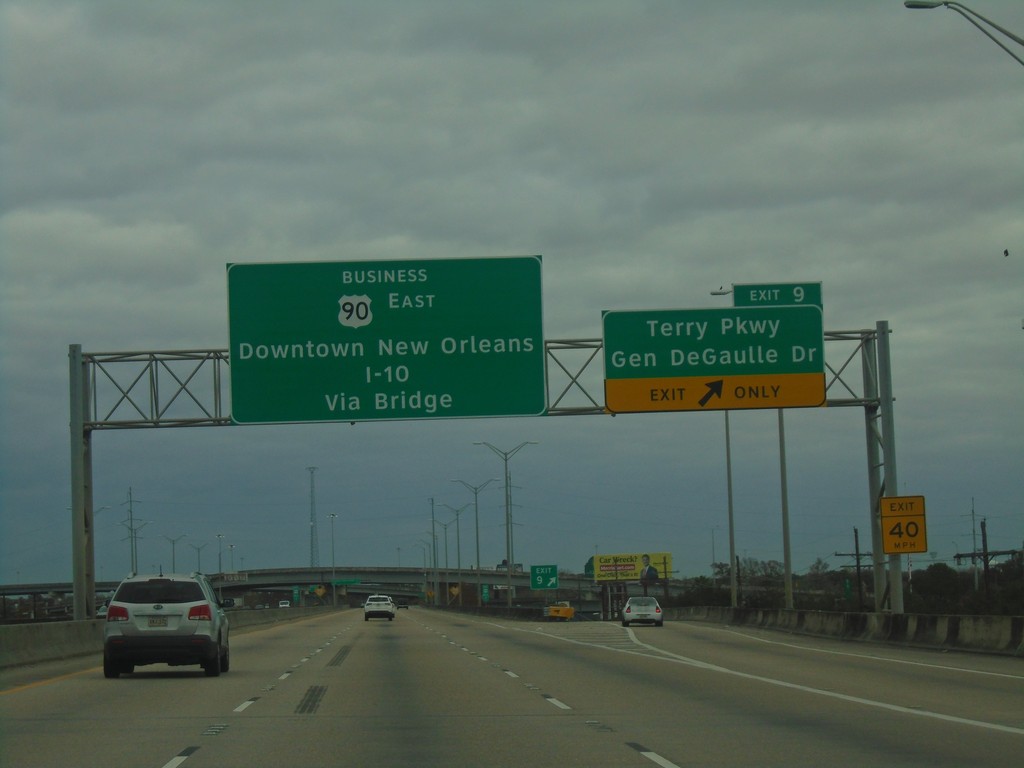
Bus. US-90 East - Exit 9
Bus. US-90 East at Exit 9 - Terry Parkway/Gen. DeGaulle Drive. Continue east on Bus. US-90 to Downtown New Orleans and I-10 via (Mississippi River) Bridge.
Taken 12-23-2018
 Gretna
Jefferson Parish
Louisiana
United States
Gretna
Jefferson Parish
Louisiana
United States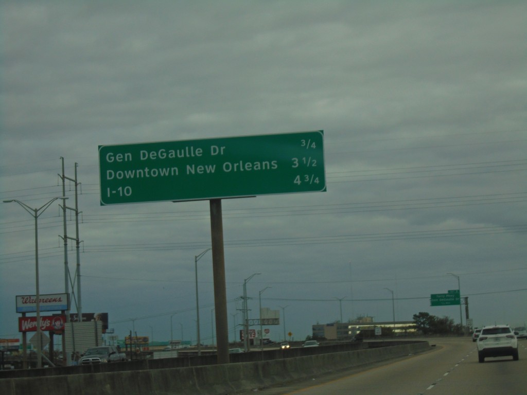
Bus. US-90 East - Distance Marker
Distance marker on Bus. US-90 East. Distance to Gen. DeGaulle Drive, Downtown New Orleans, and I-10.
Taken 12-23-2018
Gretna
Jefferson Parish
Louisiana
United States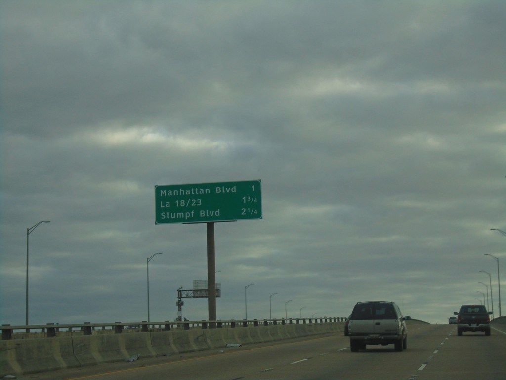
Bus. US-90 East - Next 3 Exits
Next 3 Exits on Bus. US-90 East. Manhattan Blvd./LA-18 and LA-23/Stumpf Blvd.
Taken 12-23-2018
Harvey
Jefferson Parish
Louisiana
United States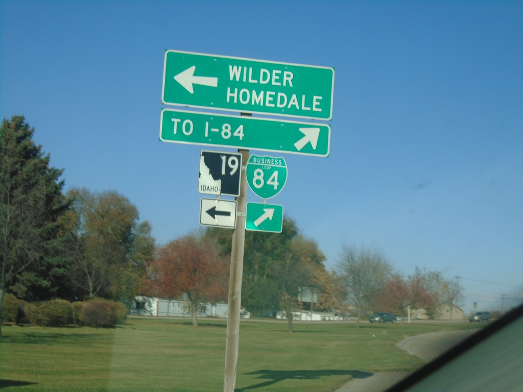
BL-84 West at ID-19 - Caldwell
BL-84 West at ID-19 in Caldwell. Turn left for ID-19 West to Wilder and Homedale. Turn right to continue on BL-84 West to I-84.
Taken 11-10-2018


 Caldwell
Canyon County
Idaho
United States
Caldwell
Canyon County
Idaho
United States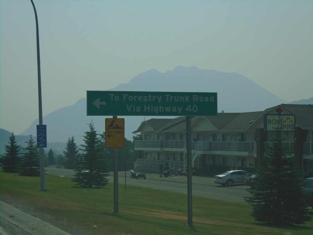
AB-3 East at AB-40 North - Coleman
AB-3 East at AB-40 North in Coleman. Use AB-40 north for Forestry Trunk Road.
Taken 08-10-2018

 Frank
Crowsnest Pass
Alberta
Canada
Frank
Crowsnest Pass
Alberta
Canada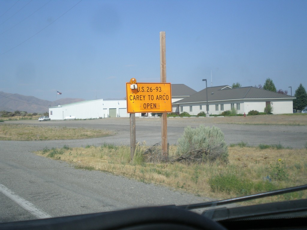
US-20 East/US-26 East/US-93 North - Road Closure Info
US-20 East/US-26 East/US-93 North - Road Closure Information in Carey. US-26/US-26/US-93 between Carey and Arco is open.
Taken 07-21-2018

 Carey
Blaine County
Idaho
United States
Carey
Blaine County
Idaho
United States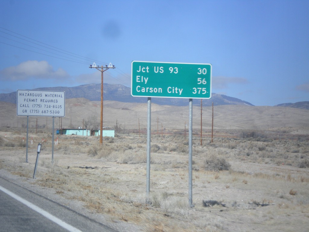
US-6/US-50 West - Distance Marker
Distance Marker on US-6/US-50 west. Distance to Jct. US-93, Ely, and Carson City (via US-50).
Taken 02-13-2018
 Baker
White Pine County
Nevada
United States
Baker
White Pine County
Nevada
United States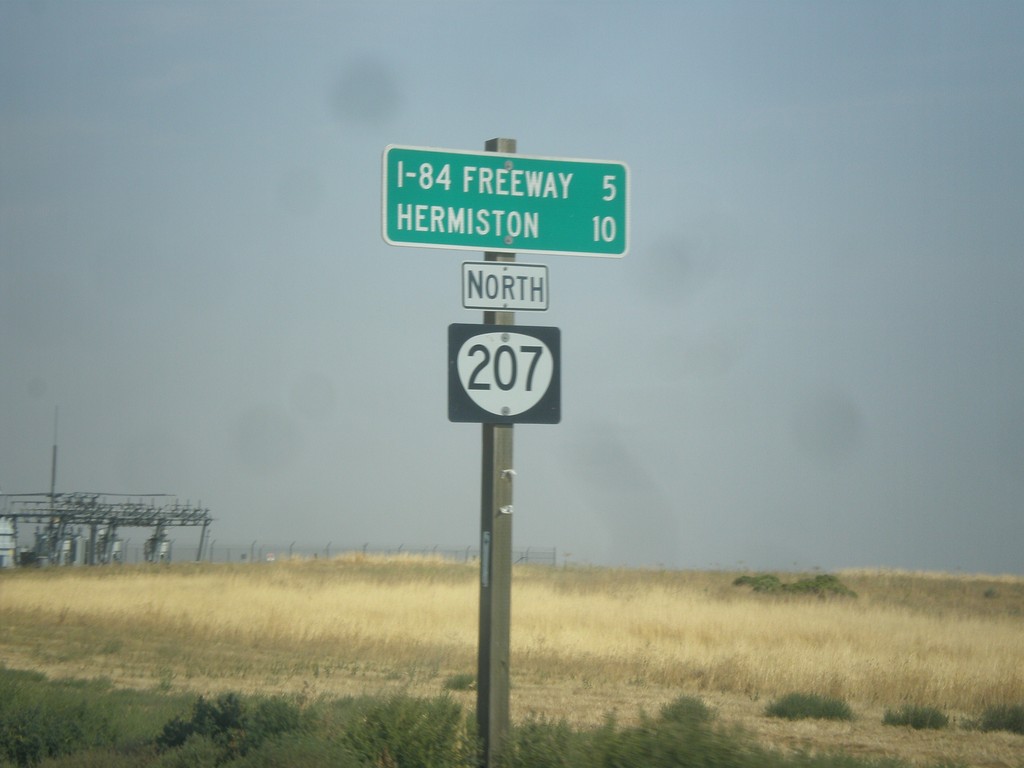
OR-207 North - Distance Marker
Distance marker on OR-207 north to I-84 Freeway and Hermiston.
Taken 09-09-2017
 Echo
Umatilla County
Oregon
United States
Echo
Umatilla County
Oregon
United States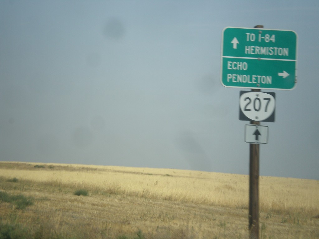
OR-207 North at Echo Jct.
OR-207 North at Echo Jct. Turn right for Echo and Pendleton, and to continue north on the Lexington-Echo Highway #320. Continue north on OR-207 for I-84 Freeway and Hermiston. OR-207 northbound becomes the Hermiston Highway #333.
Taken 09-09-2017
Echo
Umatilla County
Oregon
United States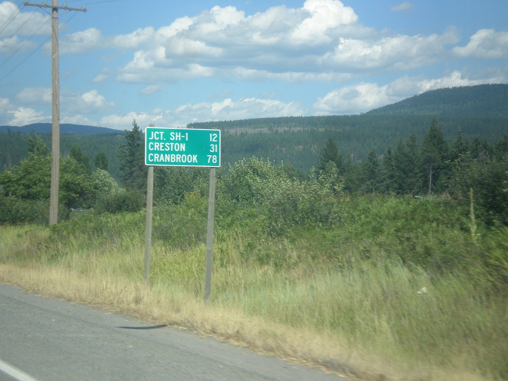
US-95 North - Distance Marker
Distance marker on US-95 north. Distance to Jct. SH-1, Creston (BC via ID-1), and Cranbrook (BC via US-95).
Taken 07-23-2017
 Bonners Ferry
Boundary County
Idaho
United States
Bonners Ferry
Boundary County
Idaho
United States