Signs Tagged With Shield Text
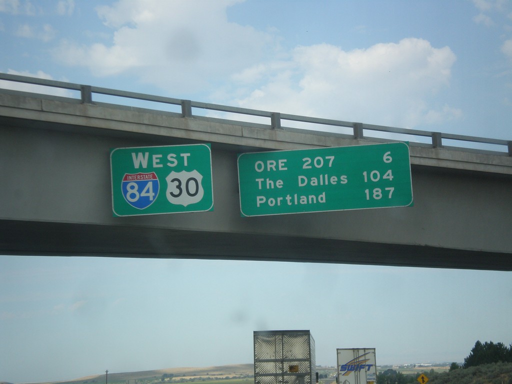
I-84/US-30 West - Distance Marker
Distance Marker on I-84/US-30 West in Stanfield. Distance to OR 207, The Dalles, and Portland.
Taken 07-15-2017


 Echo
Umatilla County
Oregon
United States
Echo
Umatilla County
Oregon
United States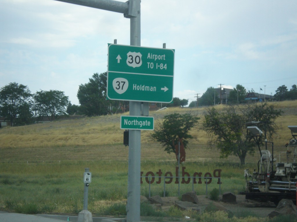
US-30 West at OR-37 North
US-30 west at OR-37 north to Holdman. Continue west on US-30 for Airport and I-84.
Taken 07-15-2017
 Pendleton
Umatilla County
Oregon
United States
Pendleton
Umatilla County
Oregon
United States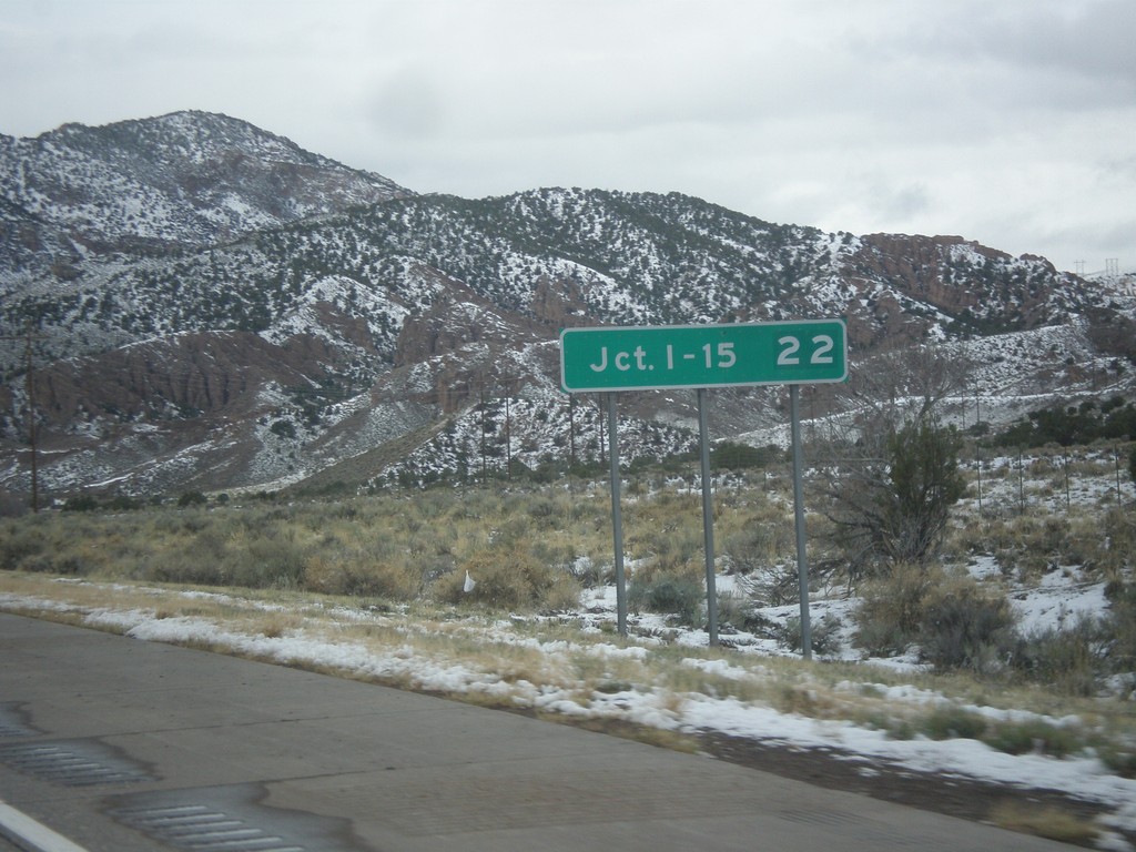
I-70 West - Distance Marker
Distance marker on I-70 west. Distance to Junction I-15.
Taken 03-31-2017
 Sevier
 County
Utah
United States
Sevier
Sevier County
Utah
United States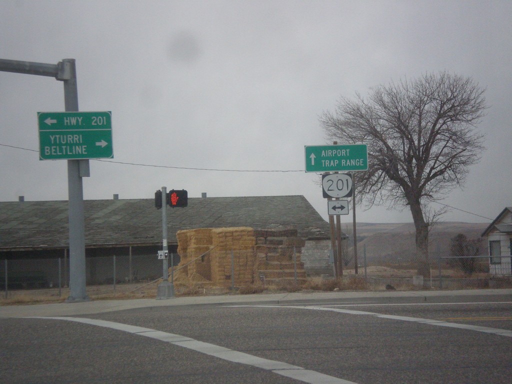
SW 4th Ave. West at OR-201
SW 4th Ave. West at OR-201. Continue straight on SW 4th Ave. for the Ontario Airport and Trap Range.
Taken 11-19-2016
 Ontario
Malheur County
Oregon
United States
Ontario
Malheur County
Oregon
United States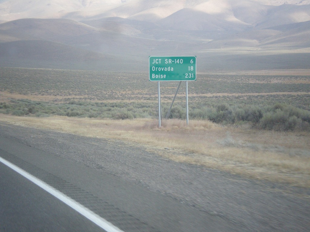
US-95 North - Distance Marker
Distance marker on US-95 north. Distance to Jct. SR-140, Orovada, and Boise (Idaho).
Taken 08-16-2016
 Winnemucca
Humboldt County
Nevada
United States
Winnemucca
Humboldt County
Nevada
United States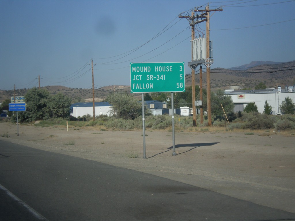
US-50 East - Distance Marker
Distance marker on US-50 east. Distance to Mound House, Jct. SR-341, and Fallon.
Taken 08-15-2016
 Carson City
Nevada
United States
Carson City
Nevada
United States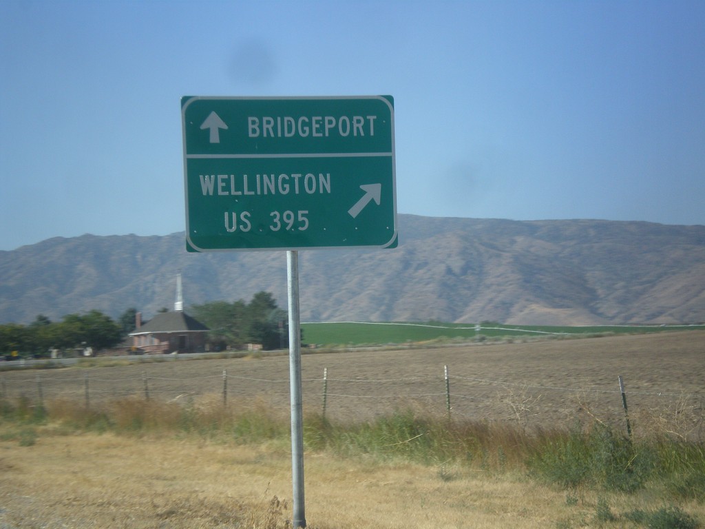
NV-208 West at NV-338
NV-208 west at NV-338 south to Bridgeport (California). Merge right to continue west on NV-208 to Wellington and US-395.
Taken 08-12-2016

 Smith Valley
Lyon County
Nevada
United States
Smith Valley
Lyon County
Nevada
United States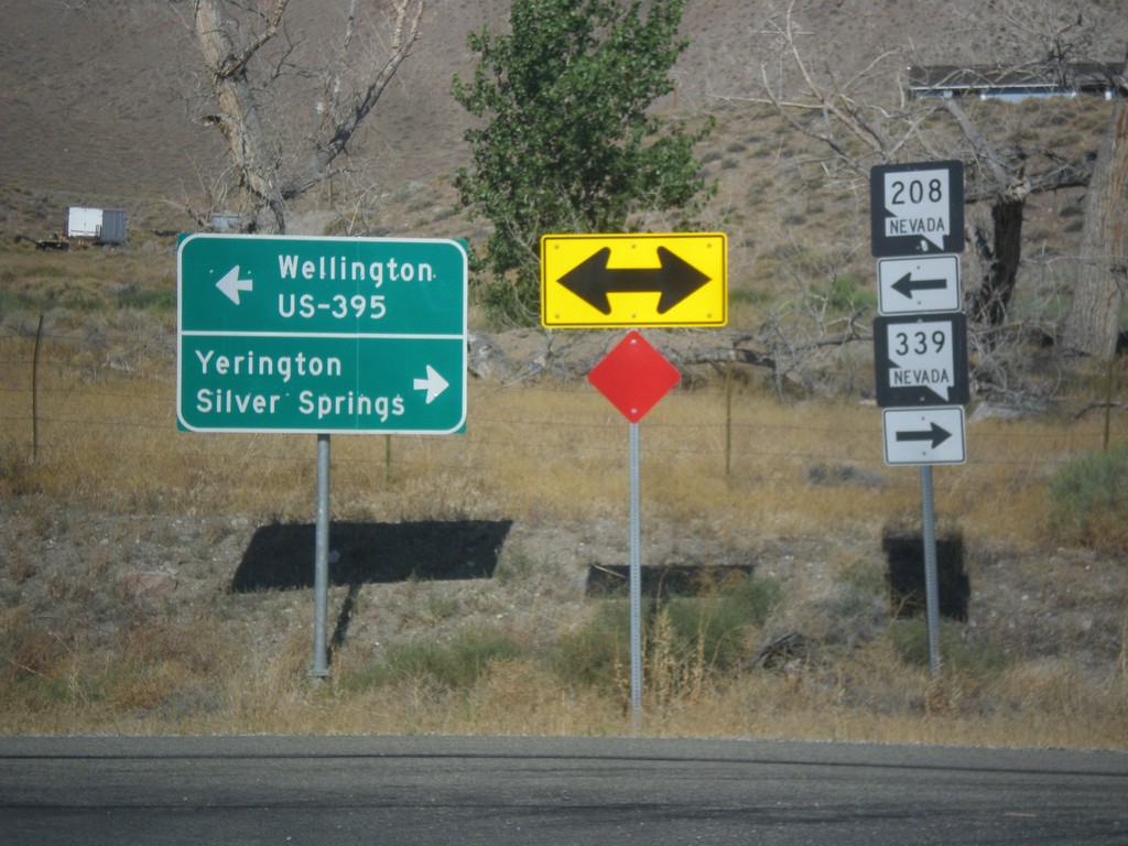
NV-208 West at NV-339
NV-208 west at NV-339. Turn right for NV-339 north to Yerington and Silver Springs. Turn left to continue west on NV-208 for Wellington and US-395 Jct.
Taken 08-12-2016
 Yerington
Lyon County
Nevada
United States
Yerington
Lyon County
Nevada
United States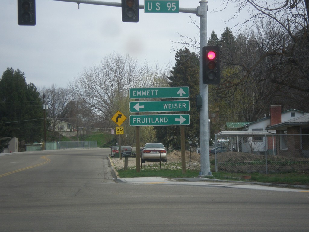
ID-52 East at US-95
ID-52 west at US-95 to Fruitland and Weiser. Continue west on ID-52 for Emmett.
Taken 03-20-2016
 Payette
 County
Idaho
United States
Payette
Payette County
Idaho
United States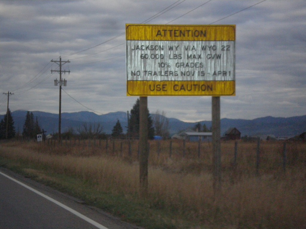
ID-33 East - Teton Pass Restrictions
Sign listing restrictions on Teton Pass in Wyoming. 60,000 lbs GVW over Teton Pass; no trailers 11-15 to 4-1. 10% grades over Teton Pass.
Taken 10-04-2015
 Tetonia
Teton County
Idaho
United States
Tetonia
Teton County
Idaho
United States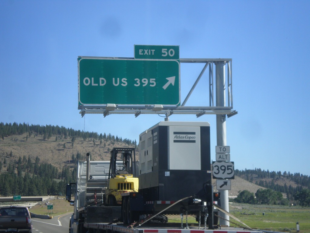
I-580/US-395 North - Exit 50
I-580/US-395 North at Exit 50 - Old US 395. Use Exit 50 for Alt. US-395.
Taken 06-15-2015


 New Washoe City
Washoe County
Nevada
United States
New Washoe City
Washoe County
Nevada
United States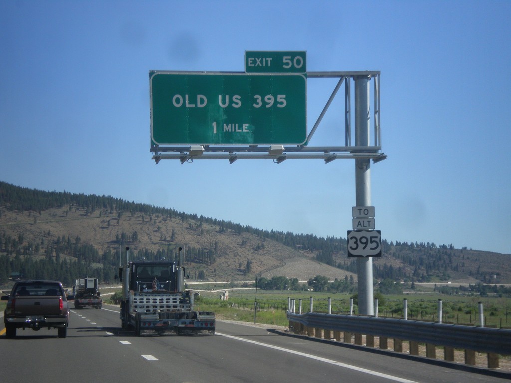
I-580/US-395 North - Exit 50
I-580/US-395 North approaching Exit 50 - Old US 395. Use Exit 50 for Alt. US-395.
Taken 06-15-2015
New Washoe City
Washoe County
Nevada
United States
CA-89 South - Distance Marker
Distance marker on CA-89 south. Distance to CA-88 Junction.
Taken 06-15-2015
 South Lake Tahoe
El Dorado County
California
United States
South Lake Tahoe
El Dorado County
California
United States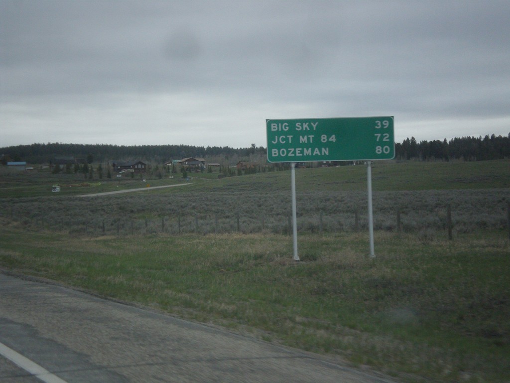
US-191 North - Distance Marker
Distance marker on US-191 north. Distance to Big Sky, Jct. MT-84, and Bozeman.
Taken 05-08-2015
 West Yellowstone
Gallatin County
Montana
United States
West Yellowstone
Gallatin County
Montana
United States
ID-19 East at BL-84
ID-19 east at BL-84 in Caldwell. Merge right for BL-84 (Cleveland Blvd.) east to Nampa. Continue straight for BL-84 West/ID-19 East for I-84.
Taken 12-14-2014

 Caldwell
Canyon County
Idaho
United States
Caldwell
Canyon County
Idaho
United States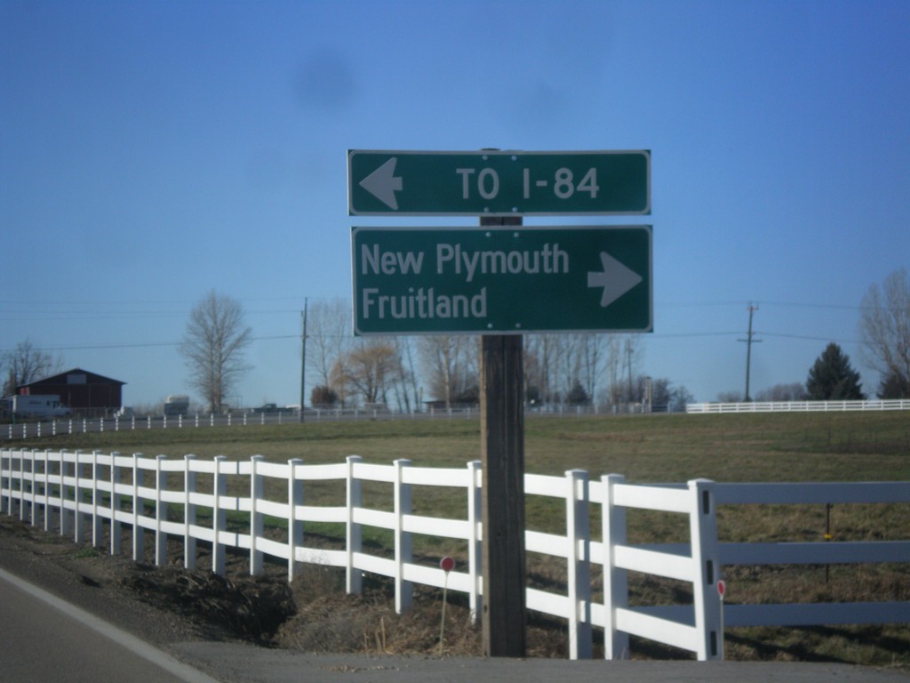
End ID-72 West at US-30
End ID-72 west at US-30. Turn right for US-30 west to New Plymouth and Emmett. Turn left for US-30 east to I-84.
Taken 12-14-2014
 New Plymouth
Payette County
Idaho
United States
New Plymouth
Payette County
Idaho
United States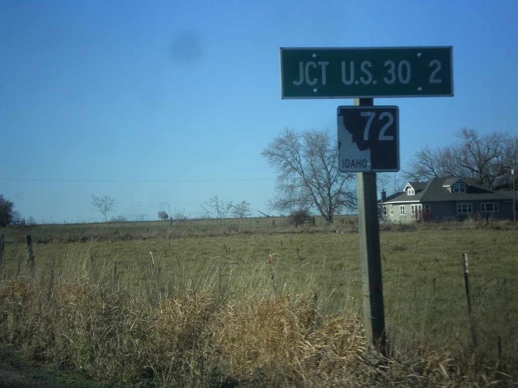
ID-72 West - Distance Marker
Distance marker on ID-72 west. Distance to US-30.
Taken 12-14-2014
New Plymouth
Payette County
Idaho
United States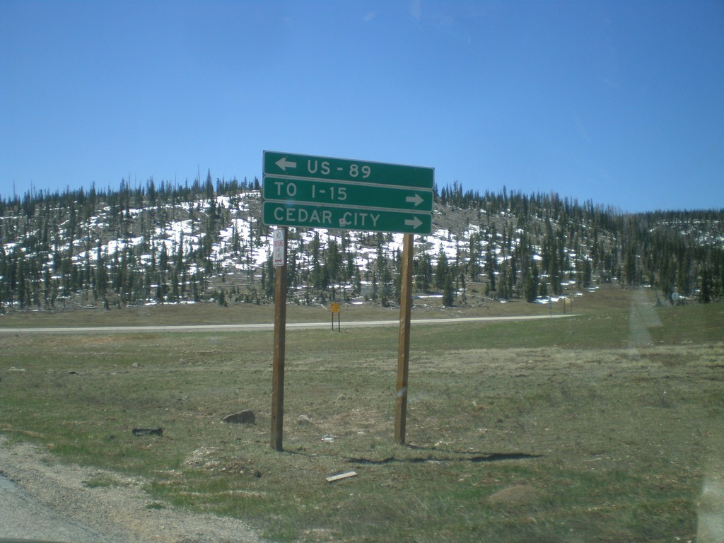
End UT-148 South at UT-14
End UT-148 south at UT-14. Turn right on UT-14 for Cedar City and I-15. Turn left on UT-14 for US-89. UT-14 is part of the Markagunt High Plateau Scenic Byway.
Taken 05-21-2014

 Brian Head
Iron County
Utah
United States
Brian Head
Iron County
Utah
United States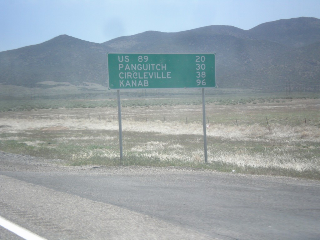
UT-20 East - Distance Marker
Distance marker on UT-20 east. Distance to US-89, Panguitch, Circleville, and Kanab.
Taken 05-19-2014
 Paragonah
Iron County
Utah
United States
Paragonah
Iron County
Utah
United States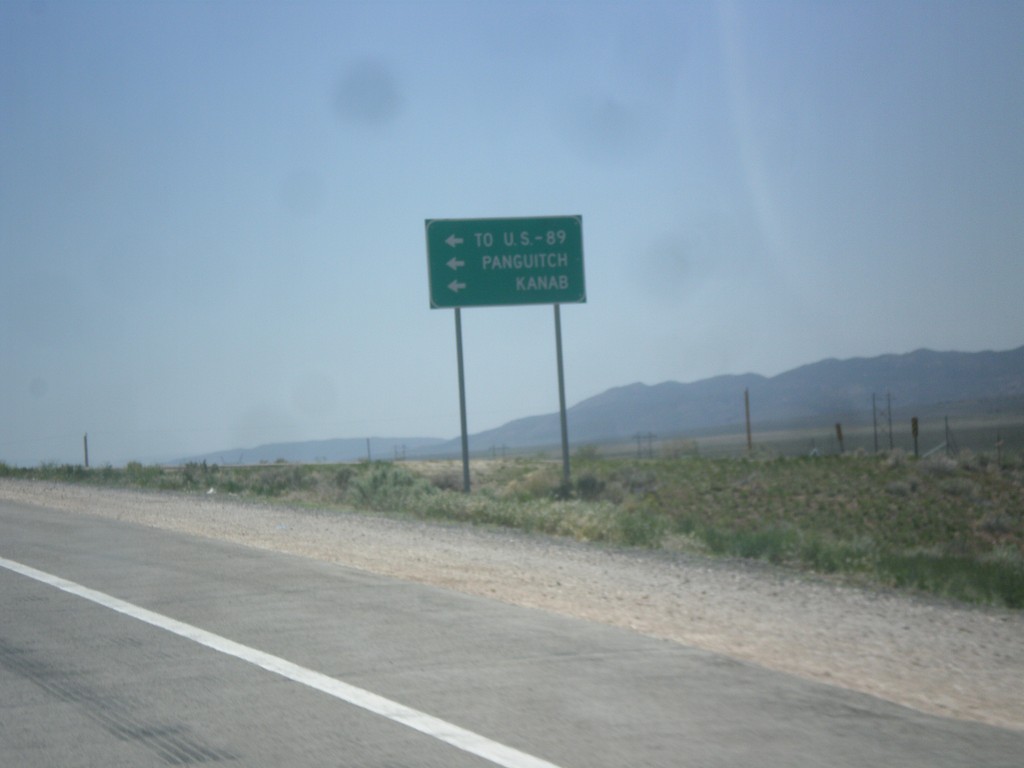
I-15 South at UT-20 Junction
I-15 south offramp at UT-20. Turn left for US-89, Panguitch, and Kanab.
Taken 05-19-2014
 Paragonah
Iron County
Utah
United States
Paragonah
Iron County
Utah
United States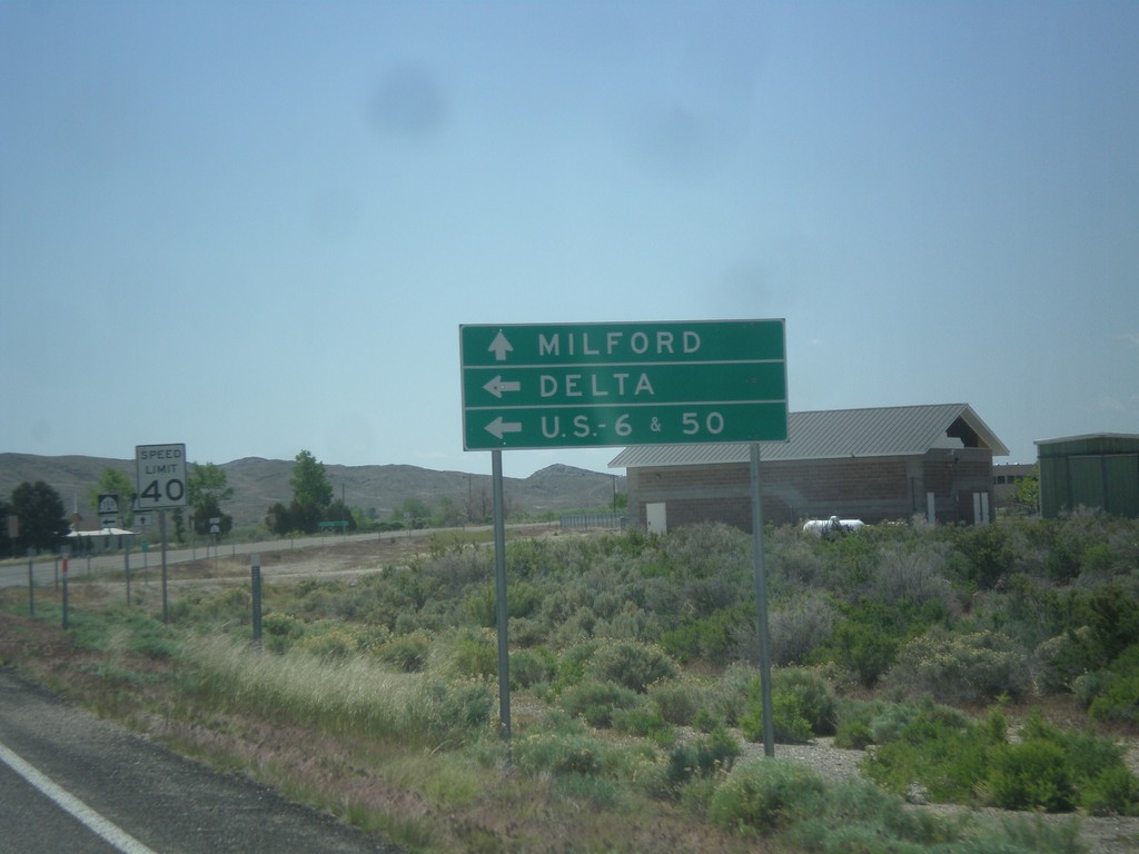
UT-21 East at UT-159
UT-21 east approaching UT-159 north to US-6/US-50 and Delta. Continue east on UT-21 for Milford.
Taken 05-19-2014

 Garrison
Millard County
Utah
United States
Garrison
Millard County
Utah
United States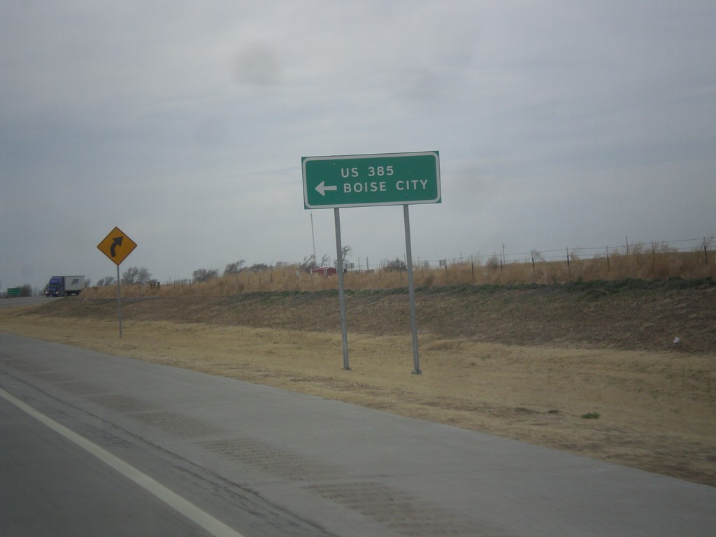
US-287 North at US-385/OK-3
US-287 north at US-385/OK-3 junction. OK-3 joins US-287 north to the Oklahoma - Colorado line. US-385 joins US-287 north to Lamar, Colorado. Notice the route US-385 is spelled out instead of displayed in a typical shield.
Taken 03-30-2014


 Boise City
Cimarron County
Oklahoma
United States
Boise City
Cimarron County
Oklahoma
United States
I-25 South Exit 451 Offramp at US-64/US-87
I-25 south Exit 451 Offramp at US-64/US-87. Turn left for US-64/US-87 East; right for US-64 west. This sign for US-64/US-87 in this picture is odd because it is not a standard shield, rather a text based big green sign.
Taken 03-29-2014


 Raton
Colfax County
New Mexico
United States
Raton
Colfax County
New Mexico
United States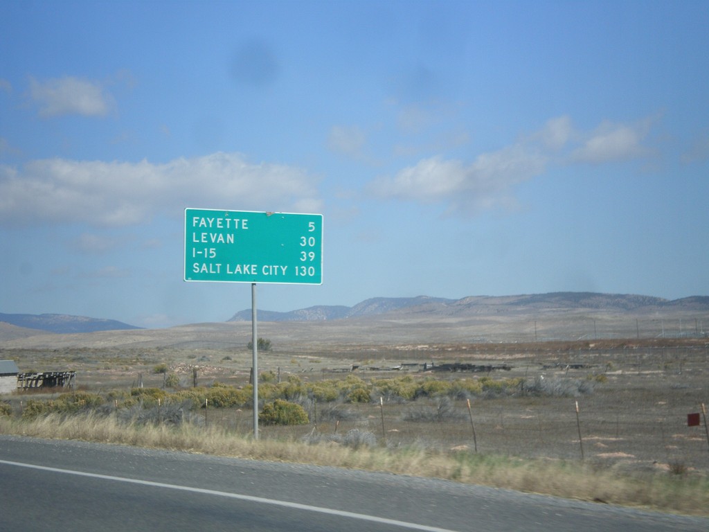
UT-28 North - Distance Marker
Distance marker on UT-28 north. Distance to Fayette, Levan, I-15, and Salt Lake City.
Taken 10-18-2013
 Gunnison
Sanpete County
Utah
United States
Gunnison
Sanpete County
Utah
United States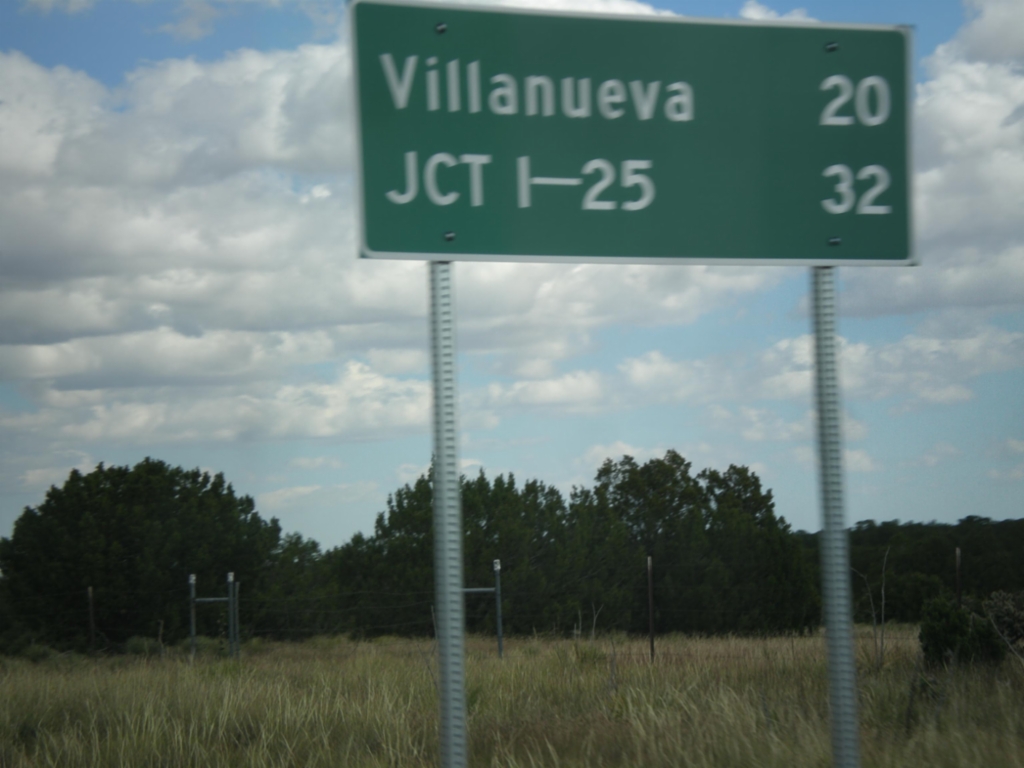
NM-3 North - Distance Marker
Distance marker on NM-3 north. Distance to Villanueva and I-25.
Taken 10-10-2013
 Encino
Torrance County
New Mexico
United States
Encino
Torrance County
New Mexico
United States