Signs Tagged With Shield Text
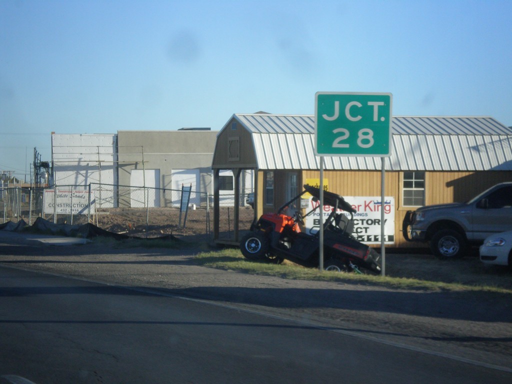
NM-188 West at NM-28
NM-118 west approaching NM-28 junction. This sign is missing the highway shield.
Taken 04-14-2013

 Las Cruces
Doña Ana County
New Mexico
United States
Las Cruces
Doña Ana County
New Mexico
United States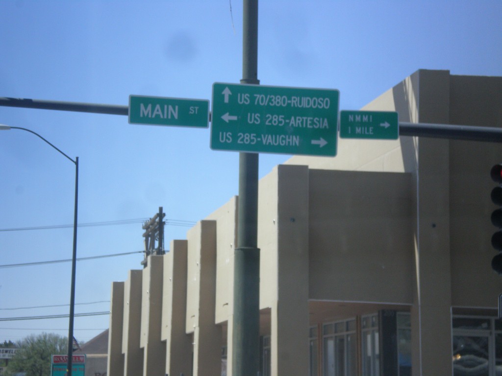
US-380 West at Main St.
US-380 west at Main St. Turn right for Main St. (to US-285 North) to Vaughn. Turn left for Main St. (to US-285 South) to Artesia. Continue west for US-380 (to US-70) to Ruidoso.
Taken 04-14-2013


 Roswell
Chaves County
New Mexico
United States
Roswell
Chaves County
New Mexico
United States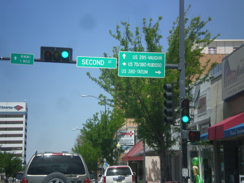
Main St. North at US-380
Main St. North at US-380. Turn right on US-380 east for Tatum, left on US-380 west (to US-70 west) for Ruidoso. Continue north on Main St. for US-285 north to Vaughn.
Taken 04-14-2013
Roswell
Chaves County
New Mexico
United States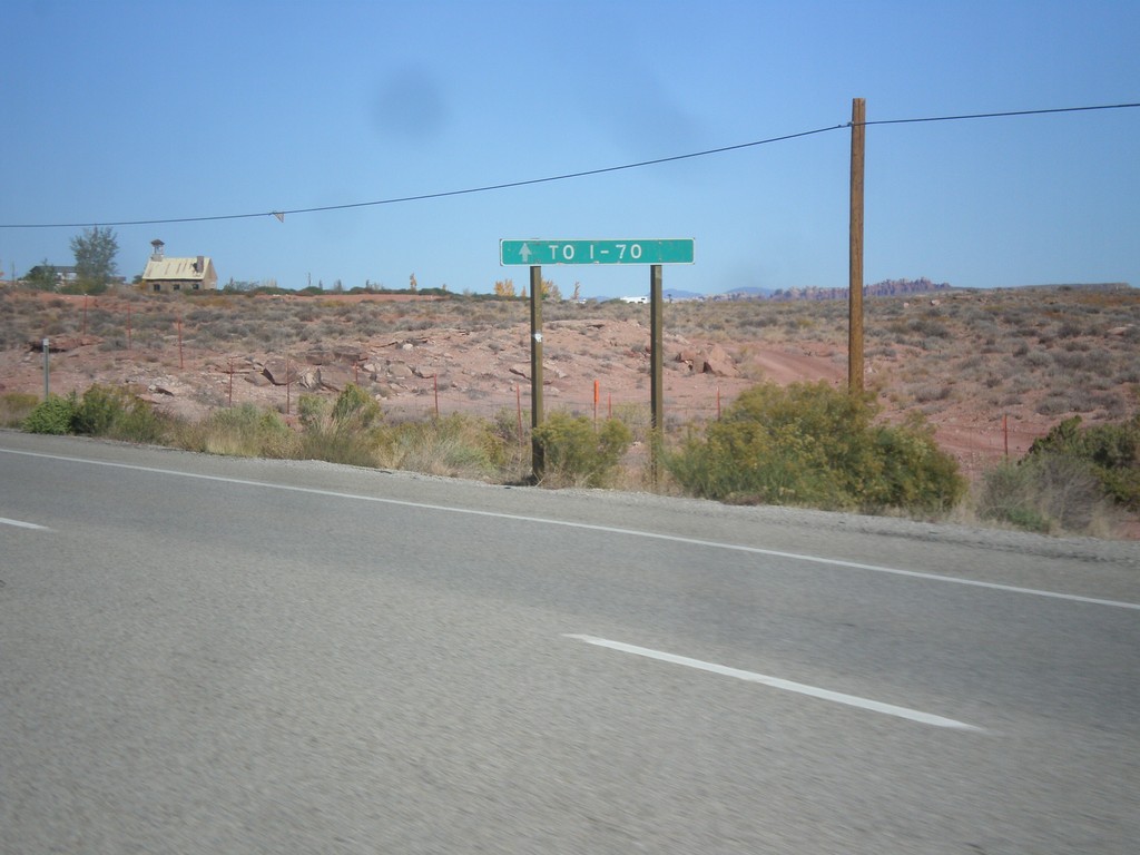
US-191 North Approaching UT-313
US-191 north approaching UT-313. Continue north on US-191 north for I-70.
Taken 10-17-2012

 Moab
Grand County
Utah
United States
Moab
Grand County
Utah
United States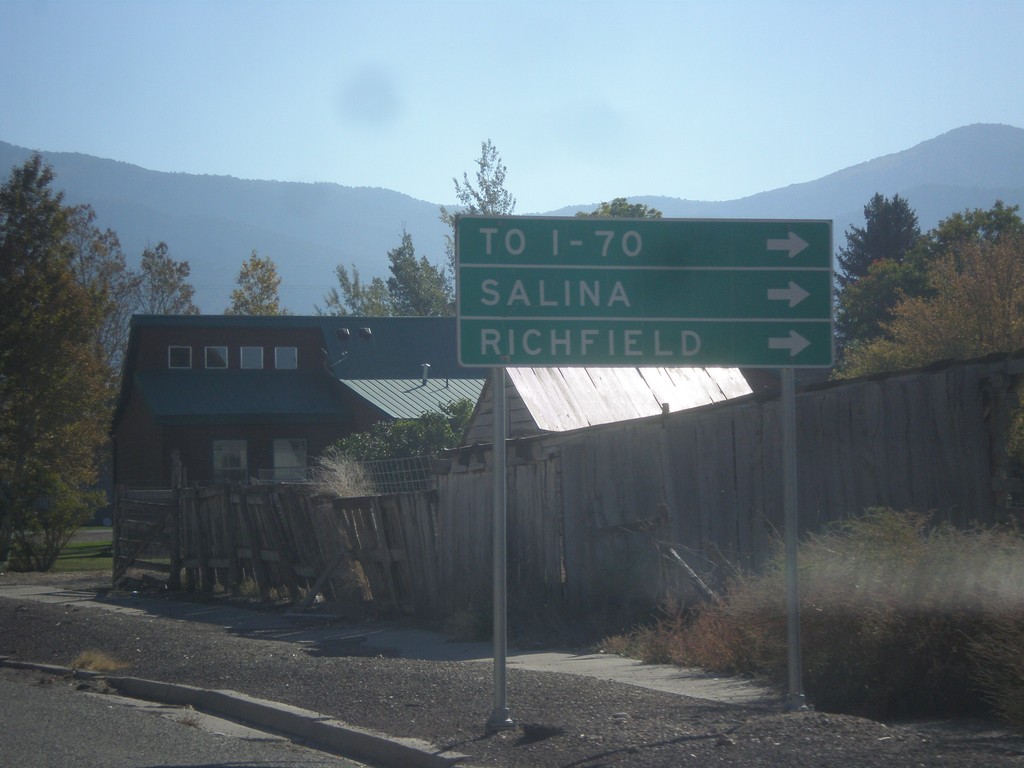
US-50 East in Scipio
US-50 east in Scipio. To continue on US-50 traffic turns right on State St. Turn right for I-70, Salina, and Richfield. US-50 provides shorter access for southbound I-15 traffic to I-70, then continuing on I-15 to I-70 jct.
Taken 10-07-2012
 Scipio
Millard County
Utah
United States
Scipio
Millard County
Utah
United States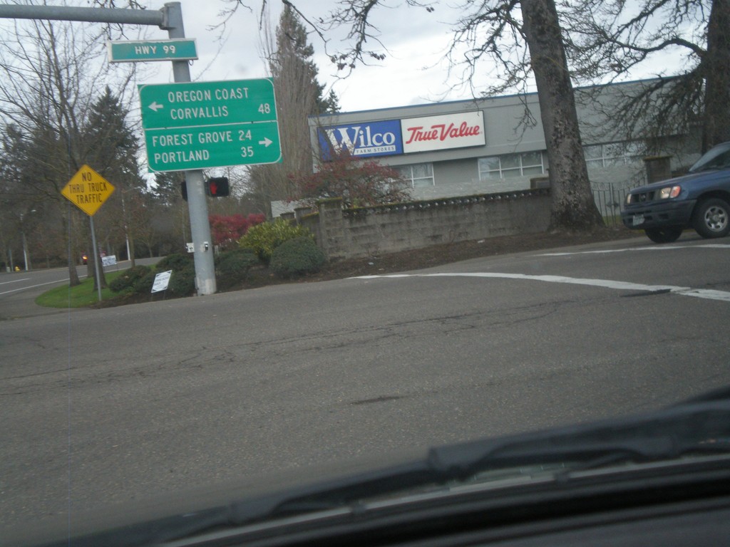
Lafayette Ave. North at OR-99W
Lafayette Ave. North at OR-99W in McMinnville. Turn left on OR-99W North for Forest Grove (via OR-47) and Portland. Turn left on OR-99W (South) for Corvallis and the Oregon Coast (via OR-18). In many places in Oregon the coast is referred to as the Oregon Coast on road signs.
Taken 02-21-2012
 McMinnville
Yamhill County
Oregon
United States
McMinnville
Yamhill County
Oregon
United States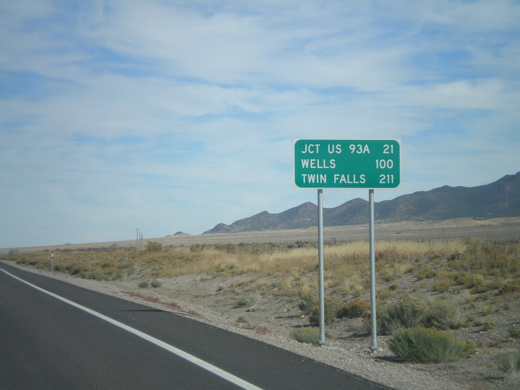
US-93 North - Distance Marker
Distance marker on US-93 north. Distance to Jct US-93A, Wells, and Twin Falls (Idaho).
Taken 10-15-2011
 Schellbourne
White Pine County
Nevada
United States
Schellbourne
White Pine County
Nevada
United States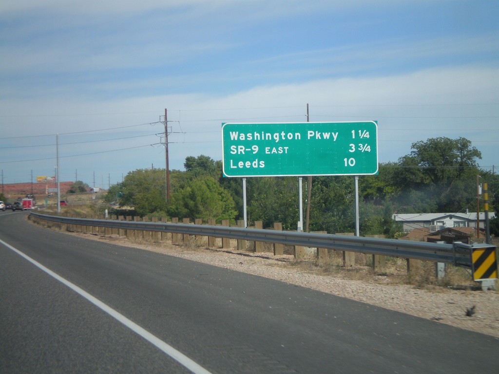
I-15 North - Distance Marker
Distance marker on I-15 north to Washington Parkway, SR-9 East, and Leeds.
Taken 10-10-2011
 Washington
 County
Utah
United States
Washington
Washington County
Utah
United States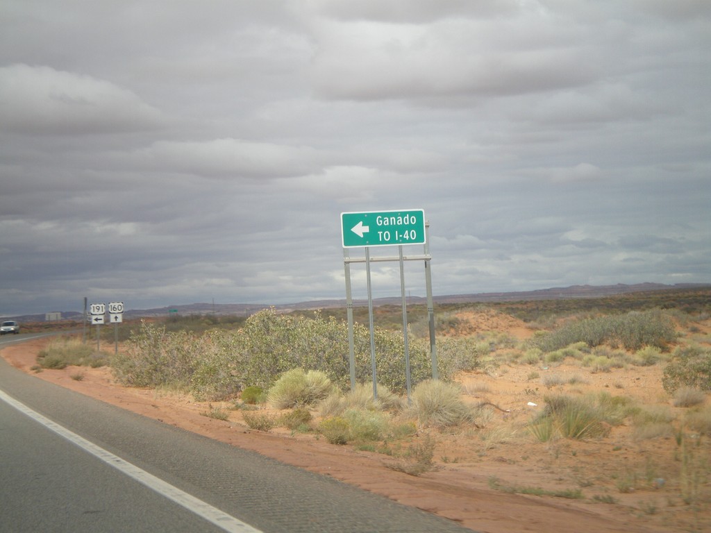
US-160 West/US-191 South Approaching US-191 South
US-160 West/US-191 South approaching US-191 south to I-40 and Ganado. The US-191 and US-160 shields are in the background of the photo.
Taken 10-08-2011

 Teec Nos Pos
Apache County
Arizona
United States
Teec Nos Pos
Apache County
Arizona
United States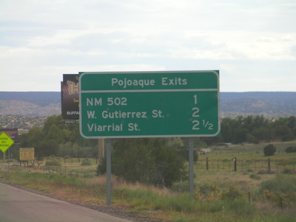
Pojoaque Exits - US-84/US-285 South
Pojoaque Exits on US-84/US-285 South: NM-502, W. Gutierrez St., Viarrial St. The later two exits are actually intersections controlled by traffic signals.
Taken 10-03-2011
 Santa Fe
 County
New Mexico
United States
Santa Fe
Santa Fe County
New Mexico
United States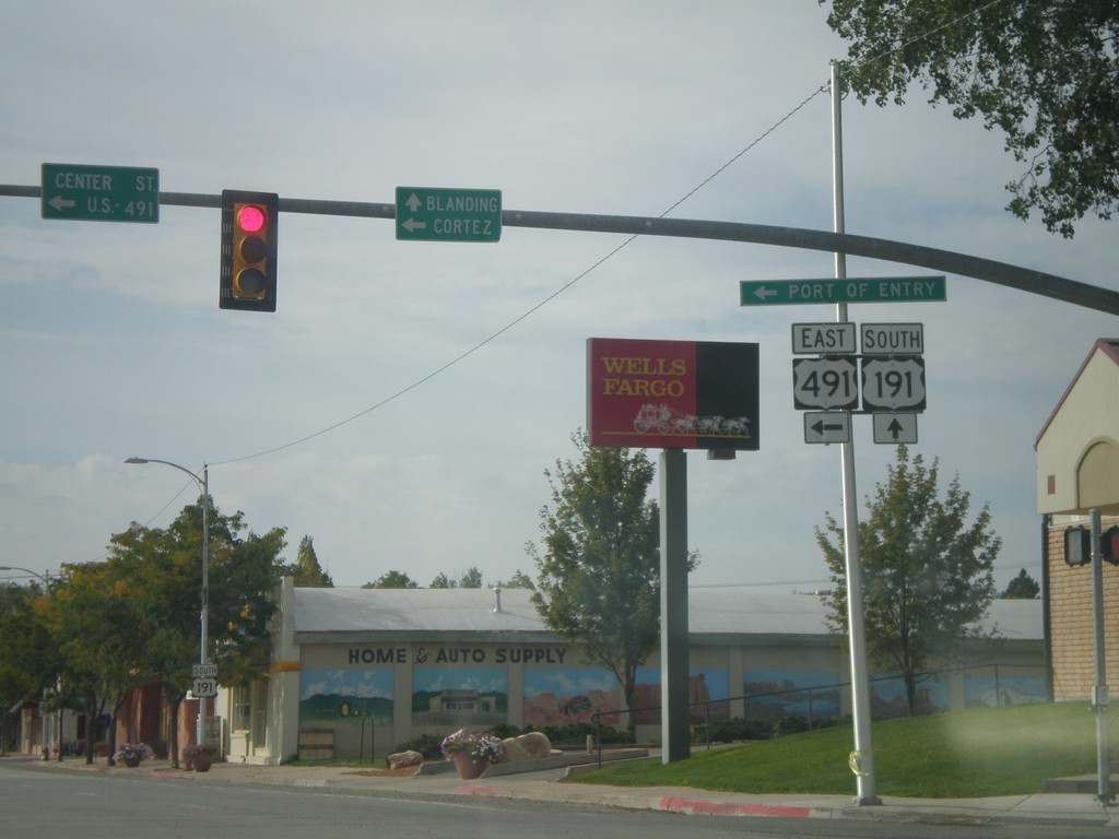
US-191 South at US-491
US-191 South at US-491. Use US-491 east for Cortez (Colorado); continue south on US-191 for Blanding. This is the northern end of US-491. Also US-491 east for the (Utah) Port of Entry.
Taken 10-02-2011
 Monticello
San Juan County
Utah
United States
Monticello
San Juan County
Utah
United States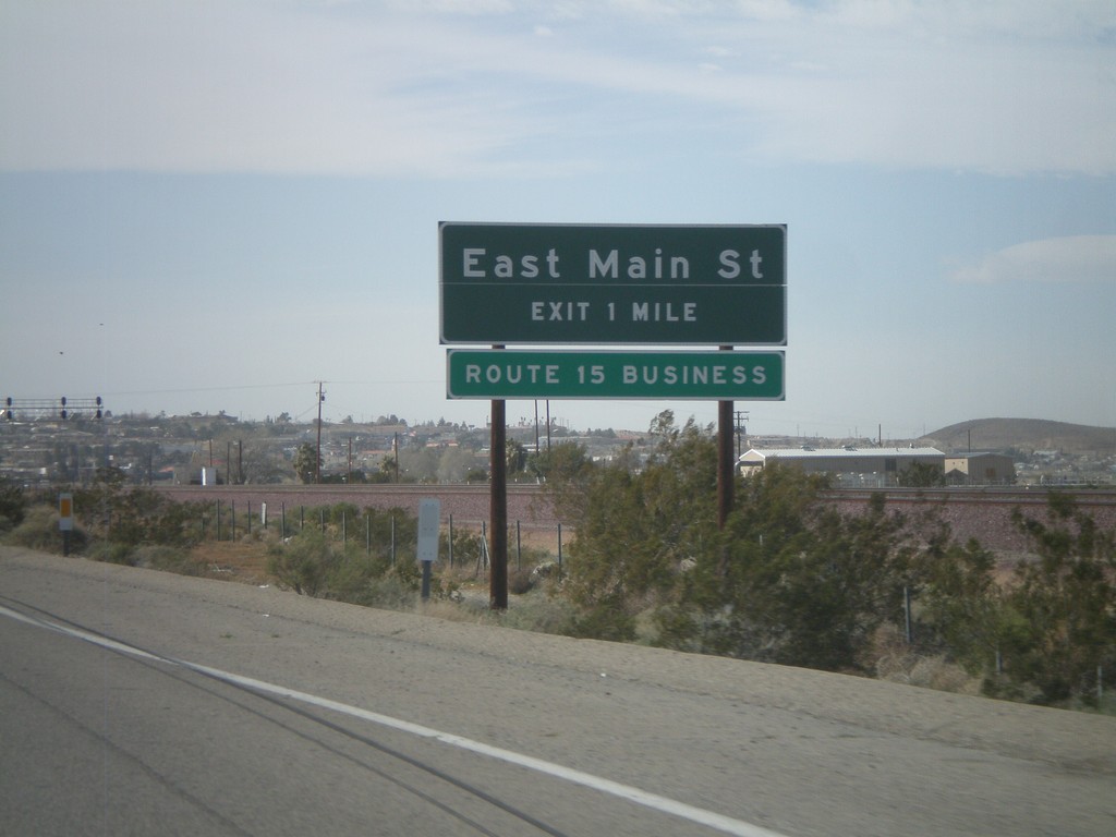
I-40 West Approaching Exit 1
I-40 west approaching Exit 1 - East Main St. East Main St. is part of Business Loop I-15.
Taken 02-25-2011
 Barstow
San Bernardino County
California
United States
Barstow
San Bernardino County
California
United States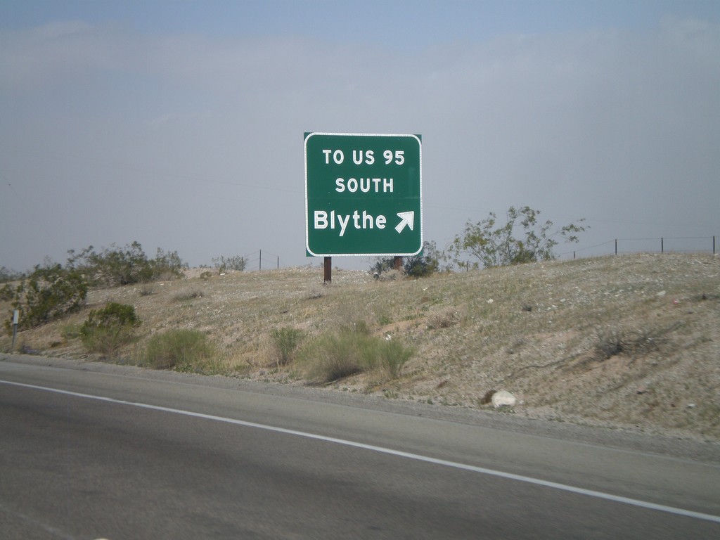
I-40 West - Exit 148
I-40 west at Exit 148 - To US-95 South/Blythe. The US-95 shield is displayed as text on this sign. This exit serves File Mile Road, and provides a cutoff between I-40 and US-95 south.
Taken 02-25-2011
 Needles
San Bernardino County
California
United States
Needles
San Bernardino County
California
United States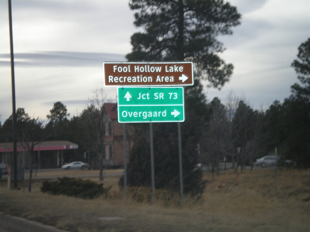
US-60/AZ-77/AZ-260 West at AZ-260
US-60/AZ-77/AZ-260 west at AZ-260 west to Overgaard and Fool Hollow Lake Recreation Area. US-60 West/AZ-77 South continues to AZ-73 Jct. AZ-260 west leaves US-60/AZ-77 here.
Taken 02-24-2011


 Show Low
Navajo County
Arizona
United States
Show Low
Navajo County
Arizona
United States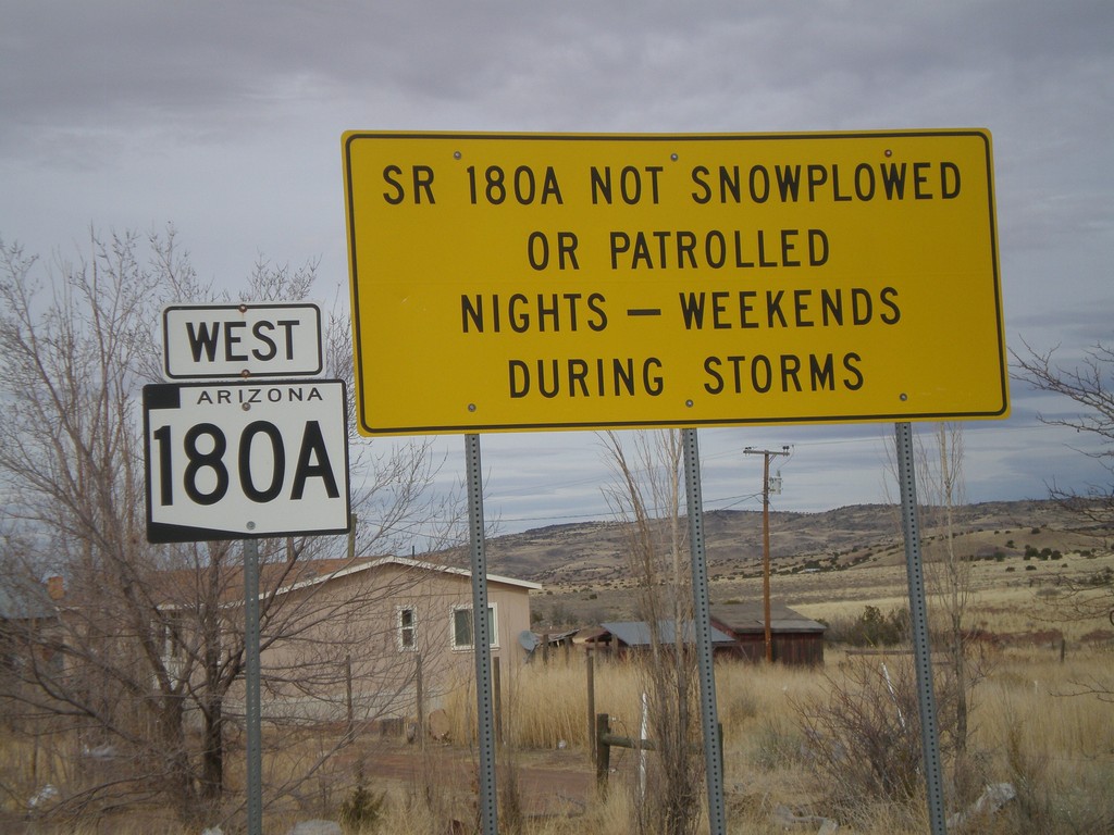
AZ-180A West - Winter Driving Warning
Warning on AZ-180A that the highway is not plowed nights or on weekends during storms.
Taken 02-24-2011
 Concho
Apache County
Arizona
United States
Concho
Apache County
Arizona
United States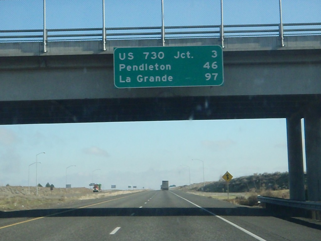
I-84 East - Distance Marker
Distance marker at Boardman Interchange. Distance to US-730 Jct., Pendleton, and La Grande.
Taken 01-19-2011

 Boardman
Morrow County
Oregon
United States
Boardman
Morrow County
Oregon
United States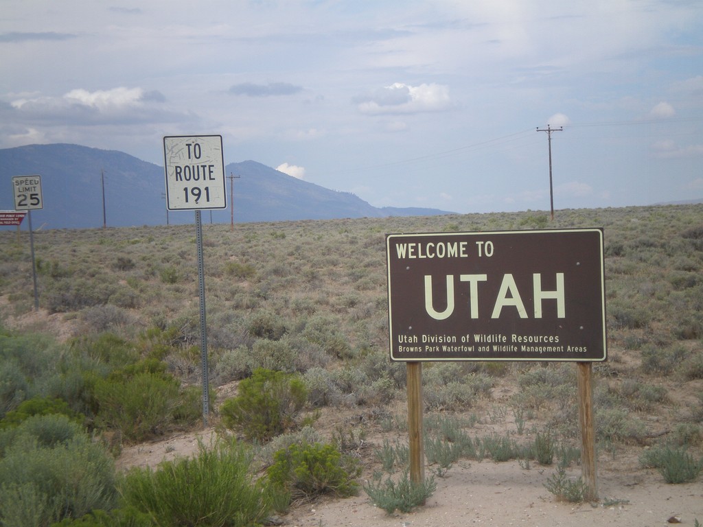
Welcome To Utah - Browns Park
Welcome to Utah on CH-1364 (Browns Park Road). This welcome sign was posted by the Utah Division of Wildlife Resources. Continue west on Browns Park Road for US-191.
Taken 08-01-2010
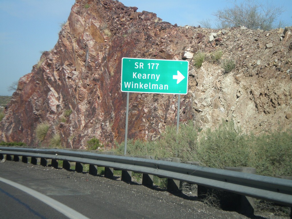
US-60 West at AZ-177 South
US-60 west at AZ-177 south to Winkelman and Kearny. AZ-177 is not displayed as a typical highway shield here, instead it is written out in text.
Taken 03-22-2010
 Superior
Pinal County
Arizona
United States
Superior
Pinal County
Arizona
United States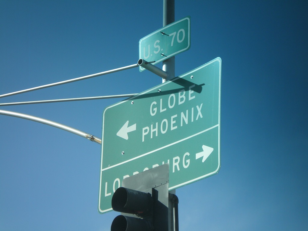
US-70 West at US-191 South
US-70 west at US-191 south. Use US-70 west for Globe and Phoenix. Use US-70 East/US-191 North for Lordsburg (NM).
Taken 03-21-2010
Safford
Graham County
Arizona
United States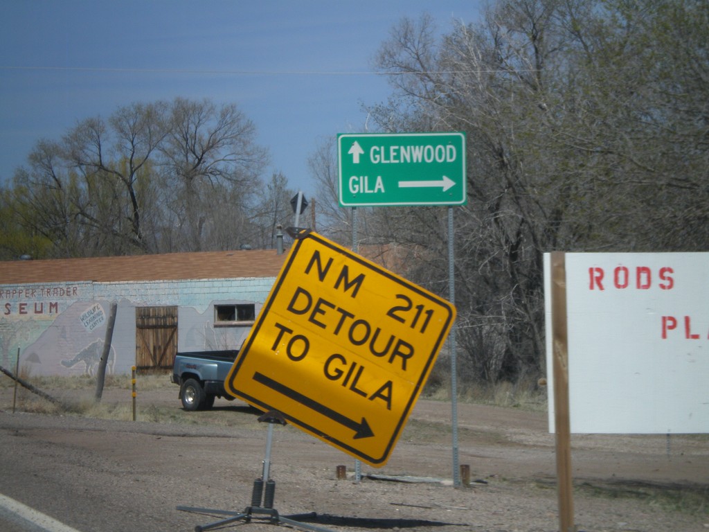
US-180 West at NM-211
US-180 west at NM-211 to Gila.
Taken 03-21-2010

 Gila
Grant County
New Mexico
United States
Gila
Grant County
New Mexico
United States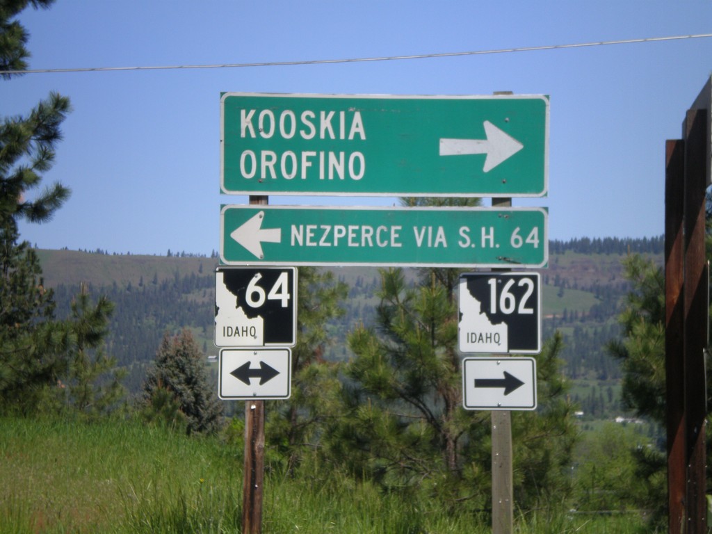
ID-162 South at ID-64
ID-162 south at ID-64. Use ID-64 west for Nezperce (via SH-64). Use ID-64/ID-162 east for Kooskia and Orofino.
Taken 05-21-2009

 Kamiah
Lewis County
Idaho
United States
Kamiah
Lewis County
Idaho
United States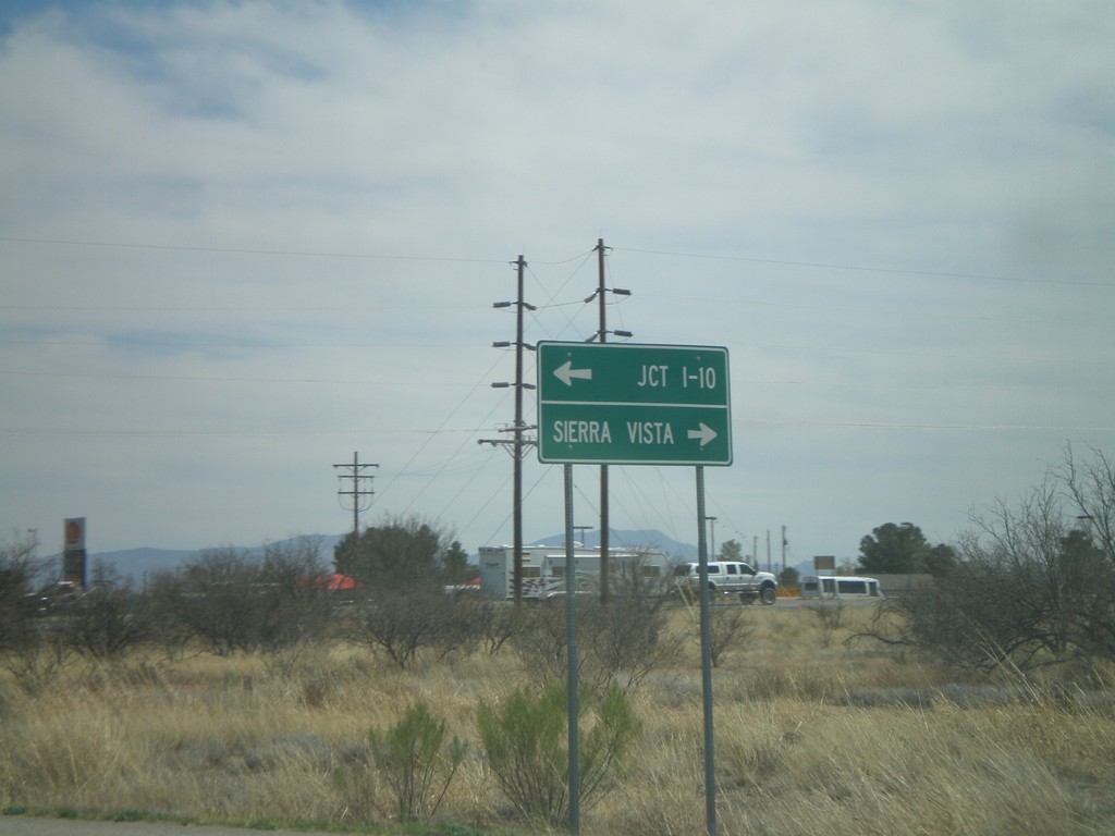
AZ-82 East At AZ-90
AZ-82 east at AZ-90. Use AZ-90 north for Jct. I-10. Use AZ-90 south for Sierra Vista.
Taken 03-22-2009

 Huachuca City
Cochise County
Arizona
United States
Huachuca City
Cochise County
Arizona
United States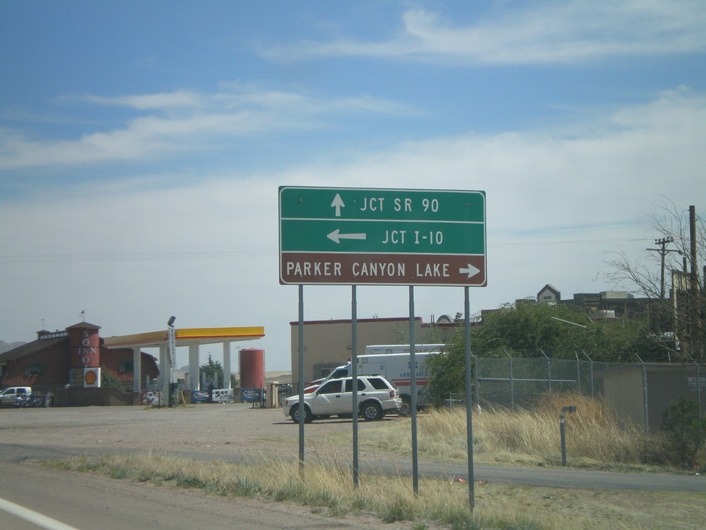
AZ-82 East Approaching AZ-83
AZ-82 east approaching AZ-83. Use AZ-83 north for I-10. Use AZ-83 south for Parker Canyon Lake.
Taken 03-22-2009
 Sonoita
Santa Cruz County
Arizona
United States
Sonoita
Santa Cruz County
Arizona
United States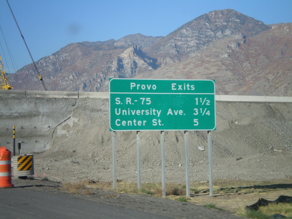
I-15 North - Provo Exits
Next 3 Provo Exits on I-15 north - UT-75, University Ave., and Center St.
Taken 10-25-2008
Springville
Utah County
Utah
United States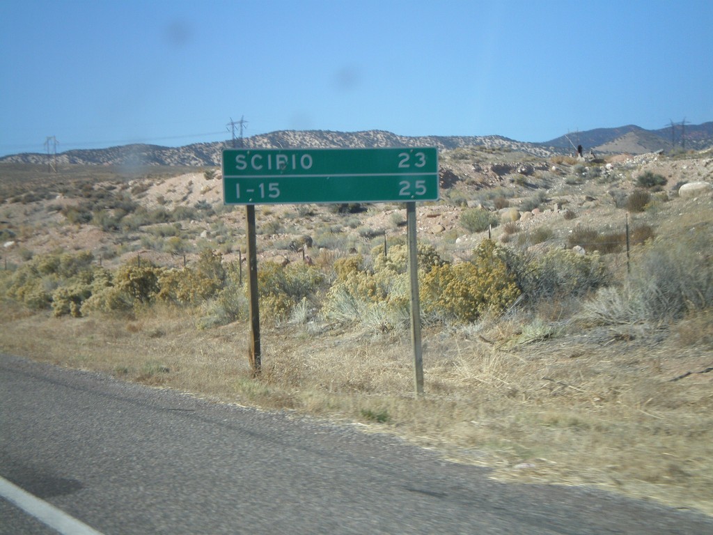
US-50 West - Distance Marker
Distance marker on US-50 west to Scipio and I-15.
Taken 10-25-2008
Salina
Sevier County
Utah
United States