Signs Tagged With Shield Text
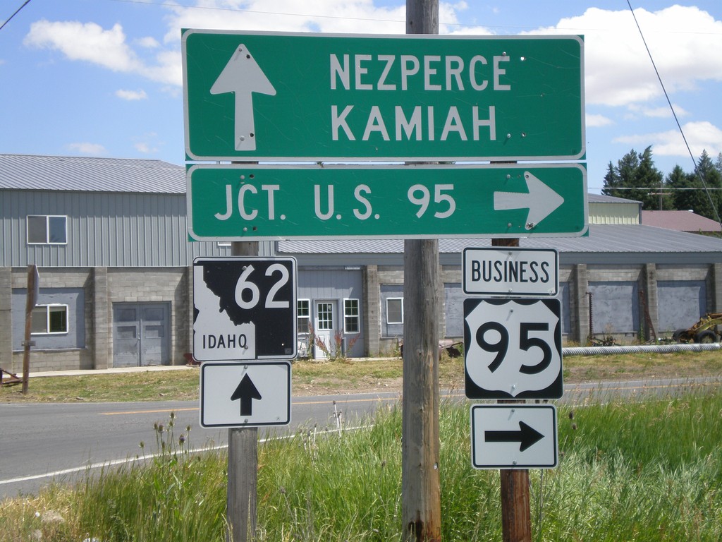
BL-95 South at ID-62
BL-95 south at ID-62 towards Kamiah and Nezperce. Turn left on BL-95 for US-95.
Taken 07-27-2008

 Craigmont
Lewis County
Idaho
United States
Craigmont
Lewis County
Idaho
United States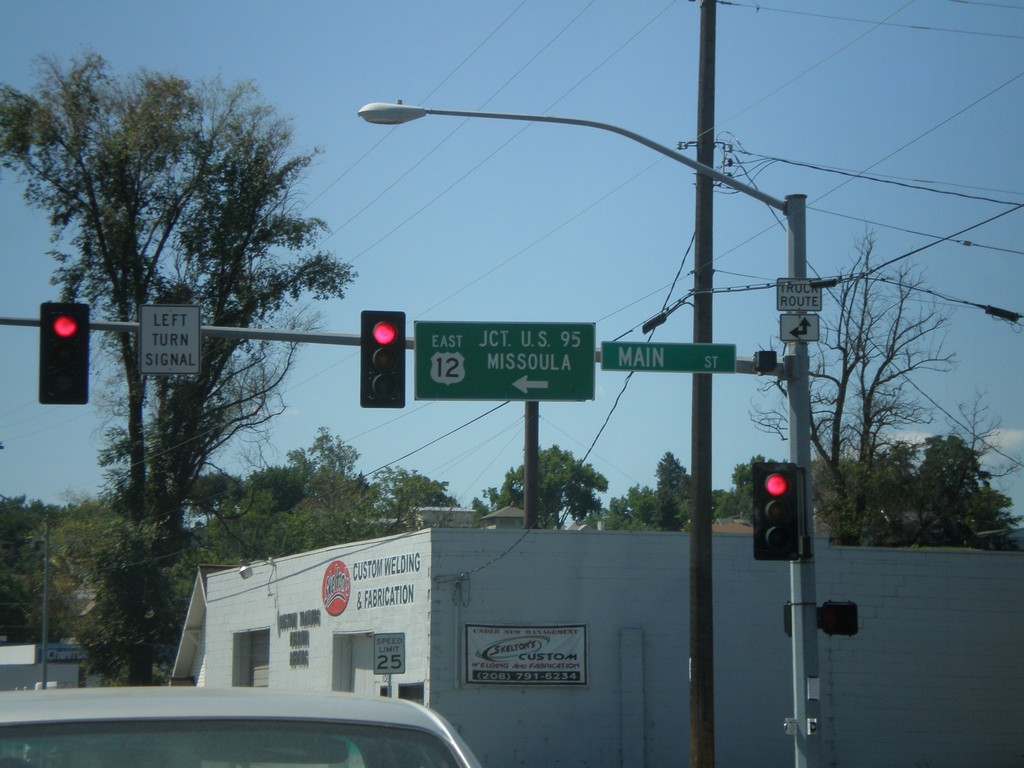
US-12 East - Levee Bypass at Main St.
US-12 East at Main St. Turn left on Main St. to continue east on US-12 to US-95 and Missoula (Montana).
Taken 07-27-2008
 Lewiston
Nez Perce County
Idaho
United States
Lewiston
Nez Perce County
Idaho
United States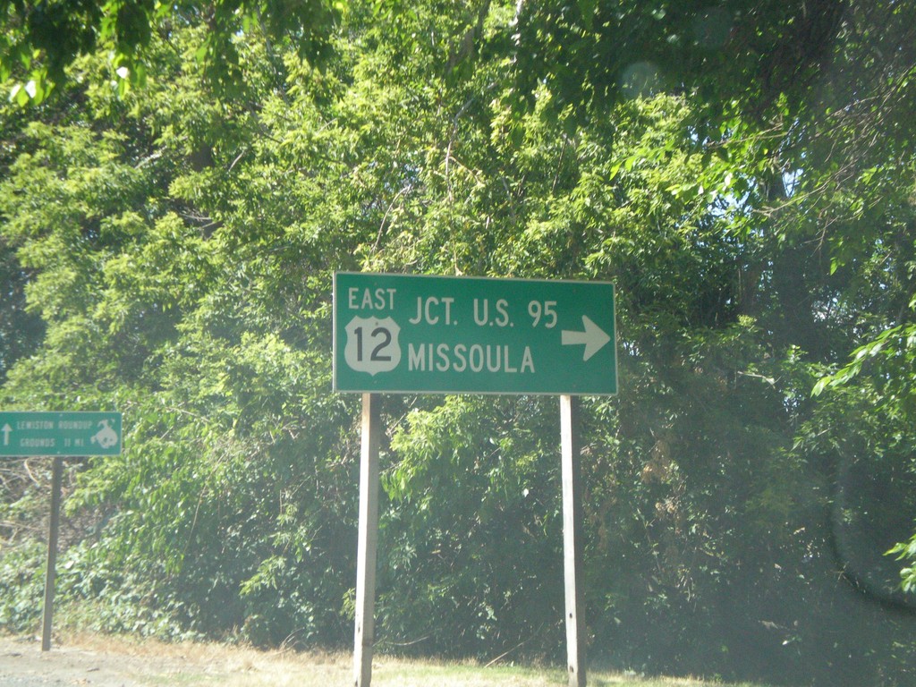
US-12 East - Interstate Bridge
US-12 east at end of Interstate Bridge. Turn right to continue east on US-12 for US-95 and Missoula (Montana).
Taken 07-27-2008
Lewiston
Nez Perce County
Idaho
United States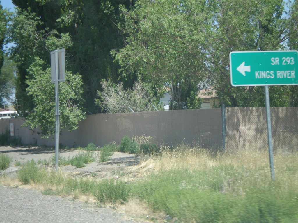
US-95 North at NV-293
US-95 north at NV-293 west to Kings River. The only mention of NV-293 is the text on the destination sign "SR-293." There are no NV-293 guide signs approaching this junction from either direction. Must Nevada junctions have advanced signage with proper route shields.
Taken 07-07-2008

 Winnemucca
Humboldt County
Nevada
United States
Winnemucca
Humboldt County
Nevada
United States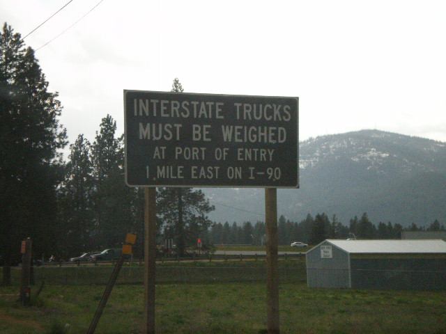
ID-41 South at I-90 - Interstate Trucks
ID-41 south approaching I-90. All Interstate trucks must be weighed at Port of Entry on I-90 East.
Taken 05-07-2008
 Post Falls
Kootenai County
Idaho
United States
Post Falls
Kootenai County
Idaho
United States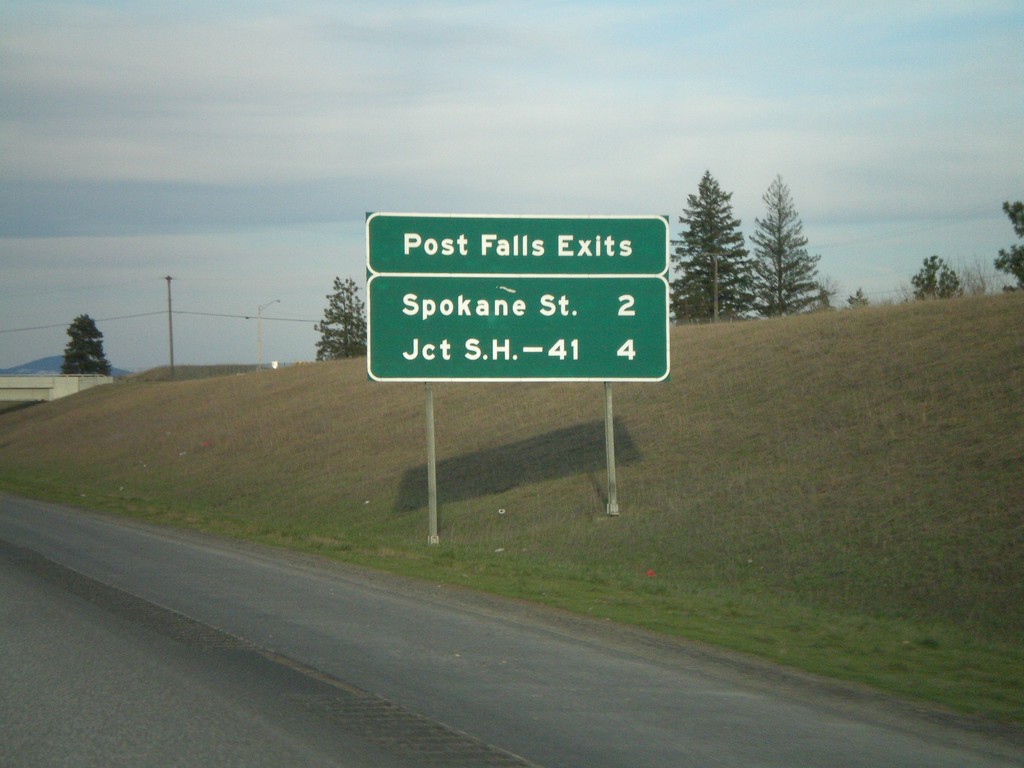
I-90 East - Post Falls Exits
Post Falls exits on I-90 east - Spokane St. and Jct. ID-41.
Taken 04-13-2008
 Post Falls
Kootenai County
Idaho
United States
Post Falls
Kootenai County
Idaho
United States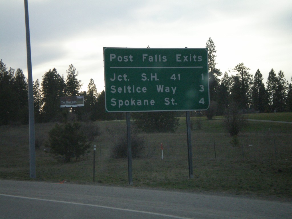
I-90 West - Post Falls Exits
Post Falls exits on I-90 West - Next 3 exits, Jct. SH-41, Seltice Way, and Spokane St.
Taken 04-13-2008
Post Falls
Kootenai County
Idaho
United States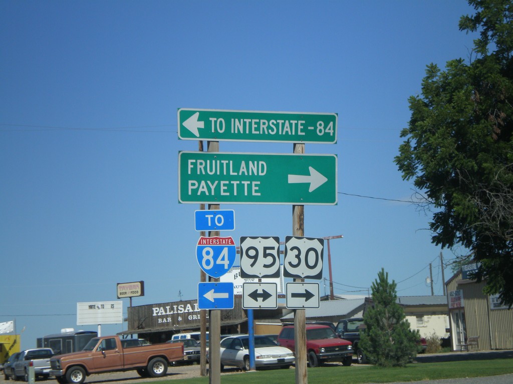
US-30 West at US-95
US-30 west at US-95. Use US-95 north to Fruitland and Payette; south to I-84. US-30 joins US-95 north through Fruitland.
Taken 06-30-2007
 Fruitland
Payette County
Idaho
United States
Fruitland
Payette County
Idaho
United States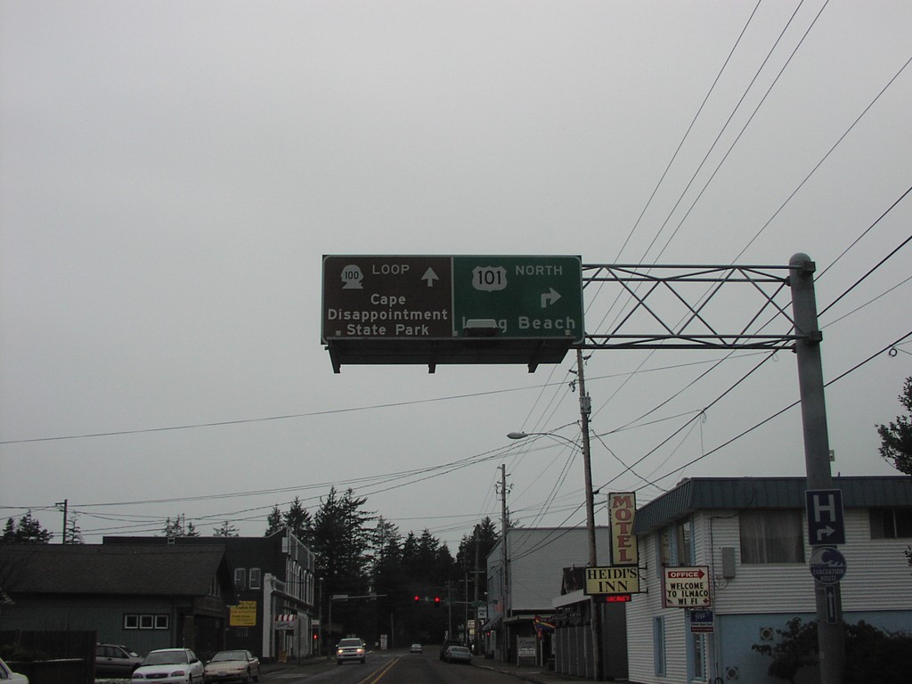
US-101 North at Loop WA-100
US-101 north approaching WA-100 Loop to Cape Disappointment State Park.
Taken 01-01-2007

 Ilwaco
Pacific County
Washington
United States
Ilwaco
Pacific County
Washington
United States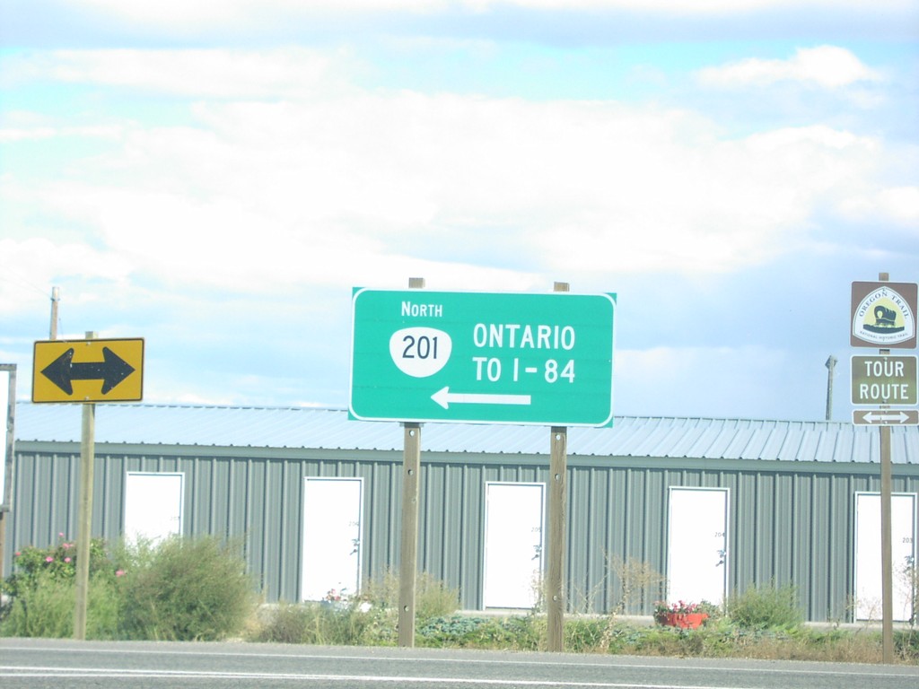
US-20/US-26 East at OR-201
US-20/US-26 east at OR-201 north To I-84 and Ontario.
Taken 10-01-2006


 Ontario
Malheur County
Oregon
United States
Ontario
Malheur County
Oregon
United States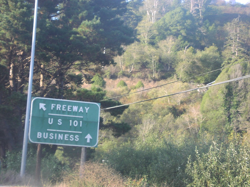
US-101 North Exit 718
US-101 north at Exit 718, Central Ave./McKinleyville. Use this exit for US-101 Business.
Taken 10-01-2006
McKinleyville
Humboldt County
California
United States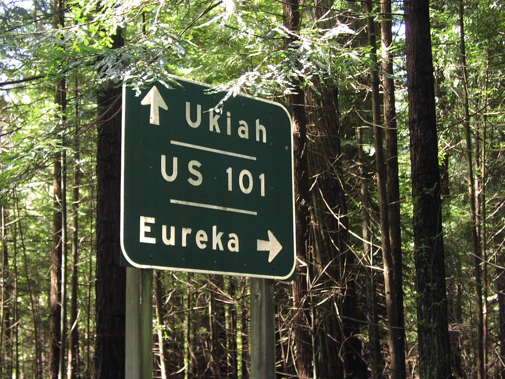
CA-254 North at US-101
US-101 to Ukiah and Eureka at northern terminous of CA-254.
Taken 04-01-2006
 Elinor
Humboldt County
California
United States
Elinor
Humboldt County
California
United States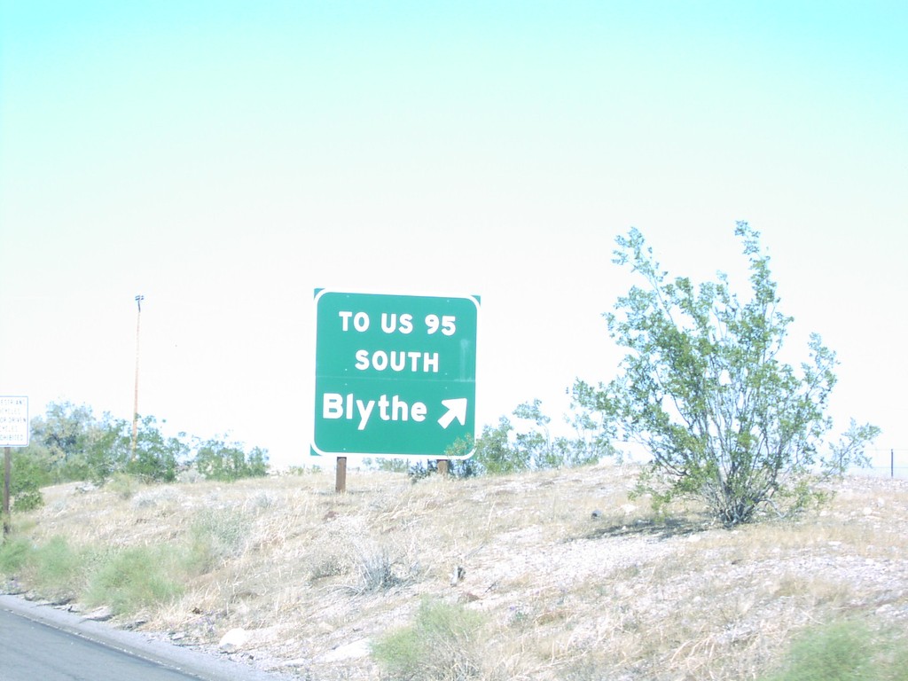
I-40 West Exit 148
I-40 west at Exit 148, To US-95 South/Blythe
Taken 02-01-2006
 Needles
San Bernardino County
California
United States
Needles
San Bernardino County
California
United States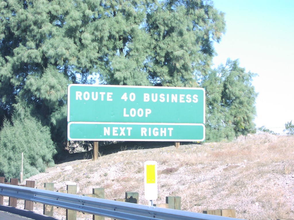
I-40 West - Needles Bus. Loop
Route 40 Business Loop next exit on I-40 west
Taken 02-01-2006
 Needles
San Bernardino County
California
United States
Needles
San Bernardino County
California
United States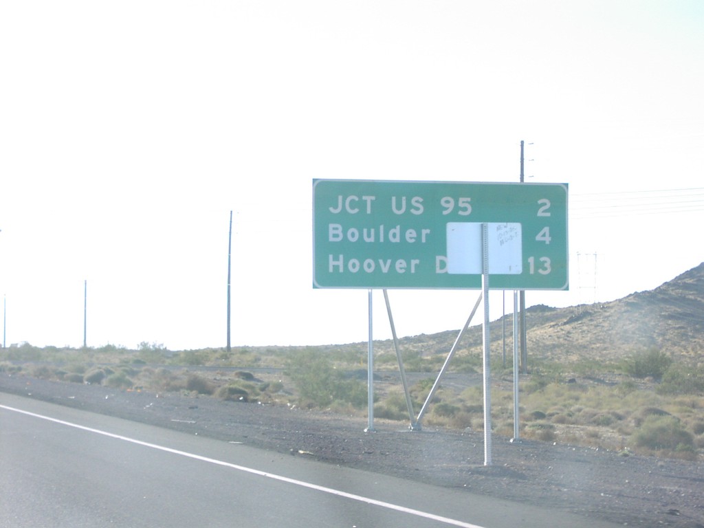
Distance Marker on US-93/US-95 South
Distance marker to US-95/Boulder City/Hoover Dam on US-93/US-95 south
Taken 02-01-2006
 Henderson
Clark County
Nevada
United States
Henderson
Clark County
Nevada
United States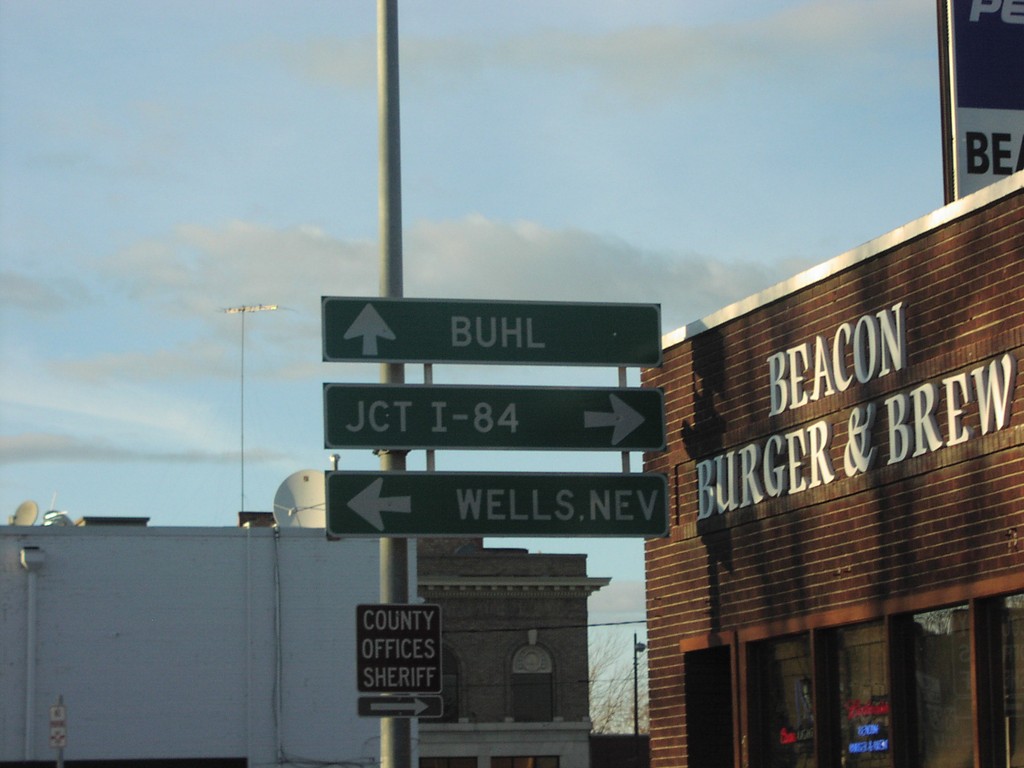
US-30 West at ID-74
US-30 west at ID-74/To US-93 junction to I-84, Wells Nev, and Buh
Taken 11-12-2005
 Twin Falls
 County
Idaho
United States
Twin Falls
Twin Falls County
Idaho
United States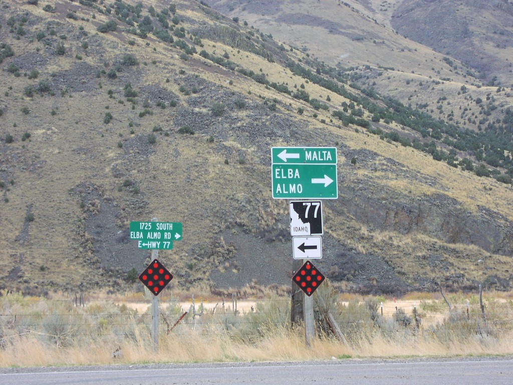
ID-77 at Elba-Almo Rd
ID-77 south at Elba-Almo Road Junc
Taken 11-12-2005
 Malta
Cassia County
Idaho
United States
Malta
Cassia County
Idaho
United States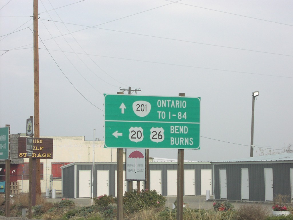
OR-201 North at US-20/US-26
US-20/US-26 west to Burns and Bend, on US-20/US-26/OR-201
Taken 11-11-2005
Ontario
Malheur County
Oregon
United States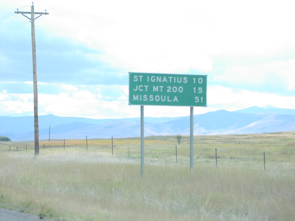
US-93 South - Distance Marker
Distance marker on US-93 south in Lake County. Distance to St. Ignatius, Jct. MT-200, and Missoula.
Taken 09-11-2005
Saint Ignatius
Lake County
Montana
United States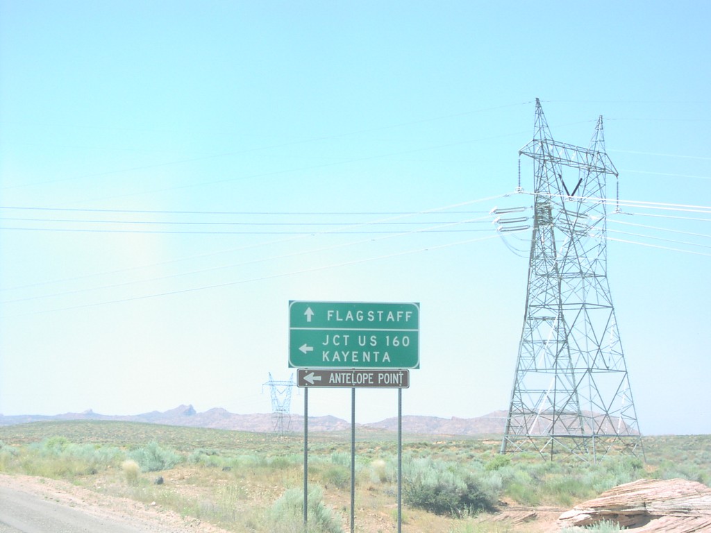
US-89 South at AZ-98 East
US-89 south at AZ-98 to Kayenta and US-160, south of Page
Taken 05-01-2005

 Page
Coconino County
Arizona
United States
Page
Coconino County
Arizona
United States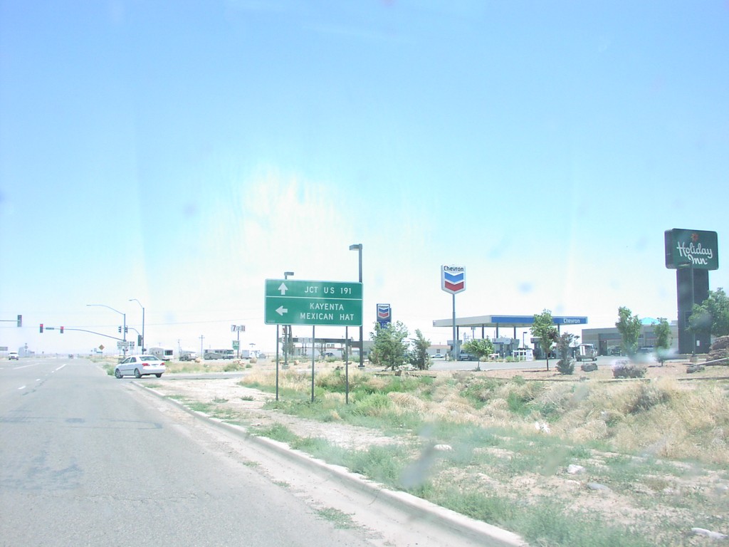
US-160 East at US-163
US-160 east approaching US-163 to Mexican Hat, in Kayenta.
Taken 05-01-2005

 Kayenta
Navajo County
Arizona
United States
Kayenta
Navajo County
Arizona
United States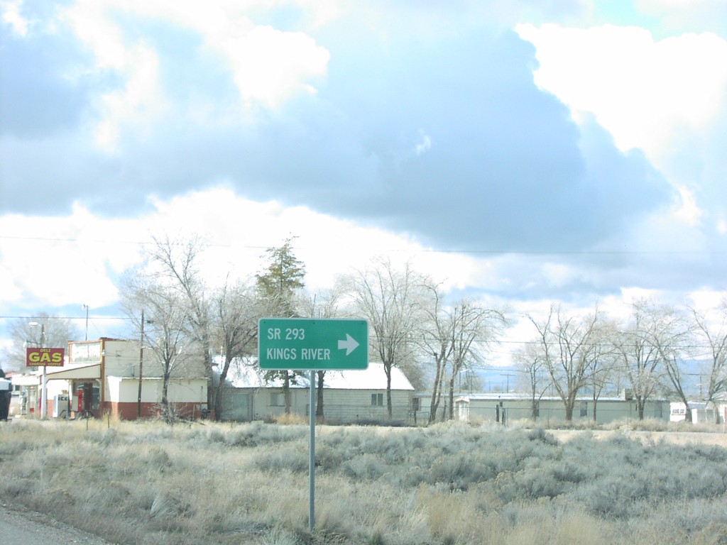
US-95 South at NV-293
US-95 south at NV-293 to Kings Valley in Orovada.
Taken 03-01-2005
Winnemucca
Humboldt County
Nevada
United States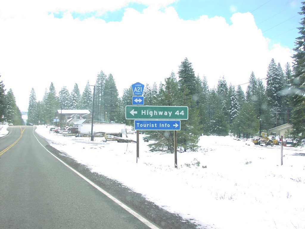
CA-36 East at CR-A21 To CA-44
CA-36/CR-A21 junction in Westwood.
Taken 03-01-2005
 Westwood
Lassen County
California
United States
Westwood
Lassen County
California
United States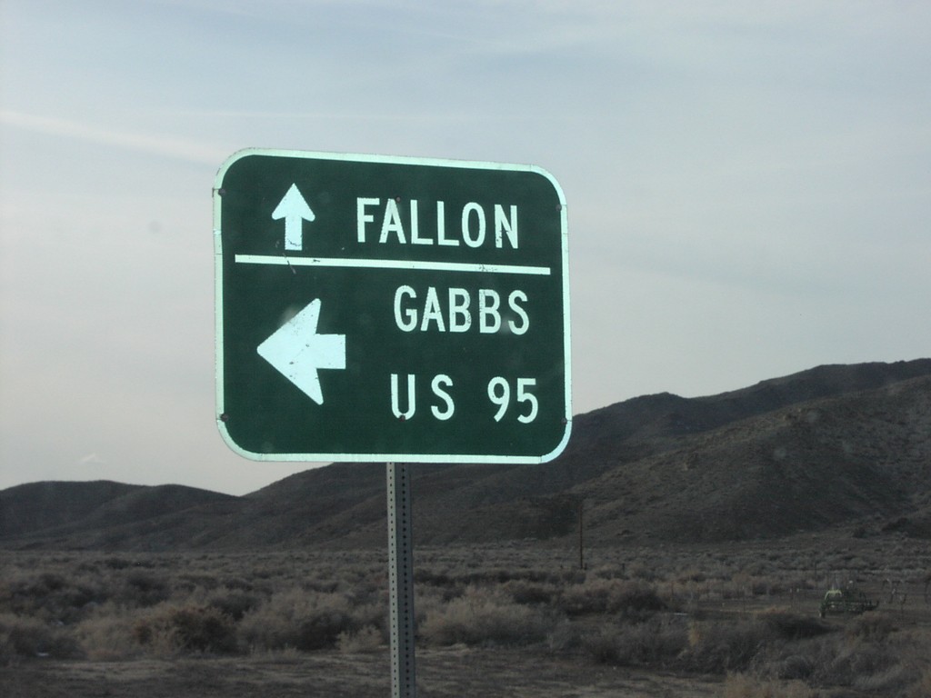
US-50 West at NV-361 South to Gabbs
Directional marker to US-95, Gabbs, and Fallon on US-50 west at NV-361 junction in Churchill County.
Taken 02-01-2005

 Fallon
Churchill County
Nevada
United States
Fallon
Churchill County
Nevada
United States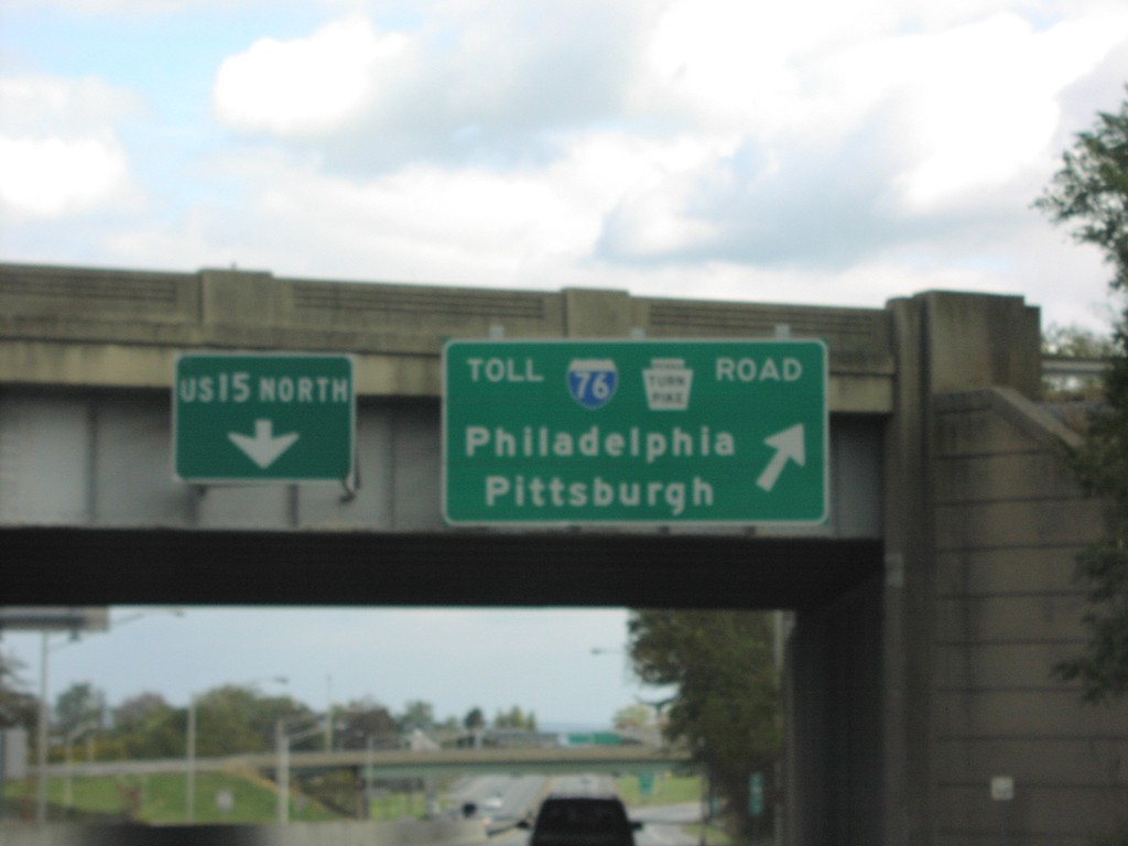
US-15 North at I-76
US-15 North at I-76/Pennsylvania Turnpike/Philadelphia/Pittsburgh onramp on US-15 North
Taken 10-01-2004

 Mechanicsburg
Cumberland County
Pennsylvania
United States
Mechanicsburg
Cumberland County
Pennsylvania
United States