Signs Tagged With Shield
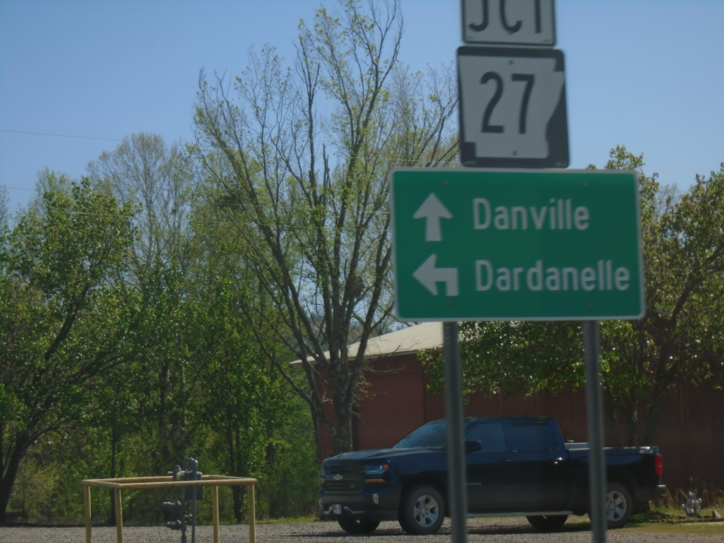
AR-10 East at AR-27
AR-10 East at AR-27 in Danville. Use AR-27 East to Dardanelle; continue on AR-10 East to Danville.
Taken 03-28-2026

 Danville
Yell County
Arkansas
United States
Danville
Yell County
Arkansas
United States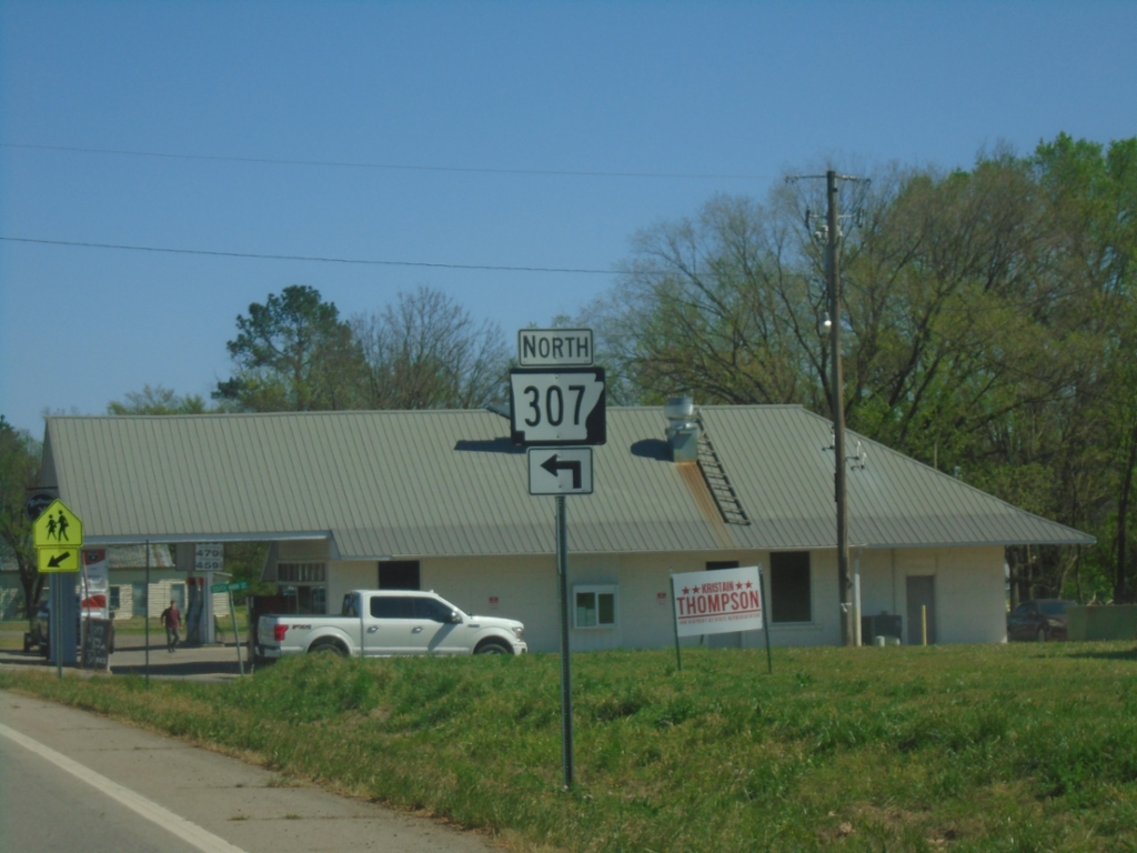
AR-10 East at AR-307
AR-10 East at AR-307 North in Belleville.
Taken 03-28-2026
 Belleville
Yell County
Arkansas
United States
Belleville
Yell County
Arkansas
United States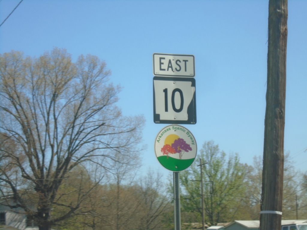
AR-10 East - Havana
AR-10 East in Havana. AR-10 is part of the West-Northwest Scenic Byway.
Taken 03-28-2026
Havana
Yell County
Arkansas
United States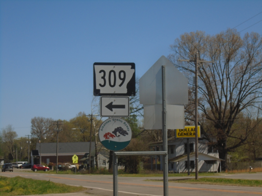
AR-10 East at AR-309 North
AR-10 East at AR-309 North in Havana.
Taken 03-28-2026
 Havana
Yell County
Arkansas
United States
Havana
Yell County
Arkansas
United States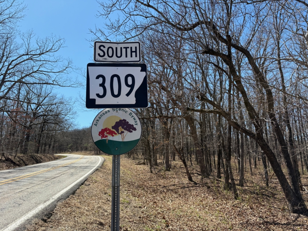
AR-309 South - Mount Magazine State Park
AR-309 South in Mount Magazine State Park. AR-309 is part of the Mount Magazine Scenic Byway.
Taken 03-28-2026
Little Rock
Logan County
Arkansas
United States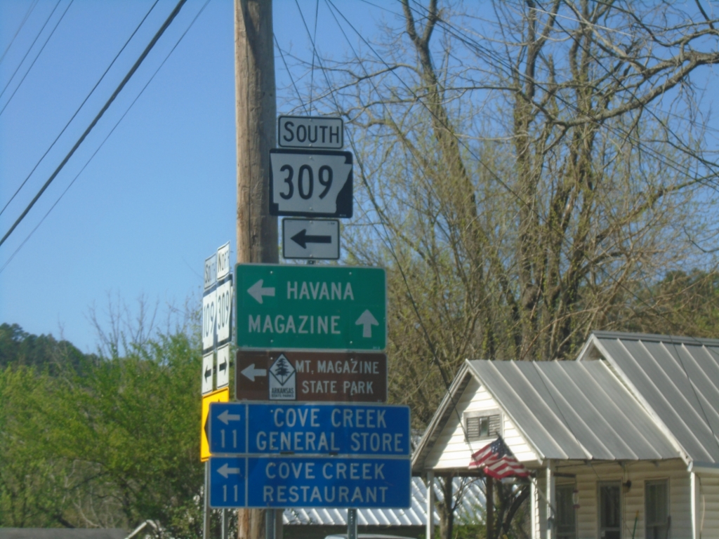
AR-109/AR-309 South at AR-109/AR-309 Split
AR-109/AR-309 South at AR-109/AR-309 Split in Paris. Turn left for AR-309 South to Havana and Mount Magazine State Park. Continue on AR-109 for Magazine.
Taken 03-28-2026
 Paris
Logan County
Arkansas
United States
Paris
Logan County
Arkansas
United States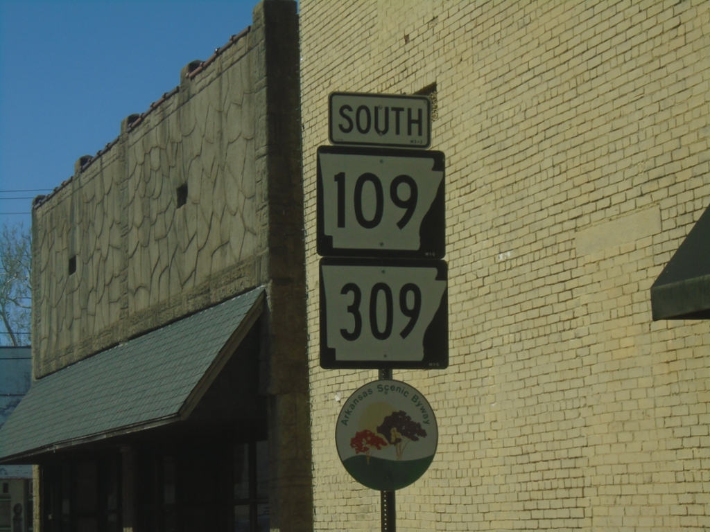
AR-109/AR-309 South - Paris
AR-109/AR-309 South - Paris. AR-309 is designated as the Mount Magazine Scenic Byway.
Taken 03-28-2026
Paris
Logan County
Arkansas
United States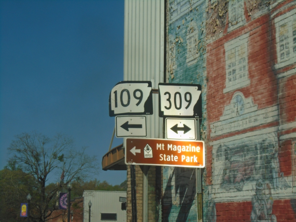
AR-22 West at AR-109/AR-309
AR-22 West at AR-109/AR-309 in Paris. Turn left on AR-109/AR-309 South to Mount Magazine State Park.
Taken 03-28-2026
 Paris
Logan County
Arkansas
United States
Paris
Logan County
Arkansas
United States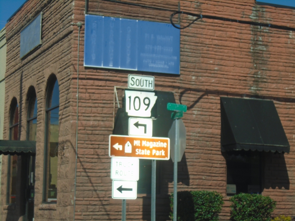
AR-22 West at AR-109/AR-309
AR-22 West at AR-109/AR-309. Turn left on AR-109/AR-309 South to Mount Magazine State Park.
Taken 03-28-2026
Paris
Logan County
Arkansas
United States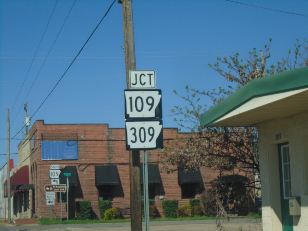
AR-22 West Approaching AR-109/AR-309
AR-22 West approaching AR-109/AR-309 in Paris.
Taken 03-28-2026
Paris
Logan County
Arkansas
United States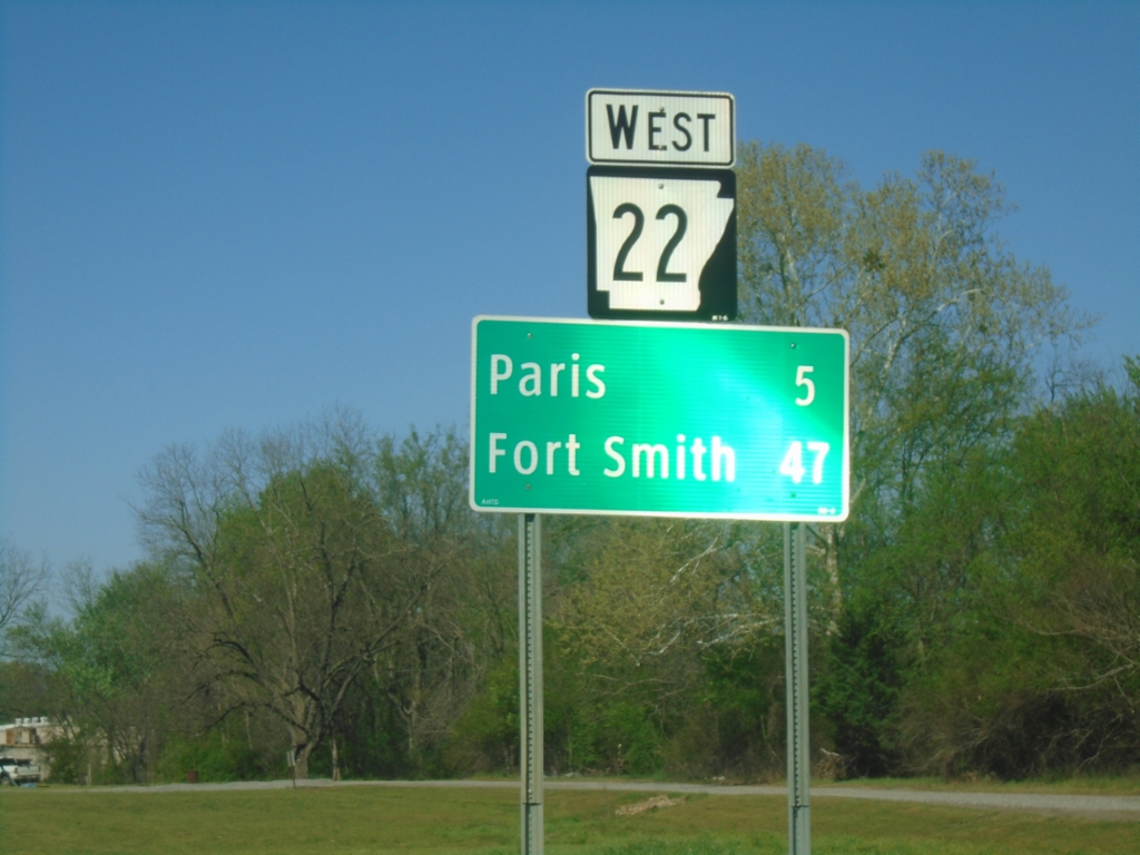
AR-22 West - Distance Marker
Distance marker on AR-22 west. Distance to Paris and Fort Smith.
Taken 03-28-2026
Subiaco
Logan County
Arkansas
United States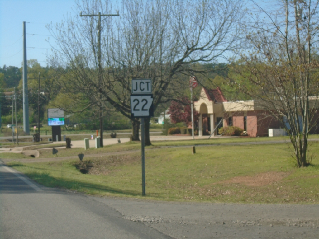
AR-197 West Approaching AR-22
AR-197 West approaching AR-22 in Subiaco.
Taken 03-28-2026
 Subiaco
Logan County
Arkansas
United States
Subiaco
Logan County
Arkansas
United States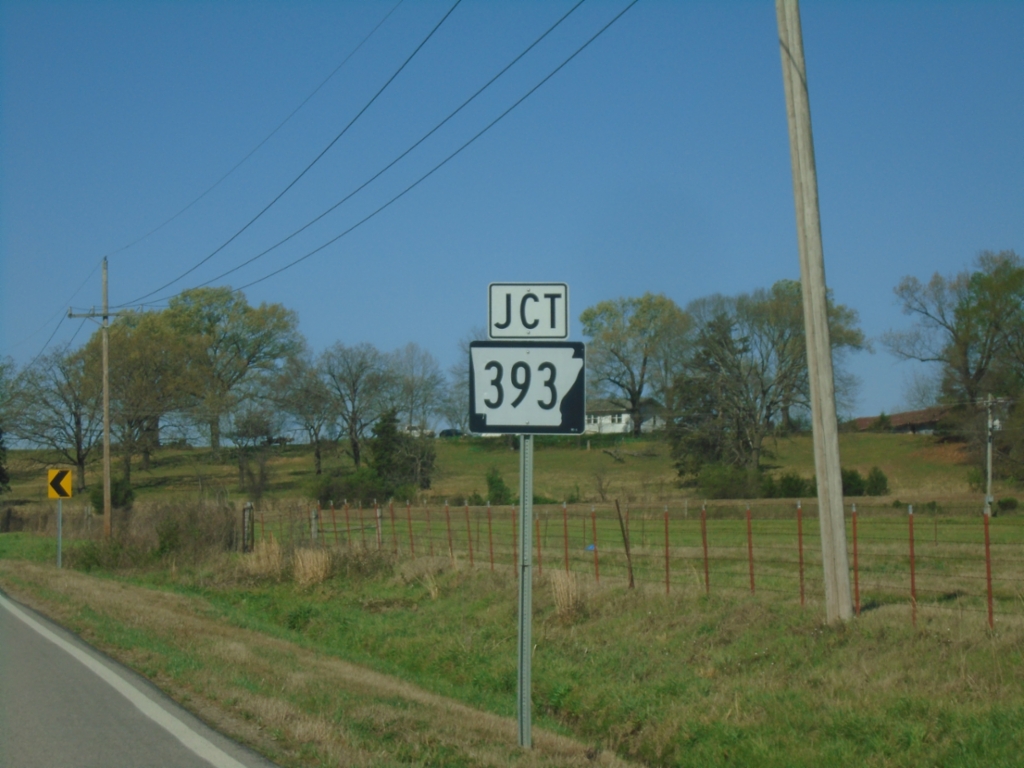
AR-197 West Approaching AR-393
AR-197 West approaching AR-393 in Logan County.
Taken 03-28-2026
 Subiaco
Logan County
Arkansas
United States
Subiaco
Logan County
Arkansas
United States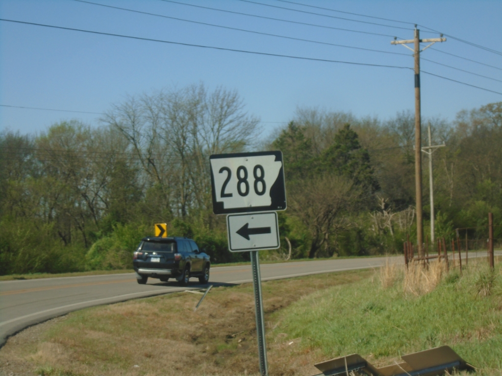
AR-197 West at AR-288
AR-197 West at AR-288 in Logan County.
Taken 03-28-2026
 Subiaco
Logan County
Arkansas
United States
Subiaco
Logan County
Arkansas
United States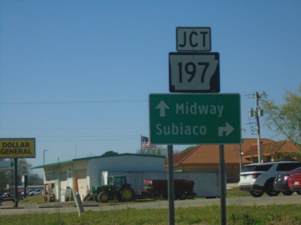
AR-109 South at AR-197
AR-109 South at AR-197 in Scranton. Use AR-197 West to Subiaco. Continue south on AR-109 to Midway.
Taken 03-28-2026
Scranton
Logan County
Arkansas
United States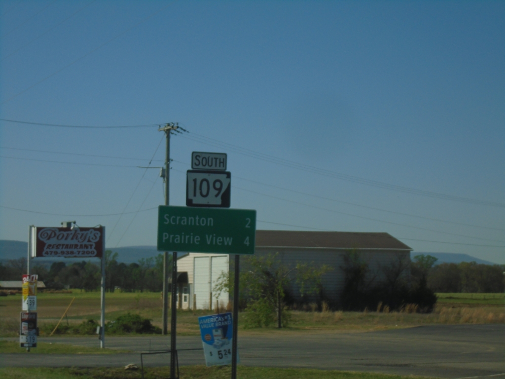
AR-109 South - Distance Marker
Distance marker on AR-109 south. Distance to Scranton and Prairie View.
Taken 03-28-2026
Scranton
Logan County
Arkansas
United States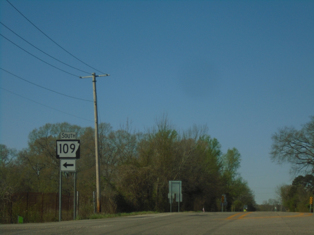
US-64 West at AR-109
US-64 West at AR-109 South in Johnson County.
Taken 03-28-2026
 Clarksville
Johnson County
Arkansas
United States
Clarksville
Johnson County
Arkansas
United States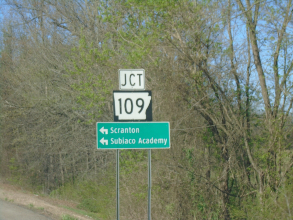
US-64 West Approaching AR-109
US-64 West approaching AR-109 in Johnson County. Use AR-109 South to Scranton and Subiaco Academy.
Taken 03-28-2026
Clarksville
Johnson County
Arkansas
United States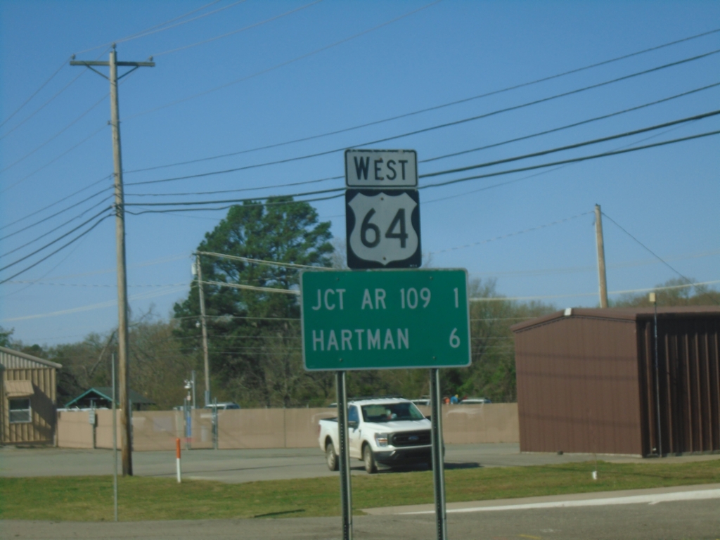
US-64 West - Distance Marker
Distance marker on US-64 West. Distance to Jct. AR-109 and Hartman.
Taken 03-28-2026
Clarksville
Johnson County
Arkansas
United States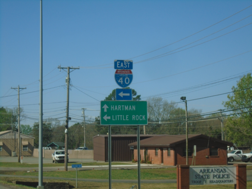
US-64 West at I-40
US-64 West at I-40 in Clarksville. Use I-40 East to Little Rock; continue west on I-64 for Hartman.
Taken 03-28-2026
 Clarksville
Johnson County
Arkansas
United States
Clarksville
Johnson County
Arkansas
United States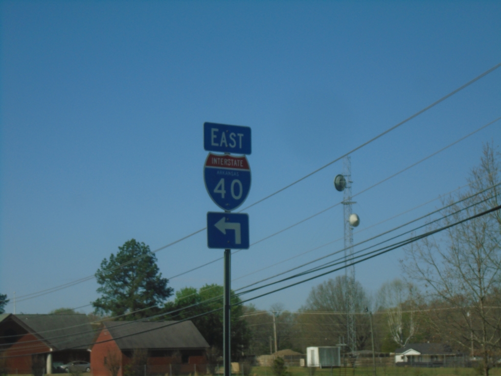
US-64 West at I-40 (Exit 55) East
US-64 West at I-40 (Exit 55) East in Clarksville.
Taken 03-28-2026
Clarksville
Johnson County
Arkansas
United States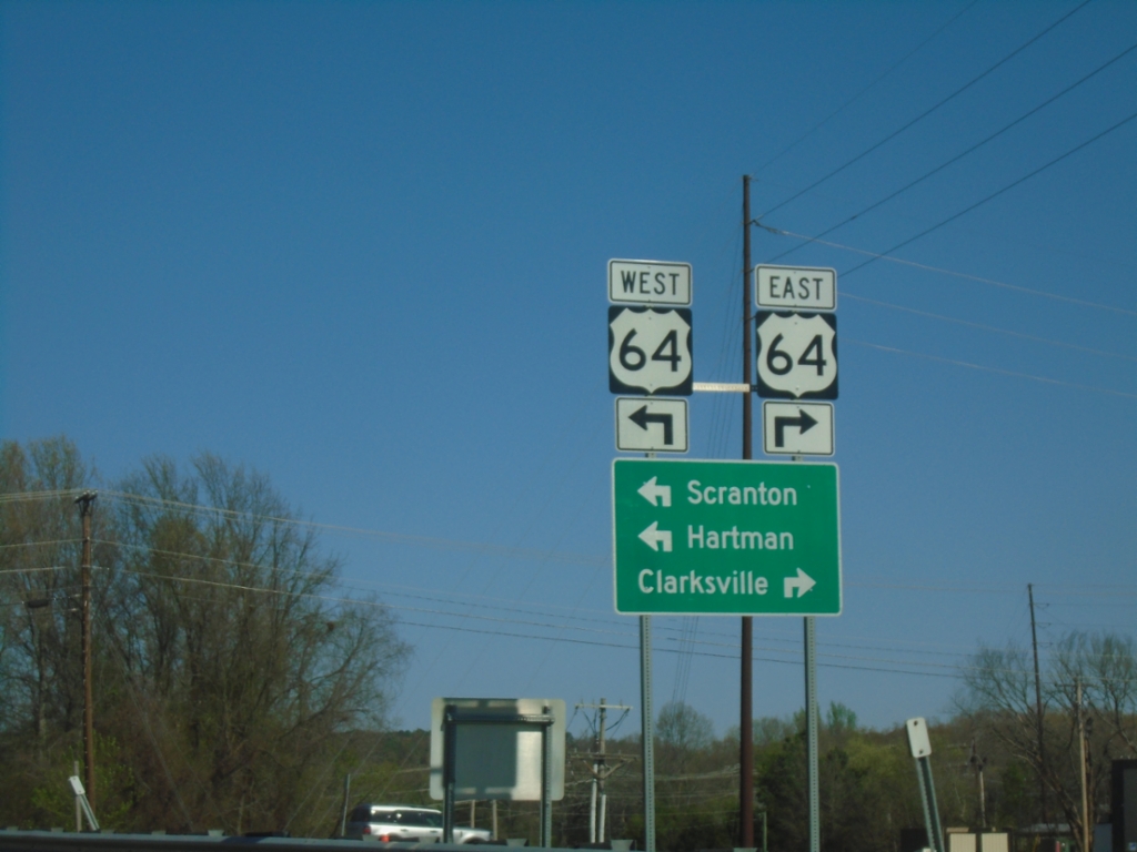
I-40 West (Exit 64) at US-64
I-40 West (Exit 64) at US-64 junction. Use US-64 East to Clarksville; US-64 West to Scranton and Hartman.
Taken 03-28-2026
Clarksville
Johnson County
Arkansas
United States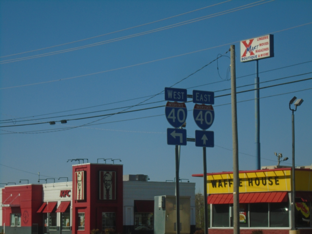
AR-103 South at I-40
AR-103 South at I-40 (Exit 58) in Clarksville.
Taken 03-28-2026
 Clarksville
Johnson County
Arkansas
United States
Clarksville
Johnson County
Arkansas
United States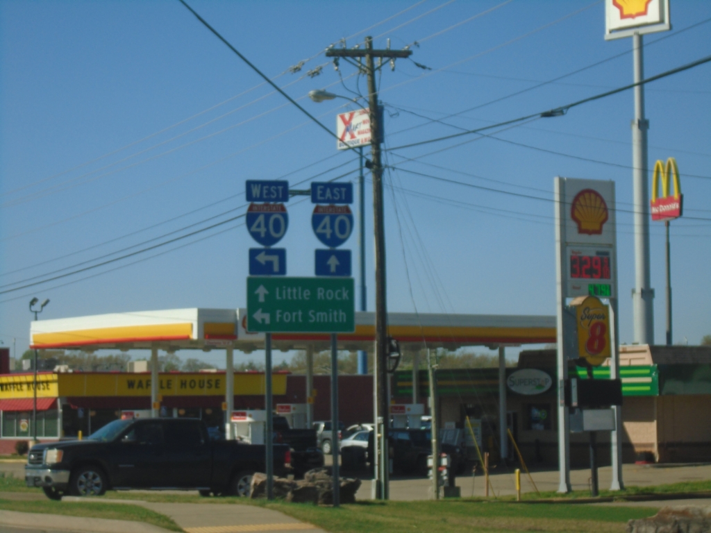
AR-103 South Approaching I-40
AR-103 South approaching I-40 in Clarksville. Use I-40 East to Little Rock; I-40 West to Fort Smith.
Taken 03-28-2026
Clarksville
Johnson County
Arkansas
United States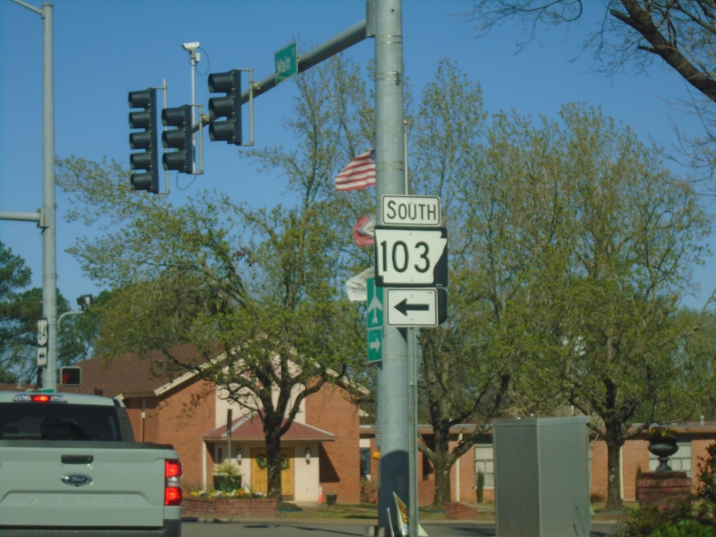
US-64 West at AR-103 - Clarksville
US-64 West (Main St.) at AR-103 (Rogers St.) in Clarksville
Taken 03-28-2026
Clarksville
Johnson County
Arkansas
United States