Signs Tagged With Shield
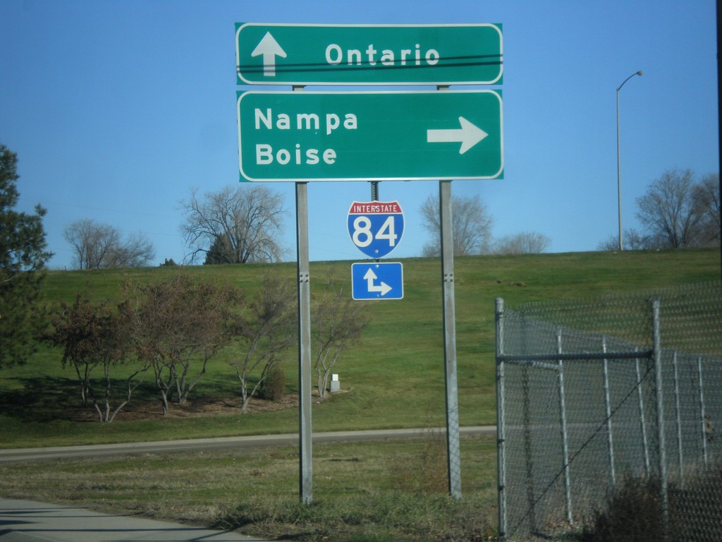
10th St. East at I-84 East
10th St. East at I-84 East (Exit 28). Turn right on I-84 for Nampa and Boise. Continue east on 10th St. for I-84 East to Ontario (Oregon).
Taken 12-14-2014


 Caldwell
Canyon County
Idaho
United States
Caldwell
Canyon County
Idaho
United States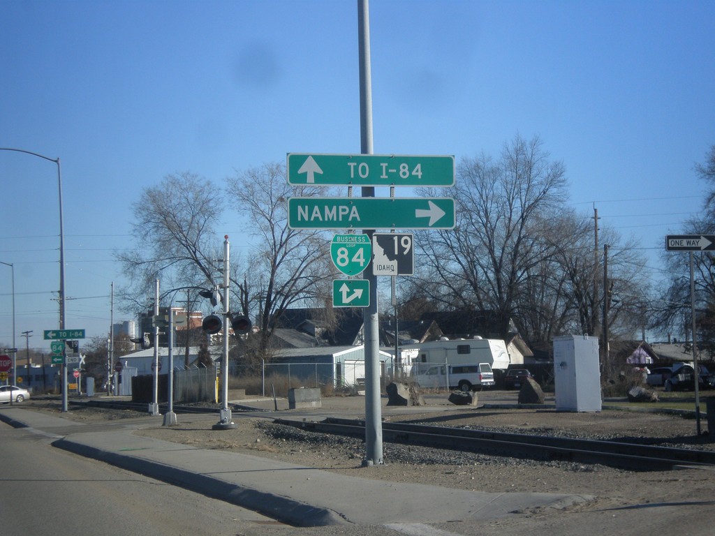
ID-19 East at BL-84
ID-19 east at BL-84 in Caldwell. Merge right for BL-84 (Cleveland Blvd.) east to Nampa. Continue straight for BL-84 West/ID-19 East for I-84.
Taken 12-14-2014

 Caldwell
Canyon County
Idaho
United States
Caldwell
Canyon County
Idaho
United States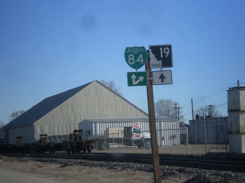
ID-19 East Approaching BL-84
ID-19 East Approaching BL-84 (Cleveland Blvd.) in Caldwell.
Taken 12-14-2014
Caldwell
Canyon County
Idaho
United States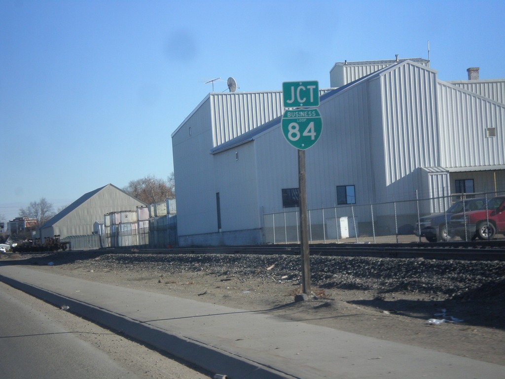
ID-19 East Approaching BL-84
ID-19 east approaching BL-84 in Caldwell.
Taken 12-14-2014
Caldwell
Canyon County
Idaho
United States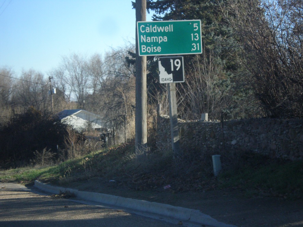
ID-19 East - Distance Marker
Distance marker on ID-19 east. Distance to Caldwell, Nampa, and Boise.
Taken 12-14-2014
Greenleaf
Canyon County
Idaho
United States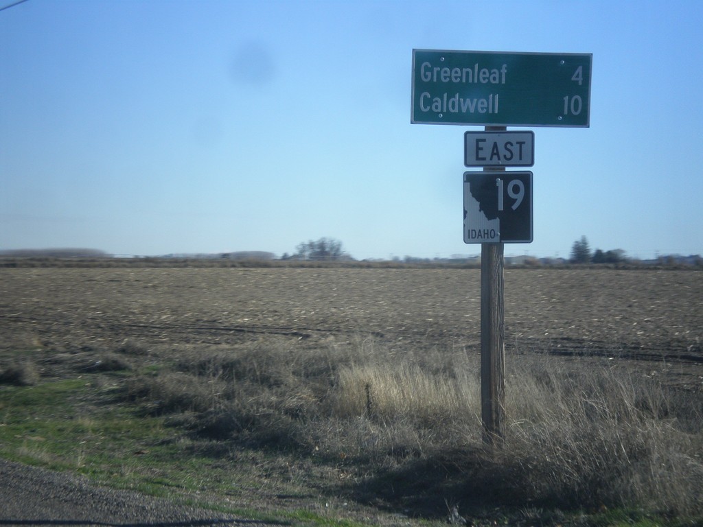
ID-19 East - Distance Marker
Distance marker on ID-19 east. Distance to Greenleaf and Caldwell.
Taken 12-14-2014
Wilder
Canyon County
Idaho
United States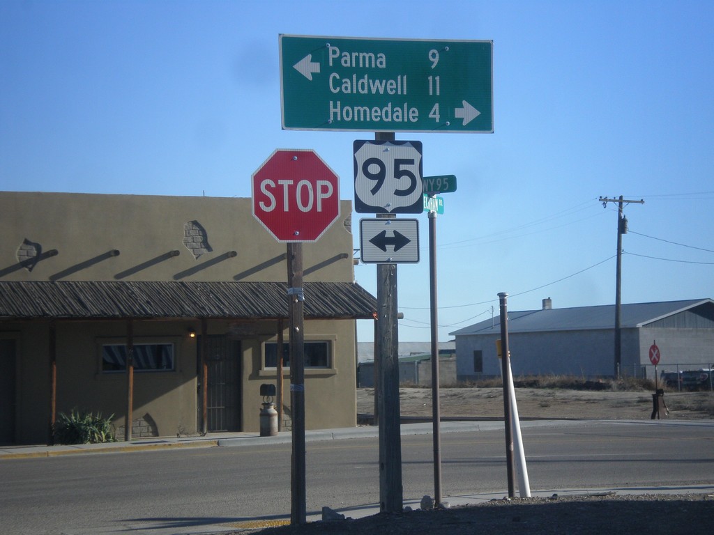
Golden Gate Ave. East at US-95
Golden Gate Ave. East at US-95 in Wilder. Turn right on US-95 south for Caldwell and Homedale. Turn left on US-95 north for Parma.
Taken 12-14-2014
 Wilder
Canyon County
Idaho
United States
Wilder
Canyon County
Idaho
United States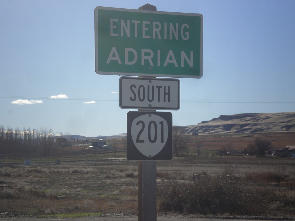
OR-201 South - Adrian
Entering Adrian on OR-201 south.
Taken 12-14-2014
 Nyssa
Malheur County
Oregon
United States
Nyssa
Malheur County
Oregon
United States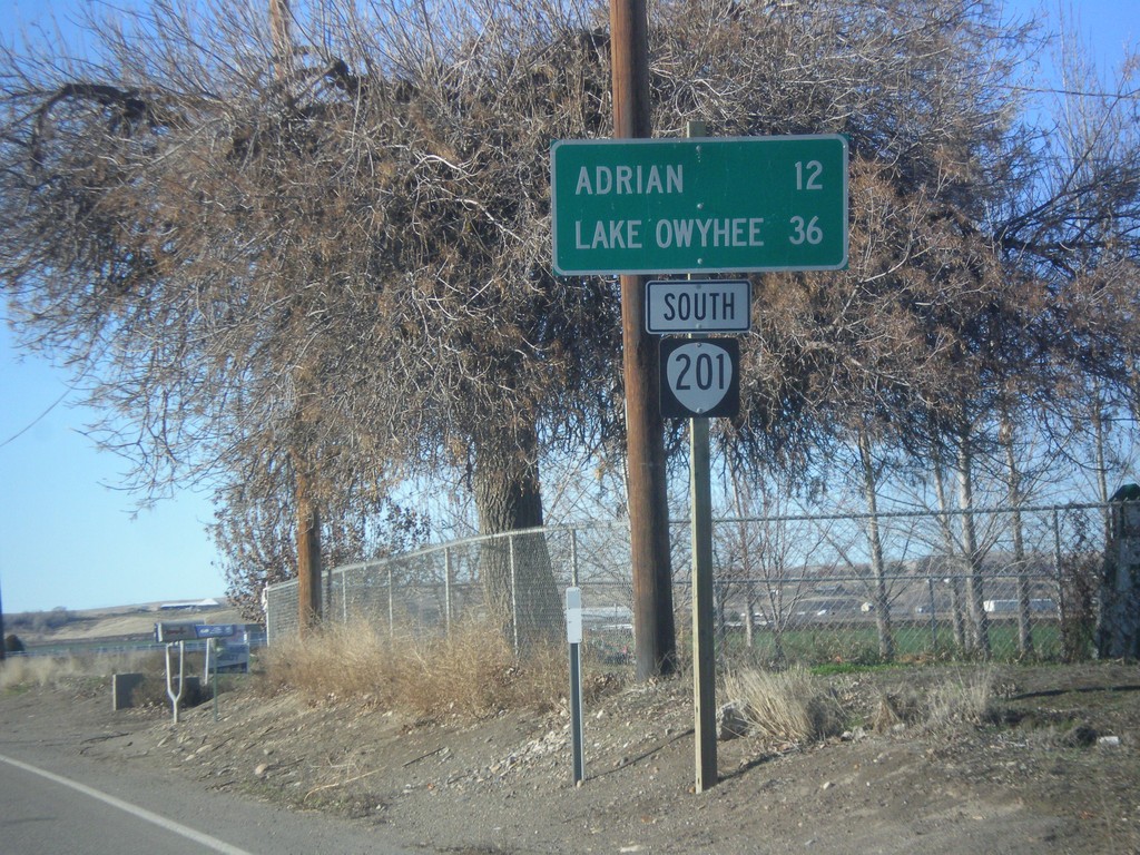
OR-201 South - Distance Marker
Distance marker on OR-201 south. Distance to Adrian and Lake Owyhee.
Taken 12-14-2014
Nyssa
Malheur County
Oregon
United States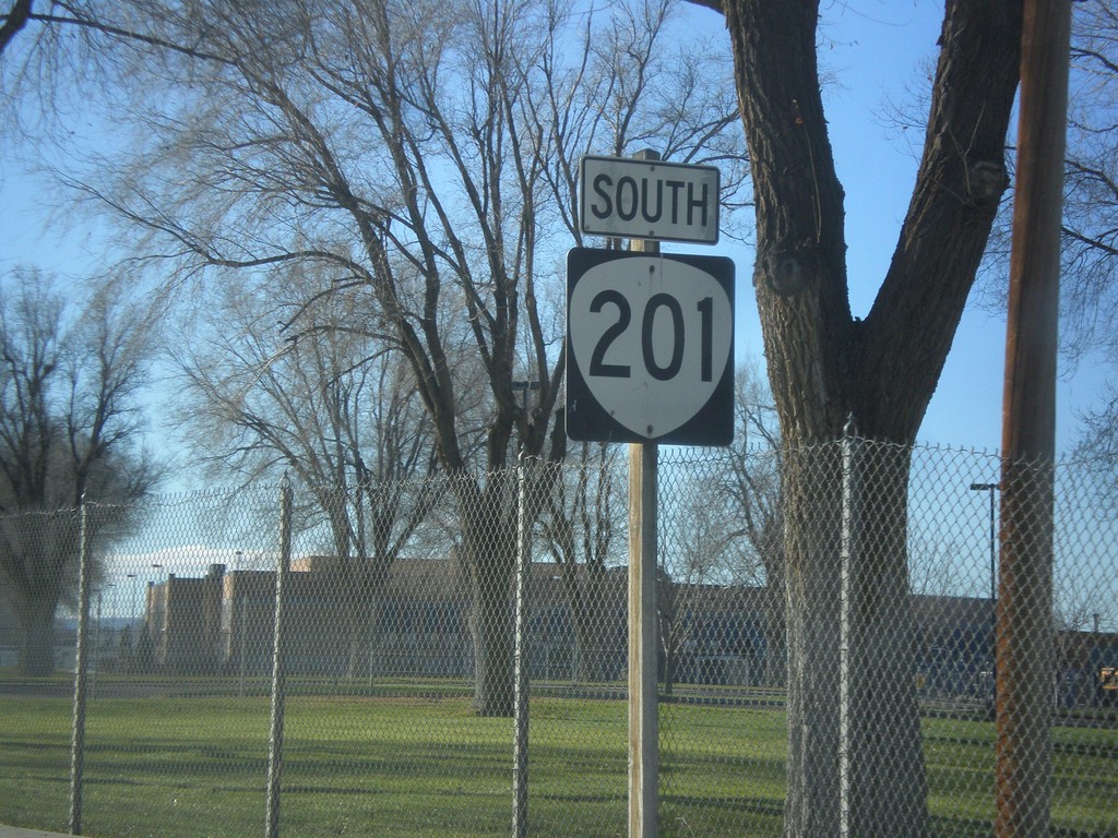
OR-201 South - Nyssa
OR-201 south in Nyssa.
Taken 12-14-2014
Nyssa
Malheur County
Oregon
United States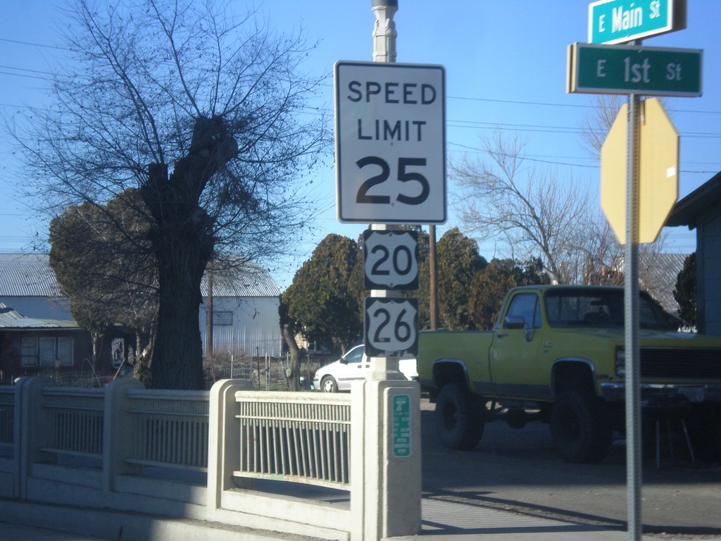
US-20/US-26 West - Nyssa
US-20/US-26 West in Nyssa. This is the first US-20/US-26 shields westbound in Oregon. In the last few years, standard Speed Limit signs have been appearing in Oregon. Normally, Oregon Speed Limit signs omit the word limit, and have larger numbers.
Taken 12-14-2014
Nyssa
Malheur County
Oregon
United States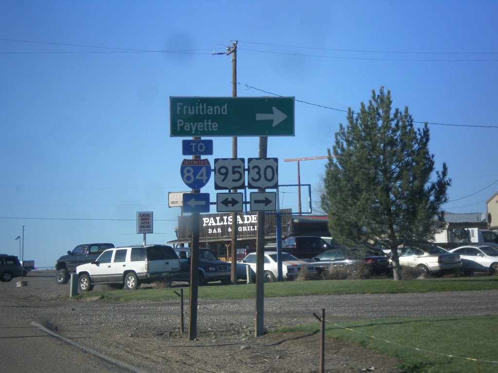
US-30 West at US-95
US-30 west at US-95. Turn right on US-95 north for Fruitland and Payette. Turn left on US-95 south for I-84. US-30 follows US-95 north to Fruitland.
Taken 12-14-2014
Fruitland
Payette County
Idaho
United States
End ID-72 West at US-30
End ID-72 west at US-30 in Payette County. Use US-30 west for I-84.
Taken 12-14-2014
 New Plymouth
Payette County
Idaho
United States
New Plymouth
Payette County
Idaho
United States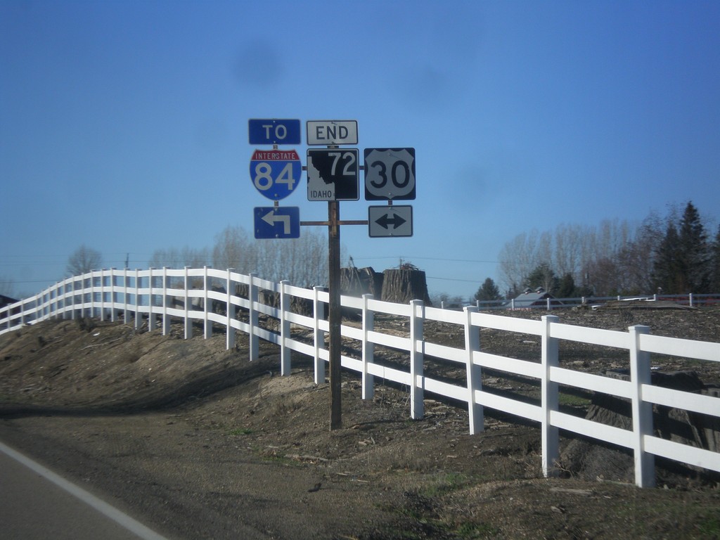
End ID-72 Approaching US-30
End ID-72 approaching US-30 in Payette County.
Taken 12-14-2014
New Plymouth
Payette County
Idaho
United States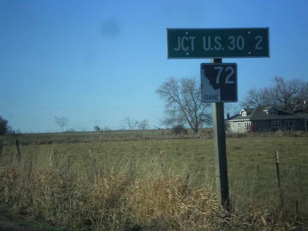
ID-72 West - Distance Marker
Distance marker on ID-72 west. Distance to US-30.
Taken 12-14-2014
New Plymouth
Payette County
Idaho
United States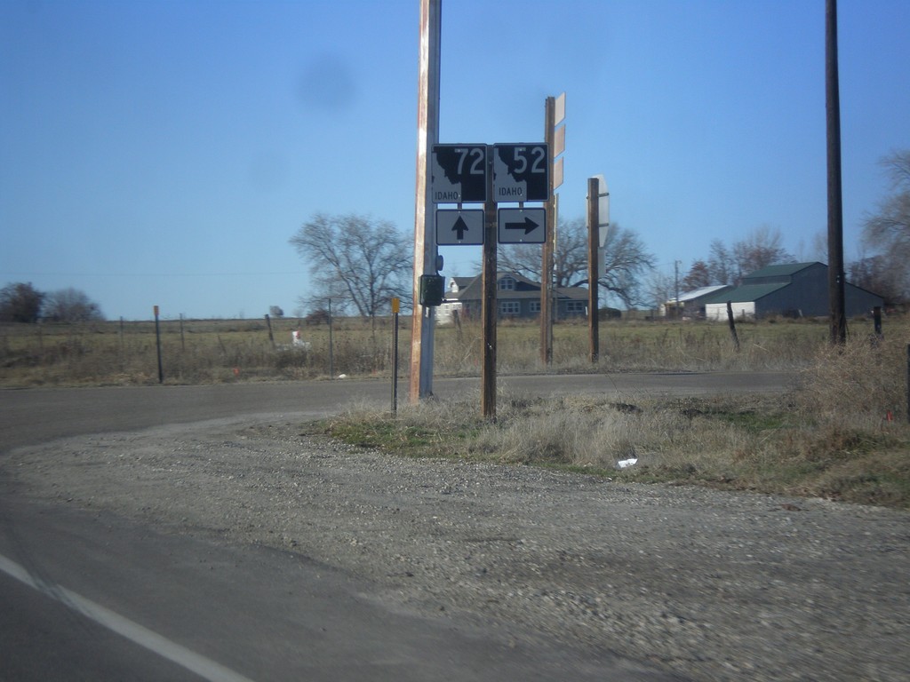
ID-52 West at ID-72
ID-52 West at ID-72 west in Payette County. Turn right to continue west on ID-52. Continue straight for ID-72 west.
Taken 12-14-2014
 New Plymouth
Payette County
Idaho
United States
New Plymouth
Payette County
Idaho
United States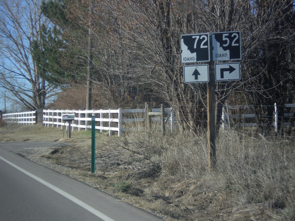
ID-52 West Approaching ID-72
ID-52 west approaching ID-72 west in Payette County.
Taken 12-14-2014
New Plymouth
Payette County
Idaho
United States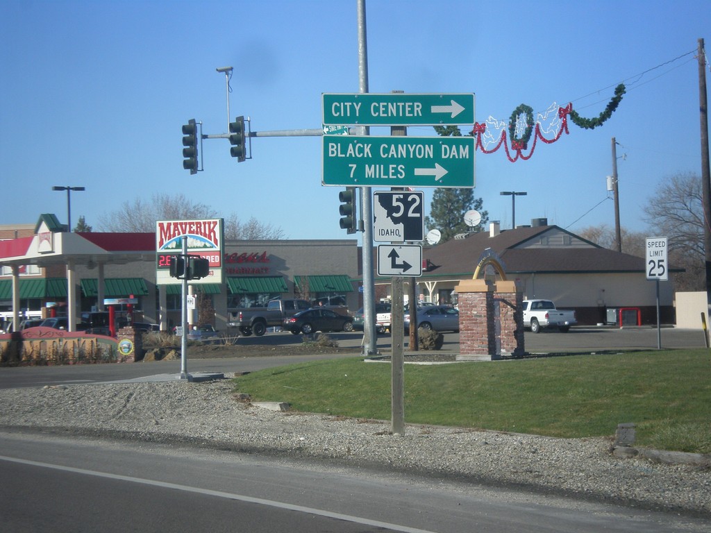
End ID-16 North at ID-52
End ID-16 north at ID-52. Turn right on ID-52 west for (Emmett) City Center and Black Canyon Dam.
Taken 12-14-2014
 Emmett
Gem County
Idaho
United States
Emmett
Gem County
Idaho
United States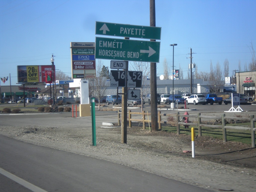
End ID-16 North at ID-52
End ID-16 north at ID-52. Turn right on ID-52 east for Emmett and Horseshoe Bend. Continue straight for ID-52 west to Payette.
Taken 12-14-2014
Emmett
Gem County
Idaho
United States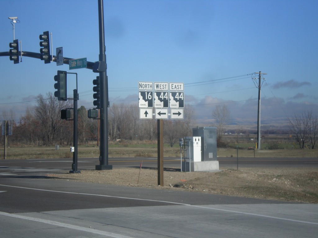
ID-16 North at ID-44
ID-16 north at ID-44 (State St.) in Ada County.
Taken 12-14-2014
 Eagle
Ada County
Idaho
United States
Eagle
Ada County
Idaho
United States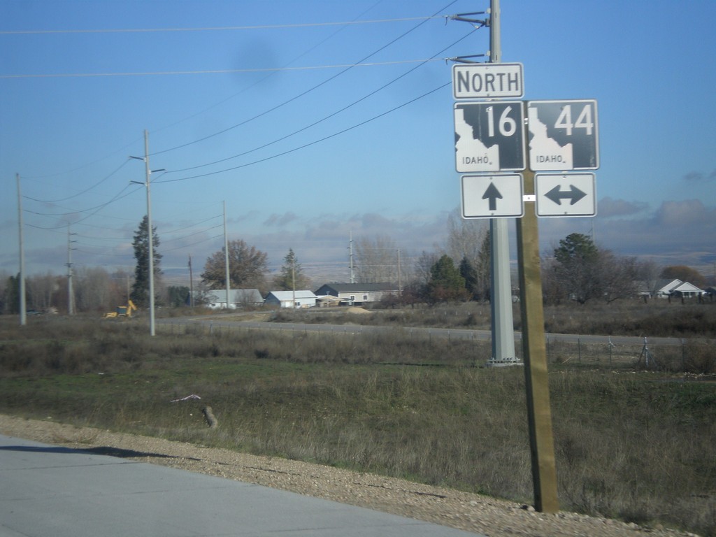
ID-16 North Approaching ID-44
ID-16 north approaching ID-44 in Ada County.
Taken 12-14-2014
Meridian
Ada County
Idaho
United States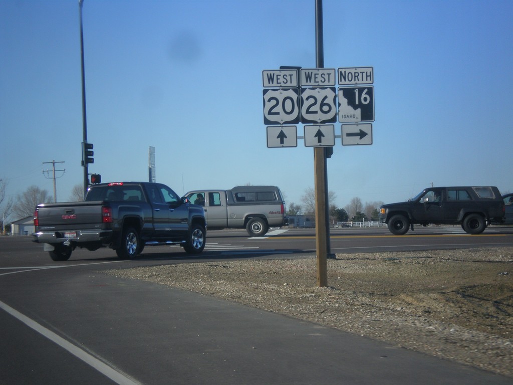
US-20/US-26 West at ID-16
US-20/US-26 West at ID-16. ID-16 between ID-44 and US-20/US-26 is the newly constructed Central Valley Expressway. Eventually ID-16 will connect to I-84 as a freeway.
Taken 12-14-2014
Meridian
Ada County
Idaho
United States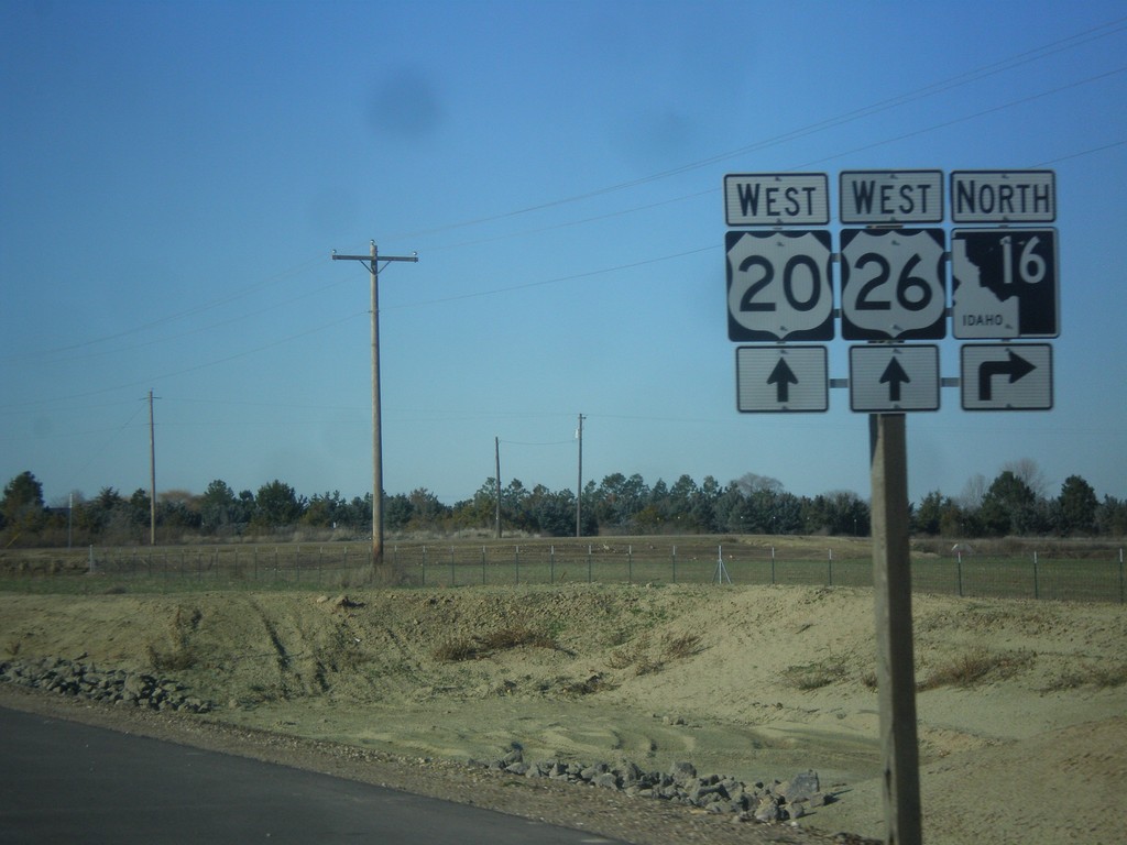
US-20/US-26 West Approaching ID-16
US-20/US-26 West approaching ID-16 in Ada County.
Taken 12-14-2014
Meridian
Ada County
Idaho
United States
US-20/US-26 West Approaching ID-16
US-20/US-26 West approaching ID-16. ID-16 was recently extended from ID-44 (State St.) to US-20/US-26 (Chinden Blvd.) in July of 2014.
Taken 12-14-2014
Meridian
Ada County
Idaho
United States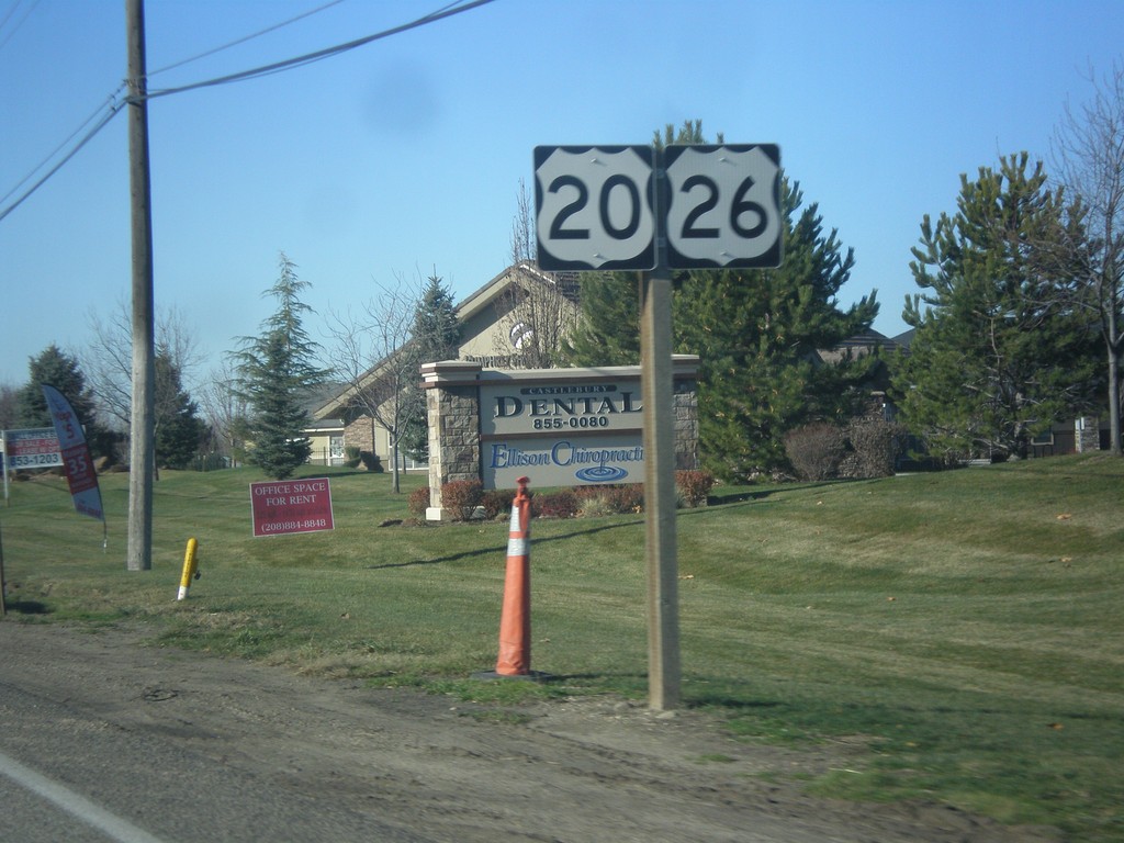
US-20/US-26 West - Boise
US-20/US-26 (Chinden Blvd.) West in Boise, just west of Eagle Road.
Taken 12-14-2014
Boise
Ada County
Idaho
United States