Signs Tagged With Shield
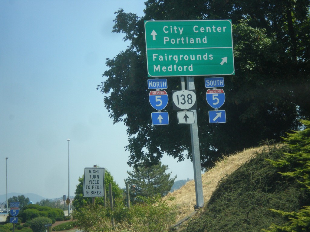
Harvard Ave. East at I-5 and OR-138
Harvard Ave. East at I-5 and OR-138. Turn right for I-5 south for Fairgrounds and Medford. Straight for I-5 North/OR-138 West to Portland; and straight for OR-138 East to City Center.
Taken 08-17-2015

 Roseburg
Douglas County
Oregon
United States
Roseburg
Douglas County
Oregon
United States
Harvard Ave. East Approaching I-5/OR-138
Harvard Ave. East approaching I-5/OR-138 in Roseburg.
Taken 08-17-2015
Roseburg
Douglas County
Oregon
United States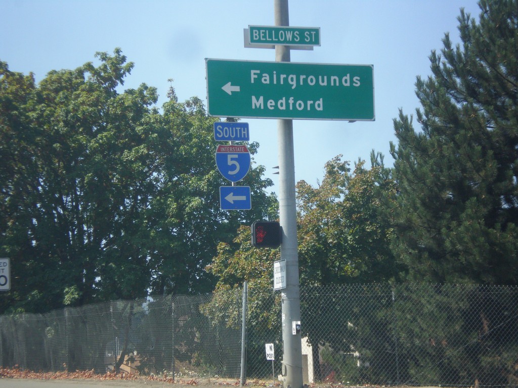
OR-138 West at I-5 South
OR-138 West at I-5 South to Fairgrounds and Medford.
Taken 08-17-2015
Roseburg
Douglas County
Oregon
United States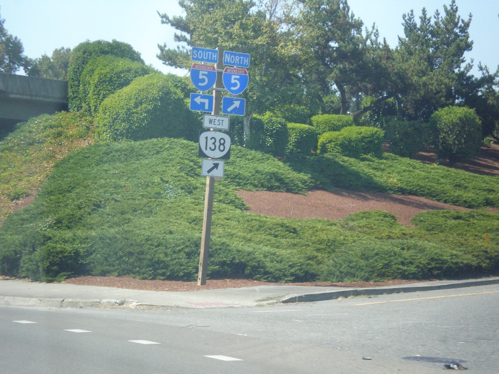
OR-138 West at I-5 Junction
OR-138 West at I-5 junction. OR-138 west joins I-5 northbound.
Taken 08-17-2015
Roseburg
Douglas County
Oregon
United States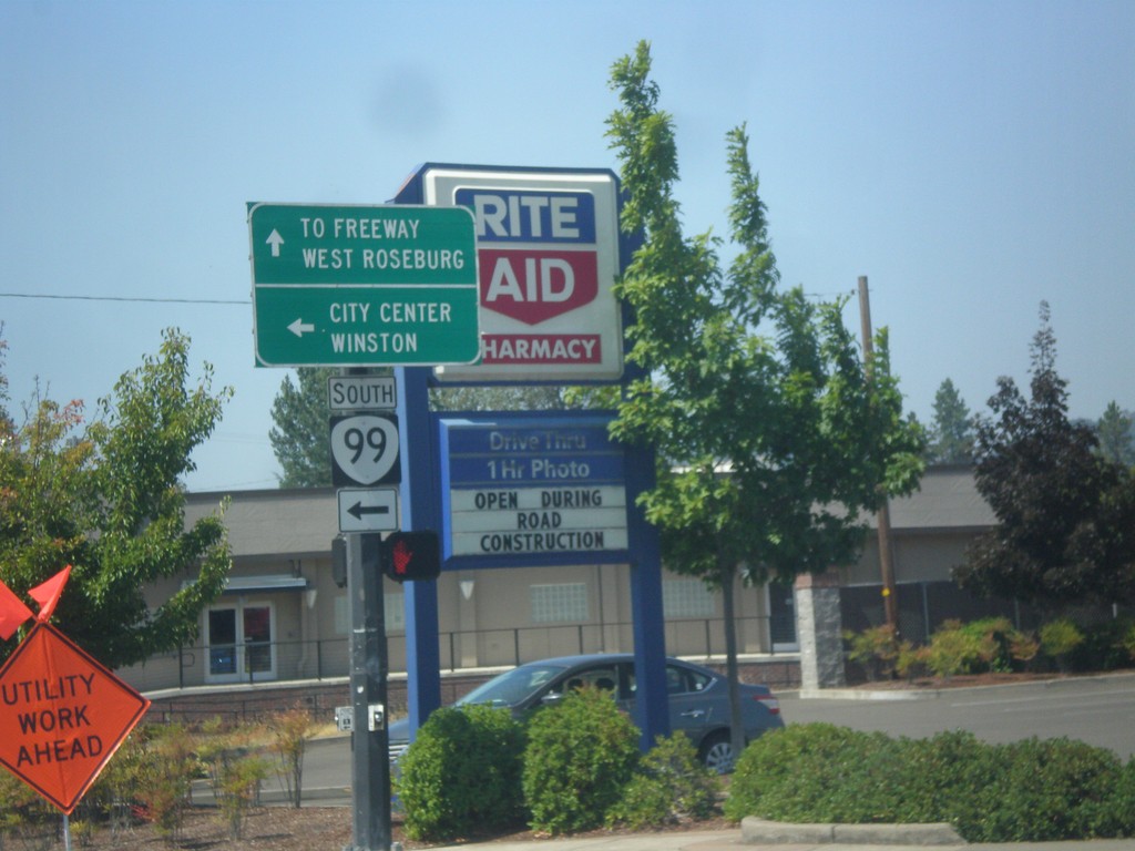
OR-138 West at OR-99 South
OR-138 West (Washington St.) at OR-99 South in Roseburg. Continue straight for OR-138 west to Freeway (I-5) and West Roseburg. Turn left for OR-99 south to City Center and Winston.
Taken 08-17-2015
 Roseburg
Douglas County
Oregon
United States
Roseburg
Douglas County
Oregon
United States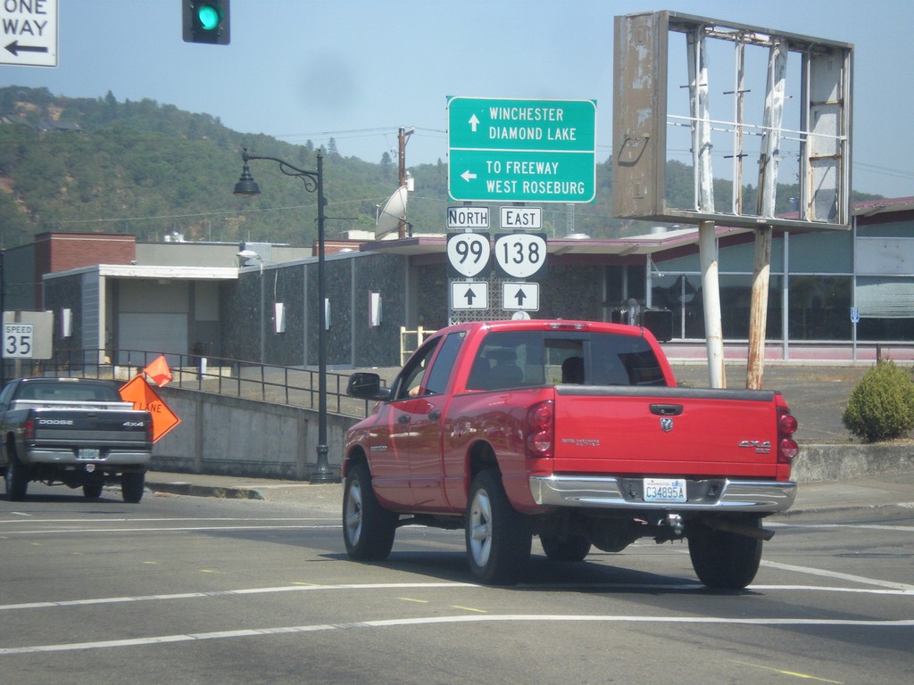
OR-99 North at OR-138
OR-99 North at OR-138 West (Washington Ave.). Continue straight for OR-99 North/OR-138 East to Diamond Lake and Winchester. Turn left for OR-138 west to Freeway (I-5) and West Roseburg.
Taken 08-17-2015
Roseburg
Douglas County
Oregon
United States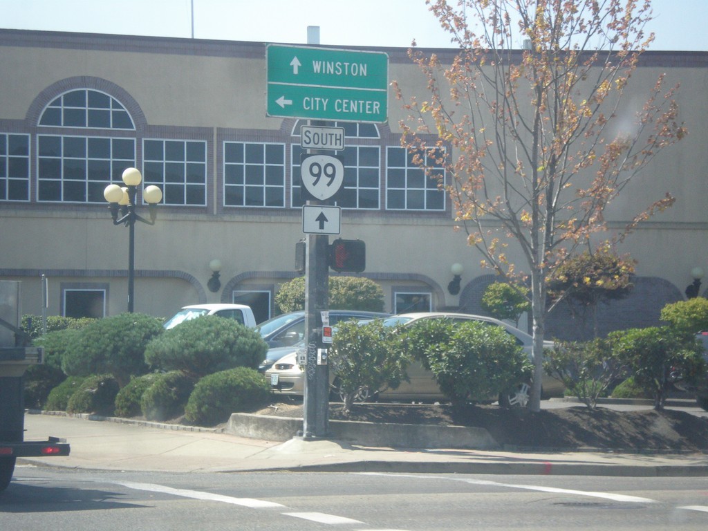
OR-99 South at Oak Ave.
OR-99 South at Oak Ave. Turn left on Oak Ave. for City Center. Continue south on OR-99 for Winston.
Taken 08-17-2015
Roseburg
Douglas County
Oregon
United States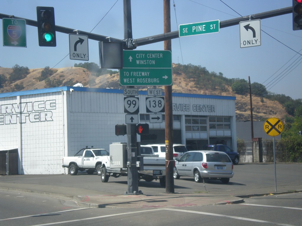
OR-99 South/OR-138 West at OR-99/OR-138 Split
OR-99 South/OR-138 West at OR-99/OR-138 Split. Turn right for OR-138 West (Pine St.) to Freeway (I-5) and West Roseburg. Continue south on OR-99 (Stephen St.) for City Center and Winston.
Taken 08-17-2015
Roseburg
Douglas County
Oregon
United States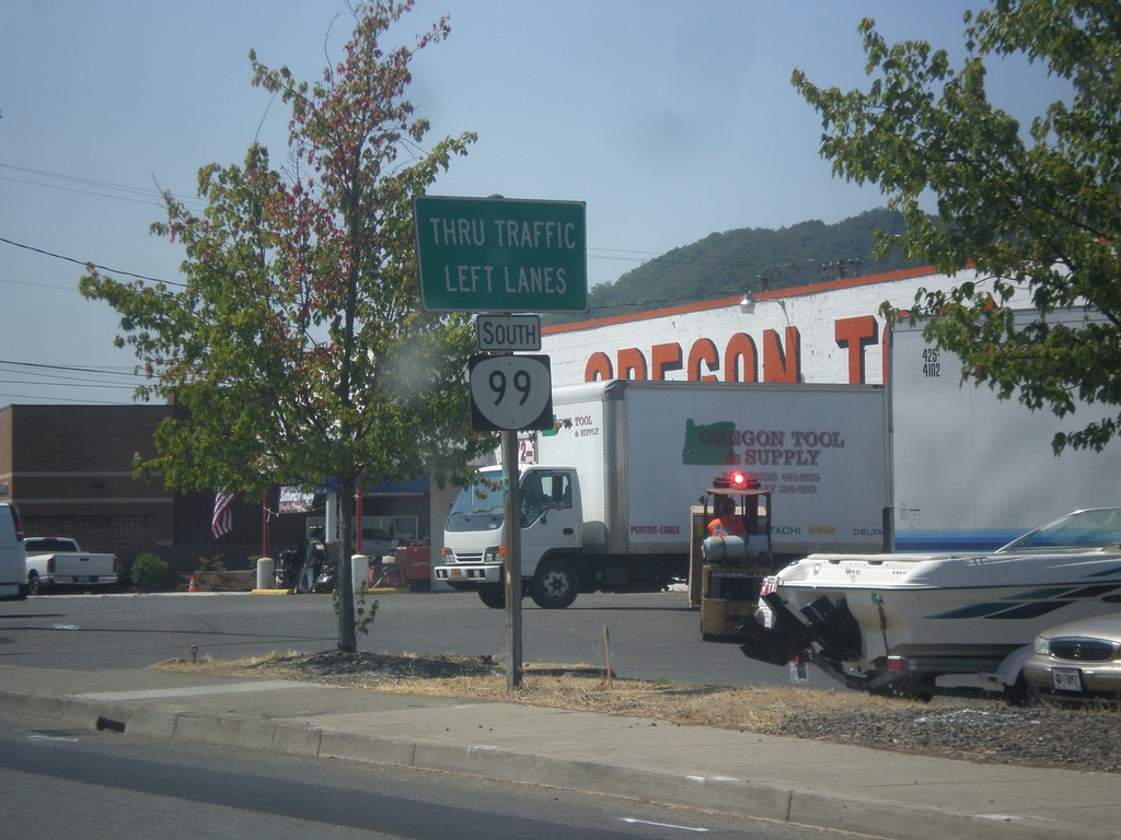
OR-99 South/OR-138 West Approaching OR-99/OR-138 Split
OR-99 South/OR-138 West approaching OR-99/OR-138 split. Use left lanes to continue south on OR-99 (Stephens St.)
Taken 08-17-2015
Roseburg
Douglas County
Oregon
United States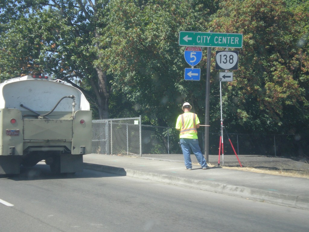
OR-138 West Approaching OR-99 In Roseburg
OR-138 West (Diamond Lake Blvd.) approaching OR-99 (Stephens St.) in Roseburg. Turn left to continue west on OR-138 and for access to I-5 and the Roseburg City Center. OR-138 joins OR-99 for a few blocks into Roseburg.
Taken 08-17-2015
Roseburg
Douglas County
Oregon
United States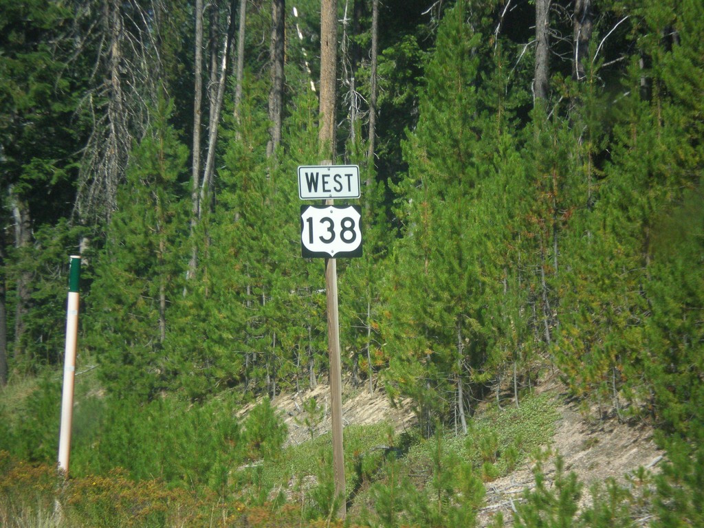
Incorrect OR-138 West Shield
Incorrect OR-138 shield displayed as a US highway marker. Taken between Lemolo Lake and Clearwater Falls.
Taken 08-17-2015
Diamond Lake
Douglas County
Oregon
United States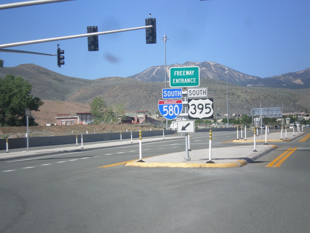
NV-431 East at I-580/US-395 South Freeway Entrance
NV-431 East at I-580/US-395 South Freeway Entrance.
Taken 06-15-2015


 Reno
Washoe County
Nevada
United States
Reno
Washoe County
Nevada
United States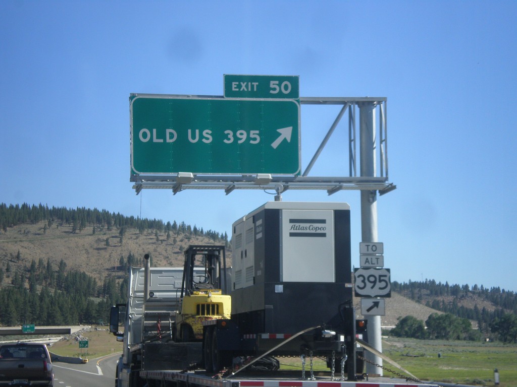
I-580/US-395 North - Exit 50
I-580/US-395 North at Exit 50 - Old US 395. Use Exit 50 for Alt. US-395.
Taken 06-15-2015
 New Washoe City
Washoe County
Nevada
United States
New Washoe City
Washoe County
Nevada
United States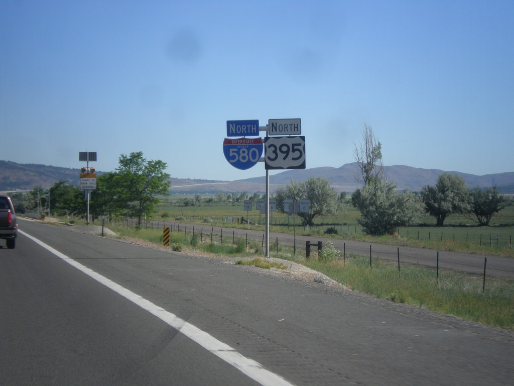
I-580 North/US-395 North - Washoe County
I-580 North/US-395 North in Washoe County.
Taken 06-15-2015
New Washoe City
Washoe County
Nevada
United States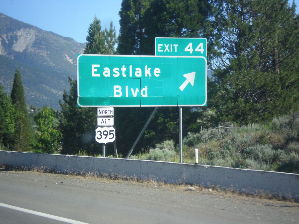
I-580/US-395 North - Exit 44
I-580/US-395 North at Exit 44 - Alt. US-395 North/Eastlake Blvd. Alt. US-395 north was created when the new I-580 freeway was completed. Alt. US-395 follows the old route of US-395 to Reno.
Taken 06-15-2015
Carson City
Washoe County
Nevada
United States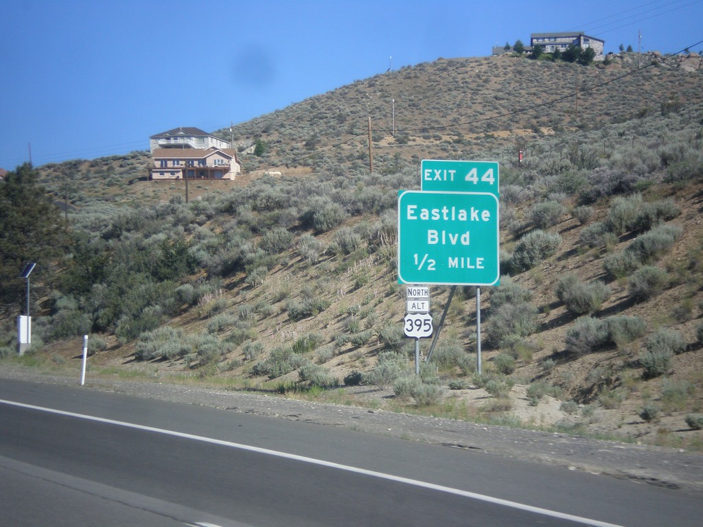
I-580/US-395 North - Exit 44
I-580/US-395 North approaching Exit 44 - Alt. US-395 North/Eastlake Blvd.
Taken 06-15-2015
Carson City
Nevada
United States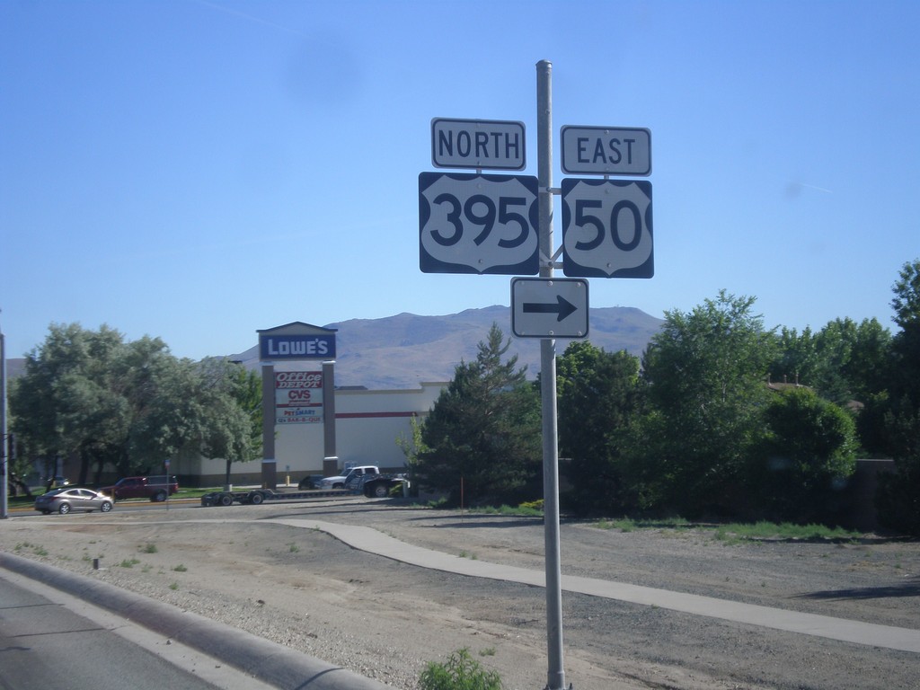
US-395 North/US-50 East at Bus. US-395 and Fairview Ave.
US-395 North/US-50 East at Bus. US-395 and Fairview Ave in Carson City. Turn right to continue on US-395 North/US-50 East. Keep straight on Carson St. for Bus. US-395.
Taken 06-15-2015

 Carson City
Nevada
United States
Carson City
Nevada
United States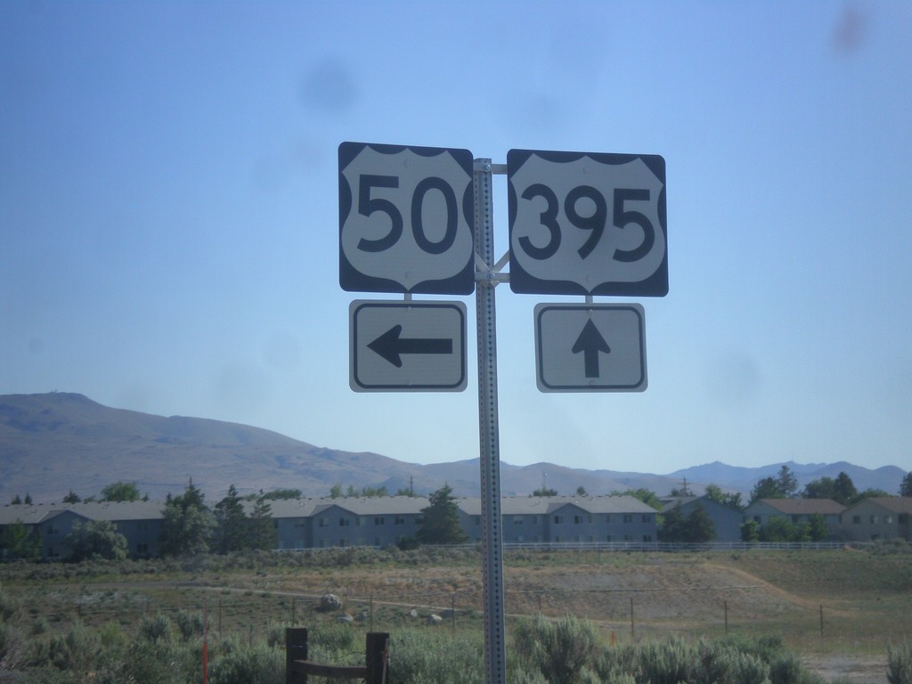
US-395 North at US-50
US-395 north at US-50 in Carson City. US-50 East joins US-395 North to Fairview Ave.
Taken 06-15-2015
Carson City
Nevada
United States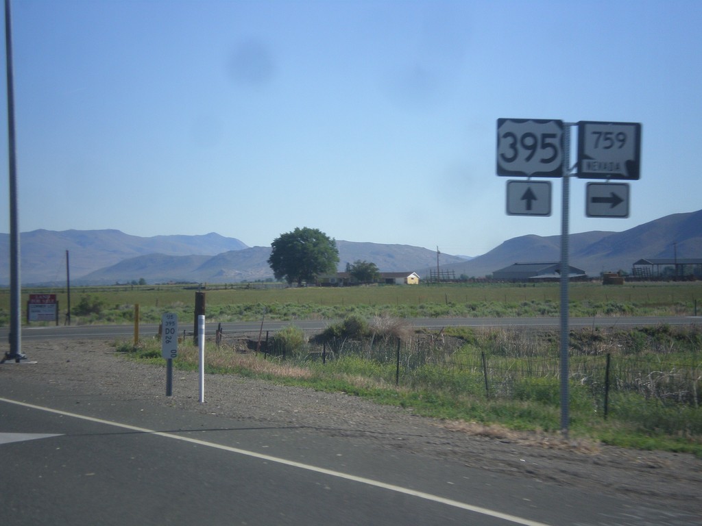
US-395 North at NV-759
US-395 north at NV-759 East (Airport Road).
Taken 06-15-2015
 Minden
Douglas County
Nevada
United States
Minden
Douglas County
Nevada
United States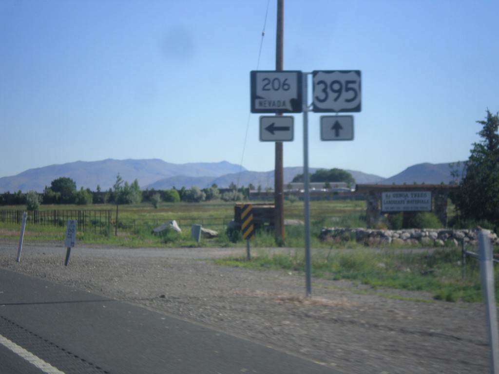
US-395 North at NV-206
US-395 North at NV-206 (Genoa Lane) jct.
Taken 06-15-2015
 Minden
Douglas County
Nevada
United States
Minden
Douglas County
Nevada
United States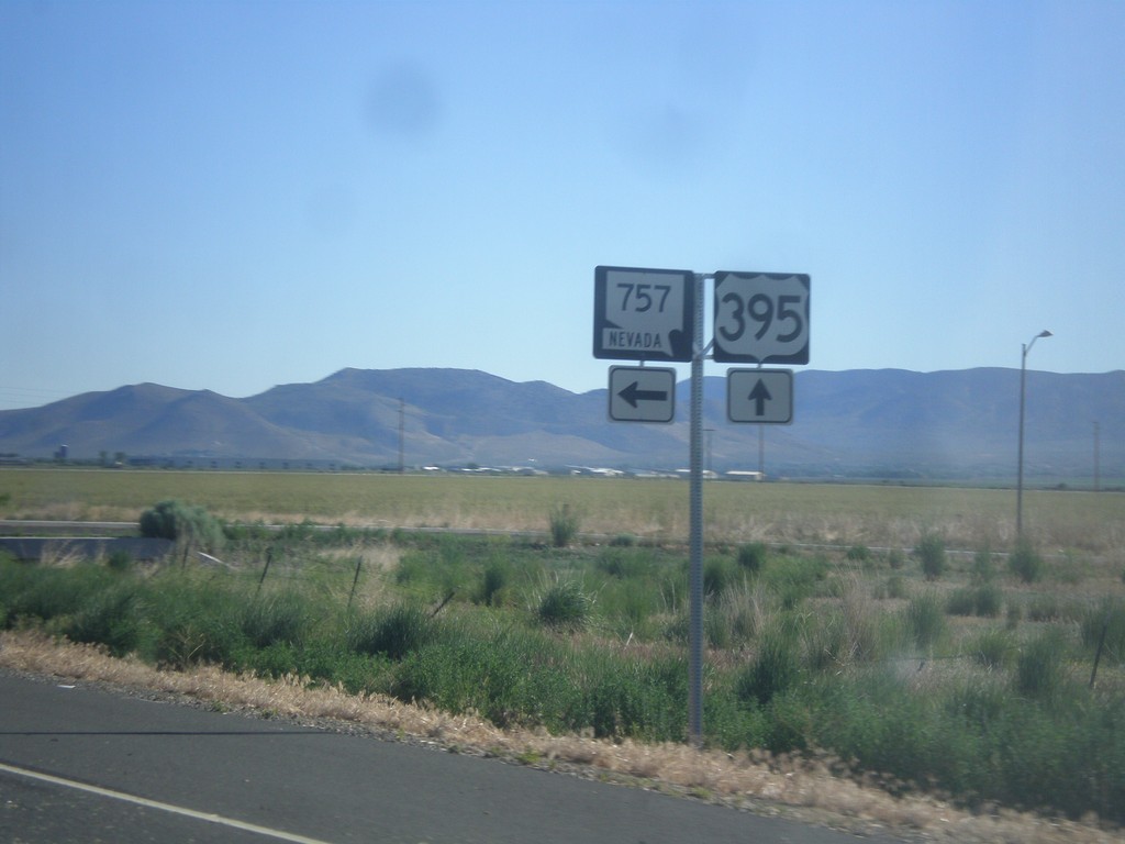
US-395 North at NV-757
US-395 north at NV-757 west.
Taken 06-15-2015
 Minden
Douglas County
Nevada
United States
Minden
Douglas County
Nevada
United States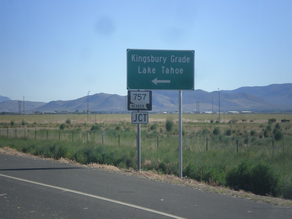
US-395 North Approaching NV-757
US-395 North approaching NV-757 west to Kingsbury Grade and Lake Tahoe.
Taken 06-15-2015
Minden
Douglas County
Nevada
United States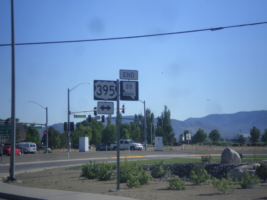
End NV-88 North at US-395
End NV-88 at US-395 in Minden.
Taken 06-15-2015
 Minden
Douglas County
Nevada
United States
Minden
Douglas County
Nevada
United States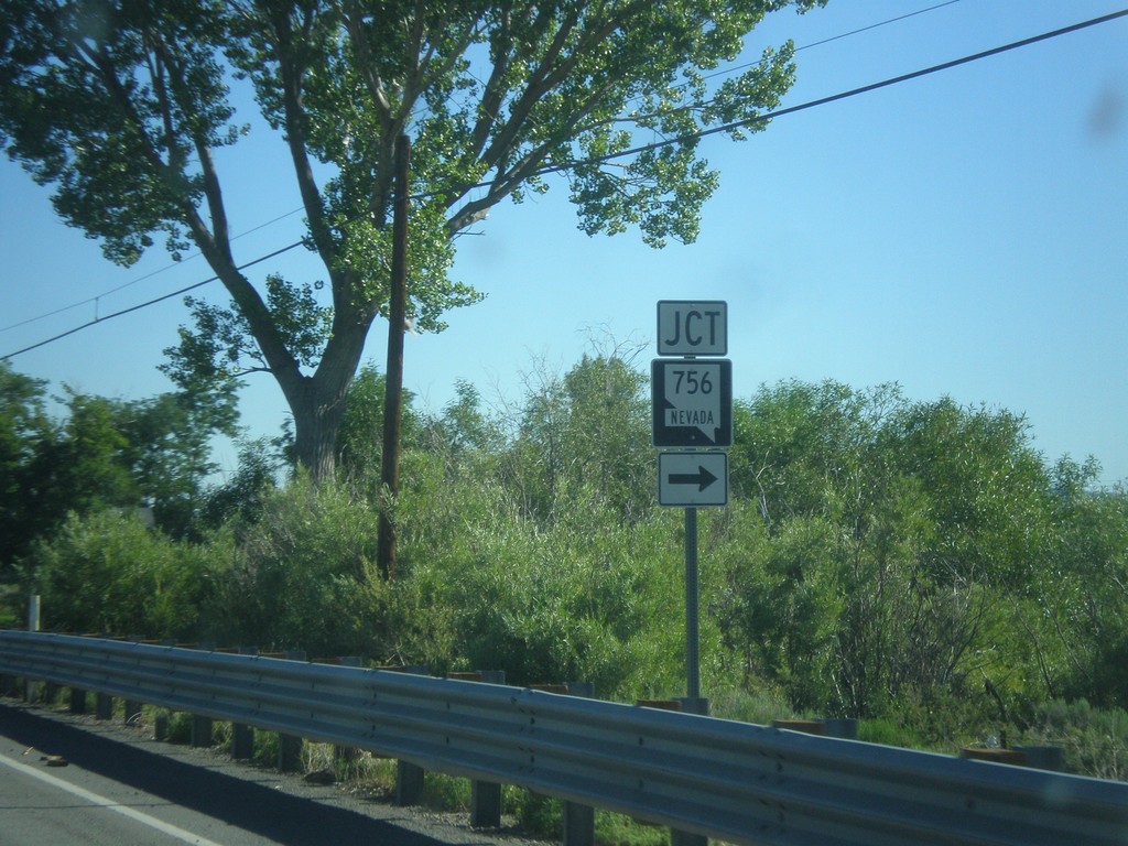
NV-88 North at NV-756
NV-88 north at NV-756 (Centerville Lane) in Gardnerville.
Taken 06-15-2015
 Gardnerville
Douglas County
Nevada
United States
Gardnerville
Douglas County
Nevada
United States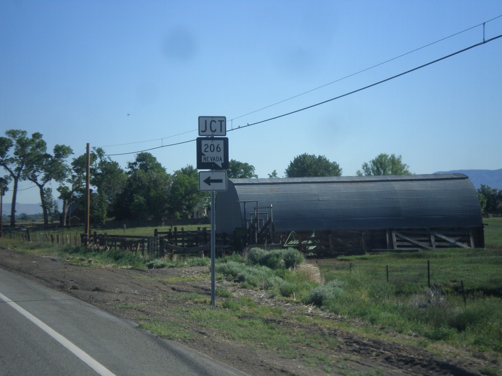
NV-88 North Approaching NV-206
NV-88 North approaching NV-206 in Douglas County.
Taken 06-15-2015
Gardnerville
Douglas County
Nevada
United States