Signs Tagged With Shield
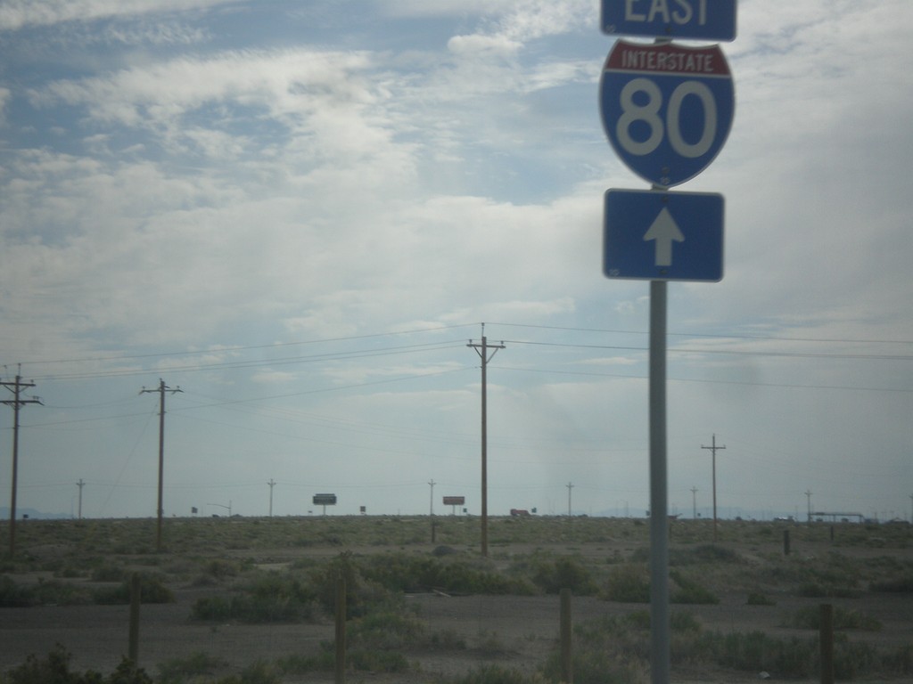
BL-80/UT-58 East at I-80
BL-80/UT-58 East at I-80 east onramp. This is the eastern end of the Wendover business loop.
Taken 06-20-2014


 Wendover
Tooele County
Utah
United States
Wendover
Tooele County
Utah
United States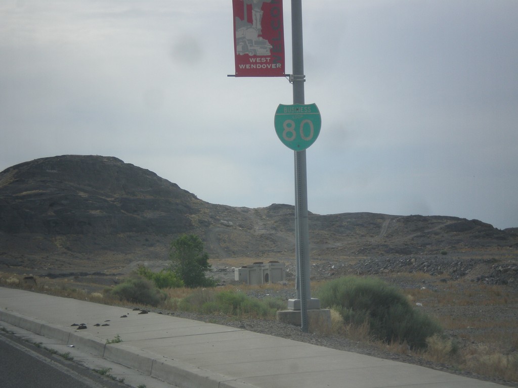
BL-80 East - West Wendover
BL-80 east shield along Wendover Blvd. in West Wendover.
Taken 06-20-2014
West Wendover
Elko County
Nevada
United States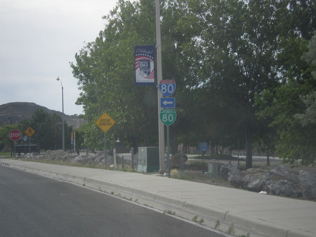
Wendover Blvd. at BL-80/Alt. US-93 Jct.
Wendover Blvd. east at BL-80/Alt. US-93 jct. Turn left for BL-80 West/Alt. US-93 North to I-80. Continue straight on Wendover Blvd. for BL-80 East/Alt. US-93 South.
Taken 06-20-2014
 West Wendover
Elko County
Nevada
United States
West Wendover
Elko County
Nevada
United States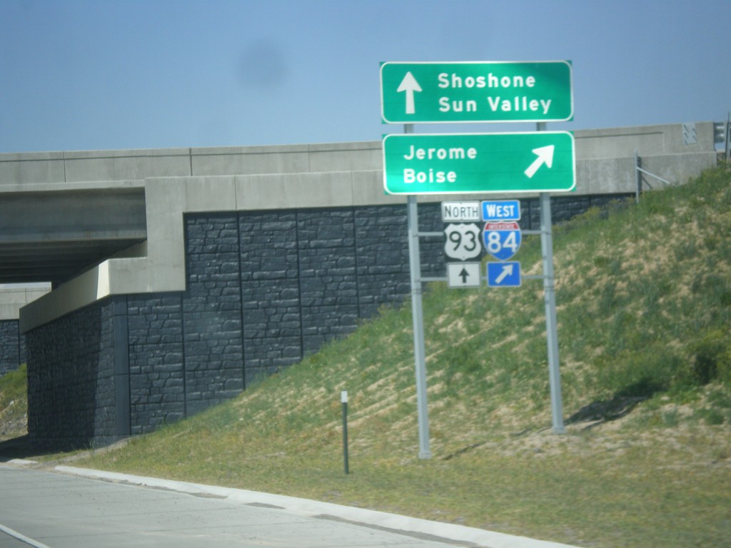
US-93 North at I-84 West
US-93 north at I-84 west to Jerome and Boise. Continue north on US-93 for Shoshone and Sun Valley.
Taken 05-22-2014

 Jerome
 County
Idaho
United States
Jerome
Jerome County
Idaho
United States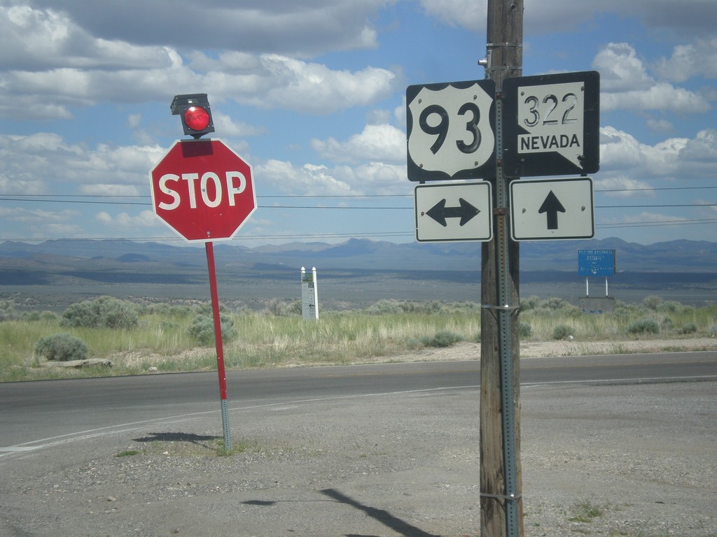
NV-322 East at US-93
NV-322 East at US-93 in Pioche. Both of the shields have fading lettering and almost look like they were hand painted on.
Taken 05-21-2014
 Pioche
Lincoln County
Nevada
United States
Pioche
Lincoln County
Nevada
United States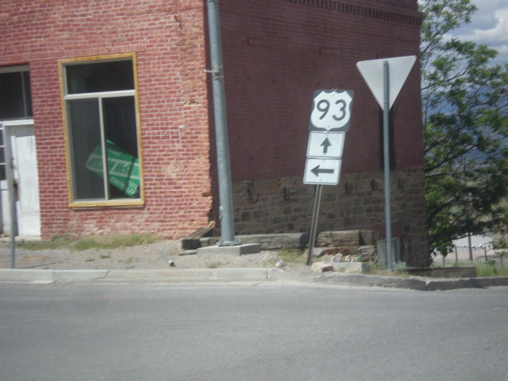
Bus US-93/NV-321 South at NV-322
Bus US-93/NV-321 South at NV-322 in Pioche. Both NV-321 and NV-322 will end up at US-93. Turn left to continue north on Bus. US-93/NV-321. Continue straight for NV-322. This is a confusing intersection because there is no signs indicating either the Nevada state highways involved, nor which street the business loop continues on as.
Taken 05-21-2014

 Pioche
Lincoln County
Nevada
United States
Pioche
Lincoln County
Nevada
United States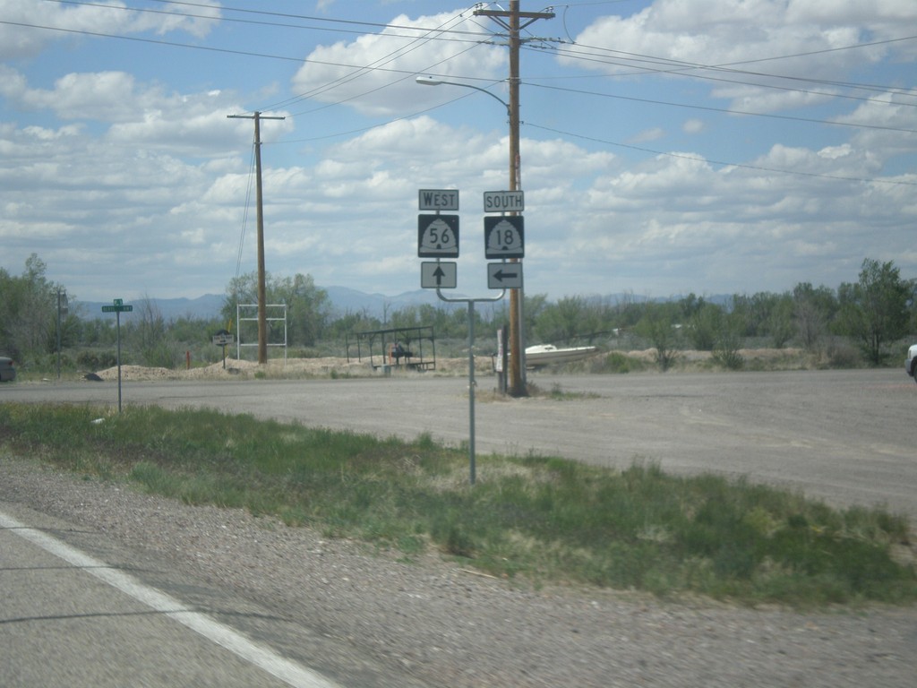
UT-56 West at UT-18 South
UT-56 west at UT-18 south in Beryl Junction.
Taken 05-21-2014

 Beryl
Iron County
Utah
United States
Beryl
Iron County
Utah
United States
I-15 North Exit 59 Offramp at UT-56
I-15 North Exit 59 offramp at UT-56 in Cedar City.
Taken 05-21-2014
 Cedar City
Iron County
Utah
United States
Cedar City
Iron County
Utah
United States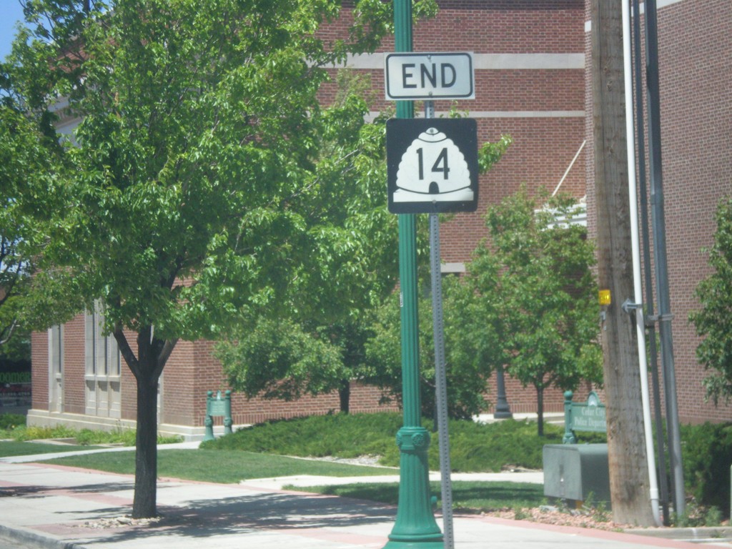
End UT-14 West at BL-15/UT-130
End UT-14 West at BL-15/UT-130 in Cedar City.
Taken 05-21-2014


 Cedar City
Iron County
Utah
United States
Cedar City
Iron County
Utah
United States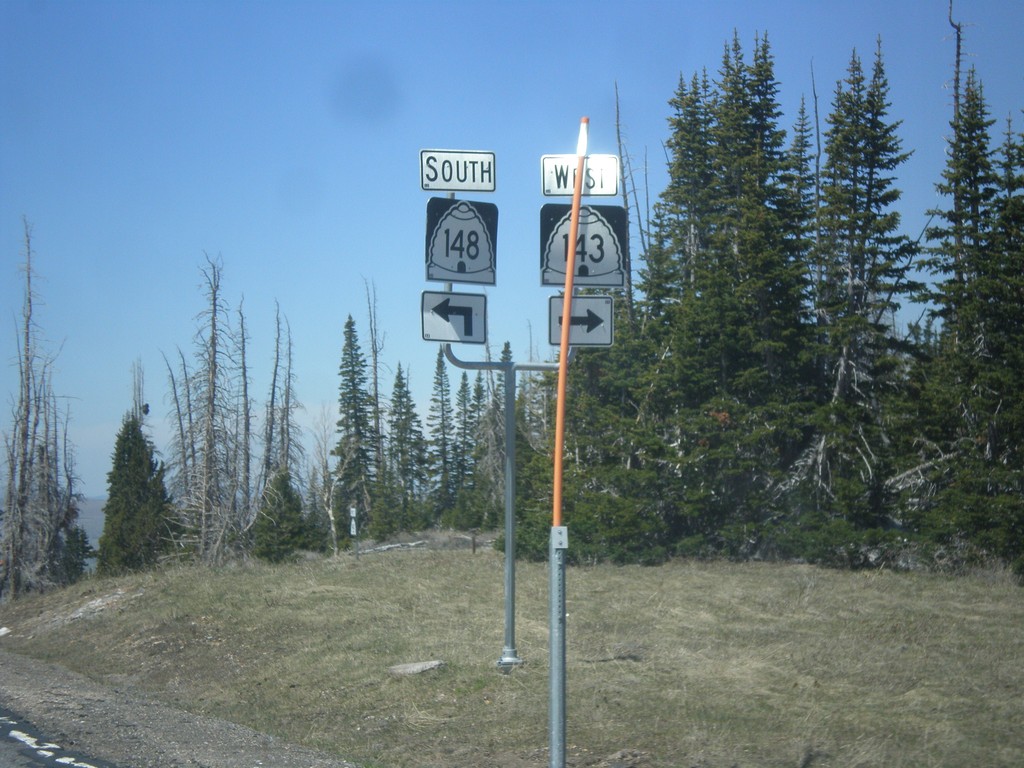
UT-143 West at UT-148
UT-143 west at UT-148. Turn right to continue west on UT-143 (Utah’s Patchwork Parkway National Scenic Byway). Turn left for UT-148 (Cedar Breaks Scenic Byway).
Taken 05-21-2014

 Brian Head
Iron County
Utah
United States
Brian Head
Iron County
Utah
United States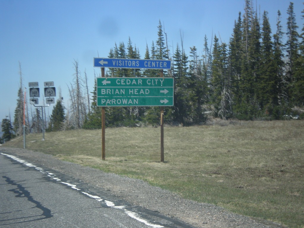
UT-143 West at UT-148
UT-143 west at UT-148. Use UT-148 south to Cedar City. Continue west on UT-143 (right turn) for Brian Head and Parowan. The Utah DOT changed direction on UT-143 between Panguitch Lake and UT-148 junction. At Panguitch UT-143 is a north/south highway. At this junction it is an east/west highway.
Taken 05-21-2014
Brian Head
Iron County
Utah
United States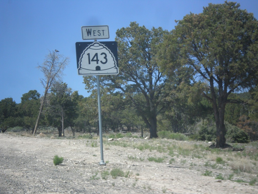
UT-143 South - Garfield County
Large UT-143 south shield outside of Panguitch in Garfield County. There are quite a few of these oversized shields outside of Panguitch on UT-143 southbound.
Taken 05-21-2014
Panguitch
Garfield County
Utah
United States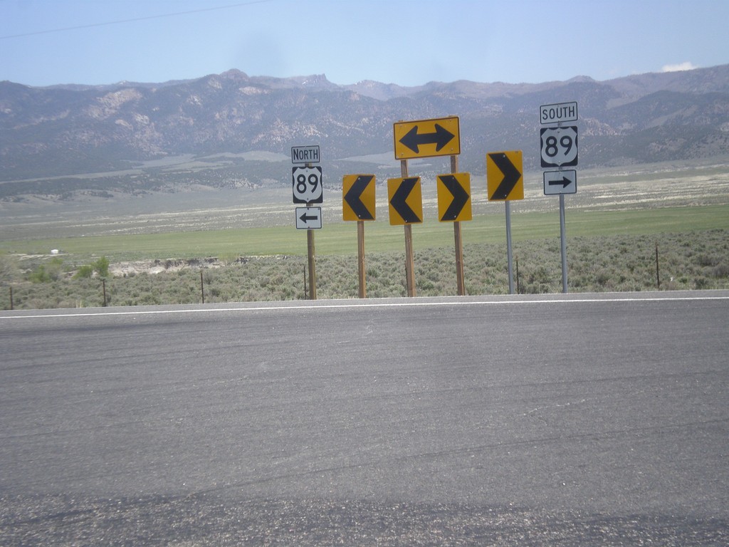
End UT-20 East at US-89
End UT-20 east at US-89 at Bear Valley Junction.
Taken 05-19-2014

 Spry
Garfield County
Utah
United States
Spry
Garfield County
Utah
United States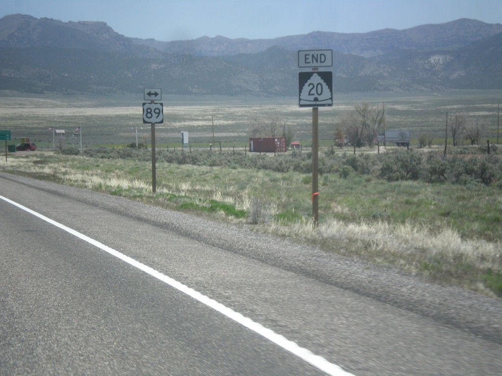
End UT-20 East at US-89
End UT-20 East at US-89 at Bear Valley Junction.
Taken 05-19-2014
Spry
Garfield County
Utah
United States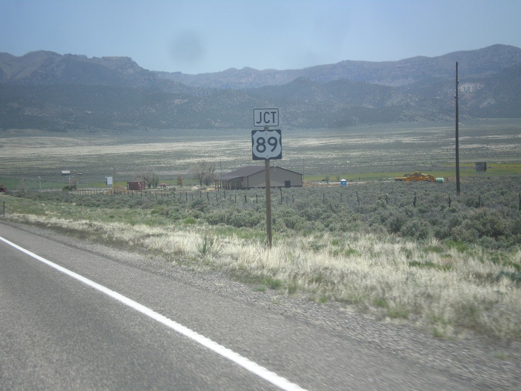
UT-20 East Approaching US-89
UT-20 East approaching US-89 at Bear Valley Junction.
Taken 05-19-2014
Panguitch
Garfield County
Utah
United States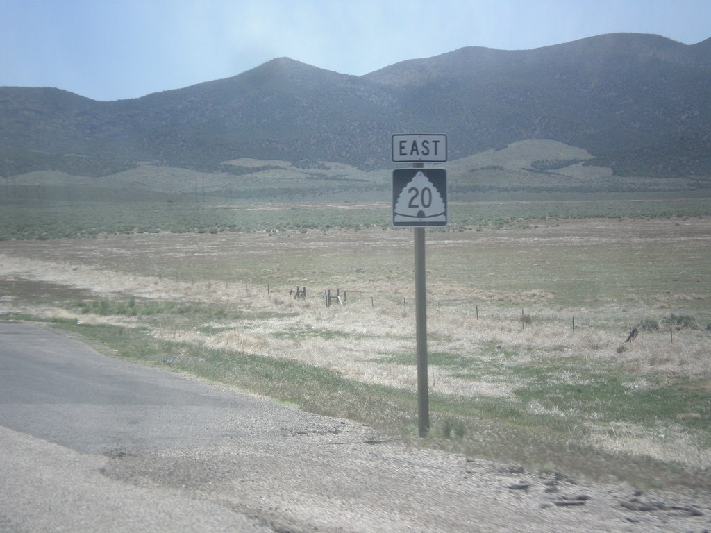
UT-20 East in Iron County
UT-20 East in Iron County. This is the first reassurance marker on UT-20 east after I-15.
Taken 05-19-2014
Paragonah
Iron County
Utah
United States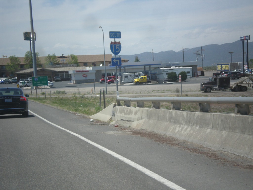
BL-15/UT-160 South at I-15 South
BL-15/UT-160 South at I-15 South (Exit 108) in Beaver.
Taken 05-19-2014
 Beaver
 County
Utah
United States
Beaver
Beaver County
Utah
United States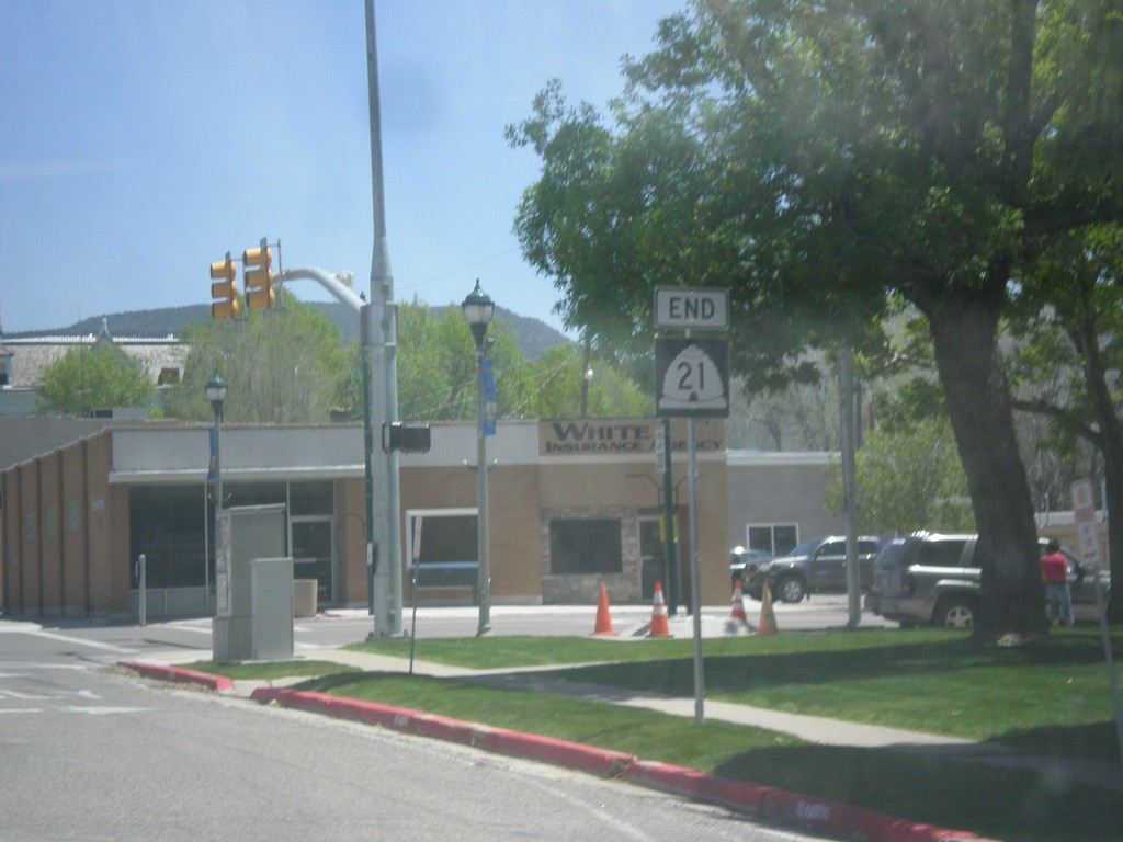
End UT-21 East at UT-160/BL-15
End UT-21 East at UT-160/BL-15 in Beaver.
Taken 05-19-2014
 Beaver
 County
Utah
United States
Beaver
Beaver County
Utah
United States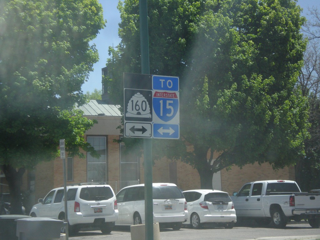
End UT-21 East at UT-160
End UT-21 east at UT-160 in Beaver. Use UT-160 to access I-15.
Taken 05-19-2014
Beaver
Beaver County
Utah
United States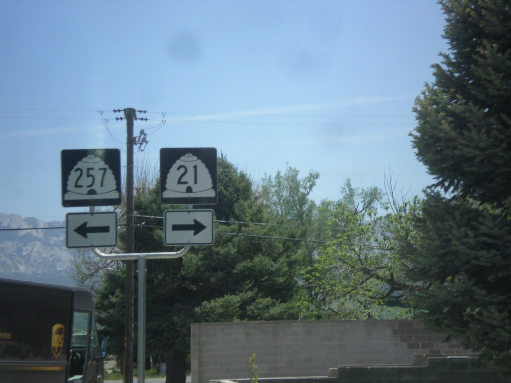
UT-21 East at UT-257 North
UT-21 East at UT-257 North in Milford.
Taken 05-19-2014
 Milford
Beaver County
Utah
United States
Milford
Beaver County
Utah
United States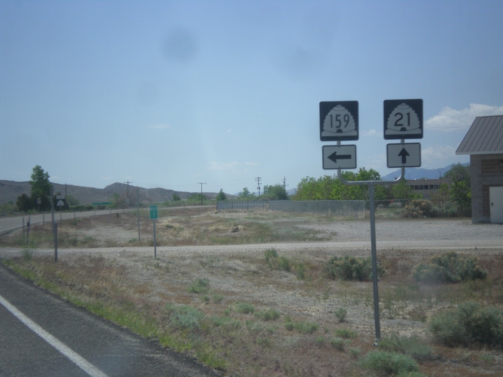
UT-21 East at UT-159
UT-21 east at UT-159 north in Garrison. Garrison is located inside Utah on the Nevada line.
Taken 05-19-2014
 Garrison
Millard County
Utah
United States
Garrison
Millard County
Utah
United States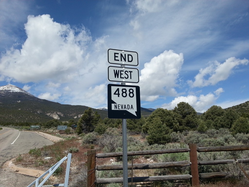
End NV-488
End NV-488 west at the Great Basin National Park boundary.
Taken 05-19-2014
 Baker
White Pine County
Nevada
United States
Baker
White Pine County
Nevada
United States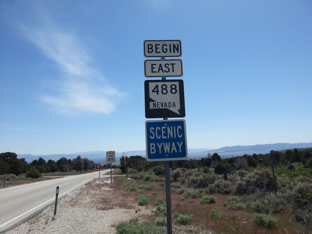
Begin NV-488 East
Begin NV-488 east at the Great Basin National Park Boundary. NV-488 is part of the Nevada Scenic Byway system.
Taken 05-19-2014
Baker
White Pine County
Nevada
United States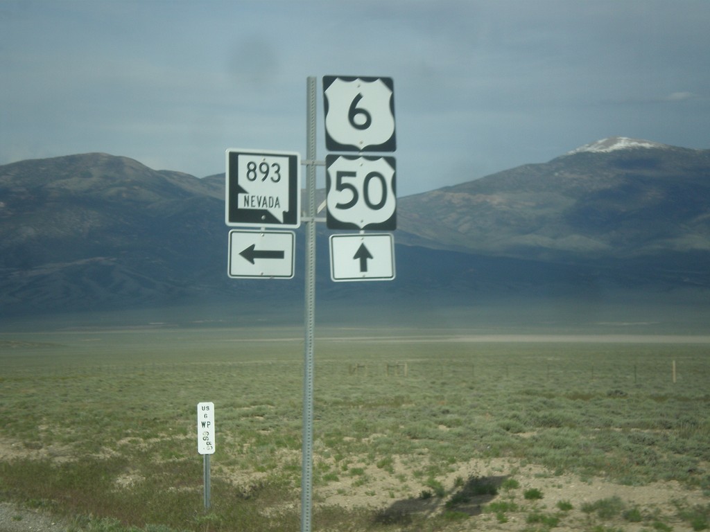
US-6/US-50 East at NV-893
US-6/US-50 East at NV-893 in White Pine County.
Taken 05-16-2014


 Majors Place
White Pine County
Nevada
United States
Majors Place
White Pine County
Nevada
United States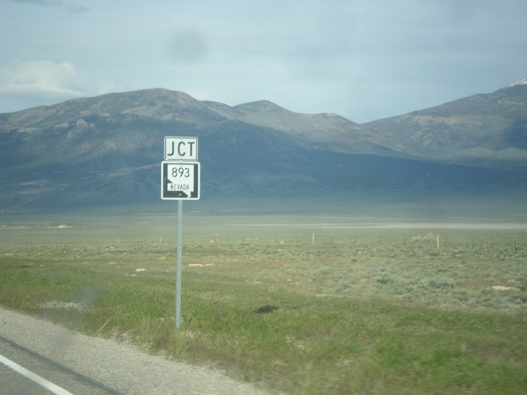
US-6/US-50 East Approaching NV-893
US-6/US-50 East approaching NV-893 in rural White Pine County, Nevada.
Taken 05-16-2014
Ely
White Pine County
Nevada
United States