Signs Tagged With Shield
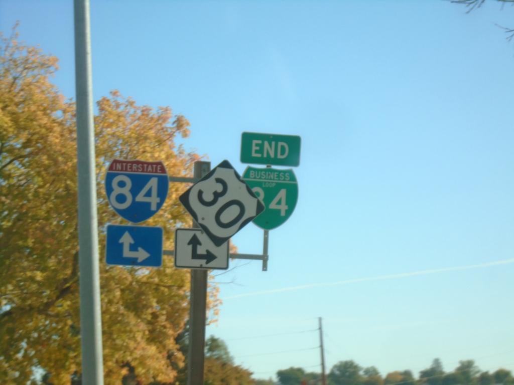
End BL-84 West at I-84/US-30
End BL-84 West at I-84/US-30 in Caldwell.
Taken 10-19-2024


 Caldwell
Canyon County
Idaho
United States
Caldwell
Canyon County
Idaho
United States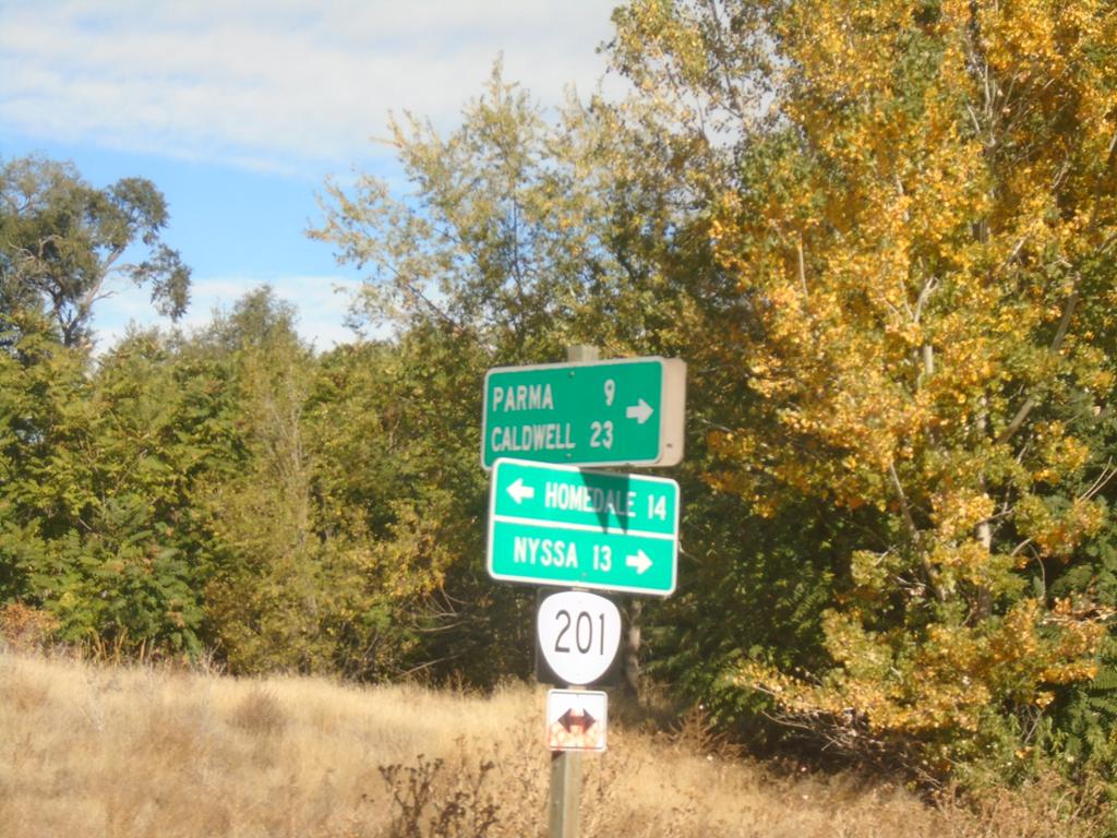
OR-201 North at OR-452
OR-201 North at OR-452 (unsigned) in Adrian. Turn right for OR-452 east to Parma (Idaho) and Caldwell (Idaho). Use OR-201 North to Nyssa; OR-201 South to Homedale (Idaho).
Taken 10-19-2024

 Adrian
Malheur County
Oregon
United States
Adrian
Malheur County
Oregon
United States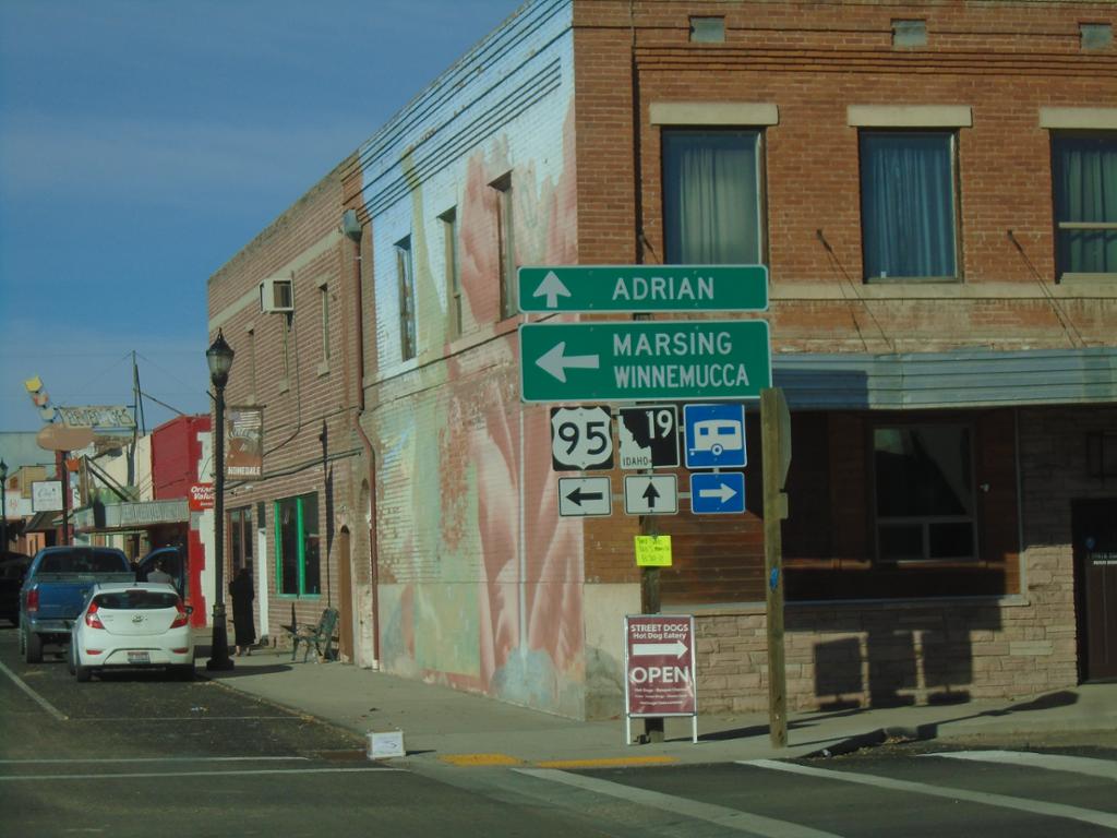
ID-19 West at Main Street - Homedale
ID-19 West at Main St. in Homedale. This intersection was formerly along the route of US-95, until a bypass was constructed along the southeast side of town. Turn left on Main Street. for US-95, Marsing, and Winnemucca (Nevada). Continue straight on Idaho Ave. for ID-19 to Adrian (Oregon).
Taken 10-19-2024

 Homedale
Owyhee County
Idaho
United States
Homedale
Owyhee County
Idaho
United States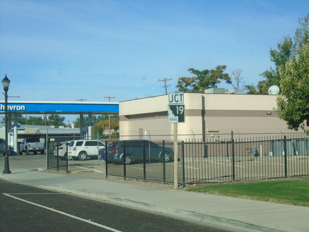
ID-19 West - Homedale
ID-19 west (Idaho Ave.) approaching Main Street in Homedale. The junction sign approaching this intersection suggests that ID-19 actually runs along Main Street.
Taken 10-19-2024
Homedale
Owyhee County
Idaho
United States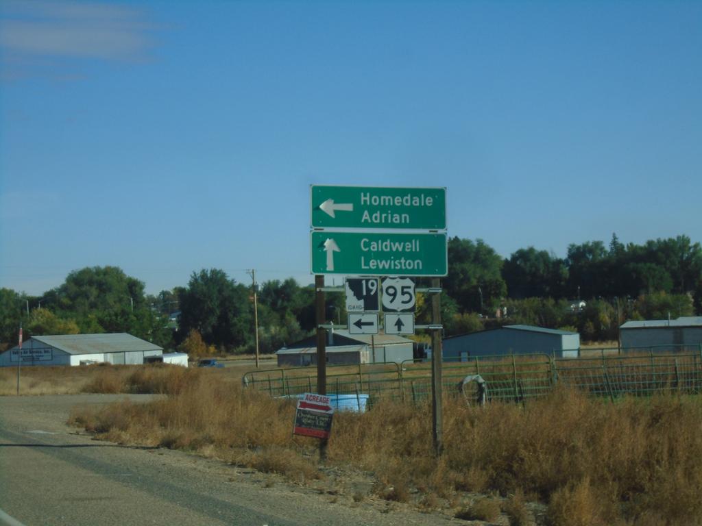
US-95 North at ID-19
US-95 North at ID-19 in Homedale. Use ID-19 west to Homedale and Adrian (Oregon). Continue on US-95 North/ID-19 East to Caldwell and Lewiston.
Taken 10-19-2024
Homedale
Owyhee County
Idaho
United States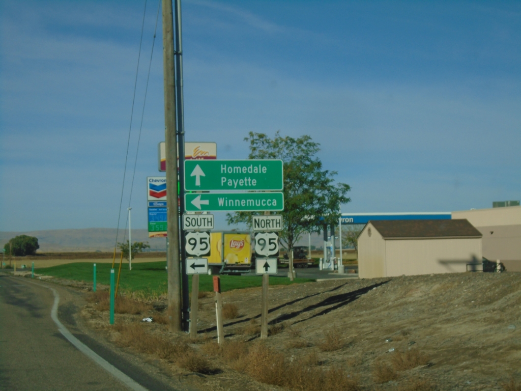
End ID-55 South at US-95
End ID-55 South at US-95. Use US-95 north to Homedale and Payette. Use US-95 south to Winnemucca (Nevada).
Taken 10-19-2024
 Marsing
Owyhee County
Idaho
United States
Marsing
Owyhee County
Idaho
United States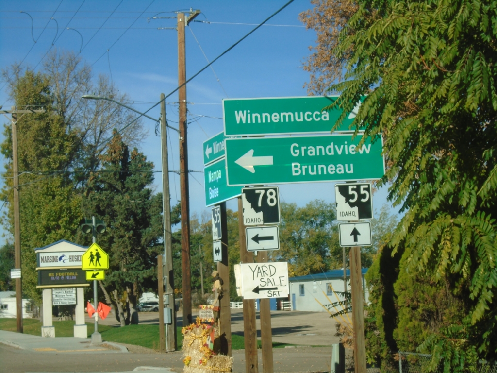
ID-55 South at ID-78
ID-55 south at ID-78 east to Grandview and Bruneau. Continue south on ID-55 for Winnemuuca (Nevada), via US-95 south.
Taken 10-19-2024
 Marsing
Owyhee County
Idaho
United States
Marsing
Owyhee County
Idaho
United States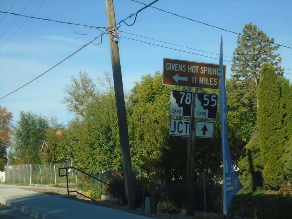
ID-55 South Approaching ID-78
ID-55 South approaching ID-78 east to Givens Hot Springs.
Taken 10-19-2024
Marsing
Owyhee County
Idaho
United States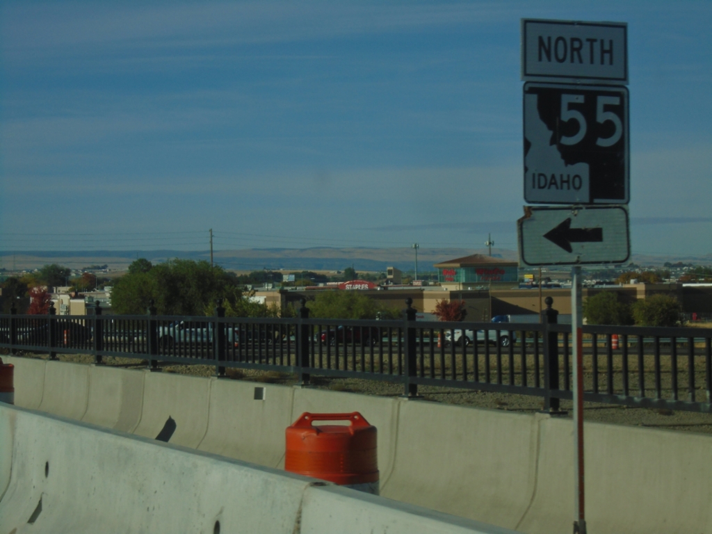
Karcher Road West at I-84/US-30 East
Karcher Road West at I-84/US-30 East/ID-55 North (Exit 33). Turn left for ID-55 North.
Taken 10-19-2024
Nampa
Canyon County
Idaho
United States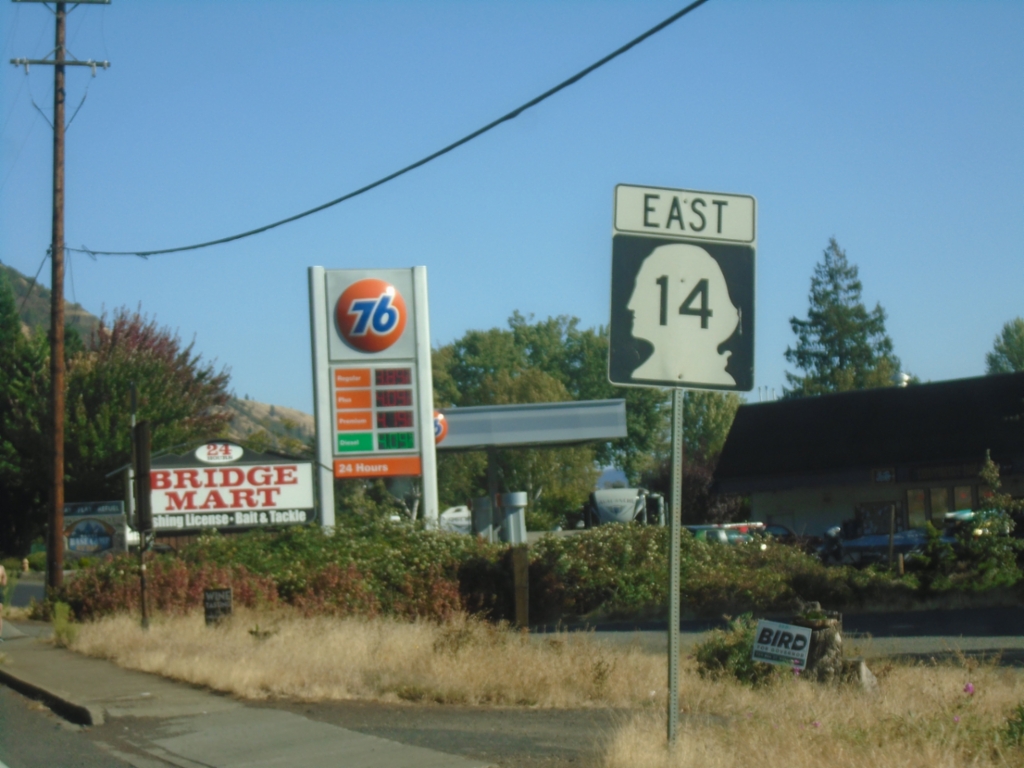
WA-14 East - White Salmon
WA-14 East in White Salmon
Taken 09-28-2024
 White Salmon
Klickitat County
Washington
United States
White Salmon
Klickitat County
Washington
United States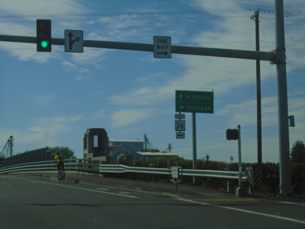
Glencoe Road South at US-26 East
Glencoe Road South at US-26 East to Portland. Continue south on Glencoe Road to Hillsboro.
Taken 09-28-2024
 North Plains
Washington County
Oregon
United States
North Plains
Washington County
Oregon
United States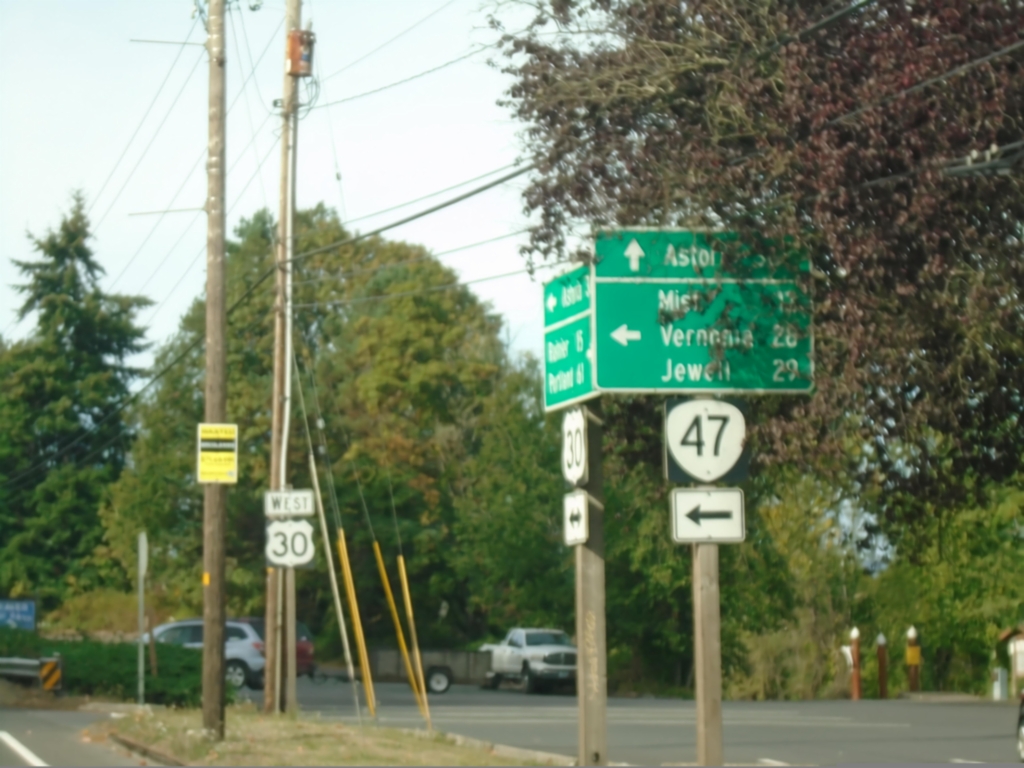
US-30 West at OR-47
US-30 West at OR-47 in Clatskanie. Use OR-47 south to Mist, Vernonia, and Jewell. Continue west on US-30 to Astoria.
Taken 09-22-2024
 Clatskanie
Columbia County
Oregon
United States
Clatskanie
Columbia County
Oregon
United States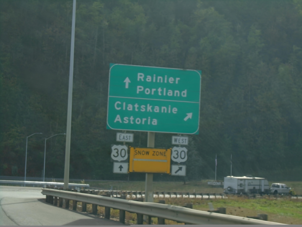
Lewis and Clark Bridge at US-30
Lewis and Clark Bridge at US-30 in Rainier. Use US-30 West to Astoria and Clatskanie. Use US-30 East to Rainier and Portland. Entering a Snow Zone.
Taken 09-22-2024
Rainier
Columbia County
Oregon
United States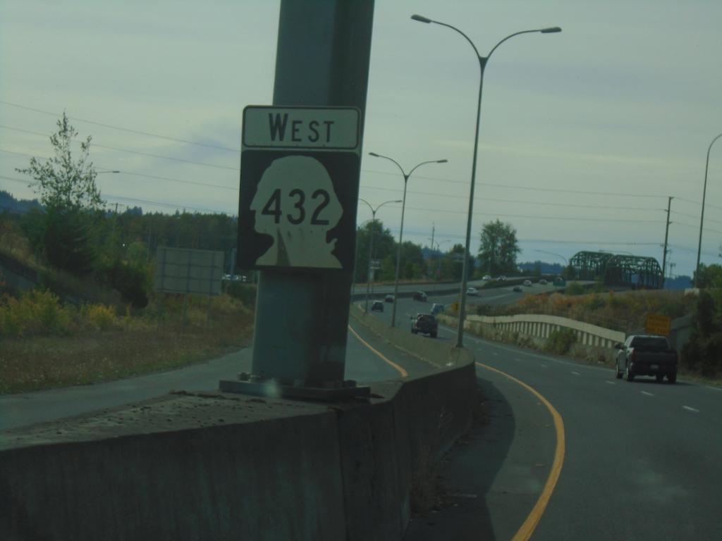
WA-432 West - Kelso
WA-432 West in Kelso
Taken 09-22-2024
 Kelso
Cowlitz County
Washington
United States
Kelso
Cowlitz County
Washington
United States
US-395 North at I-84 - Pendleton
US-395 North at I-84 in Pendleton. Use I-84 East to La Grande; I-84 West/US-395 North to Portland.
Taken 08-10-2024
 Pendleton
Umatilla County
Oregon
United States
Pendleton
Umatilla County
Oregon
United States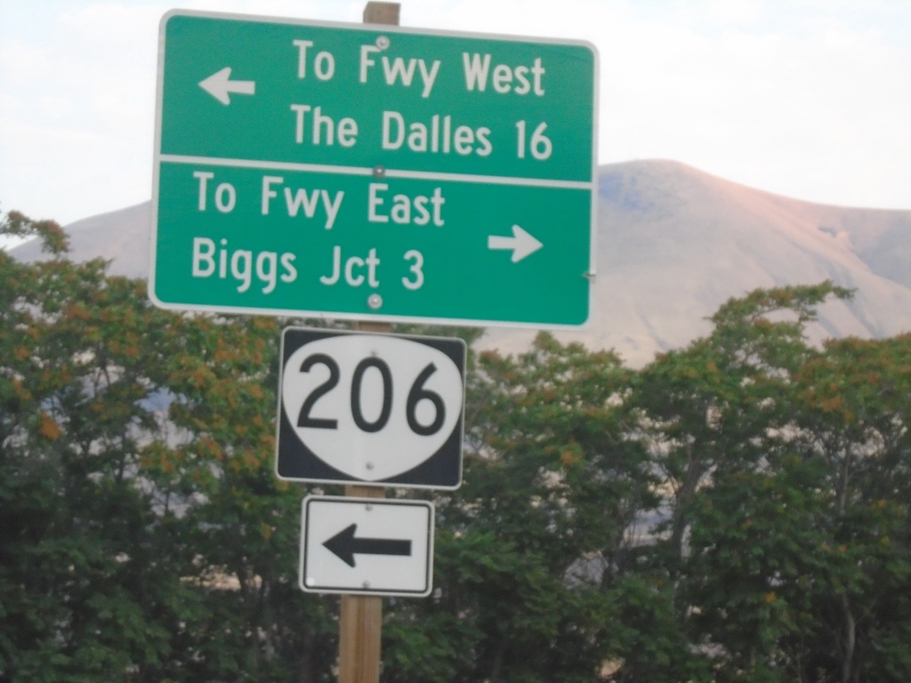
OR-206 West at Biggs-Rufus Highway
OR-206 West at Biggs-Rufus Highway. Turn left to continue on OR-206 west to Freeway West (I-84) and The Dalles. Turn right for Biggs-Rufus Highway to Freeway East (I-84) and Biggs Junction.
Taken 08-10-2024
 Wasco
Sherman County
Oregon
United States
Wasco
Sherman County
Oregon
United States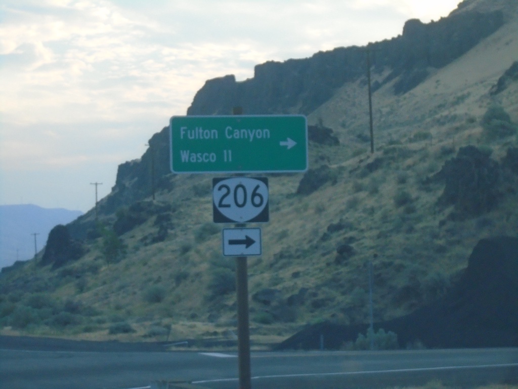
OR-206 East Approaching Biggs-Rufus Highway Junction
OR-206 East Approaching Biggs-Rufus Highway Junction. Turn right to continue east on OR-206 to Fulton Canyon and Wasco.
Taken 08-10-2024
Wasco
Sherman County
Oregon
United States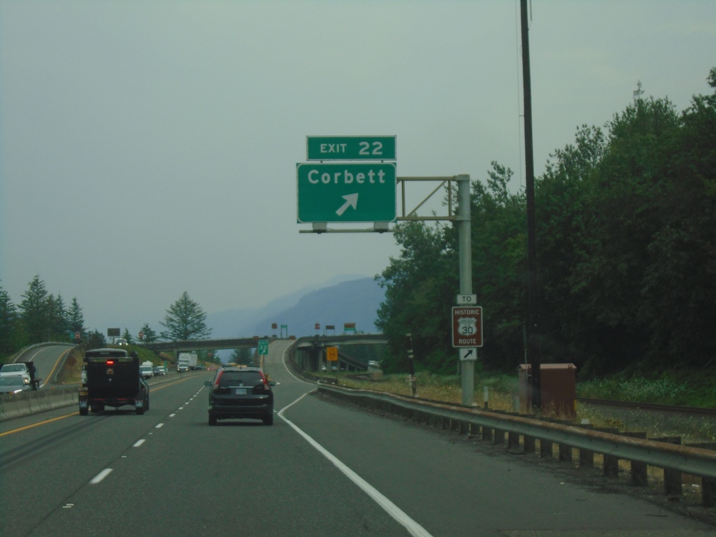
I-84 East - Exit 22
I-84 east at Exit 22 - Corbett. Use Exit 22 for access to Historic Route 30.
Taken 08-09-2024
Corbett
Multnomah County
Oregon
United States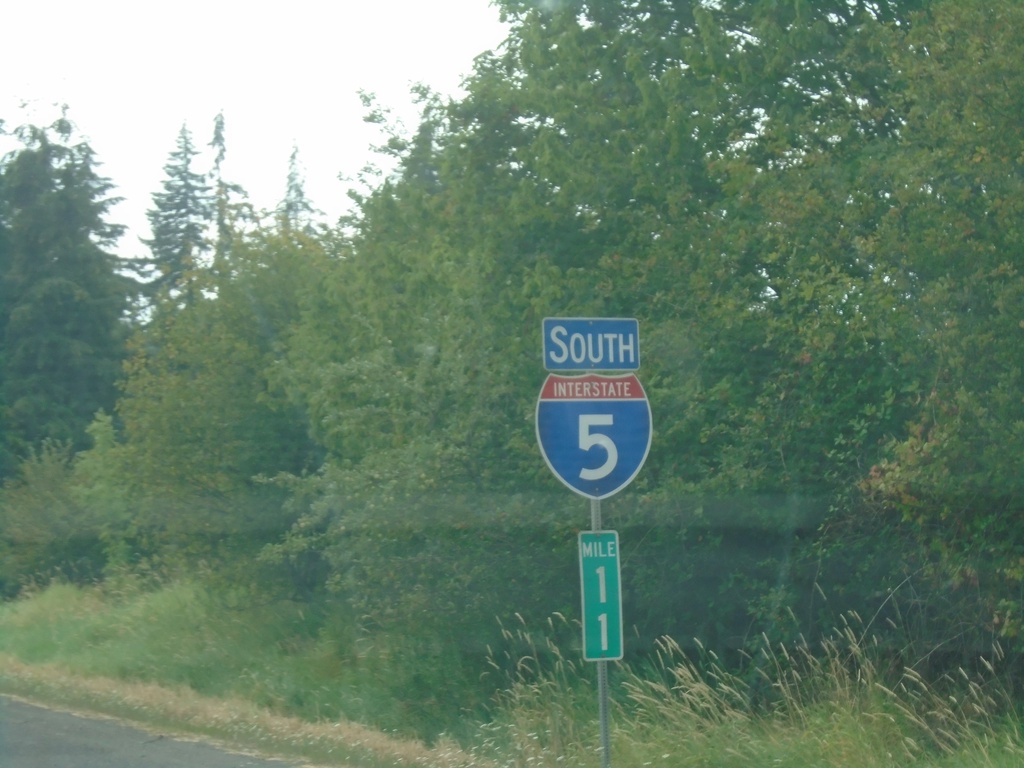
I-5 South - Clark County
I-5 South / Mile 11 in Clark County.
Taken 08-09-2024
 Ridgefield
Clark County
Washington
United States
Ridgefield
Clark County
Washington
United States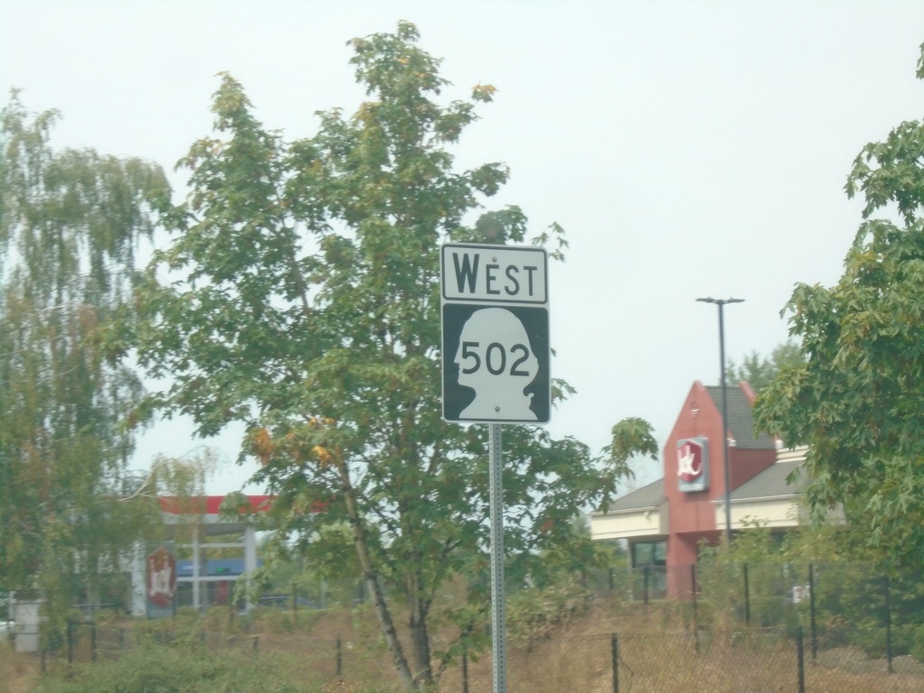
WA-502 West - Battle Ground
WA-502 west in Battle Ground.
Taken 08-09-2024
 Battle Ground
Clark County
Washington
United States
Battle Ground
Clark County
Washington
United States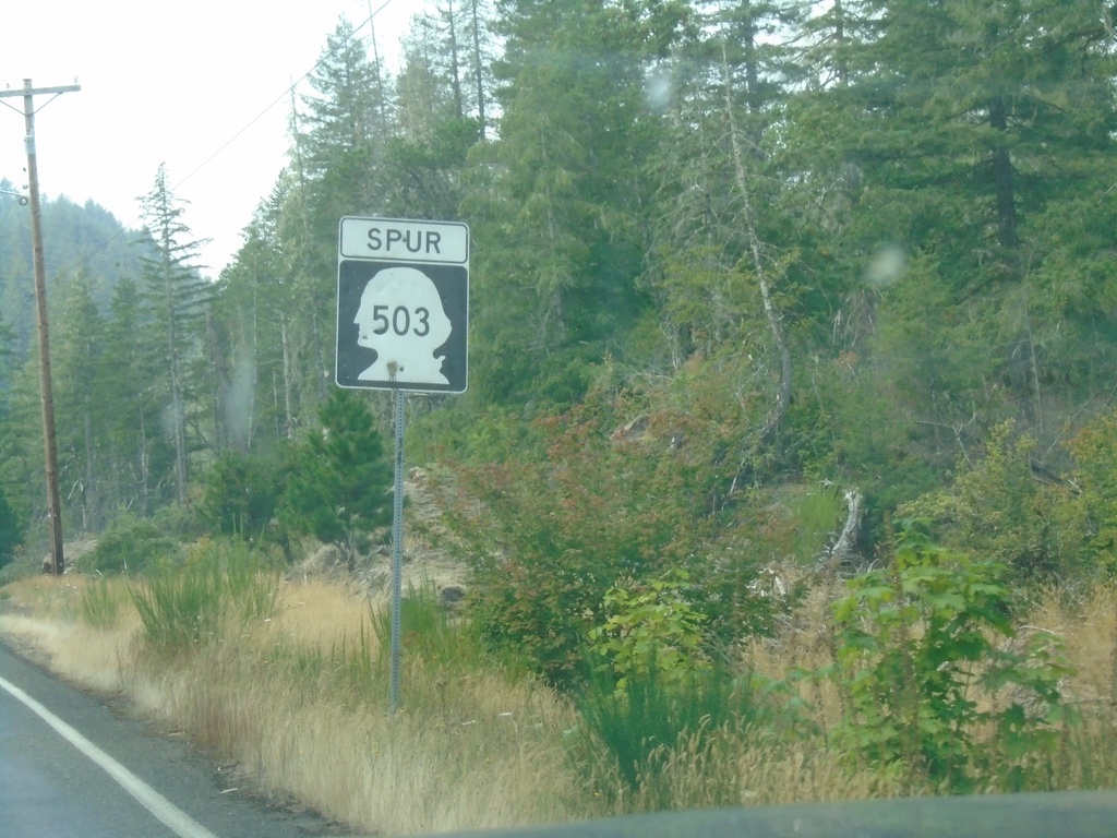
WA-503 Spur - West
WA-503 Spur west in Cowlitz County.
Taken 08-09-2024
 Cougar
Cowlitz County
Washington
United States
Cougar
Cowlitz County
Washington
United States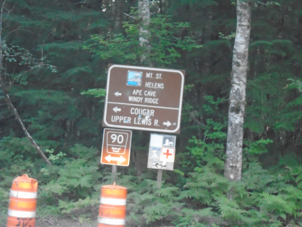
Curly Creek Road North at Lewis River Road (FR-90)
Curly Creek Road North at Lewis River Road (FR-90). Turn right for Upper Lewis River; left for Mt. St. Helens, Ape Cave, and Windy Ridge.
Taken 08-08-2024
Northwoods Skamania County Washington United States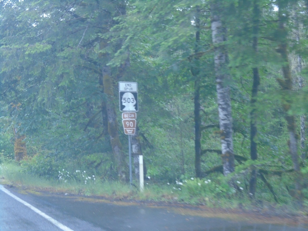
End WA-503 Spur / Begin Forest Service Road 90
End WA-503 Spur / Begin Forest Service Road 90 at Cowlitz/Skamania County Line.
Taken 06-15-2024
Cougar
Cowlitz County
Washington
United States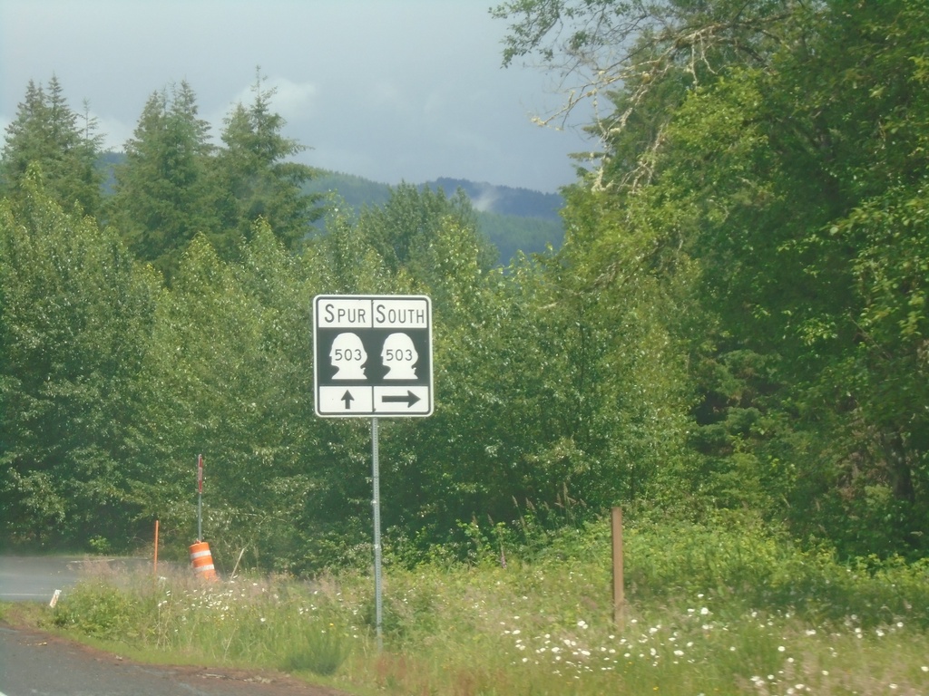
WA-503 South at WA-503 Spur
WA-503 South at WA-503 Spur. Turn right to continue south on WA-503.
Taken 06-15-2024
 Ariel
Cowlitz County
Washington
United States
Ariel
Cowlitz County
Washington
United States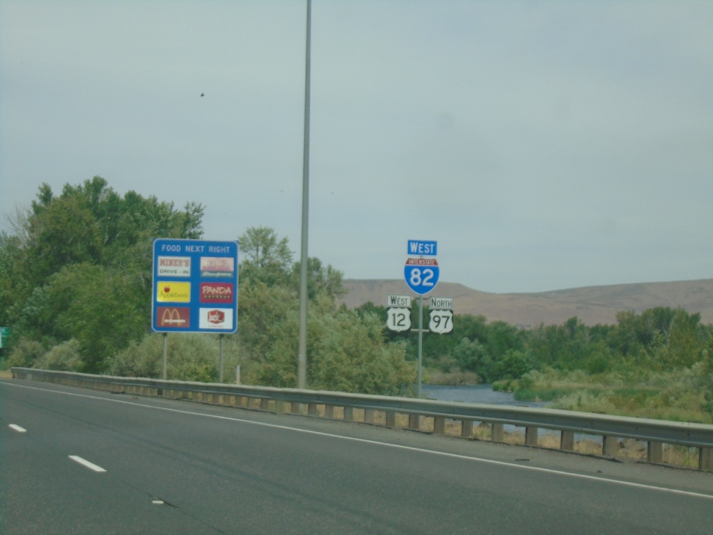
I-82/US-12 West/US-97 North
I-82/US-12 West/US-97 North shields
Taken 06-13-2024


 Union Gap
Yakima County
Washington
United States
Union Gap
Yakima County
Washington
United States