Signs Tagged With Shield
US-34 West/CO-71 North at CO-71 North
US-34 West/CO-71 North at CO-71 North to I-76.
Taken 03-30-2014


 Brush
Morgan County
Colorado
United States
Brush
Morgan County
Colorado
United States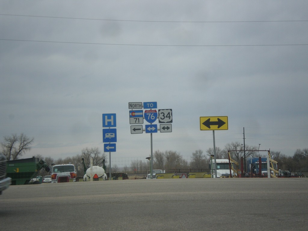
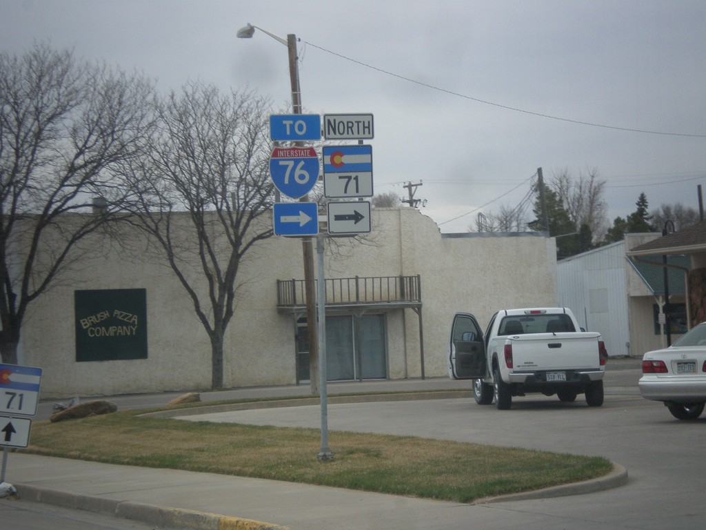
CO-71 North at US-34
CO-71 North at US-34. Turn right on US-34 for I-76 east. Turn left for CO-71 North/US-34 West.
Taken 03-30-2014
Brush
Morgan County
Colorado
United States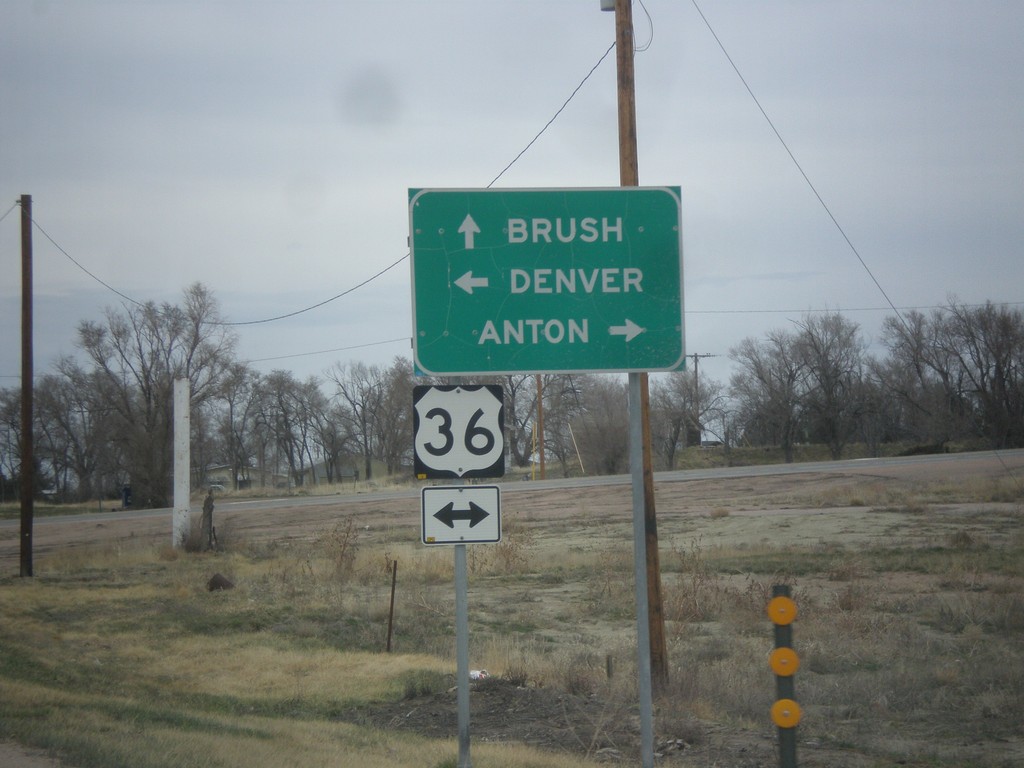
CO-71 North Approaching US-36
CO-71 north approaching US-36. Turn left for US-36 west to Denver; right on US-36 east to Anton. Continue north on CO-71 for Brush.
Taken 03-30-2014
 Woodrow
Washington County
Colorado
United States
Woodrow
Washington County
Colorado
United States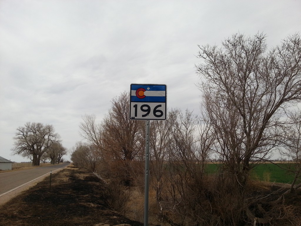
CO-196 West - Bent County
CO-196 West in Bent County.
Taken 03-30-2014
 Wiley
Bent County
Colorado
United States
Wiley
Bent County
Colorado
United States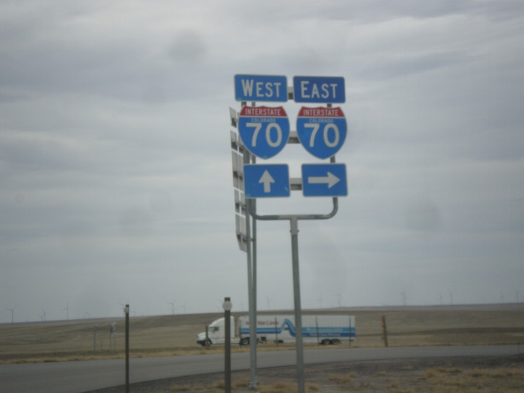
BL-70/US-40 West/US-287 North at I-70
BL-70/US-40 West/US-287 North at I-70. Turn right for I-70 East; continue over overpass for I-70/US-40 East/US-287 North. This is the western end of the Limon business loop.
Taken 03-30-2014


 Limon
Lincoln County
Colorado
United States
Limon
Lincoln County
Colorado
United States
BL-70/US-24/US-40 West/US-287 North/CO-71 South at CO-71 South
BL-70/US-24/US-40 West/US-287 North/CO-71 South at CO-71 South in Limon.
Taken 03-30-2014
 Limon
Lincoln County
Colorado
United States
Limon
Lincoln County
Colorado
United States
BL-70/US-24/US-40 West/US-287 North at CO-71
BL-70/US-24/US-40 West/US-287 North at CO-71. CO-71 joins BL-70/US-24/US-40 West/US-287 North through Limon.
Taken 03-30-2014
Limon
Lincoln County
Colorado
United States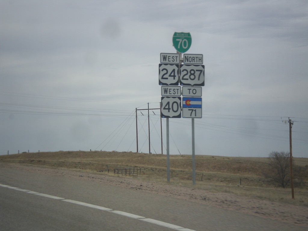
BL-70/US-24/US-40 West/US-287 North/To CO-71
BL-70/US-24/US-40 West/US-287 North/To CO-71 approaching Limon, Colorado.
Taken 03-30-2014
Limon
Lincoln County
Colorado
United States
US-40 West/US-287 North at I-70/US-24/BL-70
US-40 West/US-287 North at I-70/US-24/BL-70. Turn right for I-70/US-24 East. Continue under overpass for I-70 west. US-40/US-287 joins US-24/BL-70 through Limon. This is the eastern end of the Limon business loop.
Taken 03-30-2014
Limon
Lincoln County
Colorado
United States
US-56/US-64/US-412 West Approaching US-385/OK-325
US-56/US-64/US-412 West approaching US-385/OK-325 approaching roundabout at the Cimarron County courthouse in Boise City.
Taken 03-30-2014


 Boise City
Cimarron County
Oklahoma
United States
Boise City
Cimarron County
Oklahoma
United States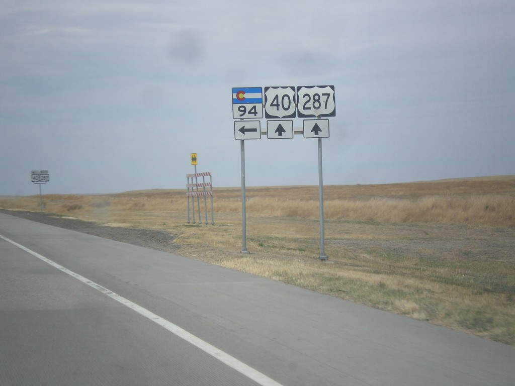
US-40 West/US-287 North at CO-94
US-40 West/US-287 North at CO-94 in Cheyenne County.
Taken 03-30-2014
 Hugo
Cheyenne County
Colorado
United States
Hugo
Cheyenne County
Colorado
United States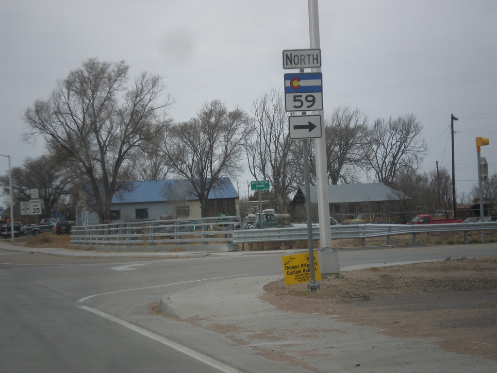
US-40 East/US-287 North at CO-59
US-40 East/US-287 North at CO-59 North in Kit Carson.
Taken 03-30-2014
 Kit Carson
Cheyenne County
Colorado
United States
Kit Carson
Cheyenne County
Colorado
United States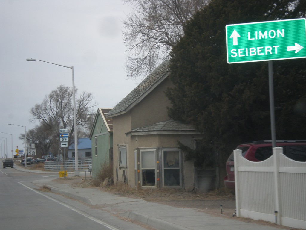
US-40 East/US-287 North - CO-59
US-40 East/US-287 North approaching CO-59. Turn north on CO-59 for Seibert. Continue on US-40 East/US-287 North for Limon.
Taken 03-30-2014
Kit Carson
Cheyenne County
Colorado
United States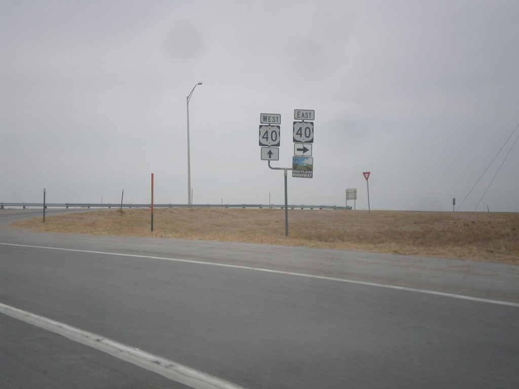
US-287 North at US-40
US-287 north at US-40. US-40 joins US-287 north to Limon. Then both highways merge onto I-70 towards Denver. This is the southern end of the High Plains Highway which connects Kit Carson and Julesburg via US-40 and US-385.
Taken 03-30-2014
Kit Carson
Cheyenne County
Colorado
United States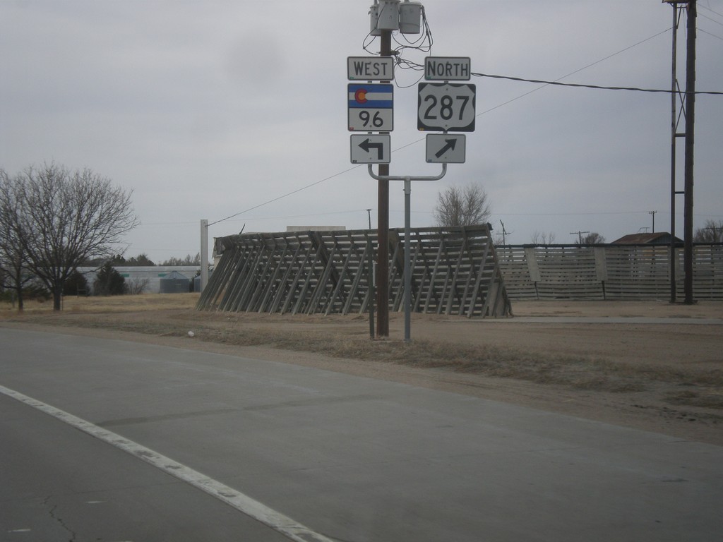
US-287 North/CO-96 West at US-287 North
US-287 North/CO-96 West at US-287 North in Eads. Merge right to continue north on US-287.
Taken 03-30-2014
 Chivington
Kiowa County
Colorado
United States
Chivington
Kiowa County
Colorado
United States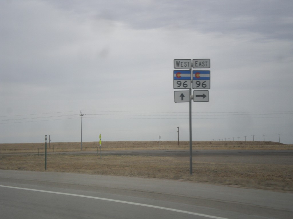
US-287 North at CO-96
US-287 north at CO-96. CO-96 joins US-287 north into Eads.
Taken 03-30-2014
Eads
Kiowa County
Colorado
United States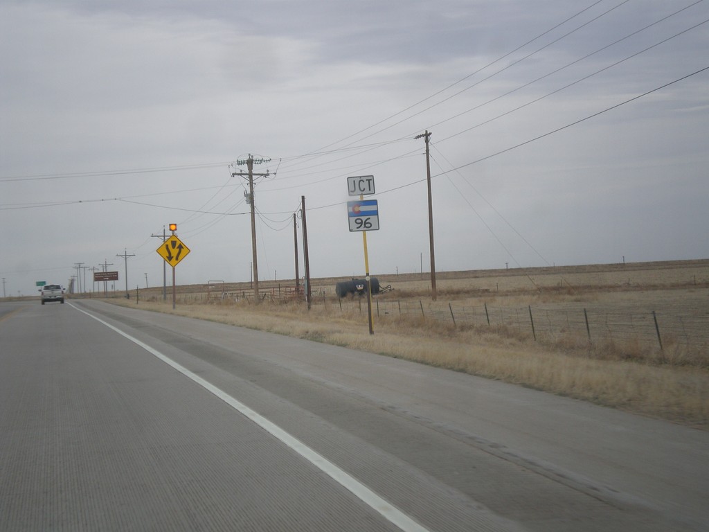
US-287 North Approaching CO-96
US-287 North approaching CO-96 in Kiowa County.
Taken 03-30-2014
Eads
Kiowa County
Colorado
United States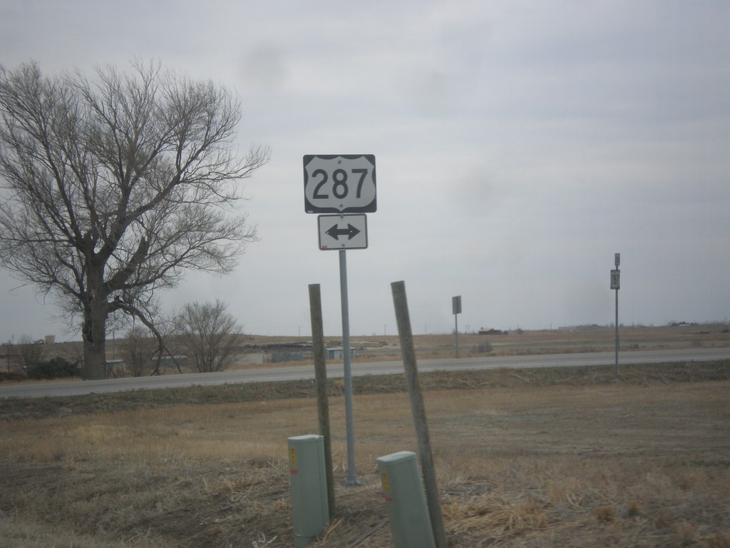
CO-196 East at US-287
CO-196 east at US-287 in Prowers County.
Taken 03-30-2014
Wiley
Prowers County
Colorado
United States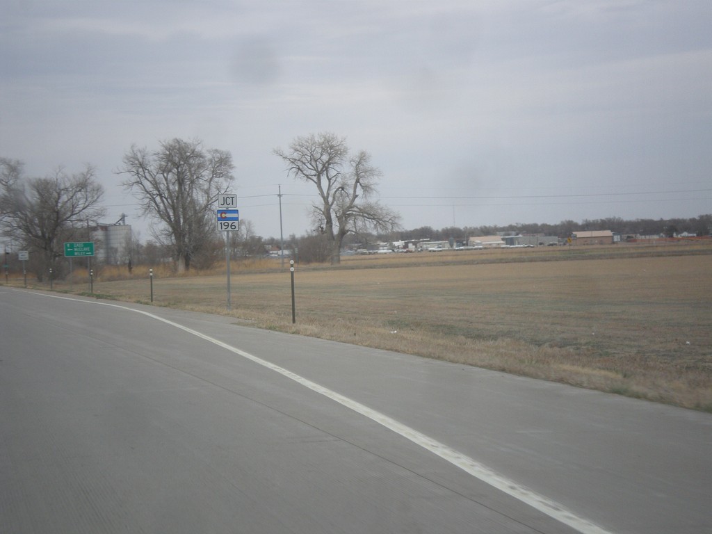
US-287 North Approaching CO-196
US-287 North approaching CO-196 in Prowers County.
Taken 03-30-2014
Wiley
Prowers County
Colorado
United States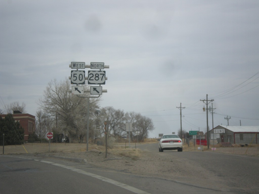
US-50 West/US-287 North at CO-196
US-50 West/US-287 North at CO-196. Merge left to continue on US-50/US-287.
Taken 03-30-2014
 Lamar
Prowers County
Colorado
United States
Lamar
Prowers County
Colorado
United States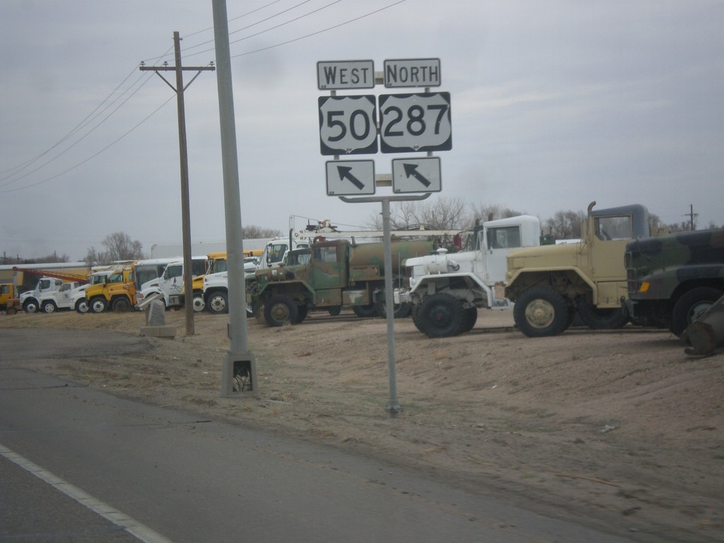
US-287 North/US-50 West - Merge Left
Merge left to continue on US-287 North/US-50 West.
Taken 03-30-2014
Lamar
Prowers County
Colorado
United States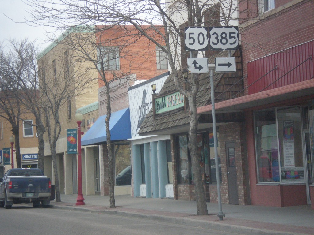
US-287/US-385 North at US-50
US-287/US-385 North at US-50 in Lamar. US-385 north joins US-50 east; US-287 north joins US-50 west.
Taken 03-30-2014
Lamar
Prowers County
Colorado
United States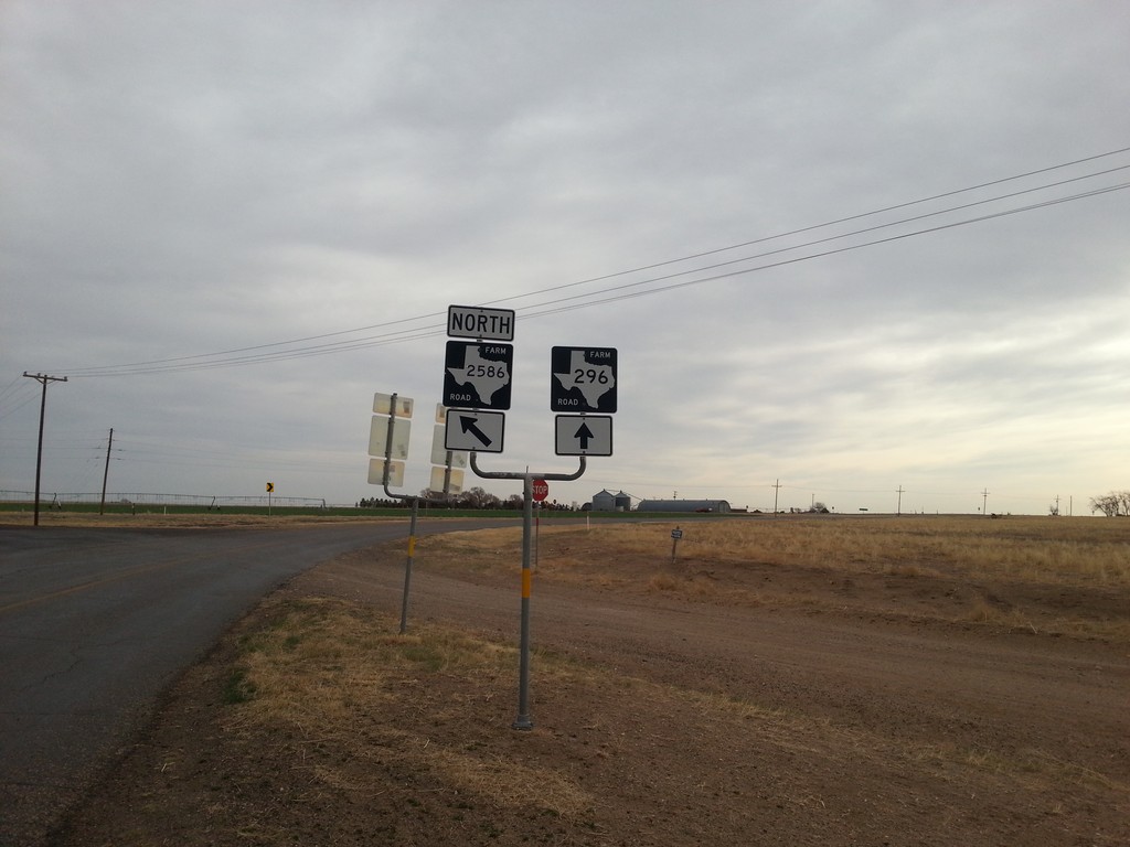
FM-296 East at FM-2586
FM-296 east at FM-2586 in Dallam County.
Taken 03-30-2014

 Texline
Dallam County
Texas
United States
Texline
Dallam County
Texas
United States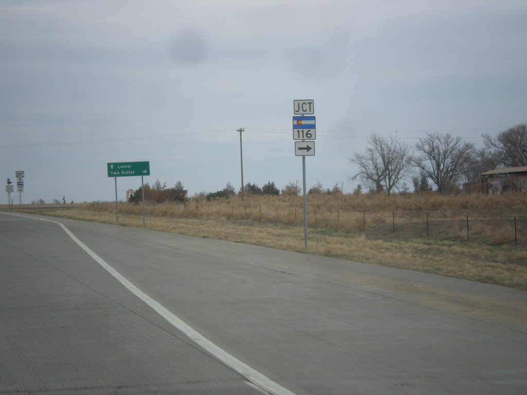
US-287/US-385 North Approaching CO-116
US-287/US-385 North approaching CO-116 in Baca County.
Taken 03-30-2014
 Two Buttes
Baca County
Colorado
United States
Two Buttes
Baca County
Colorado
United States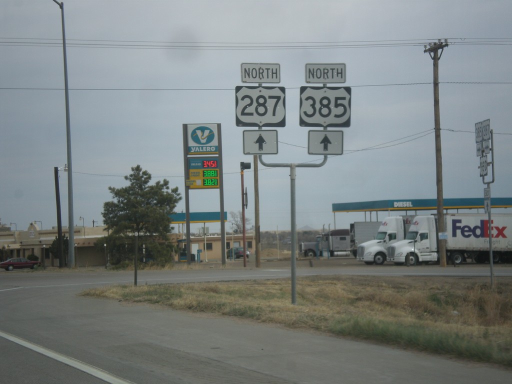
US-287/US-385 North at US-160
US-287/US-385 North at US-160 near Springfield.
Taken 03-30-2014
 Springfield
Baca County
Colorado
United States
Springfield
Baca County
Colorado
United States