Signs Tagged With Shield
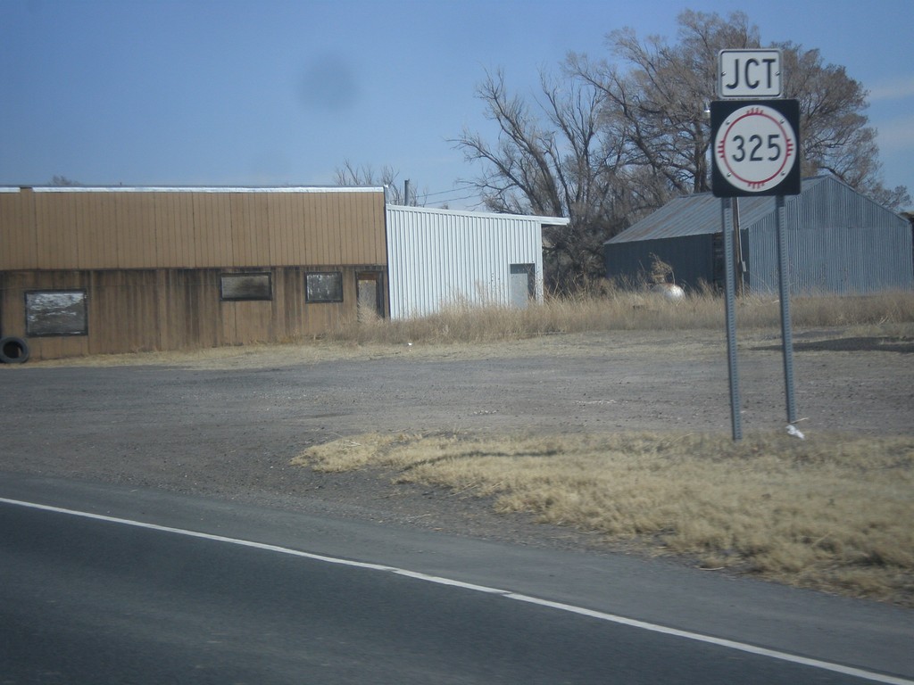
US-64/US-87 East Approaching NM-325
US-64/US-87 East approaching NM-325 in Capulin.
Taken 03-29-2014


 Des Moines
Union County
New Mexico
United States
Des Moines
Union County
New Mexico
United States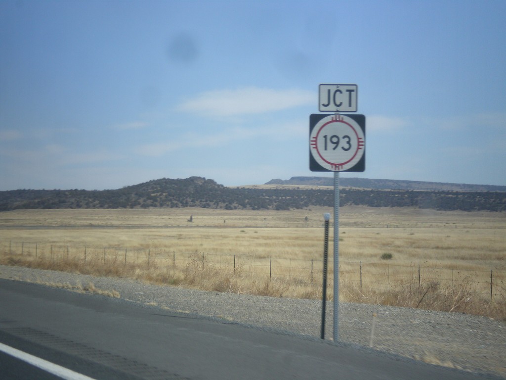
US-64/US-87 East at NM-193 Jct.
US-64/US-87 East at NM-193 Jct. in Colfax County.
Taken 03-29-2014
Raton
Colfax County
New Mexico
United States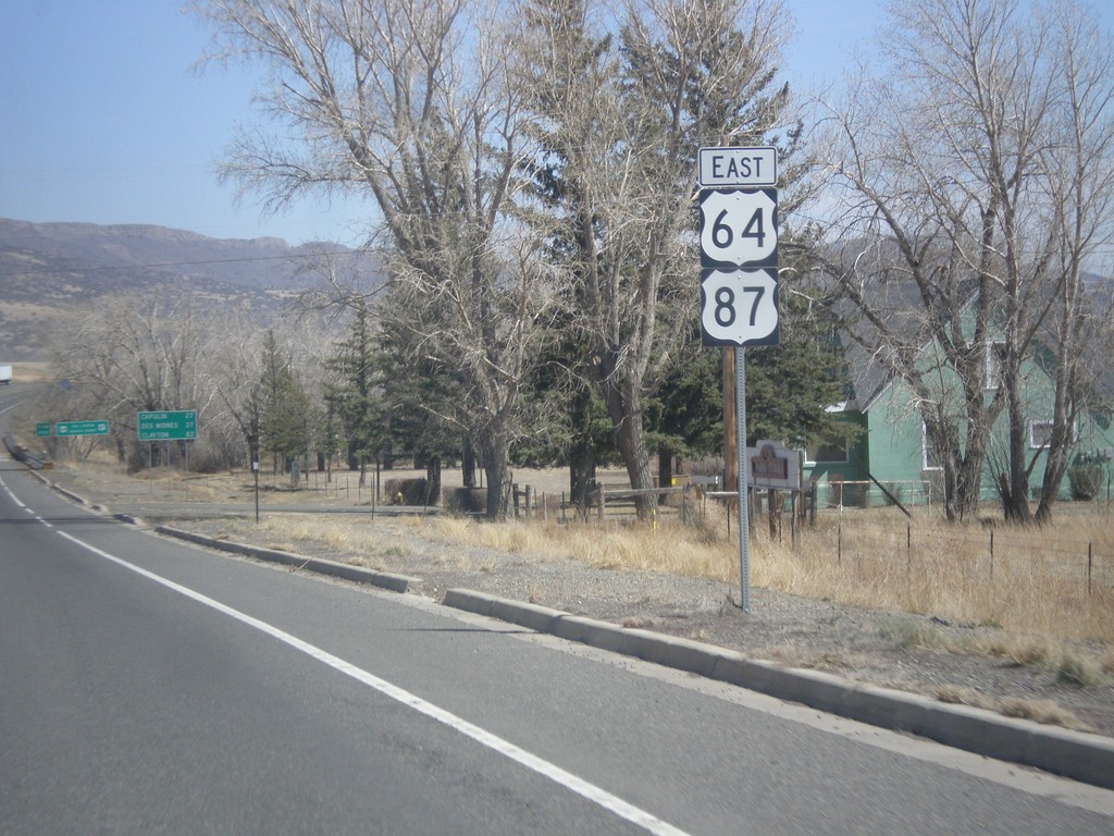
US-64/US-87 East - Raton
US-64/US-87 East shields, leaving Raton.
Taken 03-29-2014
Raton
Colfax County
New Mexico
United States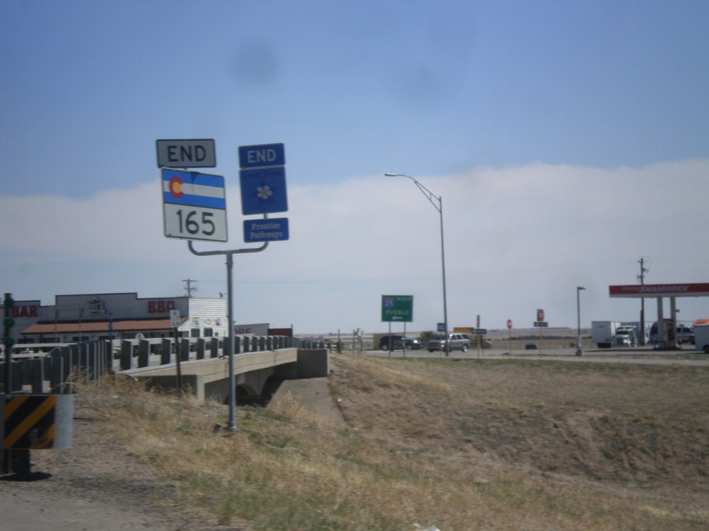
End CO-165 in Colorado City
End CO-165 east at I-25 in Colorado City. This is also the end of the Frontier Pathways Scenic Byway.
Taken 03-29-2014

 Colorado City
Pueblo County
Colorado
United States
Colorado City
Pueblo County
Colorado
United States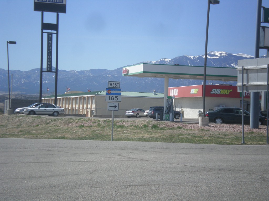
I-25 Offramp at CO-165
I-25 south offramp (Exit 74) at CO-165. Turn right for CO-165.
Taken 03-29-2014
Colorado City
Pueblo County
Colorado
United States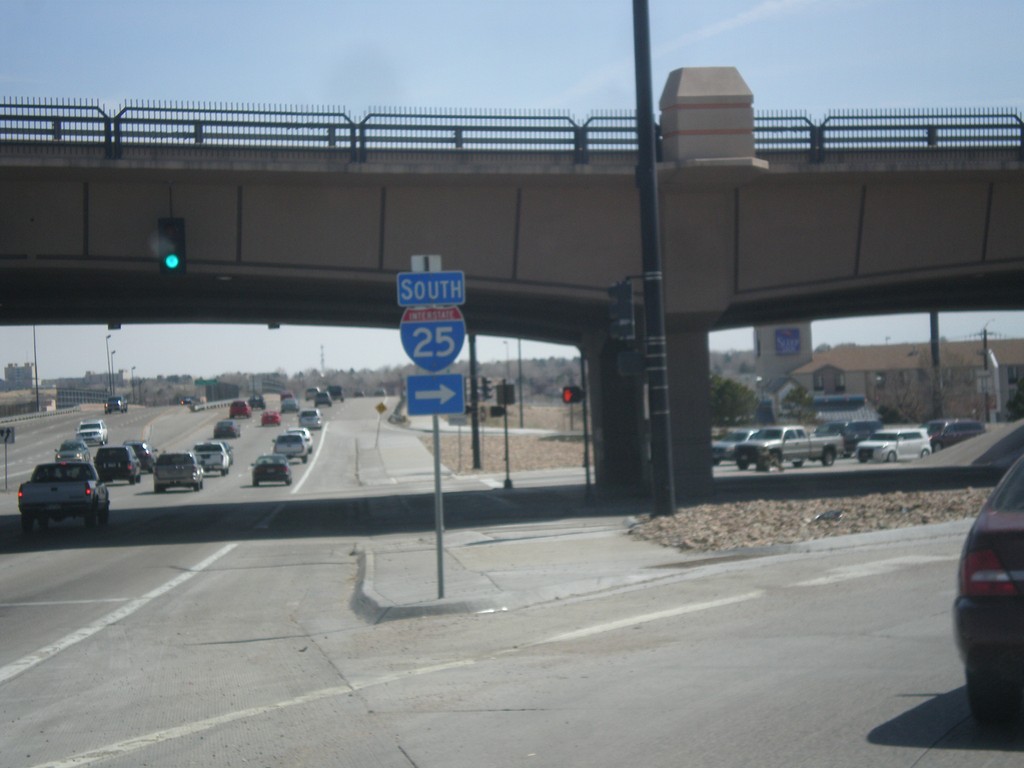
US-50 East at I-25 South
US-50 east at I-25 South onramp in Pueblo.
Taken 03-29-2014

 Pueblo
 County
Colorado
United States
Pueblo
Pueblo County
Colorado
United States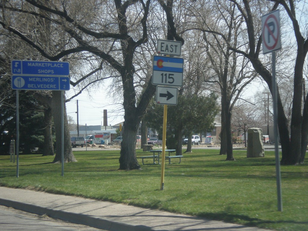
US-50 East at CO-115
US-50 east at CO-115 in Cañon City,
Taken 03-29-2014
 Cañon City
Fremont County
Colorado
United States
Cañon City
Fremont County
Colorado
United States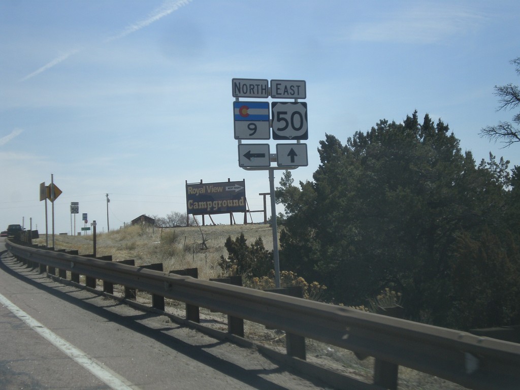
US-50 East at CO-9 North
US-50 east at CO-9 North in Fremont County.
Taken 03-29-2014
 Cañon City
Fremont County
Colorado
United States
Cañon City
Fremont County
Colorado
United States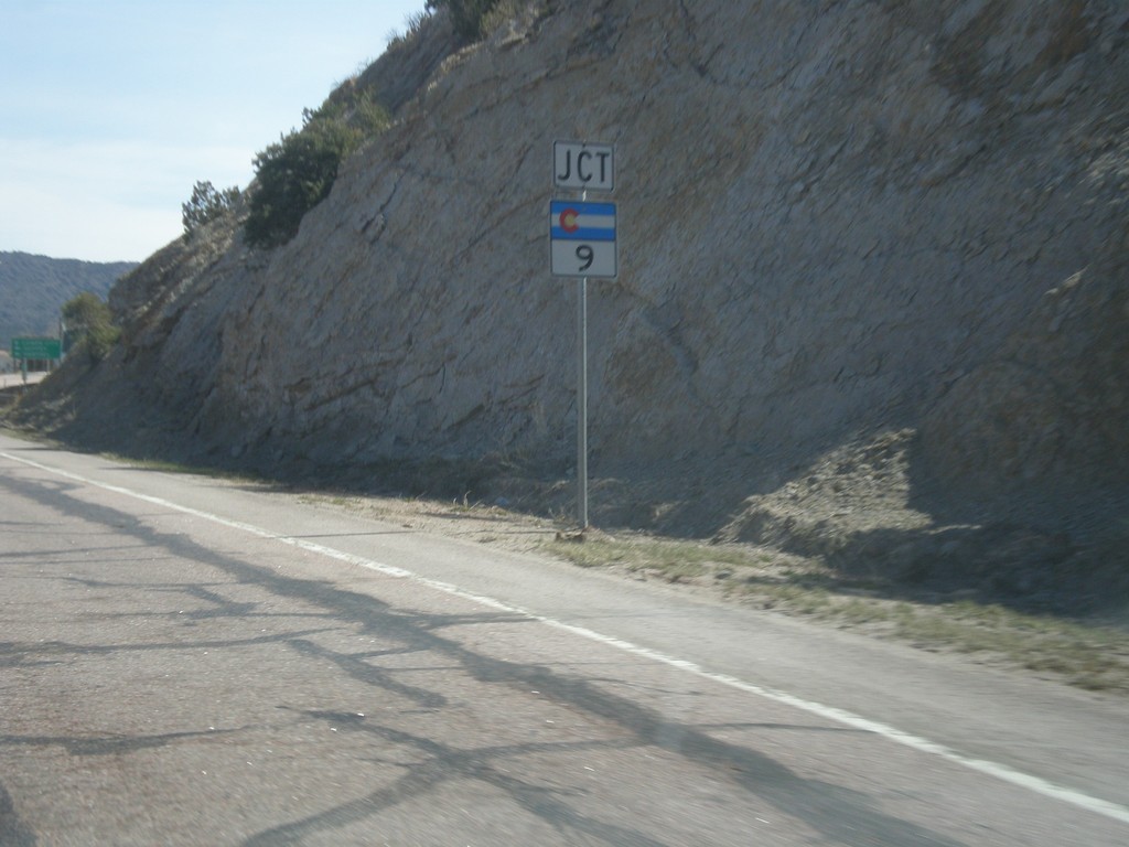
US-50 East Approaching CO-9
US-50 east approaching CO-9 in Fremont County.
Taken 03-29-2014
Cañon City
Fremont County
Colorado
United States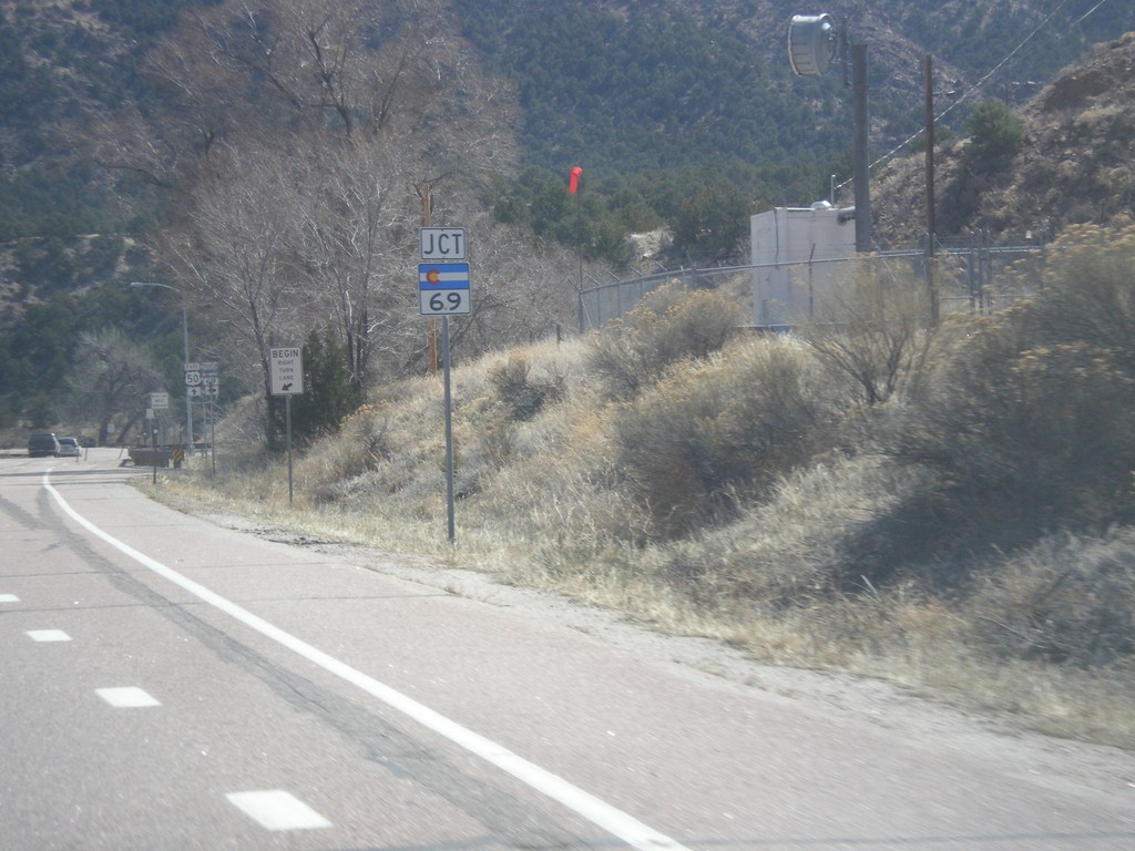
US-50 East at CO-69
US-50 east at CO-69 south.
Taken 03-29-2014
 Cotopaxi
Fremont County
Colorado
United States
Cotopaxi
Fremont County
Colorado
United States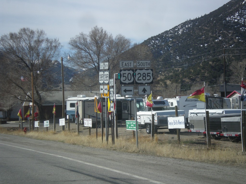
US-50 East/US-285 South at Split
US-50 East/US-285 South at split. Turn left for US-50 east, continue straight for US-285 south.
Taken 03-29-2014
 Salida
Chaffee County
Colorado
United States
Salida
Chaffee County
Colorado
United States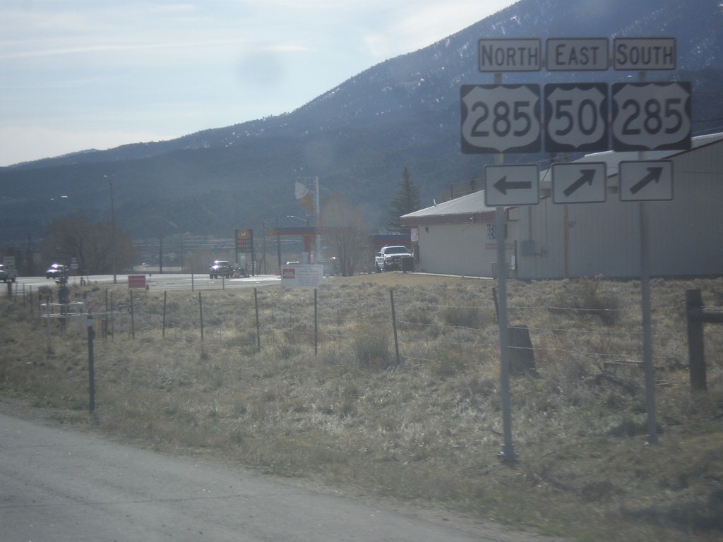
US-50 West at US-285
US-50 west at US-285. Turn left for US-285 north; straight for US-50 east/US-285 south.
Taken 03-29-2014
Salida
Chaffee County
Colorado
United States
End UT-128 East at I-70
End UT-128 east at I-70 at Exit 204.
Taken 03-28-2014


 Cisco
Grand County
Utah
United States
Cisco
Grand County
Utah
United States
US-6 East at US-191
US-6 east at US-191. Turn left for US-191 north. US-191 south joins US-6 south to Crescent Junction.
Taken 03-28-2014
 Castle Gate
Carbon County
Utah
United States
Castle Gate
Carbon County
Utah
United States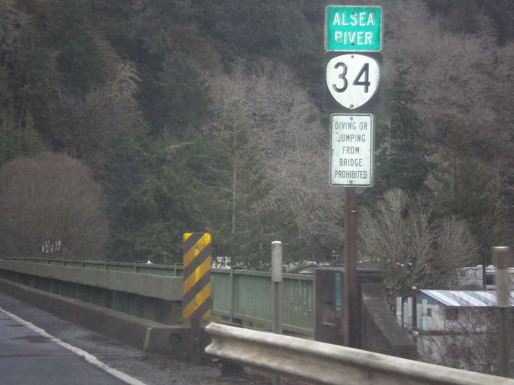
OR-34 East - Alsea River
OR-34 east at the Alsea River bridge.
Taken 02-21-2014
 Waldport
Lincoln County
Oregon
United States
Waldport
Lincoln County
Oregon
United States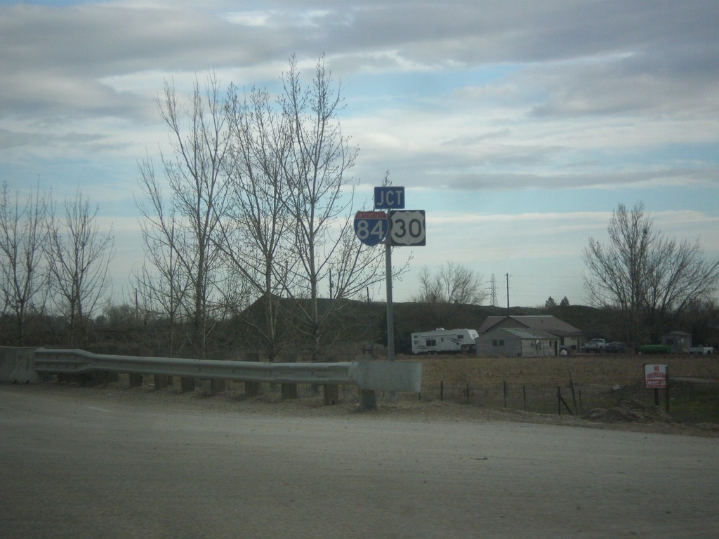
US-20/US-26 East Approaching I-84/US-30
US-20/US-26 east approaching I-84/US-30 onramp.
Taken 02-17-2014


 Caldwell
Canyon County
Idaho
United States
Caldwell
Canyon County
Idaho
United States
US-20/US-26 East/US-95 South - Parma
US-20/US-26 East/US-95 South in Parma
Taken 02-17-2014
 Parma
Canyon County
Idaho
United States
Parma
Canyon County
Idaho
United States
US-20/US-26 East - Nyssa
US-20/US-26 East in Nyssa.
Taken 02-17-2014
Nyssa
Malheur County
Oregon
United States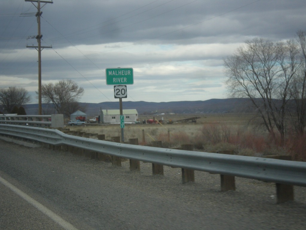
US-20 East - Malheur River
Malheur River bridge on US-20 east in Malheur County.
Taken 02-17-2014
Vale
Malheur County
Oregon
United States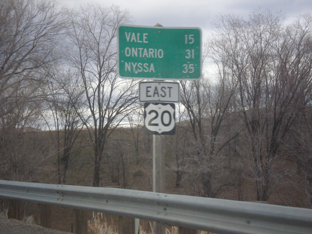
US-20 East - Distance Marker
Distance marker on US-20 east to Vale, Ontario, and Nyssa. Missing US-20 shield on sign.
Taken 02-17-2014
Harper
Malheur County
Oregon
United States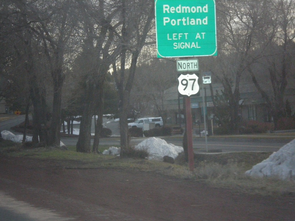
US-20 East Approaching US-97 North
US-20 east approaching Empire Blvd. jct. Use Empire Blvd. for US-97 North access towards Redmond and Portland.
Taken 02-16-2014
 Bend
Deschutes County
Oregon
United States
Bend
Deschutes County
Oregon
United States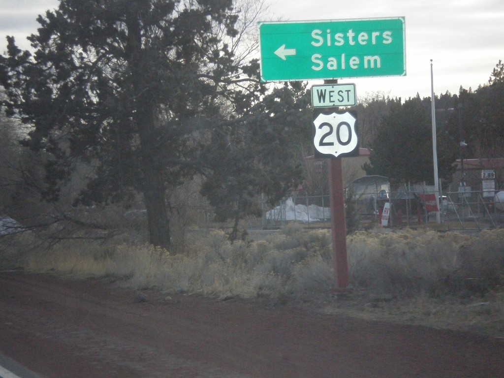
US-20 East at Return To US-20 West
US-20 East at return to US-20 West towards Sisters and Salem.
Taken 02-16-2014
Bend
Deschutes County
Oregon
United States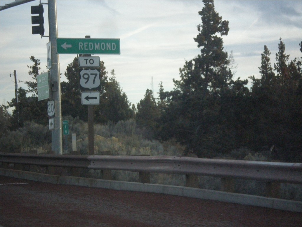
US-20 East at Robal Road
US-20 East at Robal Road. Use Robal Road east for Redmond and US-97 North.
Taken 02-16-2014
Bend
Deschutes County
Oregon
United States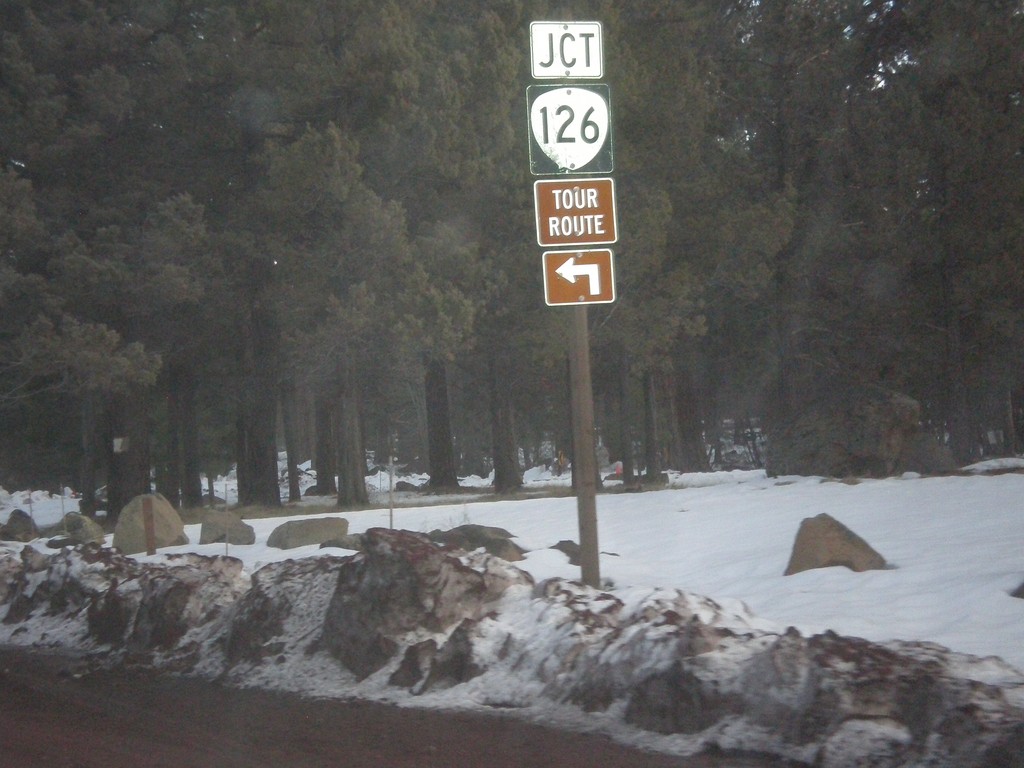
US-20/OR-126 East at US-20/OR-126 Split
US-20/OR-126 East at US-20/OR-126 split in Sisters.
Taken 02-16-2014
 Sisters
Deschutes County
Oregon
United States
Sisters
Deschutes County
Oregon
United States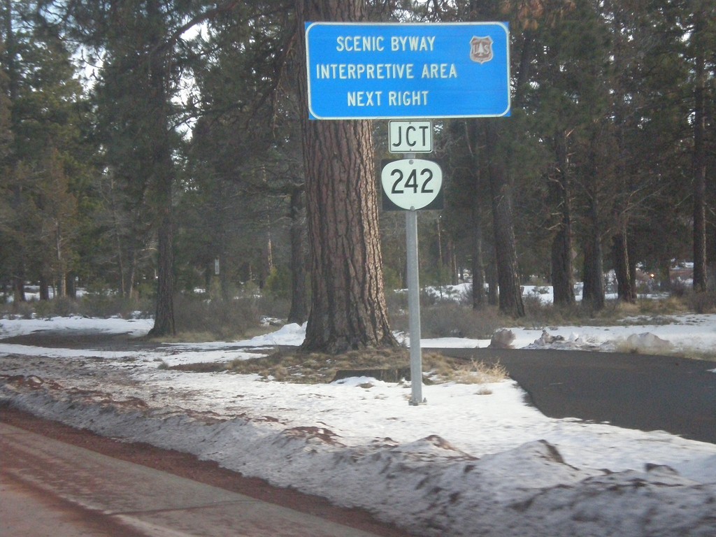
US-20/OR-126 East at OR-242
US-20/OR-126 east approaching OR-242 west, for scenic Mackenzie Pass.
Taken 02-16-2014
 Sisters
Deschutes County
Oregon
United States
Sisters
Deschutes County
Oregon
United States