Signs Tagged With Shield
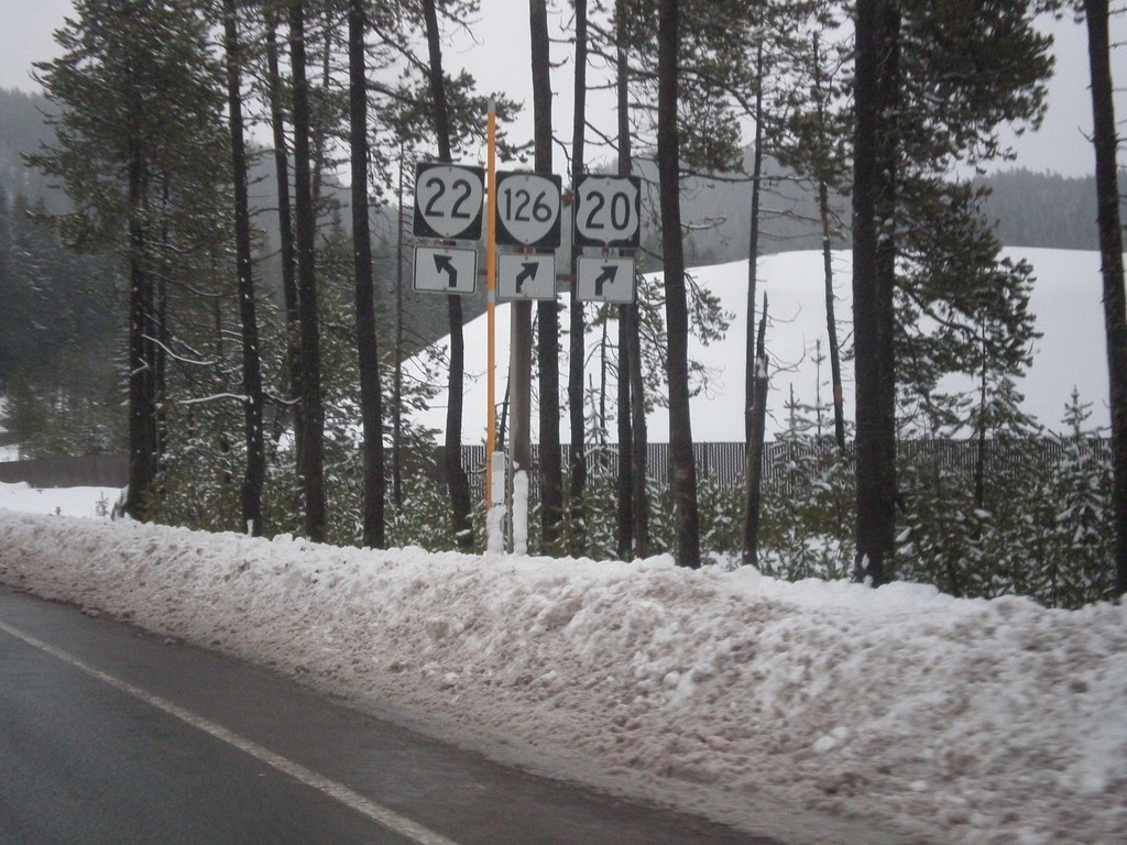
US-20/OR-126 West at OR-22
US-20 East/OR-126 East at OR-22 west. This is the western base of Santiam Pass.
Taken 02-16-2014


 Sisters
Linn County
Oregon
United States
Sisters
Linn County
Oregon
United States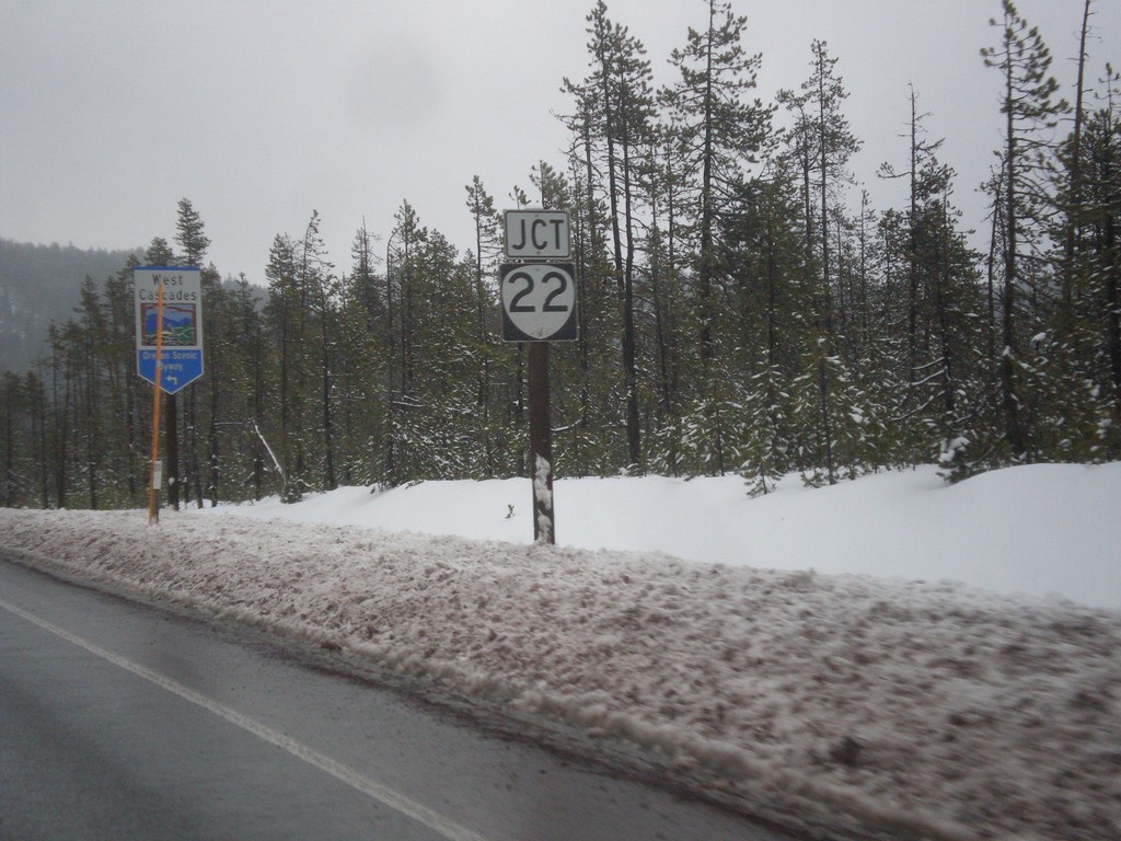
US-20/OR-126 East Approaching OR-22
US-20/OR-126 East approaching OR-22 in Linn County. In background is a West Cascades Scenic Byway sign. Turn left on OR-22 to continue on West Cascades Scenic Byway.
Taken 02-16-2014
Sisters
Linn County
Oregon
United States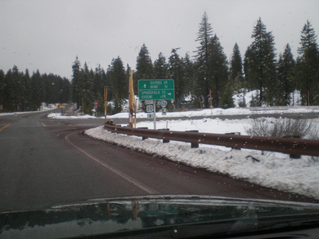
US-20 East at OR-126
US-20 east at OR-126. Turn right for OR-126 west to Eugene and Springfield. Continue east on US-20/OR-126 for Sisters and Bend. OR-126 joins US-20 over Santiam Pass to Sisters.
Taken 02-16-2014
Santiam Junction
Linn County
Oregon
United States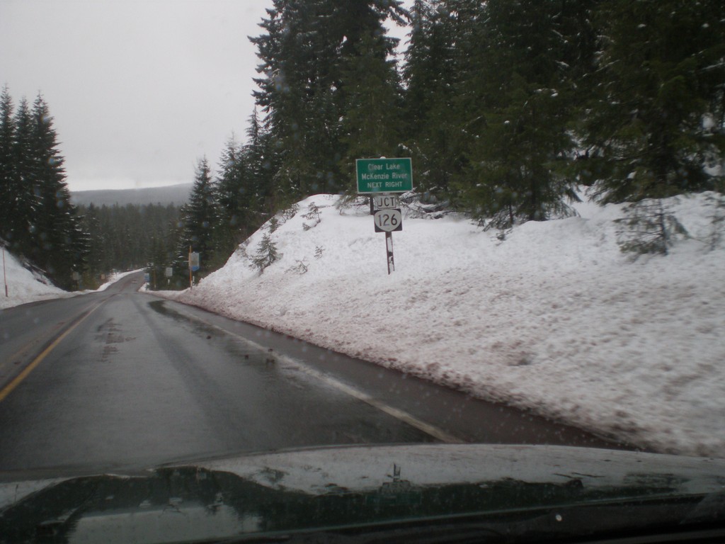
US-20 East Approaching OR-126
US-20 east approaching OR-126 to Clear Lake and Mckenzie River.
Taken 02-16-2014
Cascadia
Linn County
Oregon
United States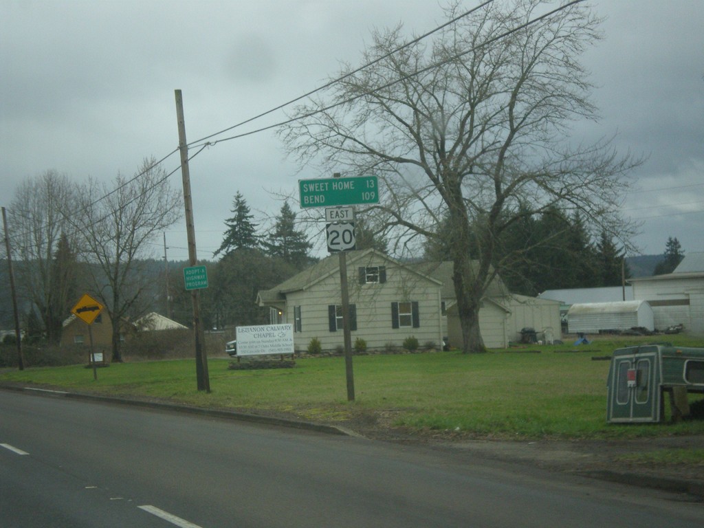
US-20 East - Distance Marker
Distance marker on US-20 east to Sweet Home and Bend.
Taken 02-16-2014
Lebanon
Linn County
Oregon
United States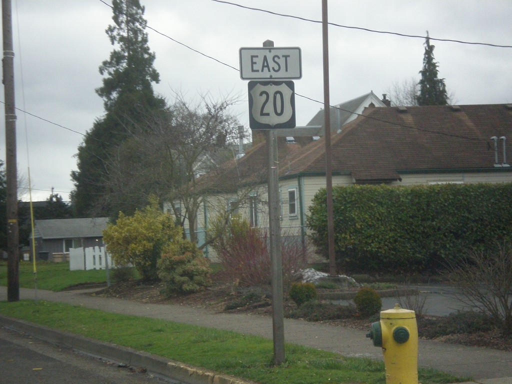
US-20 East - Lebanon
US-20 east shield in Lebanon.
Taken 02-16-2014
Lebanon
Linn County
Oregon
United States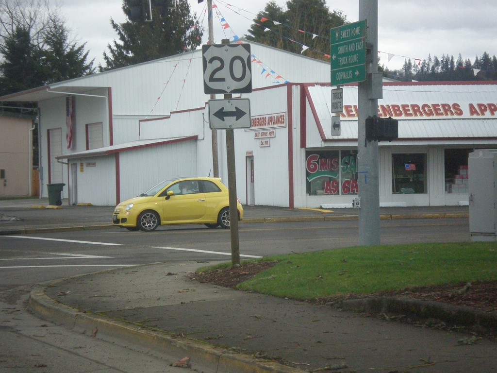
End OR-34 East at US-20
End OR-34 east at US-20 in Lebanon.
Taken 02-16-2014
 Lebanon
Linn County
Oregon
United States
Lebanon
Linn County
Oregon
United States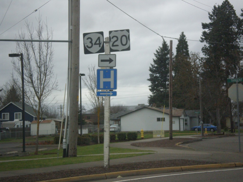
OR-34 East/(To) US-20 - 2nd St./Morgan St.
OR-34 East/(To) US-20 at 2nd St./Morgan St. in Lebanon. Turn right to continue east on OR-34, towards US-20.
Taken 02-16-2014
Lebanon
Linn County
Oregon
United States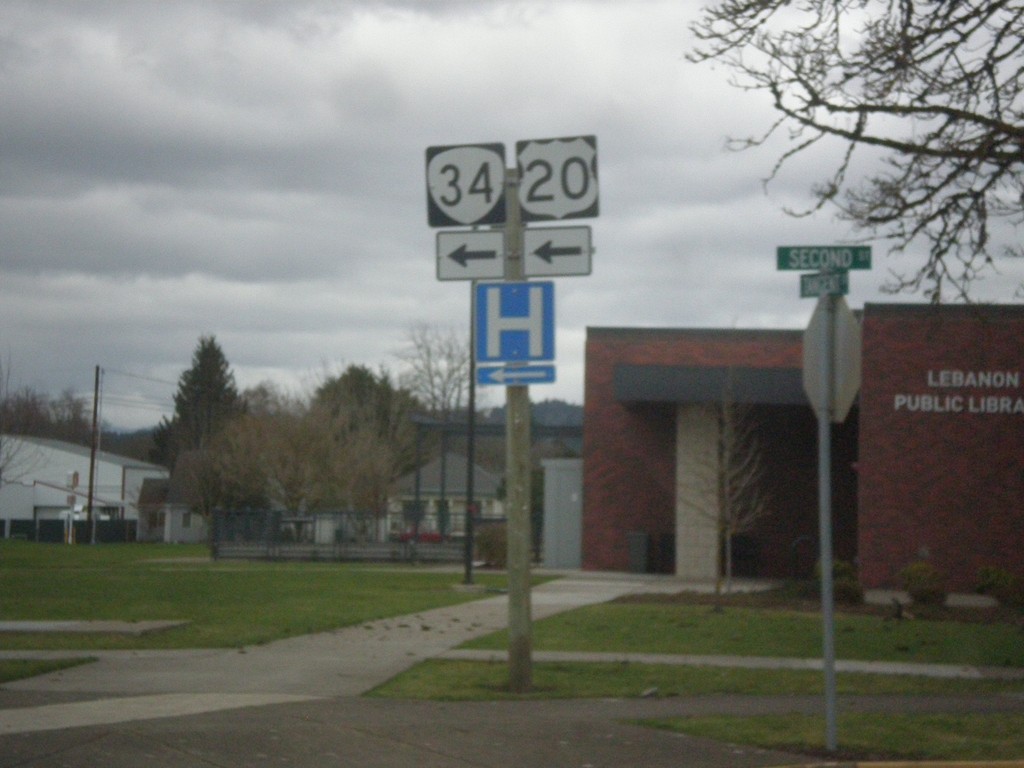
OR-34 East/(To) US-20 - 2nd St. Lebanon
OR-34 East/(To) US-20 at 2nd St. Lebanon. Turn left to continue east on OR-34.
Taken 02-16-2014
Lebanon
Linn County
Oregon
United States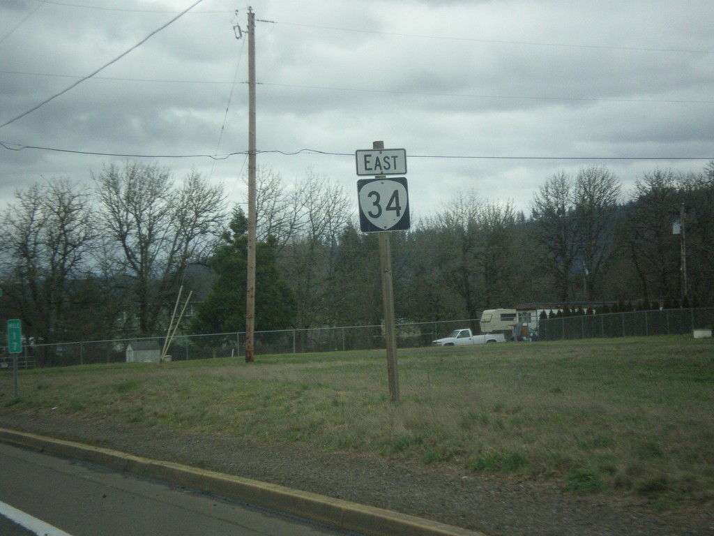
OR-34 East - Lebanon
OR-34 east shield in Lebanon.
Taken 02-16-2014
Lebanon
Linn County
Oregon
United States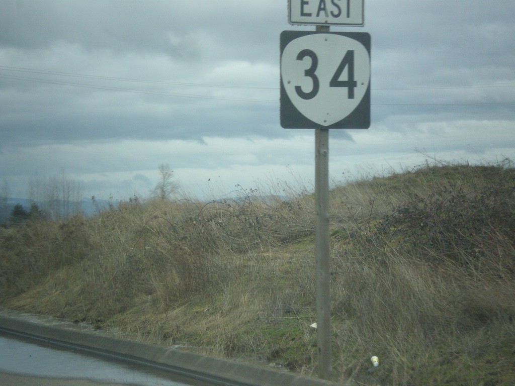
OR-34 East Shield
OR-34 East in Linn County.
Taken 02-16-2014
Tangent
Linn County
Oregon
United States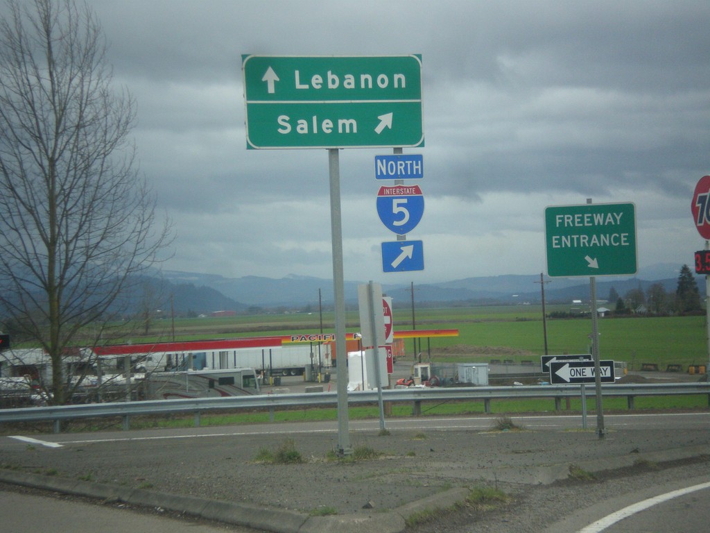
OR-34 East at I-5 North
OR-34 east at I-5 north. Use I-5 north for Salem; continue east on OR-34 for Lebanon. Notice the Freeway Entrance sign here. This type of sign is not common in Oregon at freeway entrances.
Taken 02-16-2014
 Albany
Linn County
Oregon
United States
Albany
Linn County
Oregon
United States
OR-34 East at I-5 South
OR-34 east at I-5 south. Turn right for I-5 south to Eugene; continue over freeway for I-5 north to Salem.
Taken 02-16-2014
Albany
Linn County
Oregon
United States
OR-34 East Approaching I-5
OR-34 East approaching I-5.
Taken 02-16-2014
Albany
Linn County
Oregon
United States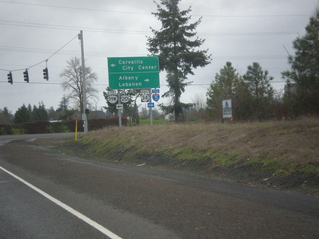
OR-34 East at Harrison Blvd.
OR-34 east at Harrison Blvd. Turn right to continue east on OR-34 towards I-5, Albany, and Lebanon. Turn left towards US-20/OR-99W, and Corvallis City Center.
Taken 02-16-2014
 Corvallis
Linn County
Oregon
United States
Corvallis
Linn County
Oregon
United States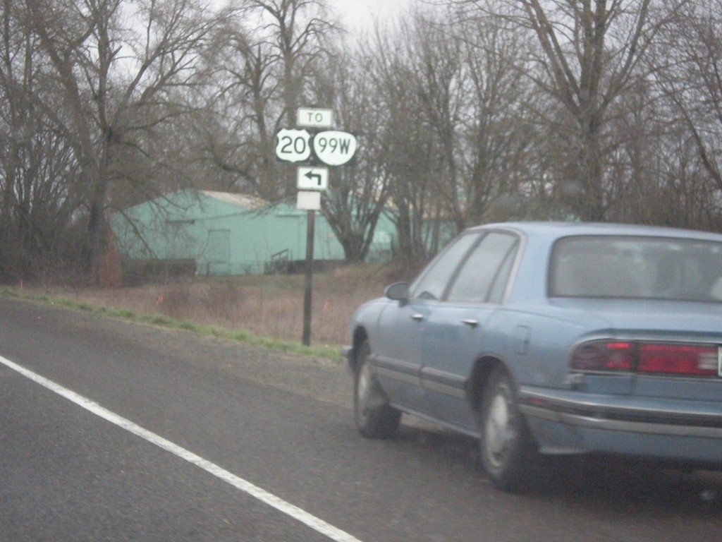
OR-34 East Approaching Harrison Blvd
OR-34 east approaching Harrison Blvd. Turn left on Harrison Blvd. for US-20/OR-99W.
Taken 02-16-2014
Corvallis
Linn County
Oregon
United States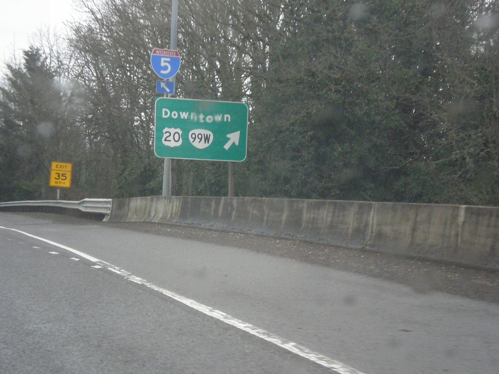
US-20/OR-34 East at US-20/OR-99W
US-20/OR-34 east at US-20/OR-99W junction. Merge right to continue east on US-20. Use US-20 East/OR-99W for Downtown (Corvallis).
Taken 02-16-2014
Corvallis
Benton County
Oregon
United States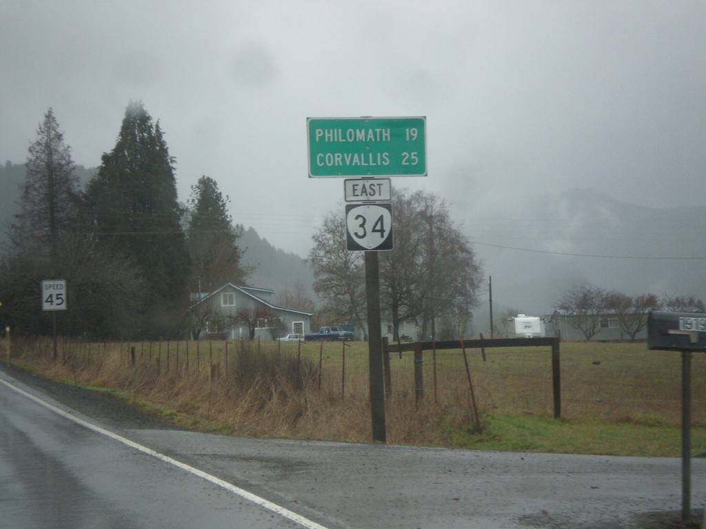
OR-34 East - Distance Marker
Distance marker on OR-34 east to Philomath and Corvallis.
Taken 02-16-2014
Alsea
Benton County
Oregon
United States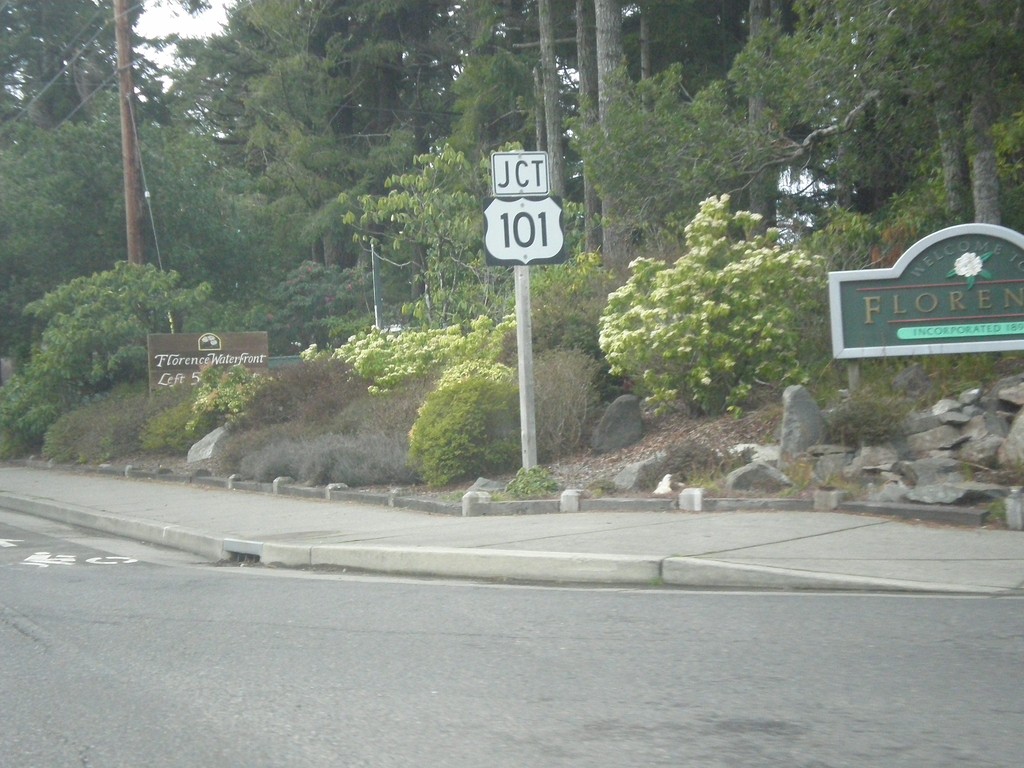
End OR-126 West Approaching US-101
End OR-126 west approaching US-101 in Florence.
Taken 02-13-2014
 Florence
Lane County
Oregon
United States
Florence
Lane County
Oregon
United States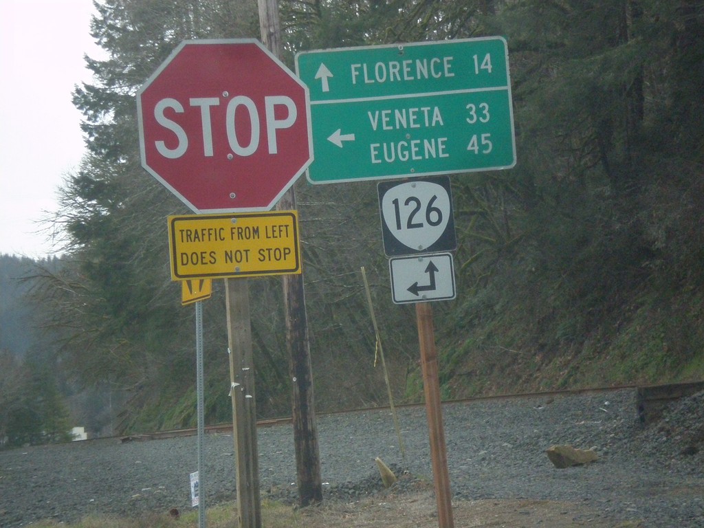
End OR-36 at OR-126
End OR-36 at OR-126. Turn left for OR-126 east to Veneta and Eugene; continue straight for OR-126 west to Florence.
Taken 02-13-2014
 Mapleton
Lane County
Oregon
United States
Mapleton
Lane County
Oregon
United States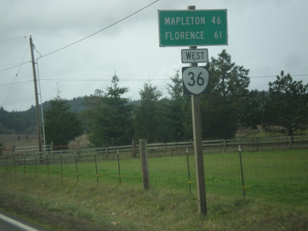
OR-36 West - Distance Marker
Distance marker on OR-36 west to Mapleton and Florence.
Taken 02-13-2014
Cheshire
Lane County
Oregon
United States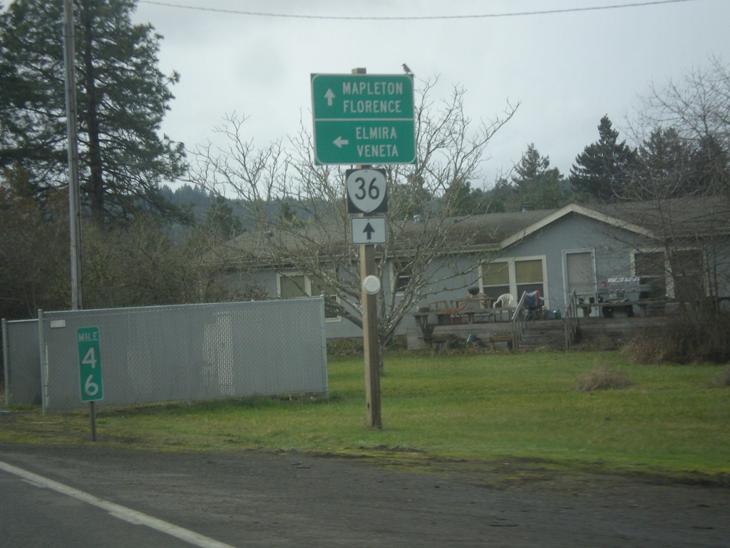
OR-36 West at Territorial Highway
OR-36 west at Territorial Highway south to Veneta and Elmira. Continue west on OR-36 for Mapleton and Florence.
Taken 02-13-2014
Cheshire
Lane County
Oregon
United States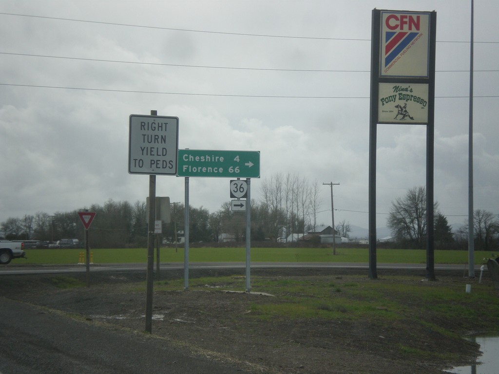
OR-99 South at OR-36
OR-99 south at OR-36 west to Cheshire and Florence.
Taken 02-13-2014
 Junction City
Lane County
Oregon
United States
Junction City
Lane County
Oregon
United States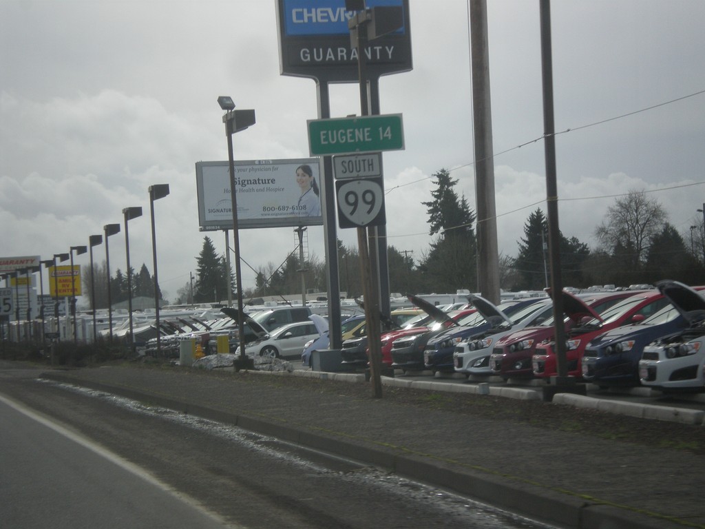
OR-99 South - Distance Marker
Distance to Eugene on OR-99 south in Junction City.
Taken 02-13-2014
Junction City
Lane County
Oregon
United States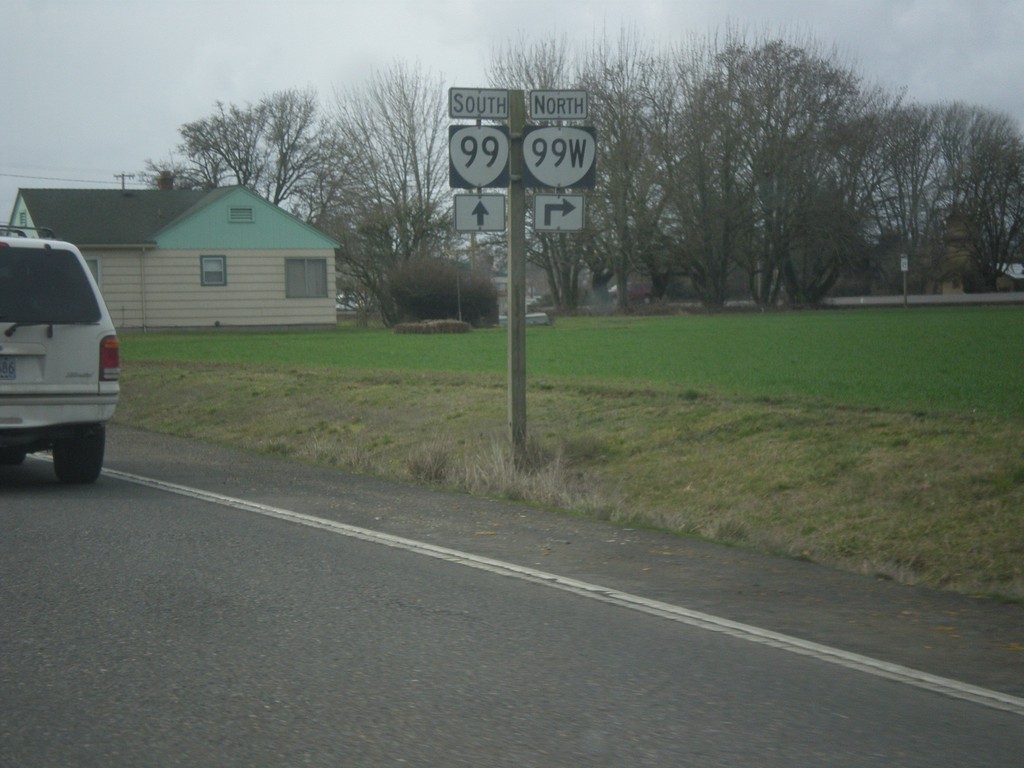
End OR-99E South at OR-99W/OR-99
End OR-99E south at OR-99W/OR-99 in Junction City.
Taken 02-13-2014
 Junction City
Lane County
Oregon
United States
Junction City
Lane County
Oregon
United States