Signs Tagged With Shield
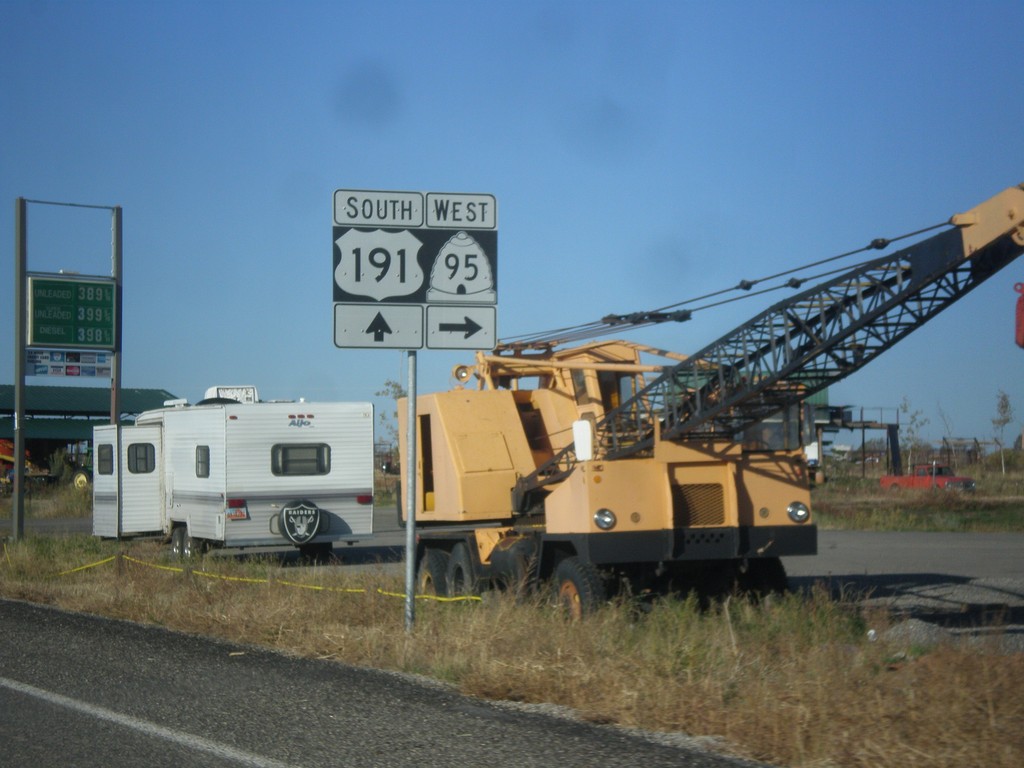
US-191 South at UT-95
US-191 south at UT-95 west, just south of Blanding.
Taken 10-14-2013

 Blanding
San Juan County
Utah
United States
Blanding
San Juan County
Utah
United States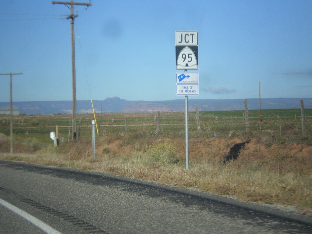
US-191 South Approaching UT-95
US-191 south approaching UT-95. UT-95 is part of the Trail of the Ancients Scenic Byway.
Taken 10-14-2013
Blanding
San Juan County
Utah
United States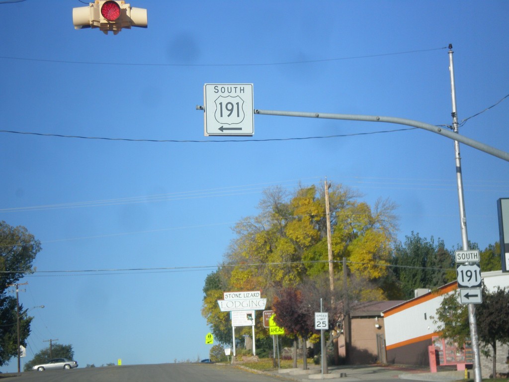
US-191 South - Blanding
US-191 south at the Center St./Main St. intersection in Blanding. US-191 turns south on Main St.
Taken 10-14-2013
Blanding
San Juan County
Utah
United States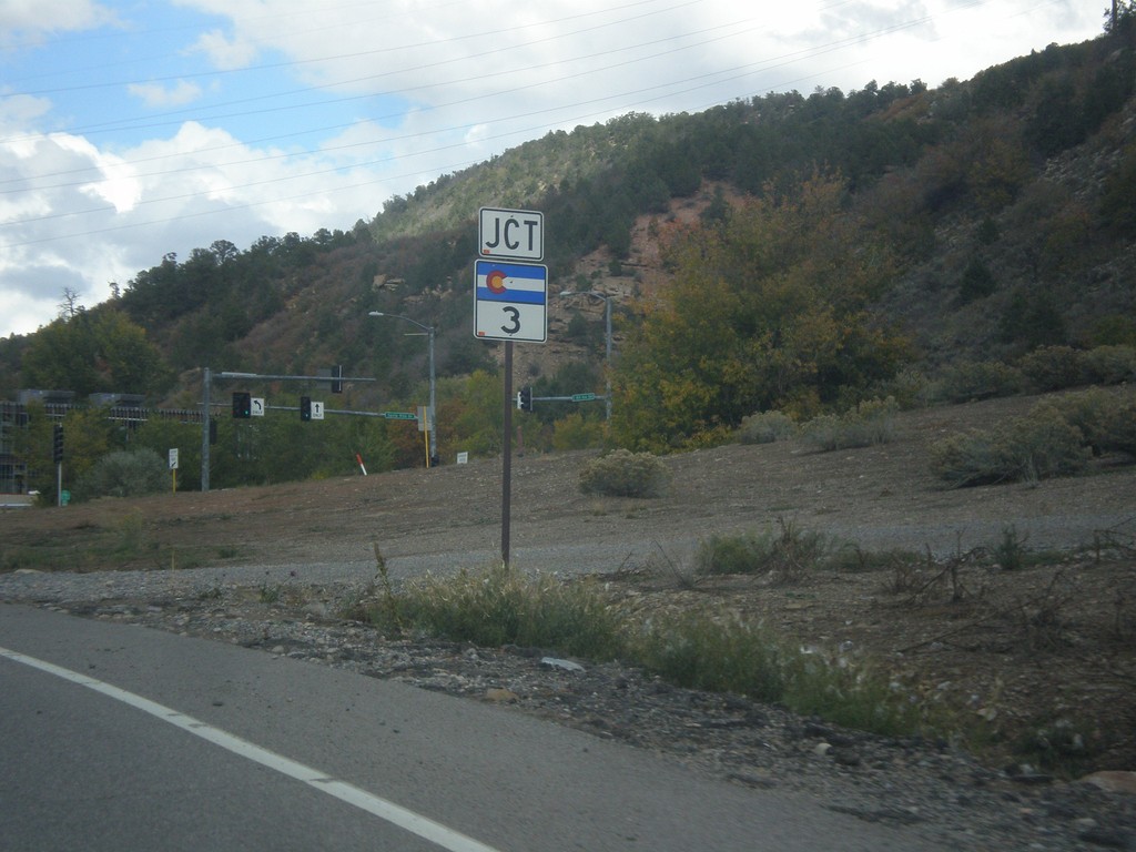
US-160 West/US-550 North Approaching CO-3
US-160 West/US-550 North Approaching CO-3 in Durango. CO-3 is a short route that runs along the east side of Durango.
Taken 10-13-2013


 Durango
La Plata County
Colorado
United States
Durango
La Plata County
Colorado
United States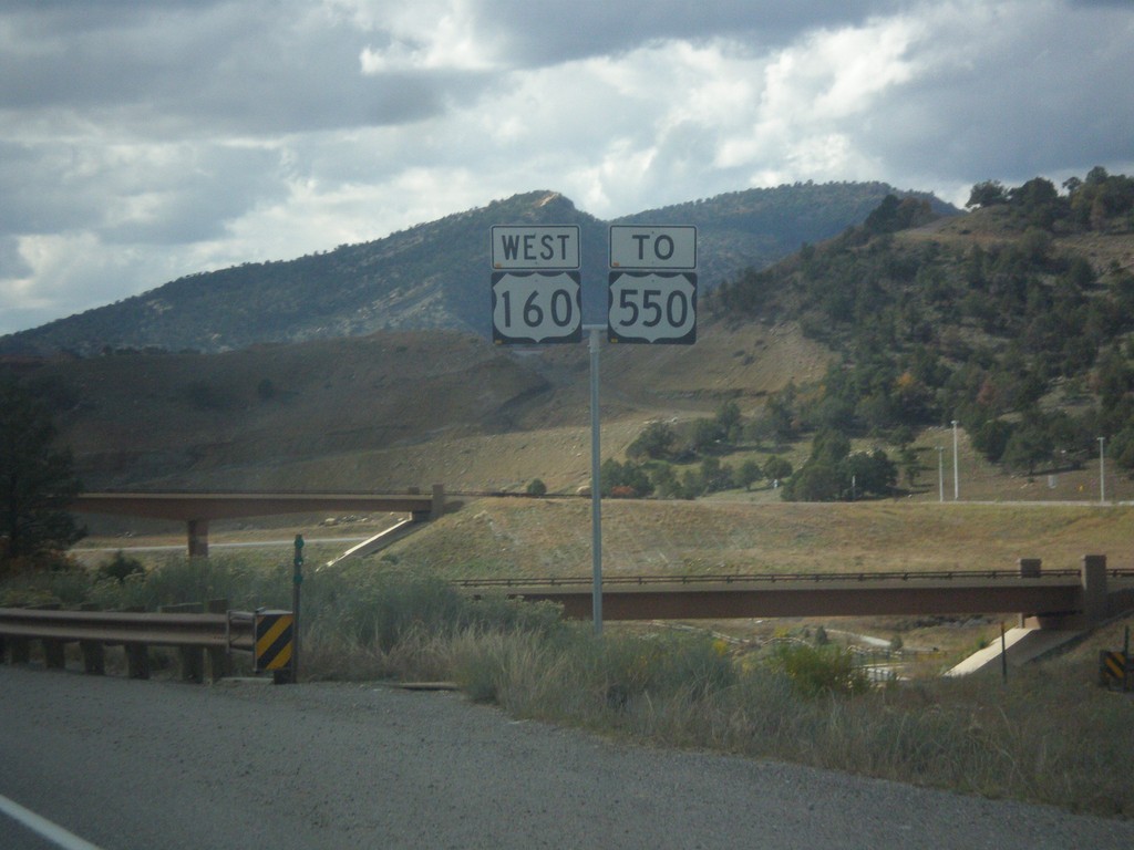
US-160 West/To US-550
US-160 West/To US-550 shields, taken just east of Durango.
Taken 10-13-2013
Durango
La Plata County
Colorado
United States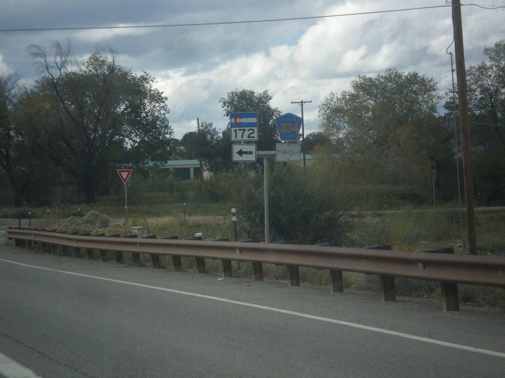
US-160 West at CO-172/CR-234
US-160 west at CO-172/CR-234 in La Plata County.
Taken 10-13-2013

 Durango
La Plata County
Colorado
United States
Durango
La Plata County
Colorado
United States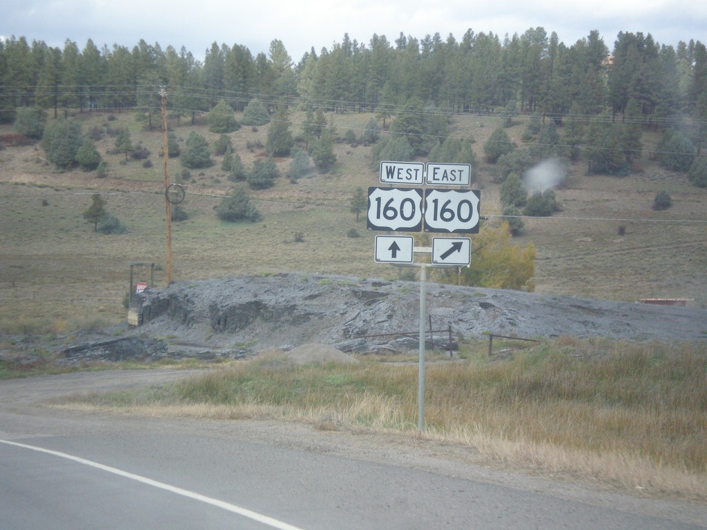
End US-84 West at US-160
End US-84 west at US-160 in Pagosa Springs. There is no END US-84 sign at this junction.
Taken 10-13-2013
 Pagosa Springs
Archuleta County
Colorado
United States
Pagosa Springs
Archuleta County
Colorado
United States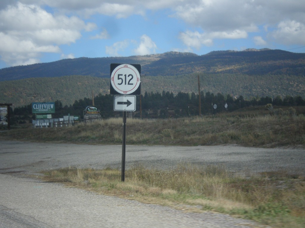
US-64 West/US-84 North - NM-512 Jct.
US-64 West/US-84 North at NM-512 junction near Tierra Amarilla.
Taken 10-13-2013

 Brazos
Rio Arriba County
New Mexico
United States
Brazos
Rio Arriba County
New Mexico
United States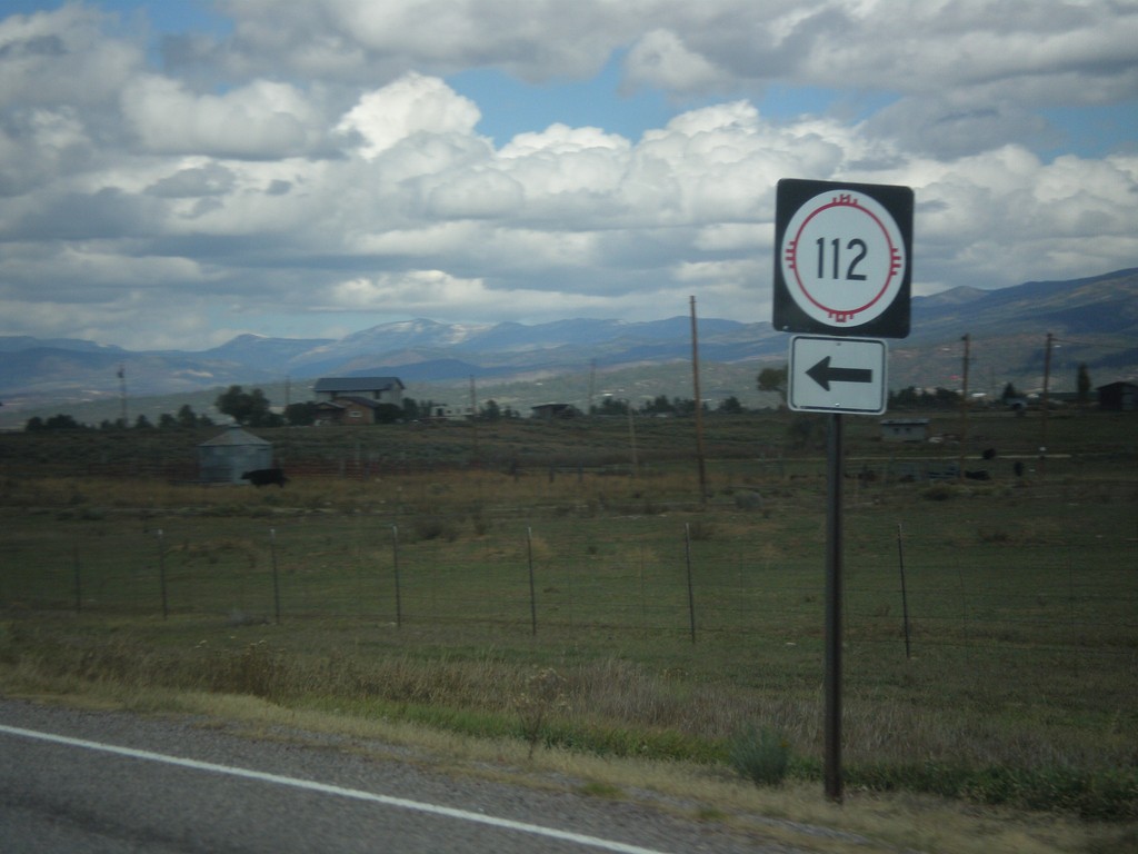
US-84/US-64 West - NM-112 Jct
US-84/US-64 West at NM-112 junction, near Tierra Amarilla.
Taken 10-13-2013
 Los Ojos
Rio Arriba County
New Mexico
United States
Los Ojos
Rio Arriba County
New Mexico
United States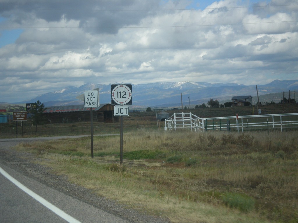
US-64 West/US-84 North Approaching NM-512
US-64 West/US-84 North approaching NM-512 near Tierra Amarilla.
Taken 10-13-2013
Tierra Amarilla
Rio Arriba County
New Mexico
United States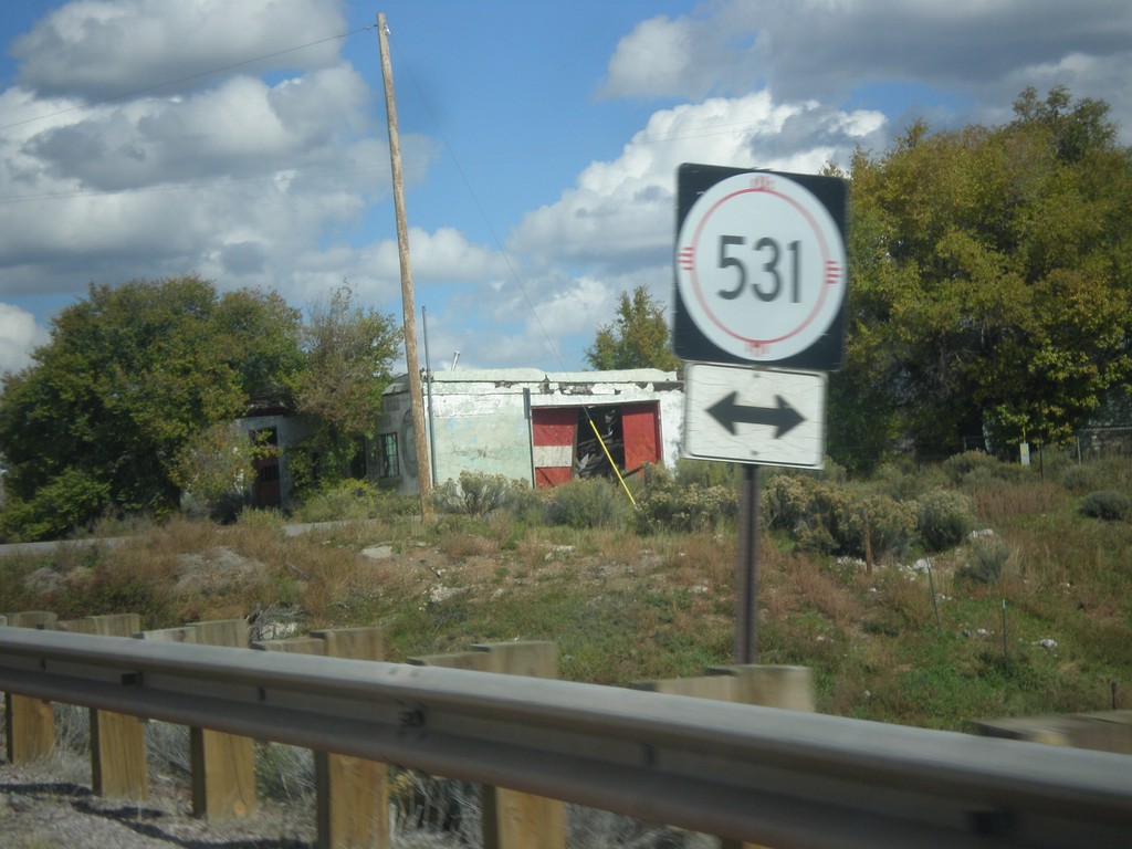
US-64 West/US-84 North at NM-531
US-64 West/US-84 north at NM-531 near Tierra Amarilla.
Taken 10-13-2013
 Tierra Amarilla
Rio Arriba County
New Mexico
United States
Tierra Amarilla
Rio Arriba County
New Mexico
United States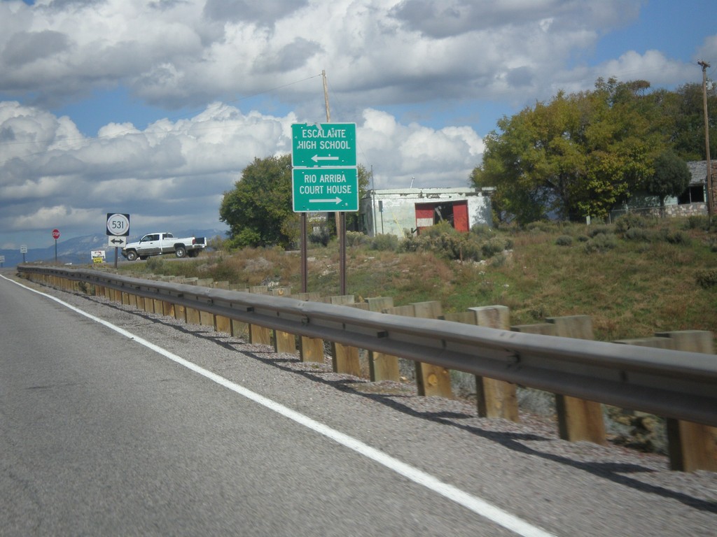
US-64 West/US-84 North Approaching NM-531
US-64 West/US-84 North approaching NM-531. Turn left for Escalante High School; turn right for Rio Arriba Court House (in Tierra Amarilla).
Taken 10-13-2013
Tierra Amarilla
Rio Arriba County
New Mexico
United States
US-64 West Approaching US-84
US-64 west approaching US-84 in Rio Arriba County.
Taken 10-13-2013
Tierra Amarilla
Rio Arriba County
New Mexico
United States
US-64 West Approaching US-84
US-64 west approaching US-84 in Rio Arriba County.
Taken 10-13-2013
Los Ojos
Rio Arriba County
New Mexico
United States
US-64 West Approaching US-285
US-64 west approaching US-285 in Tres Piedras.
Taken 10-13-2013
 Tres Piedras
Taos County
New Mexico
United States
Tres Piedras
Taos County
New Mexico
United States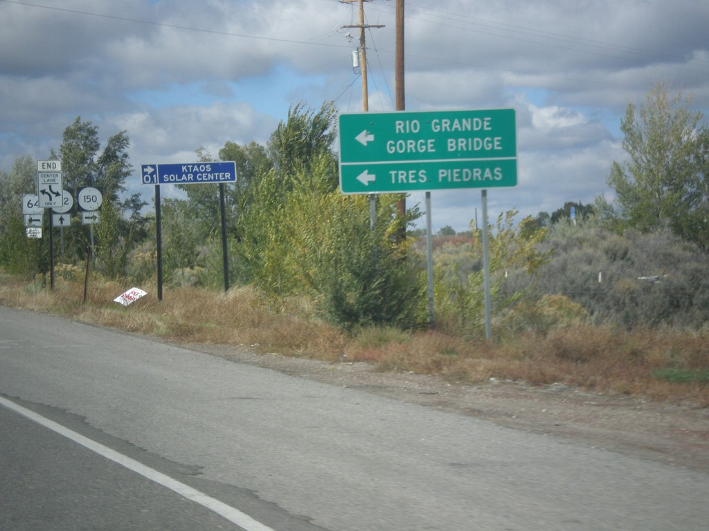
US-64 West at NM-150/NM-522
US-64 west at NM-150/NM-522 junction. Use US-64 for Tres Piedras and Rio Grande Gorge Bridge.
Taken 10-11-2013

 El Prado
Taos County
New Mexico
United States
El Prado
Taos County
New Mexico
United States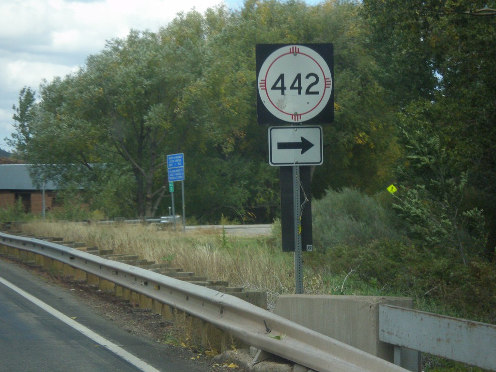
NM-518 North at NM-442
NM-518 North at NM-442 in Mora County.
Taken 10-10-2013

 Rainsville
Mora County
New Mexico
United States
Rainsville
Mora County
New Mexico
United States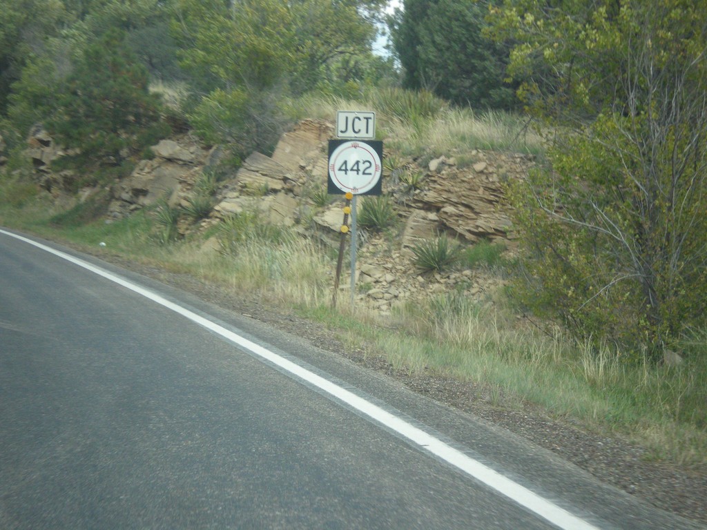
NM-518 North Approaching NM-442
NM-518 north approaching NM-442 in Mora County.
Taken 10-10-2013
Mora
Mora County
New Mexico
United States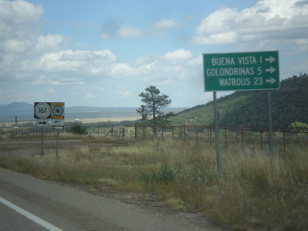
NM-518 North at NM-116
NM-518 north at NM-116 east to Buena Vista, Golondrinas, and Watrous. NM-116 follows the route of the Santa Fe Trail.
Taken 10-10-2013
 Sapello
Mora County
New Mexico
United States
Sapello
Mora County
New Mexico
United States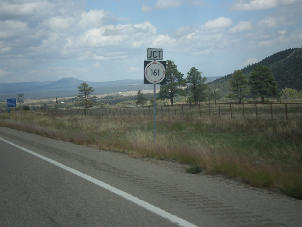
NM-518 North Approaching NM-116
NM-518 north approaching NM-116 east in Mora County.
Taken 10-10-2013
Sapello
Mora County
New Mexico
United States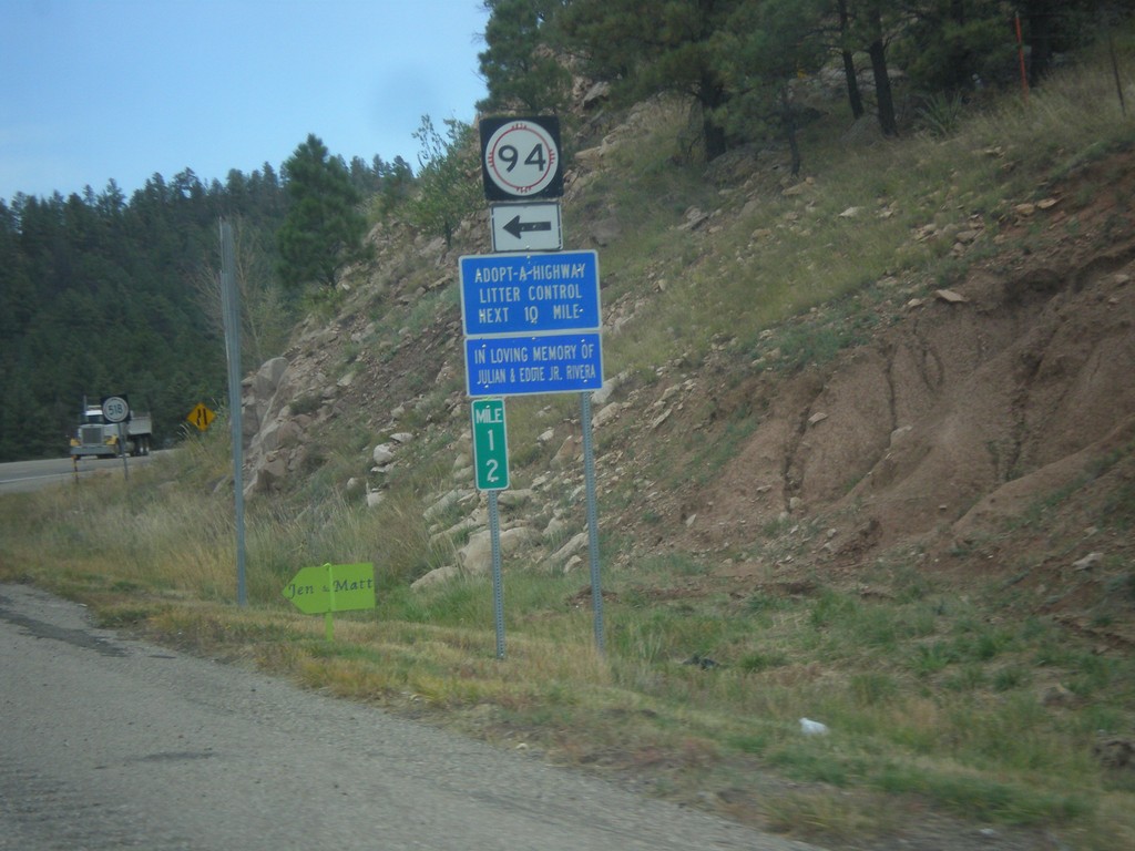
NM-518 North At NM-94
NM-518 north at NM-94 in San Miguel County.
Taken 10-10-2013
 Sapello
San Miguel County
New Mexico
United States
Sapello
San Miguel County
New Mexico
United States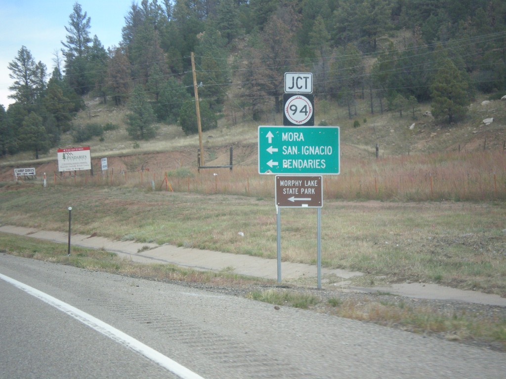
NM-518 North Approaching NM-94
NM-518 north approaching NM-94 west to San Ignacio, Pendaries, and Morphy Lake State Park. Continue north on NM-518 for Mora.
Taken 10-10-2013
Sapello
San Miguel County
New Mexico
United States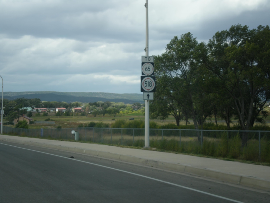
Mills Ave. - To NM-65/NM-518
Mills Ave. west, To NM-65/NM-518 in Las Vegas.
Taken 10-10-2013
 Las Vegas
San Miguel County
New Mexico
United States
Las Vegas
San Miguel County
New Mexico
United States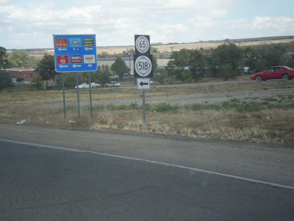
BL-25 North (Grand Ave.) at Mills Ave.
BL-25 North (Grand Ave.) at Mills Ave., which leads to NM-518 and NM-65. Mills Ave. formerly used to be NM-329.
Taken 10-10-2013
 Las Vegas
San Miguel County
New Mexico
United States
Las Vegas
San Miguel County
New Mexico
United States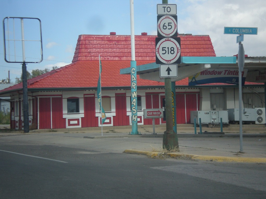
BL-25 North in Las Vegas
BL-25 north, To NM-518 and NM-65 in Las Vegas.
Taken 10-10-2013
Las Vegas
San Miguel County
New Mexico
United States