Signs Tagged With Shield
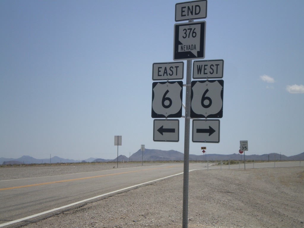
End NV-376 South at US-6
End NV-376 south at US-6.
Taken 05-04-2012

 Tonopah
Nye County
Nevada
United States
Tonopah
Nye County
Nevada
United States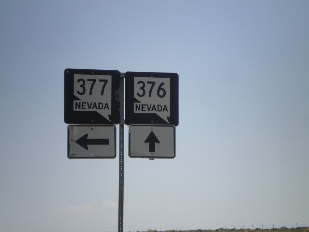
NV-376 South at NV-377
NV-376 south at NV-377. Use NV-377 east for Manhattan and Belmont.
Taken 05-04-2012
 Manhattan
Nye County
Nevada
United States
Manhattan
Nye County
Nevada
United States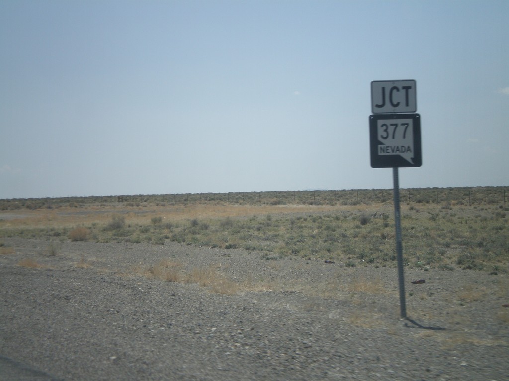
NV-376 South Approaching NV-377
NV-376 South approaching NV-377.
Taken 05-04-2012
Manhattan
Nye County
Nevada
United States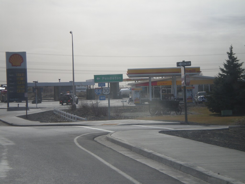
S. Main St. at I-84 East
S. Main St. at I-84/US-30 east. Turn left for I-84/US-30 to Pendleton.
Taken 02-22-2012

 Boardman
Morrow County
Oregon
United States
Boardman
Morrow County
Oregon
United States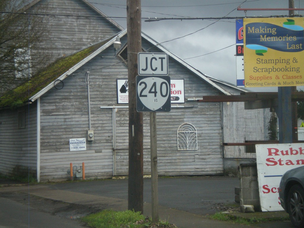
OR-99W North Approaching OR-240
OR-99W North approaching OR-240 in Newberg.
Taken 02-21-2012

 Newberg
Yamhill County
Oregon
United States
Newberg
Yamhill County
Oregon
United States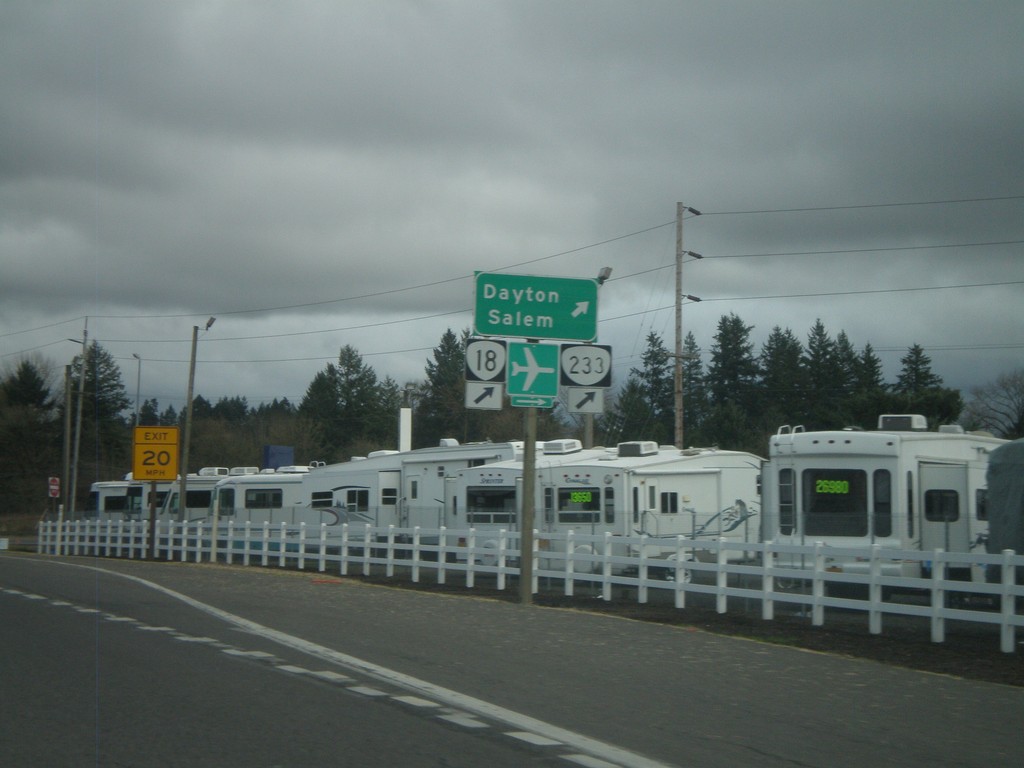
OR-99W North at OR-233 and OR-18
OR-99W North at OR-233 and OR-18 west to Dayton and Salem. OR-18 is the McMinnville Bypass, which runs along the south side of the city of McMinnville. This the eastern end of the bypass.
Taken 02-21-2012

 Dayton
Yamhill County
Oregon
United States
Dayton
Yamhill County
Oregon
United States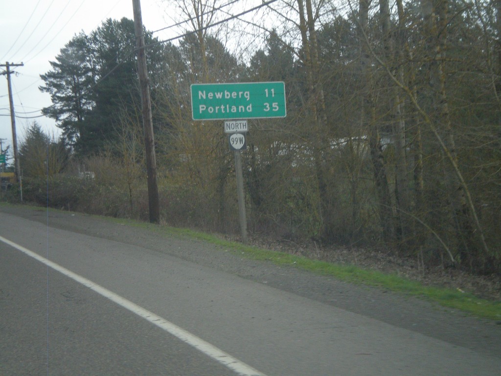
OR-99W North - Distance Marker
Distance marker on OR-99W north to Newberg and Portland. Taken on the east side of Lafayette.
Taken 02-21-2012
Dayton
Yamhill County
Oregon
United States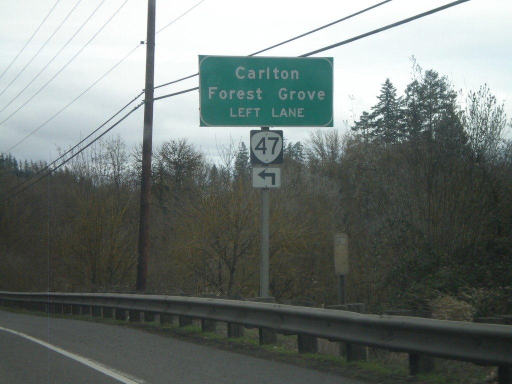
OR-99W North Approaching OR-47
OR-99W North approaching OR-47 North. Use OR-47 north for Carlton and Forest Grove.
Taken 02-21-2012
 McMinnville
Yamhill County
Oregon
United States
McMinnville
Yamhill County
Oregon
United States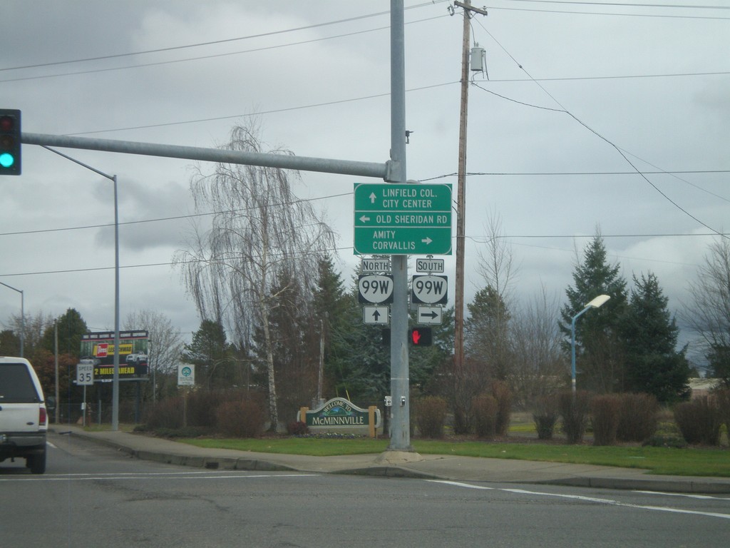
SW Baker St. North at OR-99W
SW Baker St. North at OR-99W. SW Baker St. is the ramp that connects OR-18 eastbound to OR-99W northbound and turns into a surface street. It is signed as OR-99W, but does not actually reach OR-99W until this light at Old Sheridan Road. Turn right for OR-99W South to Amity and Corvallis. Continue ahead for Linfield College and City Center (McMinnville).
Taken 02-21-2012
McMinnville
Yamhill County
Oregon
United States
SW Baker St. North Approaching OR-99W
SW Baker St. North approaching OR-99W. SW Baker St. is the ramp from OR-18 East to OR-99W north, and is signed as OR-99W. SW Baker St. actually joins with OR-99W at the next intersection with Old Sheridan Road.
Taken 02-21-2012
McMinnville
Yamhill County
Oregon
United States
US-101 North Approaching OR-6
US-101 North approaching OR-6 east.
Taken 02-19-2012

 Tillamook
 County
Oregon
United States
Tillamook
Tillamook County
Oregon
United States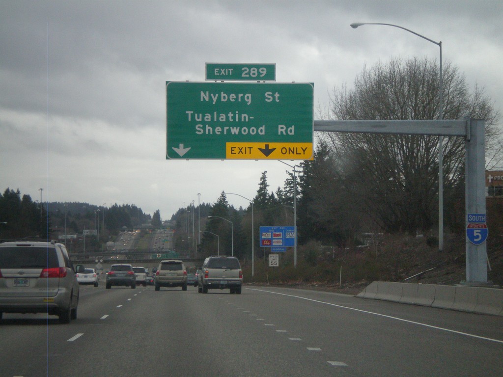
I-5 South Approaching Exit 289
I-5 south approaching Exit 289 - Nyberg St./Tualatin-Sherwood Road. An I-5 south shield is attached to the sign structure.
Taken 02-18-2012
 Lake Oswego
Washington County
Oregon
United States
Lake Oswego
Washington County
Oregon
United States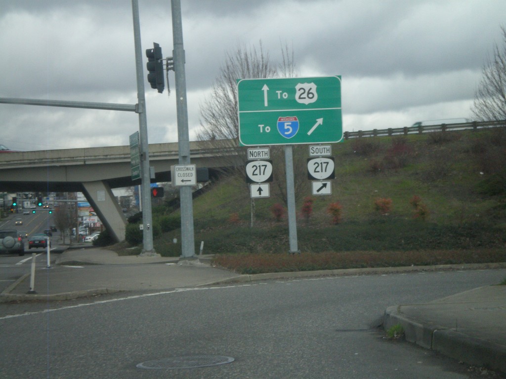
OR-8 East At OR-217 South Onramp
OR-8 East at OR-217 South onramp. Use OR-217 south for I-5; use OR-217 north for US-26.
Taken 02-18-2012


 Beaverton
Washington County
Oregon
United States
Beaverton
Washington County
Oregon
United States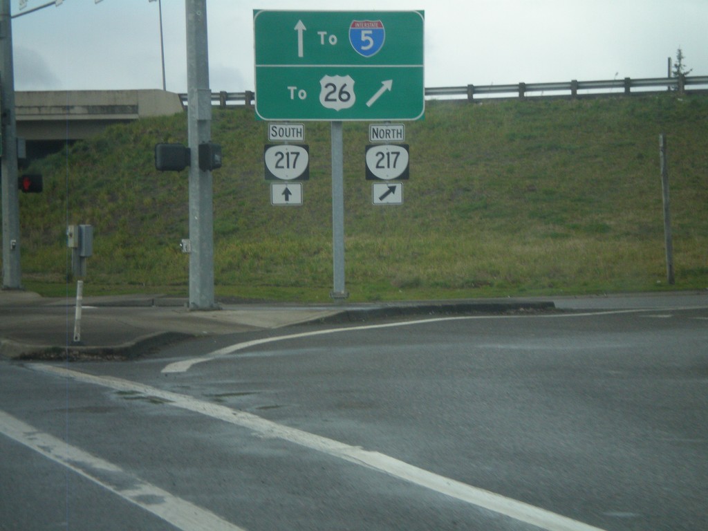
OR-8 West at at OR-217 North
OR-8 west at OR-217 north. Use OR-217 north for US-26; use OR-217 south for I-5.
Taken 02-18-2012
Beaverton
Washington County
Oregon
United States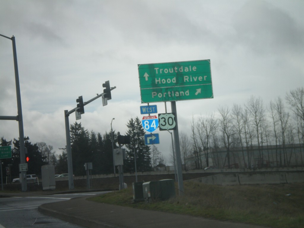
238th Ave. North at I-84
238th Dr. North at I-84/US-30 onramp. Turn right for I-84/US-30 west to Portland. Continue across overpass for I-84/US-30 East to Troutdale and Hood River.
Taken 02-18-2012
Wood Village
Multnomah County
Oregon
United States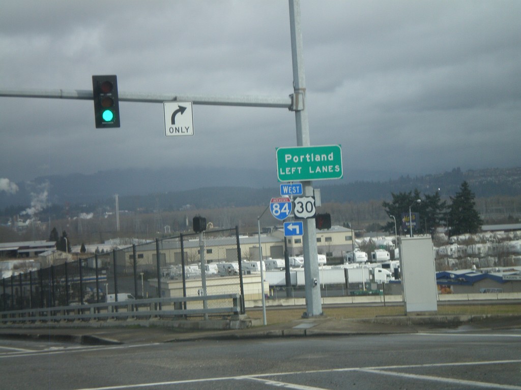
South 238th Drive at I-84
South 238th Drive at I-84. Use left lanes for I-84/US-30 West to Portland.
Taken 02-18-2012
Troutdale
Multnomah County
Oregon
United States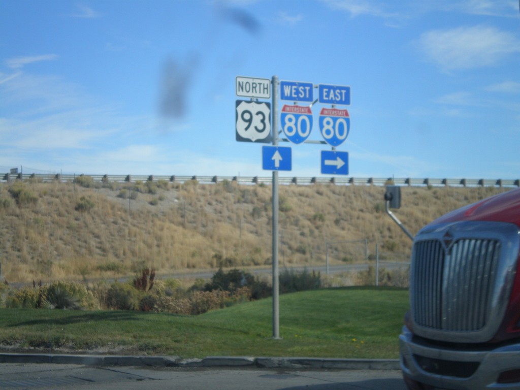
US-93 North at I-80
US-93 north at I-80 (Exit 352). Turn right for I-80 east; continue under the underpass for I-80 west.
Taken 10-15-2011


 Wells
Elko County
Nevada
United States
Wells
Elko County
Nevada
United States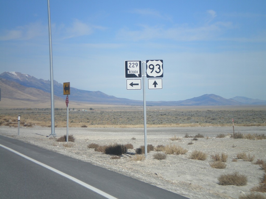
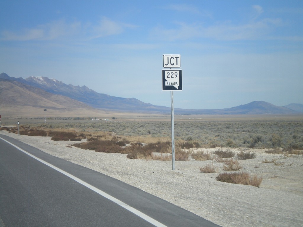
US-93 North Approaching NV-229
US-93 north approaching NV-229.
Taken 10-15-2011
 Wells
Elko County
Nevada
United States
Wells
Elko County
Nevada
United States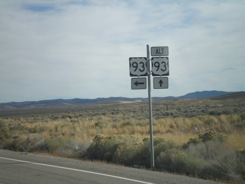
US-93 North at Alt. US-93
US-93 North at Alt. US-93 in White Pine County.
Taken 10-15-2011
Ely
White Pine County
Nevada
United States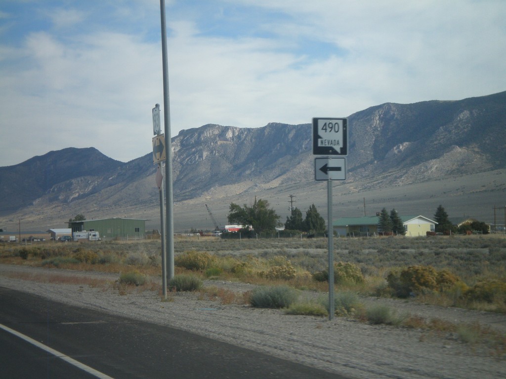
US-93 North at NV-490
US-93 north at NV-490 to Ely State Prison.
Taken 10-15-2011
 Ely
White Pine County
Nevada
United States
Ely
White Pine County
Nevada
United States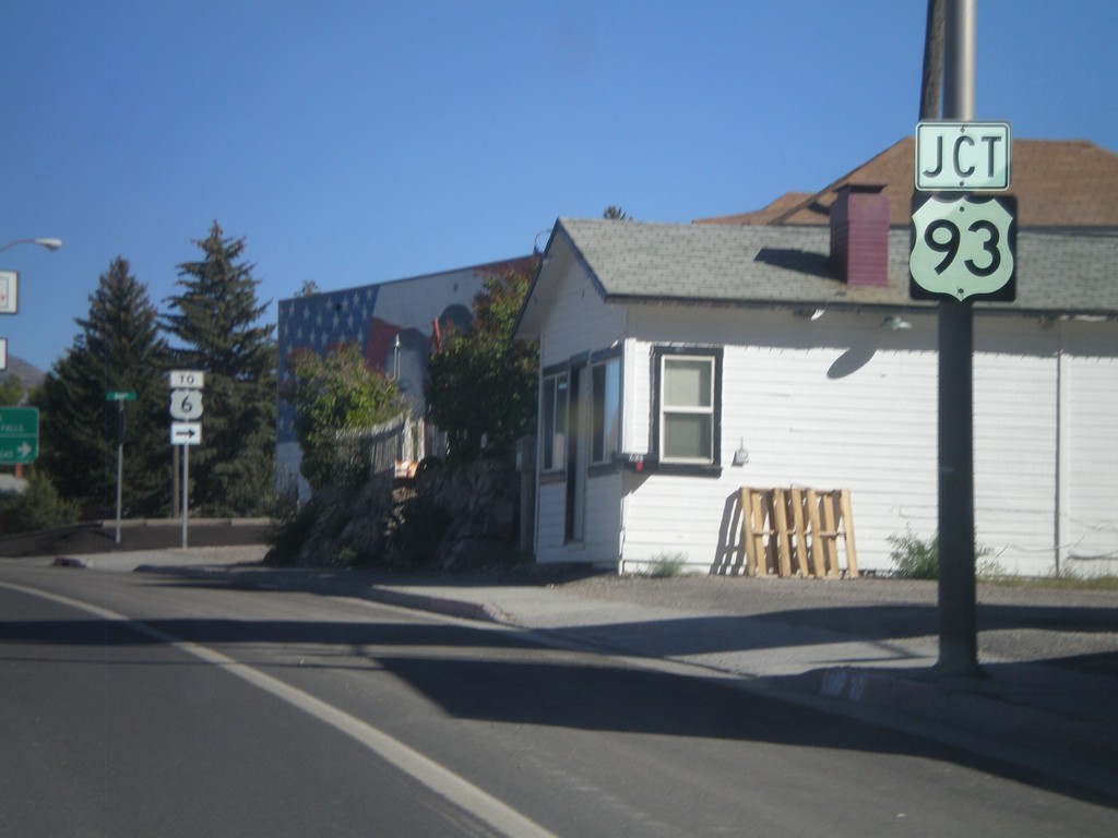
US-50 East at US-93
US-50 east at US-93. US-50 joins US-93 through Ely to Majors Junction. Use US-93 South/US-50 East for US-6.
Taken 10-14-2011
 Ely
White Pine County
Nevada
United States
Ely
White Pine County
Nevada
United States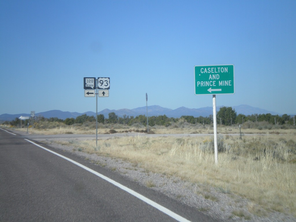
US-93 North at NV-320
US-93 north at NV-320 south to Caselton and Prince Mine.
Taken 10-14-2011
 Pioche
Lincoln County
Nevada
United States
Pioche
Lincoln County
Nevada
United States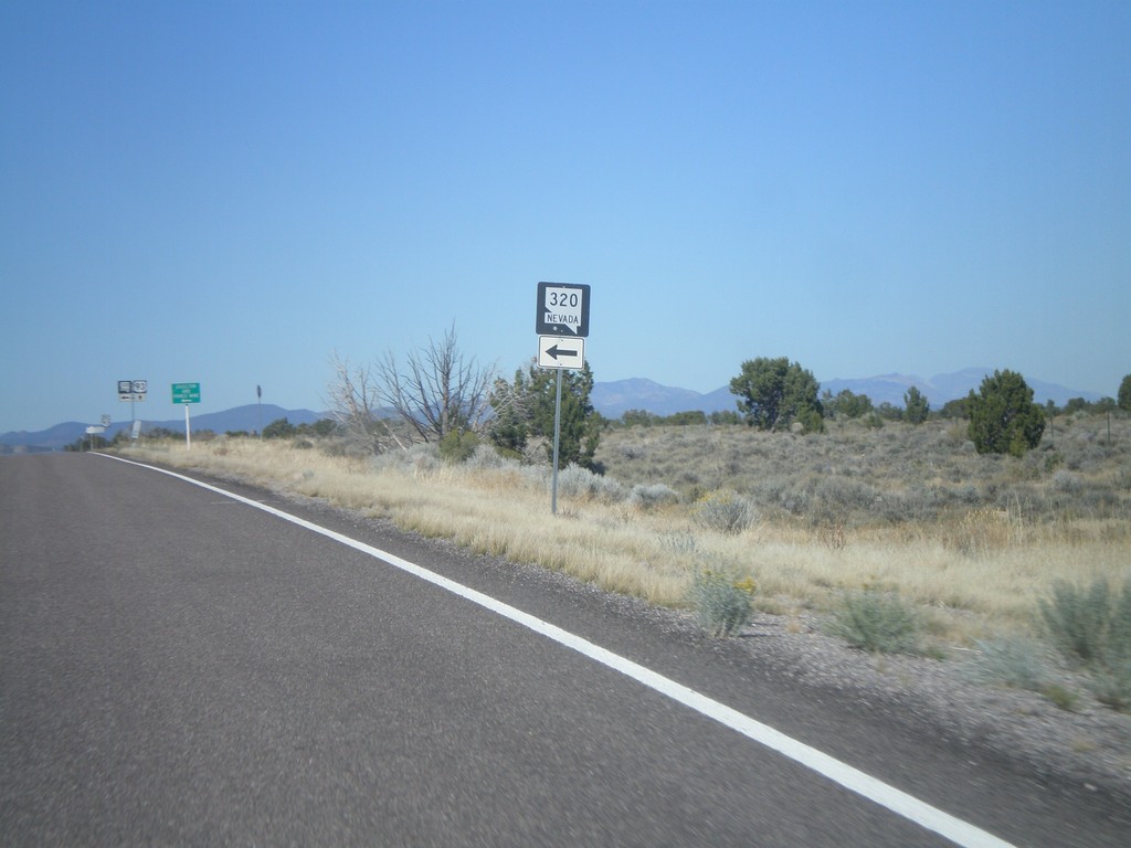
US-93 North Approaching NV-320
US-93 north approaching NV-320 south.
Taken 10-14-2011
Pioche
Lincoln County
Nevada
United States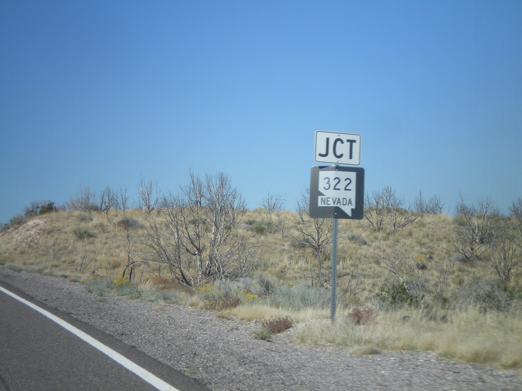
US-93 North Approaching NV-322
US-93 North approaching NV-322.
Taken 10-14-2011
 Pioche
Lincoln County
Nevada
United States
Pioche
Lincoln County
Nevada
United States