Signs Tagged With Shield
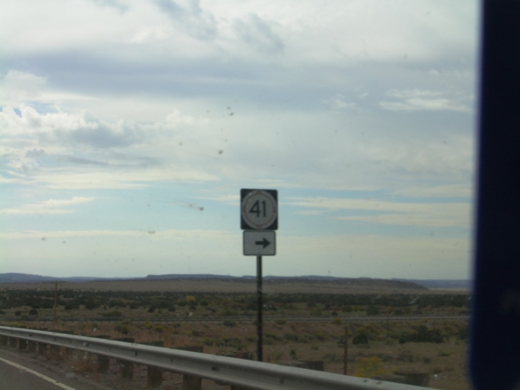
US-285 South at NM-41
US-285 South at NM-41 in rural Santa Fe County.
Taken 10-04-2011

 Lamy
Santa Fe County
New Mexico
United States
Lamy
Santa Fe County
New Mexico
United States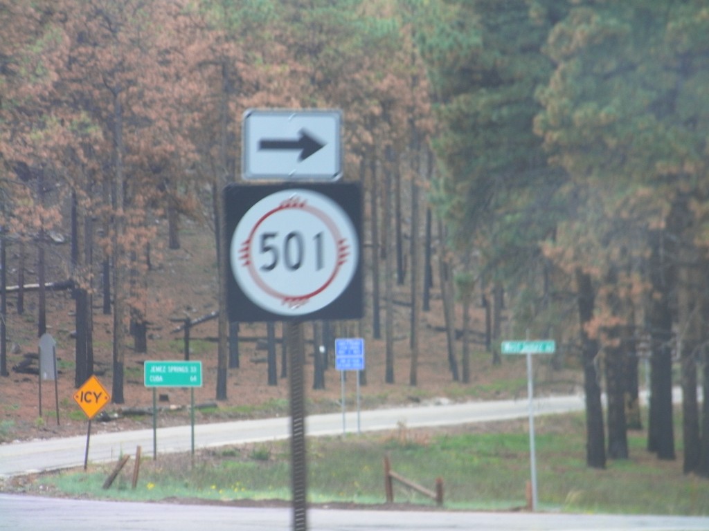
NM-4 West at NM-501
NM-4 west at NM-501 on the west side of Los Alamos.
Taken 10-04-2011

 Los Alamos
 County
New Mexico
United States
Los Alamos
Los Alamos County
New Mexico
United States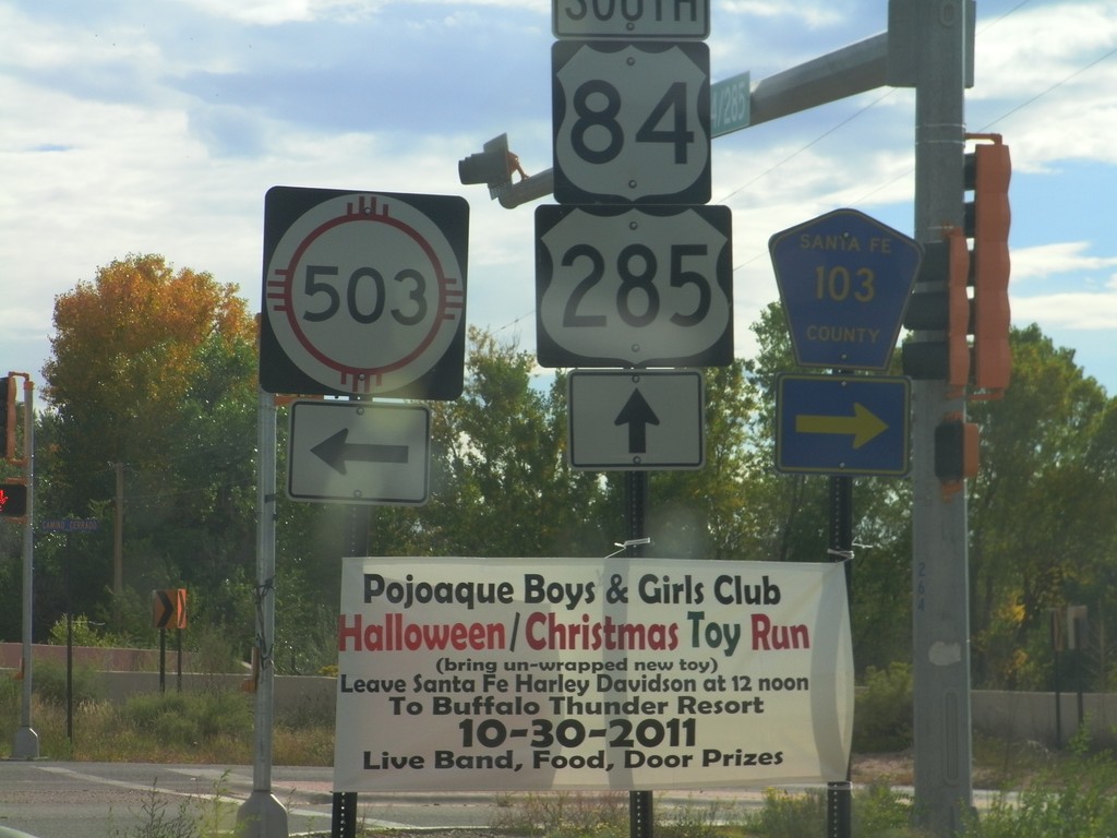
US-84/US-285 South at NM-503/CH-103
US-84/US-285 South at NM-503 and CH-103 in Pojoaque.
Taken 10-03-2011


 Santa Fe
 County
New Mexico
United States
Santa Fe
Santa Fe County
New Mexico
United States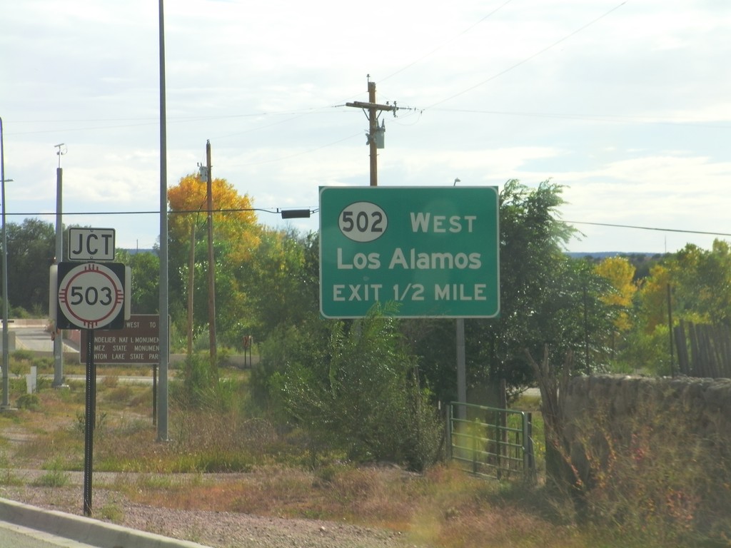
US-84/US-285 South Approaching NM-503 and NM-502
US-84/US-285 South approaching NM-503 and NM-502. The intersection with NM-503 is controlled by a stop light; the NM-502 intersection is a SPUI type interchange. Use NM-502 west for Los Alamos.
Taken 10-03-2011
 Santa Fe
 County
New Mexico
United States
Santa Fe
Santa Fe County
New Mexico
United States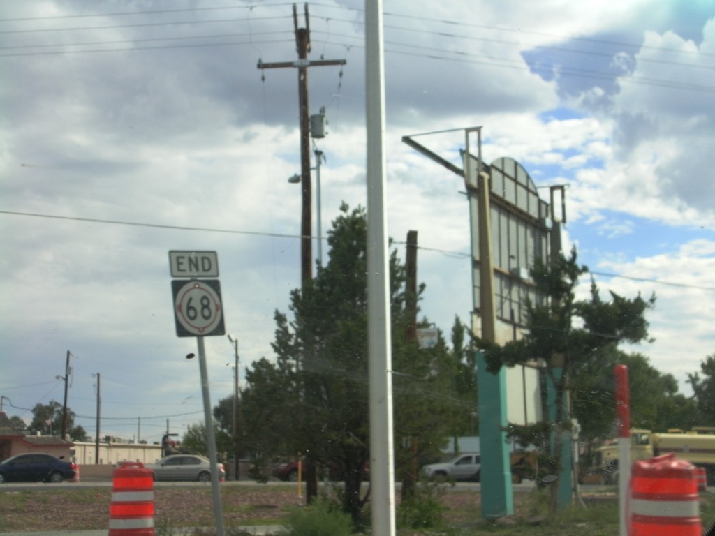
End NM-68 South at US-285/US-84
End NM-68 South at US-84/US-285 South. Traffic for US-84/US-285 North turned right a block north of here. The traffic on the right side of the pictures is US-285/US-84 merging onto NM-68.
Taken 10-03-2011
 Española
Santa Fe County
New Mexico
United States
Española
Santa Fe County
New Mexico
United States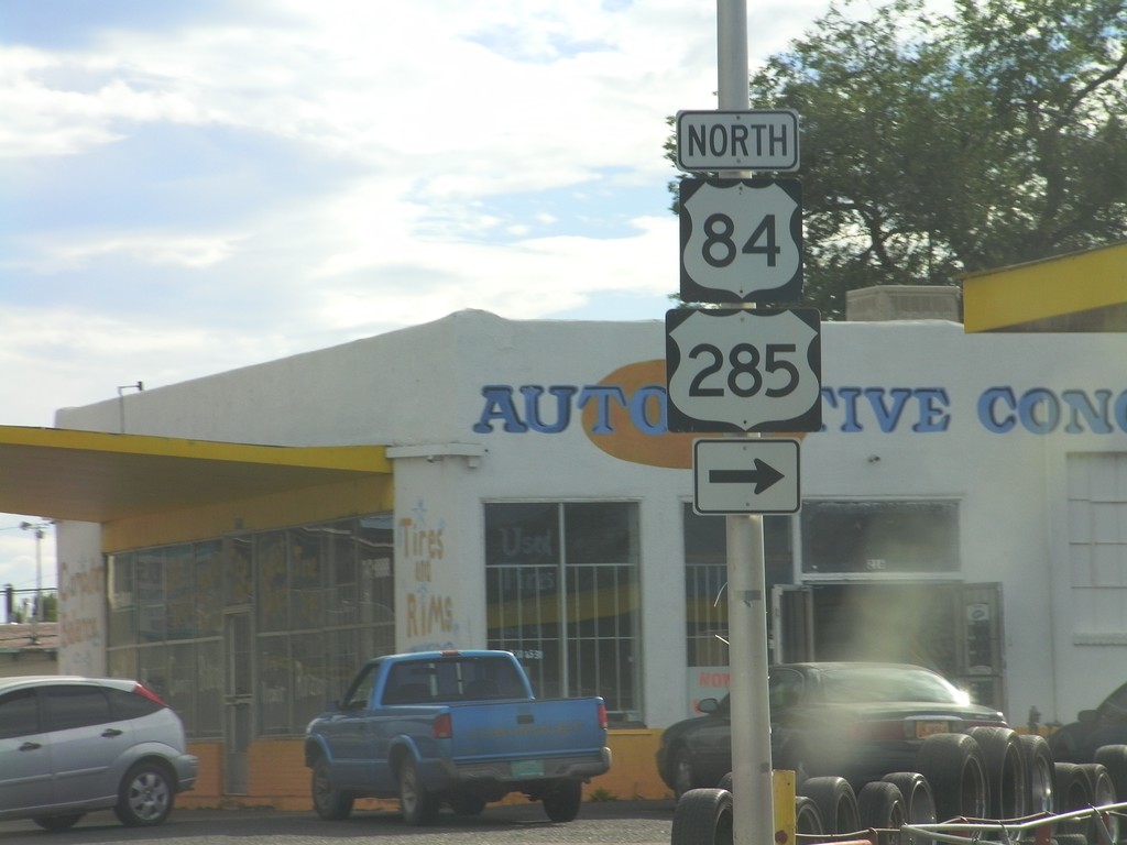
NM-68 South at US-84/US-285 North
NM-68 South (Riverside Drive) at US-84/US-285 North (Paseo de Onate) in Española. Continue south on NM-68 for US-84/US-285 South.
Taken 10-03-2011
Santa Cruz
Santa Fe County
New Mexico
United States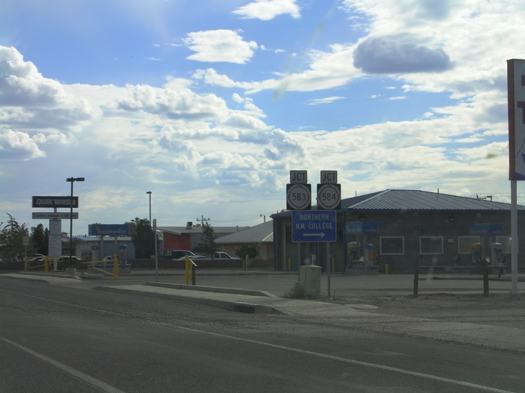
NM-68 South Approaching NM-583/NM-584
NM-68 South (Riverside Drive) approaching NM-583/NM-584 (Fairview Lane). Use NM-584 west for Northern New Mexico College.
Taken 10-03-2011

 Española
Rio Arriba County
New Mexico
United States
Española
Rio Arriba County
New Mexico
United States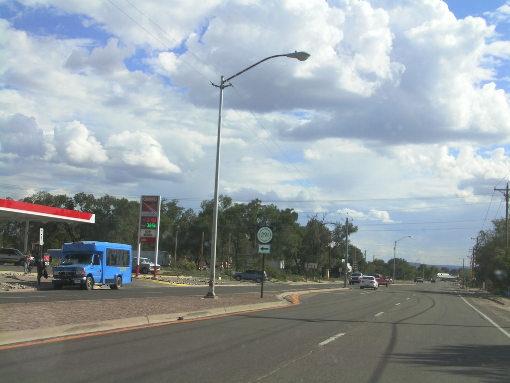
NM-68 South at NM-291 East
NM-68 south at NM-291 east. NM-291 east leaves NM-68 south here.
Taken 10-03-2011
 Española
Rio Arriba County
New Mexico
United States
Española
Rio Arriba County
New Mexico
United States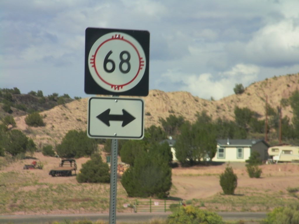
End NM-75 West at NM-68
End NM-75 West at NM-68 near Embudo.
Taken 10-03-2011
 Dixon
Rio Arriba County
New Mexico
United States
Dixon
Rio Arriba County
New Mexico
United States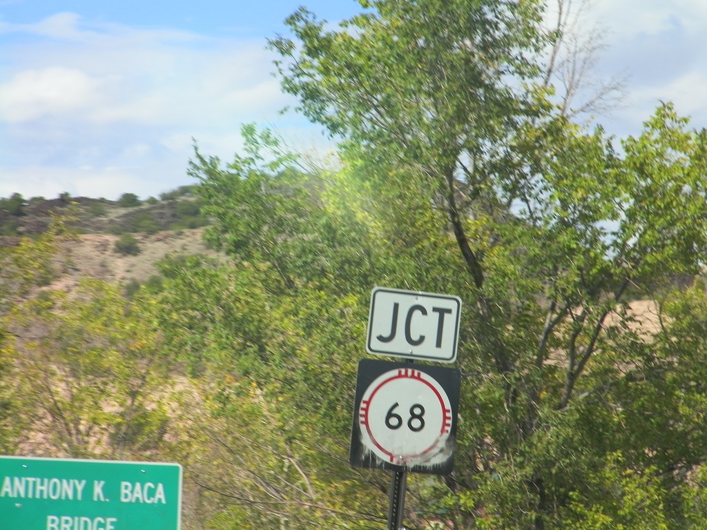
NM-75 East Approaching NM-68
NM-75 East approaching NM-68 at the Anthony K. Baca Bridge over Embudo Creek.
Taken 10-03-2011
Dixon
Rio Arriba County
New Mexico
United States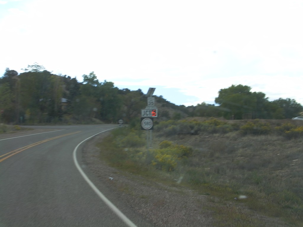
NM-75 East Approaching NM-580
NM-75 East approaching NM-580 in rural Rio Arriba County.
Taken 10-03-2011
 Dixon
Rio Arriba County
New Mexico
United States
Dixon
Rio Arriba County
New Mexico
United States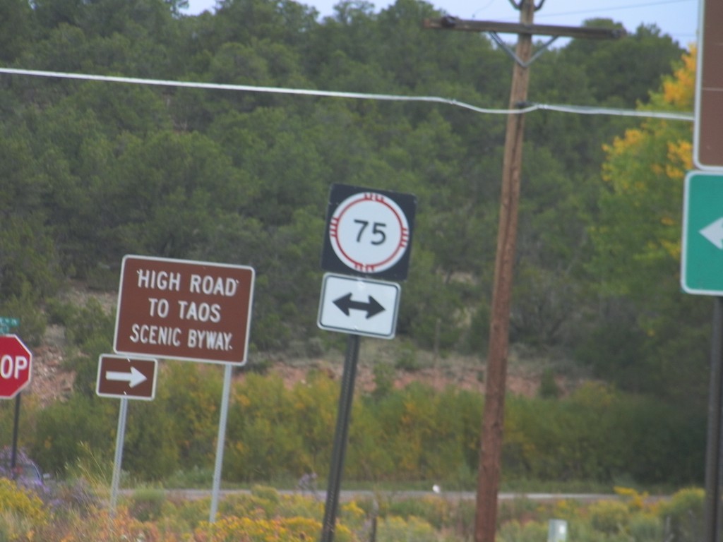
End NM-76 North at NM-75
End NM-76 north at NM-75. Turn right on NM-76 north to continue on the High Road To Taos Scenic Byway.
Taken 10-03-2011
 Peñasco
Taos County
New Mexico
United States
Peñasco
Taos County
New Mexico
United States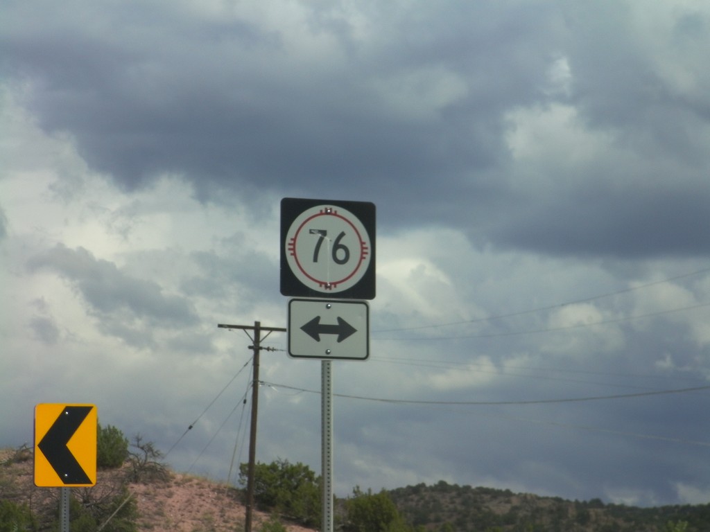
End NM-503 East at NM-76
End NM-503 East at NM-76 in rural Rio Arriba County. NM-76 is the High Road To Taos Scenic Byway.
Taken 10-03-2011
Chimayo
Rio Arriba County
New Mexico
United States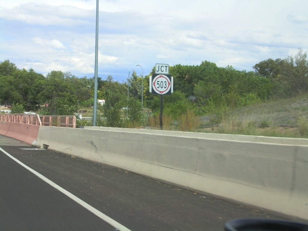
US-84/US-285 North Approaching NM-503
US-84/US-285 North approaching NM-503 in Pojoaque. This is the beginning of the High Road To Taos Scenic Byway.
Taken 10-03-2011
Santa Fe
Santa Fe County
New Mexico
United States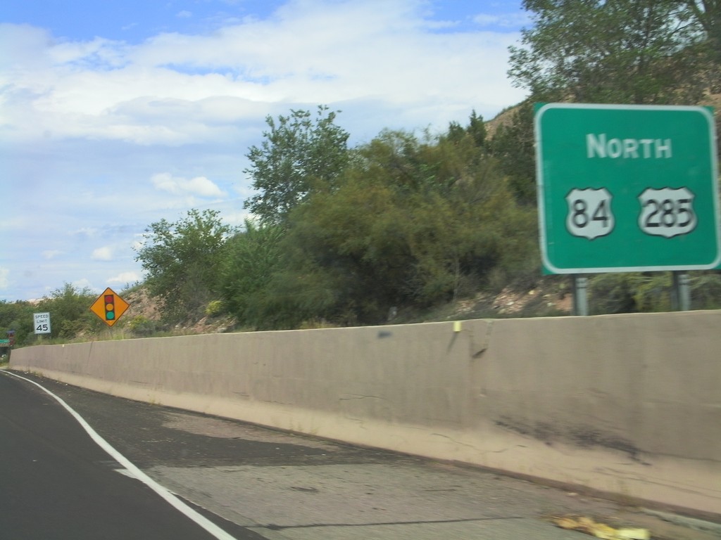
US-84/US-285 North - Pojoaque
US-84/US-285 North in Pojoaque.
Taken 10-03-2011
Jaconita
Santa Fe County
New Mexico
United States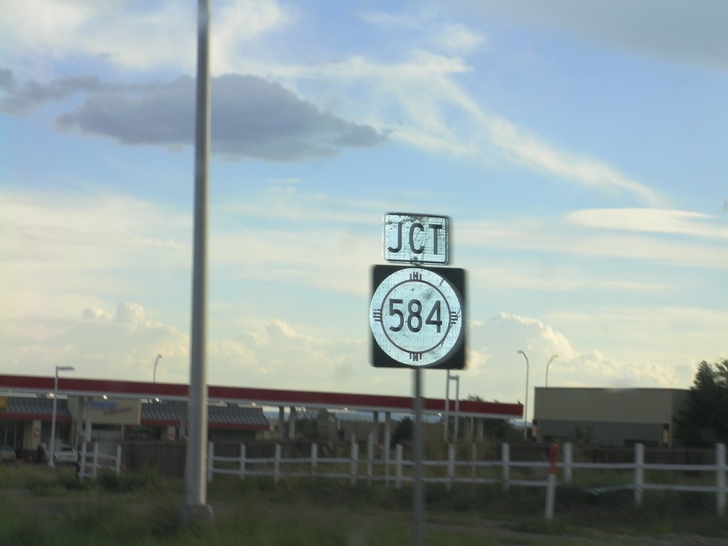
US-84/US-285 South Approaching NM-584
US-84/US-285 South approaching NM-584 (Fairview Drive) in Española.
Taken 10-02-2011
Española
Rio Arriba County
New Mexico
United States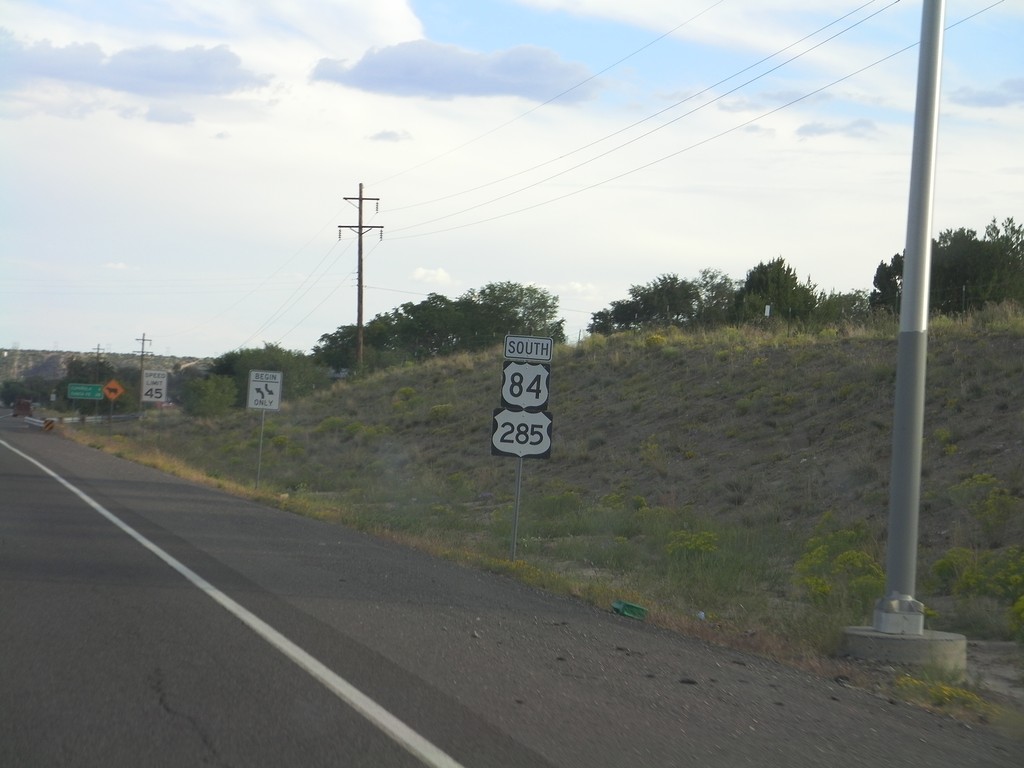
US-84/US-285 South - Rio Arriba County
US-84/US-285 South in Rio Arriba County on the outskirts of Española. Taken just south of NM-74 junction.
Taken 10-02-2011
El Duende
Rio Arriba County
New Mexico
United States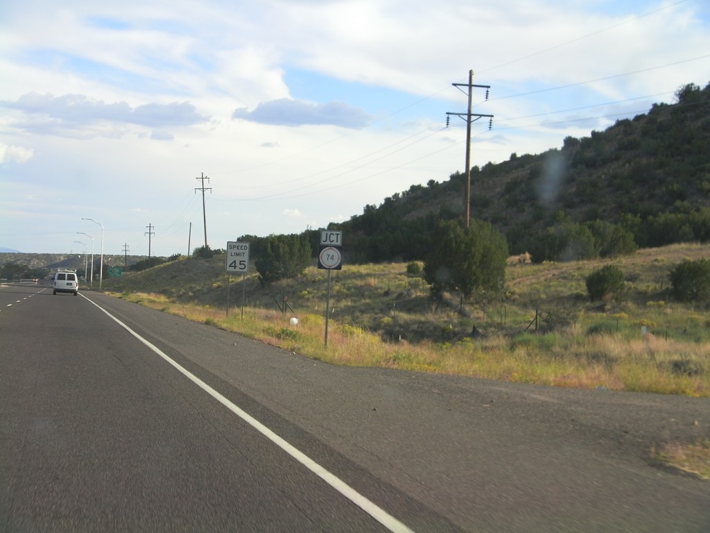
US-84/US-285 South Approaching NM-74
US-84/US-285 South approaching NM-74 near El Duende.
Taken 10-02-2011
 Hernandez
Rio Arriba County
New Mexico
United States
Hernandez
Rio Arriba County
New Mexico
United States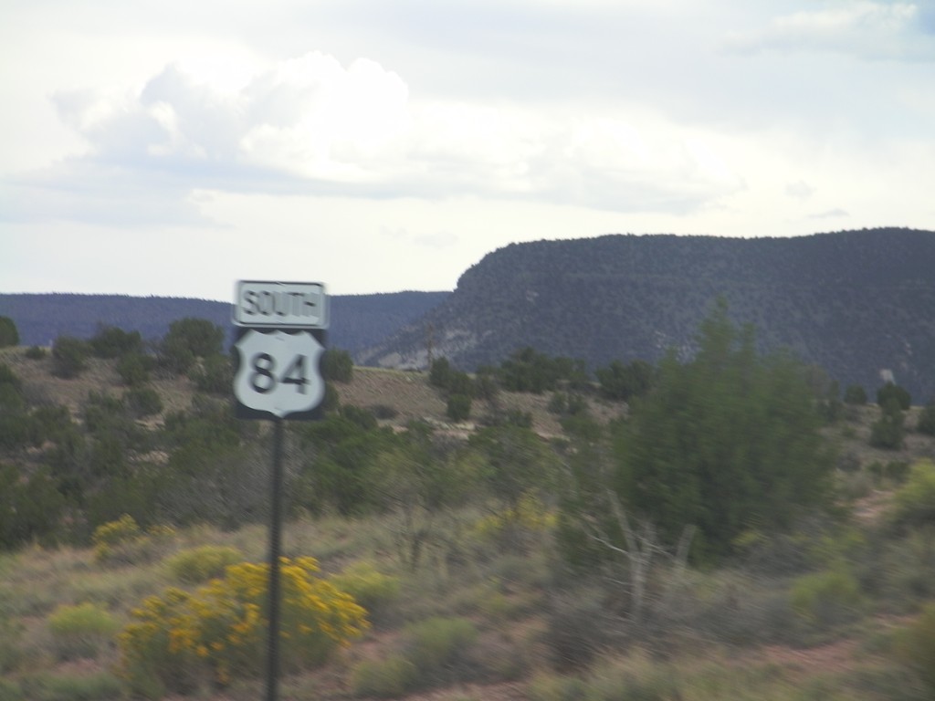
US-84 South - Rio Arriba County
US-84 South in Rio Arriba County, just south of NM-96 jct.
Taken 10-02-2011
Gallina
Rio Arriba County
New Mexico
United States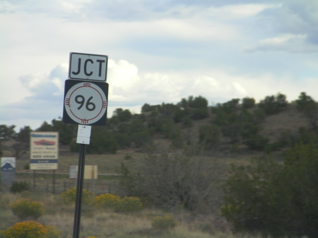
US-84 South Approaching NM-96
US-84 South approaching NM-96 west in Rio Arriba County.
Taken 10-02-2011
 Gallina
Rio Arriba County
New Mexico
United States
Gallina
Rio Arriba County
New Mexico
United States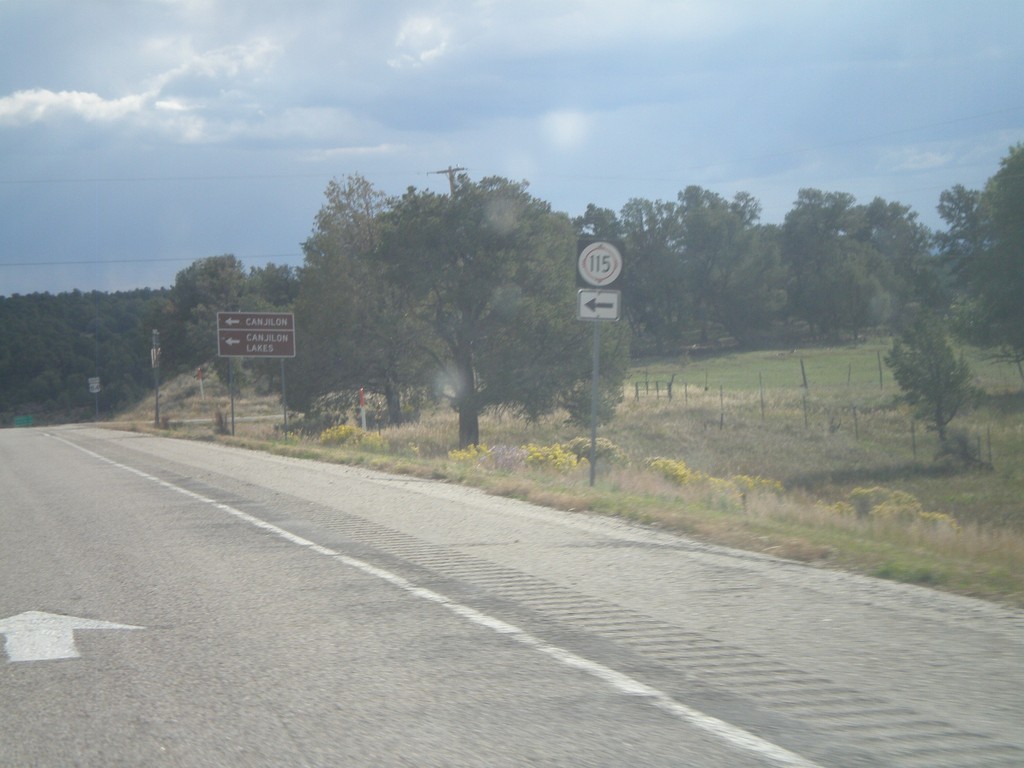
US-84 South at NM-115 East
US-84 south at NM-115 East. Use NM-115 east for Canjilon and Canjilon Lakes.
Taken 10-02-2011
 Canjilon
Rio Arriba County
New Mexico
United States
Canjilon
Rio Arriba County
New Mexico
United States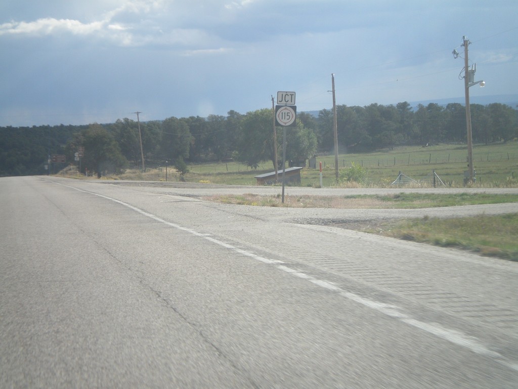
US-84 South Approaching NM-115
US-84 South approaching NM-115 in Rio Arriba County.
Taken 10-02-2011
Abiquiu
Rio Arriba County
New Mexico
United States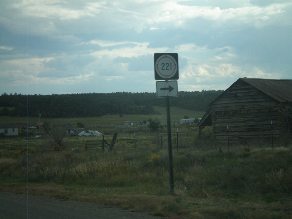
US-84 South at NM-221
US-84 South at NM-221 in Cebolla.
Taken 10-02-2011
 Cebolla
Rio Arriba County
New Mexico
United States
Cebolla
Rio Arriba County
New Mexico
United States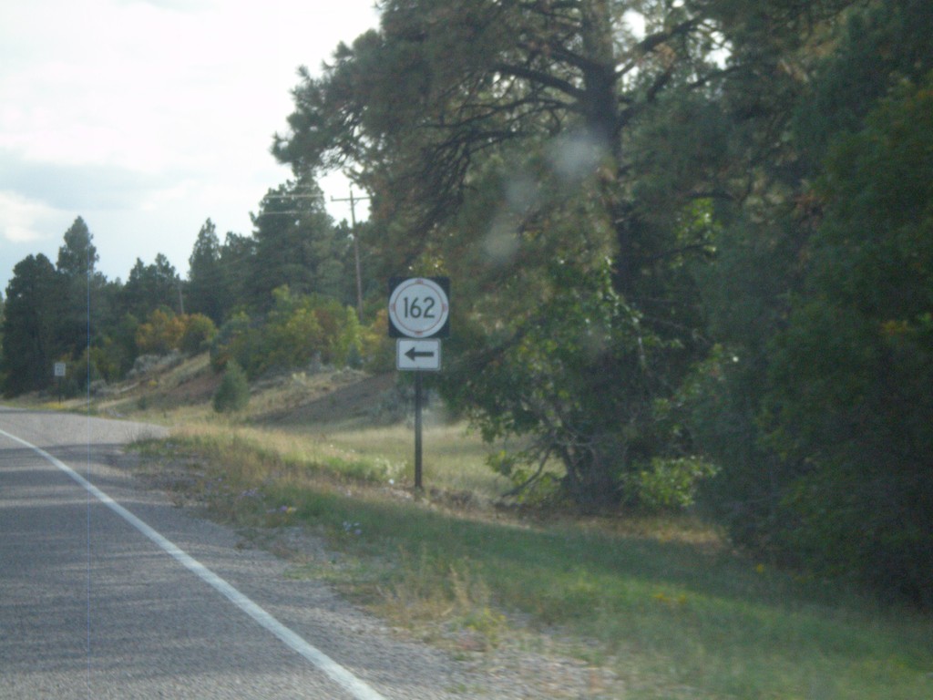
US-84 South at NM-162
US-84 South at NM-162 in Rio Arriba County.
Taken 10-02-2011
Tierra Amarilla
Rio Arriba County
New Mexico
United States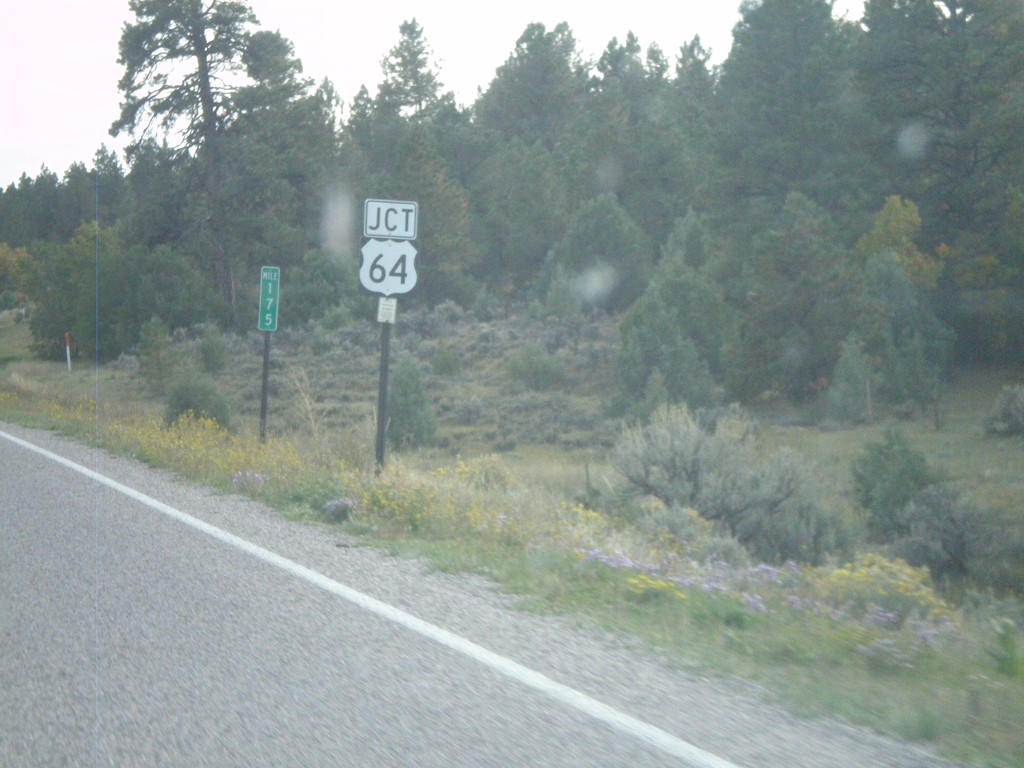
US-84 South/US-64 East At Split
US-84 South/US-64 East at Split. US-64 turns east here towards Taos. Northbound US-64 joins US-84 to west of Chama.
Taken 10-02-2011
 Los Ojos
Rio Arriba County
New Mexico
United States
Los Ojos
Rio Arriba County
New Mexico
United States