Signs Tagged With Shield
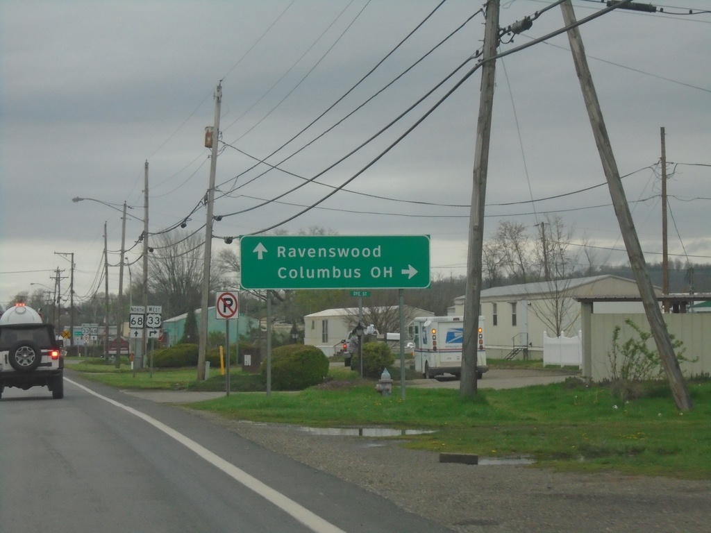
US-33 West/WV-68 North at US-33/WV-68 Split
US-33 West/WV-68 North at US-33/WV-68 split. Use US-33 West to Columbus, OH. Continue north on WV-68 to Ravenswood.
Taken 04-01-2024

 Ravenswood
Jackson County
West Virginia
United States
Ravenswood
Jackson County
West Virginia
United States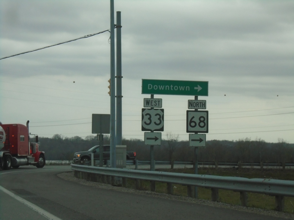
US-33 West/WV-2 South at US-33/WV-68
US-33 West/WV-2 South at US-33 West/WV-68 North to Downtown (Ravenswood).
Taken 04-01-2024
 Ravenswood
Jackson County
West Virginia
United States
Ravenswood
Jackson County
West Virginia
United States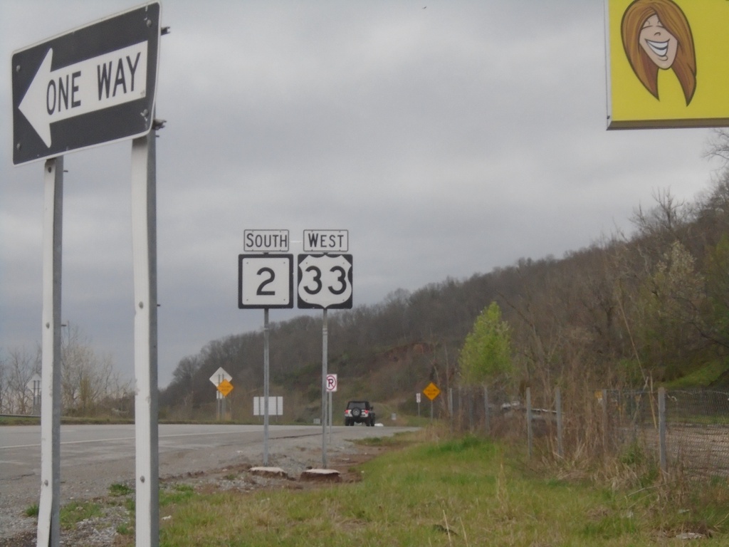
US-33 West/WV-2 South - Silverton
US-33 West/WV-2 South in Silverton
Taken 04-01-2024
Ravenswood
Jackson County
West Virginia
United States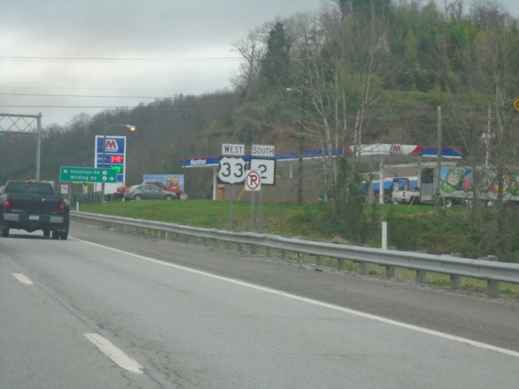
US-33 West/WV-2 South in Ravenswood
US-33 West/WV-2 South in Ravenswood
Taken 04-01-2024
Ravenswood
Jackson County
West Virginia
United States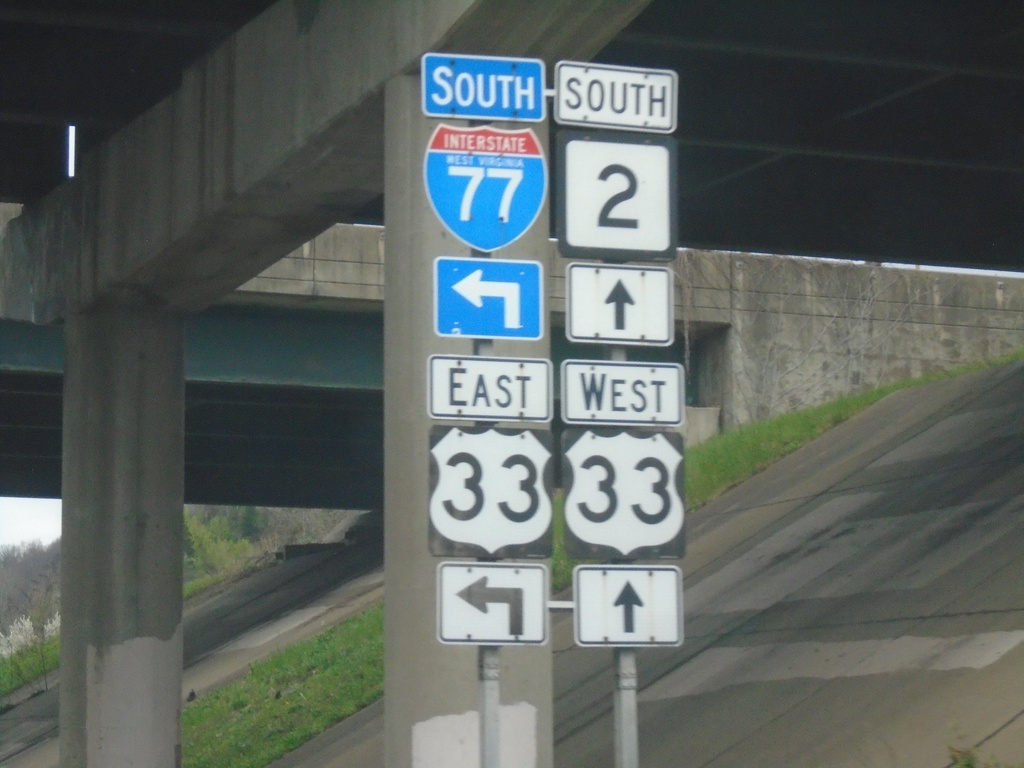
US-33 West/WV-2 South at I-77 South/US-33 East
US-33 West/WV-2 South at I-77 South/US-33 East in Ravenswood.
Taken 04-01-2024
 Ravenswood
Jackson County
West Virginia
United States
Ravenswood
Jackson County
West Virginia
United States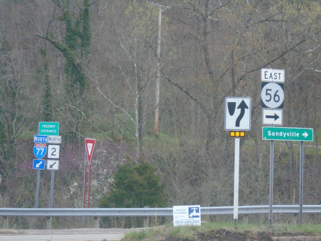
I-77 North at US-33/WV-2/WVCR-56
I-77 North at US-33/WV-2/WVCR-56. Turn right for WVCR-56 East to Sandyville. The I-77 North/WV-2 North freeway entrance is in the background.
Taken 04-01-2024
 Silverton
Jackson County
West Virginia
United States
Silverton
Jackson County
West Virginia
United States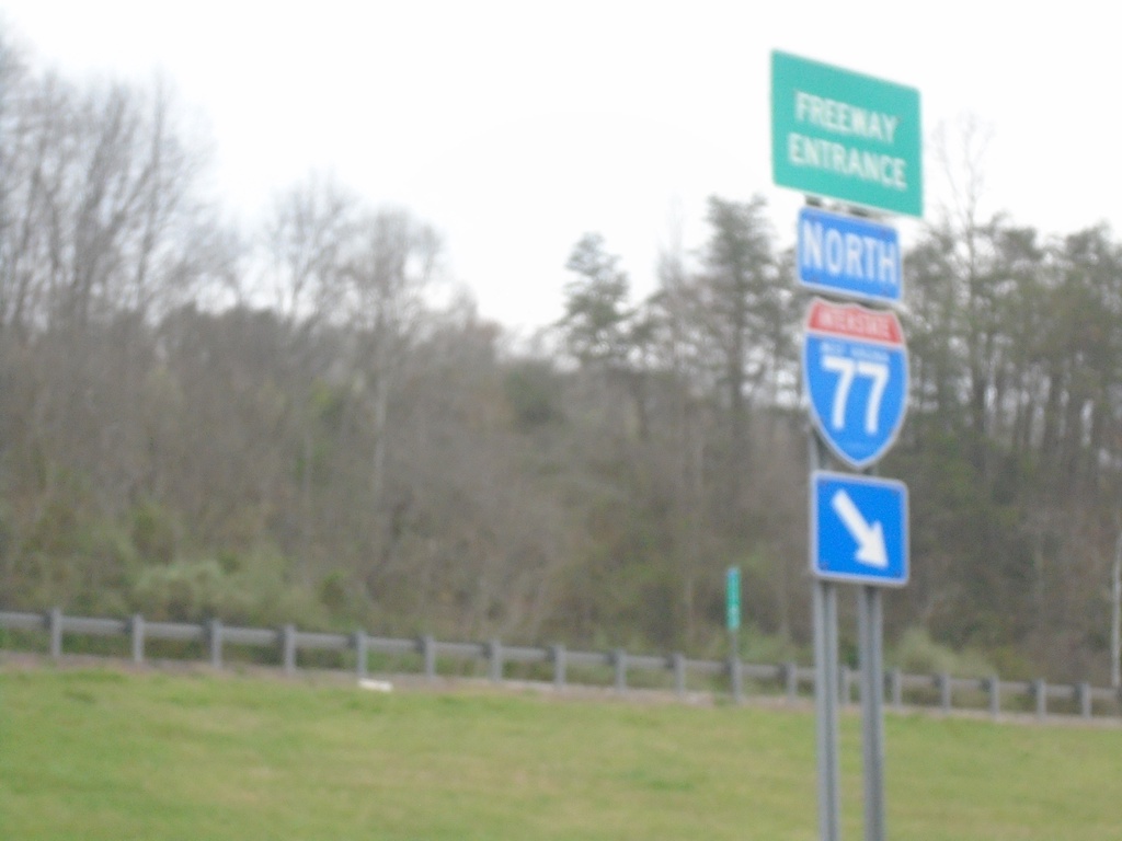
I-77 North - Freeway Entrance
Haines Branch Road at I-77 North Freeway Entrance.
Taken 04-01-2024
Charleston
Kanawha County
West Virginia
United States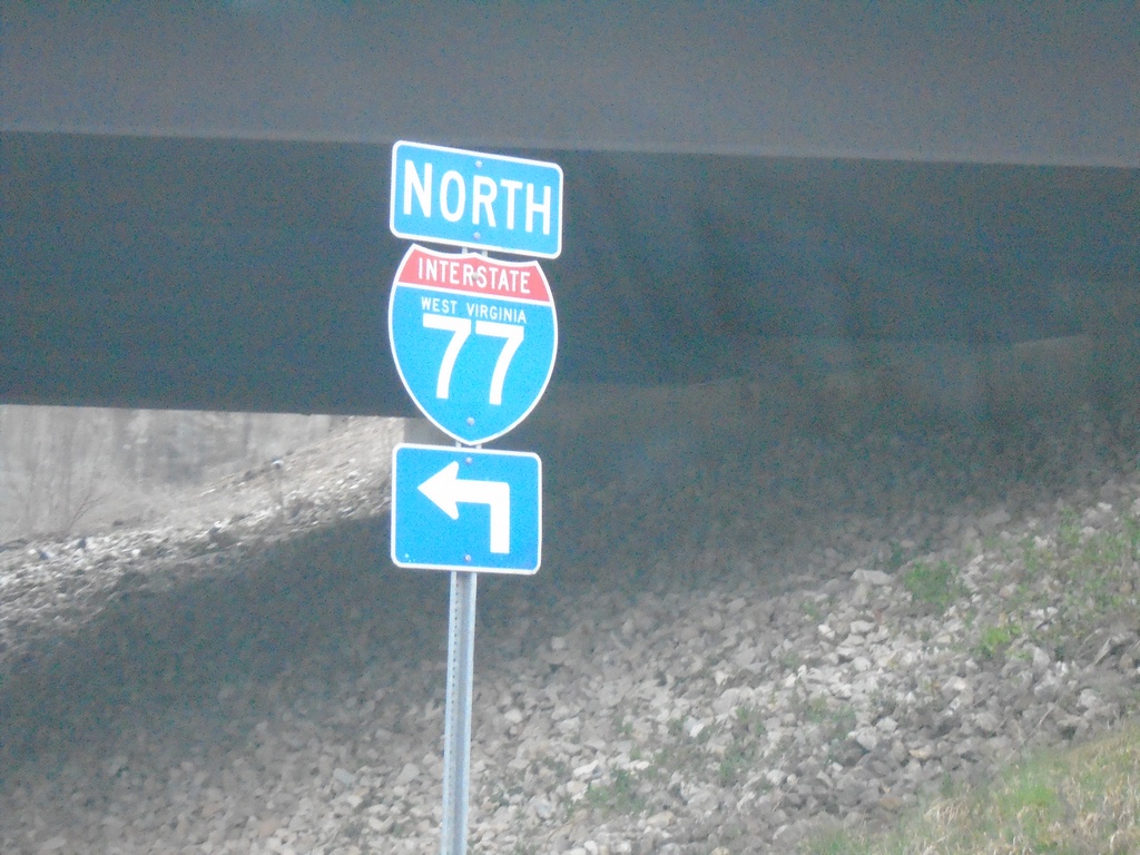
Haines Branch Road at I-77 North
Haines Branch Road at I-77 North (Exit 116)
Taken 04-01-2024
Charleston
Kanawha County
West Virginia
United States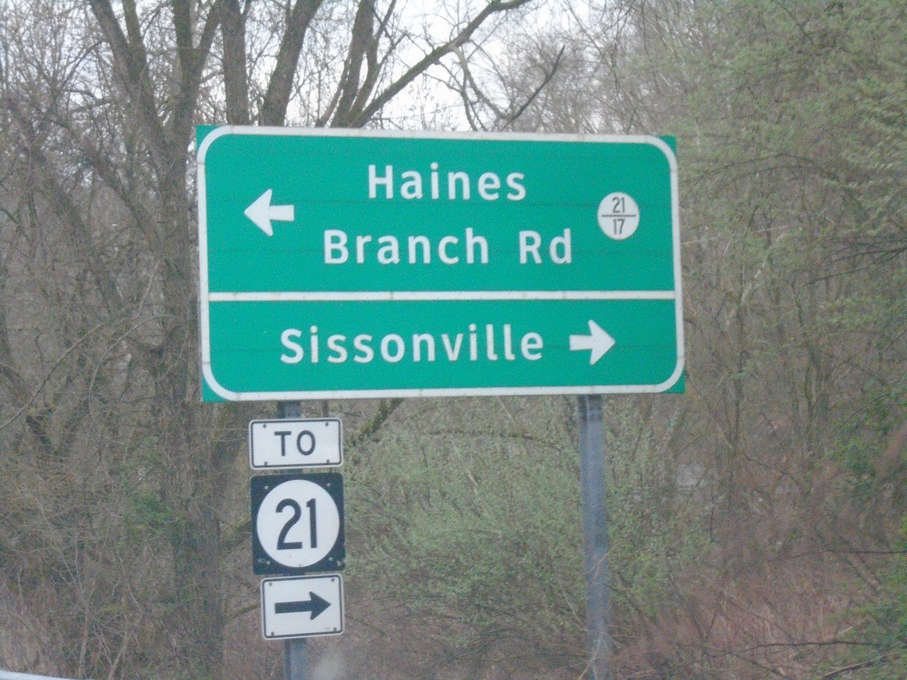
I-77 North Exit 116 Offramp at WVCR-21 and WVCR-21/17
I-77 North Exit 116 afframp at WVCR-21 and WVCR-21/17. Turn right for WVCR-21 to Sissonville; left for WVCR-21/17 to Haines Branch Road.
Taken 04-01-2024

 Charleston
Kanawha County
West Virginia
United States
Charleston
Kanawha County
West Virginia
United States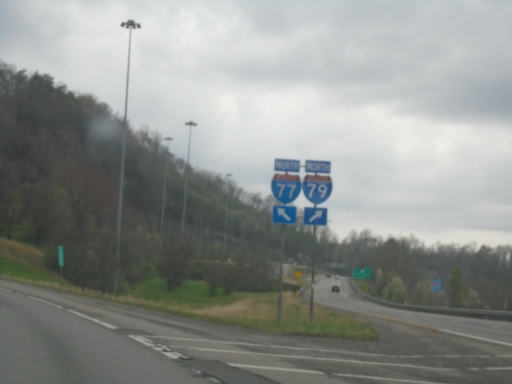
I-77 North at I-79
I-77 North at I-79 (Exit 104). Use right lanes for I-79; left lanes for I-77.
Taken 04-01-2024
 Charleston
Kanawha County
West Virginia
United States
Charleston
Kanawha County
West Virginia
United States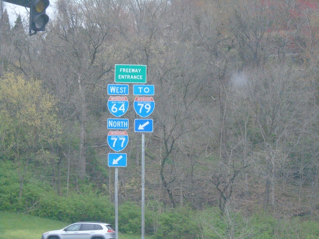
WV-114 North at I-77 North/I-64 East/To I-79
WV-114 North at I-77 North/I-64 East/To I-79 Freeway Entrance.
Taken 04-01-2024

 Charleston
Kanawha County
West Virginia
United States
Charleston
Kanawha County
West Virginia
United States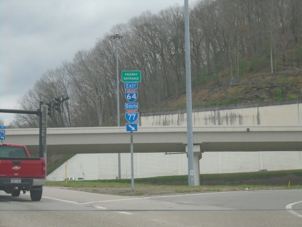
WV-114 North at I-64 East/I-77 South
WV-114 North at I-64 East/I-77 South Freeway Entrance.
Taken 04-01-2024
Charleston
Kanawha County
West Virginia
United States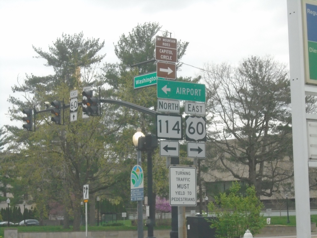
US-60 East at WV-114
US-60 East at WV-114. Turn left for WV-114 North to Airport; turn right to continue on US-60 East.
Taken 04-01-2024
 Charleston
Kanawha County
West Virginia
United States
Charleston
Kanawha County
West Virginia
United States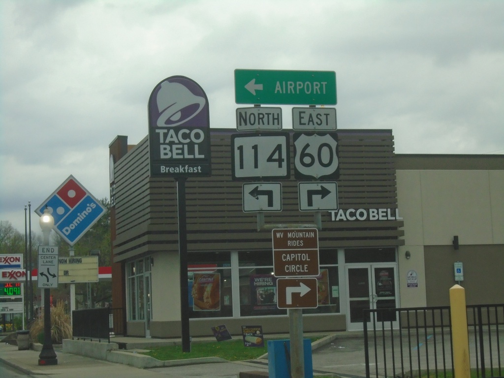
US-60 East at WV-114
US-60 East (Washington St.) at WV-114 North to Airport.
Taken 04-01-2024
Charleston
Kanawha County
West Virginia
United States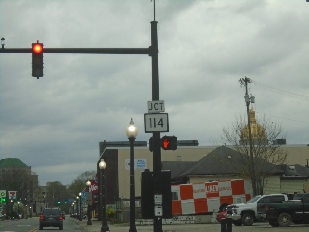
US-60 East Approaching WV-114
US-60 East (Washington St.) approaching WV-114
Taken 04-01-2024
Charleston
Kanawha County
West Virginia
United States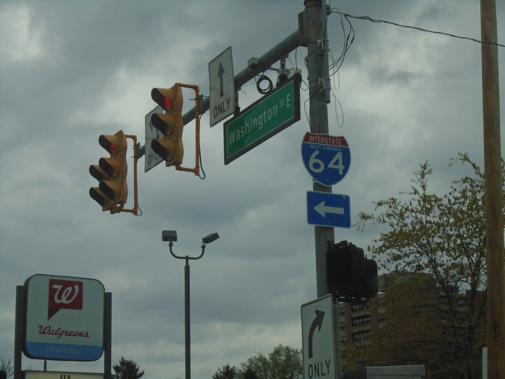
US-60 East at Morris St.
US-60 East (Washington St.) at Morris St. to I-64.
Taken 04-01-2024
Charleston
Kanawha County
West Virginia
United States
US-60 East - Lee St. at Brooks St.
US-60 East (Lee St.) at Brooks St. Turn left to continue on US-60 East and for I-64/I-77.
Taken 04-01-2024
Charleston
Kanawha County
West Virginia
United States
I-64 East/I-77 South - Charleston
I-64 East/I-77 South in Charleston
Taken 03-31-2024
Charleston
Kanawha County
West Virginia
United States
US-60 East Approaching I-64/US-119
US-60 East (Lee St.) approaching I-64/US-119 in Charleston. Use right lane for I-64 West and US-119 South (Pennsylvania St.). Use left lanes for US-119 North, I-64 East/To I-77/I-79. Continue straight on Lee St. for US-60.
Taken 03-31-2024
 Charleston
Kanawha County
West Virginia
United States
Charleston
Kanawha County
West Virginia
United States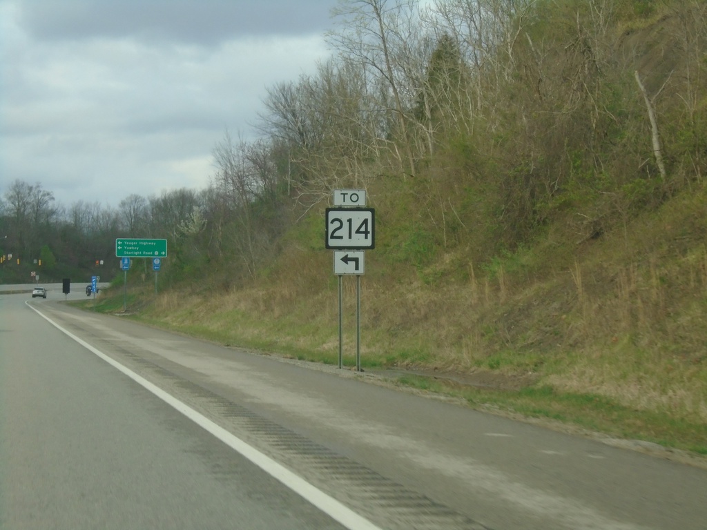
US-119 North Approaching Access Road to WV-214
US-119 North Approaching Access Road to WV-214
Taken 03-31-2024
 Alum Creek
Lincoln County
West Virginia
United States
Alum Creek
Lincoln County
West Virginia
United States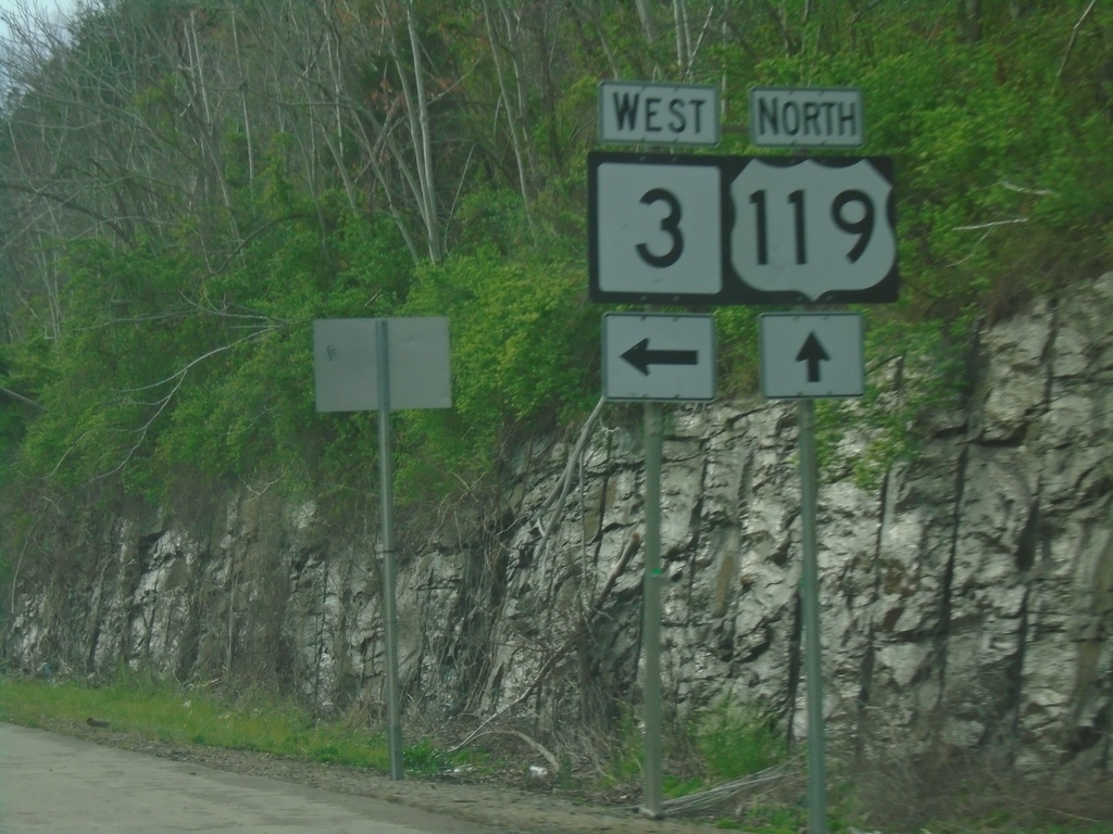
US-119 North/WV-3 West at Split
US-119 North/WV-3 West at US-119/WV-3 split in Julian.
Taken 03-31-2024
 Julian
Boone County
West Virginia
United States
Julian
Boone County
West Virginia
United States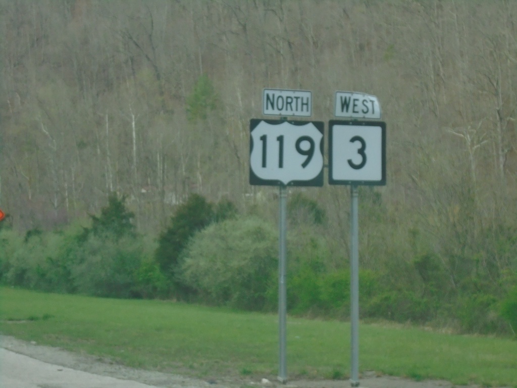
US-119 North/WV-3 West - Boone County
US-119 North/WV-3 West in Boone County
Taken 03-31-2024
Danville
Boone County
West Virginia
United States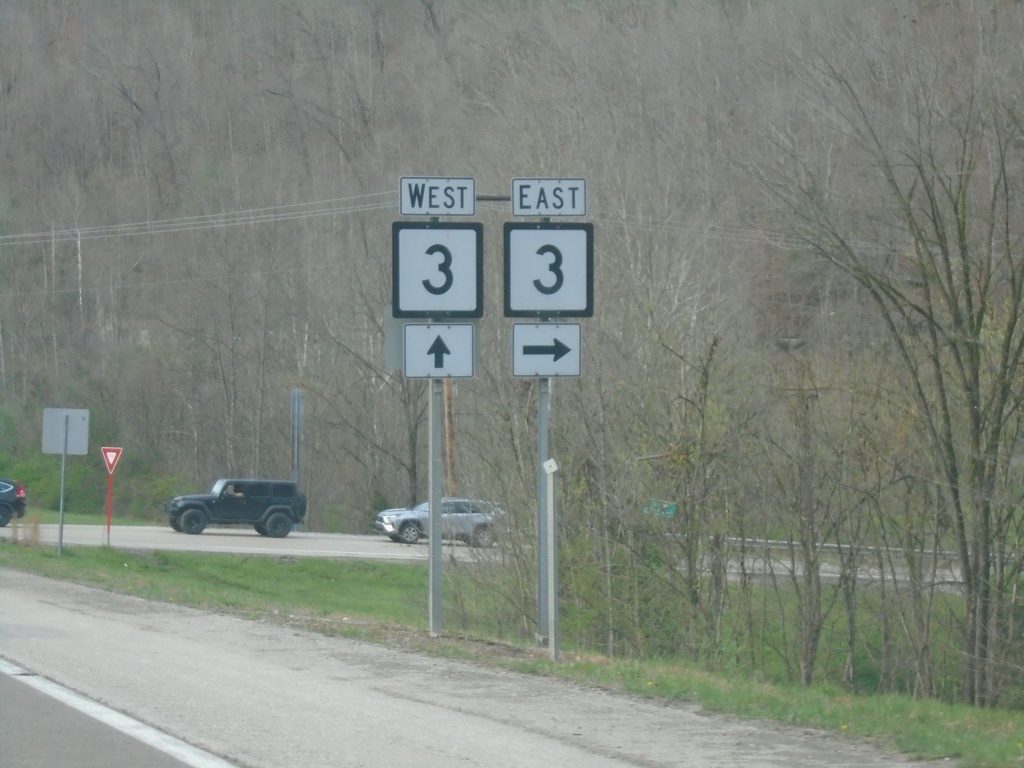
US-119 North at WV-3 East
US-119 North at WV-3 East in Boone County. WV-3 West joins US-119 northbound.
Taken 03-31-2024
Danville
Boone County
West Virginia
United States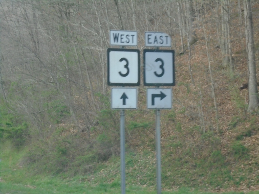
US-119 North Approaching WV-3
US-119 North approaching WV-3 in Boone County.
Taken 03-31-2024
Danville
Boone County
West Virginia
United States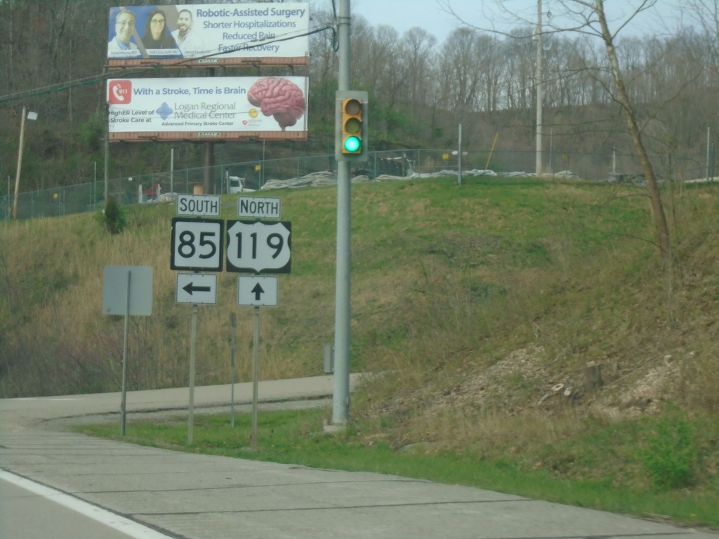
US-119 North at WV-85 South
US-119 North at WV-85 South in Danville.
Taken 03-31-2024
 Danville
Boone County
West Virginia
United States
Danville
Boone County
West Virginia
United States