Signs Tagged With Shield
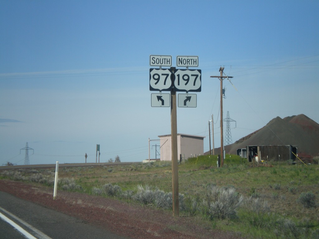
US-97 South at US-197
US-97 south at US-197 junction. Taken at Shaniko Junction.
Taken 05-27-2012

 Maupin
Wasco County
Oregon
United States
Maupin
Wasco County
Oregon
United States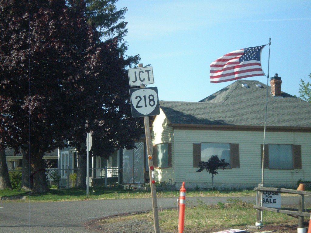
US-97 South Approaching OR-218
US-97 south approaching OR-218 in Shaniko.
Taken 05-27-2012
 Shaniko
Wasco County
Oregon
United States
Shaniko
Wasco County
Oregon
United States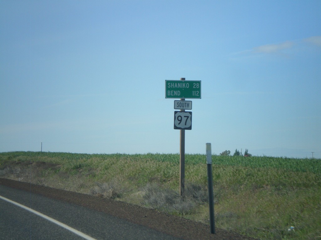
US-97 South - Distance Marker
Distance marker on US-97 south. Distance to Shaniko and Bend.
Taken 05-27-2012
Grass Valley
Sherman County
Oregon
United States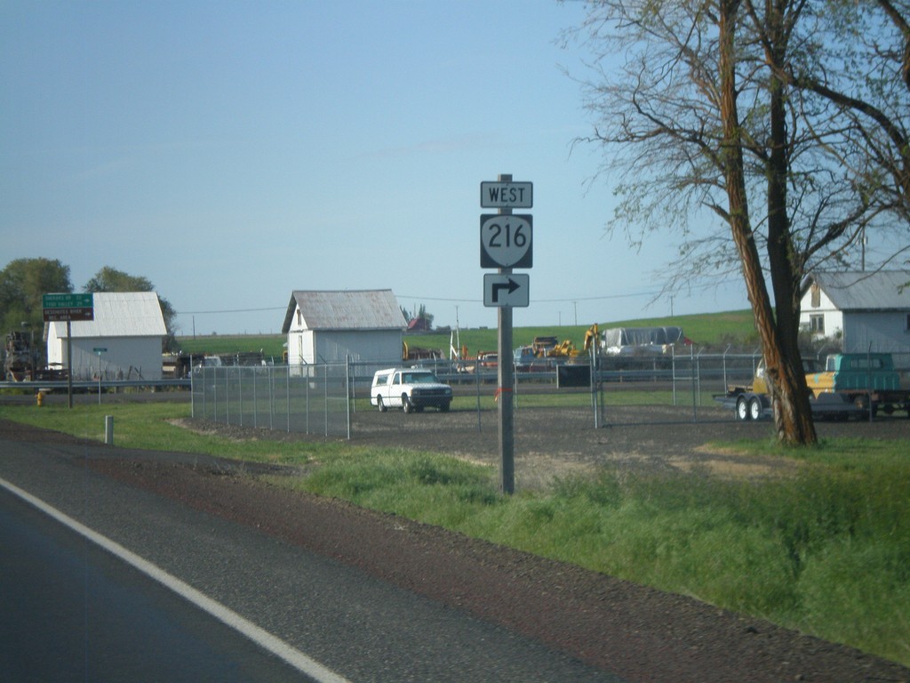
US-97 South Approaching OR-216
US-97 south approaching OR-216 west - Sherars Bridge Highway.
Taken 05-27-2012
 Grass Valley
Sherman County
Oregon
United States
Grass Valley
Sherman County
Oregon
United States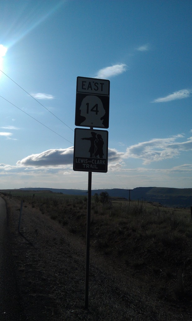
WA-14 East - Lewis and Clark Trail
WA-14 East - Lewis and Clark Trail
Taken 05-27-2012
 Maryhill
Klickitat County
Washington
United States
Maryhill
Klickitat County
Washington
United States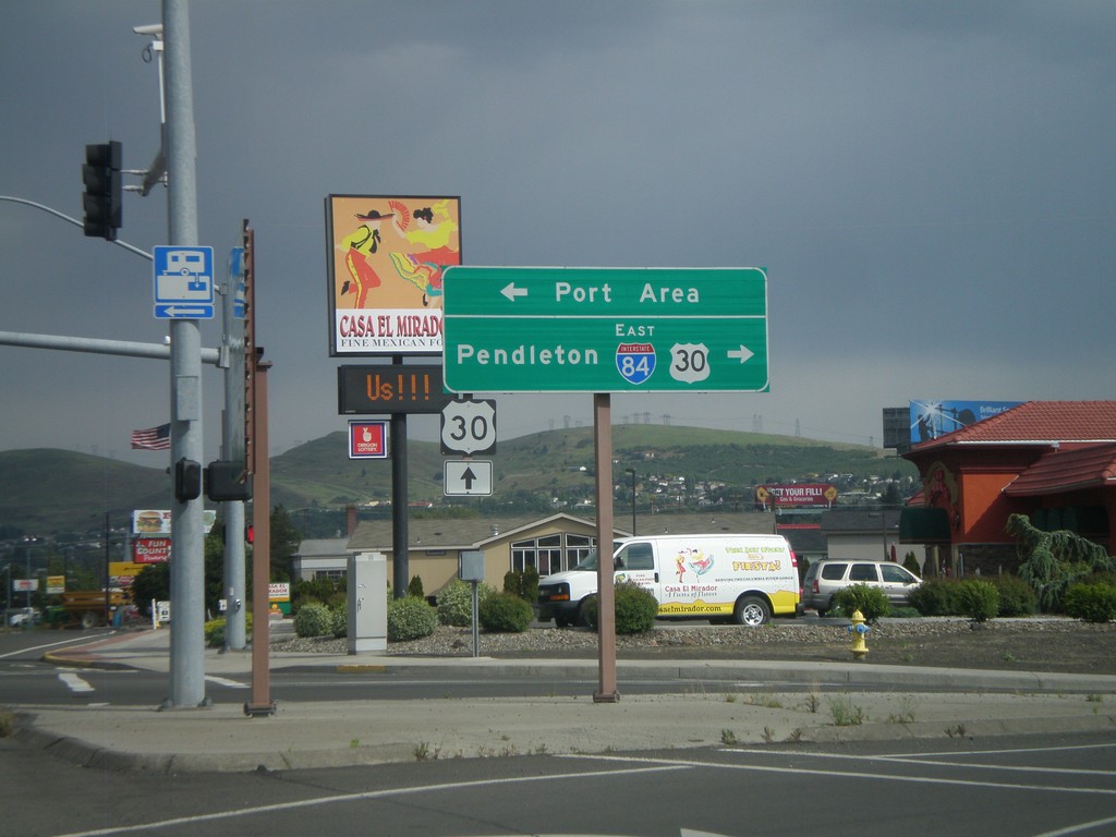
W 2nd St. at US-30 and I-84
W 2nd St. in The Dalles at US-30 and I-84 east junction. Turn right for I-84 east, to Pendleton, and US-30 west. Continue ahead on 2nd St. for US-30 east. Turn left for the Port Area along the Columbia River.
Taken 05-26-2012

 The Dalles
Wasco County
Oregon
United States
The Dalles
Wasco County
Oregon
United States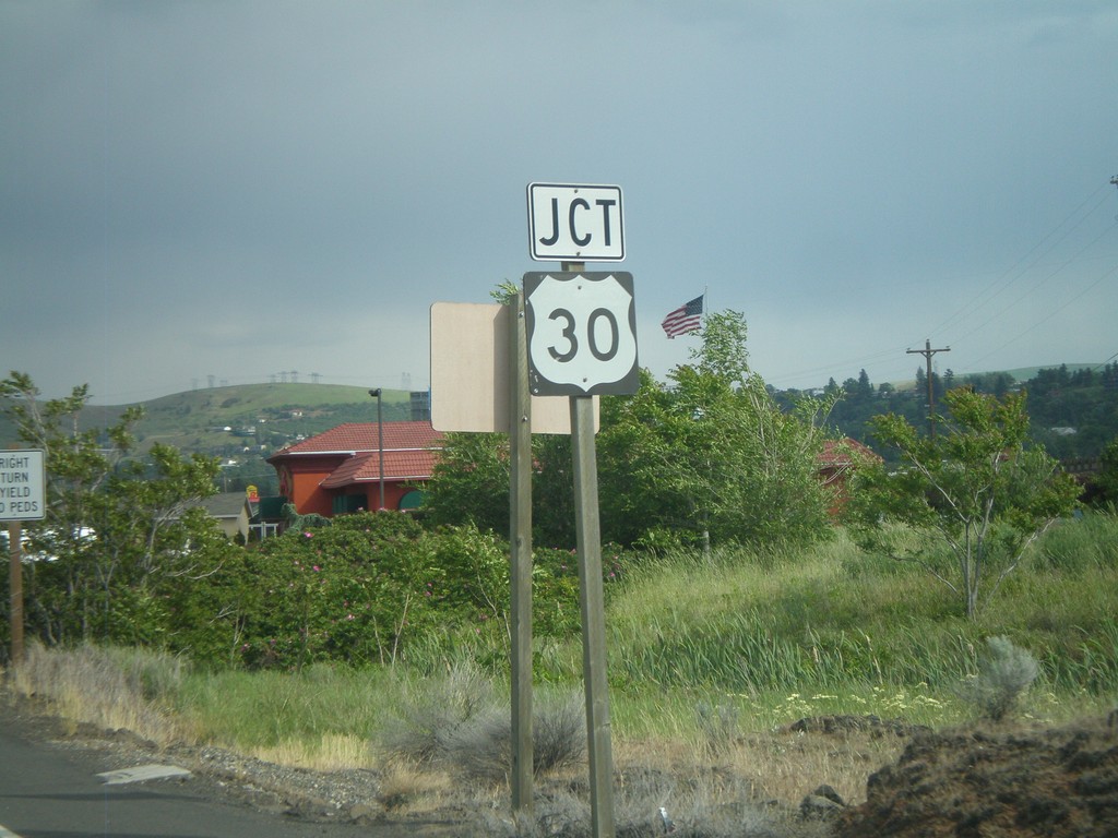
W 2nd St. Approaching US-30
W 2nd St. approaching US-30 in The Dalles.
Taken 05-26-2012
The Dalles
Wasco County
Oregon
United States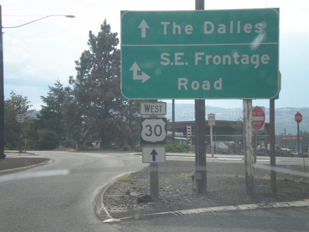
US-30 West at SE Frontage Road
US-30 west at SE Frontage Road.
Taken 05-26-2012
The Dalles
Wasco County
Oregon
United States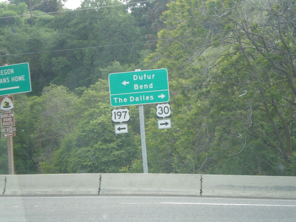
US-197 South/US-30 West at Split
US-197 South/US-30 West at US-197/US-30 split. Turn right for US-30 west to The Dalles. Turn left for US-197 south to Dufur and Bend.
Taken 05-26-2012
The Dalles
Wasco County
Oregon
United States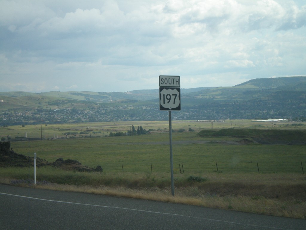
US-197 South
US-197 south. This is the first shield southbound on US-197. US-197 runs between WA-14 on the Washington side of the Columbia River, south to Shaniko Junction, Oregon at US-97. The highway is about 70 miles in length.
Taken 05-26-2012
Lyle
Klickitat County
Washington
United States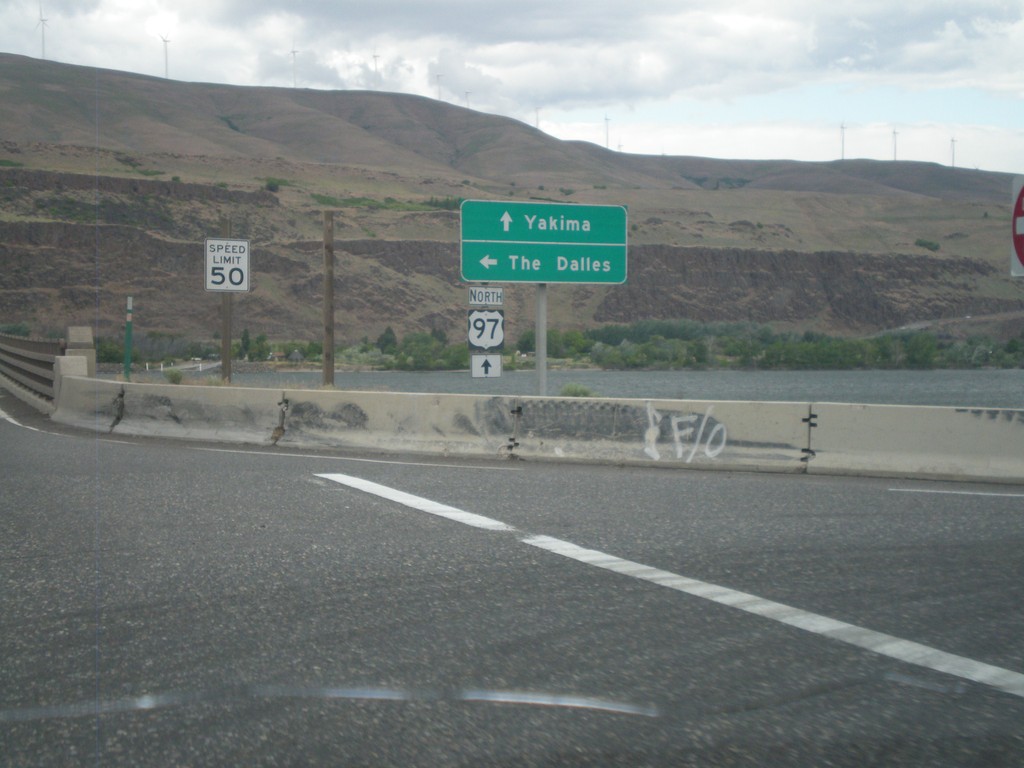
US-97 North at I-84/US-30 West
US-97 north at I-84/US-30 West (Exit 104). Turn left for I-84/US-30 west to The Dalles. Continue north on US-97 towards Yakima (Washington). US-97 crosses over the Columbia River into Washington immediately north of this junction. The Columbia River and the hills of Washington state are in the background of this photograph.
Taken 05-26-2012
Biggs Junction
Sherman County
Oregon
United States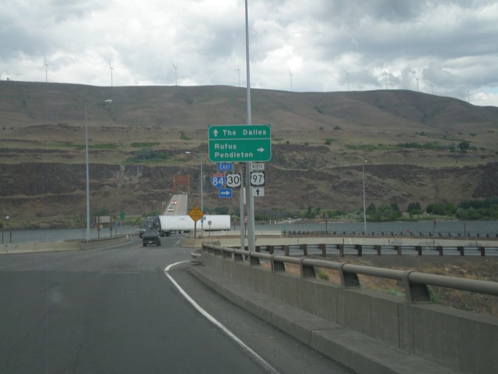
US-97 North at I-84/US-30 (Exit 104)
US-97 north at I-84/US-30 (Exit 104) junction. Turn right on I-84/US-30 east for Rufus and Pendleton. Continue over freeway for I-84/US-30 west to The Dalles. The Columbia River, and bridge over the Columbia River into Washington is in the background of the photograph.
Taken 05-26-2012
Wasco
Sherman County
Oregon
United States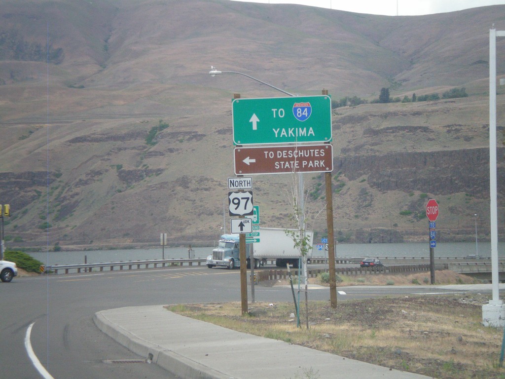
US-97 North at I-84 Frontage Road
I-84 north at I-84 Frontage Road, and approaching I-84/US-30 junction. Turn left on the Frontage Road for Deschutes State Park. Continue north on US-97 for I-84 junction, and Yakima (Washington). The Columbia River and Washington state are in the background of the photograph.
Taken 05-26-2012
Wasco
Sherman County
Oregon
United States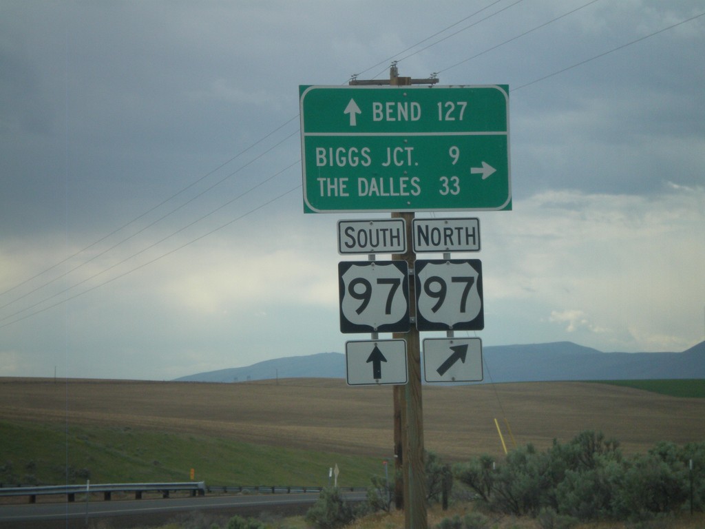
OR-206 West at US-97
OR-206 west at US-97 onramp. Turn right for US-97 north to Biggs Junction and The Dalles. Continue over the highway for US-97 southbound ramp to Bend.
Taken 05-26-2012
 Wasco
Sherman County
Oregon
United States
Wasco
Sherman County
Oregon
United States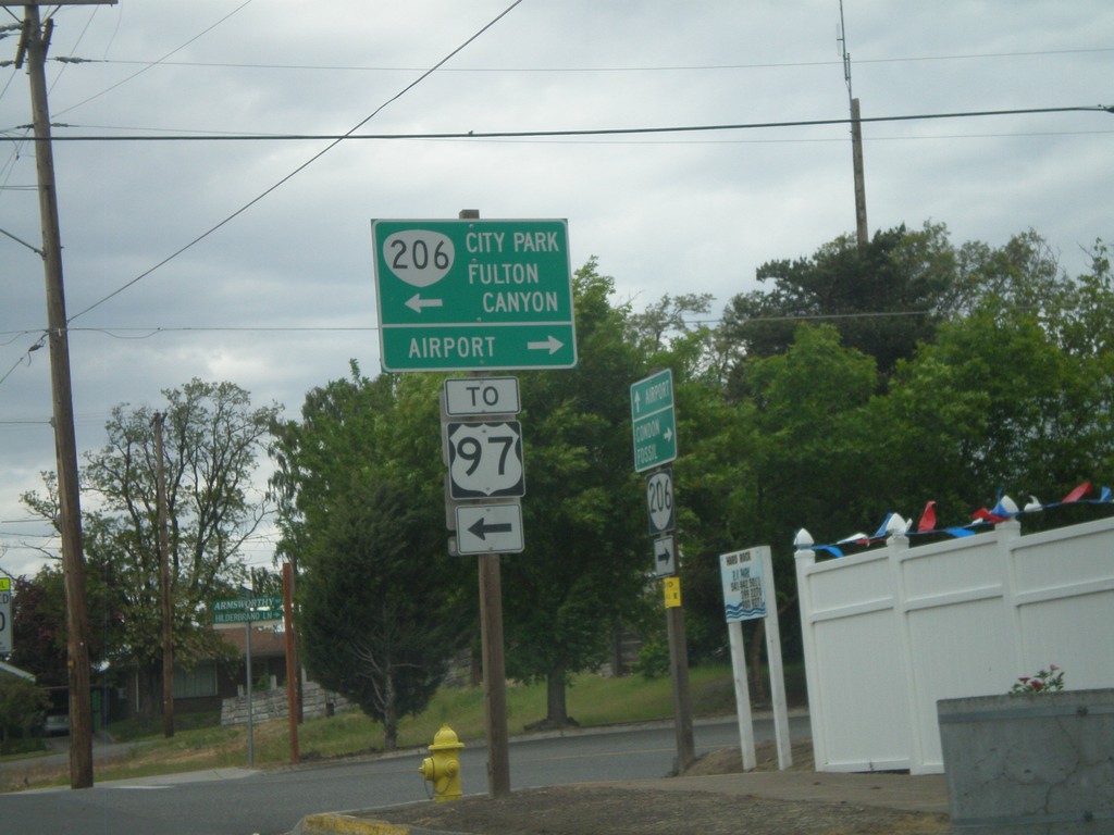
OR-206 West In Wasco
OR-206 west on Clark St. at Armsworthy St. in Wasco. Turn left on Armsworthy St. to continue on OR-206 for Fulton Canyon, (Wasco) City Park and US-97. Turn right for the Wasco Airport.
Taken 05-26-2012
Wasco
Sherman County
Oregon
United States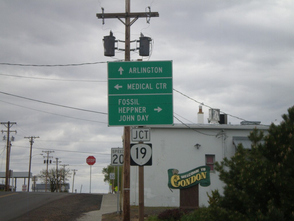
OR-206 East at OR-19
OR-206 east at OR-19 in Condon. Continue ahead for OR-19 north to Arlington. Turn right for OR-206 East/OR-19 South for Fossil, Heppner, and John Day. Turn left on Main St. for the Medical Center.
Taken 05-26-2012
 Condon
Gilliam County
Oregon
United States
Condon
Gilliam County
Oregon
United States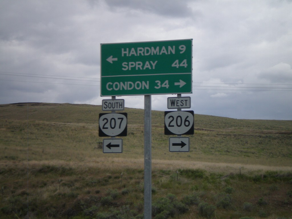
OR-206 West/OR-207 West at Split
OR-206 West/OR-207 West at OR-206/OR-207 split. Turn right for OR-206 west to Condon. Turn left for OR-207 west to Hardman and Spray.
Taken 05-26-2012
 Heppner
Morrow County
Oregon
United States
Heppner
Morrow County
Oregon
United States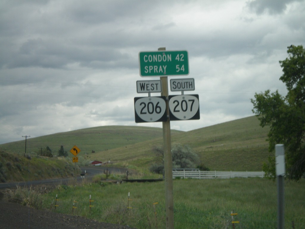
Distance Marker on OR-206/OR-207
Distance marker on OR-206 West/OR-207 South to Condon and Spray.
Taken 05-26-2012
Heppner
Morrow County
Oregon
United States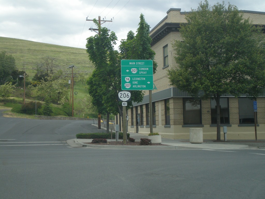
OR-74 North at OR-206/OR-207
OR-74 north at OR-206 and OR-207 in Heppner. Turn right to continue north on OR-74 North and OR-207 North to Lexington, Ione, and Arlington. Turn left on Main St. for OR-207 south and OR-206 west to Condon and Spray.
Taken 05-26-2012
 Heppner
Morrow County
Oregon
United States
Heppner
Morrow County
Oregon
United States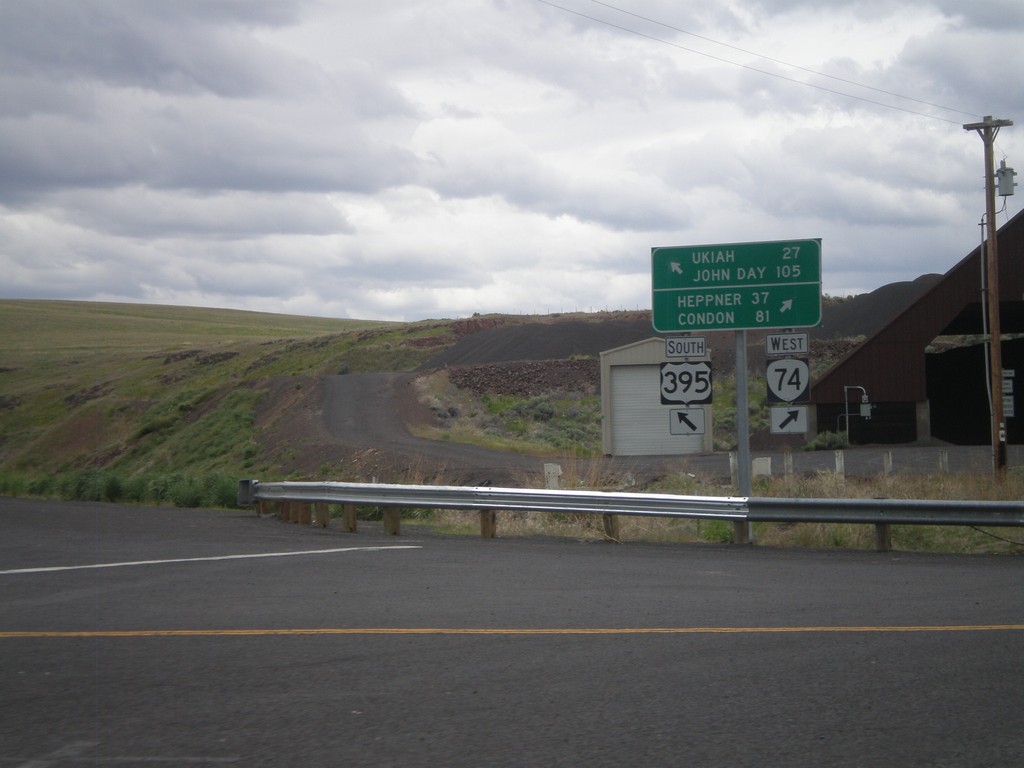
US-395 South at OR-74
US-395 south at OR-74. Turn right for OR-74 west to Heppner and Condon. Merge left for US-395 south to Ukiah and John Day.
Taken 05-26-2012
 Pilot Rock
Umatilla County
Oregon
United States
Pilot Rock
Umatilla County
Oregon
United States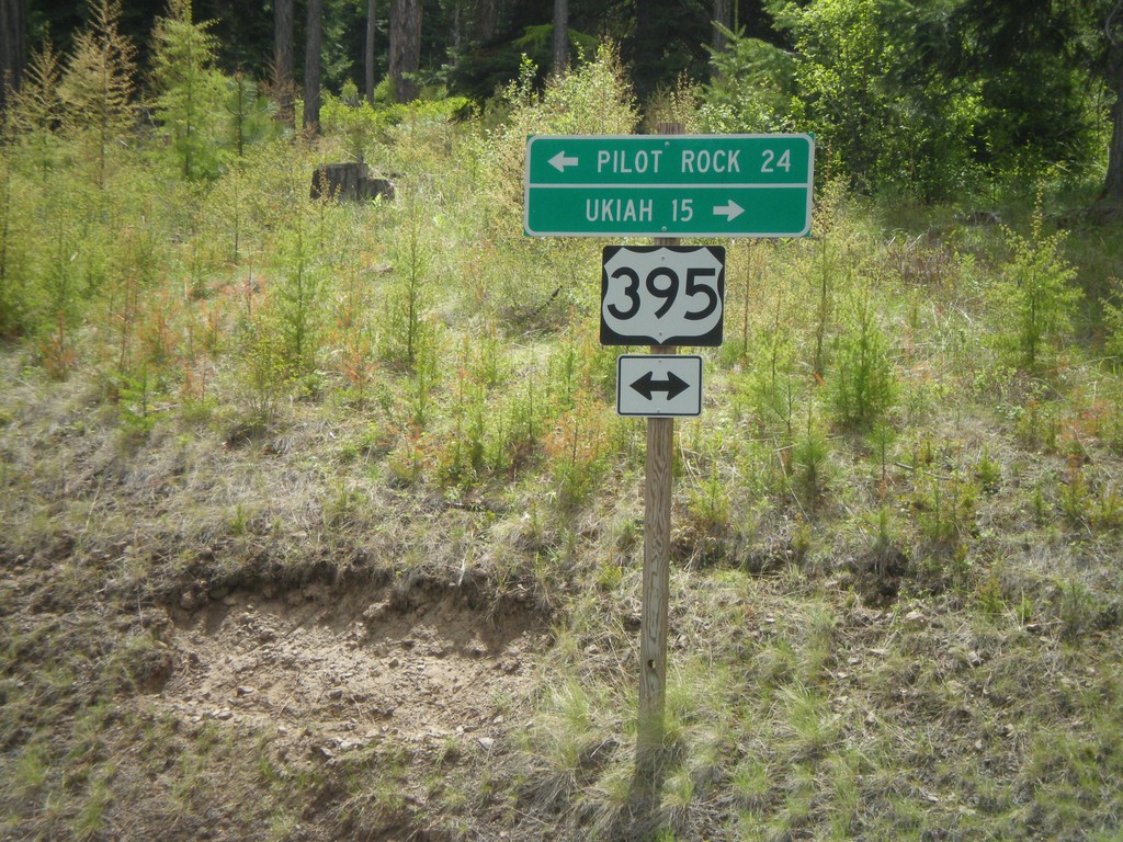
US-395 Jct. at Battle Mountain State Park
US-395 junction at Battle Mountain State Park entrance road. Turn right for US-395 south to Ukiah; left for US-395 north to Pilot Rock.
Taken 05-26-2012
Gurdane
Umatilla County
Oregon
United States
End OR-244 West at US-395
End OR-244 west at US-395. Turn right for US-395 north to Pendleton. Turn left for US-395 south to Long Creek and John Day.
Taken 05-26-2012
 Ukiah
Umatilla County
Oregon
United States
Ukiah
Umatilla County
Oregon
United States
End OR-244 West at US-395
End OR-244 west at US-395 junction.
Taken 05-26-2012
Ukiah
Umatilla County
Oregon
United States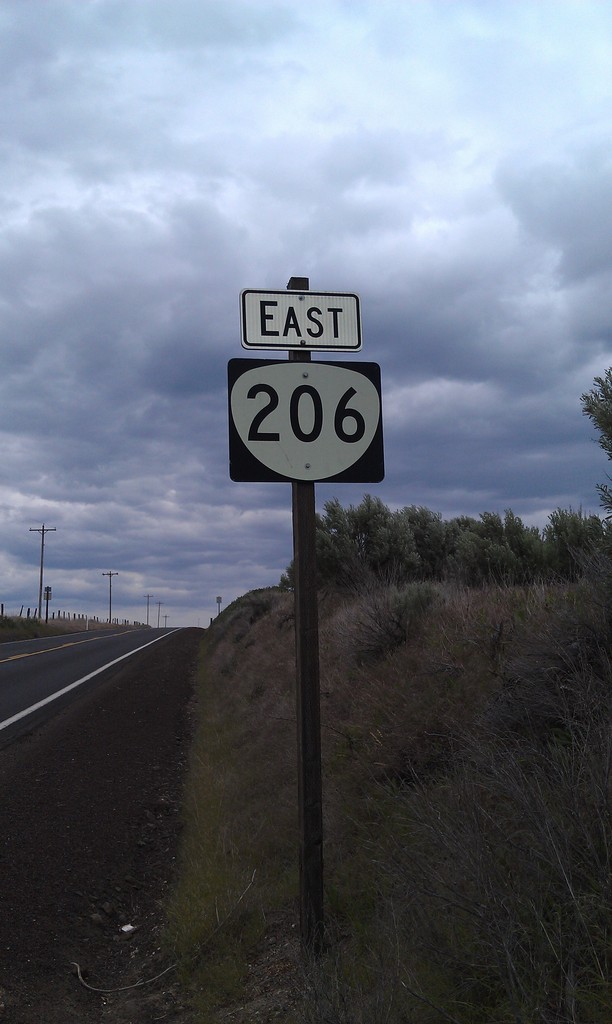
OR-206 East
East OR-206, taken just east of US-97 near Wasco.
Taken 05-26-2012
Wasco
Sherman County
Oregon
United States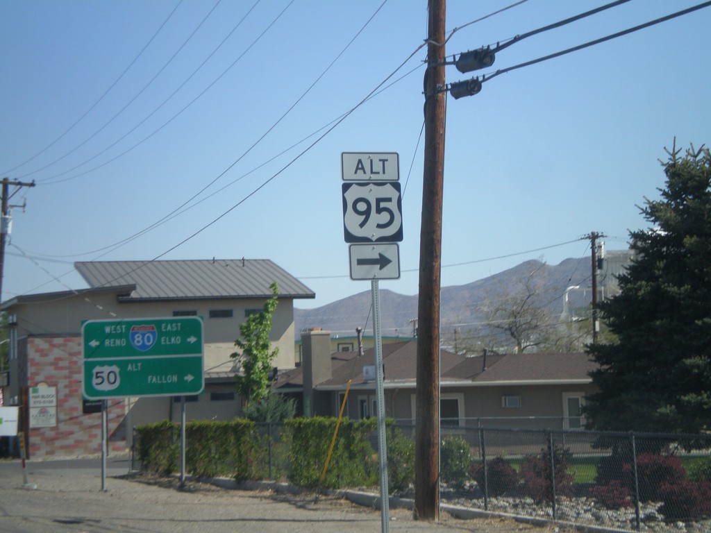
US-95 Alt. North at US-50 Alt./BL-80
US-95 ALT at US-50 ALT to Fallon and BL-80 to Reno and Elko. Turn right to continue on US-95 Alt.
Taken 05-07-2012


 Fernley
Lyon County
Nevada
United States
Fernley
Lyon County
Nevada
United States