Signs Tagged With Shield
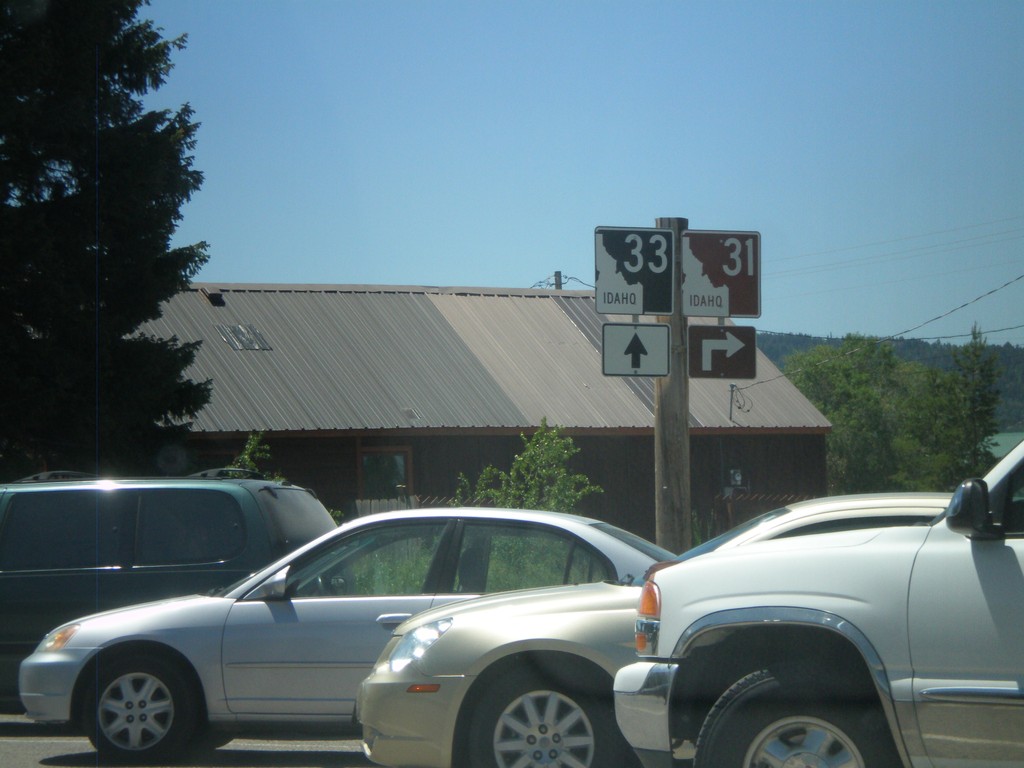
ID-33 East at ID-31
ID-33 east at ID-32 in Victor. The Teton Scenic Byway turns right here onto ID-31.
Taken 07-02-2011

 Victor
Teton County
Idaho
United States
Victor
Teton County
Idaho
United States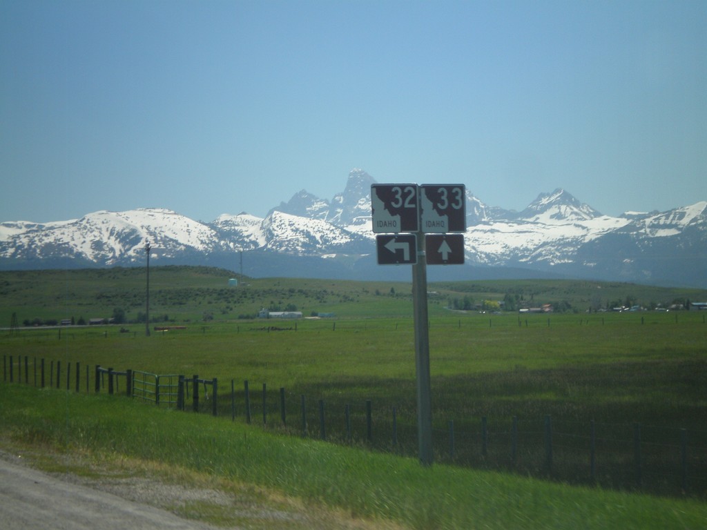
ID-33 East at ID-32 North
ID-33 East at ID-32 North. The Teton Scenic Byway joins ID-33 east here. The Teton Range is in the background of the photo.
Taken 07-02-2011
 Felt
Teton County
Idaho
United States
Felt
Teton County
Idaho
United States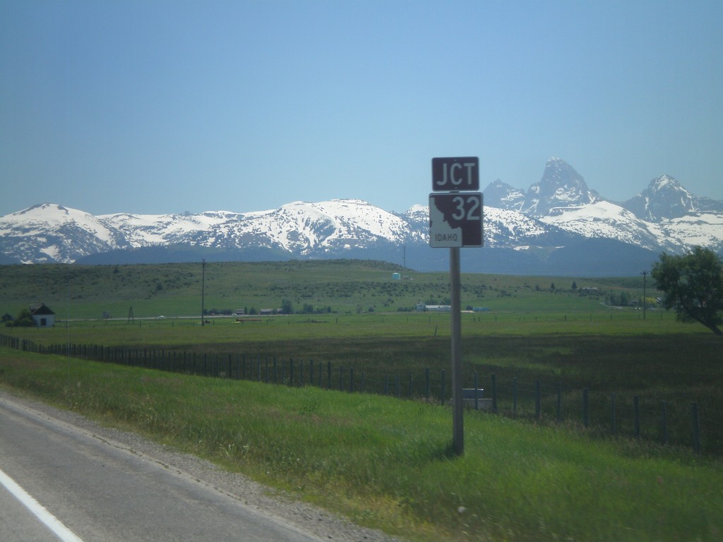
ID-33 East Approaching ID-32
ID-33 east approaching ID-32 in Tetonia. The peaks of the Teton Range are in the background.
Taken 07-02-2011
Tetonia
Teton County
Idaho
United States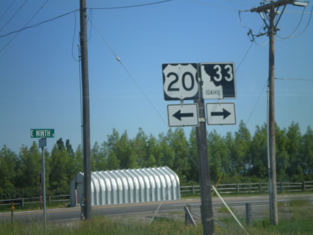
ID-33 East at US-20 Access Road
ID-33 East at US-20 access road. Turn left for US-20; turn right to continue on ID-33 east.
Taken 07-02-2011
 Sugar City
Madison County
Idaho
United States
Sugar City
Madison County
Idaho
United States
ID-33 East - Sugar City
ID-33 east in Sugar City. Turn right to continue on ID-33.
Taken 07-02-2011
Sugar City
Madison County
Idaho
United States
ID-33 East in Rexburg
ID-33 north (N 2nd St.) at Yellowstone Highway in Rexburg. Turn right to continue on ID-33.
Taken 07-02-2011
Rexburg
Madison County
Idaho
United States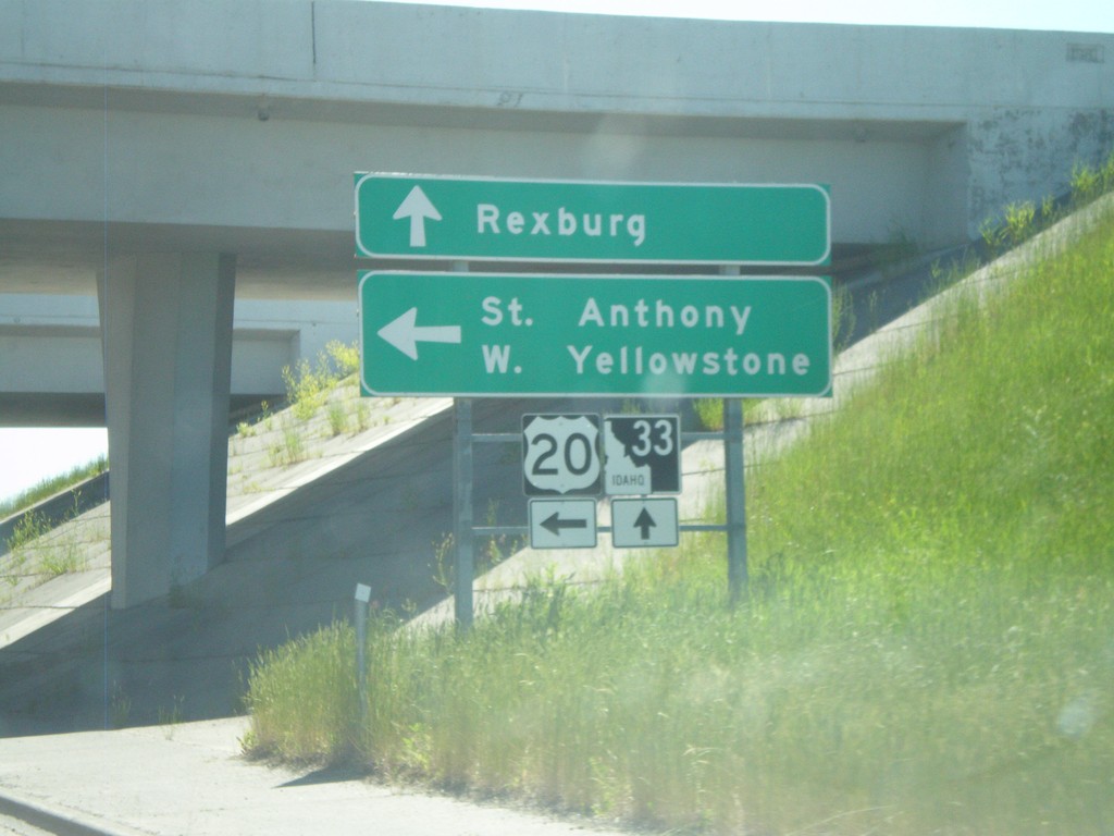
ID-33 East at US-20 East
ID-33 east at US-20 east. Use US-20 east for St. Anthony and West Yellowstone (Montana). Continue east on ID-33 for downtown Rexburg.
Taken 07-02-2011
Rexburg
Madison County
Idaho
United States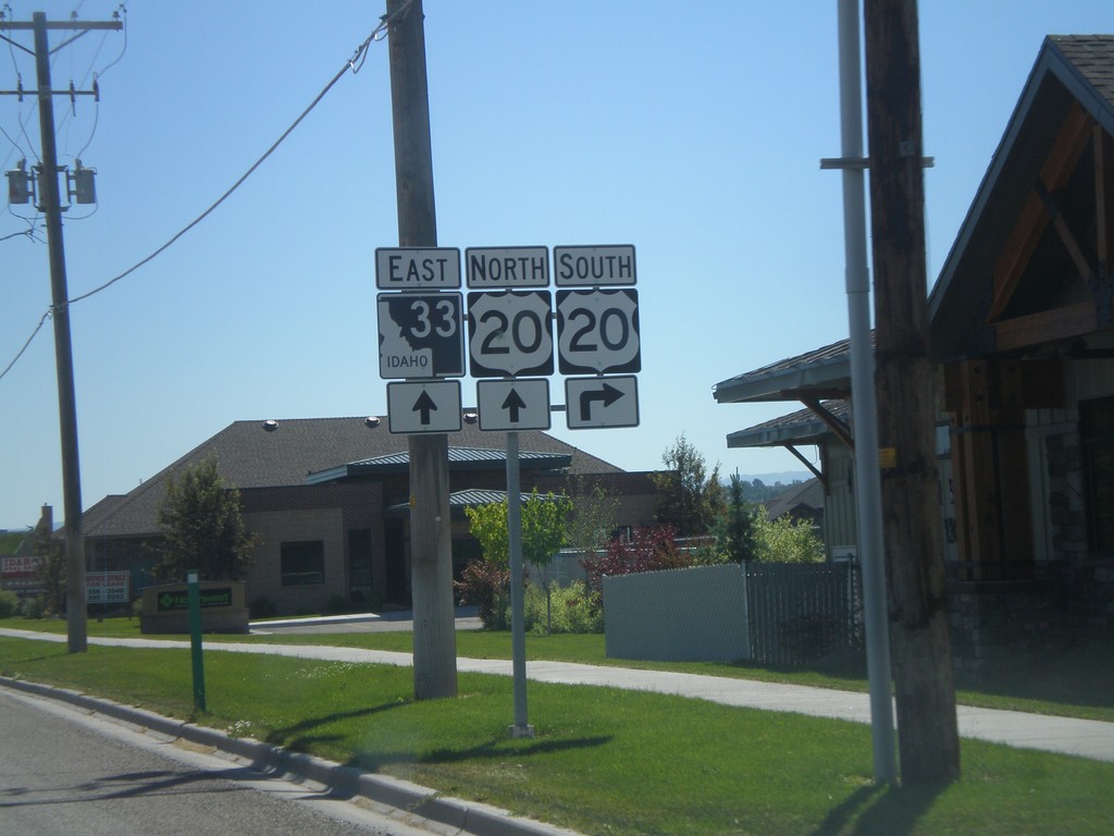
ID-33 East Approaching US-20
ID-33 east approaching US-20 in Rexburg.
Taken 07-02-2011
Rexburg
Madison County
Idaho
United States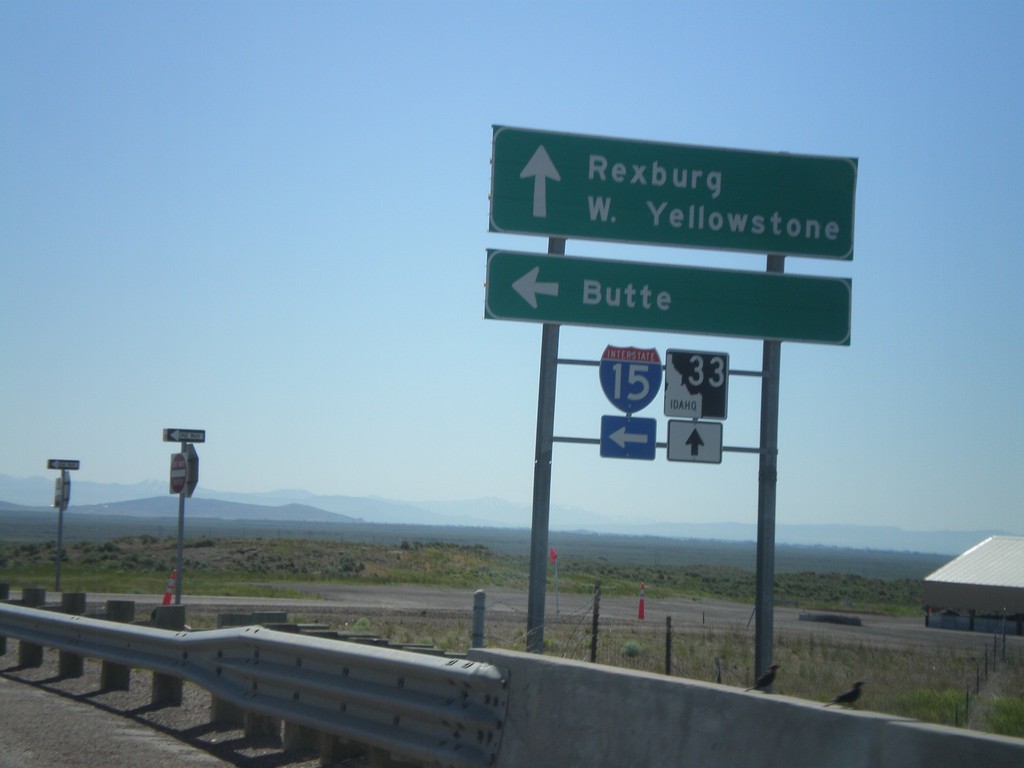
ID-33 East at I-15 North
ID-33 East at I-15 North (Exit 143). Use I-15 North for Butte (Montana). Continue east on ID-33 for Rexburg and West Yellowstone (Montana).
Taken 07-02-2011
 Roberts
Jefferson County
Idaho
United States
Roberts
Jefferson County
Idaho
United States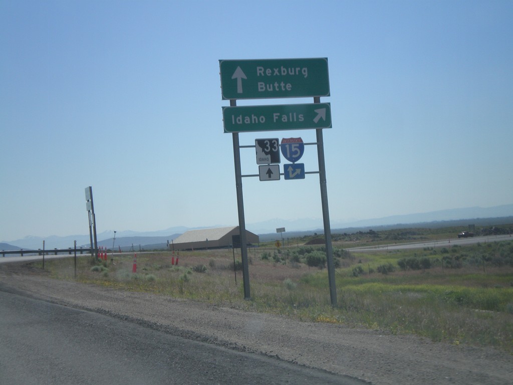
ID-33 East at I-15 South
ID-33 east at I-15 south to Idaho Falls. Continue over overpass for I-15 north onramp to Butte (Montana). Continue east on ID-33 for Rexburg.
Taken 07-02-2011
Sage Junction
Jefferson County
Idaho
United States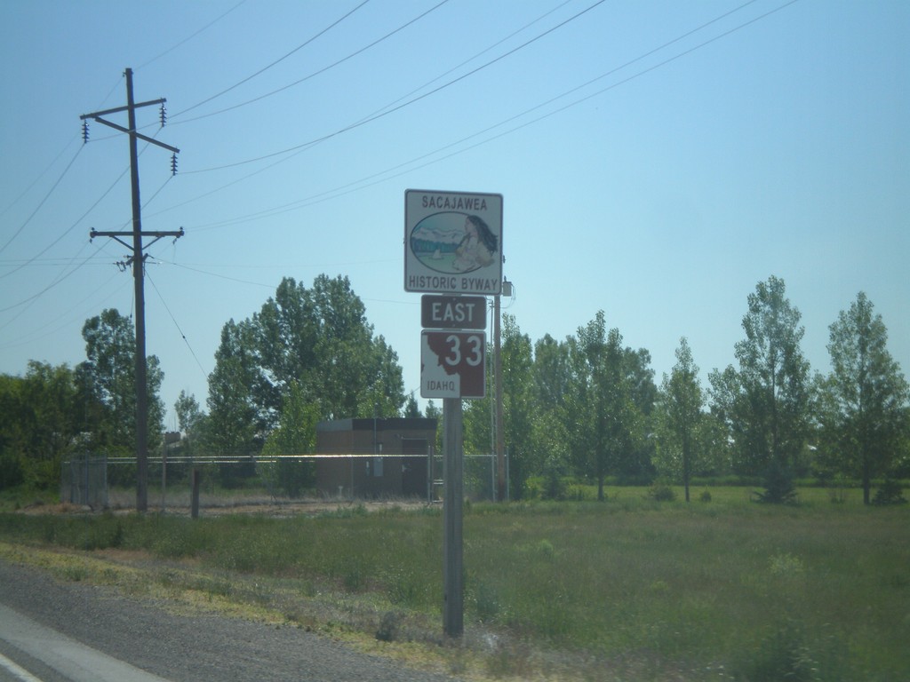
ID-33 East - Sacajawea Historic Byway
Sacajawea Historic Byway on ID-33 east, near Mud Lake.
Taken 07-02-2011
Terreton
Jefferson County
Idaho
United States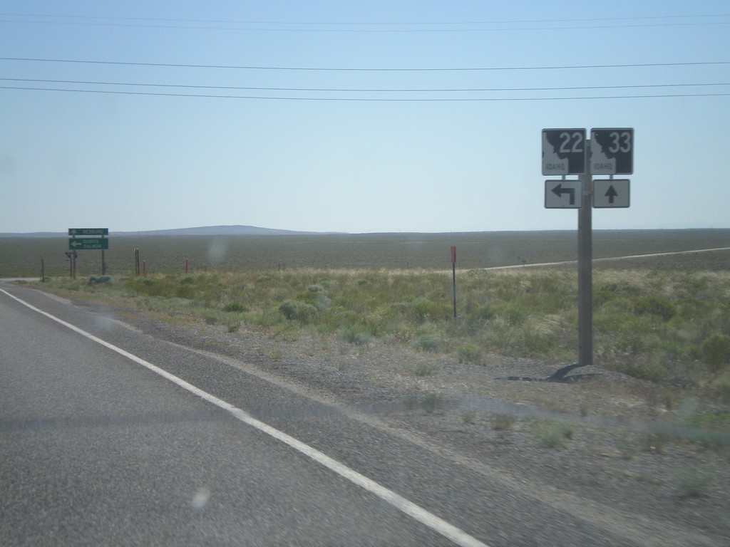
ID-33 East Approaching ID-22
ID-33 east approaching ID-22. Turn left for ID-22 east.
Taken 07-02-2011
 Berenice
Butte County
Idaho
United States
Berenice
Butte County
Idaho
United States
NV-427 South at I-80
NV-427 South at I-80 (Exit 46) onramp. Turn right for I-80 west; continue under highway for I-80 east. BL-80 starts here and runs through downtown Fernley, rejoining I-80 at Exit 48.
Taken 06-13-2011


 Fernley
Lyon County
Nevada
United States
Fernley
Lyon County
Nevada
United States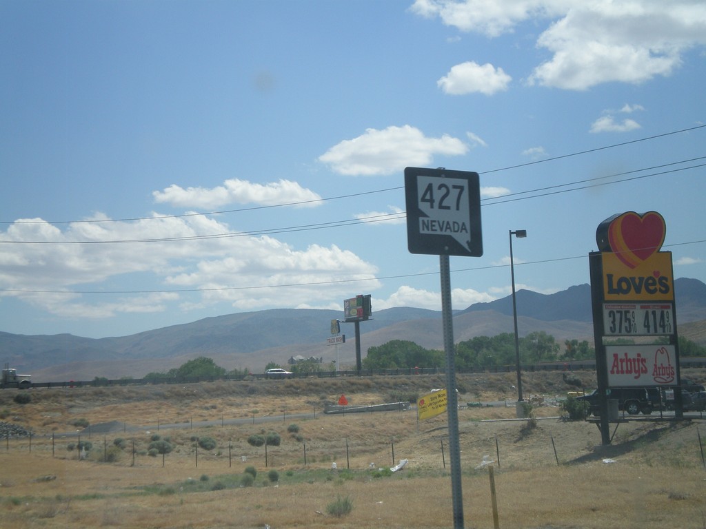
NV-427 South - Fernley
NV-427 South in Fernley.
Taken 06-13-2011
Fernley
Lyon County
Nevada
United States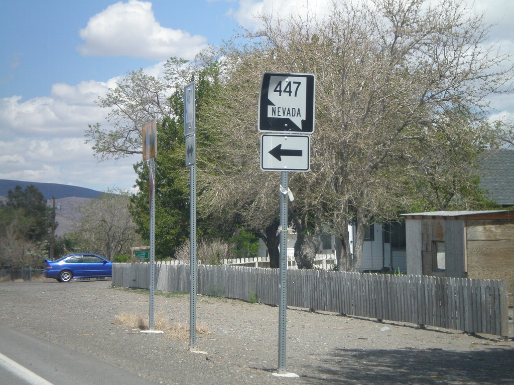
NV-427 East at NV-447
NV-427 east at NV-447 in Wadsworth.
Taken 06-13-2011
 Wadsworth
Washoe County
Nevada
United States
Wadsworth
Washoe County
Nevada
United States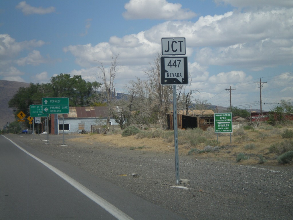
NV-427 East Approaching NV-447
NV-427 East approaching NV-447 in Wadsworth. Turn north on NV-447 for Pyramid Lake and Gerlach.
Taken 06-13-2011
Sparks
Washoe County
Nevada
United States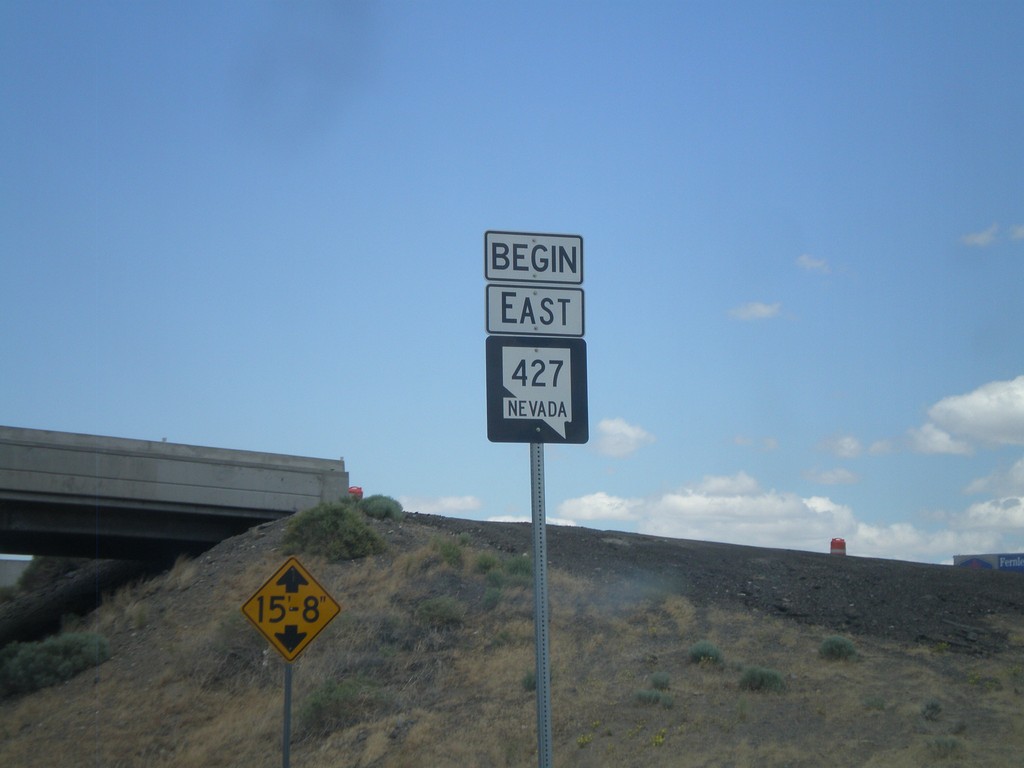
Begin NV-427 East
Begin NV-427 East at I-80 (Exit 43). NV-427 runs from Exit 43 on I-80 into Fernley.
Taken 06-13-2011
Wadsworth
Washoe County
Nevada
United States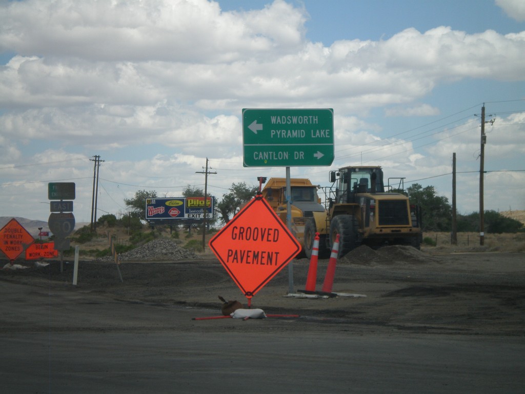
I-80 East Offramp at NV-427
I-80 East Offramp (Exit 43) at NV-427 East. Turn left for NV-427 (not signed) for Wadsworth and Pyramid Lake. Turn right for Cantlon Drive.
Taken 06-13-2011
Wadsworth
Washoe County
Nevada
United States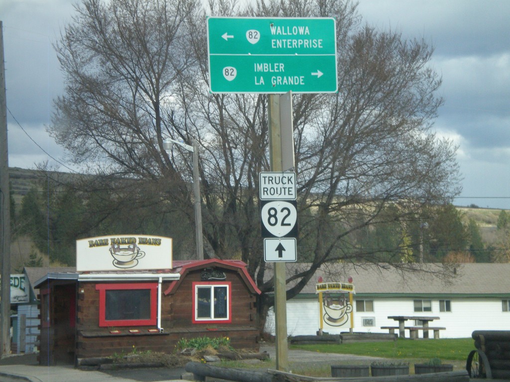
End OR-204 East at OR-82
End OR-204 East at OR-82. Use OR-82 east for Wallowa and Enterprise; use OR-82 west for Imbler and La Grande. For OR-82 truck traffic continue ahead.
Taken 04-28-2011

 Elgin
Union County
Oregon
United States
Elgin
Union County
Oregon
United States
End OR-204 East At OR-82
End OR-204 East at OR-82 in Elgin.
Taken 04-28-2011
Elgin
Union County
Oregon
United States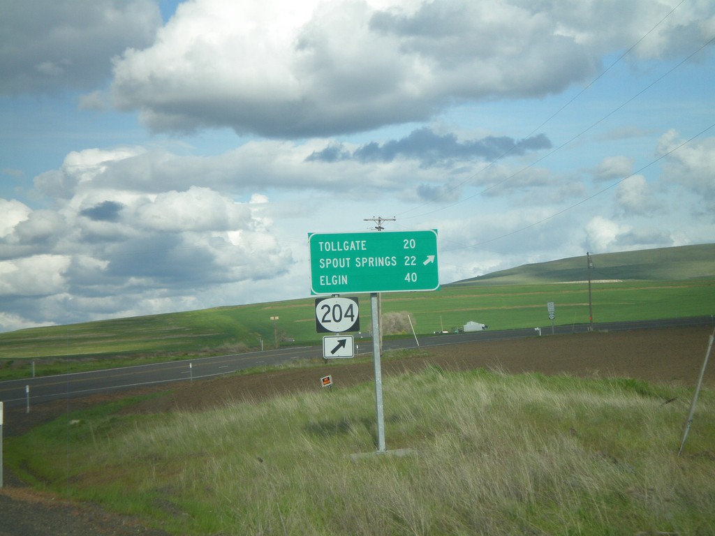
OR-204 East at Winn Road
OR-204 east at Winn Road. Merge right to continue on OR-204 for Tollgate, Spout Springs, and Elgin.
Taken 04-28-2011
Weston
Umatilla County
Oregon
United States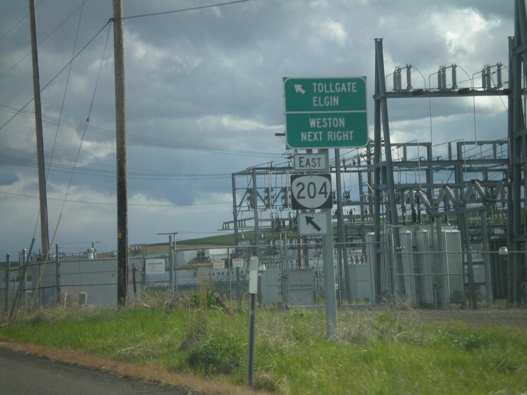
OR-204 East at Weston
OR-204 east at Weston. Merge left to continue on OR-204 for Tollgate and Elgin.
Taken 04-28-2011
Weston
Umatilla County
Oregon
United States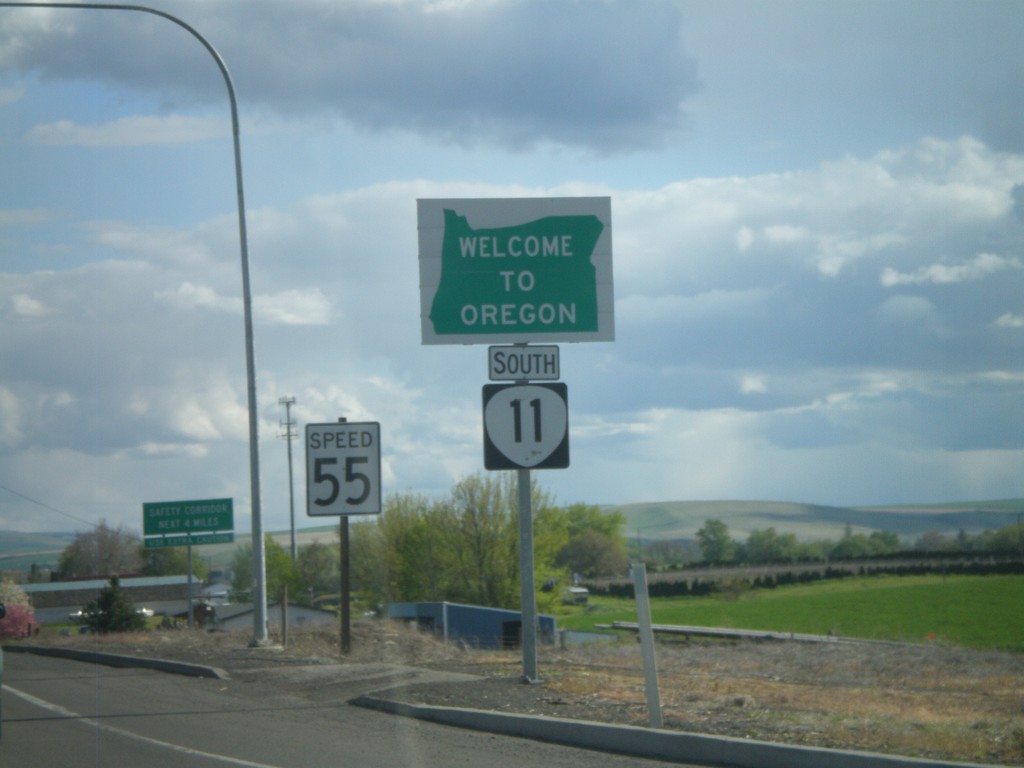
OR-11 South - Welcome To Oregon
Welcome to Oregon on OR-11 south at the Washington-Oregon state line. Also the first speed limit sign in Oregon is in the background - 55 MPH. Most Oregon speed limit signs omit the word Limit.
Taken 04-28-2011
 Milton-Freewater
Umatilla County
Oregon
United States
Milton-Freewater
Umatilla County
Oregon
United States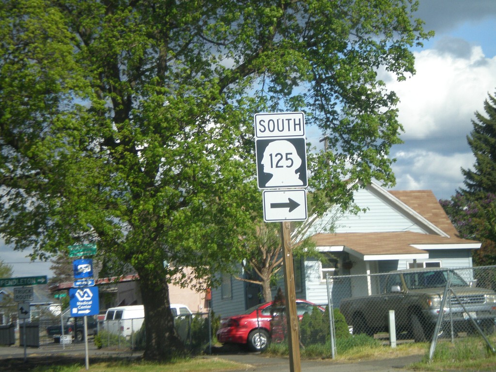
WA-125 - W. Pine St. at N. 9th St.
WA-125 - W. Pine St. at N. 9th St. in Walla Walla. Turn right to continue south on WA-125.
Taken 04-28-2011
 Walla Walla
 County
Washington
United States
Walla Walla
Walla Walla County
Washington
United States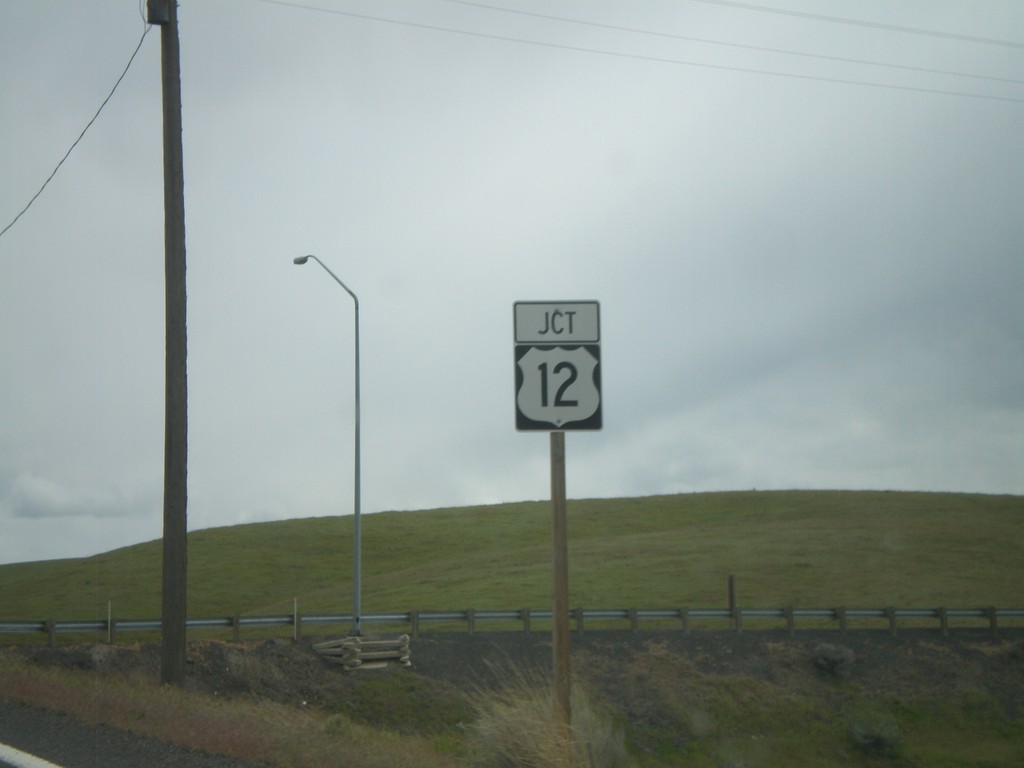
End WA-261 East at US-12
End WA-261 East at US-12 in Columbia County.
Taken 04-28-2011

 Dayton
Columbia County
Washington
United States
Dayton
Columbia County
Washington
United States