Signs Tagged With Shield
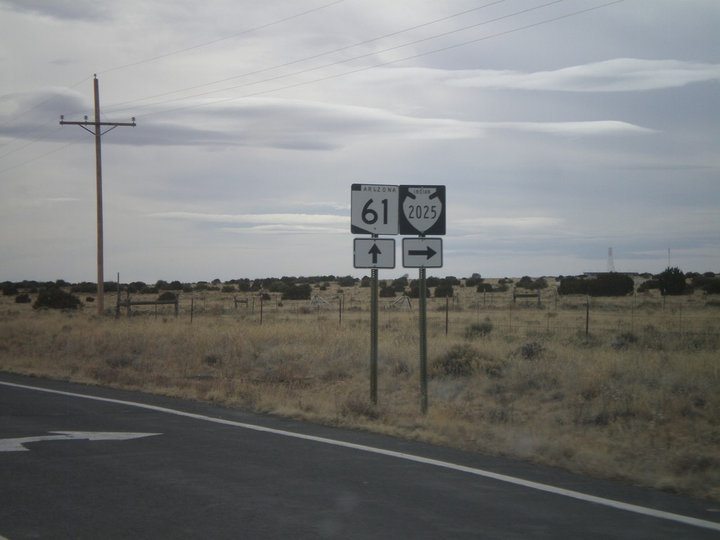
AZ-61 West Approaching Navajo-2025
AZ-61 west approaching Navajo-2025.
Taken 02-24-2011

 Sanders
Apache County
Arizona
United States
Sanders
Apache County
Arizona
United States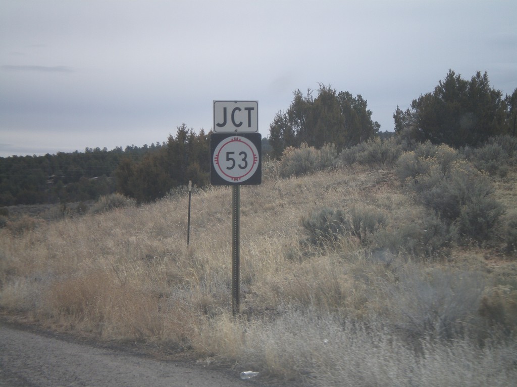
NM-602 South Approaching NM-53
NM-602 south approaching NM-53.
Taken 02-24-2011

 Zuni
McKinley County
New Mexico
United States
Zuni
McKinley County
New Mexico
United States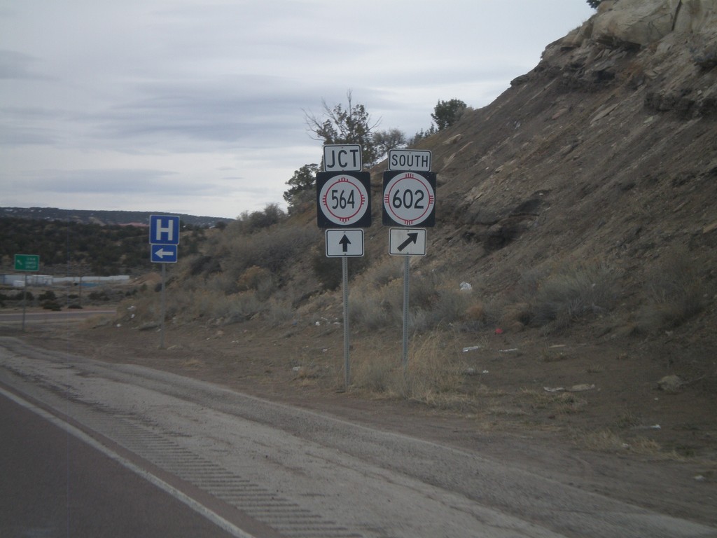
NM-602 South Approaching NM-564
NM-602 south approaching NM-564. Turn right to continue south on NM-602. NM-564 is the eastern belt route around Gallup.
Taken 02-24-2011
 Gallup
McKinley County
New Mexico
United States
Gallup
McKinley County
New Mexico
United States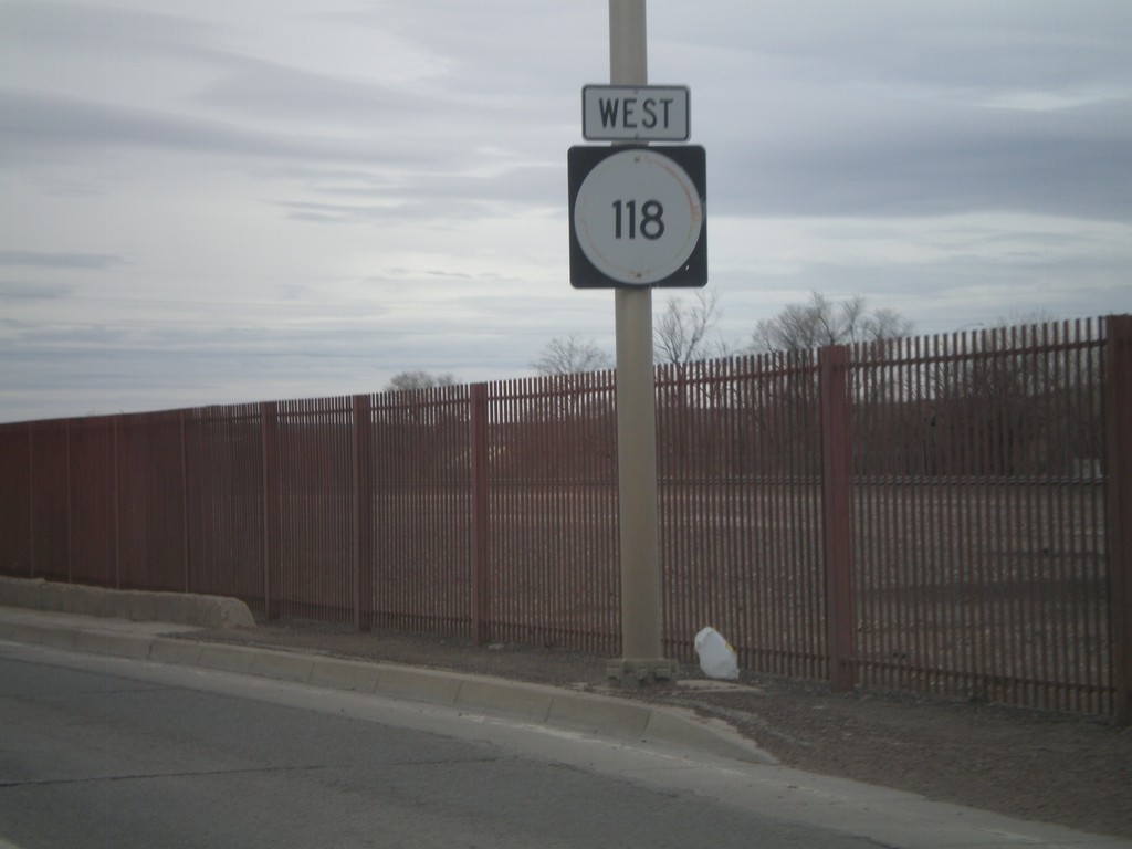
NM-118 West - Downtown Gallup
NM-118 west in Downtown Gallup.
Taken 02-24-2011
 Gallup
McKinley County
New Mexico
United States
Gallup
McKinley County
New Mexico
United States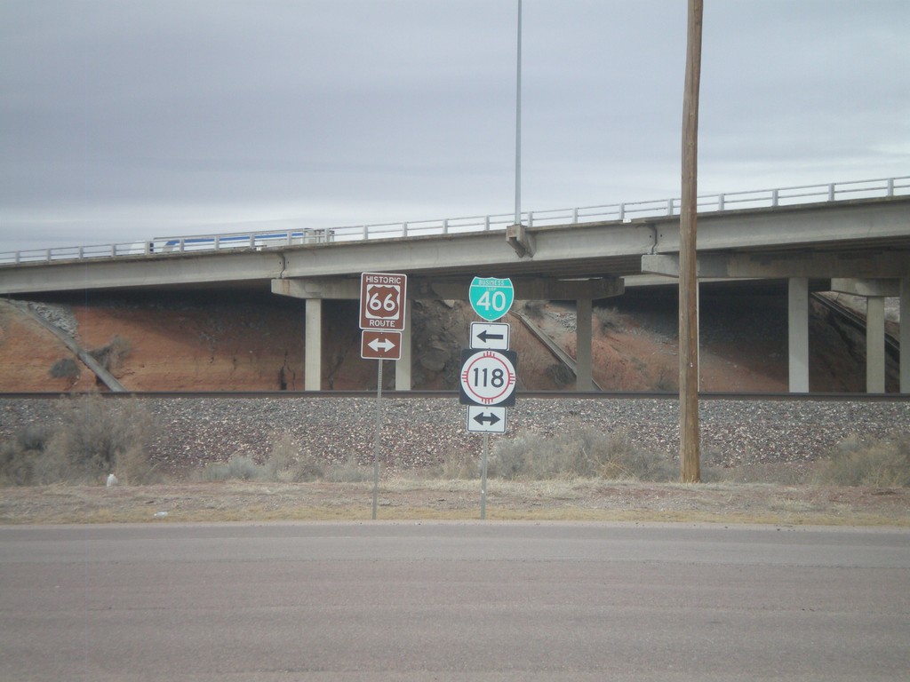
I-40 East Exit 26 offramp at NM-118
I-40 east Exit 26 offramp at NM-118/BL-40. NM-118 is the route of former US-66.
Taken 02-24-2011

 Gallup
McKinley County
New Mexico
United States
Gallup
McKinley County
New Mexico
United States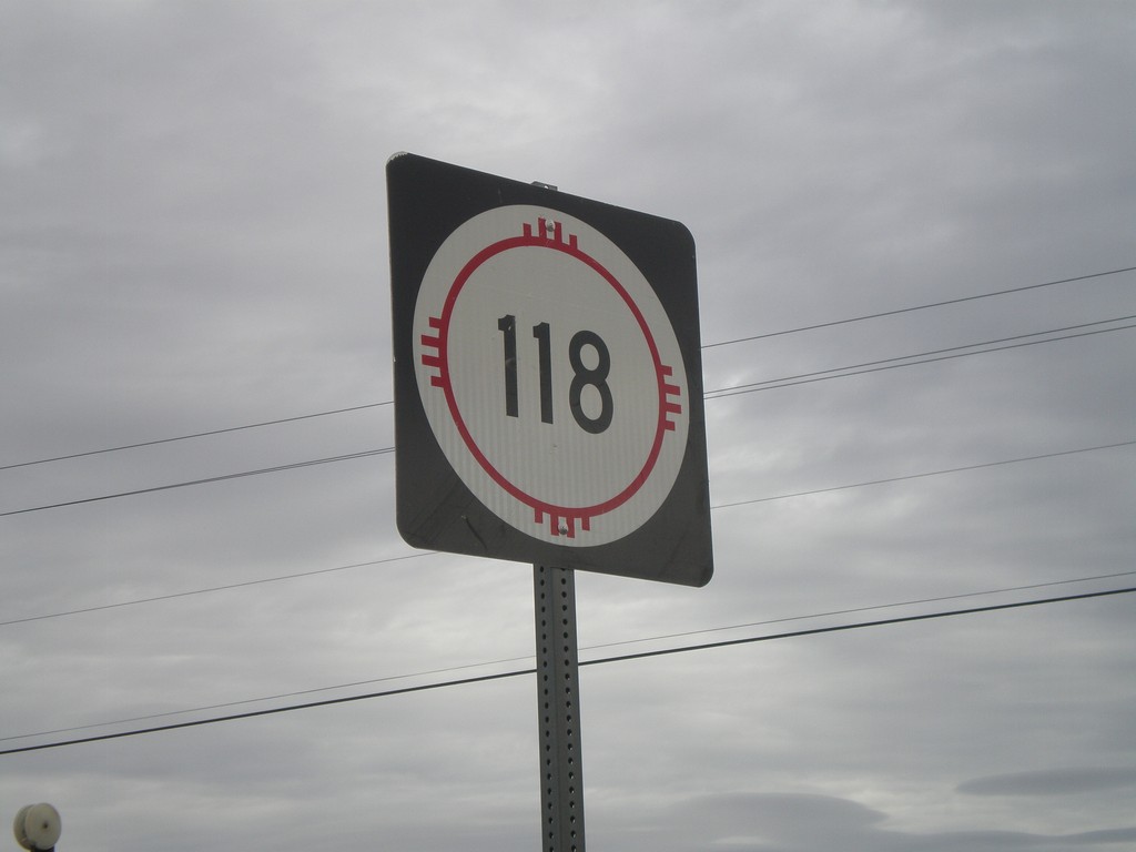
NM-118 East
NM-118 East in rural McKinley County.
Taken 02-24-2011
Gallup
McKinley County
New Mexico
United States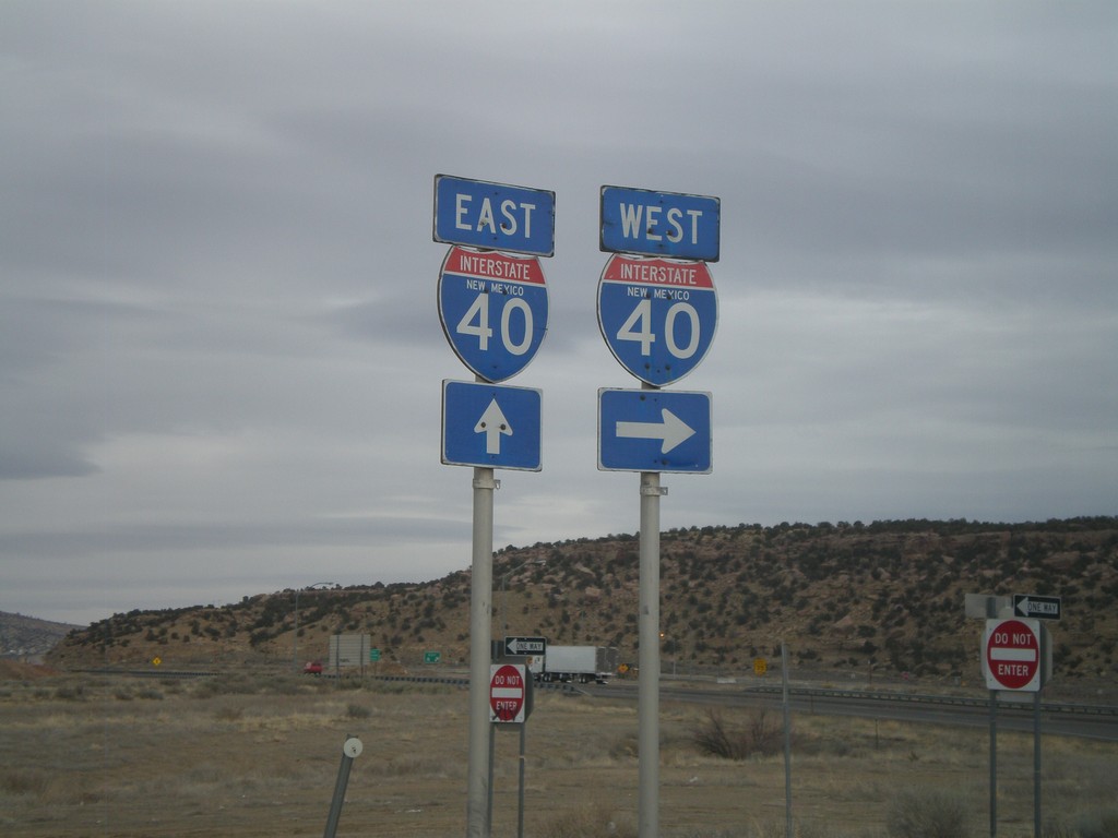
NM-118 West at I-40 East
NM-118 west at I-40 east (Exit 8) onramp. Continue west on NM-118 for westbound I-40 access.
Taken 02-24-2011
Gallup
McKinley County
New Mexico
United States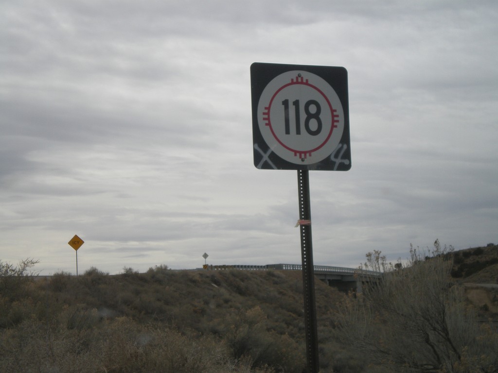
NM-118 West
NM-118 west shield, just west of I-40 (Exit 8) onramps. This sign is been spray painted, as has many other signs in the Gallup area.
Taken 02-24-2011
Gallup
McKinley County
New Mexico
United States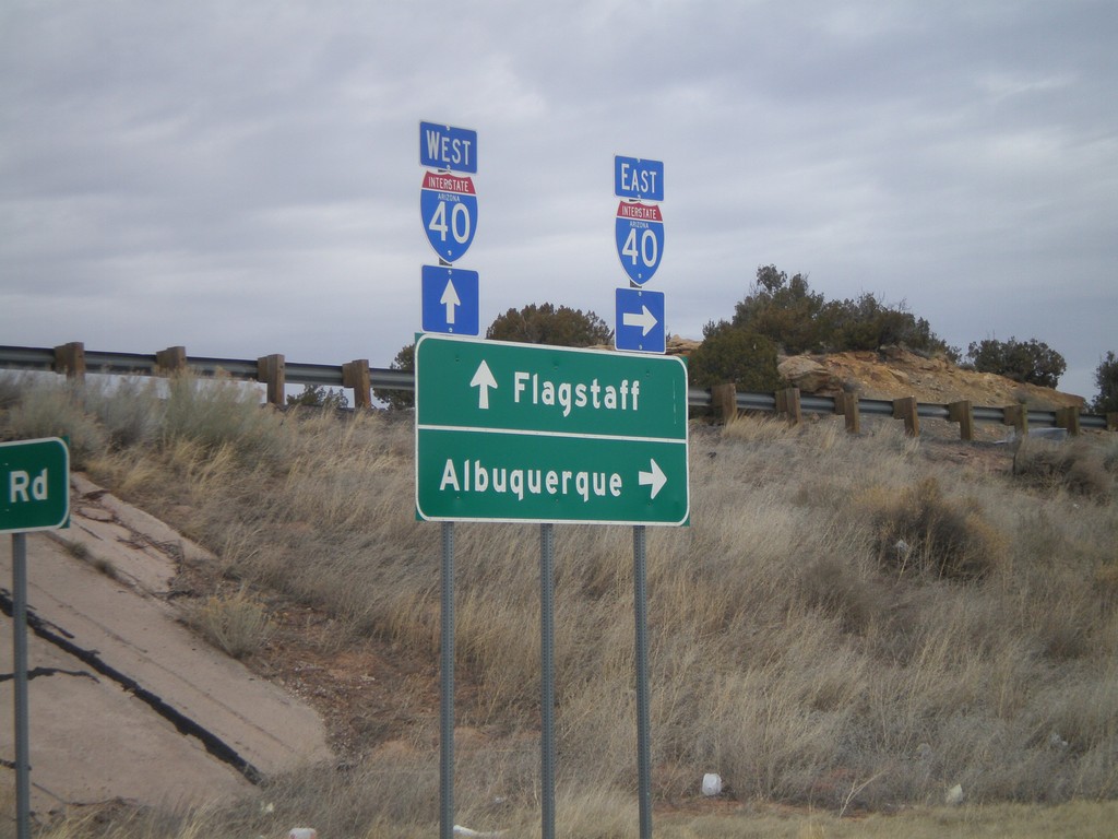
I-40 Onramp at Exit 346
I-40 onramp at Exit 346. Use I-40 west for Flagstaff; use I-40 east for Albuquerque.
Taken 02-24-2011
Houck
Apache County
Arizona
United States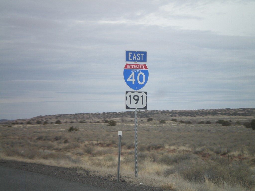
I-40 East/US-191 South
I-40 East/US-191 south in Apache County, Arizona. The US-191 shield is actually in error, because US-191 does not join I-40 eastbound for another 3 miles.
Taken 02-24-2011
 Chambers
Apache County
Arizona
United States
Chambers
Apache County
Arizona
United States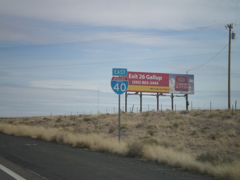
I-40 East Shield
I-40 East, Arizona, shield in Holbrook.
Taken 02-24-2011
 Holbrook
Navajo County
Arizona
United States
Holbrook
Navajo County
Arizona
United States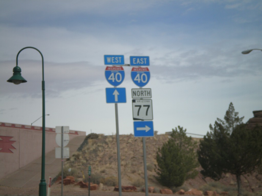
BL-40 East/AZ-77 North at I-40
BL-40 East/AZ-77 North at I-40 freeway entrance. Use I-40 west for Flagstaff; use I-40 east for Albuquerque. AZ-77 joins I-40 east through Holbrook.
Taken 02-24-2011
Holbrook
Navajo County
Arizona
United States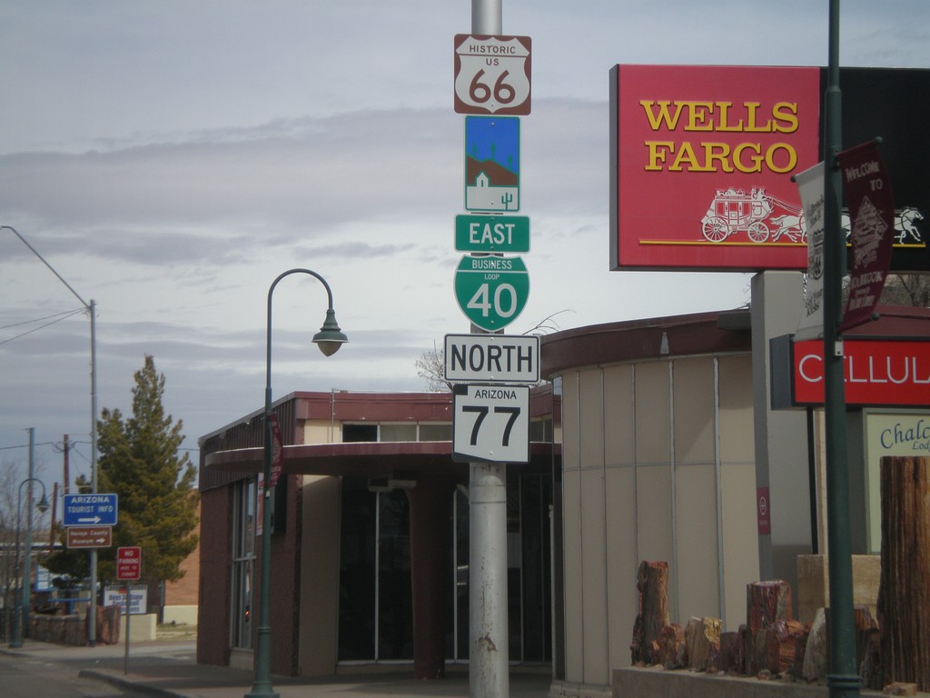
BL-40 East/AZ-77 North - Arizona Scenic Byway
BL-40 east/AZ-77 north in Holbrook. BL-40 in Holbrook follows the historic route of US-66 and is signed as an Arizona Scenic Byway.
Taken 02-24-2011
Holbrook
Navajo County
Arizona
United States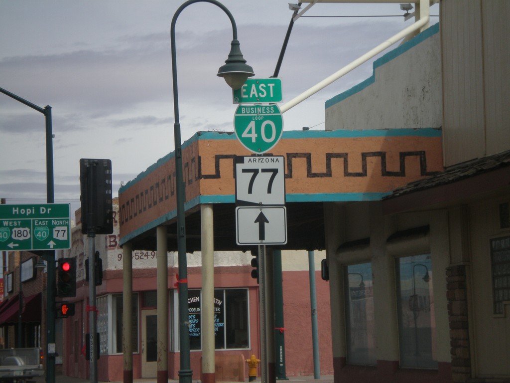
AZ-77 North/US-180 West at BL-40
AZ-77 North/US-180 West at BL-40 in downtown Holbrook. Continue straight on Navajo Blvd. for AZ-77 North/BL-40 East. Turn left on Hopi Drive for US-180 West/BL-40 west.
Taken 02-24-2011
 Holbrook
Navajo County
Arizona
United States
Holbrook
Navajo County
Arizona
United States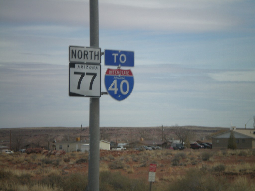
AZ-77 North To I-40
AZ-77 north to I-40 (and US-180 west which is not signed) in Holbrook.
Taken 02-24-2011
Holbrook
Navajo County
Arizona
United States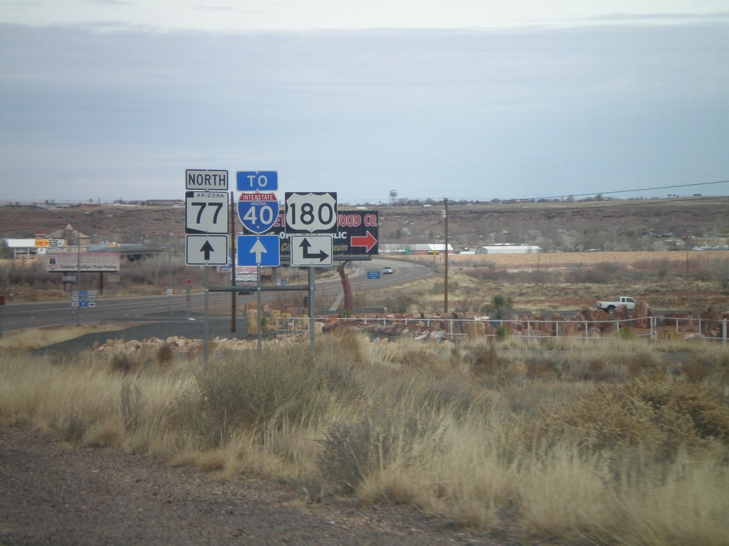
AZ-77 North at US-180
AZ-77 north at US-180. Turn right for US-180 east; continue north on AZ-77 for US-180 east to I-40.
Taken 02-24-2011
Holbrook
Navajo County
Arizona
United States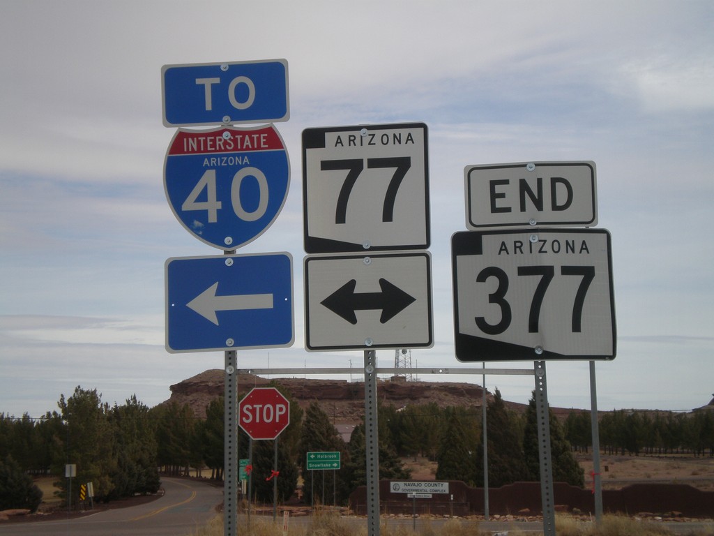
End AZ-377 at AZ-77
End AZ-377 at AZ-77. Use AZ-77 north for I-40.
Taken 02-24-2011
 Holbrook
Navajo County
Arizona
United States
Holbrook
Navajo County
Arizona
United States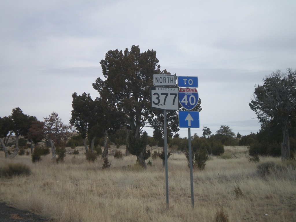
AZ-377 North To I-40
AZ-377 north to I-40. Many of the shields along AZ-277 and AZ-377 north between Heber and Holbrook have a To I-40 shield in addition to the state highway shield.
Taken 02-24-2011
Heber-Overgaard
Navajo County
Arizona
United States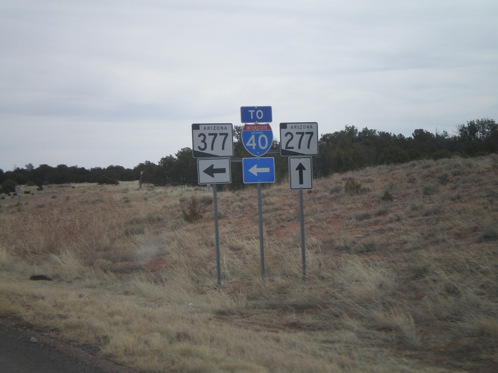
AZ-277 North at AZ-377 (To I-40)
AZ-277 north at AZ-377 (To I-40)
Taken 02-24-2011
 Heber-Overgaard
Navajo County
Arizona
United States
Heber-Overgaard
Navajo County
Arizona
United States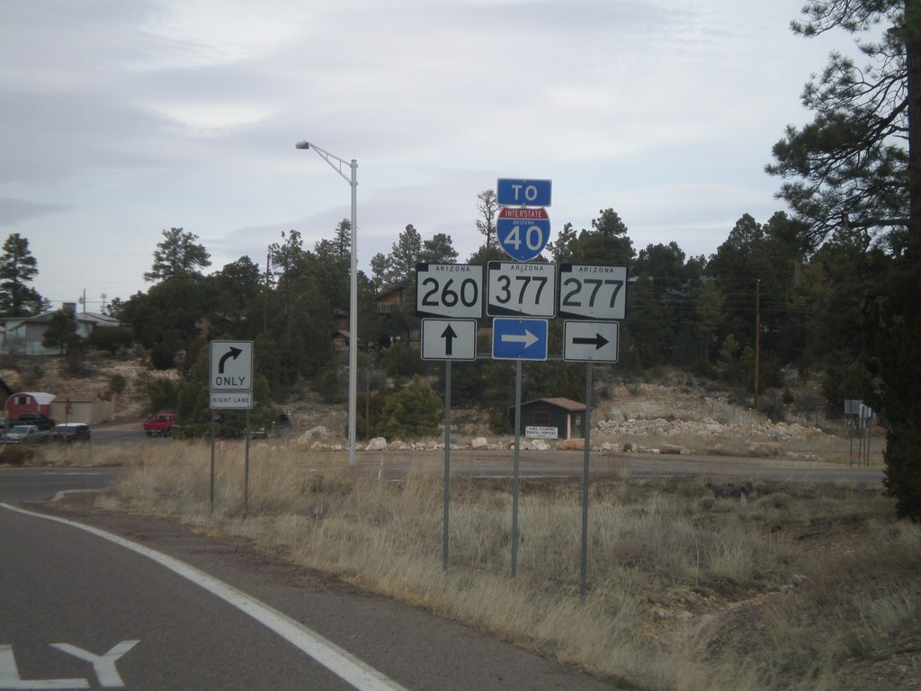
AZ-260 West at AZ-277
AZ-260 west at AZ-277 north (To AZ-377 and I-40).
Taken 02-24-2011
 Heber-Overgaard
Navajo County
Arizona
United States
Heber-Overgaard
Navajo County
Arizona
United States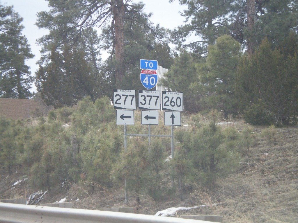
AZ-260 East at AZ-277 North
AZ-260 east at AZ-277 north. Use AZ-277 north for AZ-377 and I-40.
Taken 02-24-2011
Heber-Overgaard
Navajo County
Arizona
United States
AZ-87 North at AZ-260
AZ-87 north at AZ-260 east in Payson.
Taken 02-24-2011
 Payson
Gila County
Arizona
United States
Payson
Gila County
Arizona
United States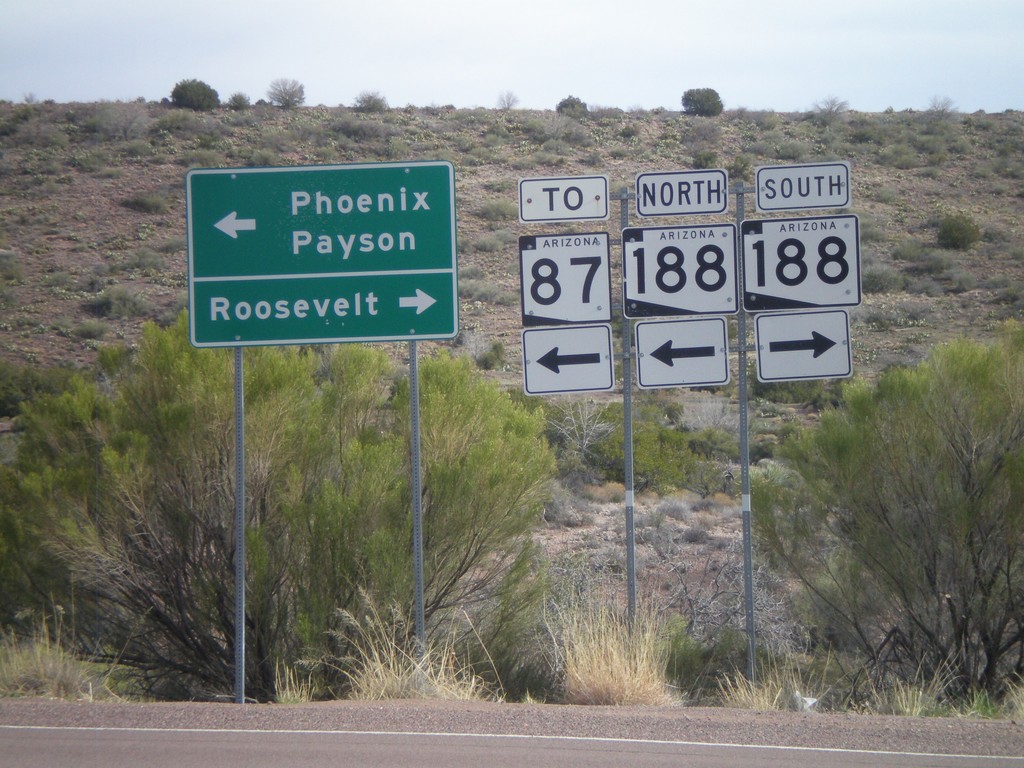
AZ-188 Jct. Leaving Mazatzal Rest Area
AZ-188 junction leaving Mazatzal Rest Area. Turn right for AZ-188 South to Roosevelt. Turn left for AZ-188 North for AZ-87, Phoenix, and Payson.
Taken 02-24-2011
 Gisela
Gila County
Arizona
United States
Gisela
Gila County
Arizona
United States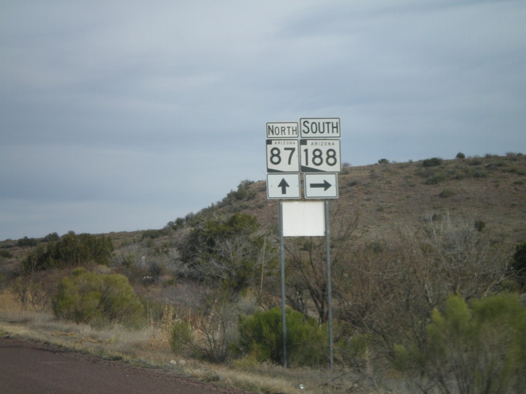
AZ-87 North at AZ-188
AZ-87 north at AZ-188 South.
Taken 02-24-2011
Payson
Gila County
Arizona
United States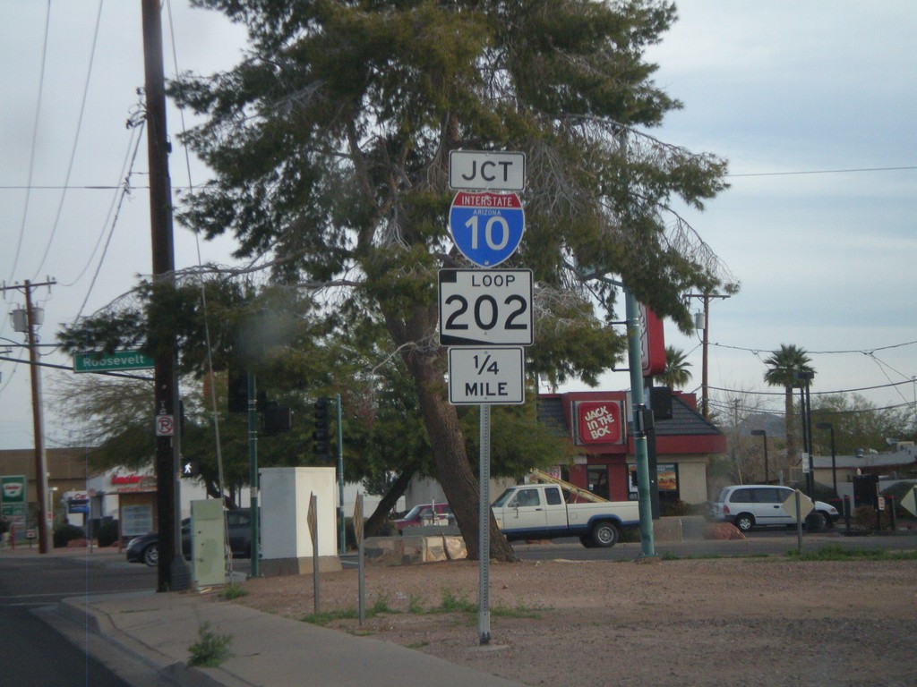
N. 24th St. Approaching AZ-202 Loop and I-10
N. 24th St. approaching AZ-202 Loop and I-10.
Taken 02-24-2011

 Phoenix
Maricopa County
Arizona
United States
Phoenix
Maricopa County
Arizona
United States