Signs Tagged With Shield
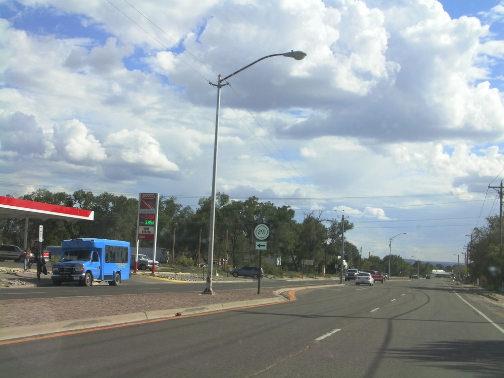
NM-68 South at NM-291 East
NM-68 south at NM-291 east. NM-291 east leaves NM-68 south here.
Taken 10-03-2011

 Española
Rio Arriba County
New Mexico
United States
Española
Rio Arriba County
New Mexico
United States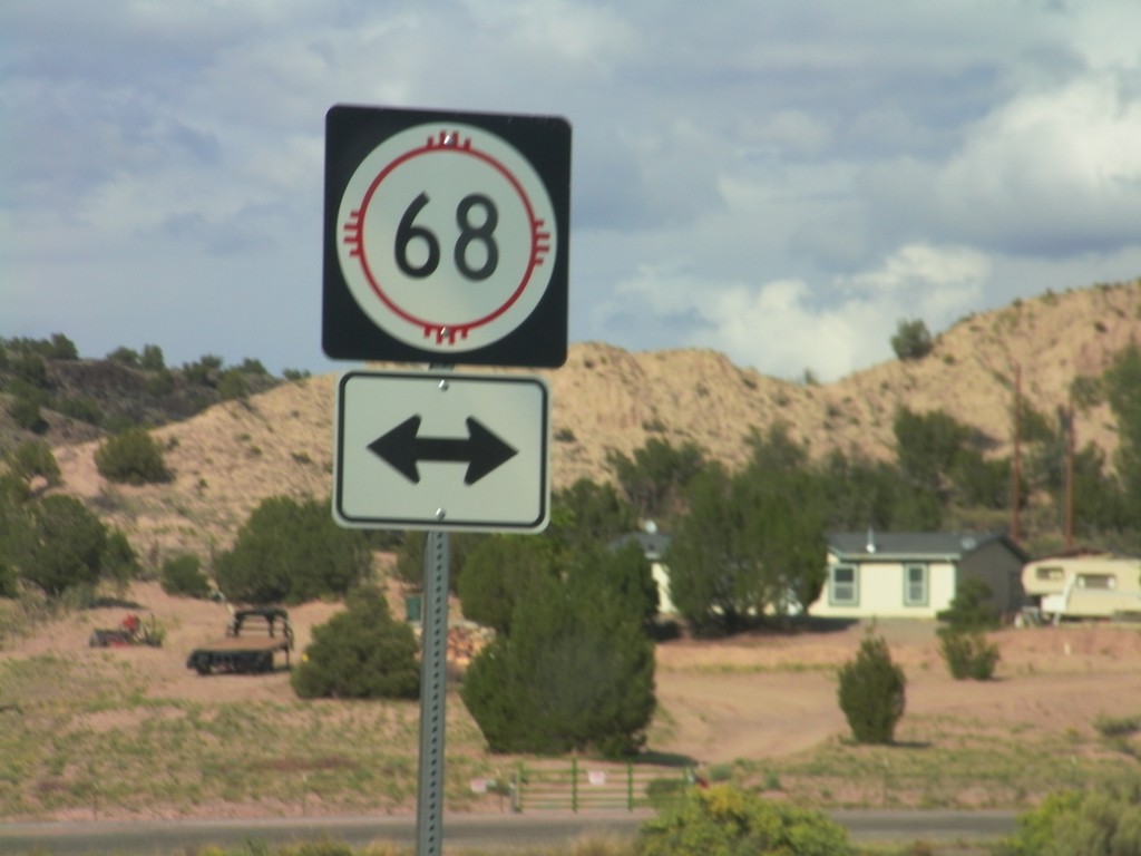
End NM-75 West at NM-68
End NM-75 West at NM-68 near Embudo.
Taken 10-03-2011
 Dixon
Rio Arriba County
New Mexico
United States
Dixon
Rio Arriba County
New Mexico
United States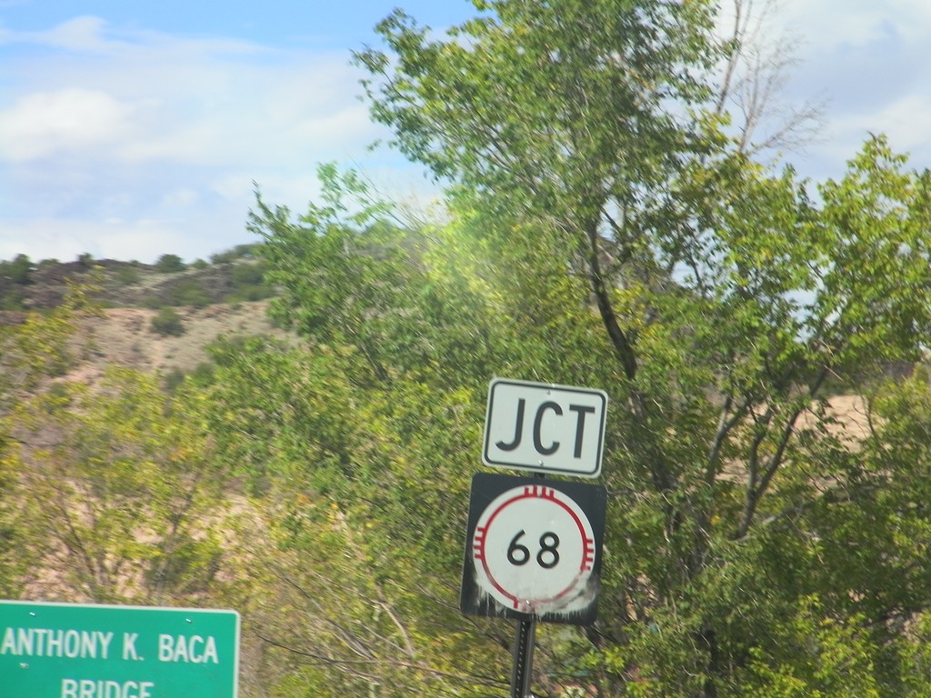
NM-75 East Approaching NM-68
NM-75 East approaching NM-68 at the Anthony K. Baca Bridge over Embudo Creek.
Taken 10-03-2011
Dixon
Rio Arriba County
New Mexico
United States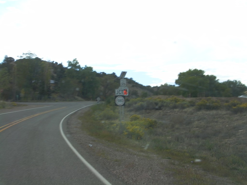
NM-75 East Approaching NM-580
NM-75 East approaching NM-580 in rural Rio Arriba County.
Taken 10-03-2011
 Dixon
Rio Arriba County
New Mexico
United States
Dixon
Rio Arriba County
New Mexico
United States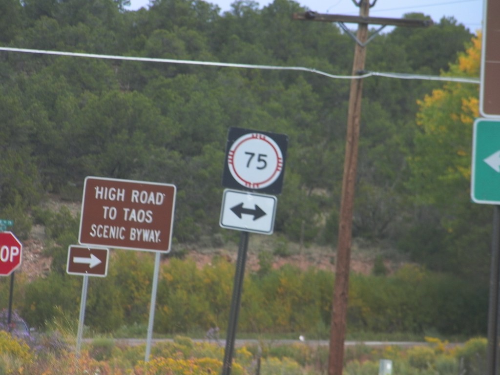
End NM-76 North at NM-75
End NM-76 north at NM-75. Turn right on NM-76 north to continue on the High Road To Taos Scenic Byway.
Taken 10-03-2011
 Peñasco
Taos County
New Mexico
United States
Peñasco
Taos County
New Mexico
United States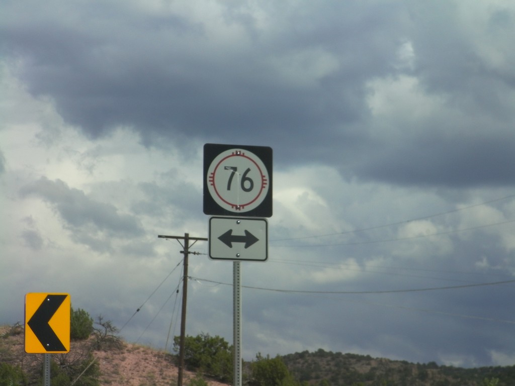
End NM-503 East at NM-76
End NM-503 East at NM-76 in rural Rio Arriba County. NM-76 is the High Road To Taos Scenic Byway.
Taken 10-03-2011
 Chimayo
Rio Arriba County
New Mexico
United States
Chimayo
Rio Arriba County
New Mexico
United States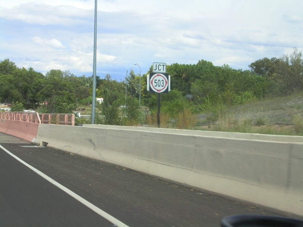
US-84/US-285 North Approaching NM-503
US-84/US-285 North approaching NM-503 in Pojoaque. This is the beginning of the High Road To Taos Scenic Byway.
Taken 10-03-2011

 Santa Fe
 County
New Mexico
United States
Santa Fe
Santa Fe County
New Mexico
United States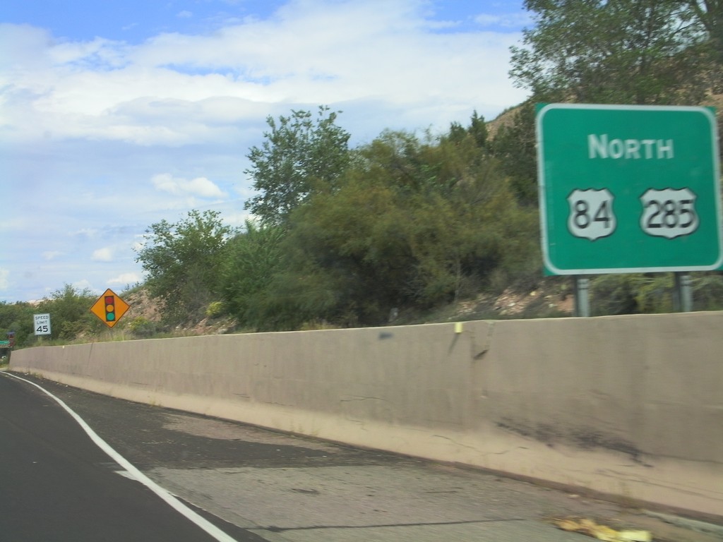
US-84/US-285 North - Pojoaque
US-84/US-285 North in Pojoaque.
Taken 10-03-2011
Jaconita
Santa Fe County
New Mexico
United States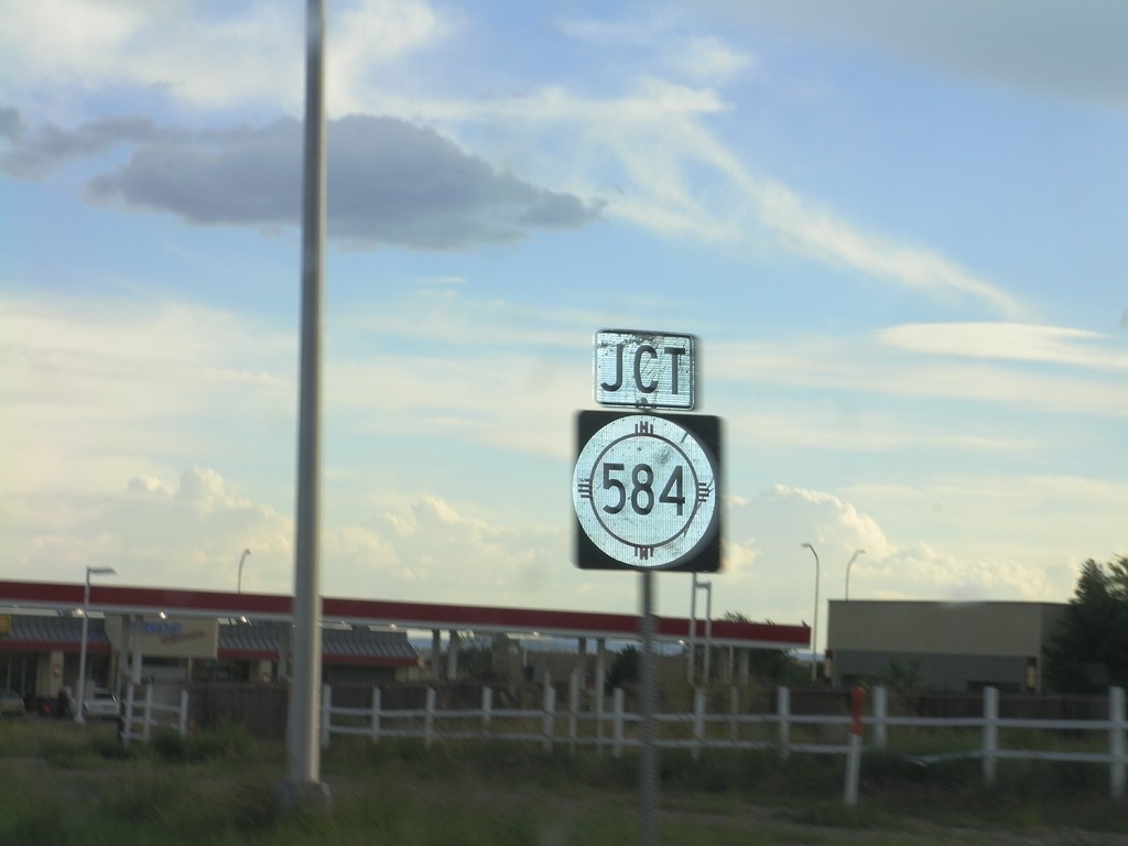
US-84/US-285 South Approaching NM-584
US-84/US-285 South approaching NM-584 (Fairview Drive) in Española.
Taken 10-02-2011
 Española
Rio Arriba County
New Mexico
United States
Española
Rio Arriba County
New Mexico
United States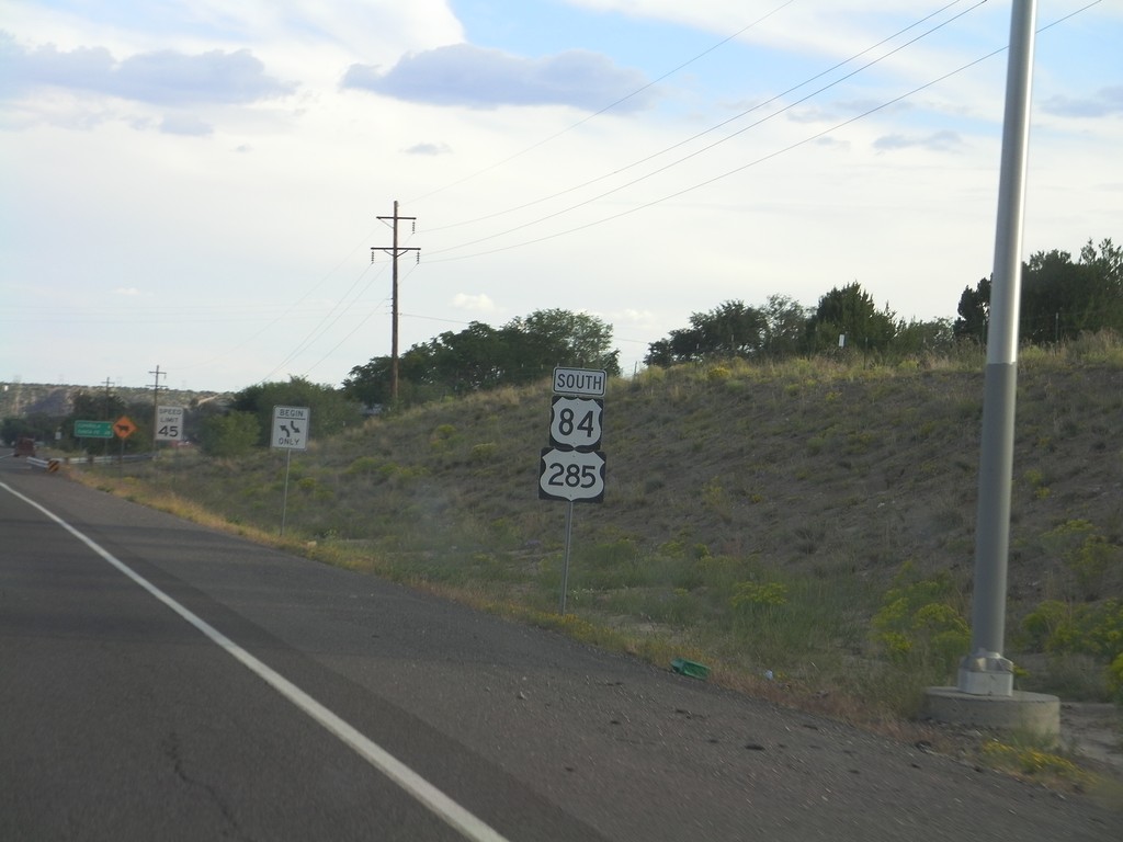
US-84/US-285 South - Rio Arriba County
US-84/US-285 South in Rio Arriba County on the outskirts of Española. Taken just south of NM-74 junction.
Taken 10-02-2011
El Duende
Rio Arriba County
New Mexico
United States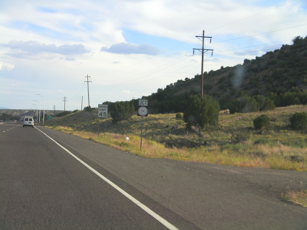
US-84/US-285 South Approaching NM-74
US-84/US-285 South approaching NM-74 near El Duende.
Taken 10-02-2011
 Hernandez
Rio Arriba County
New Mexico
United States
Hernandez
Rio Arriba County
New Mexico
United States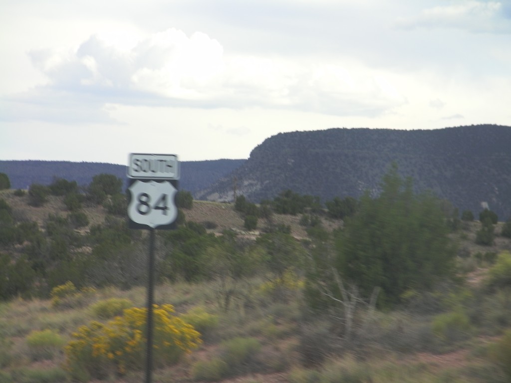
US-84 South - Rio Arriba County
US-84 South in Rio Arriba County, just south of NM-96 jct.
Taken 10-02-2011
Gallina
Rio Arriba County
New Mexico
United States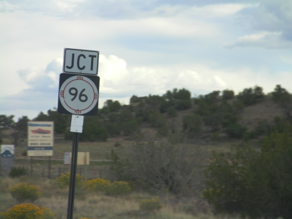
US-84 South Approaching NM-96
US-84 South approaching NM-96 west in Rio Arriba County.
Taken 10-02-2011
 Gallina
Rio Arriba County
New Mexico
United States
Gallina
Rio Arriba County
New Mexico
United States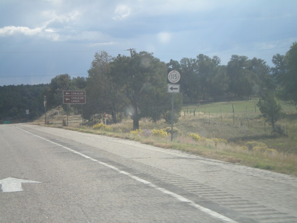
US-84 South at NM-115 East
US-84 south at NM-115 East. Use NM-115 east for Canjilon and Canjilon Lakes.
Taken 10-02-2011
 Canjilon
Rio Arriba County
New Mexico
United States
Canjilon
Rio Arriba County
New Mexico
United States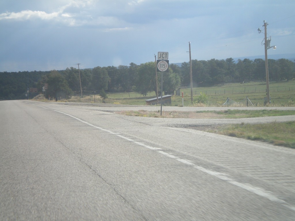
US-84 South Approaching NM-115
US-84 South approaching NM-115 in Rio Arriba County.
Taken 10-02-2011
Abiquiu
Rio Arriba County
New Mexico
United States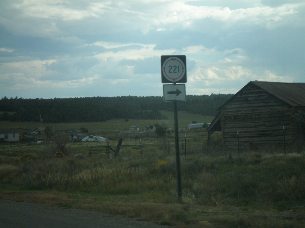
US-84 South at NM-221
US-84 South at NM-221 in Cebolla.
Taken 10-02-2011
 Cebolla
Rio Arriba County
New Mexico
United States
Cebolla
Rio Arriba County
New Mexico
United States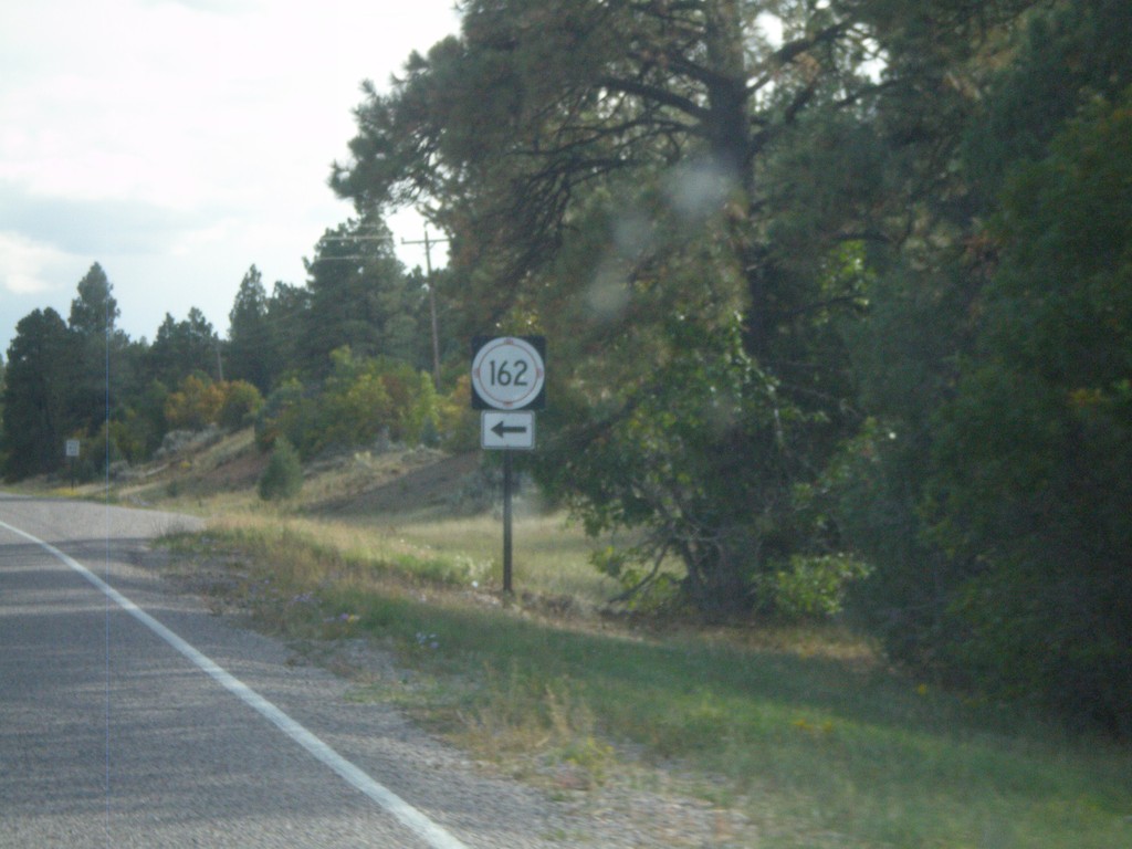
US-84 South at NM-162
US-84 South at NM-162 in Rio Arriba County.
Taken 10-02-2011
Tierra Amarilla
Rio Arriba County
New Mexico
United States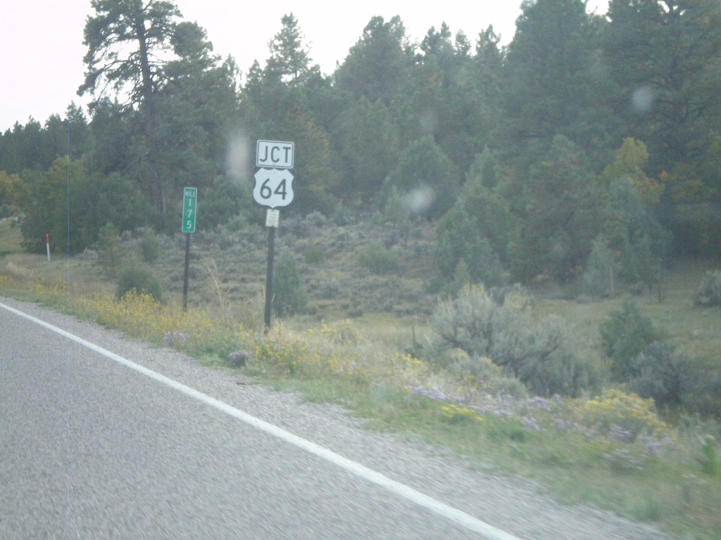
US-84 South/US-64 East At Split
US-84 South/US-64 East at Split. US-64 turns east here towards Taos. Northbound US-64 joins US-84 to west of Chama.
Taken 10-02-2011
 Los Ojos
Rio Arriba County
New Mexico
United States
Los Ojos
Rio Arriba County
New Mexico
United States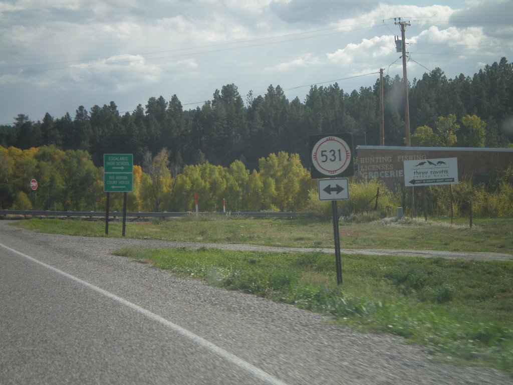
US-84 South/US-64 East at NM-531
US-84 South/US-64 East at NM-531 in Tierra Amarilla. Turn right on NM-531 for Escalante High School; left for Rio Arriba (County) Court House.
Taken 10-02-2011
 Tierra Amarilla
Rio Arriba County
New Mexico
United States
Tierra Amarilla
Rio Arriba County
New Mexico
United States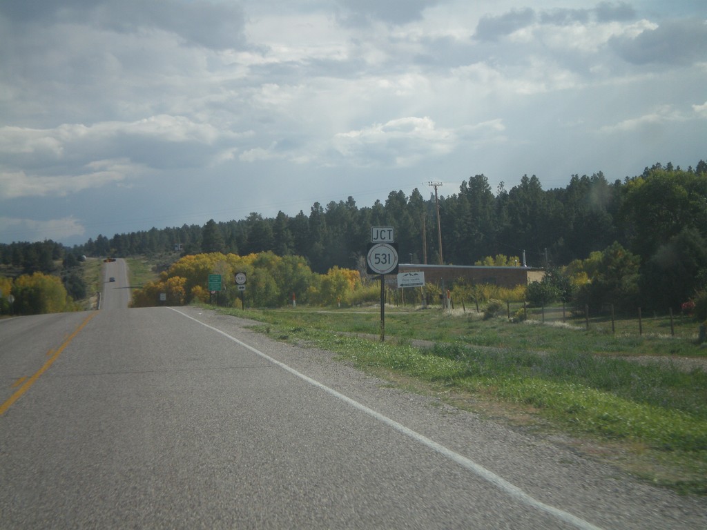
US-84 South/US-64 East Approaching NM-531
US-84 South/US-64 East approaching NM-531 in Tierra Amarilla.
Taken 10-02-2011
Tierra Amarilla
Rio Arriba County
New Mexico
United States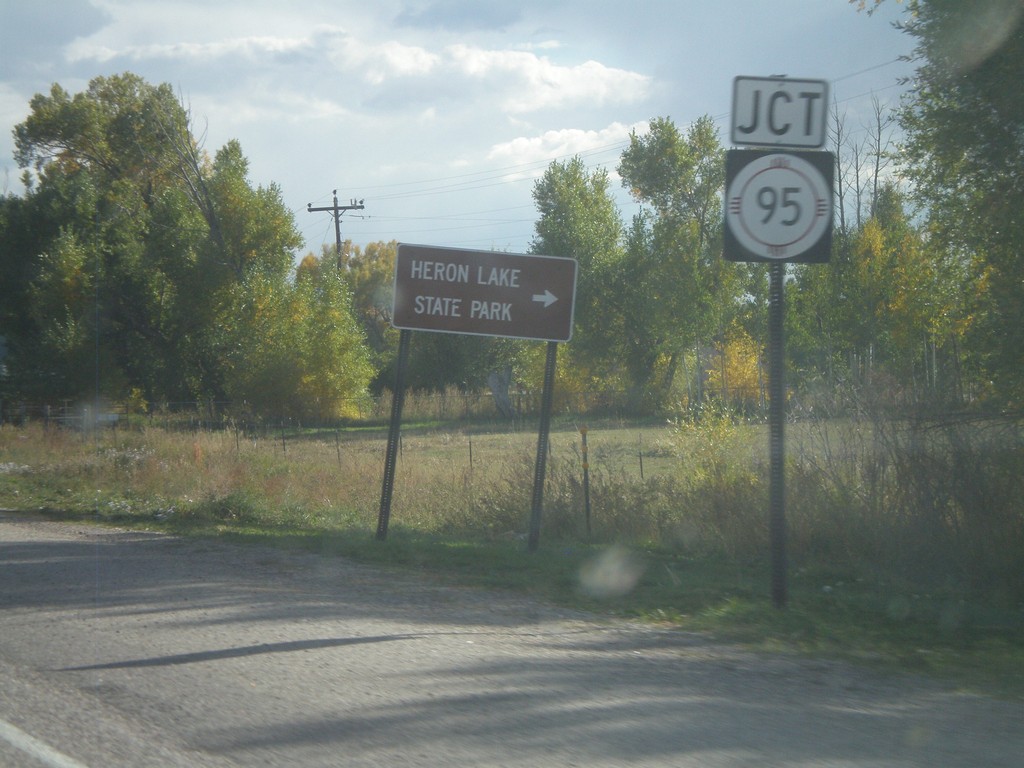
US-84 South/US-64 East Approaching NM-95
US-84 South/US-64 East approaching NM-95. Use NM-95 for Heron Lake State Park.
Taken 10-02-2011
 Los Ojos
Rio Arriba County
New Mexico
United States
Los Ojos
Rio Arriba County
New Mexico
United States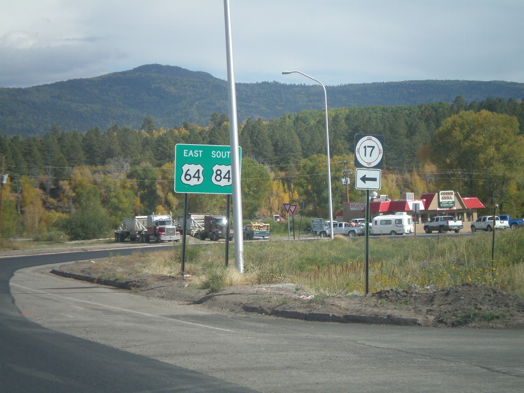
US-84 South/US-64 East at NM-17
US-84 South/US-64 East at NM-17 in Chama. Turn right to continue on US-84 South/US-64 East; turn left for NM-17.
Taken 10-02-2011
 Chama
Rio Arriba County
New Mexico
United States
Chama
Rio Arriba County
New Mexico
United States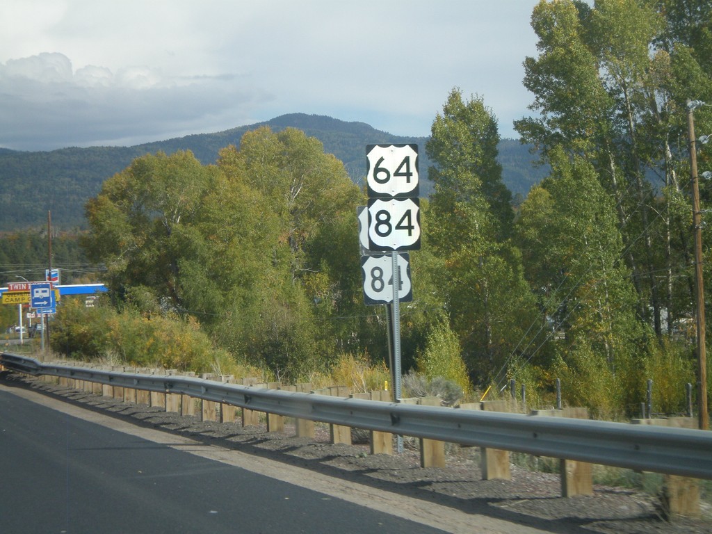
US-64/US-84 in Chama
US-64/US-84 in Chama. There were two sets of every sign when this picture was taken between US-64/US-84 junction west of here into Chama. There was road construction and it appears new signs were part of the project.
Taken 10-02-2011
Chama
Rio Arriba County
New Mexico
United States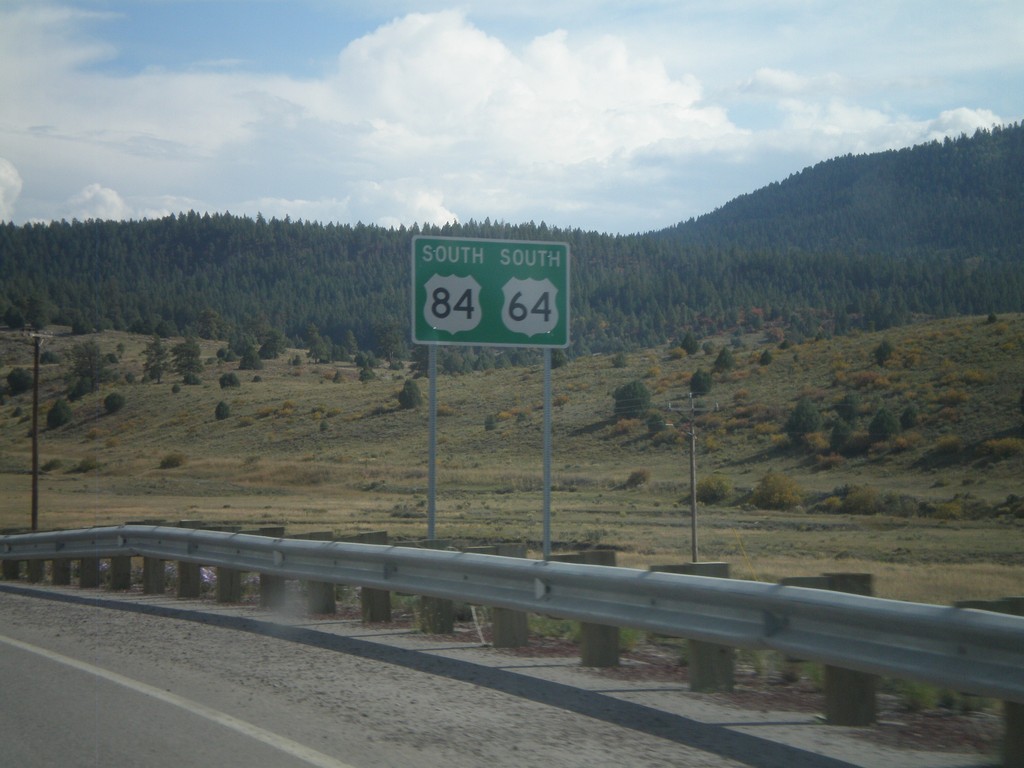
US-64 East/US-84 South
US-64 East/US-84 South in Rio Arriba County.
Taken 10-02-2011
Chama
Rio Arriba County
New Mexico
United States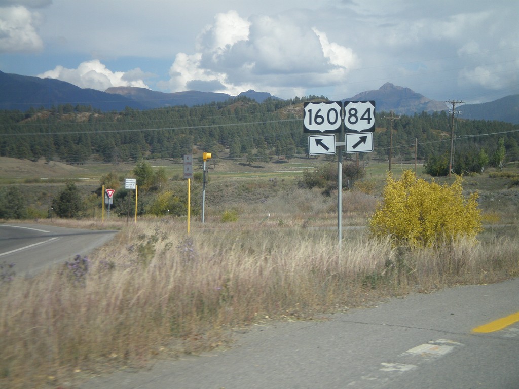
US-160 East at US-84
US-160 east at US-84 in Pagosa Springs. Merge right for US-84. This is the western terminus of US-84. The eastern end of US-84 is in Midway, Georgia.
Taken 10-02-2011
 Pagosa Springs
Archuleta County
Colorado
United States
Pagosa Springs
Archuleta County
Colorado
United States