Signs Tagged With Shield
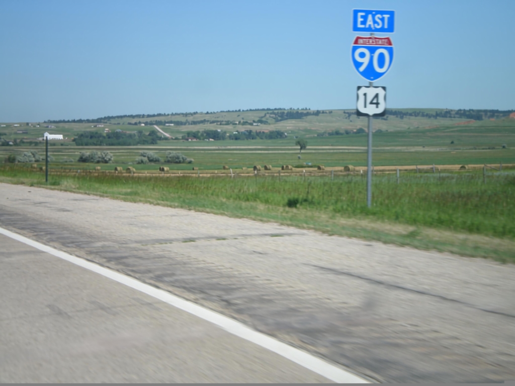
I-90 East/US-14 East
I-90/US-14 East shields. These are the first I-90/US-14 reassurance markers in South Dakota on I-90/US-14 east.
Taken 07-03-2011

 Spearfish
Lawrence County
South Dakota
United States
Spearfish
Lawrence County
South Dakota
United States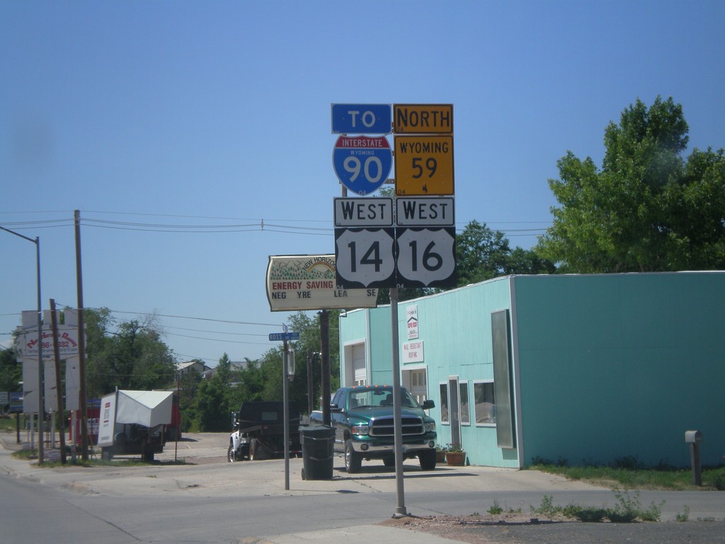
US-14/US-16 West/WY-59 North/To I-90
US-14/US-16 West, WY-59 North, To I-90 (Business I-90) in Gillette.
Taken 07-03-2011


 Gillette
Campbell County
Wyoming
United States
Gillette
Campbell County
Wyoming
United States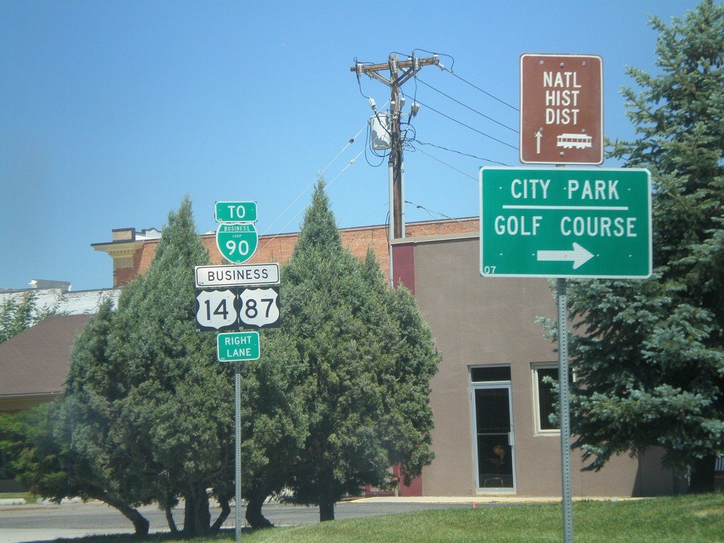
BL-90/Business US-87/Business US-14 in Sheridan
BL-90/Business US-87/Business US-14 (Coffeen Ave.) west at Main St in downtown Sheridan. Turn right on Main St. for the Sheridan City Park and Golf Course.
Taken 07-03-2011

 Sheridan
 County
Wyoming
United States
Sheridan
Sheridan County
Wyoming
United States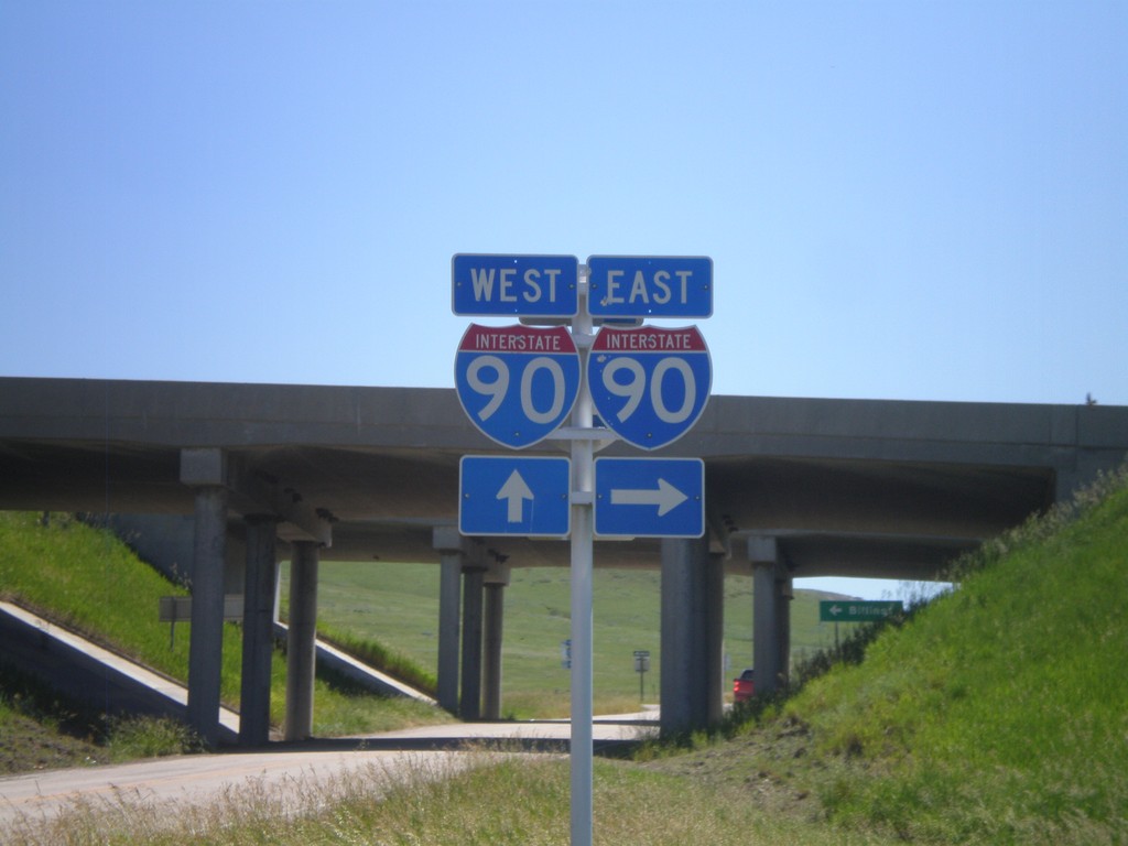
I-90 Onramps at Exit 549
I-90 onramp at Exit 549. Turn right for I-90 east; continue ahead under the underpass for I-90 west.
Taken 07-03-2011
 Aberdeen
Big Horn County
Montana
United States
Aberdeen
Big Horn County
Montana
United States
End WY-343 at WY-345
End WY-343 at WY-345. Use WY-345 east for I-90.
Taken 07-03-2011

 Parkman
Sheridan County
Wyoming
United States
Parkman
Sheridan County
Wyoming
United States
WY-343 North at WY-345
End WY-343 north at WY-345 near Parkman.
Taken 07-03-2011
Parkman
Sheridan County
Wyoming
United States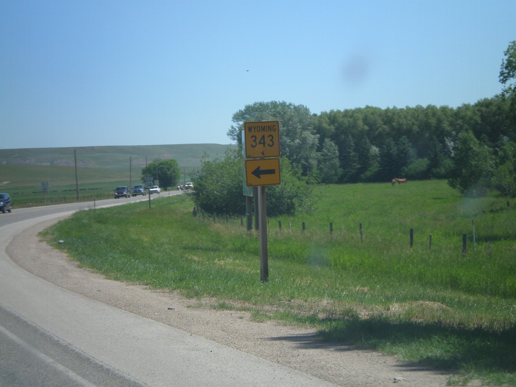
US-14 East At WY-343
US-14 east at WY-343 north.
Taken 07-03-2011
Dayton
Sheridan County
Wyoming
United States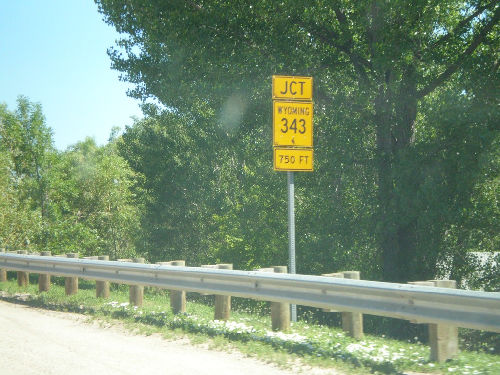
US-14 East Approaching WY-343
US-14 east approaching WY-343 east in Dayton.
Taken 07-03-2011
Ranchester
Sheridan County
Wyoming
United States
US-310/WY-789 North Approaching US-14A
US-310/WY-789 North approaching US-14A in Lovell.
Taken 07-03-2011


 Lovell
Big Horn County
Wyoming
United States
Lovell
Big Horn County
Wyoming
United States
US-14/US-16/US-20 West/WY-789 North
US-14/US-16/US-20 West/WY-789 North leaving Greybull.
Taken 07-03-2011
 Greybull
Big Horn County
Wyoming
United States
Greybull
Big Horn County
Wyoming
United States
US-16/US-20 West/WY-789 North - Basin
US-16/US-20 West/WY-789 north in Basin.
Taken 07-03-2011
Basin
Big Horn County
Wyoming
United States
US-16/US-20 West/WY-789 North At WY-30
US-16/US-20 West/WY-789 North At WY-30 in Basin.
Taken 07-03-2011
 Basin
Big Horn County
Wyoming
United States
Basin
Big Horn County
Wyoming
United States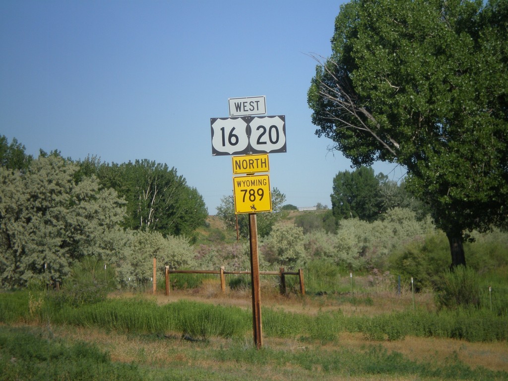
US-16/US-20 West/WY-789 North - Manderson
US-16/US-20 West/WY-789 North in Manderson.
Taken 07-03-2011
Manderson
Big Horn County
Wyoming
United States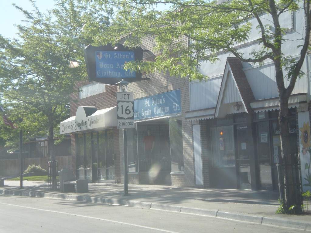
US-20 West/WY-789 North Approaching US-16
US-20 West/WY-789 North Approaching US-16 in Worland.
Taken 07-03-2011
Worland
Washakie County
Wyoming
United States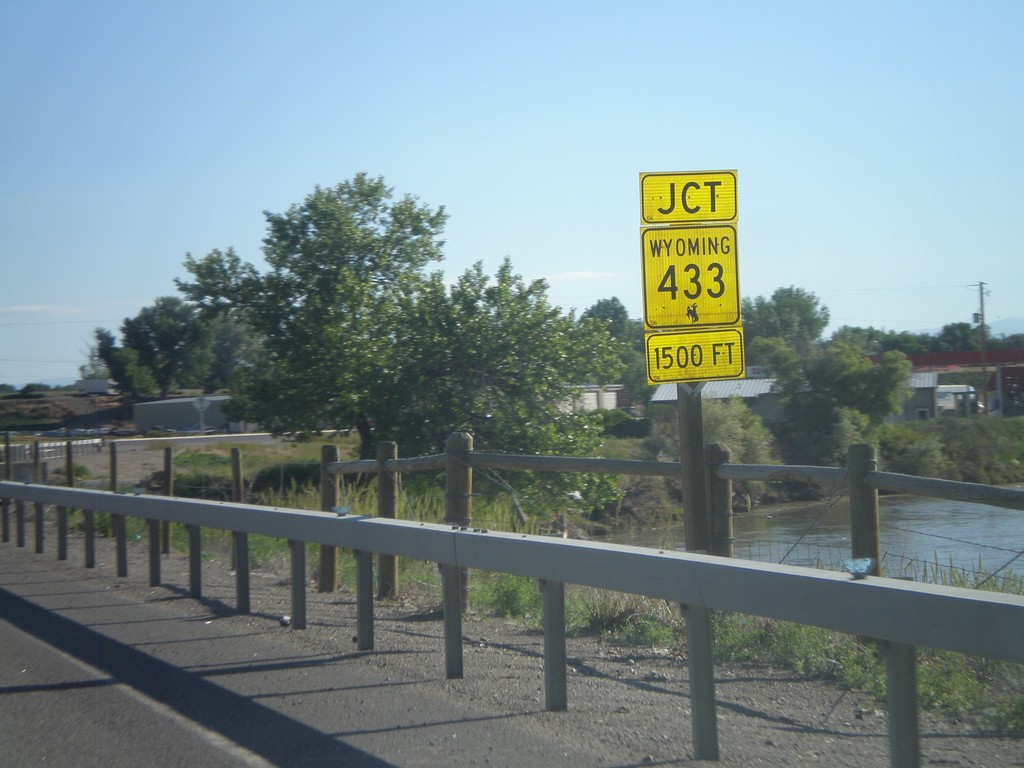
US-20/US-16 West/WY-789 North Approaching WY-433
US-20/US-16 West/WY-789 North Approaching WY-433. The river in the background is the Big Horn River.
Taken 07-03-2011
 Manderson
Big Horn County
Wyoming
United States
Manderson
Big Horn County
Wyoming
United States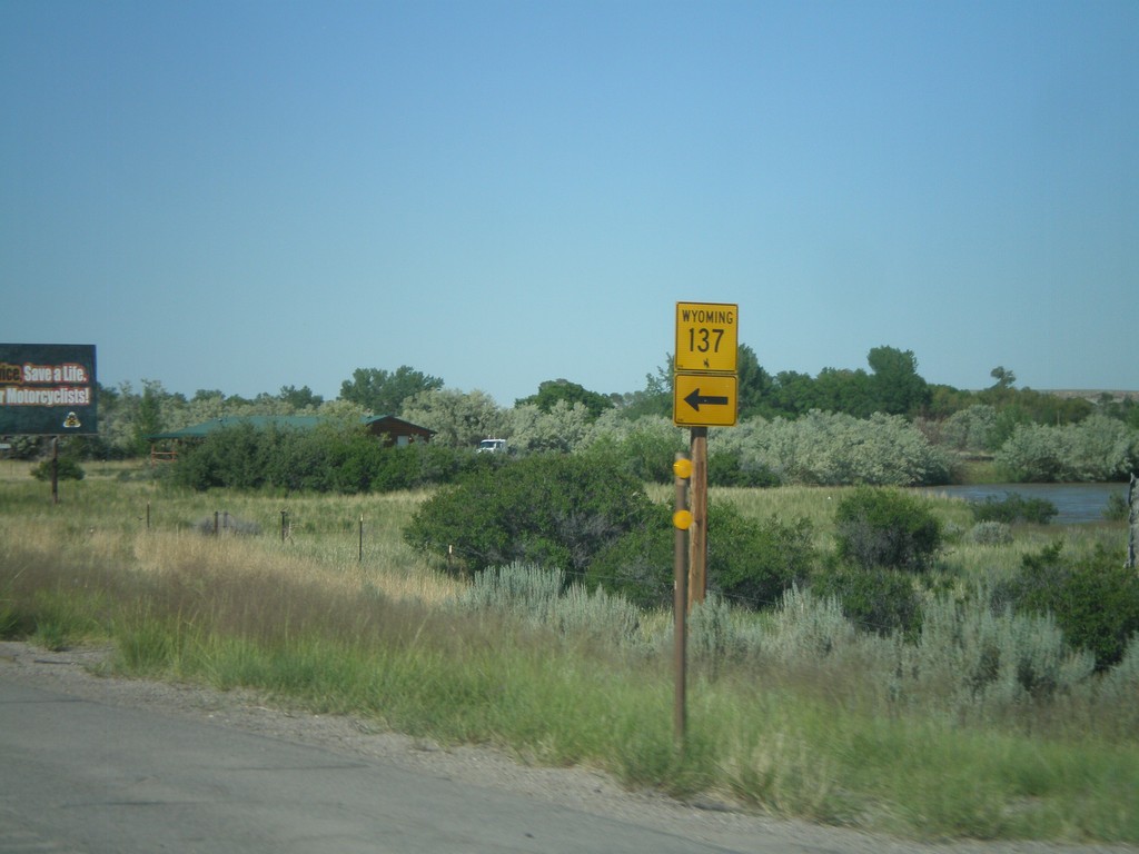
WY-789 North Approaching WY-137
WY-789 north approaching WY-137.
Taken 07-02-2011
 Riverton
Fremont County
Wyoming
United States
Riverton
Fremont County
Wyoming
United States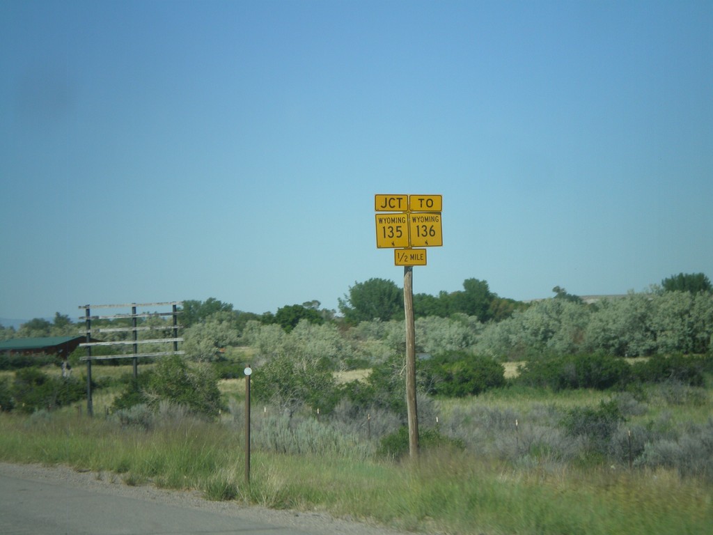
WY-789 North Approaching WY-135/To WY-136
WY-789 North Approaching WY-135/To WY-136 - 1/2 mile.
Taken 07-02-2011

 Riverton
Fremont County
Wyoming
United States
Riverton
Fremont County
Wyoming
United States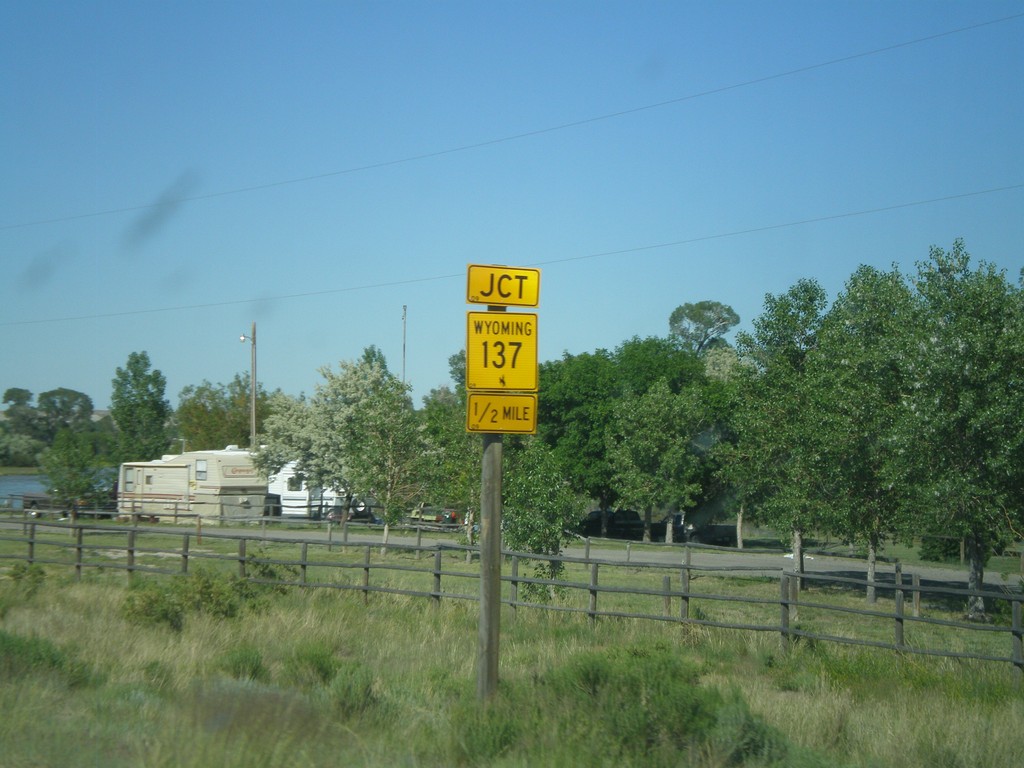
WY-789 North Approaching WY-137
WY-789 north approaching WY-137 near Riverton.
Taken 07-02-2011
Riverton
Fremont County
Wyoming
United States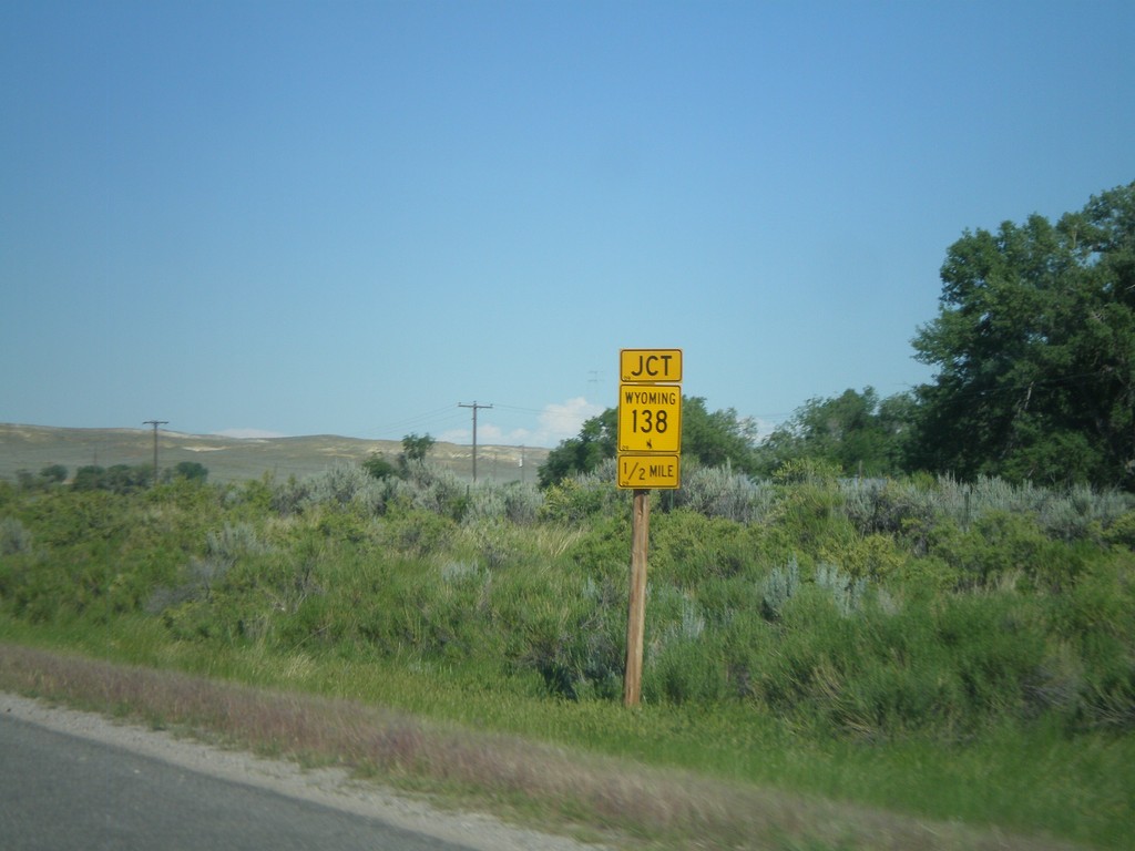
WY-789 North Approaching WY-138
WY-789 North Approaching WY-138 between Lander and Riverton.
Taken 07-02-2011
 Riverton
Fremont County
Wyoming
United States
Riverton
Fremont County
Wyoming
United States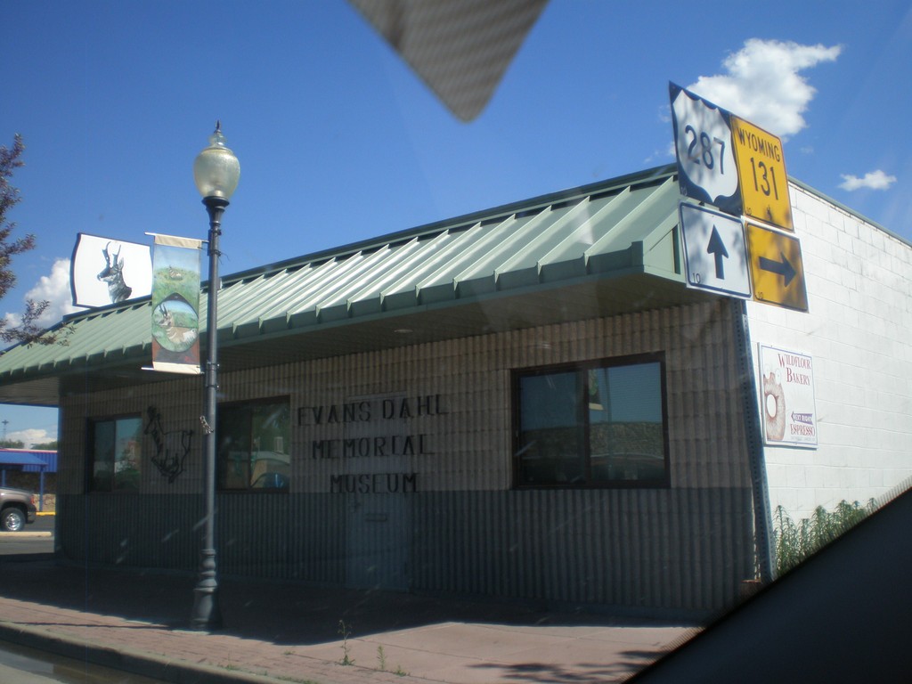
US-287 South at WY-131
US-287 South at WY-131 in downtown Lander.
Taken 07-02-2011

 Lander
Fremont County
Wyoming
United States
Lander
Fremont County
Wyoming
United States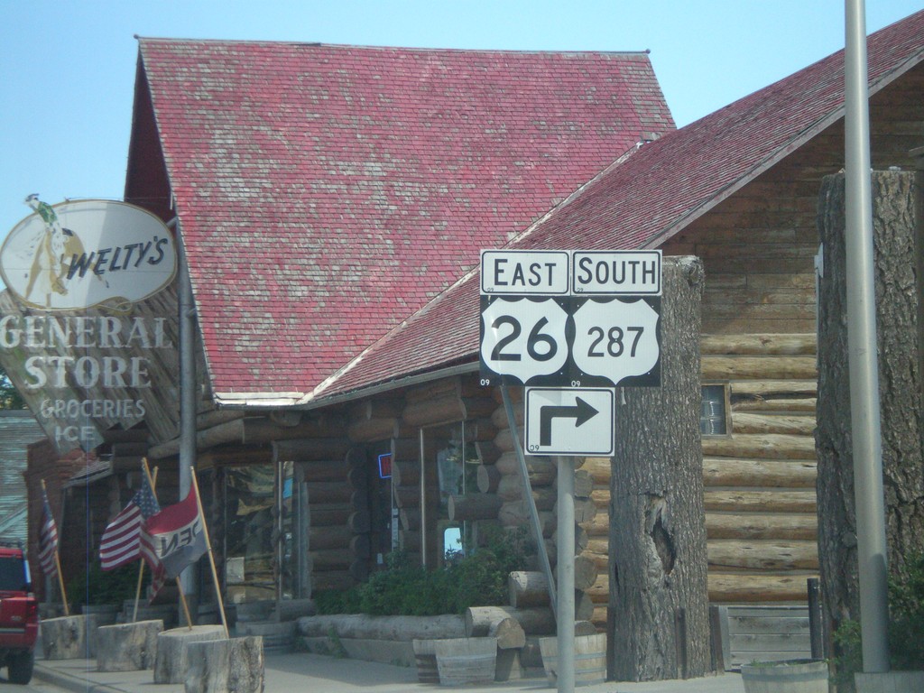
US-287 South/US-26 East - Dubois
To continue south on US-287 South/US-26 East turns turn right Dubois.
Taken 07-02-2011
 Dubois
Fremont County
Wyoming
United States
Dubois
Fremont County
Wyoming
United States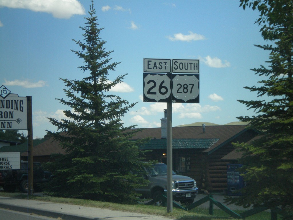
US-26 East/US-287 South - Dubois
US-26 East/US-287 South in Dubois, Wyoming.
Taken 07-02-2011
Dubois Fremont County Wyoming United States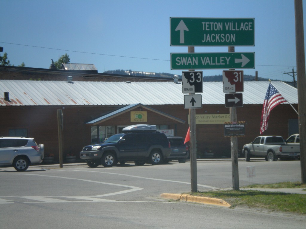
ID-33 East at ID-31
ID-33 East at ID-31 in Victor. Turn right on ID-31 south for Swan Valley. Continue ahead on ID-33 for Teton Village and Jackson (both in Wyoming). Teton Scenic Byway leaves ID-33 here and follows ID-31 south.
Taken 07-02-2011

 Victor
Teton County
Idaho
United States
Victor
Teton County
Idaho
United States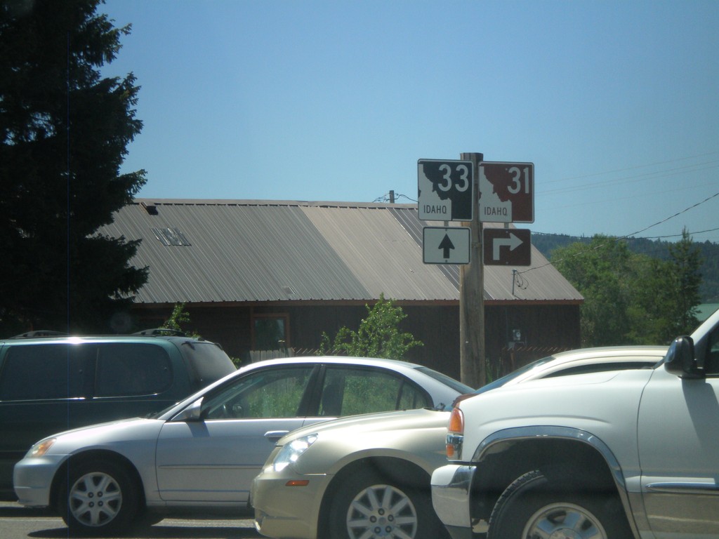
ID-33 East at ID-31
ID-33 east at ID-32 in Victor. The Teton Scenic Byway turns right here onto ID-31.
Taken 07-02-2011
Victor
Teton County
Idaho
United States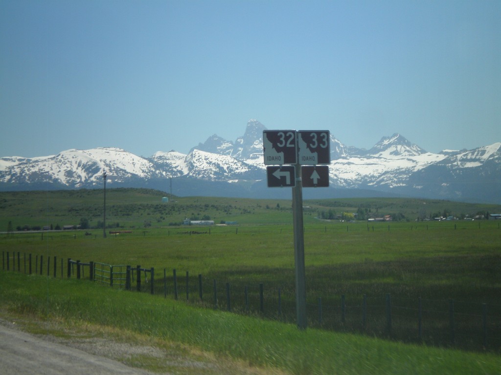
ID-33 East at ID-32 North
ID-33 East at ID-32 North. The Teton Scenic Byway joins ID-33 east here. The Teton Range is in the background of the photo.
Taken 07-02-2011
 Felt
Teton County
Idaho
United States
Felt
Teton County
Idaho
United States