Signs Tagged With Shield
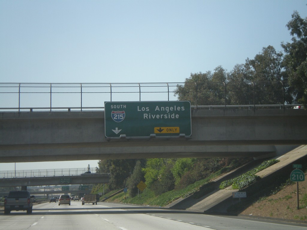
CA-210 West Approaching Exit 75B
CA-210 west approaching Exit 75B - I-215 South/Los Angeles/Riverside. CA-210 shield is on the right.
Taken 02-28-2011

 San Bernardino
 County
California
United States
San Bernardino
San Bernardino County
California
United States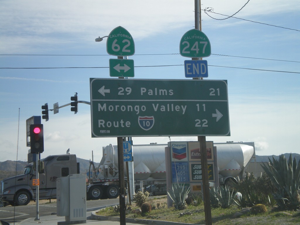
End CA-247 South at CA-62
End CA-247 south at CA-62. Use CA-62 east for 29 Palms; use CA-62 east for I-10 and Morongo Valley.
Taken 02-25-2011


 Yucca Valley
San Bernardino County
California
United States
Yucca Valley
San Bernardino County
California
United States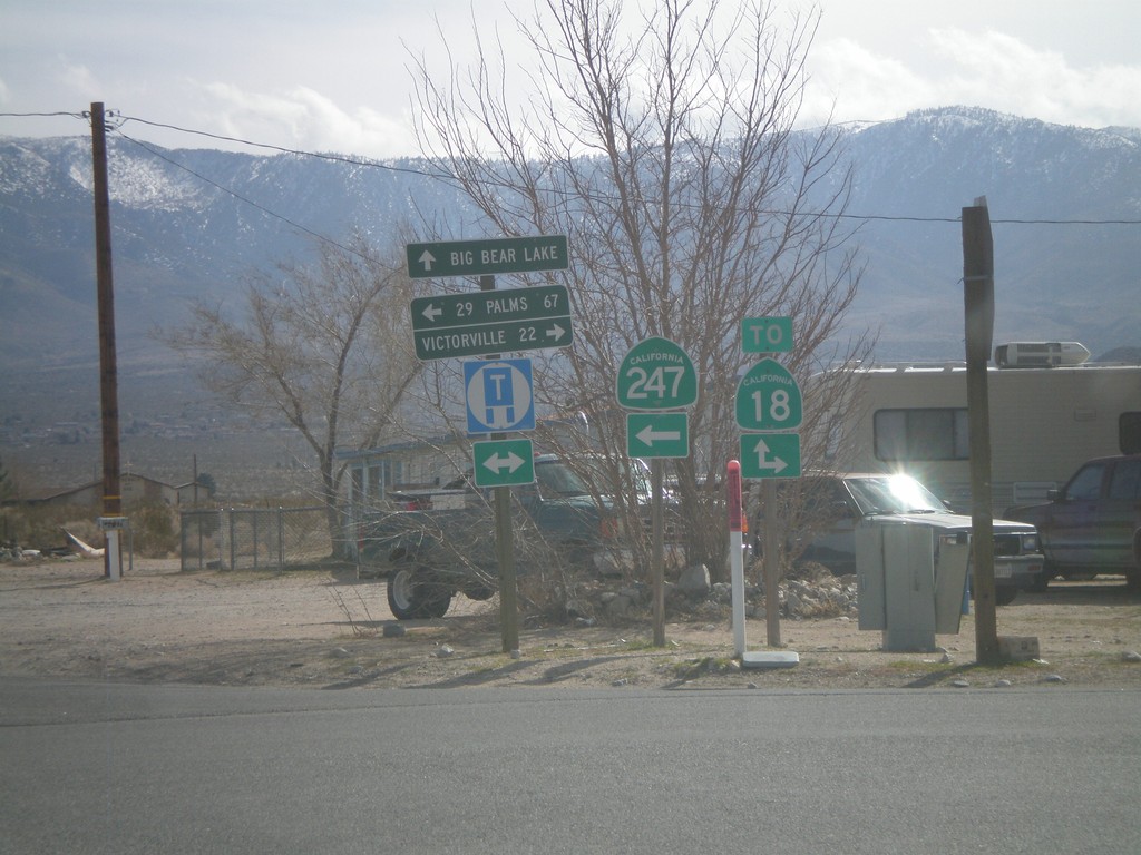
CA-247 South at CA-18
CA-247 south at CA-18. This is not the true junction with CA-18, which lies a little to the south and east. Use CA-18 west for Victorville; use CA-18 east for Big Bear Lake; use CA-247 south for 29 Palms.
Taken 02-25-2011
 Lucerne Valley
San Bernardino County
California
United States
Lucerne Valley
San Bernardino County
California
United States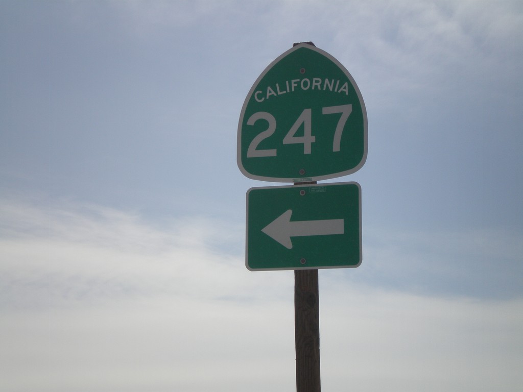
I-15 South at CA-247
I-15 south at Exit 183 offramp at CA-247 jct. Turn left for CA-247, Barstow Road.
Taken 02-25-2011
 Barstow
San Bernardino County
California
United States
Barstow
San Bernardino County
California
United States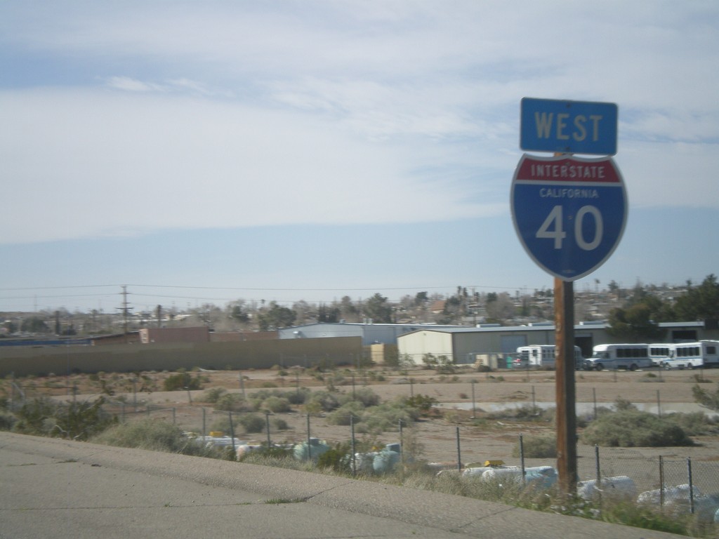
I-40 West - Last I-40 Shield
Last I-40 shield on I-40 west, just west of Exit 1.
Taken 02-25-2011
 Barstow
San Bernardino County
California
United States
Barstow
San Bernardino County
California
United States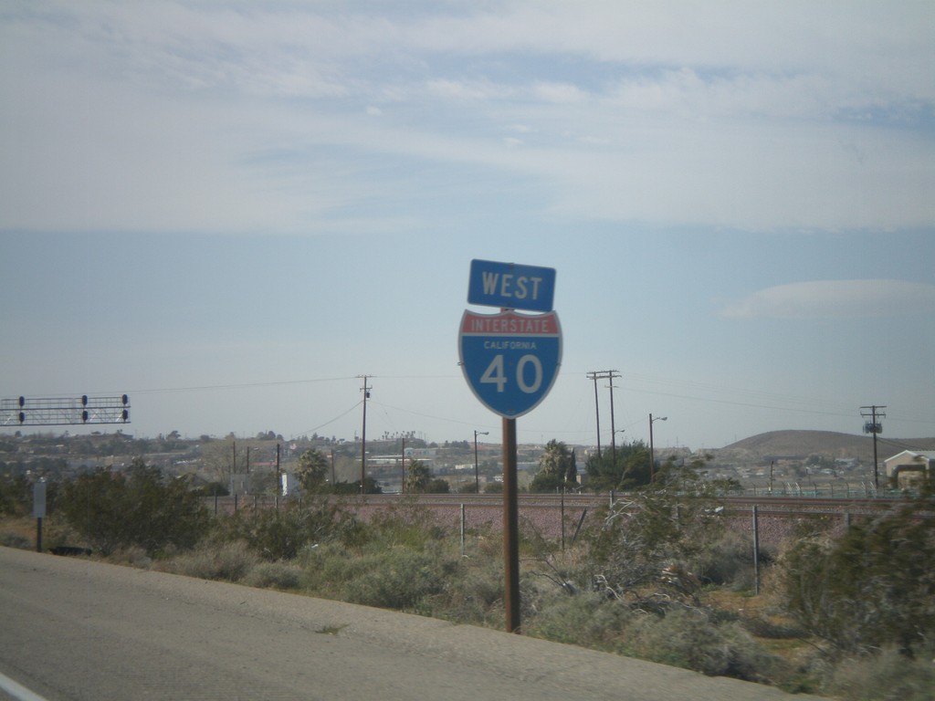
I-40 West - California
I-40 West - California shield in Barstow.
Taken 02-25-2011
Barstow
San Bernardino County
California
United States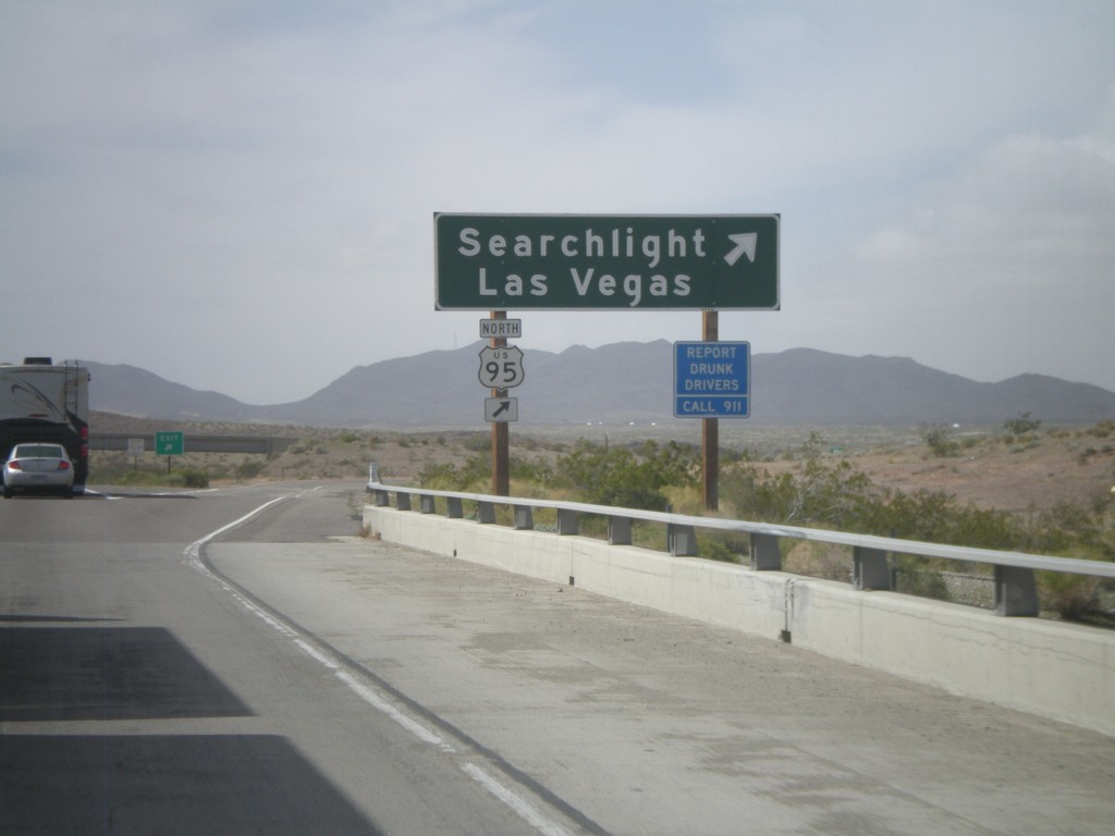
I-40 West - Exit 133
I-40 west at Exit 133 - US-95 North/Searchlight/Las Vegas. US-95 north leaves I-40 westbound here and heads north into Nevada. Eastbound, US-95 south joins I-40 through Needles.
Taken 02-25-2011
 Needles
San Bernardino County
California
United States
Needles
San Bernardino County
California
United States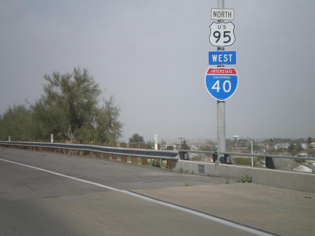
I-40 West/US-95 North Shields
I-40 West/US-95 North shields in Needles.
Taken 02-25-2011
Needles
San Bernardino County
California
United States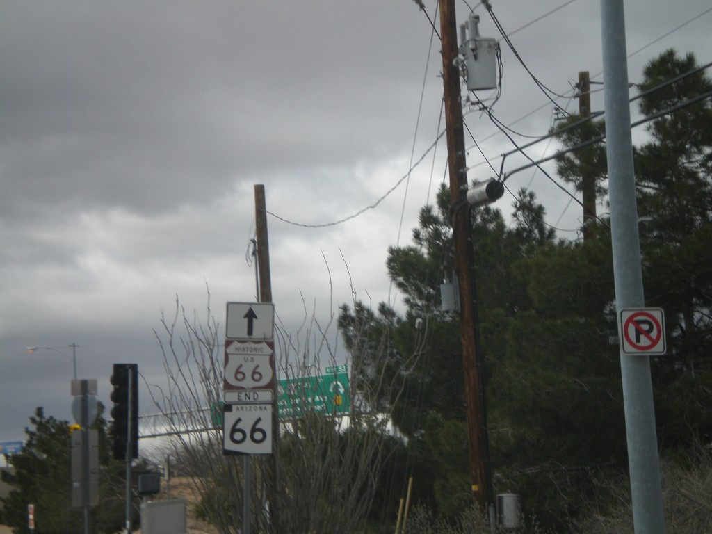
End AZ-66 At I-40/US-93
End AZ-66 West at I-40/US-93 Jct. Historic Loop US-66 continues west through downtown Kingman.
Taken 02-25-2011


 Kingman
Mohave County
Arizona
United States
Kingman
Mohave County
Arizona
United States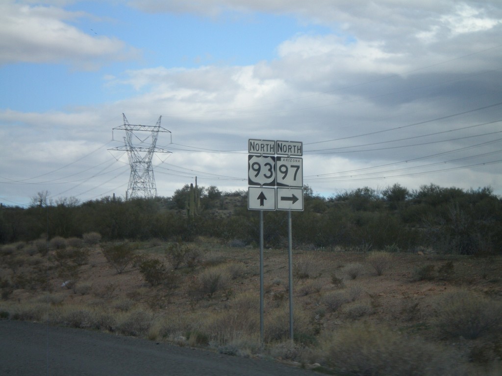
US-93 North at AZ-97 North
US-93 north at AZ-97 north. Use AZ-97 north for Bagdad and Hillside.
Taken 02-25-2011
 Nothing
Mohave County
Arizona
United States
Nothing
Mohave County
Arizona
United States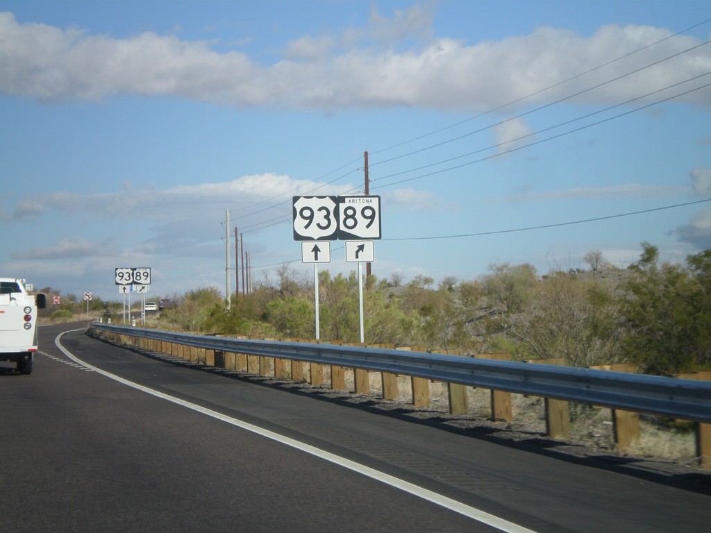
US-93 North at AZ-89 North
US-93 north at AZ-89 north.
Taken 02-25-2011
 Wickenburg
Yavapai County
Arizona
United States
Wickenburg
Yavapai County
Arizona
United States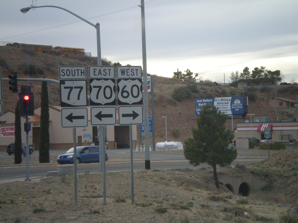
US-60 West/AZ-77 South at US-70
US-60 west/AZ-77 south at US-70. Turn left for US-70 and to continue south on AZ-77. Turn right to continue west on US-60.
Taken 02-24-2011


 Globe
Gila County
Arizona
United States
Globe
Gila County
Arizona
United States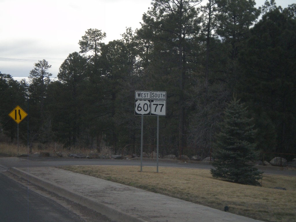
US-60 West/AZ-77 South
US-60 West/AZ-77 South leaving Show Low.
Taken 02-24-2011
Show Low
Navajo County
Arizona
United States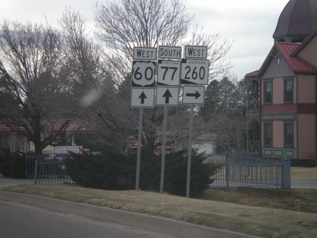
US-60 West/AZ-77 South/AZ-260 West at AZ-260
US-60 West/AZ-260 West/AZ-77 South at AZ-260. Turn right to continue on AZ-260. Continue straight for US-60 West/AZ-77 South.
Taken 02-24-2011
 Show Low
Navajo County
Arizona
United States
Show Low
Navajo County
Arizona
United States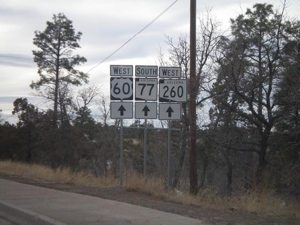
US-60 West/AZ-260 West/AZ-77 South
US-60 West/AZ-260 West/AZ-77 South in Show Low.
Taken 02-24-2011
Show Low
Navajo County
Arizona
United States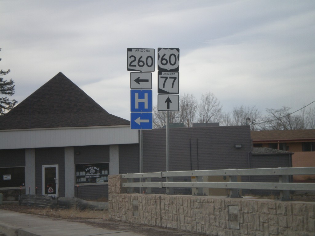
US-60 West/AZ-77 South at AZ-260
US-60 West/AZ-77 South at AZ-260. Turn left for AZ-260 west; continue straight for US-60 West/AZ-77 South/AZ-260 West.
Taken 02-24-2011
Show Low
Navajo County
Arizona
United States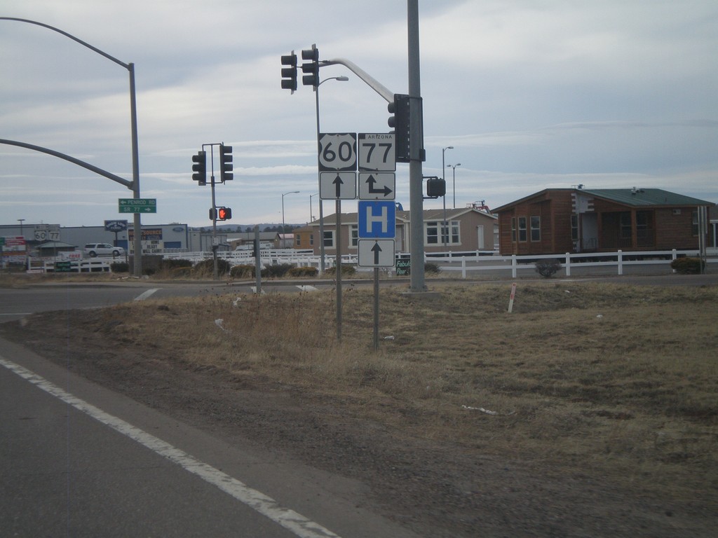
US-60 West at AZ-77
US-60 west at AZ-77. Turn right for AZ-77 north. Continue straight for US-60 west and AZ-77 south. AZ-77 joins US-60 west to Globe.
Taken 02-24-2011
Show Low
Navajo County
Arizona
United States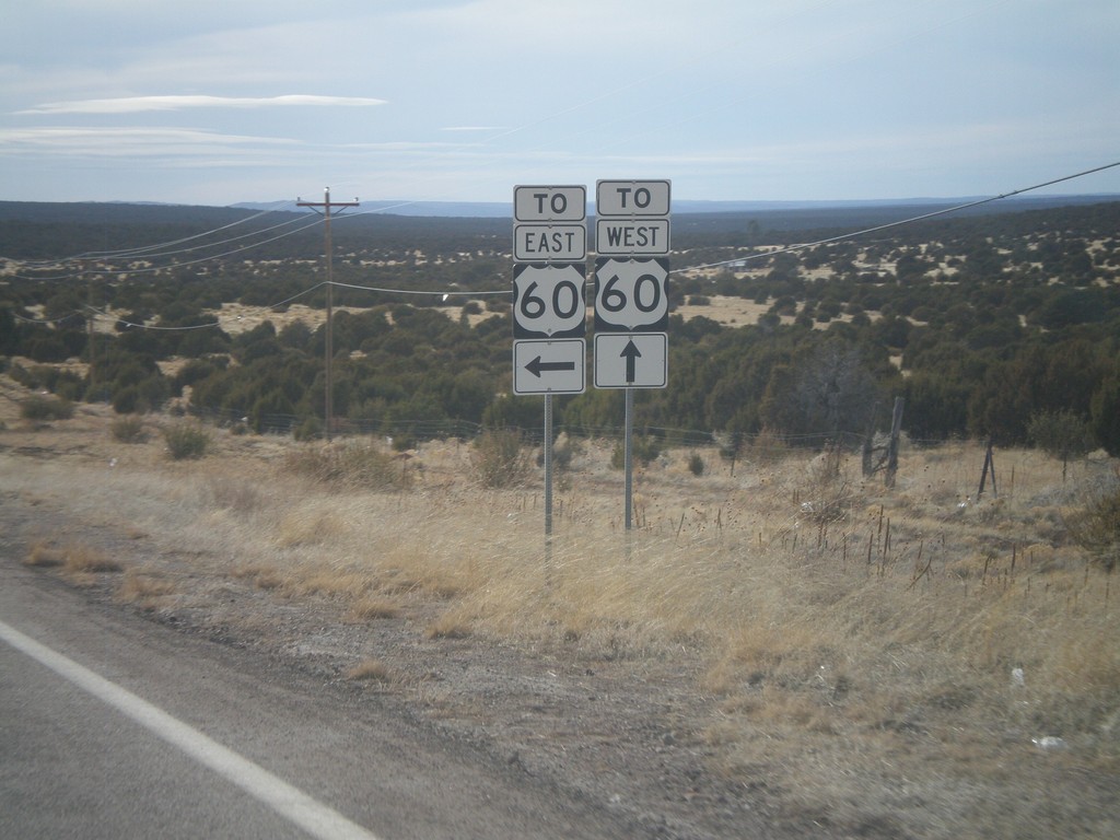
AZ-61 West at US-60
AZ-61 west at US-60. Turn left for US-60 east; continue ahead for US-60 west.
Taken 02-24-2011
 Show Low
Apache County
Arizona
United States
Show Low
Apache County
Arizona
United States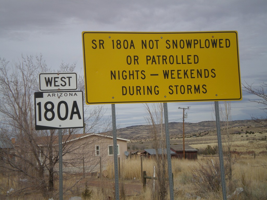
AZ-180A West - Winter Driving Warning
Warning on AZ-180A that the highway is not plowed nights or on weekends during storms.
Taken 02-24-2011
 Concho
Apache County
Arizona
United States
Concho
Apache County
Arizona
United States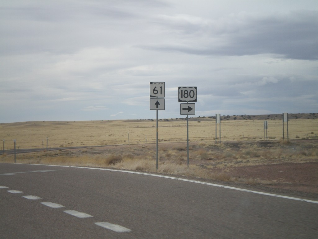
US-180 West/AZ-61 West at Split
US-180 West/AZ-61 West at US-180/AZ-61 split. Turn right for US-180 West; continue straight for AZ-61 West.
Taken 02-24-2011
 Saint Johns
Apache County
Arizona
United States
Saint Johns
Apache County
Arizona
United States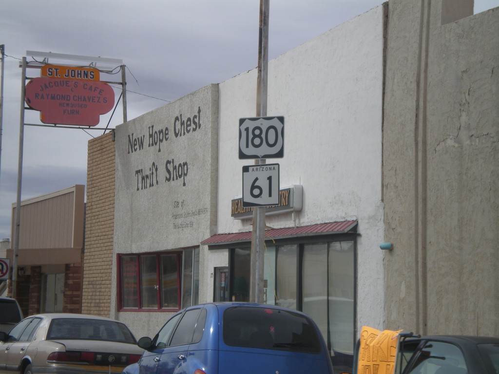
US-180 West/AZ-61 West
US-180 West/AZ-61 West in St. Johns.
Taken 02-24-2011
Saint Johns
Apache County
Arizona
United States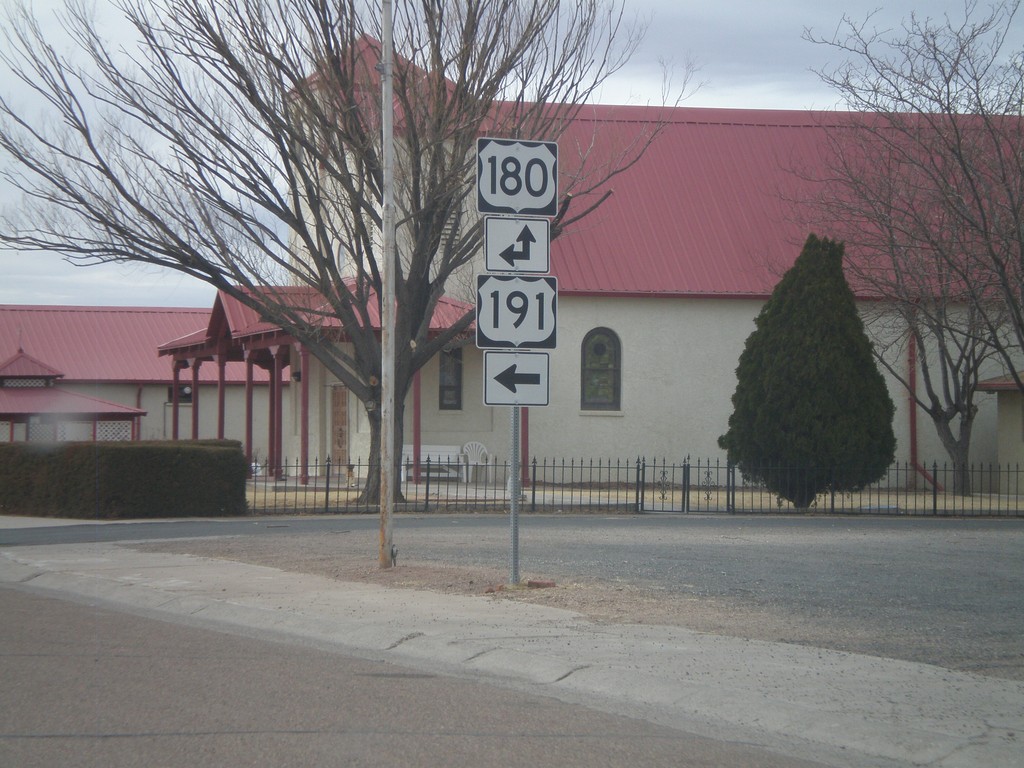
US-191 South/AZ-61 West at US-180
US-191 South/AZ-61 West at US-180. AZ-61 is not signed at this intersection. Turn left for US-191 South/US-180 East. Continue straight for US-180 West/AZ-61 West.
Taken 02-24-2011
 Saint Johns
Apache County
Arizona
United States
Saint Johns
Apache County
Arizona
United States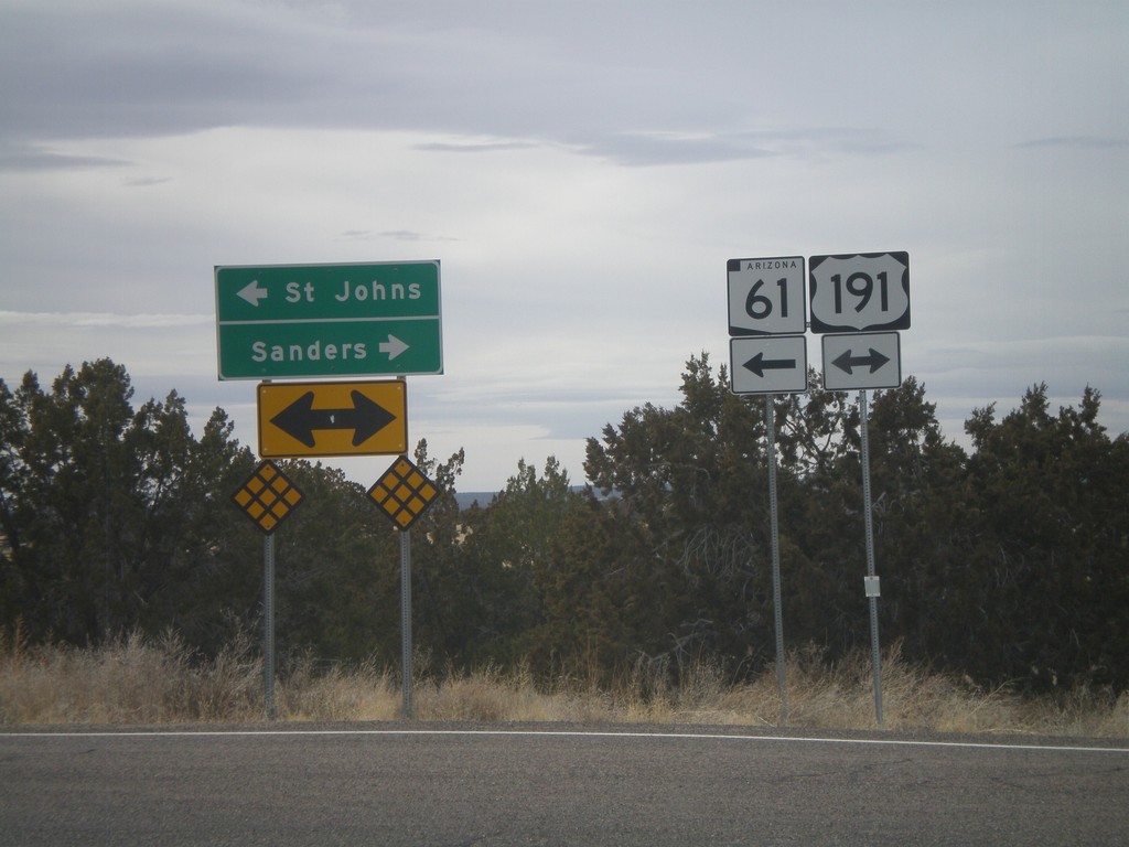
AZ-61 West at US-191
AZ-61 west at US-191. AZ-61 west joins US-191 south to St. Johns. Use US-191 South/AZ-61 West for St. Johns. Use US-191 North for Sanders.
Taken 02-24-2011
Saint Johns
Apache County
Arizona
United States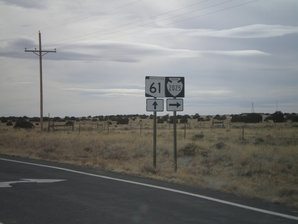
AZ-61 West Approaching Navajo-2025
AZ-61 west approaching Navajo-2025.
Taken 02-24-2011
 Sanders
Apache County
Arizona
United States
Sanders
Apache County
Arizona
United States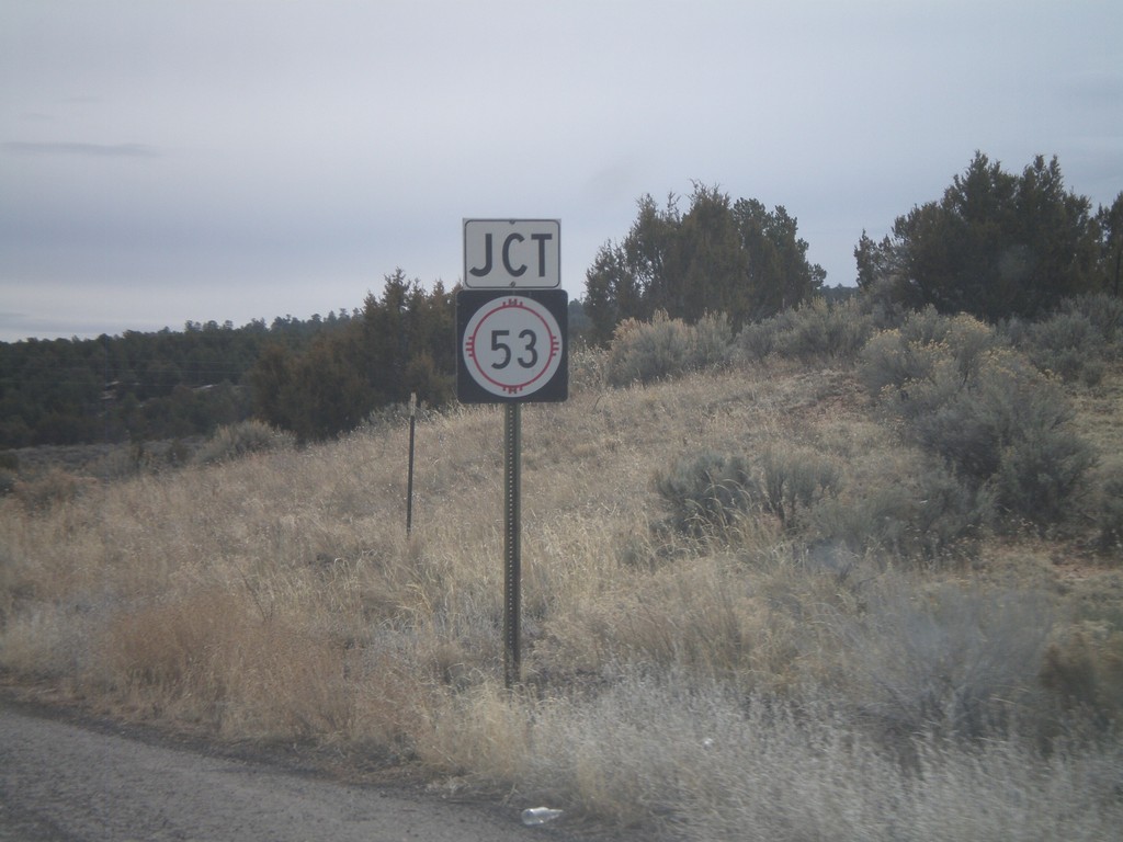
NM-602 South Approaching NM-53
NM-602 south approaching NM-53.
Taken 02-24-2011

 Zuni
McKinley County
New Mexico
United States
Zuni
McKinley County
New Mexico
United States